Scenic Railway – Federal Pass Track


3 hrs

282 m
Hard track
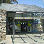


Echo Point Information Centre


(0km) Echo Point Archway Intersection → Oreades Lookout

430 m
12 mins
19m
-47m
Easy track
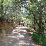
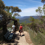
Turn left: From the intersection, this walk follows the ‘Three Sisters’ arrow[1] gently uphill along the concrete path, keeping the main valley behind and to the left. The track then leads up, past a short fence, to a clear intersection with the Three Sisters Walk[2].
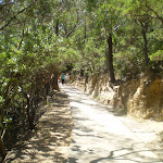
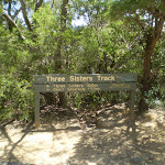
Continue straight: From the intersection, this walk follows the ‘Three Sisters 400m’ arrow[3] downhill along the concrete path, keeping the valley to the right. After about 15m the walk leads past a stone seat (on the left), with a blue tongue lizard sculpture[4]. The walk continues gently downhill for another 60m to pass another sandstone seat (on the left). From here the path winds gently downhill for another 70m to find yet another sandstone seat (on the left). The path continues downhill for another 45m to find a clear intersection marked with a large ‘Three Sisters Walk’ sign[5]. On the right is a small flat loose gravel area with two seats.


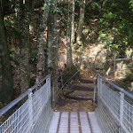
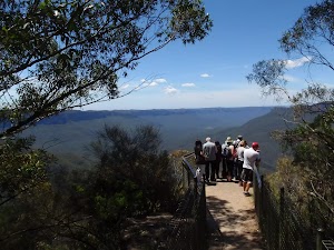
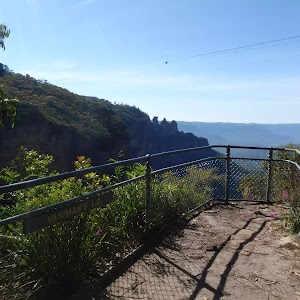
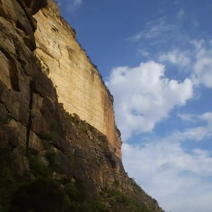
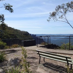
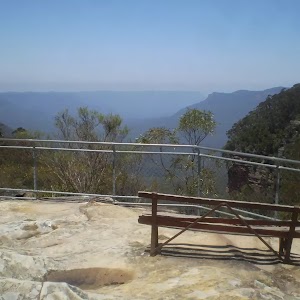
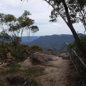
Continue straight: From the intersection, this walk follows the ‘Three Sisters, Giant Stairway’ sign[6] moderately steeply downhill along the smooth concrete path[7]. After about about 90m[8] this path leads past stone seat (on the left) in a small sandstone overhang[9]. Check the miniature cicada sculptures[10] above the overhang. From here this walk continues downhill along the path for about 30m to find the fenced Oreades Lookout[11] (on the right).


(0.43km) Oreades Lookout → Int of Prince Henry Cliff Track and the Three Sisters Footpath
20 m
1 mins
0m
-11m
Easy track
(0.45km) Int of Lady Game Lookout Track and the Three Sisters Footpath → Top of the Giant Staircase
20 m
1 mins
0m
-10m
Easy track
(0.46km) Top of the Giant Staircase → Lady Game Lookout
10 m
1 mins
0m
-12m
Very easy
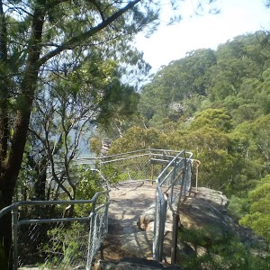
Lady Game Lookout
(0.46km) Top of the Giant Staircase → The Three Sisters Bridge Intersection
40 m
4 mins
0m
-31m
Hard track
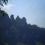
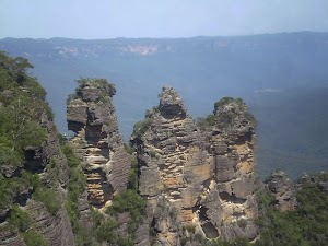
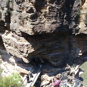
(0.5km) The Three Sisters Bridge Intersection → The Three Sisters
10 m
0m
0m
Very easy
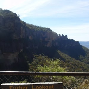
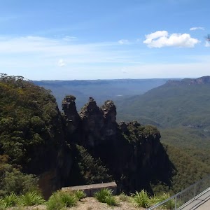
The Three Sisters
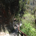
(0.5km) The Three Sisters Bridge intersection → Bottom of Giant Staircase
200 m
19 mins
20m
-151m
Hard track
(0.71km) Bottom of Giant Staircase → Int of Federal Pass, Scenic Railway and Dardenelles Tracks
290 m
10 mins
33m
-36m
Moderate track
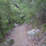
(1km) Int of Federal Pass, Scenic Railway and Dardenelles Tracks → Cooks Crossing
1.7 km
52 mins
179m
-169m
Moderate track
(2.72km) Cooks Crossing → Int of Furber Steps and Scenic Railway Track
170 m
5 mins
21m
-12m
Easy track
(2.89km) Int of Furber Steps and Scenic Railway Track → Scenic World
700 m
24 mins
233m
-36m
Hard track
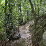
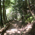
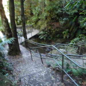
Turn left: From the intersection, this walk follows the ‘Scenic Skyway’ sign up the wooden steps and across the short wooden boardwalk to the other side. The track continues with the hand railing on the left, until reaching the base of the Furber Steps. From here, the walk continues up the concrete steps, zigzagging steeply up the side of the cliff, until reaching the Furber Lookout at the base of the last flight of steps.
Continue straight: From the Furber Lookout, this walk heads up the concrete stairs, climbing to the top. The walk passes the ‘Furber Steps’ signpost and continues along the bush track, winding up along the side of the hill until coming to the intersection of the Furber Steps and the Lynes Point tracks.
Turn left : From the lookout, this walk follows the bush track, heading down the short metal staircase to the intersection of the Lynes Point bush track at the bottom.
Continue straight: From the lookout, this walk heads up the stairs, climbing to the top. Here it continues along the bush track, winding past a large rock overhang with a bench seat underneath and through the forest for a short while, to the signposted intersection of the ‘Underfalls Walk’.
Continue straight: From the intersection, the track follows the bush track heading up the hill, winding up through the forest for a short while. Soon the track bends slightly around to the right and comes to the Rainforest Lookout, at the base of the set of wooden steps.
Turn left : From the Rainforest Lookout, this walk heads up the wooden steps, climbing to the top where it comes to a ‘T’ intersection with the ‘Round Walk’ track.
Turn left: From the intersection, this walk follows the ‘Scenic Skyway’ sign down the wooden steps, then flattens out for a short distance before continuing up the other side, climbing up the long, steep set of wooden steps. At the top, the walk comes to the intersection of the Round Walk and the Juliets Balcony track (unsignposted).
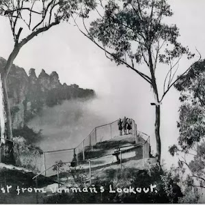
Veer right: From the intersection, this walk heads to the top of the metal stairs. The track then continues steeply up through the bush, climbing to Vanimans Lookout.
Turn left: From Vanimans Lookout, this walk heads up the wooden steps, climbing up the hill through the bush until it comes to the intersection with the Prince Henry Cliff Walk.
Turn left: From the intersection, this walk follows the only unsignposted bush track up the gentle hill. It winds up the wooden steps, bending around to the left until it flattens out at the intersection with the Scenic World footbridge.
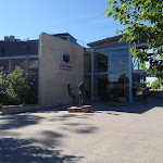
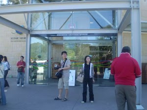
Continue straight: From the intersection, this walk heads along the wooden footbridge that winds around the back of the Scenic World multi-story car park, to the concrete footpath. The walk continues around the main building, climbing up some concrete steps to the main entrance of Scenic World.
(2.89km) Int of Furber Steps and Scenic Railway Track → Scenic Railway (Bottom Platform)
170 m
4 mins
10m
-15m
Easy track
(3.06km) Scenic Railway (Bottom Platform) → Scenic World
300 m
26 mins
210m
-8m
Very easy
Scenic World
Maps for the Scenic Railway – Federal Pass Track walk
You can download the PDF for this walk to print a map.These maps below cover the walk and the wider area around the walk, they are worth carrying for safety reasons.
| Six Foot Track | 1:50 000 Map Series | Six Foot Track | NSW-six-foot-track |
| Katoomba | 1:25 000 Map Series | 89301S KATOOMBA | NSW-89301S |
| Katoomba | 1:100 000 Map Series | 8930 KATOOMBA | 8930 |
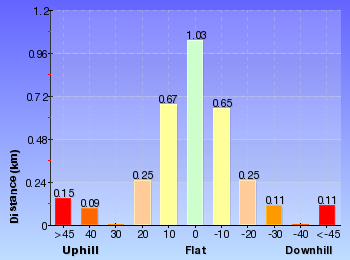
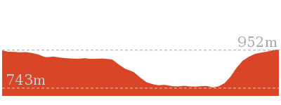
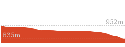
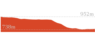
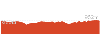
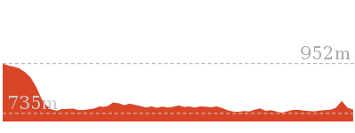
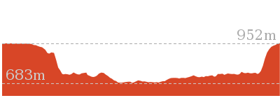
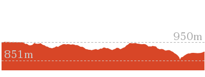
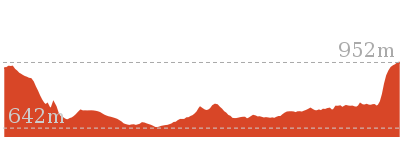
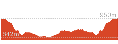
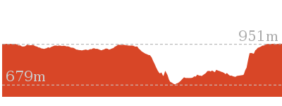
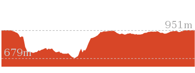
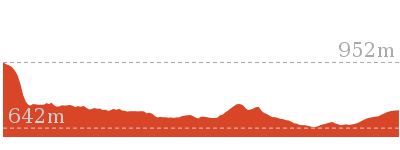
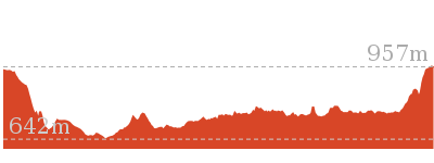
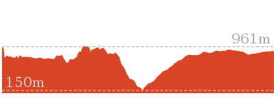
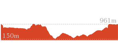
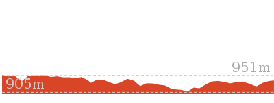
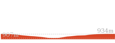
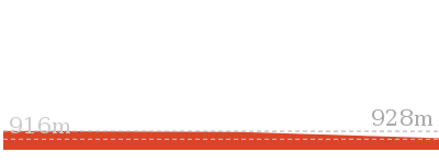
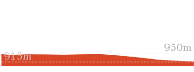
Cross sectional view of the Scenic Railway – Federal Pass Track bushwalking track
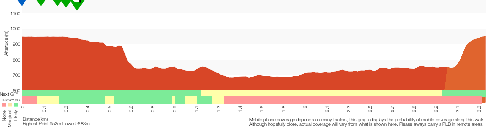
Analysis and summary of the altitude variation on the Scenic Railway – Federal Pass Track
Overview of this walks grade – based on the AS 2156.1 – 2001
Under this standard, a walk is graded based on the most difficult section of the walk.
| Length | 3.1 km | ||
| Time | 3 hrs | ||
| . | |||
| Grade 4/6 Hard track |
AS 2156.1 | Gradient | Very steep (4/6) |
| Quality of track | Clear and well formed track or trail (2/6) | ||
| Signs | Clearly signposted (1/6) | ||
| Experience Required | No experience required (1/6) | ||
| Weather | Storms may impact on navigation and safety (3/6) | ||
| Infrastructure | Generally useful facilities (such as fenced cliffs and seats) (1/6) |
Some more details of this walks Grading
Here is a bit more details explaining grading looking at sections of the walk
Gradient
2km of this walk has short steep hills and another 800m has gentle hills with occasional steps. Whilst another 300m is flat with no steps and the remaining 240m is very steep.
Quality of track
Around 2.3km of this walk follows a clear and well formed track or trail, whilst the remaining 1km follows a smooth and hardened path.
Signs
This whole walk, 3.4km is clearly signposted.
Experience Required
This whole walk, 3.4km requires no previous bushwalking experience.
weather
Around 3.2km of this walk is not usually affected by severe weather events (that would unexpectedly impact safety and navigation), whilst the remaining 200m is affected by storms that may impact your navigation and safety.
Infrastructure
This whole walk, 3.4km is close to useful facilities (such as fenced cliffs and seats).
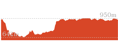
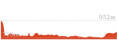
Similar walks
854 m Circuit
45 mins
Hard track
869 m Circuit
1 hr 15 mins
Hard track
872 m Return
30 mins
Easy track

1.1 km Return
45 mins
Hard track
1.1 km Circuit
2 hrs
Hard track

1.1 km Return
45 mins
Moderate track

1.2 km Return
2 hrs
Hard track
1.5 km Circuit
1 hr 45 mins
Hard track

1.7 km Return
2 hrs
Hard track

1.7 km Return
3 hrs 45 mins
Hard track
2.1 km One way
1 hr 15 mins
Moderate track
2.7 km Return
2 hrs 30 mins
Moderate track

3.1 km One way
3 hrs
Hard track
3.2 km One way
1 hr 45 mins
Moderate track
3.8 km Circuit
3 hrs
Hard track

4 km Return
2 hrs
Moderate track

4.4 km One way
3 hrs 45 mins
Hard track
4.8 km Circuit
3 hrs
Hard track
4.8 km Circuit
3 hrs
Hard track
4.8 km Circuit
3 hrs
Hard track
5.8 km Circuit
5 hrs 30 mins
Hard track
5.9 km Circuit
3 hrs 30 mins
Hard track

6.6 km One way
4 hrs
Hard track


6.7 km Return
4 hrs 30 mins
Moderate track
6.8 km Circuit
5 hrs
Hard track


6.8 km One way
3 hrs 30 mins
Moderate track
8 km One way
5 hrs
Hard track
9.4 km Circuit
5 hrs 30 mins
Hard track
12.4 km Return
7 hrs 30 mins
Hard track
16.2 km Return
11 hrs
Experienced only


29.2 km One way
2 Days
Experienced only


29.3 km One way
3 Days
Experienced only
33.8 km Circuit
3 Days
Experienced only
Other Nearby walks
2.2 km Return
1 hr 30 mins
Moderate track
3.1 km Return
1 hr 30 mins
Moderate track

595 m One way
30 mins
Moderate track

218 m Return
20 mins
Moderate track


254 m Return
15 mins
Moderate track
556 m Return
20 mins
Very easy
1.8 km One way
1 Hr
Moderate track

352 m Circuit
20 mins
Moderate track
308 m Return
15 mins
Moderate track

570 m Return
20 mins
Moderate track

150 m Return
15 mins
Moderate track
582 m Return
30 mins
Moderate track
Plan your trip to and from the walk here
The Scenic Railway – Federal Pass Track walk starts at the Echo Point Archway Intersection (gps: -33.731966, 150.31271)Your transport options to Echo Point Archway Intersection are by;
(get details)
The Scenic Railway – Federal Pass Track ends at the Scenic World (gps: -33.728585, 150.30095)
Your transport options to Scenic World are by;
(get details)


Short URL = http://wild.tl/fpxx
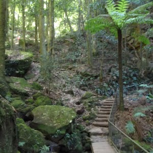
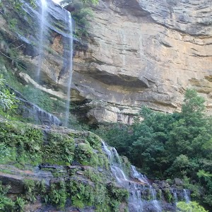
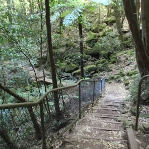
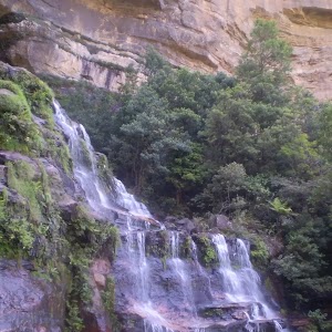
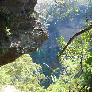
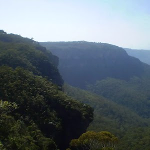
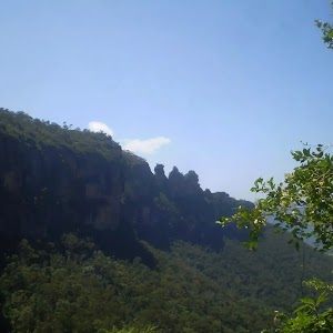
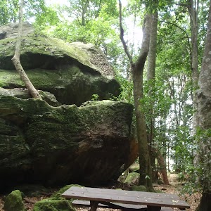
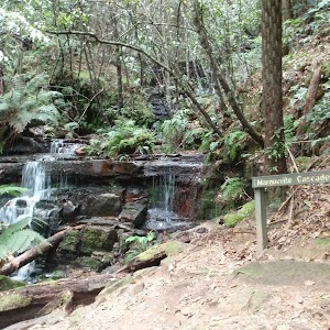
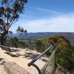
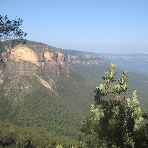
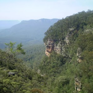
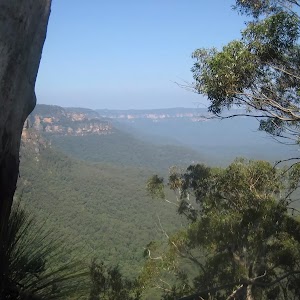
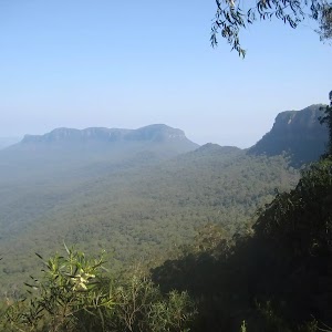
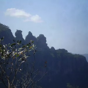
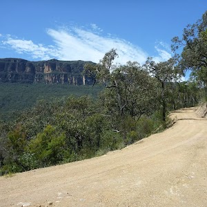
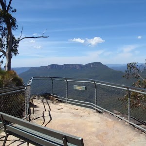
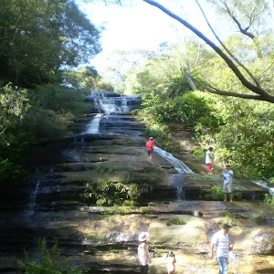
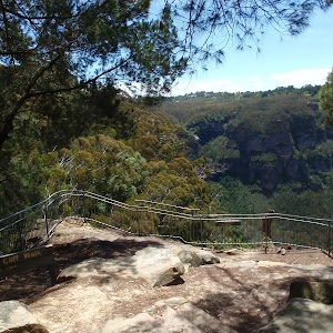
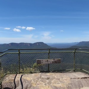
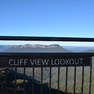
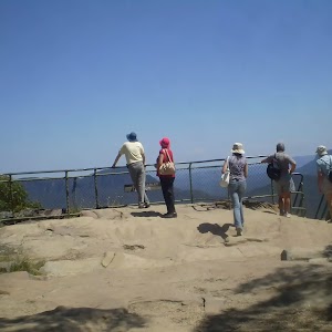
Gallery images
There are other downloads I am still working on.
You will probably need to login to access these — still all free.
* KML (google earth file)
* GPX (GPS file)
Special Maps/ brochures
* A3 topo maps
* PDF with Lands Topo map base
* PDF with arial image (and map overlay)
I wanted to get the main site live first, this extra stuff will come in time.
Happy walking
Matt 🙂
Comments