Scenic World to Echo Point


1 hr 15 mins

192 m
Moderate track
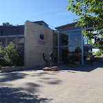


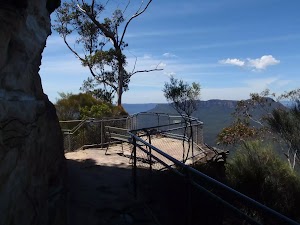
Scenic World
(0km) Scenic World → Int of Katoomba Kiosk Track and Prince Henry Cliff Walk

430 m
9 mins
18m
-39m
Moderate track
Continue straight: From the intersection, this walk follows the bush track down the gentle hill, winding down some wooden steps as the track bends around to the right. It then arrives at the signposted intersection of the ‘Prince Henry Cliff Walk’ and the track to the base of the Scenic Railway.
Veer left: From the intersection, the walk follows the ‘Caravan Park’ sign along the bush track that winds along the side of the hill, heading through the forest to the signposted intersection of the Prince Henry Cliff Walk at the back of the park, near the Katoomba Falls Kiosk.
(0.43km) Int of Katoomba Kiosk Track and Prince Henry Cliff Walk → Katoomba Falls Kiosk
50 m
1 mins
2m
0m
Easy track
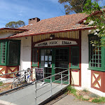
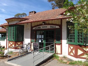
Katoomba Falls Kiosk
(0.43km) Int of Katoomba Kiosk Track and Prince Henry Cliff Walk → Int of Katoomba Kiosk Loop and Witches Leap Track
30 m
1 mins
0m
-5m
Moderate track
(0.46km) Int of Prince Henry Cliff Walk and Reids Plateau loop → Int of Solitary Lookout track and Prince Henry Cliff Walk
70 m
2 mins
1m
-13m
Moderate track
(0.53km) Int of Solitary Lookout track and Prince Henry Cliff Walk → Solitary Lookout
20 m
1 mins
0m
-10m
Easy track
Solitary Lookout
(0.53km) Int of Solitary Lookout track and Prince Henry Cliff Walk → Kedumba River lookout
60 m
3 mins
3m
-18m
Moderate track
Kedumba River lookout

(0.59km) Kedumba River lookout → Katoomba Cascades
180 m
4 mins
22m
-4m
Moderate track
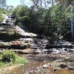
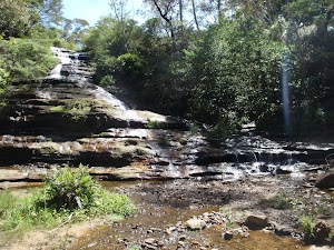
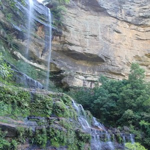
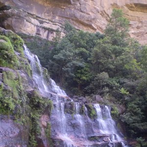
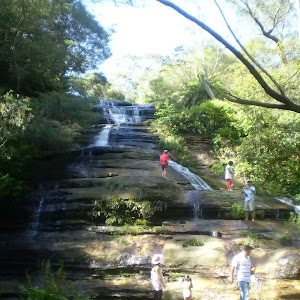
Katoomba Cascades
(0.77km) Katoomba Cascades → Katoomba Falls Park
130 m
3 mins
18m
-1m
Moderate track
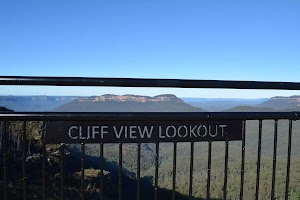
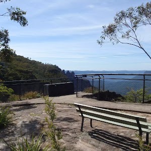
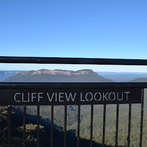
(0.89km) Katoomba Falls Park → Cliff View Lookout
280 m
7 mins
10m
-28m
Very easy

Continue straight: From the intersection[8], this walk follows the stenciled concrete path keeping the handrails on the right, almost immediately passing under the cables of the ‘Skyway’ cable car[9]. This walk continues for about 40m and goes up and over a gentle rise to come to a concrete platform[10] marked by the ‘Cliff View Lookout’ sign on the fence[11].
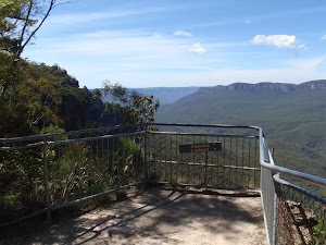
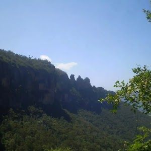
Cliff View Lookout

(1.17km) Cliff View Lookout → Wollumai Lookout
240 m
8 mins
25m
-29m
Moderate track
Wollumai Lookout
(1.41km) Wollumai Lookout → Allambie Lookout
100 m
3 mins
10m
-13m
Moderate track
Allambie Lookout
(1.51km) Allambie Lookout → Lady Darley Lookout
140 m
4 mins
19m
-11m
Moderate track
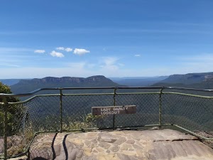
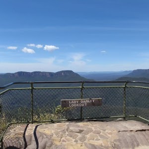
Lady Darley Lookout
(1.65km) Lady Darley Lookout → Kedumba View
200 m
8 mins
36m
-27m
Moderate track
(1.85km) Kedumba View → Queen Elizabeth Lookout
280 m
9 mins
29m
-34m
Very easy
Continue straight: From the intersection, this walk follows the lower of the two footpaths, heading south down to the large lookout underneath Echo Point. At the end of this side trip, retrace your steps back to the main walk then Turn sharp left.
Queen Elizabeth Lookout
(1.85km) Int of Echo Point and Queen Elizabeth Lookout tracks → Echo Point
70 m
3 mins
1m
-19m
Very easy
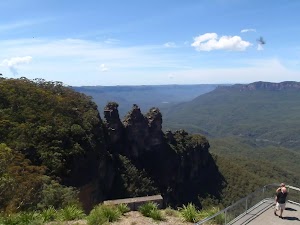
Echo Point
Maps for the Scenic World to Echo Point walk
You can download the PDF for this walk to print a map.These maps below cover the walk and the wider area around the walk, they are worth carrying for safety reasons.
| Six Foot Track | 1:50 000 Map Series | Six Foot Track | NSW-six-foot-track |
| Katoomba | 1:25 000 Map Series | 89301S KATOOMBA | NSW-89301S |
| Katoomba | 1:100 000 Map Series | 8930 KATOOMBA | 8930 |
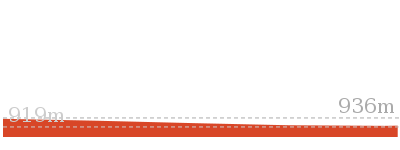
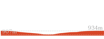
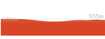
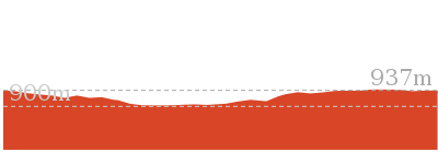
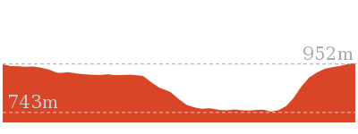
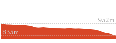
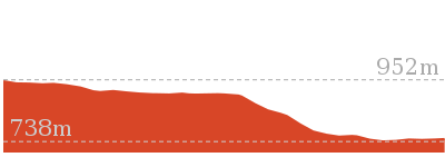
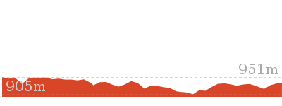
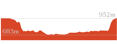
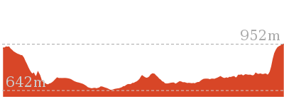
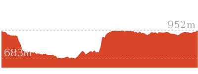
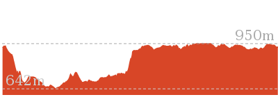
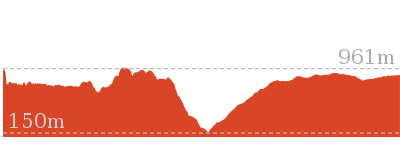
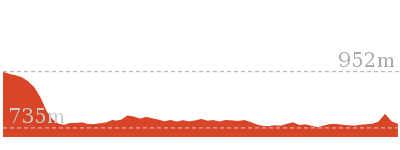
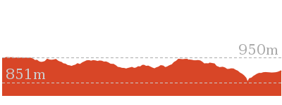
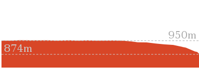
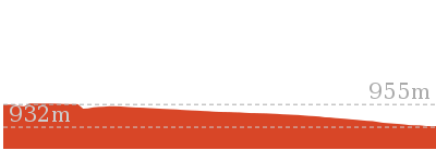
Cross sectional view of the Scenic World to Echo Point bushwalking track
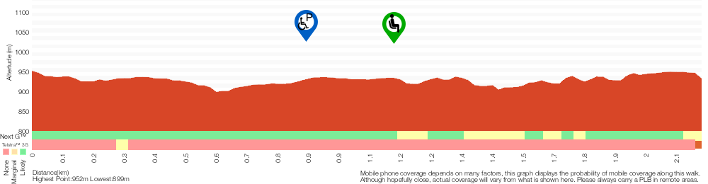
Analysis and summary of the altitude variation on the Scenic World to Echo Point
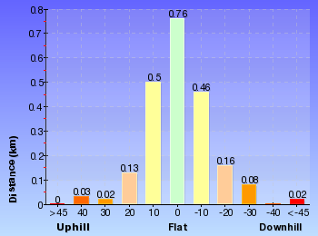
Overview of this walks grade – based on the AS 2156.1 – 2001
Under this standard, a walk is graded based on the most difficult section of the walk.
| Length | 2.1 km | ||
| Time | 1 hr 15 mins | ||
| . | |||
| Grade 3/6 Moderate track |
AS 2156.1 | Gradient | Gentle hills with occasional steps (2/6) |
| Quality of track | Formed track, with some branches and other obstacles (3/6) | ||
| Signs | Directional signs along the way (3/6) | ||
| Experience Required | Some bushwalking experience recommended (3/6) | ||
| Weather | Weather generally has little impact on safety (1/6) | ||
| Infrastructure | Limited facilities, not all cliffs are fenced (3/6) |
Some more details of this walks Grading
Here is a bit more details explaining grading looking at sections of the walk
Gradient
Around 1.5km of this walk has gentle hills with occasional steps, whilst the remaining 680m is flat with no steps.
Quality of track
990m of this walk follows a formed track, with some branches and other obstacles and another 940m follows a smooth and hardened path. The remaining (210m) follows a clear and well formed track or trail.
Signs
Around 1.2km of this walk has directional signs at most intersection, whilst the remaining 960m is clearly signposted.
Experience Required
Around 2.1km of this walk requires no previous bushwalking experience, whilst the remaining 50m requires some bushwalking experience.
weather
This whole walk, 2.1km is not usually affected by severe weather events (that would unexpectedly impact safety and navigation).
Infrastructure
Around 1.9km of this walk is close to useful facilities (such as fenced cliffs and seats), whilst the remaining 260m has limited facilities (such as not all cliffs fenced).
Similar walks

254 m Return
15 mins
Moderate track
352 m Circuit
20 mins
Moderate track
556 m Return
20 mins
Very easy
854 m Circuit
45 mins
Hard track
869 m Circuit
1 hr 15 mins
Hard track
1.1 km Circuit
2 hrs
Hard track

1.1 km Return
45 mins
Moderate track

1.2 km Return
2 hrs
Hard track
1.5 km Circuit
1 hr 45 mins
Hard track

1.7 km Return
2 hrs
Hard track

1.7 km Return
3 hrs 45 mins
Hard track
1.8 km One way
1 Hr
Moderate track

2.2 km Return
1 hr 30 mins
Moderate track
3.1 km One way
3 hrs
Hard track
3.1 km Return
1 hr 30 mins
Moderate track

4.4 km One way
3 hrs 45 mins
Hard track
5.8 km Circuit
5 hrs 30 mins
Hard track
6.8 km Circuit
5 hrs
Hard track


6.8 km One way
3 hrs 30 mins
Moderate track
9.4 km Circuit
5 hrs 30 mins
Hard track
12.4 km Return
7 hrs 30 mins
Hard track
16.2 km Return
11 hrs
Experienced only

33.8 km Circuit
3 Days
Experienced only
Other Nearby walks

29.2 km One way
2 Days
Experienced only


29.3 km One way
3 Days
Experienced only
5.9 km Circuit
3 hrs 30 mins
Hard track


6.7 km Return
4 hrs 30 mins
Moderate track
2.7 km Return
2 hrs 30 mins
Moderate track
218 m Return
20 mins
Moderate track

595 m One way
30 mins
Moderate track

4 km Return
2 hrs
Moderate track

3.2 km One way
1 hr 45 mins
Moderate track

3.1 km One way
3 hrs
Hard track
1.1 km Return
45 mins
Hard track
872 m Return
30 mins
Easy track
Plan your trip to and from the walk here
The Scenic World to Echo Point walk starts at the Scenic World (gps: -33.728585, 150.30096)Your transport options to Scenic World are by;
(get details)
The Scenic World to Echo Point ends at the Echo Point (gps: -33.732682, 150.312)
Your transport options to Echo Point are by;
(get details)


Short URL = http://wild.tl/swtep
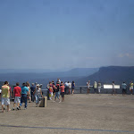
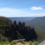
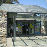
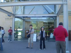
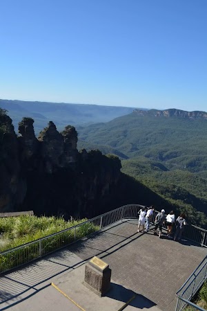
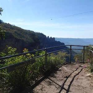
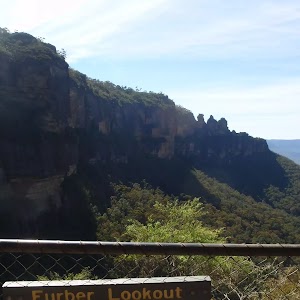
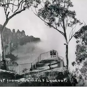
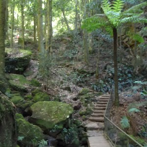
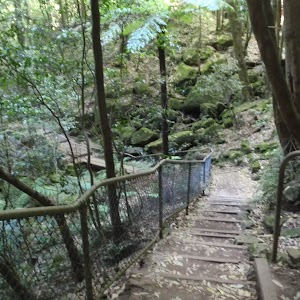
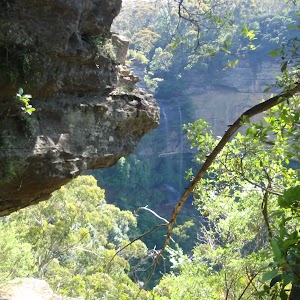
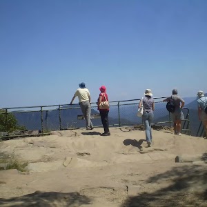
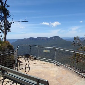
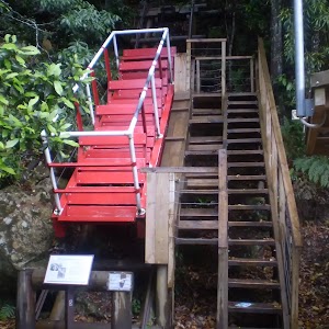
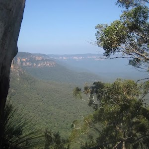
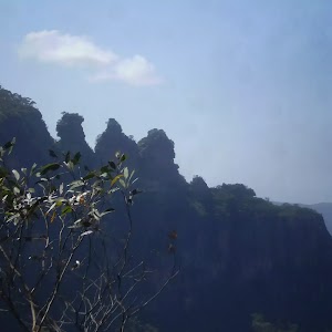
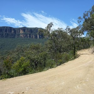
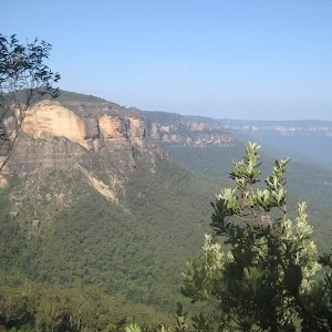
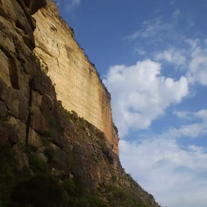
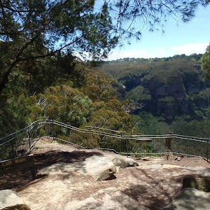
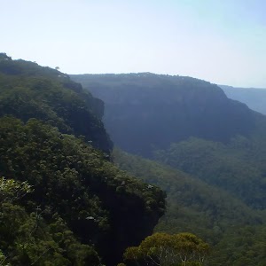
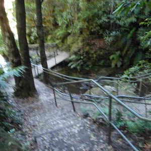
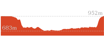
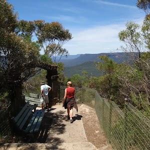
Gallery images
There are other downloads I am still working on.
You will probably need to login to access these — still all free.
* KML (google earth file)
* GPX (GPS file)
Special Maps/ brochures
* A3 topo maps
* PDF with Lands Topo map base
* PDF with arial image (and map overlay)
I wanted to get the main site live first, this extra stuff will come in time.
Happy walking
Matt 🙂
Comments