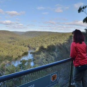
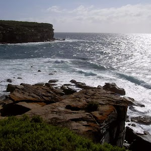
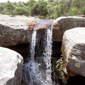
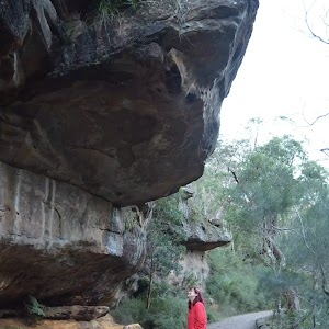
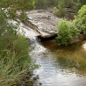
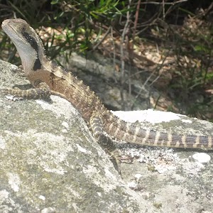
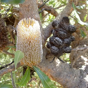
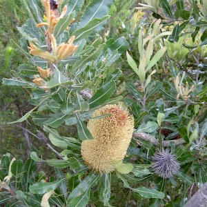
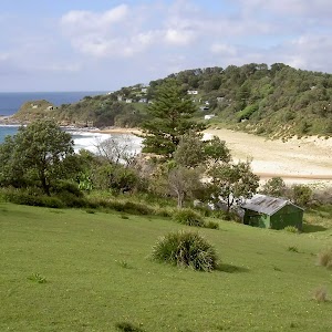
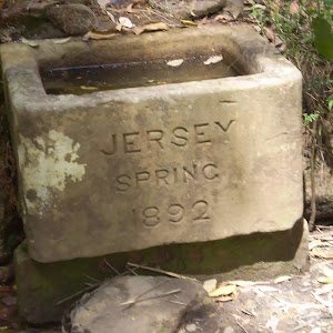
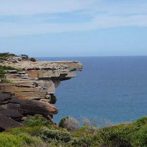
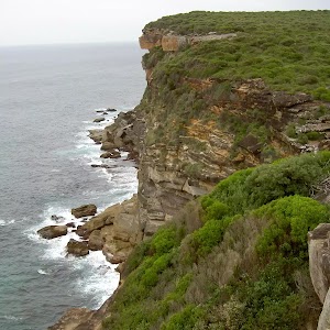
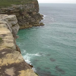
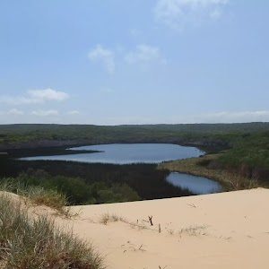
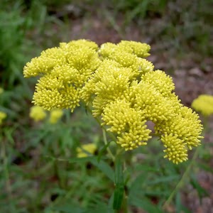
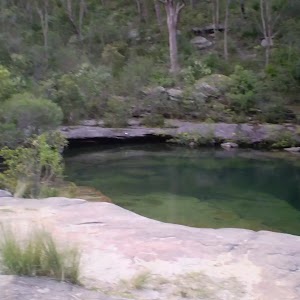
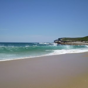
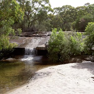
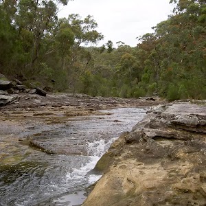
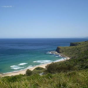
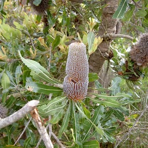
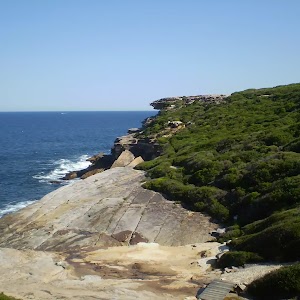
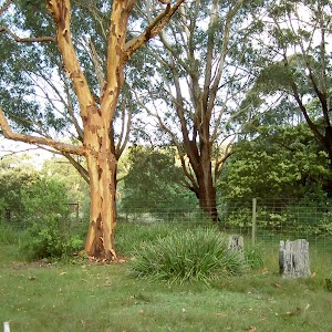
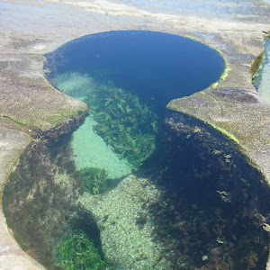
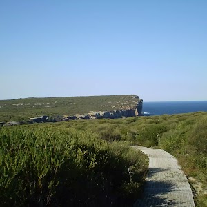
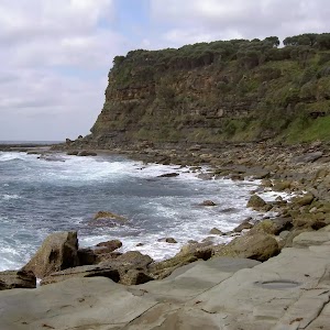
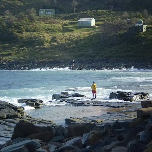
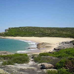
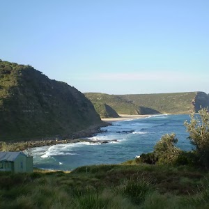
Home arrow Hiking near Sydney arrow Royal National Park
Login Form


Lost Password?
No account yet? Register
Royal National Park
Bundeena to Jibbon Head Circuit E-mail
 

Time
    Distance
Climb
Style

  2 Hrs 30 mins
  6.8 km
  134 m
  Circuit

   0.1 km NE of Bundeena 
  Royal National Park  ferry car  
  Track: Moderate 
     

A short walk from the small town of Bundeena to Jibbon Head with views of Cronulla and north up the coast. From here the track turns and goes along a sandy servicetrail, looping around and down the southern coast. The short sidetrip out to Bundeena Lookout is well worth the walk with absolutely fantastic views up and down the coast and out to the ocean. From here the track heads back through the roads to Bundeena Ferry. The fantastic views that this walk offers of the coast make the road walking seem worth it.

 
Bundeena to Little Marley Beach E-mail
 

Time
    Distance
Climb
Style

  5 Hrs
  14 km
  441 m
  Return

   0.1 km NE of Bundeena 
  Royal National Park  ferry car  
  Track: Moderate 
     

Exploring the coastline of the Royal National Park this track has fantastic views and a great place to swim at Little Marley Beach. Bundeena is a great place to start the walk with places to grab a bite to eat. If possible the ferry ride from Cronulla to Bundeena is great fun and an excellent way to start a day of walking. With this walk, prepare to be astounded by great views of the ocean and cliffs.

 
Bundeena to Marley Beach E-mail
 

Time
    Distance
Climb
Style

  4 Hrs
  12.6 km
  412 m
  Return

   0.1 km NE of Bundeena 
  Royal National Park  car ferry  
  Track: Moderate 
     

From the small town of Bundeena to one of the largest beaches in the Royal National Park this walk has great views of the Coast as it heads south through the heath and along the rockshelf. This is before descending to Marley Beach which offers the opportunity to swim and explore the lagoon before heading back to Bundeena. On a sunny day this track is a pure delight.

 
Bundeena to Marley Head E-mail
 

Time
    Distance
Climb
Style

  3 Hrs
  10.9 km
  274 m
  Circuit

   0.1 km NE of Bundeena 
  Royal National Park  ferry car  
  Track: Moderate 
     

From Bundeena this track heads south to the coast and then loops around Marley Head, with the track changing from going through the heath to going along the cliffs. There are great views from Marley Head and the section between Marley and Bundeena Lookout is just astounding. Look out for lizards in the heath sections as it abounds with wildlife.

 
Coast Track (Bundeena to Otford) E-mail
 

Time
    Distance
Climb
Style

  2 Days
  27.3 km
  1353 m
  One way

   0.1 km NE of Bundeena 
  Royal National Park  ferry car train  
  Track: Hard 
     

Following the coast south this walk covers the coastline of the Royal National Park and can truly only be described as amazing. With breathtaking coastal views from Bundeena to Otford this trail follows the cliffs through the scrub. Its well-managed and signposted track allows walkers to enjoy the truly fantastic views out to sea and along the cliffs.

 
Coast Track (Otford to Bundeena) E-mail
 

Time
    Distance
Climb
Style

  2 Days
  27.3 km
  1253 m
  One way

   0.8 km NE of Otford 
  Royal National Park  train car ferry  
  Track: Hard 
     

Following the coast through the Royal National Park with its magnificent coastal views this trail is truly amazing. Although walked traditionally from Bundeena the track is well-signposted so either direction is fine to walk. Plenty of coastal cliff views the entire way of this walk there ae also a number of houses built during the Depression that scatter the coast, forming small villages. overnight at at North Era (or stay at the YHA - see day 2 notes)

 
Couranga E-mail
 

Time
    Distance
Climb
Style

  4 Hrs 30 mins
  10 km
  460 m
  Return

   0.5 km WSW of Waterfall 
  Royal National Park  car train bus  
  Track: Hard 
     

This is a pleasent walk which takes you through some of Royal National Parks more diverse ecosystems. From Waterfall Station car park it heads through bush and heath to descend to the rainforest and palms on the banks of the Hacking River. A great track to explore Royal National Parks floral diversity.

 
Curra Moors Loop E-mail
 

Time
    Distance
Climb
Style

  3 Hrs 30 mins
  9.2 km
  242 m
  Circuit

   12.3 km SW of Bundeena 
  Royal National Park  car  
  Track: Hard 
     

This track is a nice walk mostly along service trails. The track passes through heath and some areas of trees (flowering in spring). This walk follows the Coastal Track along the headland giving great views along the coast and out to sea.

 
Engadine to Audley E-mail
 

Time
    Distance
Climb
Style

  2 Hrs 30 mins
  5.7 km
  176 m
  One way

   0.2 km SW of Engadine 
  Royal National Park  train car  
  Track: Hard 
     

From Engadine Railway Station this track ventures into the centre of the Royal National Park through light scrub. Highlights include down at Tuckawa Rill Creek where the cascading water and small rockpools contrast beautifully with the surrounding dry bushland. On from here and there are great views of the Hacking River from up on the Robertson's Roundabout. Then the track descends into the parklands surrounding the visitor centre at Audley.

 
Forest Way Track E-mail
 

Time
    Distance
Climb
Style

  1 Hrs 45 mins
  4.5 km
  186 m
  Circuit

   3.3 km ESE of Waterfall 
  Royal National Park  car  
  Track: Moderate 
     

Opened in 1886 the Forest Path was once part of a controversial logging site and was the first time that logging was stopped in Australia by protest. Now however, it is a short trail looping around the hill as it follows the Hacking River. Through a shaded environment of ferns and eucalypts this trail forms a very pretty environment that was definitely worth preserving.

 
Garie Beach to Garawarra to Burning Palms Circuit E-mail
 

Time
    Distance
Climb
Style

  7 Hrs
  13.5 km
  754 m
  Circuit

   10.7 km SSE of Heathcote 
  Royal National Park  car  
  Track: Hard 
     

Using a variety of tracks this trail follows the coast as well as going inland to Garrawarra Farm. With great coastal views and a magnificent palm jungle this track demonstrates perfectly the diversity of the Royal National Park. Of historical significance are the houses scattered along the coast that were built in the depression. Spare time along the way to have a swim at one of the many fantastic beaches.

 
Garie Beach to Helensburgh (The Burgh Track) E-mail
 

Time
    Distance
Climb
Style

  4 Hrs 30 mins
  11 km
  663 m
  One way

   10.7 km SSE of Heathcote 
  Royal National Park  car train  
  Track: Hard 
     

Travelling along the well-maintained Burgh Track, passing great views of the ocean and the cliffs, before turning inland and passing beautiful nature and environment views. Going to Helensburgh this trail offers the chance to catch the train home. The environment and views near Lady Wakehurst Dr are incredibly special as the track winds its way through a shrouded eucalypt environment.

 
Heathcote to Audley E-mail
 

Time
    Distance
Climb
Style

  4 Hrs 15 mins
  10 km
  330 m
  One way

   1 km SW of Heathcote 
  Royal National Park  car  
  Track: Moderate 
     

Through scrub and heath this track goes into the Royal National Park along a well-managed bushtrack. Passing great pools and sections of creek at Karloo Pools and Ulloola Falls. With great rest spots at both of these places (especially with the toilet at Ulloola) this walk is even more the pleasant. Coming into Audley there are great views of the Hacking River and once at Audley the visitor centre's a good spot to grab a bit to eat.

 
Heathcote to Engadine via Audley E-mail
 

Time
    Distance
Climb
Style

  6 Hrs 30 mins
  14.9 km
  643 m
  One way

   1 km SW of Heathcote 
  Royal National Park  train car  
  Track: Hard 
     

Encompassing a large section of central Royal National Park this track goes through the heath and scrub along a well-managed and signposted track, circling from Heathcote Railway Station around to Engadine Station. With public transport at both ends, toilets and water at both Uloola Falls and Reid's Park this track has ample infrastructure to keep a walker out for a day. And this is all without losing the integrity of the bushland.

 
Heathcote to Waterfall via Karloo Pools and Uloola Falls E-mail
 

Time
    Distance
Climb
Style

  4 Hrs 30 mins
  11.3 km
  390 m
  One way

   1 km SW of Heathcote 
  Royal National Park  train car  
  Track: Hard 
     

Starting and ending at railway stations this easily accessibly tracks ventures into central Royal National Park along a well-maintained bushtrack, going to a beautiful set of waterholes and rockflats at Karloo Pools. The track continues to the peaceful campsite at Uloola Falls. Abruptly, the trail changes to a servicetrail, continuing to Waterfall Railway Station.

 
Karloo Track E-mail
 

Time
    Distance
Climb
Style

  3 Hrs
  5.6 km
  312 m
  Return

   1 km SW of Heathcote 
  Royal National Park  train car  
  Track: Moderate 
     

A popular trail for those wanting an easily accessible and well-signposted bushtrack with a great place to swim. The Karloo Track is follows the bushtrack from Heathcote Railway Station east into the Royal National Park to a great set of waterholes on Kangaroo Creek. But this walk offers more than just a set of waterholes at the end due to its fantastic views from the ridge of the surrounding bushland.

 
Lady Carrington Drive to Palona Cave E-mail
 

Time
    Distance
Climb
Style

  2 Hrs
  7.2 km
  253 m
  Return

   7.4 km S of Heathcote 
  Royal National Park  car  
  Track: Hard 
     

Along an old horse carriage-way this trail heads north until turning off the wide servicetrail and going up to a beautiful limestone cave. In typical sandstone country Palona Cave's different geology makes it well worth the visit as is the beautiful cascading waterfall at the cave. Along Lady Carrington Drive watch out for bike riders as this is a highly popular cycling route.

 
Loftus to Winifred Falls E-mail
 

Time
    Distance
Climb
Style

  4 Hrs
  11.1 km
  406 m
  One way

   0.5 km NNE of Loftus 
  Royal National Park  train car  
  Track: Hard 
     

Following well-maintained bushtracks and servicetrails this track descends into the Royal National Park before going to a spectacular set of pools and cascading falls on South Western Creek. The Royal National Park Information Centre on Sir Betram Stevens Drive is approximately in the middle of this walk and is a great spot to grab a bite to eat before continuing to the falls. Unfortunately, its necessary to have a car to get from Winifred Falls out of the park.

 
Marley Track E-mail
 

Time
    Distance
Climb
Style

  4 Hrs 30 mins
  10.9 km
  354 m
  Circuit

   3.8 km SW of Bundeena 
  Royal National Park  car  
  Track: Hard 
     

This walk takes you down from the ridge to the quiet Deer Pool on Marley Creek. You pass the Big and Little Marley beaches with an optional side trip to Wattamola Dam. This side trip is well worth it on a hot day to take a dip. The track then leads away from the coast to loop back to the same place on the Bundeena Drive.

 
Mt Bass- Winifred Falls E-mail
 

Time
    Distance
Climb
Style

  2 Hrs 30 mins
  6.8 km
  213 m
  Return

   6.5 km WSW of Bundeena 
  Royal National Park  car  
  Track: Hard 
     

This track follows Mount Bass Fire Trail down to the bush track which then leads to Winifred Falls. Be prepared to get your feet wet crossing upper Winifred Falls. The Winifred Falls are realy nice. The Winifred Falls are complimented by the brilliant side trip down to to South West Arm pools. These pools are a geat place for a swim and a bite to eat before returning to the road.

 
Otford to Figure of Eight Pools Circuit E-mail
 

Time
    Distance
Climb
Style

  6 Hrs
  13.4 km
  705 m
  Circuit

   0.8 km NE of Otford 
  Royal National Park  train car  
  Track: Hard 
     

Exploring the southern coast of Royal National Park this trail experiences different trails and environments, with shrouded walking the Palm Forest to cleared views of the Coastline. With a short sidetrip out to the Figure of 8 Pools this walk becomes a great day in the bush. The views from the Burgh Ridge are something special as it is possible to see far into the distance down the coast in both directions.

 
Otford to Figure of Eight Pools via Burning Palms E-mail
 

Time
    Distance
Climb
Style

  6 Hrs 30 mins
  13.2 km
  729 m
  Return

   0.8 km NE of Otford 
  Royal National Park  train car  
  Track: Hard 
     

From Otford Train Station this track soon enters into the Royal National Park at the coast. There are great views of Wollongong down the coast. The track also passes through the magnificent Palm Jungle and Burning Palms beach. This is a great spot to go to get the toes wet and enjoy the environment. This track then continues to Figure of Eight Pools.

 
Otford to Helensburgh E-mail
 

Time
    Distance
Climb
Style

  5 Hrs 15 mins
  12.9 km
  587 m
  One way

   0.8 km NE of Otford 
  Royal National Park  train car  
  Track: Hard 
     

Largely along servicetrails and well-managed bushtracks the Otford to Helensburgh Trail goes from train station to train station through parts of southern Royal National Park. Although, the constant servicetrails can be tedious at various points the bushtrack between Garrawarra and the Hacking River is incredibly beautiful as it winds its way down the hill through shrouded eucalypt forest and low-lying scrub.

 
Providential Point E-mail
 

Time
    Distance
Climb
Style

  30 mins
  1.4 km
  55 m
  Return

   6.9 km SSW of Bundeena 
  Royal National Park  car  
  Walk: Easy 
     

Providential Point is a quick and easy walk to see some beautiful coastline. The walk passes through the Providential Point campsite and continues out to the railed cliff edge. These views are complimented by the large cliffs on either side of this great short walks lookout.

 
Robertson's Roundabout E-mail
 

Time
    Distance
Climb
Style

  1 Hrs 15 mins
  2.3 km
  155 m
  Circuit

   3.7 km ENE of Heathcote 
  Royal National Park  car  
  Track: Moderate 
     

From the Royal National Park Centre this track crosses the Hacking River before rising steeply up onto the ridge to fantastic views of the Hacking River. If you also look carefully into the distance Cronulla is also visible on the horizon at the highest points. After a short circuit with good views of the surrounding bushland the track descends back down to the river and the visitor centre

 
Wallumarra to Palona Cave E-mail
 

Time
    Distance
Climb
Style

  4 Hrs 30 mins
  11.4 km
  446 m
  Return

   5.9 km ESE of Waterfall 
  Royal National Park  car  
  Track: Hard 
     

Although, the Wallumarra Servicetrail and the sidetrip to the Beehives are not the most interesting tracks in Royal National Park, the Wallumarra Bushtrack and the trail to Palona Cave make up for this. Winding next to Bola Creek the Wallumarra Bushtrack is very pretty, as is the track to Palona. With a short break at Bola Picnic Area and next to the waterfall at Palona Cave this makes for a great walk.

 
Wallumarra Track to Bola Creek E-mail
 

Time
    Distance
Climb
Style

  1 Hrs 45 mins
  4.4 km
  74 m
  One way

   5.9 km ESE of Waterfall 
  Royal National Park  car  
  Track: Moderate 
     

This track could be like any other servicetrail walk until reaching the end of the servicetrail and the start of the bushtrack. With great views and a rough bushtrack going down the hill this track suddenly becomes a lot more interesting. Once reaching Bola Creek the winding bushtrack goes next to the creek through a dark forest until meeting up with Lady Carrington Dr.

 
Wallumarra Track to Forest Way E-mail
 

Time
    Distance
Climb
Style

  4 Hrs 30 mins
  12 km
  477 m
  Circuit

   5.9 km ESE of Waterfall 
  Royal National Park  car  
  Track: Moderate 
     

Following a section of servicetrail this track heads along the ridge until descending off the hill down to Bola Creek. Although the servicetrail is not the most interesting the bushtrack is enjoyable, especially down on the creek as the track winds its way through the forest. After a short break at the Bola Picnic Area the track circles around along the Forest Path. This track was one of the first in Royal National Park (established in 1886) and still remains very pretty.

 
Winifred Falls E-mail
 

Time
    Distance
Climb
Style

  2 Hrs
  4.4 km
  175 m
  One way

   7.1 km W of Bundeena 
  Royal National Park  car  
  Track: Hard 
     

Winifred Falls is one of the best waterfalls in Royal National Park. The track not only goes to the magnificent falls but has the optional side trip down to the beautiful South West Arm Pools. Anice Falls are not as great as Winifred but worth the visit the walk then continues through the heath to Maianbar Rd.

 
Wises Track E-mail
 

Time
    Distance
Climb
Style

  1 Hrs 30 mins
  4.1 km
  50 m
  One way

   10.3 km SW of Bundeena 
  Royal National Park  car  
  Track: Moderate 
     

This isn't a particularly special walk, but is a nice way to see different heath environments. The track was once an old road which has now been turned into a service trail. There are many wildflowers and banksia bushes amongst the heath of this track.

 
© 2008 Wildwalks
-server 2- Page was generated in 0.217893 seconds