Gordon to Hornsby (overnight at Scout camp)


2 Days

1024 m
Hard track


(0km) Gordon Station → Int. Blackbutt Creek Trk and Vale St

980 m
20 mins
6m
-54m
Easy track
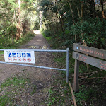
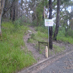
Continue straight: From Gordon Station bus depot, this walk heads up the hill of St Johns Ave to the Pacific Highway. The walk crosses to the other side at the pedestrian crossing. From here, this walk follows the shop fronts up the Pacific Highway, then turns left onto Moree St. This street is followed until the walk turns right onto Vale St. This walk continues along Vale St for a short time to the intersection with the bush track on the left of the street.
(0.98km) Int. Blackbutt Creek Trk and Vale St → Int. Blackbutt Ck Pathway and Blackbutt Ck Trail
430 m
8 mins
0m
-12m
Moderate track
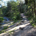
Veer left: From the intersection, this walk heads down the hill, passing a concrete sewerage inspection hole on the right. The trail continues along the creek line for another 20m, to the intersection which leads down to the creek on the right.
(1.41km) Int. Blackbutt Ck Pathway and Blackbutt Ck Trail → Int. Lady Game Drive and Falls Creek Trk
1.3 km
25 mins
7m
-42m
Moderate track
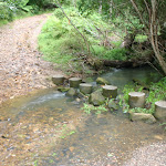
Continue straight: From the intersection, this walk follows the left-hand arrow on the ‘Blackbutt Creek Track’ sign, down the hill. The track contours with the creek on the right, and the houses high on the left, for approximately 1km to then steeply descend to the intersection above the concreted water-crossing.
Continue straight: From the intersection, this walk heads down the hill, across the concrete ford (creek), to then turn right and follow along side the creek. The trail tends left away from the creek, up to a white gate.
(2.74km) Int. Lady Game Drive and Falls Creek Trk → Allen Park
1.2 km
23 mins
49m
-23m
Easy track
(3.95km) Allen Park → Int of GNW and Ryde Road trail (west)
1.1 km
23 mins
22m
-55m
Moderate track
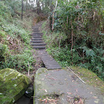
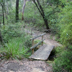
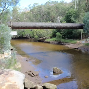
Continue straight: From the intersection, the walk follows the ‘Great North Walk – Deburghs Bridge’ sign[4] downhill along the wide management trail. The trail soon bends right and follows the power lines[5] down, stepping over a partially buried, green metal pipeline[6] (sometimes hissing[7]). After this, the trail follows a GNW arrow[8] left as the trail significantly narrows and leads down a series of timbers steps[9] then across the rocky Blackbutt Creek[10][11]. Here, the walk follows the GNW arrow up onto the rock platform[12], where the track turns left then leads along the flat to a T-intersection with a GNW arrow post[13], and a set of steps[14] (up to your right AND down to your left).
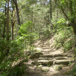
Turn right: From the intersection, the walk follows the GNW arrow post up the timber steps[15]. The track then leads up some stone steps[16] and comes to a three-way intersection, where a sign points back to ‘Lane Cove River Weir via Great North Walk’[17].
Continue straight: From the intersection, this walk follows the ‘Thornleigh via Great North Walk’ sign[18] down a couple of steps[19] and along the track towards Deburghs Bridge, keeping the valley to your left. After about 50m, the track leads under the large concrete Deburghs Bridge[20], with some graffiti[21]. On the other side of the bridge, the track bends right to head up over some rocks, following two sections of hand railing[22][23]. From the end of these handrails, the track leads gently up among the grass trees[24] for about 400m (and a weedy section of track) to come to a clear T-intersection[25] with a management trail, where a ‘Great North Walk’ sign[26] points back down the track.
(5.07km) Int of GNW and Ryde Road trail (west) → Int of GNW and Gloucester Ave service trail (sth)
900 m
19 mins
35m
-30m
Moderate track
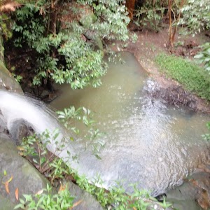
Turn left: From the intersection, this walk follows the ‘Thornleigh Oval’ sign[31] west, gently down the track, away from the management trail. The track almost immediately passes the large metal pipe (crossing the Lane Cove River[32]) then winds down the rocky track[33] for about 200m, through open eucalypt forest[34] with some limited views left over the valley, to come to a weedy section of track marked with a concrete sewerage access point[35]. Here the track mostly flattens out and leads along the side of the hill for about 400m to head down a few steps and cross Quarry Creek[36]. The walk then heads up some steps and follows the track for another 30m to come to a T-intersection[37] with the Gloucester Ave fire trail, marked with a GNW and NPWS arrow post[38].
Turn left: From the intersection, the walk follows the GNW arrow post[39] gently uphill along the management trail, away from the gate whilst keeping the power line poles on your left. After about 30m (just past the second power pole), this trail leads to an intersection with a track (on the left), marked with another set of NPWS & GNW arrow posts[40] (just under the high tension power lines[41]).
(5.97km) Int of GNW and Gloucester Ave service trail (sth) → Int of the GNW and mid Gloucester Ave fire trail access track
690 m
15 mins
22m
-11m
Moderate track
Continue straight: From the green shed, this walk follows the track[47] along the side of the hill, keeping the valley to your left (running parallel with the high tension power lines, up to your right). After about 150m, this walk comes to an intersection with a faint track on your right (that leads a short distance to a management trail), marked with a GNW arrow post[48].
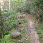
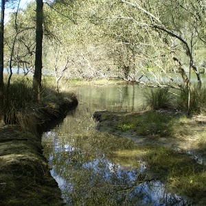
Continue straight: From the intersection, this walk follows the GNW arrow post along the mostly flat track, through the dense forest, and almost immediately passes a concrete sewerage access point[49]. After about 70m, this walk heads down a few timbers steps to cross a small gully[50], where the track continues for another 100m (passing close to a few houses[51]), then crosses two flat timber bridges[52] over Congham Creek. Here the walk veers left up onto the rock platform[53] and follows the track gently uphill for another 80m to come to a three-way intersection, marked with a GNW arrow post[54] (and a sign pointing left to ‘Marsfield’[55]).
Veer right: From the intersection, the walk follows the GNW arrow post[56] north, uphill for about 30m to come to a faint intersection with a track (on your right) marked with a GNW arrow post[57].
Veer left: From the intersection, this walk follows the GNW arrow post[58] gently uphill along the side of the hill (keeping the valley to your left) for about 100m to come to a small clearing and three way intersection, marked with yet another GNW arrow post[59] and a pile of rocks[60] (on your left).
(6.66km) Int of the GNW and mid Gloucester Ave fire trail access track → Int of the Great North Walk and the West Pymble service trail link track
620 m
14 mins
29m
-36m
Hard track
(7.28km) Int of the GNW and the West Pymble service trail link track → Int of the GNW and the Avondale creek service trail
210 m
4 mins
5m
-7m
Moderate track
(7.48km) Int of the GNW and the Avondale creek service trail → Int of the GNW and the South Turramurra High School trail
490 m
13 mins
46m
-12m
Moderate track
Continue straight: From the intersection, this walk heads gently uphill following the main track, whilst keeping the valley to your left for about 30m to come to a clear Y-intersection marked with a GNW arrow post[75].
Veer left: From the intersection, this walk follows the GNW arrow post[76] along the track, keeping the Lane Cove River a short distance to your left[77]. After about 80m, the track steps up to and crosses a short section to timber boardwalk/bridge[78]. Here the walk climbs up the rocky hill following a series of concrete access points[79] and timber steps[80] for about 230m to come to a T-intersection with a management trail, marked with a GNW arrow post[81].
(7.97km) Int of the GNW and the Turramurra High School service trail → Creek crossing
840 m
17 mins
23m
-35m
Moderate track
Continue straight: From the intersection just below the Koombalah Ave gate, this walk follows the management trail gently downhill, whilst keeping the valley to your left. The trail initially leads over a rock platform, then about 50m later, leads down a steep hill[84]. The trail then heads gently down for about 400m before a short steep hill[85] leads down to a metal high tension power line tower[86]. Here the trail bends right and leads down and along the side of the hill for another 200m to pass another high tension power line tower[87] and head behind a few houses. Just behind the second house, this walk comes to ephemeral creek on a rock platform[88].
(8.81km) Creek crossing → Browns Waterhole int
300 m
6 mins
2m
-17m
Moderate track
Turn left: From the intersection, this walk follows the GNW arrow post downhill[91] along the wide, shared, concrete path. After about 50m, this path leads under some high tension power lines[92] then bends right[93]. About 50m after passing under the power lines, this path leads to an intersection with a track[94] (on your left, that leads to an informal unfenced lookout), just before a GNW arrow post[95].
Continue straight: From the intersection, the walk heads fairly steeply downhill along the concrete path. The path passes a few signs[96] over about 100m, then comes to an intersection with a track (on your left), marked with a timber barricade and a GNW arrow post[97].
Veer right: From the intersection, this follows the concrete path downhill for just shy of 50m to come to a intersection with a dirt management trail[98]. This intersection is beside the Lane Cove River crossing[99] (on your left) and is marked with a ‘The Great North Walk’ sign here[100].
Browns Waterhole
(9.11km) Browns Waterhole int → Int of GNW and the STEP track (east)
570 m
12 mins
24m
-14m
Easy track
Veer left: From the intersection, this walk follows the GNW arrow post[108] downhill along the management trail for about 30m to cross a small culverted creek[109]. The walk then follows the trail up the short hill to come to an intersection with the signposted ‘STEP track’[110][111] (on your right).
(9.68km) Int of GNW and the STEP track (east) → Int of GNW and the STEP track (west)
580 m
10 mins
8m
-9m
Easy track
(10.26km) Int of GNW and the STEP track (west) → Int of the GNW and the Morona Ave trail
2.2 km
39 mins
54m
-23m
Moderate track
Veer right: From the intersection, this walk follows the ‘Thornleigh Station’ sign[123] past the ‘Lane Cove Valley’ map, initially keeping the other trail and river to your left. The trail follows the valley floor, keeping the river just to your left, for a bit over 500m, to then cross the Lane Cove River at a rocky ford[124]. This crossing may become impassable after heavy or prolonged rain. On the other side of the river, this walk continues along the trail[125] for about 400m (with the river now close by on your right) to come to an intersection with a faint track[126] (on your left, that leads up towards Pennant Hills Park).
Continue straight: From the intersection, the walk follows the management trail, keeping the river just to your right. After about 60m, the trail bends right and crosses the Lane Cove River at a rocky ford[127], then continues along the valley floor among the fern trees (and concrete pipe access points[128]) for about 900m to cross the Lane Cove River again at another rocky ford[129]. (These crossings may become impassable after heavy or prolonged rain). The trail then continues along the valley floor[130] (with the river now on your left) for just over 150m to come to an intersection at the bottom of the sealed Morona Ave trail[131] (on your right), marked with a ‘Lane Cove Valley’ map/sign[132] and a GNW arrow post[133].
(12.46km) Int of the GNW and the Morona Ave trail → Conscript Pass
330 m
8 mins
24m
-8m
Moderate track
(12.79km) Conscript Pass → Int of the GNW and Lorna Pass tracks
100 m
3 mins
19m
0m
Moderate track
Conscript Pass
(12.9km) Int of the GNW and Lorna Pass tracks → BP camping area
840 m
20 mins
55m
-34m
Hard track
Turn left : From the intersection, this walk follows the ‘Baden Powell Scout Centre’ sign[155] gently down along the side of the hill for just shy of 40m to come to a four-way intersection, where a ‘Thornleigh Oval’ sign[156] points back along the track.
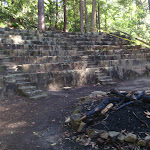
Continue straight: From the intersection, this walk follows the ‘Baden-Powell Scout Centre’ sign[157] and the GNW arrow post[158] west along the narrow track. The track leads through the dense heath[159] for about 120m to come to an intersection and clearing at a rocky outcrop[160], marked with a GNW arrow post[161].
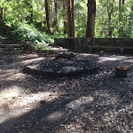
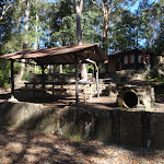
Turn right: From the clearing, this walk follows the GNW arrow post north, downhill along the narrow track. After about 120m the rocky track leads to a small flat clearing[162] where this walk turn left (following the GNW arrow post) passing through about 20m of heath to come to another clearing (with a campfire scar[163]). Following the GNW arrow post, this walk soon bends right to step down to the edge of a creek[164]. Here the walk turns left and follows the creek downstream for about 20m to then bend right and cross Scout Creek[165]. The walk then heads uphill along the widening track for about 130m (passing a few scout constructions[166], and a track on the left[167]) then walks up under the high ropes course[168]. About 20m after the ropes course, this walk comes to an intersection with a dirt driveway[169], beside the green Pioneer Hut[170] (shed on the left). There is also a tap and drinking fountain here[171].
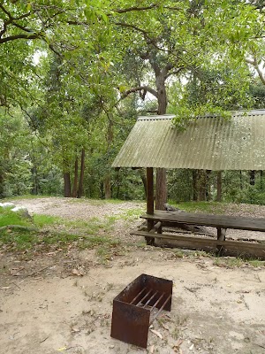
Turn right: From the intersection, this walk follows the gravel driveway[172] east, away from the Pioneer Hut[173] and towards the picnic shelters. After about 30m (just after the left bend), this walk comes to some of these picnic shelters[174] and several tiered platforms (on your right) – this is the camping area (there is a stone building up to your right).
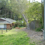
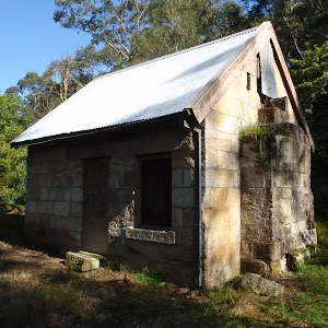
Baden Powell Scout Centre
End of day 1
(13.74km) BP camping area → Int of BP camp and unnamed track
450 m
10 mins
20m
-21m
Hard track
Turn left: From the intersection, this walk follows the track downhill, initially keeping the green Pioneer Hut[183] (shed) on your right. After about 20m, the track begins to narrow and heads under the high ropes course[184]. The walk continues downhill for about 130m (passing a track on the right[185] and a few scout constructions[186]) to cross Scout Creek[187]. Here the walk bends left and follows the creek for about 20m before turning right, and stepping up, at a faint intersection. The track then veers left to find a clearing (with a campfire scar[188]) then about 20m through the heath on the other side, this walk finds another flat clearing[189]. Here the walk turns right and follows the GNW arrow post up along the rocky track for about 120m to come to a rocky outcrop and clearing marked with another GNW arrow post[190].
(14.19km) Int of BP camp and unnamed track → Back of Thornleigh Oval
370 m
7 mins
27m
0m
Moderate track
Continue straight: From the intersection, this walk follows the ‘Thornleigh Oval’ sign[194] gently up along the side for the hill for about 40m to come to an intersection with ‘Lorna Pass’ (on your right), and a large Great North Walk sign pointing back to the ‘Baden Powell Scout Centre’[195].
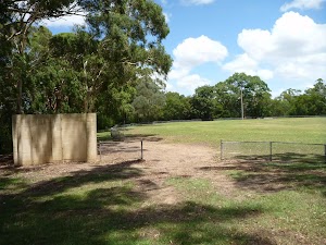
Continue straight: From the intersection, this walk follows the GNW arrow post and ‘Thornleigh Station’ sign[196] uphill along the wide rocky track[197]. After just over 150m, the track bends left (ignoring a faint track on your right[198]) and heads uphill for another 40m to come to the back (south-east corner) of Thornleigh Oval[199], marked with a ‘Lane Cove National Park’ signpost[200].
(14.55km) Back of Thornleigh Oval → Int of Handley and Ferguson Avenues
160 m
3 mins
3m
0m
Easy track
Thornleigh Oval
(14.71km) Int of Handley and Ferguson Avenues → Thornleigh Train Station
920 m
16 mins
19m
-5m
Easy track
Veer left: From the base of the steps, this walk follows the GNW arrow across ‘Railway Pde’[220], heading towards the train line. At the fence, this walk veers left and leads along the pedestrian alley[221] for about 60m before turning right and climbing up the railway bridge steps[222], coming to the ‘Thornleigh’ Train Station[223].
(15.63km) Thornleigh Train Station → Morgan Rd
990 m
18 mins
7m
-47m
Easy track
(16.62km) Morgan Rd → Int of Bike Trail and Morgan Rd tracks
230 m
4 mins
3m
-7m
Moderate track
(16.85km) Int of Bellamy trail and Morgan Rd tracks → Zig Zag Creek Bridge int.
130 m
2 mins
0m
-6m
Easy track

Thornleigh zigzag railway
(16.97km) Zig Zag Creek Bridge intersection → The Jungo
1.4 km
25 mins
16m
-37m
Moderate track
The Jungo
(18.41km) Jungo campsite → Int of GNW and Stringybark Ridge trail
100 m
2 mins
1m
0m
Moderate track
(18.51km) Int of GNW and Stringybark Ridge trail → Elouera Lookout
1 km
27 mins
81m
-58m
Moderate track
Elouera Lookout
(19.56km) Elouera Lookout → Int of the Great North Walk and the Blackfellows Head lookout track
2.8 km
1 hr 10 mins
188m
-194m
Moderate track
Veer left: From the intersection, this walk heads north along the main rocky track, keeping the valley down to your left. The track leads along beside a rock wall (which is on your right) and through a rock outcrop[291], where the track soon heads quite steeply uphill along the eroded track[292] for a short time. At the top of this steep section, the rocky track continues to meander much more gently up along the side of the hill[293] for about 300m, then crosses a small, rocky gully[294], just below some houses[295]. The track then continues gently uphill for about 100m to an intersection with the unsignposted Blackfellows Head track[296] (on your right).
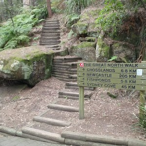
(22.33km) Int of the Great North Walk and the Blackfellows Head lookout track → Fishponds Lookout
1.1 km
23 mins
28m
-96m
Hard track
Veer left: From the intersection, this walk follows the ‘Fishponds’ sign[298] past the ‘Berowra Valley Regional Park’ sign[299], gently uphill along the narrow ridge[300]. The track is mostly flat for about 200m before it starts to head fairly steeply down over some rocks[301] and down a set of rock steps[302]. This area comes alive with Patersonia lilies and pink wax flowers in early spring. The track then continues fairly gently down along the narrow ridge[303] for another 200m before leading through a crack in a rock, then down a bit further to climb down through a particularly steep rocky section[304]. Near the bottom of this descent, this walk passes a couple of arrow posts[305], where the track bends right to pass below a large rock overhang[306]. Just beyond this overhang, the track bends left and leads across Waitara Creek at the interesting holes in the rock know as ‘the spa’[307]. This creek may become impassable after heavy rain, the rocks can also be slippery. Across the creek, the walk comes to a large rock platform and a Blue Gum Track post[308]. After stopping to enjoy cool spot, this walk continues left along the unfenced rock platform[309] (keeping the creek down to your left). The walk soon steps off this large rock (at the far right-hand corner, through the fork in a tree[310]). This walk heads over another rock platform[311], then along a notably flat section of track[312] (now with Berowra Creek on your left), passing beside some cascades[313] for about 100m before climbing up and over some rocks and under a sandstone overhang[314]. The track leads around the side of the hill for about 100m, then down to cross a small creek using the small flat timber bridge[315]. The walk then climbs up some timber steps[316] to a fenced lookout[317] over Fishponds, at a well-signposted intersection[318]. A sign points back along the track to ‘Thornleigh Station’[319].
Fishponds Lookout
(23.39km) Fishponds Lookout → Fishponds crossing
70 m
2 mins
3m
-4m
Moderate track
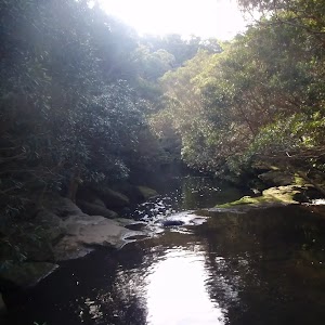
Fishponds
(23.39km) Fishponds Lookout → Int of Blue Gum Walk and Joes Mountain Service Trail
300 m
7 mins
39m
0m
Moderate track
Continue straight: From the intersection, the walk follows the ‘Hornsby Station’ sign up[335] along the track a short distance to come to an intersection with a wide management trail[336].
(23.69km) Int of Blue Gum Walk and Joes Mountain Service Trail → Int of Great North Walk and Rosemead Rd service trail
850 m
19 mins
35m
-45m
Moderate track
(24.54km) Int of Great North Walk and Rosemead Rd service trail → Berowra Valley Bushland Park
30 m
1 mins
4m
0m
Easy track
Berowra Valley Bushland Park

(24.57km) Berowra Valley Bushland Park → Int of Quarry Road and Great North Walk
540 m
14 mins
89m
-12m
Hard track
Continue straight: From the intersection, this walk follows the GNW arrow post up a couple of timber steps[360] and then follows the track as it winds up over the gentle rise. Once over the rise, the track then leads down to the intersection with Quarry Rd, where a ‘Great North Walk’ sign[361] points back up the track.
(25.12km) Int of Quarry Road and Great North Walk → Hornsby Train Station
720 m
14 mins
34m
-8m
Easy track
Continue straight: From the intersection, this walk follows Quarry Rd up the gentle hill[364] for about 180m, then follows the GNW arrow[365] left onto Dural St[366]. The footpath leads past the unit block, then past a few shops to come to an intersection with the Pacific Hwy. Following the GNW arrow, this walk turns right across ‘Dural St’[367], passes a few more shops, then crosses ‘Dural Lane’[368] before turning left across the Pacific Hwy at the traffic lights[369]. Here the walk continues straight across the ‘Station St’ pedestrian crossing[370], past the large ‘Great North Walk’ sign[371] and across the bus lane to the western entrance of Hornsby Station[372].
Maps for the Gordon to Hornsby (overnight at Scout camp) walk
You can download the PDF for this walk to print a map.These maps below cover the walk and the wider area around the walk, they are worth carrying for safety reasons.
| Hornsby | 1:25 000 Map Series | 91304S HORNSBY | NSW-91304S |
| Parramatta River | 1:25 000 Map Series | 91303N PARRAMATTA RIVER | NSW-91303N |
| Sydney | 1:100 000 Map Series | 9130 SYDNEY | 9130 |
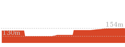
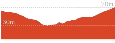
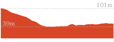
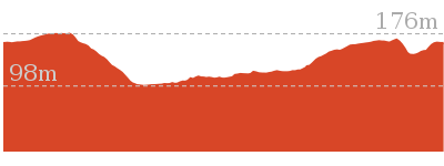
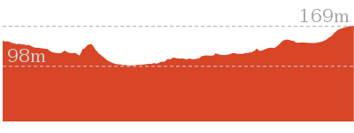
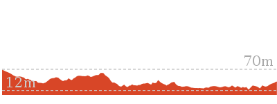
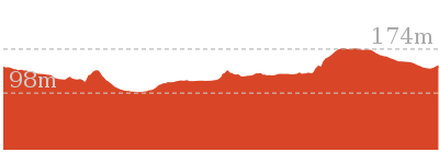
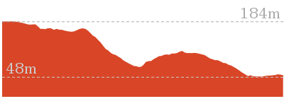
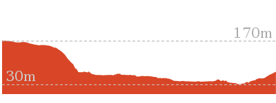
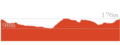
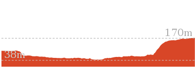
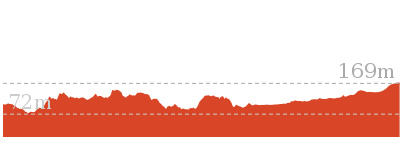
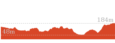
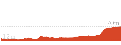
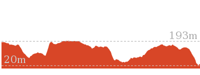
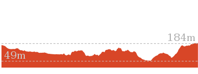
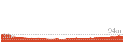
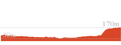
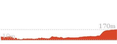
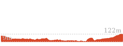
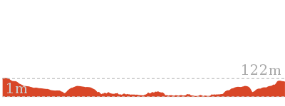
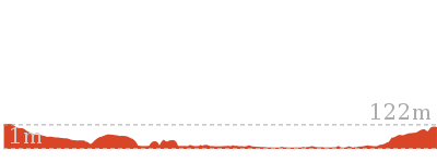
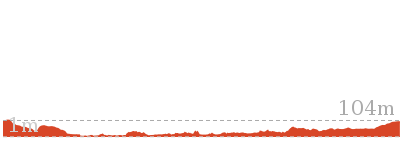
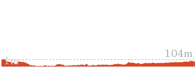
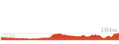
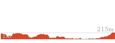
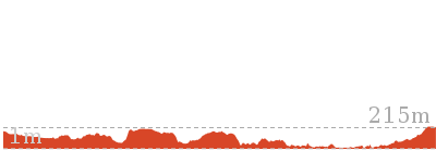
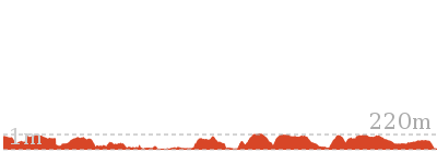
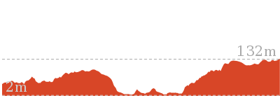
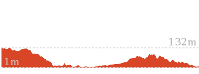
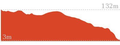
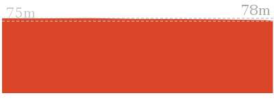
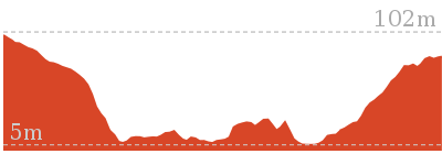
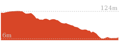
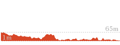
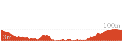
Cross sectional view of the Gordon to Hornsby (overnight at Scout camp) bushwalking track
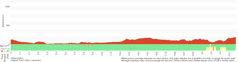
Analysis and summary of the altitude variation on the Gordon to Hornsby (overnight at Scout camp)
Daily actual walking time estimates
| Day | Walking Time | Length |
|---|---|---|
| 1 | 4 hrs 39 mins | 13.7 km |
| 2 | 4 hrs 24 mins | 12.2 km |
Overview of this walks grade – based on the AS 2156.1 – 2001
Under this standard, a walk is graded based on the most difficult section of the walk.
| Length | 25.8 km | ||
| Time | 2 Days | ||
| . | |||
| Grade 4/6 Hard track |
AS 2156.1 | Gradient | Very steep (4/6) |
| Quality of track | Rough track, where fallen trees and other obstacles are likely (4/6) | ||
| Signs | Minimal directional signs (4/6) | ||
| Experience Required | Moderate level of bushwalking experience recommended (4/6) | ||
| Weather | Storms may impact on navigation and safety (3/6) | ||
| Infrastructure | Limited facilities, not all cliffs are fenced (3/6) |
Some more details of this walks Grading
Here is a bit more details explaining grading looking at sections of the walk
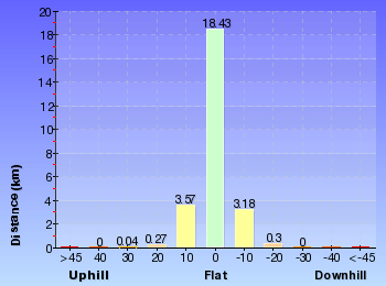
Gradient
13km of this walk has short steep hills and another 8km has gentle hills with occasional steps. Whilst another 3.6km is flat with no steps and the remaining 1.6km is very steep.
Quality of track
11km of this walk follows a formed track, with some branches and other obstacles and another 10km follows a clear and well formed track or trail. Whilst another 2.7km follows a smooth and hardened path and the remaining 1.4km follows a rough track, where fallen trees and other obstacles are likely.
Signs
14km of this walk has directional signs at most intersection and another 11km is clearly signposted. The remaining (800m) has minimal directional signs.
Experience Required
16km of this walk requires no previous bushwalking experience and another 9km requires some bushwalking experience. The remaining (990m) requires a leader a with moderate level of bushwalking experience.
weather
Around 22km of this walk is not usually affected by severe weather events (that would unexpectedly impact safety and navigation), whilst the remaining 4.1km is affected by storms that may impact your navigation and safety.
Infrastructure
Around 16km of this walk has limited facilities (such as not all cliffs fenced), whilst the remaining 10km is close to useful facilities (such as fenced cliffs and seats).
Similar walks
529 m One way
15 mins
Moderate track

619 m One way
30 mins
Moderate track
1.3 km One way
30 mins
Moderate track
2.7 km Circuit
1 Hr
Moderate track


3.2 km Return
1 hr 30 mins
Moderate track
4.2 km Circuit
2 hrs
Hard track

4.2 km Circuit
1 hr 45 mins
Hard track
4.4 km One way
1 hr 45 mins
Hard track

4.4 km One way
1 hr 45 mins
Moderate track
5.1 km One way
2 hrs
Hard track
5.1 km Circuit
2 hrs
Hard track
5.5 km Return
2 hrs
Moderate track

5.6 km Return
2 hrs 30 mins
Hard track
6 km One way
2 hrs 30 mins
Hard track


6.1 km One way
2 hrs 30 mins
Hard track
6.6 km Circuit
2 hrs 30 mins
Hard track

6.7 km Circuit
3 hrs
Hard track

8 km One way
3 hrs
Hard track
8.4 km One way
3 hrs 15 mins
Hard track


8.4 km Circuit
3 hrs
Moderate track

8.6 km One way
3 hrs 45 mins
Hard track

8.9 km One way
3 hrs 30 mins
Hard track

9 km One way
3 hrs 45 mins
Hard track
9.7 km One way
3 hrs 45 mins
Hard track
9.7 km One way
4 hrs
Hard track
10.2 km One way
4 hrs
Hard track
10.2 km One way
3 hrs 45 mins
Moderate track
10.3 km One way
3 hrs 45 mins
Hard track

10.7 km One way
4 hrs 30 mins
Hard track

11.6 km One way
4 hrs 30 mins
Hard track

11.7 km One way
4 hrs 15 mins
Hard track

11.9 km Circuit
5 hrs
Hard track


12.2 km One way
4 hrs 30 mins
Hard track
13.3 km One way
4 hrs 30 mins
Hard track
15.5 km One way
6 hrs
Hard track

16.1 km One way
6 hrs 45 mins
Hard track


16.3 km One way
6 hrs
Hard track
17.5 km One way
6 hrs 45 mins
Hard track


18.1 km One way
6 hrs 45 mins
Hard track

20.6 km One way
8 hrs
Hard track
22.3 km One way
9 hrs
Hard track
22.6 km One way
9 hrs 18 mins
Hard track


28.1 km One way
2 Days
Hard track

33 km One way
2 Days
Hard track


35.9 km One way
2 Days
Hard track

43.1 km One way
3 Days
Hard track

44.4 km One way
3 Days
Hard track

Other Nearby walks

6 km One way
2 hrs 45 mins
Hard track

6.8 km One way
3 hrs
Experienced only
9 km One way
4 hrs
Hard track
4.7 km Return
2 hrs
Moderate track
4.7 km One way
2 hrs 15 mins
Hard track

360 m Return
15 mins
Easy track
2.6 km One way
1 hr 15 mins
Hard track
3.6 km Return
1 hr 30 mins
Hard track
3 km Return
1 hr 30 mins
Moderate track

3.5 km Circuit
1 hr 30 mins
Hard track

6.1 km One way
2 hrs 30 mins
Moderate track
6.7 km Circuit
2 hrs 45 mins
Moderate track
Plan your trip to and from the walk here
The Gordon to Hornsby (overnight at Scout camp) walk starts at the Gordon Station (gps: -33.756038, 151.15425)Your transport options to Gordon Station are by;
(get details)
The Gordon to Hornsby (overnight at Scout camp) ends at the Hornsby Train Station (gps: -33.703509, 151.09801)
Your transport options to Hornsby Train Station are by;
(get details)


Short URL = http://wild.tl/gthwoabpsc
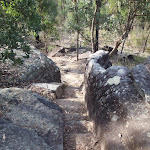
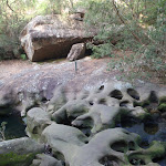
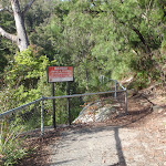
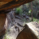
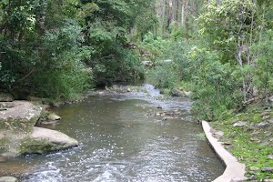
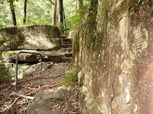
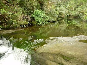
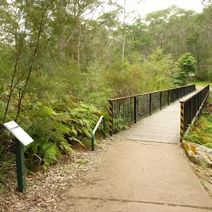
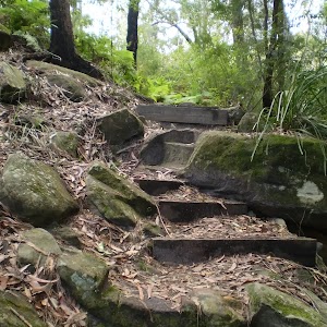
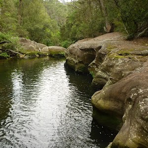
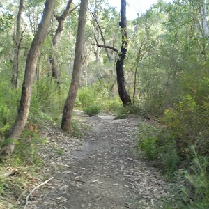
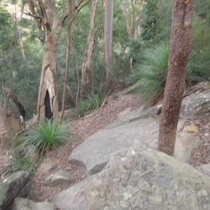
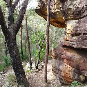
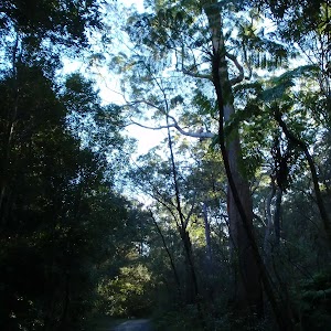
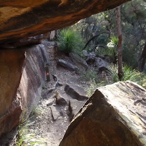
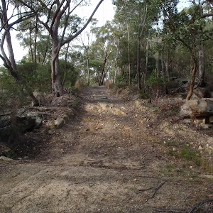
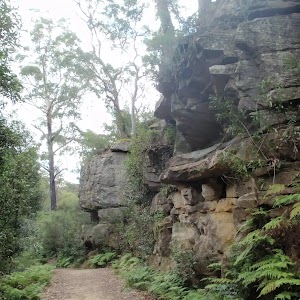
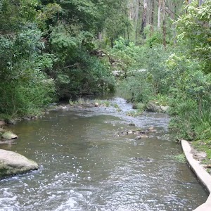
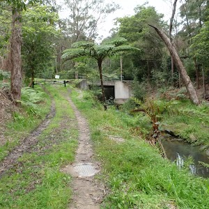
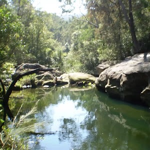
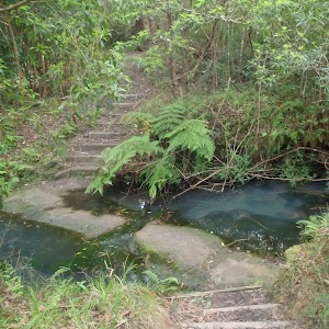
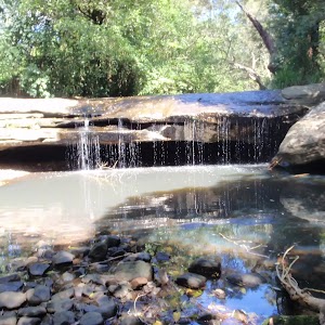
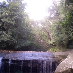
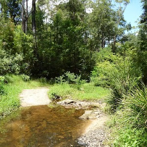
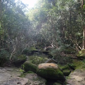
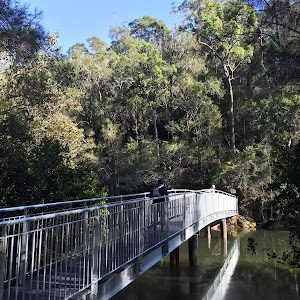
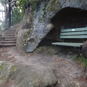
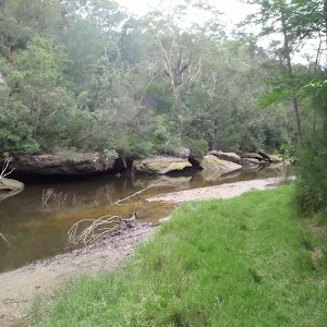
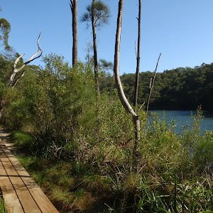
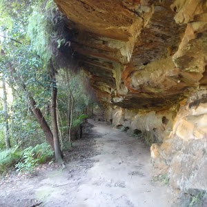
Gallery images
There are other downloads I am still working on.
You will probably need to login to access these — still all free.
* KML (google earth file)
* GPX (GPS file)
Special Maps/ brochures
* A3 topo maps
* PDF with Lands Topo map base
* PDF with arial image (and map overlay)
I wanted to get the main site live first, this extra stuff will come in time.
Happy walking
Matt 🙂
Comments