St Ives to Davidson Park via Casuarina Track


4 hrs

399 m
Hard track


(0km) Hunter Ave (opposite Yarrabung Rd) → Int of Pipeline Track and Founders Way

910 m
19 mins
28m
-43m
Easy track
(0.91km) Int of Pipeline Track and Founders Way → Int of Pipeline and Bungaroo Tracks
180 m
3 mins
8m
0m
Easy track
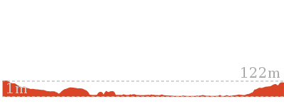
(1.09km) Int of Pipeline and Bungaroo Tracks → Int of Bungaroo and Lower Link Track
1.3 km
33 mins
47m
-165m
Hard track
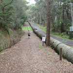
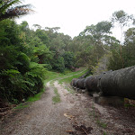
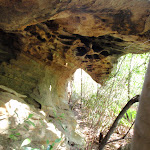
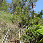
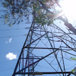
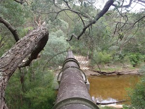
Turn left: From the intersection, this walk follows the bush track east towards the rock platforms, where it follows the steps down a cleft between the rocks. The walk continues along the bush track, winding through the bush and under some high-tension power lines and down some spaced-out wooden steps, until it comes to the intersection with the middle link track at a rock surface with some green painted arrows.
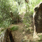
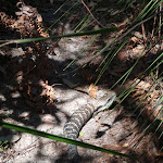
Veer left: From the intersection, this walk follows the bush track heading east, down the hill and through the bush for a while, steadily winding down wooden and rock steps. The track heads down around some rock platforms and past an information sign on a local bird called the Anomalous Hornbill. The walk passes a track marker and continues down some more wooden steps to the intersection of the lower link track.
(2.39km) Int of Bungaroo and Lower Link Track → Int of Gov. Phillip and Bungaroo tracks
240 m
4 mins
10m
-5m
Moderate track
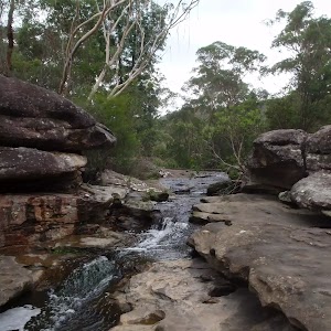
Bungaroo

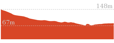
(2.63km) Int of Gov. Phillip and Bungaroo tracks → Int of Davidson and Governor Phillip tracks
700 m
16 mins
30m
-38m
Moderate track
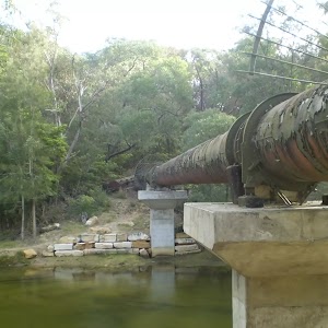
Pipeline
(3.32km) Int of Davidson and Governor Phillip tracks → Int of Lyrebird and Carroll Creek tracks
1.5 km
28 mins
39m
-31m
Moderate track
(4.83km) Int of Lyrebird and Carroll Creek tracks → Int of Casuarina and Carroll Creek Tracks
740 m
12 mins
21m
-3m
Moderate track
(5.58km) Int of Casuarina and Carroll Creek Tracks → Int of Casuarina Track and Boree Road service trail
1.4 km
34 mins
101m
-45m
Hard track
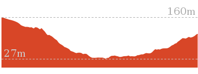
(7km) Int of Casuarina Track and Boree Road service trail → Casuarina Lookout
1.7 km
46 mins
111m
-182m
Hard track
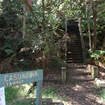
(8.74km) Casuarina Lookout → Bottom of the Casuarina Steps
130 m
2 mins
0m
-9m
Moderate track
(8.87km) Bottom of the Casuarina Steps → Int of Davidson Park driveway and Rotary Rotunda path
160 m
3 mins
4m
-2m
Very easy
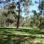
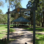
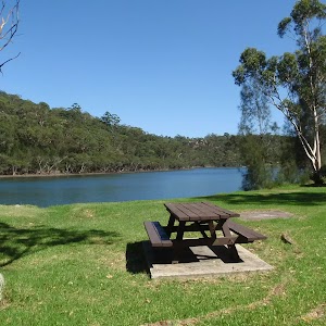
Davidson picnic area

Maps for the St Ives to Davidson Park via Casuarina Track walk
You can download the PDF for this walk to print a map.These maps below cover the walk and the wider area around the walk, they are worth carrying for safety reasons.
| Hornsby | 1:25 000 Map Series | 91304S HORNSBY | NSW-91304S |
| Parramatta River | 1:25 000 Map Series | 91303N PARRAMATTA RIVER | NSW-91303N |
| Sydney | 1:100 000 Map Series | 9130 SYDNEY | 9130 |
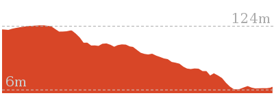
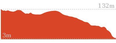
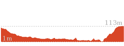
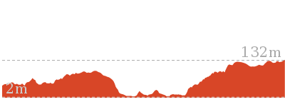
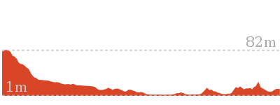
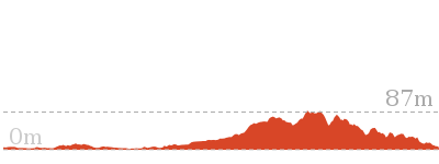
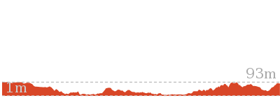
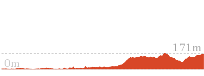
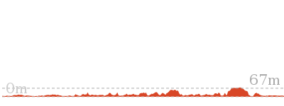
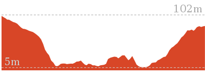
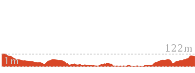
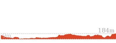
Cross sectional view of the St Ives to Davidson Park via Casuarina Track bushwalking track
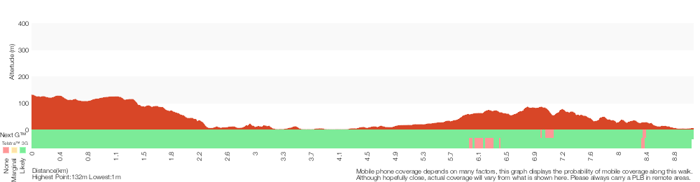
Analysis and summary of the altitude variation on the St Ives to Davidson Park via Casuarina Track
Overview of this walks grade – based on the AS 2156.1 – 2001
Under this standard, a walk is graded based on the most difficult section of the walk.
| Length | 9 km | ||
| Time | 4 hrs | ||
| . | |||
| Grade 4/6 Hard track |
AS 2156.1 | Gradient | Very steep (4/6) |
| Quality of track | Rough track, where fallen trees and other obstacles are likely (4/6) | ||
| Signs | Directional signs along the way (3/6) | ||
| Experience Required | Some bushwalking experience recommended (3/6) | ||
| Weather | Weather generally has little impact on safety (1/6) | ||
| Infrastructure | Limited facilities, not all cliffs are fenced (3/6) |
Some more details of this walks Grading
Here is a bit more details explaining grading looking at sections of the walk
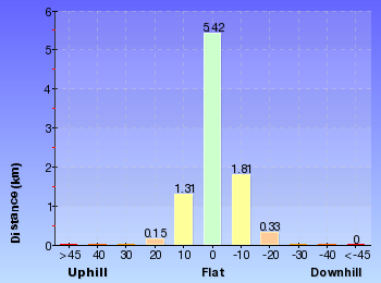
Gradient
3.7km of this walk has short steep hills and another 3.6km has gentle hills with occasional steps. Whilst another 1.4km is very steep and the remaining 330m is flat with no steps.
Quality of track
4.2km of this walk follows a rough track, where fallen trees and other obstacles are likely and another 3.4km follows a formed track, with some branches and other obstacles. Whilst another 1.2km follows a clear and well formed track or trail and the remaining 160m follows a smooth and hardened path.
Signs
Around 4.9km of this walk has directional signs at most intersection, whilst the remaining 4.1km is clearly signposted.
Experience Required
Around 6km of this walk requires some bushwalking experience, whilst the remaining 2.8km requires no previous bushwalking experience.
weather
This whole walk, 9km is not usually affected by severe weather events (that would unexpectedly impact safety and navigation).
Infrastructure
Around 6km of this walk is close to useful facilities (such as fenced cliffs and seats), whilst the remaining 3.5km has limited facilities (such as not all cliffs fenced).
Similar walks
3 km Return
1 hr 30 mins
Moderate track

3.5 km Circuit
1 hr 30 mins
Hard track

3.6 km Return
1 hr 30 mins
Hard track
3.8 km One way
1 hr 30 mins
Hard track

3.8 km One way
1 hr 45 mins
Hard track

4.7 km Return
2 hrs
Moderate track
4.7 km One way
2 hrs 15 mins
Hard track

5.8 km One way
2 hrs 30 mins
Hard track
6.8 km One way
3 hrs
Experienced only
7 km Return
3 hrs 45 mins
Moderate track

7 km Circuit
2 hrs 30 mins
Hard track
11.2 km One way
4 hrs 30 mins
Hard track
11.5 km One way
4 hrs 30 mins
Hard track

14.1 km One way
5 hrs 30 mins
Moderate track
15.1 km Circuit
5 hrs 45 mins
Experienced only
Other Nearby walks

6 km One way
2 hrs 45 mins
Hard track

2.6 km One way
1 hr 15 mins
Hard track
3 km Return
1 hr 15 mins
Moderate track

5.5 km Return
2 hrs
Moderate track


12.2 km One way
4 hrs 30 mins
Hard track

25.8 km One way
2 Days
Hard track
13.3 km One way
4 hrs 30 mins
Hard track

10.7 km One way
4 hrs 30 mins
Hard track


1.8 km One way
50 mins
Moderate track
3.5 km Return
1 hr 30 mins
Moderate track

3.2 km One way
1 hr 30 mins
Moderate track
2 km Return
1 hr 15 mins
Hard track

Plan your trip to and from the walk here
The St Ives to Davidson Park via Casuarina Track walk starts at the Hunter Ave (opposite Yarrabung Rd) (gps: -33.74178, 151.16694)Your transport options to Hunter Ave (opposite Yarrabung Rd) are by;
(get details)
The St Ives to Davidson Park via Casuarina Track ends at the Int of Davidson Park driveway and Rotary Rotunda path (gps: -33.768199, 151.20325)
Your transport options to Int of Davidson Park driveway and Rotary Rotunda path are by;
(get details)


Short URL = http://wild.tl/ptdpvct
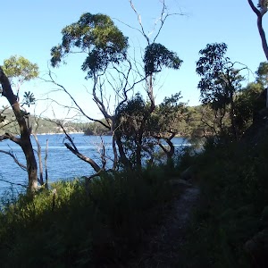
Gallery images
There are other downloads I am still working on.
You will probably need to login to access these — still all free.
* KML (google earth file)
* GPX (GPS file)
Special Maps/ brochures
* A3 topo maps
* PDF with Lands Topo map base
* PDF with arial image (and map overlay)
I wanted to get the main site live first, this extra stuff will come in time.
Happy walking
Matt 🙂
Comments