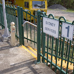
Cowan to Wondabyne station via Patonga rest area


2 Days

1523 m
Hard track
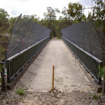


(0km) Cowan Station → Freeway Bridge

300 m
6 mins
8m
-15m
Easy track
(0.3km) Freeway Bridge → Jerusalem Bay
2.2 km
50 mins
61m
-222m
Moderate track
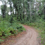
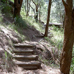
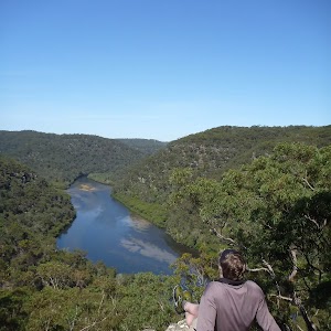
Continue straight: From the intersection, this walk heads downhill along the rocky track[23][24]. The track leads past a few rock walls[25] over about 350m, then turns right onto, then steps down off, a long thin rock platform[26]. The track continues down along the side of the valley for another 200m, passing into a much more lush and dense forest[27], where the track then crosses the creek at a large rock platform[28]. On the other side of the creek, the track leads right down along the other side of the valley[29], passing a few small sandstone overhangs[30][31] then a particularly broad angophora tree[32] after about 500m. Soon after this angophora, the track leads down some rock steps[34] then begins to widen for about 300m, and passes a small track (on your right) marked with a ‘No Camping or fires allowed’ sign[35]. By this point, the broad waters (or mud flats, depending on the tide) of Cowan Creek are obvious[36], on your right. The walk now continues along the generally broad and flat track[37] for another 500m, then climbs up a set of concrete steps[38], marked with a GNW arrow post. At the top of these steps is a large, fairly flat clearing[39] with a ‘No Camping’ and a ‘Great North Walk’ sign[40] and a great view up the middle of Jerusalem Bay[41].
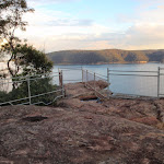
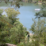
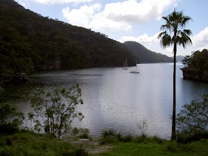
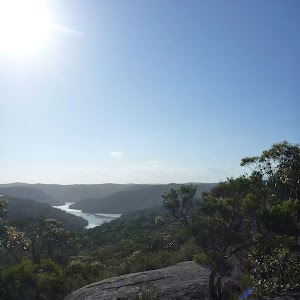
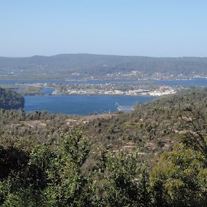
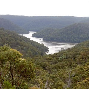
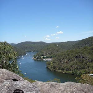
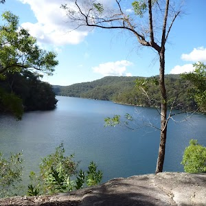
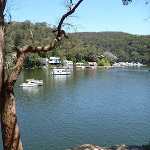
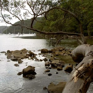
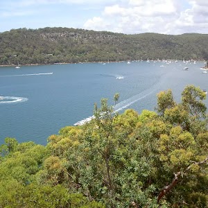
Jerusalem Bay
(2.46km) Jerusalem Bay → Int. Jerusalem Bay Trk and Brooklyn Dam Service Trail
3 km
1 hr 29 mins
350m
-183m
Hard track
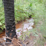
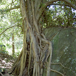
Continue straight: From the top of the ridge, this walk follows the ‘Brooklyn Dam’ sign[64], gently uphill, heading north through the tall heath. The mostly flat track leads through the forest[65], with an occasional glimpse[66][67] to the freeway and down to Brooklyn. after about 400m, the track bends left and leads through a long cleft in the rock[68]. Here the track start to head more and more steeply down[69] for the next 350m, until heading down some timber steps[70] which lead to Campbells Creek. The walk steps over the small (orange, polluted [71]) creek to find a flat sandy clearing [72] a few metres past the creek.
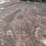
Continue straight: From the small clearing[73], this walk follows the clear track away from the creek, and soon bends left then begins to climb. The rocky track climbs steeply for about 200m, passing among the grass trees and eucalyptus[74]. The track flattens out and passes alongside a rock wall[75], then resumes the climb up the hill. At the top of this climb, the track passes a couple of small rock overhangs[76] then climbs about halfway up a section of rock[77] to follow the longer section of rock platform[78] to the right. The track then gently undulates along the side of the hill, passing a section of hand rail[79] after about 70m. The track then follows a series of small rock walls[80] (on your left) for about 250m before climbing up onto a flat, sandy track. This soon leads to a faint intersection[81] (with a track on your right, which goes to a large rock platform[82]). From here, the sandy track stays mostly flat[83] for about 300m before veering left at a GNW arrow post, leading up a more rocky section of track[84] and then climbing up some steel pegs[85] in the rock wall at the next GNW arrow post[86]. Here the track leads up the short hill and comes to a T-intersection with a wide management trail, where a ‘Jerusalem Bay’ sign[87] points back down the hill.
(5.49km) Int. Jerusalem Bay Trk and Brooklyn Dam Service Trail → freeway view point
100 m
2 mins
3m
-11m
Hard track
(5.49km) Int. Jerusalem Bay Trk and Brooklyn Dam Service Trail → Upper Int. of Brooklyn Dam Service Track and Brooklyn Dam Bushtrack
2.8 km
57 mins
86m
-133m
Moderate track
(8.28km) Upper Int. of Brooklyn Dam Service Track and Brooklyn Dam Bushtrack → NW Brooklyn Dam Campsite
1.3 km
28 mins
31m
-95m
Moderate track
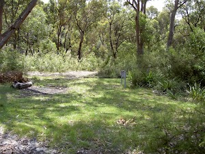
Small Campsite Brooklyn Dam
(9.63km) NW Brooklyn Dam Campsite → NE Brooklyn Dam Campsite
180 m
4 mins
7m
-7m
Hard track
(9.63km) NW Brooklyn Dam Campsite intersection → Lower Int. of Brooklyn Dam Service Track and Brooklyn Dam Bushtrack
90 m
2 mins
1m
-1m
Easy track
(9.72km) Lower Int. of Brooklyn Dam Service Track and Brooklyn Dam Bushtrack → NE Brooklyn Dam Campsite
700 m
13 mins
14m
-14m
Easy track
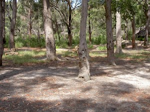
Large Campsite Brooklyn Dam
(10.42km) NE Brooklyn Dam Campsite → Int of George & William Sts
2.7 km
59 mins
100m
-165m
Hard track
Continue straight: From the intersection, this walk follows the ‘Brooklyn Station’ sign[151] gently downhill along the management trail, keeping the Hawkesbury River glimpses to your left. The trail gently undulates[152] for about 600m before bending left to find a large clearing[153] and water glimpses. From the clearing, the trail starts to lead downhill[154] towards the water, and after nearly 100m, the trail leads steeply down a short section of concreted trail[155]. Just after this, the trail leads steeply again over a longer section of concrete[156], where the trail then leads through a rock cutting[157] to find an even longer and steeper section of concrete trail[158]. This section of concrete leads down for about 220m, sweeping left to head around a locked gate[159], past a large ‘Great North Walk’ sign[160] to find the southern end of William St. Here the walk turns right to head down William St[161] then across George St[162] to find a few ‘Great North Walk’ signs on the corner[163].
(13.1km) Int of George & William Sts → Int of Brooklyn & Dangar Rds
200 m
4 mins
2m
-5m
Very easy
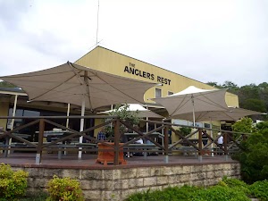
Brooklyn Accomodation
(13.3km) Int of Brooklyn AND Dangar Rds → Hawkesbury River Railway Station
90 m
1 mins
1m
0m
Very easy
(13.39km) Brooklyn Railway Station → Brooklyn Ferry Terminal
100 m
2 mins
0m
-3m
Easy track
(13.49km) Brooklyn Ferry Terminal → Patonga Wharf car park
8.4 km
1 Hr
3m
-2m
Easy track
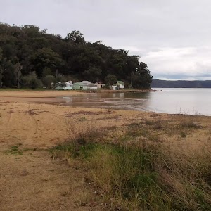
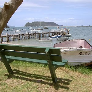
Patonga Village
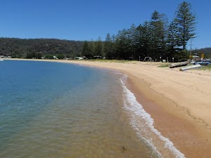
(21.84km) Patonga Wharf car park → Eastern end of Patonga Beach
530 m
10 mins
14m
-13m
Easy track
Continue straight: From the boat ramp, this walk follows the power lines across the car park, keeping the water to the right. The walk heads around the gate and continues to follow the power lines across the sand, coming to the eastern end of Patonga Beach and the ‘Brisbane Water National Park’ sign[197]. This area of the beach is also know as ‘Dark Corner’.
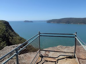
(22.37km) Eastern end of Patonga Beach → Broken Bay View
590 m
21 mins
122m
0m
Moderate track
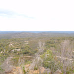
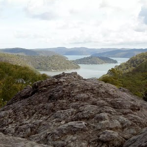
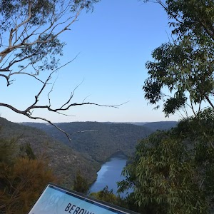
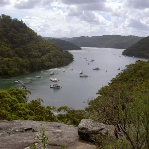
Broken Bay View

(22.96km) Broken Bay View → Warrah Lookout intersection
700 m
15 mins
26m
-26m
Moderate track
Veer right: From the intersection, this walk follows the Great North Walk arrow downhill along the wide management trail. After about 250m, the trail passes a track on the right (marked with 5 large boulders – this informal track leads to an unfenced view). The walk continues along the management trail for another 100m and comes to an intersection near the Warrah Lookout, and a sign pointing back to ‘Patonga’[201].
(23.66km) Warrah Lookout intersection → Warrah Lookout
70 m
2 mins
0m
-12m
Easy track
Warrah Lookout
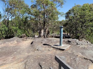
(23.66km) Warrah Lookout intersection → Warrah Trig Station
310 m
7 mins
39m
0m
Easy track
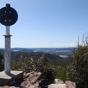
Warrah Trig Station
(23.97km) Warrah Trig Station → Warrah car park
30 m
1 mins
0m
0m
Easy track
(24km) Warrah Car Park → Int Warrah Trig Rd trail and Warrah Trig Station Rd
310 m
5 mins
2m
-4m
Easy track
(24.31km) Int of Warrah Trig trail and Warrah Trig Station Rd → Int of Great North Walk and Patonga Dr
1.2 km
22 mins
23m
-14m
Moderate track
Veer right: From the intersection, this walk follows the GNW arrow marker around the drainage ditch[206] to follow the track running parallel to Patonga Drive (keeping the road about 20m to your left). The track leads through the heath and scribbly gum forest[207] for about 100m before passing some distant ocean views[208] (on your right), where the track continues for another 150m to come to the sealed Patonga Drive[209]. Here the walk follows the GNW arrow post[210] across the road to a locked gate and management trail[211], marked with a ‘Great North Walk’ sign[212].
(25.53km) Int of Great North Walk and Patonga Dr → Int of Rest Area and Girrakool tracks
120 m
2 mins
0m
-4m
Easy track
(25.65km) Int of Rest Area and Girrakool tracks → Rest Area
210 m
3 mins
1m
-7m
Moderate track
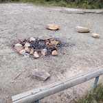
Patonga rest area
End of day 1
(25.85km) Rest Area → Rock platform intersection
950 m
15 mins
12m
-13m
Moderate track
Turn left: From the intersection, this walk follows the ‘Girrakool’ sign[223] gently up along the wide trail. After about 200m, the trail bends left[224], then leads gently down for another 100m, coming to an intersection[225] where the main trail bends right (and with the narrower Patonga Creek trail ahead), marked with a GNW arrow post[226].
Turn right: From the intersection, this walk follows the GNW arrow post north along the wide sandy management trail. The trail leads among the heath and large scribbly gums[227] for about 270m to come to T-intersection[228] with another wide trail[229], marked with a ‘Patonga’ sign[230] pointing back up along the trail.
Turn left: From the intersection, this walk follows the ‘Girrakool’ sign[231] downhill along the management trail. Over the next 200m, the trail gently bends right then comes to an intersection (just before a large open rock platform[232]), marked with a ‘Girrakool’ sign[233] (pointing right).
(26.81km) Int of Hawkesbury track and Patonga Dr trail → Int of Hawkesbury track and Sani Depot Trail
1.1 km
21 mins
25m
-39m
Moderate track
(27.92km) Int of Hawkesbury track and Sani Depot Trail → Rock Platform
1.3 km
25 mins
21m
-56m
Moderate track
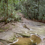
Continue straight: From the intersection, this walk follows the wide trail downhill[249], keeping the valley to your left. The trail winds downhill for almost 600m, crossing a couple of culverted creeks[250][251], until, just after a left-hand bend, this walk comes to a noteable rock platform[252] (with an ephemeral creek) and filtered view down the valley (to your left)[253].
(29.25km) Rock Platform → Int of Hawkesbury track near Patonga Creek
520 m
12 mins
24m
-27m
Moderate track
(29.77km) Int of Hawkesbury track near Patonga Creek → Int of Hawkesbury Track and Dillons Trail
2.3 km
52 mins
128m
-86m
Hard track
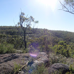
Veer left: From the view point over Woy Woy Landfill[276], this walk heads west following the rocky track uphill, directly away from the view. The sandy track[277] soon leads up a few rock steps[278] and after about 130m, climbs up a few carved steps[279] onto a fairly large rock platform[280], marked with a GNW arrow post[281]. The track now undulates, following a series of GNW arrow posts (generally up) along a rocky ridge line[282], passing over many rock platforms[283] for almost 1km (enjoying the distant views[284][285] over Woy Woy Bay and the Brisbane Water, to your right) to come to the highpoint on this section of track[286]. From here, the track continues mostly flat for the next 500m, then begins to head downhill for about 300m to come to a clear intersection[287] with the signposted ‘Dillons Trail’[288]. There is a sign pointing back up the track towards ‘Patonga’[289].
(32.05km) Int of Hawkesbury Track and Dillons Trail → Int of Tunnel Track and Mt Wondabyne trail
650 m
12 mins
23m
-9m
Moderate track
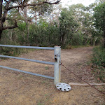
Turn right: From the intersection, this walk follows the GNW arrow post[293] gently uphill along the ‘Tunnel Trail’. After about 50m, the trail passes through a metal gate[294] and fence then continues for just over 100m to come to the signposted intersection with the ‘Rocky Ponds Trail’[295], where a ‘Patonga’ sign[296] points back down along the trail.
Continue straight: From the intersection, this walk follows the GNW arrow marker and the ‘Girrakool’ sign[297] north, gently uphill along the wide trail. The trail winds along the side of the hill for just over 450m, to come to a small crest[298] and a clear three-way intersection with the signposted ‘Mt Wondabyne’ trail[299] (on the left).
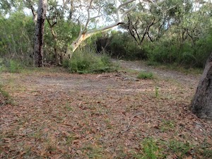
(32.7km) Int of Tunnel Track and Mt Wondabyne trail → Mt Wondabyne Campsite
760 m
16 mins
49m
0m
Moderate track
Mt Wondabyne Campsite
(33.45km) Mt Wondabyne Campsite → Int of Great North Walk and Mt Wondabyne Peak tracks
90 m
2 mins
6m
0m
Moderate track
(33.54km) Int of Great North Walk and Mt Wondabyne Peak tracks → Mt Wondabyne Peak
210 m
5 mins
20m
-1m
Hard track
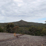
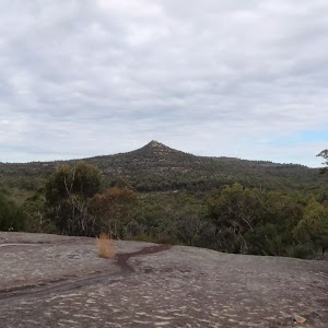
Mt Wondabyne

(33.54km) Int of GNW and Mt Wondabyne Peak tracks → Int of GNW and Mullet Creek Trail
950 m
21 mins
11m
-109m
Hard track
(34.49km) Int of GNW and Mullet Creek Trail → Int of GNW and Mullet Creek Trail (east)
220 m
4 mins
4m
-14m
Easy track
(34.7km) Int of GNW and Mullet Creek Trail (east) → Int of GNW and Thommos Loop trail
830 m
18 mins
50m
-15m
Moderate track
(35.53km) Int of GNW and Thommos Loop track → Int of the Great North Walk and Patonga service trail
1.5 km
28 mins
34m
-54m
Moderate track
(37.02km) Int of the Great North Walk and Patonga service trail → Kariong Brook crossing
690 m
24 mins
21m
-122m
Hard track
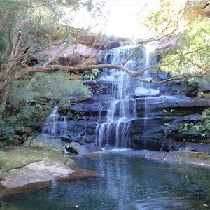
Kariong Brook Falls

(37.71km) Kariong Brook crossing → Myron Brook crossing
400 m
11 mins
33m
-28m
Hard track
(38.11km) Myron Brook crossing → Int of GNW and Wondabyne Station Trail
1.6 km
36 mins
178m
-36m
Hard track
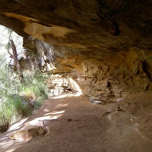
(39.67km) Int of GNW and Wondabyne Station tracks → Eastern end of the Pindar Cave Track
630 m
11 mins
5m
-19m
Moderate track
(40.3km) Eastern end of the Pindar Cave Track → Clearing above Wondabyne Station
1 km
19 mins
3m
-72m
Hard track
(41.34km) Clearing above Wondabyne Station → Wondabyne Station
440 m
13 mins
15m
-100m
Hard track
Wondabyne
Maps for the Cowan to Wondabyne station via Patonga rest area walk
You can download the PDF for this walk to print a map.These maps below cover the walk and the wider area around the walk, they are worth carrying for safety reasons.
| Gosford | 1:25 000 Map Series | 91312S GOSFORD | NSW-91312S |
| Cowan | 1:25 000 Map Series | 91304N COWAN | NSW-91304N |
| Broken Bay | 1:25 000 Map Series | 91301N BROKEN BAY | NSW-91301N |
| Ku-ring-gai Chase National Park Tourist Map | 1:40 000 Map Series | CMA Ku-ring-gai Chase National Park Tourist Map | CMA Ku-ring-gai Chase National Park Tourist Map |
| Gosford | 1:100 000 Map Series | 9131 GOSFORD | 9131 |
| Sydney | 1:100 000 Map Series | 9130 SYDNEY | 9130 |
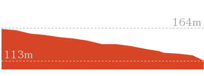
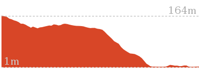
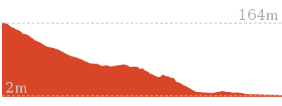
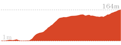
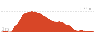
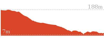
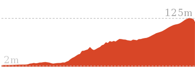
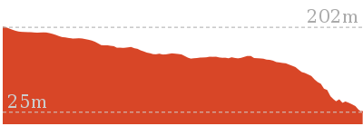
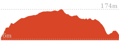
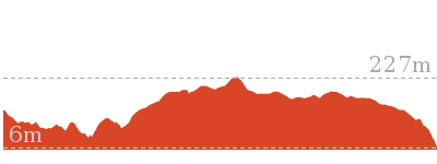
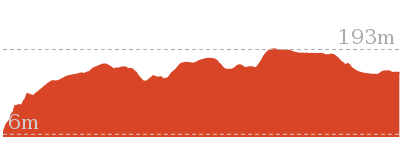
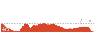
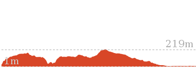
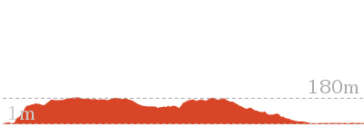
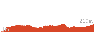
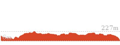
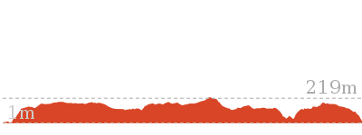
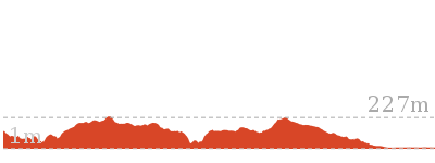
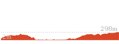
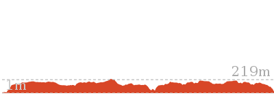
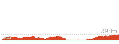
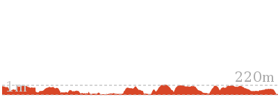
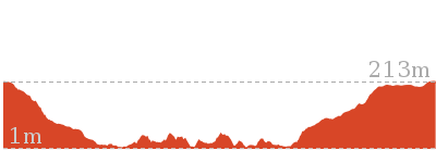
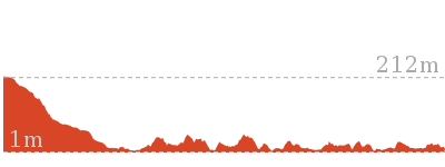
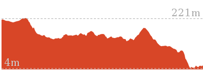
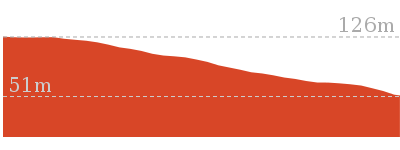
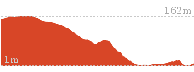
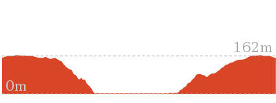
Cross sectional view of the Cowan to Wondabyne station via Patonga rest area bushwalking track
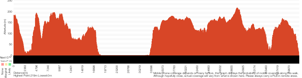
Analysis and summary of the altitude variation on the Cowan to Wondabyne station via Patonga rest area
Daily actual walking time estimates
| Day | Walking Time | Length |
|---|---|---|
| 1 | 7 hrs 45 mins | 26.2 km |
| 2 | 5 hrs 45 mins | 16.1 km |
Overview of this walks grade – based on the AS 2156.1 – 2001
Under this standard, a walk is graded based on the most difficult section of the walk.
| Length | 33.4 km | ||
| Time | 2 Days | ||
| . | |||
| Grade 4/6 Hard track |
AS 2156.1 | Gradient | Very steep (4/6) |
| Quality of track | Rough track, where fallen trees and other obstacles are likely (4/6) | ||
| Signs | Minimal directional signs (4/6) | ||
| Experience Required | Some bushwalking experience recommended (3/6) | ||
| Weather | Storms may impact on navigation and safety (3/6) | ||
| Infrastructure | Limited facilities (such as cliffs not fenced, significant creeks not bridged) (4/6) |
Some more details of this walks Grading
Here is a bit more details explaining grading looking at sections of the walk
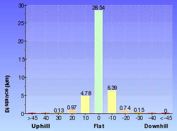
Gradient
13km of this walk has short steep hills and another 11km has gentle hills with occasional steps. Whilst another 10km is flat with no steps and the remaining 7km is very steep.
Quality of track
26km of this walk follows a clear and well formed track or trail and another 9km follows a rough track, where fallen trees and other obstacles are likely. Whilst another 7km follows a formed track, with some branches and other obstacles and the remaining 390m follows a smooth and hardened path.
Signs
25km of this walk has directional signs at most intersection and another 14km is clearly signposted. The remaining (2.2km) has minimal directional signs.
Experience Required
Around 27km of this walk requires no previous bushwalking experience, whilst the remaining 14km requires some bushwalking experience.
weather
Around 39km of this walk is not usually affected by severe weather events (that would unexpectedly impact safety and navigation), whilst the remaining 2.5km is affected by storms that may impact your navigation and safety.
Infrastructure
25km of this walk is close to useful facilities (such as fenced cliffs and seats) and another 16km has limited facilities (such as not all cliffs fenced). The remaining (1.2km) has limited facilities (such as cliffs not fenced, significant creeks not bridged).
Similar walks
756 m Return
20 mins
Easy track
2.2 km One way
1 Hr
Moderate track
2.8 km One way
1 hr 15 mins
Moderate track
4.3 km Return
2 hrs
Moderate track
4.3 km One way
1 hr 45 mins
Moderate track
4.9 km Return
2 hrs
Moderate track
5.1 km Return
2 hrs
Moderate track
5.8 km Return
2 hrs 30 mins
Hard track
8.1 km Return
3 hrs 30 mins
Hard track
9.5 km One way
4 hrs
Hard track
10.1 km One way
4 hrs 15 mins
Hard track

10.8 km Circuit
4 hrs 30 mins
Hard track

11.5 km Return
6 hrs
Experienced only
12.3 km One way
5 hrs 30 mins
Hard track

13.4 km One way
5 hrs 30 mins
Hard track
15.4 km One way
6 hrs
Hard track
15.5 km One way
5 hrs 45 mins
Hard track
16.1 km One way
6 hrs 30 mins
Experienced only

17 km One way
6 hrs 30 mins
Hard track
18.1 km One way
7 hrs 30 mins
Experienced only
19.5 km One way
7 hrs 30 mins
Hard track
20.7 km One way
8 hrs 30 mins
Hard track
24 km One way
8 hrs 30 mins
Experienced only

24.8 km One way
10 hrs
Hard track

24.8 km One way
2 Days
Hard track

26.2 km One way
10 hrs
Hard track
26.2 km One way
2 Days
Hard track

27.4 km One way
2 Days
Hard track
28.1 km One way
2 Days
Experienced only
41.5 km One way
3 Days
Hard track
43.1 km One way
3 Days
Hard track
Other Nearby walks
7.2 km One way
3 hrs 30 mins
Hard track

9.4 km One way
4 hrs 30 mins
Hard track
8.7 km One way
4 hrs
Hard track
5.7 km One way
2 hrs 45 mins
Hard track
12.9 km One way
6 hrs
Hard track

22.6 km One way
9 hrs 18 mins
Hard track

420 m Return
15 mins
Very easy

3 km Return
1 hr 15 mins
Moderate track

2.2 km Return
1 hr 15 mins
Hard track

1.9 km Return
45 mins
Moderate track
8.2 km Return
3 hrs
Hard track
5.9 km Circuit
3 hrs
Hard track
Plan your trip to and from the walk here
The Cowan to Wondabyne station via Patonga rest area walk starts at the Cowan Station (gps: -33.593766, 151.17169)Your transport options to Cowan Station are by;
(get details)
The Cowan to Wondabyne station via Patonga rest area ends at the Wondabyne Station (gps: -33.492083, 151.25696)
Your main transport option to Wondabyne Station is by;
Important Note: There is no car transport option to the end of this walk.


Short URL = http://wild.tl/ctwsvvdbc
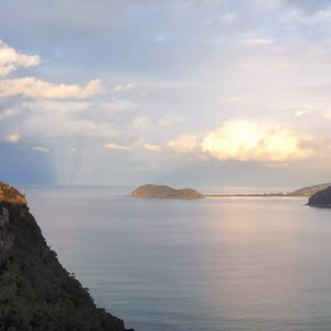
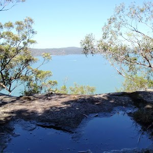
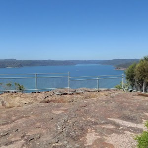
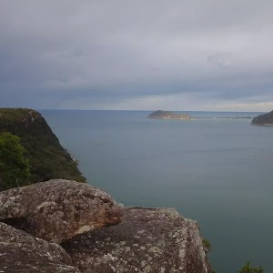
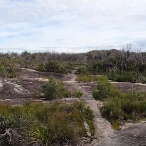
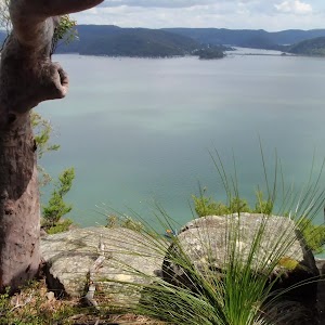
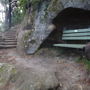
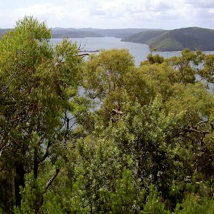
Gallery images
There are other downloads I am still working on.
You will probably need to login to access these — still all free.
* KML (google earth file)
* GPX (GPS file)
Special Maps/ brochures
* A3 topo maps
* PDF with Lands Topo map base
* PDF with arial image (and map overlay)
I wanted to get the main site live first, this extra stuff will come in time.
Happy walking
Matt 🙂
Comments