Red Hands Cave Circuit via Campfire Creek


3 hrs 45 mins

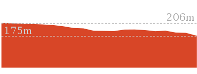
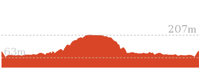
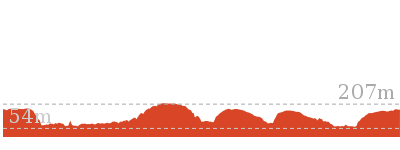
396 m
Experienced only
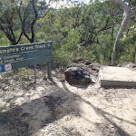


(0km) Campfire Creek car park → Int. Red Hands Cave and Carpark Trk

190 m
7 mins
0m
-42m
Hard track
(0.19km) Eastern side of Causeway → Int. Red Hands Cave and Carpark Trk
60 m
1 mins
3m
-1m
Moderate track
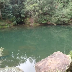
Turn right: From the causeway, the walk follows the ‘Camp Fire Creek Track’ sign along the water’s edge to the signposts for ‘Red Hands Cave’ and ‘Car park’. Now Continue straight to join the main walk.
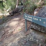
(0.19km) Int. Red Hands Cave and Carpark Trk → Red Hands Cave
3 km
1 hr 11 mins
206m
-91m
Moderate track
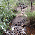
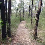
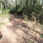
Continue straight: From the intersection, the walk heads across the small bridge and up the track. The walk soon passes over another small wooden bridge and then continues through the bush, with the creek on the right. Winding for a short time, the track comes to an un-signposted intersection.
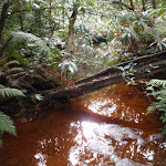
Turn left: From the intersection, the walk heads up the hill, winding above the creek (on the right). The track follows the hillside for quite some time, passing near the creek in places, before coming to a ‘Glenbrook Causeway’ sign.
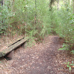
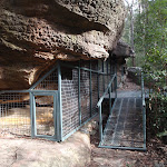
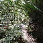
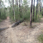
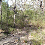
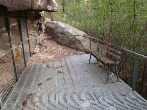
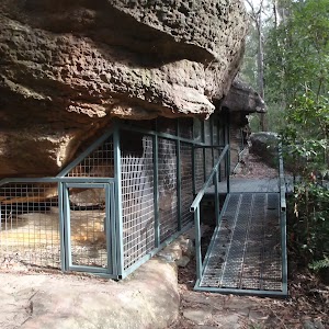
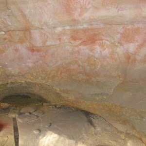
Continue straight: From the intersection, the walk follows the ‘Red Hands Cave’ sign down across the creek. The track leads over a small rise across another smaller creek, then follows the hillside for a short while, passing a bench seat and then a small log bridge. The track then starts tending left, heading up to a rocky outcrop where the walk arrives at the metal verandah of Red Hands Cave.
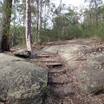
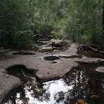
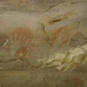
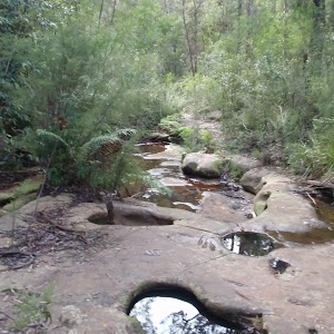
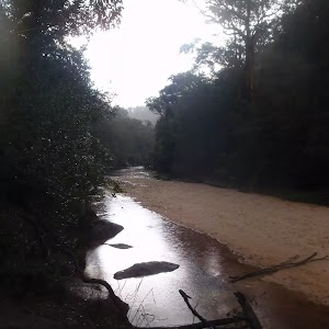
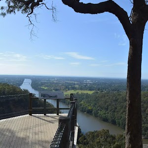
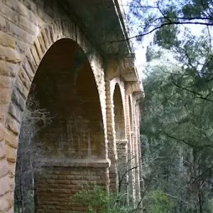
Red Hands Cave
(3.21km) Red Hands Cave → Red Hands Cave car park
500 m
12 mins
41m
-10m
Moderate track
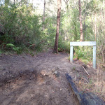
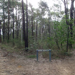
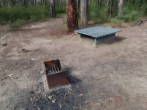
Red Hands Cave Picnic Area
(3.71km) Red Hands Cave car park → Axe Grinding Grooves
2.1 km
44 mins
42m
-161m
Moderate track
Turn left: From the creek intersection, the walk follows the ‘Glenbrook Causeway’ sign, keeping the water on the left. The track continues up to a rock overhang from where it heads down the hill, coming near the creek again. The track follows the creek to a junction with another creek. To the left is a large sandstone area and approximately 10m along the track is a sign explaining the grooves in the sandstone.
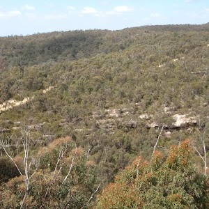
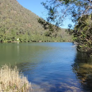
Axe Grinding Grooves

(5.8km) Axe Grinding Grooves → Campfire Creek car park
2.6 km
54 mins
107m
-89m
Experienced only
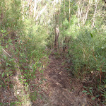
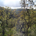
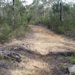
Turn left: From the intersection, this walk follows the wide track north as it bends to the right and heads down the hill into the more open forest. The track soon passes a blue ‘Shared use’ sign and comes to an intersection with a short but wide road access track.
Continue straight: From the intersection, the walk heads up the management trail, away from the road and the blue sign. The trail winds for a short time, follow a ‘Cycling Track’ sign down a track. The track winds down through the bush to an area where the track splits and then joins back together again. The walk then comes to a clearer area with access to the road on the right and a few log stumps in the clearing.
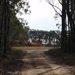
Veer left: From the log stumps in the intersection, the walk heads down the hill, keeping the road on the right. The track winds down to a very sandy section of track before heading up and across the hill. The track passes over a few rocky surfaces and passes a road-access track (on the right) before heading down the hill. The track is very rocky as it leads down to the hairpin corner in the road, where the car park is located. The track heads across the car park, keeping the road on the right, and arrives at the signpost.
Maps for the Red Hands Cave Circuit via Campfire Creek walk
You can download the PDF for this walk to print a map.These maps below cover the walk and the wider area around the walk, they are worth carrying for safety reasons.
| Penrith | 1:25 000 Map Series | 90303N PENRITH | NSW-90303N |
| Penrith | 1:100 000 Map Series | 9030 PENRITH | 9030 |
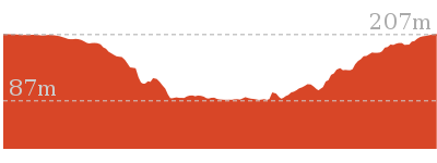
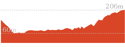
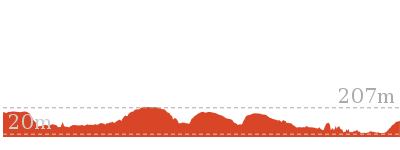
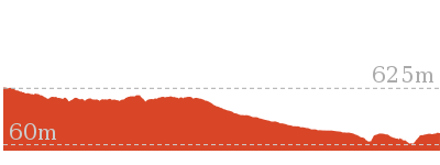
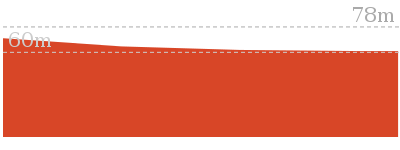
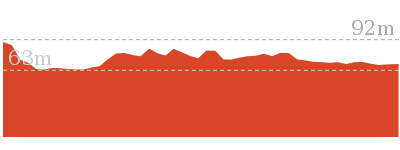
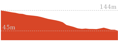
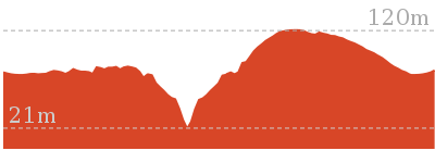
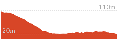
Cross sectional view of the Red Hands Cave Circuit via Campfire Creek bushwalking track
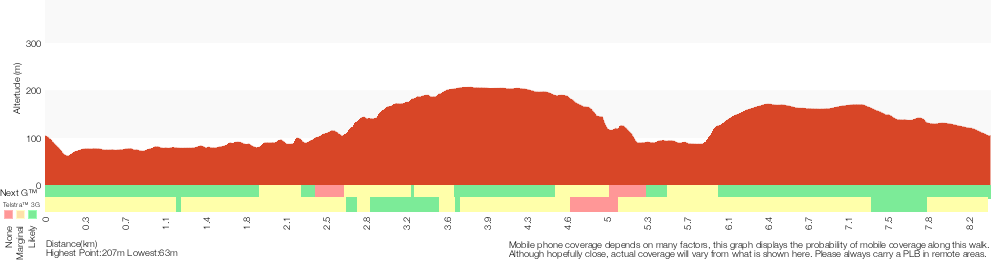
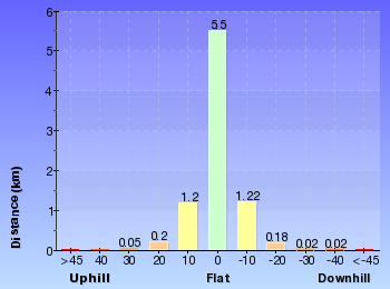
Analysis and summary of the altitude variation on the Red Hands Cave Circuit via Campfire Creek
Overview of this walks grade – based on the AS 2156.1 – 2001
Under this standard, a walk is graded based on the most difficult section of the walk.
| Length | 8.4 km | ||
| Time | 3 hrs 45 mins | ||
| . | |||
| Grade 5/6 Experienced only |
AS 2156.1 | Gradient | Very steep (4/6) |
| Quality of track | Rough track, where fallen trees and other obstacles are likely (4/6) | ||
| Signs | No directional signs (5/6) | ||
| Experience Required | Moderate level of bushwalking experience recommended (4/6) | ||
| Weather | Storms may impact on navigation and safety (3/6) | ||
| Infrastructure | No facilities provided (5/6) |
Some more details of this walks Grading
Here is a bit more details explaining grading looking at sections of the walk
Gradient
6km of this walk has short steep hills and another 1.8km has gentle hills with occasional steps. The remaining (900m) is very steep.
Quality of track
8km of this walk follows a formed track, with some branches and other obstacles and another 710m follows a rough track, where fallen trees and other obstacles are likely. The remaining (190m) follows a clear and well formed track or trail.
Signs
4.8km of this walk has directional signs at most intersection and another 2.9km is clearly signposted. The remaining (710m) Has no directional signs.
Experience Required
Around 8km of this walk requires no previous bushwalking experience, whilst the remaining 710m requires a leader a with moderate level of bushwalking experience.
weather
Around 8km of this walk is not usually affected by severe weather events (that would unexpectedly impact safety and navigation), whilst the remaining 710m is affected by storms that may impact your navigation and safety.
Infrastructure
5km of this walk is close to useful facilities (such as fenced cliffs and seats) and another 2.4km has limited facilities (such as not all cliffs fenced). The remaining (710m) has no facilities provided.
Similar walks
1 km Return
30 mins
Moderate track
4.1 km Circuit
2 hrs
Moderate track
4.3 km One way
1 hr 45 mins
Experienced only

4.4 km One way
2 hrs
Hard track
8.3 km Circuit
3 hrs 45 mins
Hard track
16.6 km Circuit
2 Days
Experienced only
18.8 km One way
2 Days
Very experienced only
29.6 km One way
3 Days
Hard track
Other Nearby walks
218 m Return
20 mins
Moderate track
522 m Return
20 mins
Hard track

2.5 km Return
1 hr 15 mins
Hard track
1 km Return
45 mins
Moderate track

1.7 km Return
1 hr 30 mins
Hard track
512 m Return
30 mins
Hard track

74 m Return
10 mins
Very easy
2.8 km Circuit
1 hr 15 mins
Hard track
756 m Return
30 mins
Hard track

3.2 km Return
1 hr 30 mins
Hard track
1.4 km Return
1 Hr
Moderate track

2 km Circuit
1 Hr
Hard track

Plan your trip to and from the walk here
The Red Hands Cave Circuit via Campfire Creek walk starts and ends at the Campfire Creek car park (gps: -33.780202, 150.61726)Your main transport option to Campfire Creek car park is by;
(get details)


Short URL = http://wild.tl/rhcxx
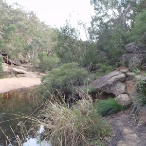
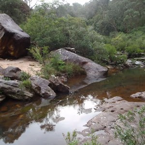
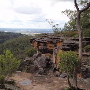
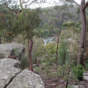
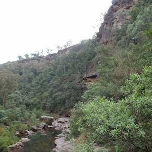
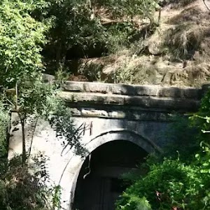
Gallery images
There are other downloads I am still working on.
You will probably need to login to access these — still all free.
* KML (google earth file)
* GPX (GPS file)
Special Maps/ brochures
* A3 topo maps
* PDF with Lands Topo map base
* PDF with arial image (and map overlay)
I wanted to get the main site live first, this extra stuff will come in time.
Happy walking
Matt 🙂
Comments