Glenbrook to Lapstone via Euroka


2 Days

1136 m
Very experienced only


Glenbrook
(0km) Glenbrook Station → End of Station St

580 m
10 mins
16m
-9m
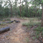
Moderate track
(0.58km) End of Station St → Station St mngt trail
650 m
12 mins
6m
-16m
Easy track
(1.23km) Station St mngt trail → Glenbrook Creek Beach
430 m
17 mins
7m
-102m
Hard track
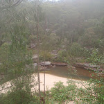
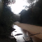
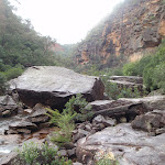
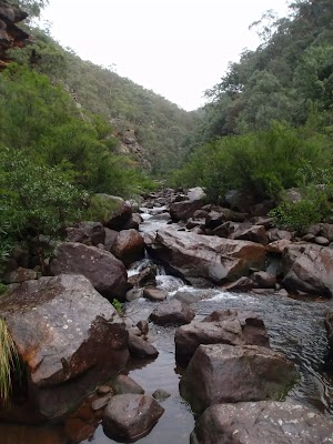
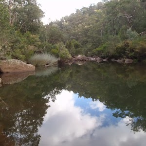
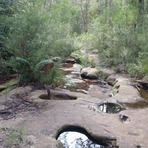
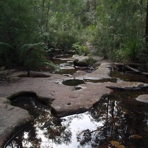
Glenbrook Creek Sandbar

(1.66km) Glenbrook Creek Beach → Int. Blue Pool and Glenbrook Gorge trks
1 km
26 mins
68m
-72m
Hard track
(2.69km) Int. Blue Pool and Glenbrook Gorge trks → Blue Pool
70 m
1 mins
2m
-2m
Hard track
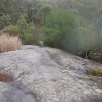
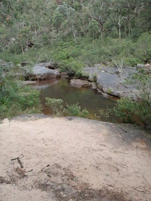
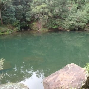
Blue Pool

(2.69km) Int. Blue Pool and Glenbrook Gorge trks → Int. Bruce Rd and Bruce Rd access trk
210 m
7 mins
24m
-18m
Hard track
Turn right: From the intersection, the walk heads across the hillside tending left to a ‘Blue Pool’ sign at a corner in a road.
(2.9km) Int. Bruce Rd and Bruce Rd access trk → Eastern side of Causeway
230 m
5 mins
5m
-13m
Moderate track
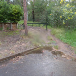
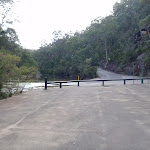
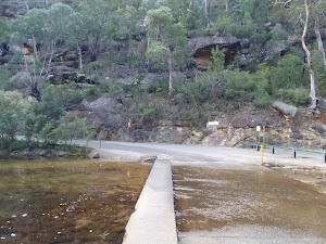
Glenbrook causeway
(3.13km) Eastern side of Causeway → Campfire Creek sign side of Causeway
10 m
1m
0m
Moderate track
(3.15km) Campfire Creek sign side of Causeway → Red Hands Cave
3.1 km
1 hr 12 mins
208m
-92m
Moderate track
Continue straight: From the intersection, the walk follows the ‘Red Hands Cave’ sign, keeping the creek to the right. The track winds and undulates, soon coming to a rock platform which crosses a creek (with the gully on the left). Here, the walk continues along the lower track, not heading up the rock steps. The track continues along the hillside and comes to a sign titled ‘Neighbours’.
Continue straight: From the intersection, the walk heads across the small bridge and up the track. The walk soon passes over another small wooden bridge and then continues through the bush, with the creek on the right. Winding for a short time, the track comes to an un-signposted intersection.
Turn left: From the intersection, the walk heads up the hill, winding above the creek (on the right). The track follows the hillside for quite some time, passing near the creek in places, before coming to a ‘Glenbrook Causeway’ sign.
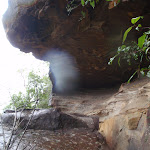
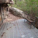
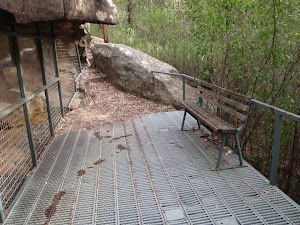
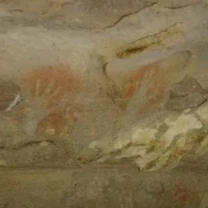
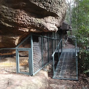
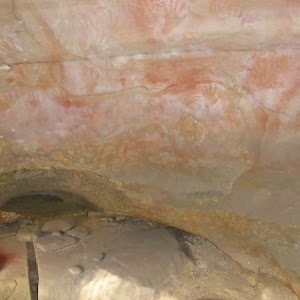
Continue straight: From the intersection, the walk follows the ‘Red Hands Cave’ sign down across the creek. The track leads over a small rise across another smaller creek, then follows the hillside for a short while, passing a bench seat and then a small log bridge. The track then starts tending left, heading up to a rocky outcrop where the walk arrives at the metal verandah of Red Hands Cave.
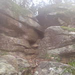
Red Hands Cave
(6.21km) Red Hands Cave → Red Hands Cave car park
500 m
12 mins
41m
-10m
Moderate track
Red Hands Cave Picnic Area
(6.71km) Red Hands Cave car park → Axe Grinding Grooves
2.1 km
44 mins
42m
-161m
Moderate track
Turn left: From the creek intersection, the walk follows the ‘Glenbrook Causeway’ sign, keeping the water on the left. The track continues up to a rock overhang from where it heads down the hill, coming near the creek again. The track follows the creek to a junction with another creek. To the left is a large sandstone area and approximately 10m along the track is a sign explaining the grooves in the sandstone.
Axe Grinding Grooves

(8.8km) Axe Grinding Grooves → The Ironbark Picnic Area
970 m
19 mins
90m
-6m
Experienced only
Turn right: From the intersection, the walk follows the wide track south, gently down the hill as it bends to the left. The track then heads down the hill a bit more steeply, and crosses a gully before gently climbing the other side. Not far after the gully, the track comes to an un-signposted intersection with the Ironbark access track, on the left.
Turn left : From the intersection, the walk follows the narrower track east towards the road. The track opens up at the car park, and the walk crosses the road to the Ironbark picnic area.
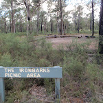
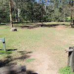
Ironbark Picnic Area
(9.76km) The Ironbark Picnic Area → Nioka Campsite
1.3 km
25 mins
4m
-94m
Moderate track
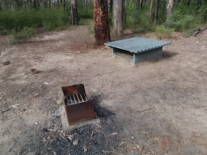
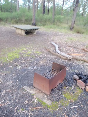
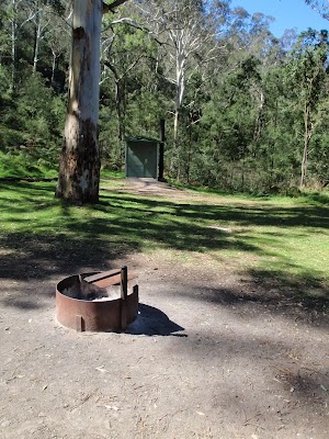
Euroka Campground – Nioka
Euroka Campground – Red Gum
(11.07km) Nioka Campsite → Top of Darug campsite car park
240 m
5 mins
4m
-4m
Easy track
Continue straight: From the signposts, the walk follows the ‘Daruk’[2] arrow along the flat dirt road, keeping the hill up to the left. After passing the garbage bins, the trail crosses a small creek and comes to an intersection with a bush track on the left, just before the signposted ‘Darug’ campsite.
Euroka Campground – Darug
End of day 1
(11.31km) Top of Darug campsite car park → Campfire Creek sign side of Causeway
2.5 km
56 mins
111m
-130m
Hard track
Continue straight: From the intersection, the walk heads north, following neither of the arrows on the sign. The track soon comes to Mount Portal Trail, just next to the intersection with Euroka Road.
Veer right: From the intersection, the walk follows the ‘The Causeway’ sign, along the bush track. The track tends right into the low grassy bush. As the track continues down the hill, the grass gives way to wattle bush covering the gully. The track leads down many stairs then crosses a creek or two before winding along the hillside. The track then continues down into the gully to pass a fading track, on the left, then winds through to a hairpin corner on the road, marked by a ‘Euroka Track’ sign (pointing back the way you came).
Veer right: From the intersection, the walk heads down the steep road to the causeway.
(13.84km) Campfire Creek sign side of Causeway → Eastern side of Causeway
10 m
0m
-1m
Moderate track
(13.85km) Eastern side of Causeway → Jelly Bean Pool
320 m
6 mins
5m
-6m
Hard track
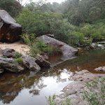
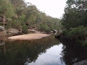
Jellybean Pool
(14.17km) Jelly Bean Pool → Int. Gorge Walking and Jelly Bean Pool Trk
600 m
14 mins
32m
-38m
Hard track
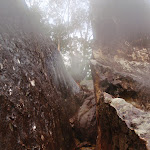
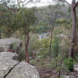
Glenbrook Gorge
(14.77km) Int. Gorge Walking and Jelly Bean Pool Trk → Glenbrook Gorge Beach
270 m
7 mins
9m
-20m
Hard track
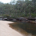
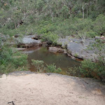
Glenbrook Gorge Beach
(15.05km) Glenbrook Gorge Beach → Int. at junction of Nepean River and Glenbrook Creek
2.1 km
1 hr 23 mins
332m
-357m
Very experienced only
Continue straight: From the intersection, the walk leads downstream, keeping the creek below on the right as it heads along the rock shelf. The track continues to an intersection behind a large rock shelf, next to the river.
(17.14km) Int. at junction of Nepean River and Glenbrook Creek → Nepean Point
150 m
2 mins
0m
0m
Experienced only
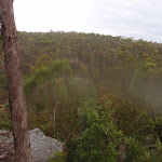
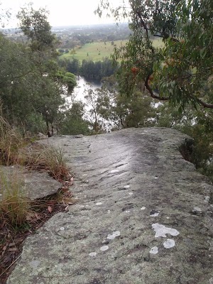
Nepean view point

(17.14km) Int. at junction of Nepean River and Glenbrook Creek → Int. Tunnel Gully trk and Nepean Pt trk
1 km
22 mins
51m
-41m
Hard track
(18.15km) Int. Tunnel Gully trk and Nepean Pt trk → Int. Tunnel Gully trk and car wreck trk
430 m
10 mins
68m
0m
Moderate track
(18.59km) Int. Tunnel Gully trk and car wreck trk → Lapstone lookout
210 m
5 mins
2m
-29m
Hard track
Turn left: From the intersection, the track leads down the ridgeline, keeping the houses and railway behind and the creek below on the left. The track winds down the rocky ridge to a rock surface with a view over the Nepean River. At the end of this side trip, retrace your steps back to the main walk then Turn left.
Lapstone Nepean View
(18.59km) Int. Tunnel Gully trk and car wreck trk → Int. Station trk and Tunnel Gully trk
120 m
2 mins
5m
0m
Moderate track
(18.71km) Int. Station trk and Tunnel Gully trk → Platform 2 Lapstone Station
50 m
1 mins
7m
0m
Moderate track
Lapstone
Maps for the Glenbrook to Lapstone via Euroka walk
You can download the PDF for this walk to print a map.These maps below cover the walk and the wider area around the walk, they are worth carrying for safety reasons.
| Penrith | 1:25 000 Map Series | 90303N PENRITH | NSW-90303N |
| Penrith | 1:100 000 Map Series | 9030 PENRITH | 9030 |
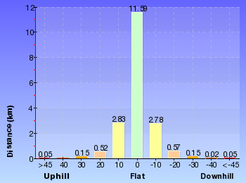
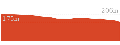
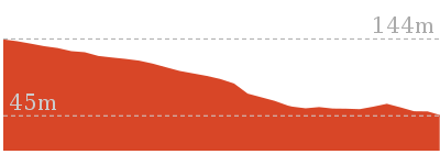
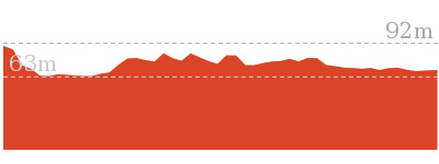
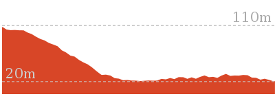
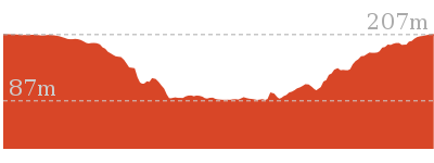
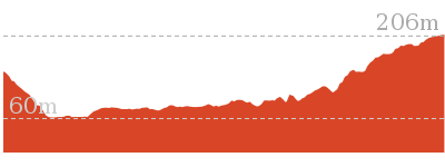
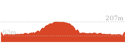
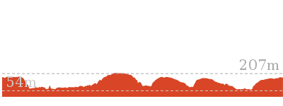
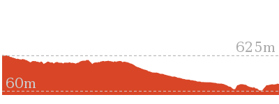
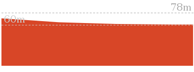
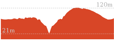
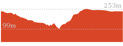
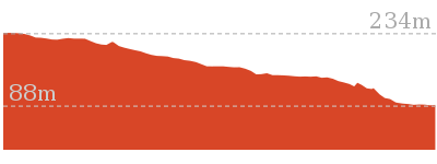
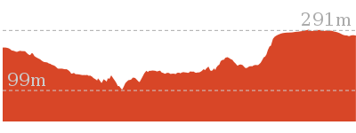
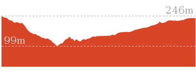
Cross sectional view of the Glenbrook to Lapstone via Euroka bushwalking track
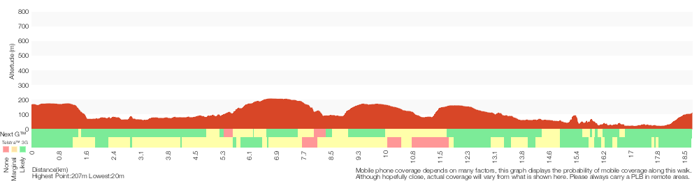
Analysis and summary of the altitude variation on the Glenbrook to Lapstone via Euroka
Daily actual walking time estimates
| Day | Walking Time | Length |
|---|---|---|
| 1 | 4 hrs 15 mins | 11.4 km |
| 2 | 3 hrs 28 mins | 7.8 km |
Overview of this walks grade – based on the AS 2156.1 – 2001
Under this standard, a walk is graded based on the most difficult section of the walk.
| Length | 18.8 km | ||
| Time | 2 Days | ||
| . | |||
| Grade 6/6 Very experienced only |
AS 2156.1 | Gradient | Very steep (4/6) |
| Quality of track | Off track (no visible track at times) (6/6) | ||
| Signs | No directional signs (5/6) | ||
| Experience Required | Moderate level of bushwalking experience recommended (4/6) | ||
| Weather | Storms may impact on navigation and safety (3/6) | ||
| Infrastructure | No facilities provided (5/6) |
Some more details of this walks Grading
Here is a bit more details explaining grading looking at sections of the walk
Gradient
9km of this walk has short steep hills and another 8km is very steep. Whilst another 2.2km has gentle hills with occasional steps and the remaining 25m is flat with no steps.
Quality of track
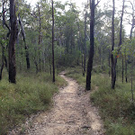
9km of this walk follows a formed track, with some branches and other obstacles and another 4.4km follows a rough track, where fallen trees and other obstacles are likely. Whilst another 2km follows a clear and well formed track or trail and a 2km section follows a known route where there is no visible track. The remaining 1.6km follows a smooth and hardened path.
Signs
8km of this walk has directional signs at most intersection and another 4.5km is clearly signposted. Whilst another 3.4km has minimal directional signs and the remaining 2.7km Has no directional signs.
Experience Required
13km of this walk requires no previous bushwalking experience and another 4.3km requires some bushwalking experience. The remaining (1km) requires a leader a with moderate level of bushwalking experience.
weather
Around 16km of this walk is not usually affected by severe weather events (that would unexpectedly impact safety and navigation), whilst the remaining 3.1km is affected by storms that may impact your navigation and safety.
Infrastructure
9km of this walk is close to useful facilities (such as fenced cliffs and seats) and another 4.2km has limited facilities (such as not all cliffs fenced). Whilst another 3.2km has limited facilities (such as cliffs not fenced, significant creeks not bridged) and the remaining 2.7km has no facilities provided.
Similar walks
522 m Return
20 mins
Hard track

756 m Return
30 mins
Hard track

1 km Return
30 mins
Moderate track
1.7 km Return
1 hr 30 mins
Hard track
2.5 km Return
1 hr 15 mins
Hard track
3.2 km Return
1 hr 30 mins
Hard track
4.1 km Circuit
2 hrs
Moderate track
4.3 km One way
1 hr 45 mins
Experienced only

4.4 km One way
2 hrs
Hard track
8.3 km Circuit
3 hrs 45 mins
Hard track
8.4 km Circuit
3 hrs 45 mins
Experienced only

16.6 km Circuit
2 Days
Experienced only
29.6 km One way
3 Days
Hard track
Other Nearby walks
1 km Return
45 mins
Moderate track

1.4 km Return
1 Hr
Moderate track

2 km Circuit
1 Hr
Hard track

218 m Return
20 mins
Moderate track
512 m Return
30 mins
Hard track

74 m Return
10 mins
Very easy
2.8 km Circuit
1 hr 15 mins
Hard track
4.3 km Circuit
2 hrs 30 mins
Hard track
4 km Return
2 hrs
Hard track

6 km One way
3 hrs
Hard track
2.6 km Circuit
1 hr 30 mins
Hard track

2.9 km One way
2 hrs
Hard track
Plan your trip to and from the walk here
The Glenbrook to Lapstone via Euroka walk starts at the Glenbrook Station (gps: -33.76894, 150.62134)Your transport options to Glenbrook Station are by;
(get details)
The Glenbrook to Lapstone via Euroka ends at the Platform 2 Lapstone Station (gps: -33.773274, 150.64281)
Your transport options to Platform 2 Lapstone Station are by;
(get details)


Short URL = http://wild.tl/gtls
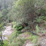
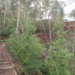
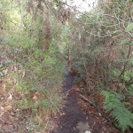
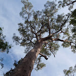
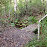
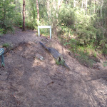
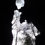
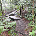
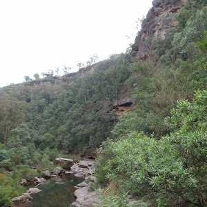
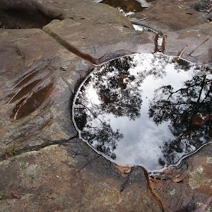
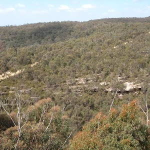
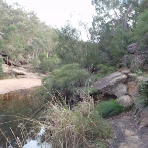
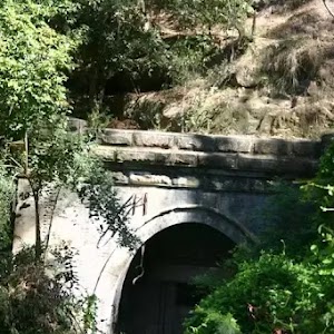
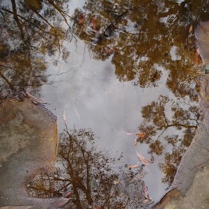
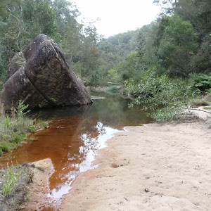
Gallery images
There are other downloads I am still working on.
You will probably need to login to access these — still all free.
* KML (google earth file)
* GPX (GPS file)
Special Maps/ brochures
* A3 topo maps
* PDF with Lands Topo map base
* PDF with arial image (and map overlay)
I wanted to get the main site live first, this extra stuff will come in time.
Happy walking
Matt 🙂
Comments