Medlow Bath to the Collosseum


2 hrs 15 mins

440 m
Hard track
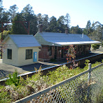


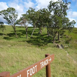
(0km) Meadlow Bath Railway Station → Int of Station St and Belgravia Rd

280 m
4 mins
1m
-2m
Easy track
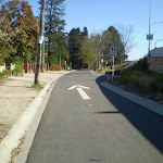
(0.28km) Int of Station St and Belgravia Rd → End of Belgravia Rd
230 m
5 mins
9m
-15m
Easy track
(0.51km) End of Belgravia Rd → Int of Wonderland and Belgravia St Tracks
160 m
6 mins
0m
-37m
Moderate track
(0.67km) Int of Wonderland and Belgravia St Tracks → Int of Wonderland and Sunbath Tracks
80 m
2 mins
0m
-16m
Moderate track
(0.75km) Int of Wonderland and Sunbath Tracks → Int of Sunbath and Tuckers Lookout Track
60 m
1 mins
0m
-10m
Moderate track
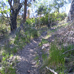
(0.81km) Int of Sunbath and Tuckers Lookout Track → Int of Colosseum and Megalong Valley Tracks
320 m
12 mins
14m
-113m
Hard track
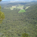
(1.12km) Int of Colosseum and Megalong Valley Tracks → The Colosseum
540 m
25 mins
106m
-117m
Moderate track
Maps for the Medlow Bath to the Collosseum walk
You can download the PDF for this walk to print a map.These maps below cover the walk and the wider area around the walk, they are worth carrying for safety reasons.
| Katoomba | 1:25 000 Map Series | 89301S KATOOMBA | NSW-89301S |
| Katoomba | 1:100 000 Map Series | 8930 KATOOMBA | 8930 |
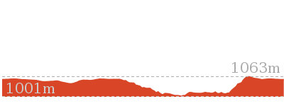
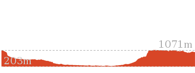
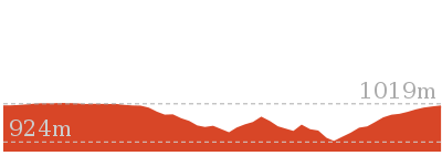
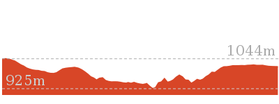
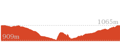
Cross sectional view of the Medlow Bath to the Collosseum bushwalking track
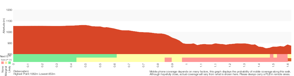
Analysis and summary of the altitude variation on the Medlow Bath to the Collosseum
Overview of this walks grade – based on the AS 2156.1 – 2001
Under this standard, a walk is graded based on the most difficult section of the walk.
| Length | 3.3 km | ||
| Time | 2 hrs 15 mins | ||
| . | |||
| Grade 4/6 Hard track |
AS 2156.1 | Gradient | Very steep (4/6) |
| Quality of track | Formed track, with some branches and other obstacles (3/6) | ||
| Signs | Directional signs along the way (3/6) | ||
| Experience Required | Some bushwalking experience recommended (3/6) | ||
| Weather | Storms may impact on navigation and safety (3/6) | ||
| Infrastructure | Limited facilities, not all cliffs are fenced (3/6) |
Some more details of this walks Grading
Here is a bit more details explaining grading looking at sections of the walk
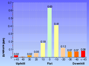
Gradient
700m of this walk has short steep hills and another 370m is flat with no steps. Whilst another 320m is very steep and the remaining 280m has gentle hills with occasional steps.
Quality of track
860m of this walk follows a formed track, with some branches and other obstacles and another 510m follows a smooth and hardened path. The remaining (300m) follows a clear and well formed track or trail.
Signs
Around 1.3km of this walk is clearly signposted, whilst the remaining 320m has directional signs at most intersection.
Experience Required
Around 1km of this walk requires some bushwalking experience, whilst the remaining 650m requires no previous bushwalking experience.
weather
Around 1.3km of this walk is not usually affected by severe weather events (that would unexpectedly impact safety and navigation), whilst the remaining 320m is affected by storms that may impact your navigation and safety.
Infrastructure
Around 1.2km of this walk has limited facilities (such as not all cliffs fenced), whilst the remaining 510m is close to useful facilities (such as fenced cliffs and seats).
Similar walks
3.5 km Circuit
1 hr 30 mins
Moderate track

3.5 km Circuit
1 hr 30 mins
Moderate track
Other Nearby walks
44.8 km One way
3 Days
Hard track
44.8 km One way
2 Days
Hard track

47.8 km One way
2 Days
Very experienced only

2 km Return
1 Hr
Moderate track

47.8 km One way
3 Days
Very experienced only
1.4 km Circuit
45 mins
Moderate track
5.4 km Circuit
3 hrs 30 mins
Hard track

3.1 km One way
2 hrs
Hard track

1.6 km Return
1 Hr
Moderate track
2.3 km One way
1 hr 15 mins
Moderate track
9.3 km Circuit
4 hrs 30 mins
Hard track
8.7 km Circuit
3 hrs 30 mins
Hard track
Plan your trip to and from the walk here
The Medlow Bath to the Collosseum walk starts and ends at the Meadlow Bath Railway Station (gps: -33.673633, 150.2807)Your transport options to Meadlow Bath Railway Station are by;
(get details)


Short URL = http://wild.tl/mbttc
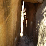
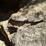
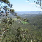
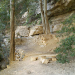
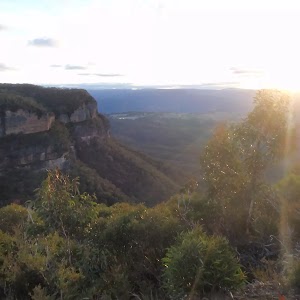
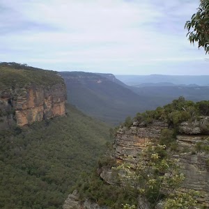
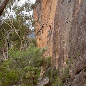
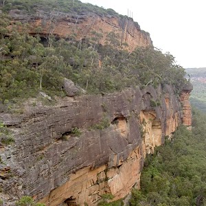
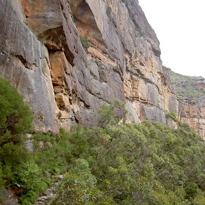
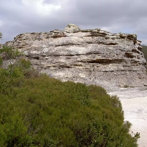
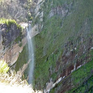
Gallery images
There are other downloads I am still working on.
You will probably need to login to access these — still all free.
* KML (google earth file)
* GPX (GPS file)
Special Maps/ brochures
* A3 topo maps
* PDF with Lands Topo map base
* PDF with arial image (and map overlay)
I wanted to get the main site live first, this extra stuff will come in time.
Happy walking
Matt 🙂
Comments