Cox’s River return via Narrowneck


2 Days

2390 m
Very experienced only


Free Beacon Hire
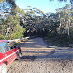
(0km) Explorers Tree → Six Foot Track Info Shelter

260 m
5 mins
8m
-6m
Easy track
(0.26km) Six Foot Track Info Shelter → Int of 6 Foot Track and Norths Lookout Trail
550 m
12 mins
2m
-68m
Moderate track
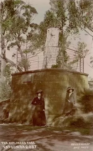
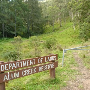
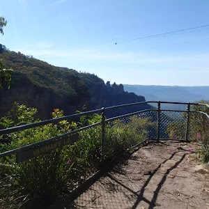
Explorers Tree (Katoomba)
(0.81km) Int of Six Foot Track and Norths Lookout Trail → Int at Lower Nellies Glen
1.6 km
44 mins
26m
-337m
Hard track
(2.44km) Int at Lower Nellies Glen → Megalong Village site
2.1 km
37 mins
15m
-102m
Moderate track
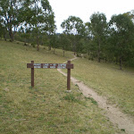
Continue straight: From the intersection, this walk walk follows the ‘Six Foot Track’ sign[31] along the Nellies Glen trail, to cross the culverted Diamond Creek[32] to then come pass alongside the old Megalong ‘Village site’[33] and horse paddock[34] (which is on your left).
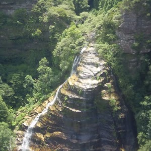
Megalong Village (Historic)
(4.5km) Megalong Village site → Int Mitchells Creek and Nellies Glen Rd trails
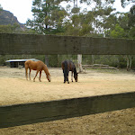
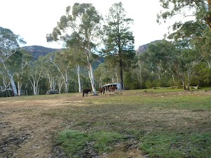
1.1 km
18 mins
8m
-23m
Easy track
(5.6km) Intersection of Medlow Gap Management Trail and 6 Foot Track → Megalong Ford
1.5 km
26 mins
21m
-39m
Easy track
(7.09km) Megalong Ford → Int of Six Foot Track and Megalong Rd
1.1 km
22 mins
40m
-21m
Moderate track
(8.23km) Int of 6 Foot Track and Megalong Rd → Megalong Cemetery
100 m
2 mins
0m
-5m
Easy track
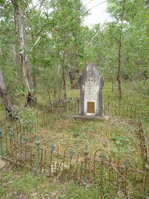
Megalong Cemetery (historical)
(8.32km) Megalong Cemetery → Int Near Guyver Bridge
770 m
15 mins
14m
-34m
Easy track
(9.09km) Int Near Guyver Bridge → Euroka back gate
1.9 km
41 mins
69m
-122m
Moderate track
(10.94km) Private Gate → Bowtells Bridge East
3.4 km
1 hr 25 mins
157m
-348m
Hard track
(14.38km) Bowtells Swing Bridge → Bowtells Swing Bridge North
130 m
4 mins
15m
-8m
Moderate track
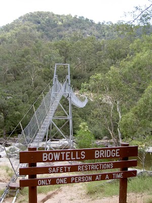
Bowtells Swing Bridge
(14.51km) Bowtells Bridge West → Coxs River Campsite
1.2 km
28 mins
56m
-92m
Moderate track
Turn sharp right: From the intersection and clearing, this walk follows the ‘Camping Ground-500mtrs’ sign[134] north up the timber steps. The track soon bends left and follows the side of the hill[135] for about 130m to then head through a gate with a ‘Welcome’ sign[136]. The walk continues along the clear track for another 70m to the intersection with the timber path[137] just below the ‘Six Foot Track Lodge’[138].
Continue straight: From the intersection below the ‘Six Foot Track Lodge’[139], this walk follows the clear track west initially keeping the lodge up to your right. After about 30m this walk crosses a gully[140] then climbs over a fence using stile[141]. Here the walk turns right and follows the track for almost 50m to a T-intersection[142] with a wide trail, beside a private property gate[143] and marked with several ‘Six Foot Track’ signs[144].
Veer left: From the intersection, this walk follows the ‘Camping Ground-200m’ sign[145] gently down along wide trail[146]. After about 230m the trail flattens out and passes below the main camping area[147] marked with a ‘Coxs River Reserve’ sign[148]. About 30m past here, this walk comes to a clear intersection with a dirt road marked with a ‘Six Foot Track’ sign[149].
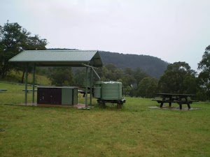
Coxs River Camping Area
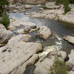
Coxs River

End of day 1
(15.71km) Coxs River Campsite → Coxs River Floodplain
170 m
3 mins
3m
-5m
Hard track
(15.88km) Cox’s River Campsite (East) → Little River and Coxs River Int
3.1 km
1 hr 1 mins
87m
-106m
Hard track
(19.01km) Little River and Coxs River Int → Quartpot Gully/ Coxs River Track Intersection
3.3 km
1 hr 5 mins
93m
-119m
Hard track
(22.31km) Quartpot Gully/ Coxs River Track Intersection → Coxs River Blue Mountains NP Entry
1.7 km
35 mins
66m
-67m
Moderate track
(23.99km) Coxs River Blue Mountains NP Entry → Int of Coxs Ck and Breakfast Ck Trks
3.2 km
1 hr 15 mins
169m
-186m
Hard track
Breakfast Creek Campsite
(27.23km) Int of Coxs Ck and Breakfast Ck Trks → Breakfast Ck and Blackhorse Ridge Trk Int
3.7 km
1 hr 33 mins
281m
-185m
Hard track
(30.97km) Breakfast Ck and Blackhorse Ridge Trk Int → Int of Ironpot Mtn and Dunphys Servicetrails
3.1 km
1 hr 26 mins
361m
-54m
Hard track
(34.1km) Int of Ironpot Mtn and Dunphys Servicetrails → Dunphys Camping Area
290 m
8 mins
32m
-1m
Easy track
Dunphys Camping Area
(34.39km) Dunphys Camping Area → Int Dunphys Servicetrail and Bellbird Ridge L.O. trk
720 m
21 mins
90m
-23m
Moderate track
(35.11km) Int Dunphys Servicetrail and Bellbird Ridge L.O. trk → Int Medlow Gap Management Trail and Carlons Head trk
570 m
11 mins
24m
-9m
Moderate track
(35.68km) Int Medlow Gap Management Trail and Carlons Head trk → Bottom of Carlon Head Pass
550 m
28 mins
192m
-10m
Experienced only
(36.23km) Bottom of Carlon Head Pass → Top of Carlon Head Pass
100 m
20 mins
102m
0m
Very experienced only
Carlon Head Pass
(36.32km) Top of Carlon Head Pass → Fire Tower
1.3 km
27 mins
91m
-27m
Experienced only
(37.64km) Fire Tower → Int of Glenraphael and Cliff Drives
9.6 km
3 hrs 27 mins
361m
-454m
Moderate track
Continue straight: From the intersection, this walk follows the dirt road up to the top of the steep hill. The track then flattens out and continues along until it reaches the intersection of the northern Castle Head track.
Continue straight: From the intersection, this walk heads north, following the dirt road as it undulates along the ridge for a while, before it reaches the National Park gate and the car park just on the other side. (For emergency access, keys to the National Park gate are available from the local council, police and National Parks services.)
Continue straight: From the National Park gate, this walk follows Glenraphael Drive north through the parking area. The dirt road continues through the bush, undulating along the ridge for about 1km before coming to the signposted intersection at the top of the Golden Stairs, with some more car parking either side of the road.
Continue straight: From the Golden Stairs car park, this walk follows the dirt road north, down the gentle hill and along the ridge as it undulates up and down for about 1km, before reaching the Sydney Water management trail – this is closed to the public at all times.
Veer right: From the intersection, this walk follows the dirt road heading up the hill and undulating along the ridge for about 1km, before it climbs up to the intersection with Cliff Drive.
(47.2km) Int of Glenraphael and Cliff Drives → Scenic World
570 m
11 mins
7m
-34m
Easy track
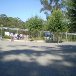
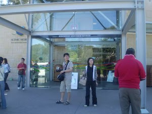
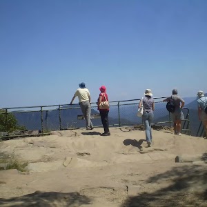
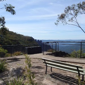
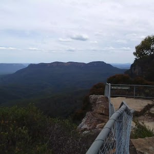
Scenic World
Maps for the Cox’s River return via Narrowneck walk
You can download the PDF for this walk to print a map.These maps below cover the walk and the wider area around the walk, they are worth carrying for safety reasons.
| Six Foot Track | 1:50 000 Map Series | Six Foot Track | NSW-six-foot-track |
| Hampton | 1:25 000 Map Series | 89304S HAMPTON | NSW-89304S |
| Jenolan | 1:25 000 Map Series | 89303N JENOLAN | NSW-89303N |
| Jamison | 1:25 000 Map Series | 89302N JAMISON | NSW-89302N |
| Katoomba | 1:25 000 Map Series | 89301S KATOOMBA | NSW-89301S |
| Katoomba | 1:100 000 Map Series | 8930 KATOOMBA | 8930 |
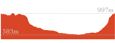
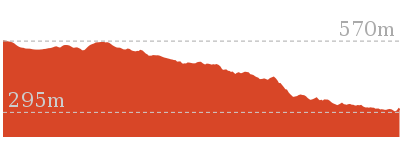
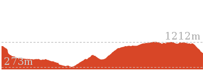
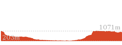
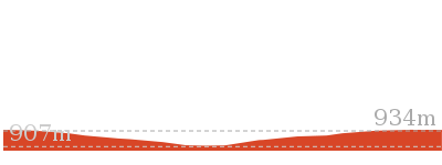
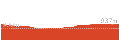
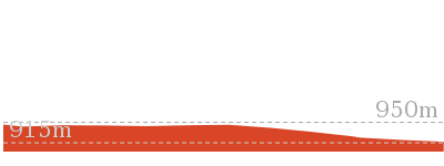
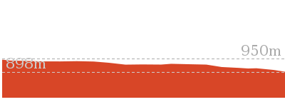
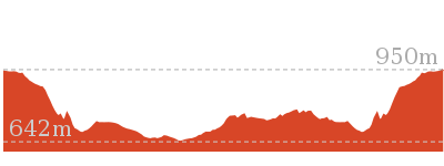
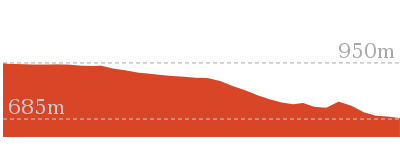
Cross sectional view of the Cox’s River return via Narrowneck bushwalking track
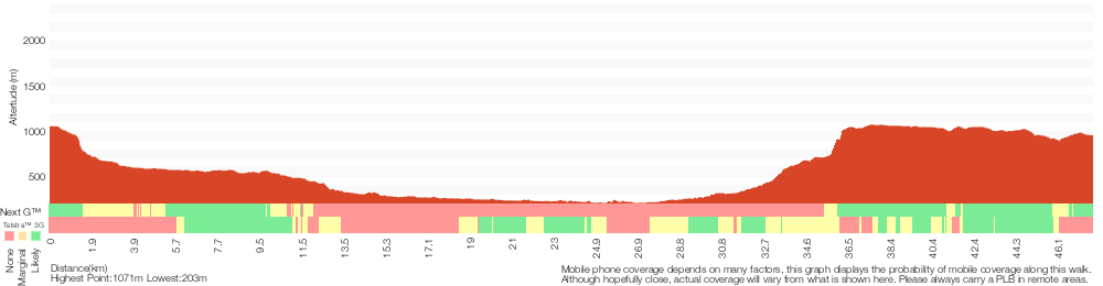
Analysis and summary of the altitude variation on the Cox’s River return via Narrowneck
Daily actual walking time estimates
| Day | Walking Time | Length |
|---|---|---|
| 1 | 5 hrs 39 mins | 15.7 km |
| 2 | 12 hrs 31 mins | 32.1 km |
Overview of this walks grade – based on the AS 2156.1 – 2001
Under this standard, a walk is graded based on the most difficult section of the walk.
| Length | 47.8 km | ||
| Time | 2 Days | ||
| . | |||
| Grade 6/6 Very experienced only |
AS 2156.1 | Gradient | Very steep exposed rock scrambling and climbing (6/6) |
| Quality of track | Off track (no visible track at times) (6/6) | ||
| Signs | No directional signs (5/6) | ||
| Experience Required | High level of bushwalking experience recommended (5/6) | ||
| Weather | Forecast, unforecast storms and severe weather likely to have an impact on your navigation and safety (5/6) | ||
| Infrastructure | Limited facilities (such as cliffs not fenced, significant creeks not bridged) (4/6) |
Some more details of this walks Grading
Here is a bit more details explaining grading looking at sections of the walk
Gradient
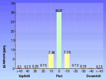
28km of this walk has short steep hills, 9km has gentle hills with occasional steps and another 8km is very steep. Whilst another 1.5km section of this walk is flat with no steps and a 550m is very steep with difficult rock scrambles. The remaining 95m is very steep with exposed rock scrambles and climbing.
Quality of track
21km of this walk follows a formed track, with some branches and other obstacles and another 20km follows a clear and well formed track or trail. Whilst another 5km follows a rough track, where fallen trees and other obstacles are likely and a 1.3km section follows a rough unclear track. The remaining 95m follows a known route where there is no visible track.
Signs
27km of this walk has directional signs at most intersection and another 13km is clearly signposted. Whilst another 7km has minimal directional signs and the remaining 1.4km Has no directional signs.
Experience Required
20km of this walk requires no previous bushwalking experience and another 15km requires a leader a with moderate level of bushwalking experience. Whilst another 13km requires some bushwalking experience and the remaining 95m requires a leader with a high level of bushwalking experience.
weather
29km of this walk is not usually affected by severe weather events (that would unexpectedly impact safety and navigation) and another 18km is affected by storms that may impact your navigation and safety. Whilst another 720m is affected by forecast, unforecast storms and severe weather events that may impact on navigation and safety and the remaining 95m forecast, unforecast storms and severe weather likely to have an impact on your navigation and safety.
Infrastructure
21km of this walk is close to useful facilities (such as fenced cliffs and seats) and another 14km has limited facilities (such as not all cliffs fenced). The remaining (12km) has limited facilities (such as cliffs not fenced, significant creeks not bridged).
Similar walks
2 km Return
1 Hr
Moderate track


4 km Return
2 hrs
Moderate track

4.2 km Return
1 hr 45 mins
Hard track

5.9 km Circuit
3 hrs 30 mins
Hard track

6.8 km Circuit
5 hrs
Hard track

7 km One way
3 hrs 30 mins
Very experienced only

12.6 km Return
5 hrs 30 mins
Hard track
16.2 km Return
11 hrs
Experienced only

20 km Return
7 hrs
Moderate track

44.8 km One way
3 Days
Hard track
44.8 km One way
2 Days
Hard track

47.8 km One way
3 Days
Very experienced only
Other Nearby walks
2.2 km Return
1 hr 30 mins
Moderate track

1.8 km One way
1 Hr
Moderate track

1.7 km Return
2 hrs
Hard track

1.1 km Return
45 mins
Moderate track

352 m Circuit
20 mins
Moderate track
854 m Circuit
45 mins
Hard track
582 m Return
30 mins
Moderate track
3.3 km Return
1 hr 30 mins
Moderate track

892 m Return
30 mins
Moderate track
4.8 km Circuit
3 hrs
Hard track
2.3 km Return
1 hr 30 mins
Hard track

1.7 km Return
1 hr 15 mins
Hard track
Plan your trip to and from the walk here
The Cox’s River return via Narrowneck walk starts at the Explorers Tree (gps: -33.70397, 150.29126)Your transport options to Explorers Tree are by;
(get details)
The Cox’s River return via Narrowneck ends at the Scenic World (gps: -33.728585, 150.30095)
Your transport options to Scenic World are by;
(get details)


Short URL = http://wild.tl/crrvdc
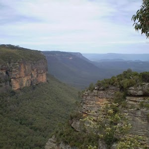
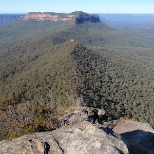
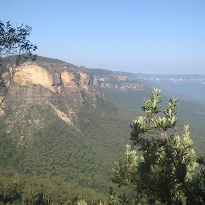
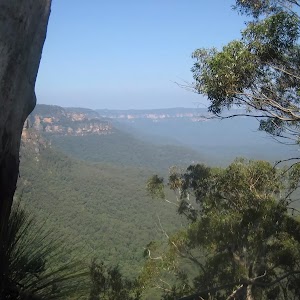
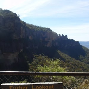
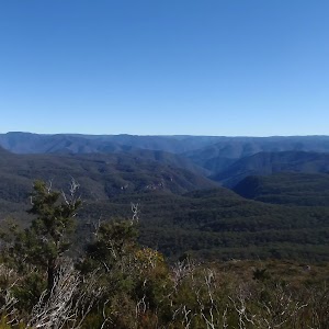
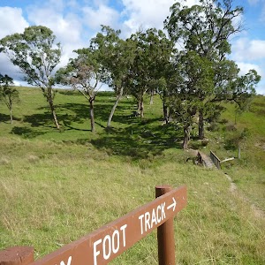
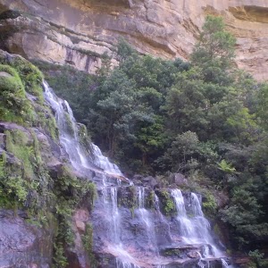
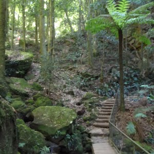
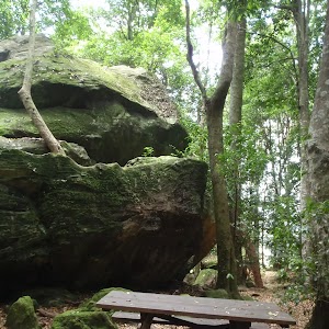
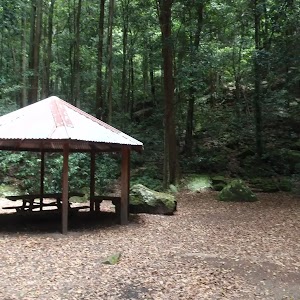
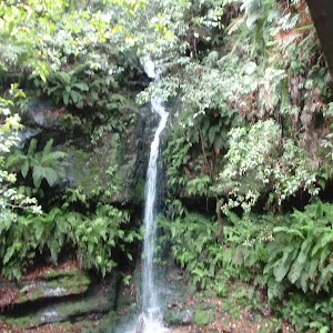
Gallery images
There are other downloads I am still working on.
You will probably need to login to access these — still all free.
* KML (google earth file)
* GPX (GPS file)
Special Maps/ brochures
* A3 topo maps
* PDF with Lands Topo map base
* PDF with arial image (and map overlay)
I wanted to get the main site live first, this extra stuff will come in time.
Happy walking
Matt 🙂
Comments