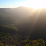
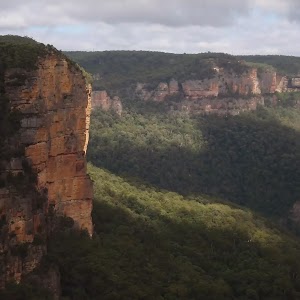
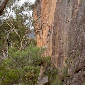
Grand Canyon, Cliff Top and Braeside Walks


4 hrs 30 mins

603 m
Hard track
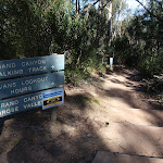


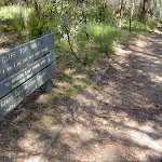


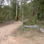


(0km) Neates Glen car park → Neates Glen car park sign

640 m
18 mins
13m
-151m
Moderate track
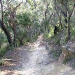
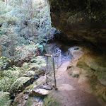
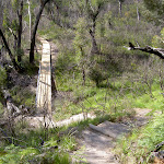
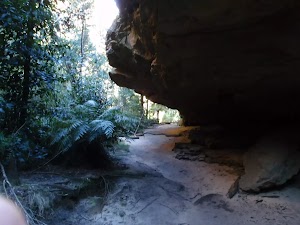
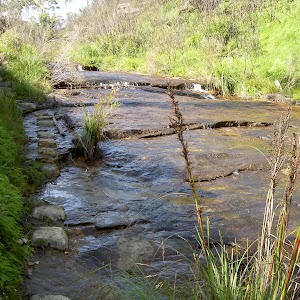
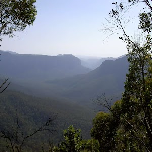
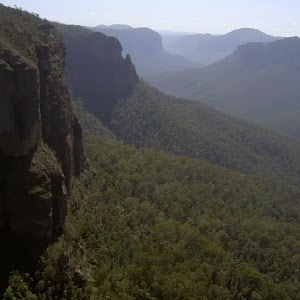
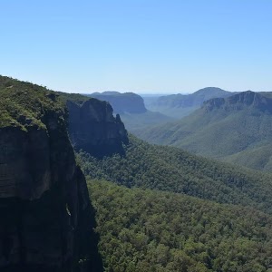
Neates Glen

(0.64km) Neates Glen car park sign → Rotunda
540 m
14 mins
31m
-53m
Hard track
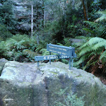
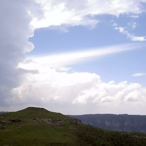
Rotunda
(1.18km) Rotunda → Evans Lookout
2.7 km
1 hr 23 mins
314m
-212m
Hard track
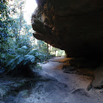
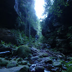
Continue straight: From the waterfall, this walk continues to contour around the canyon wall, keeping it on the right of the track. The track does so for quite some time before winding down deeper into the canyon after rounding a hill. The track winds down to a signposted intersection. From here, the track crosses the creek a few times before turning left at a rock overhang then crossing the creek again. The track quickly winds through the creek before passing over a bridge and continuing down the canyon. After approximately 200m, the track winds past a pool in the creek to then come to a signposted rock in a creek.
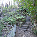
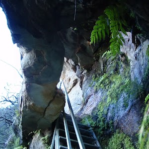
Veer left: From the intersection, the walk crosses the creek to another sign, pointing up the stairs to Evans Lookout. The walk climbs these stairs, up through the gap in the cliffs. The walk heads up the gully on stone cut steps which are soon met by a railing for a short while, and then up a set of wooden steps to the intersection with several signs.
Veer left: From the intersection, the walk follows the ‘Evans Lookout’ arrow[1] up the hill, weaving around boulders. The track then tends left before climbing up the stairs, through a pass in the rock, to Evans Lookout.
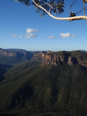
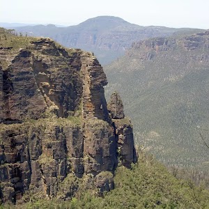
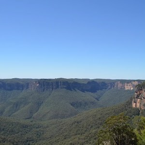
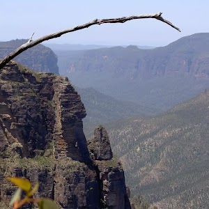
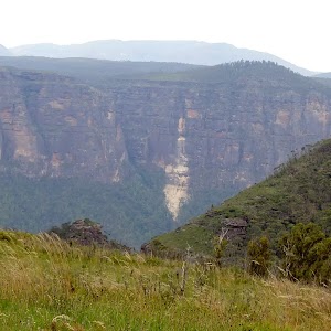
Evans Lookout
(3.87km) Evans Lookout → Evans Lookout toilets
140 m
4 mins
21m
0m
Moderate track
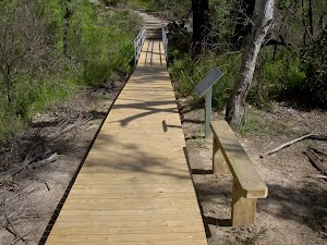
Continue straight: From the information sign, the walk heads around Evans Lookout car park to the toilets at the opposite end (away from the cliffs).
Hayward Gully
(4km) Evans Lookout toilets → Barrow Lookout
2.1 km
53 mins
104m
-165m
Moderate track
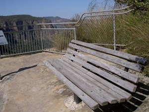
Veer right: From the bench seat, this walk heads down along the cliff top with the valley below on the right. The track descends some stairs for approximately 200m to flatten out for 100m or so before descending some more stairs, to ‘Barrow Lookout’.
Barrow Lookout
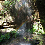
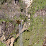
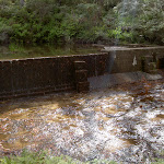
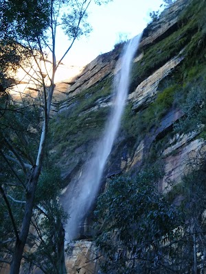
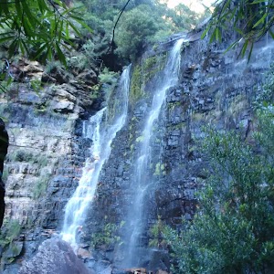
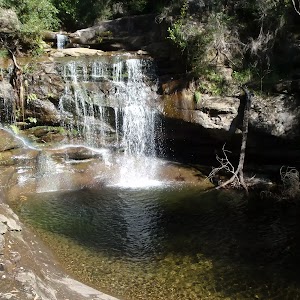
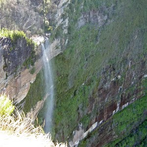
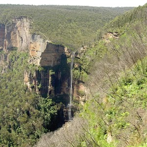
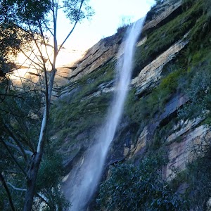
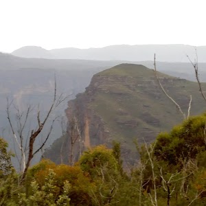
Govetts Leap (falls)
(6.1km) Barrow Lookout → Braeside Picnic Area
1.2 km
22 mins
54m
-10m
Hard track
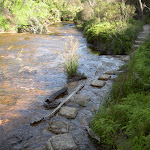
Veer left: From the intersection, this walk follows the ‘Braeside Walk’ sign, up the stream, along the rocky track. The walk leads approximately 100m, to then go down to the creek. The stepping stones are followed up stream to a set of stairs. This walk climbs the stairs and continues south-west for approximately 100m to find some overhead power lines. The walk continues upstream, passing an overgrown track on the left (which heads underneath power lines on the left to join up with a management trail above on the hill). This track is passed, as the brook is followed for approximately 100m, passing some large boulders on the right as the track continues approximately 500m to the Braeside Picnic Area.
Braeside Picnic Area
(7.31km) Braeside Picnic Area → Int. Braeside Service Trail and Braeside Picnic Area
60 m
1 mins
8m
0m
Moderate track
(7.37km) Int. Braeside Service Trail and Braeside Picnic Area → Int. James Rd
1.2 km
24 mins
53m
-3m
Moderate track
(8.59km) Int. James Rd → Neates Glen car park
700 m
12 mins
5m
-11m
Moderate track
Continue straight: From the Bush Rock Cafe(now closed), this walk heads along the road leaving the cafe behind on the left. The track continues down the road for a short time, passing Somerset Ave on the left, to then come to Neates Glen car park on the right.
Maps for the Grand Canyon, Cliff Top and Braeside Walks walk
You can download the PDF for this walk to print a map.These maps below cover the walk and the wider area around the walk, they are worth carrying for safety reasons.
| Katoomba | 1:25 000 Map Series | 89301S KATOOMBA | NSW-89301S |
| Katoomba | 1:100 000 Map Series | 8930 KATOOMBA | 8930 |
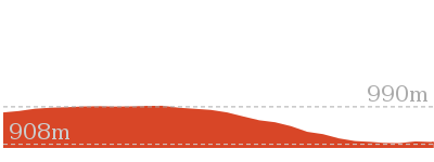
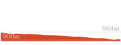
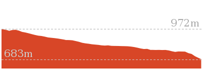
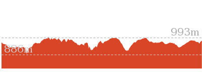
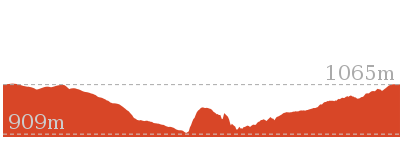
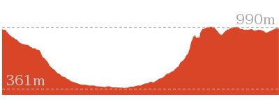
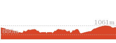
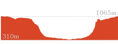
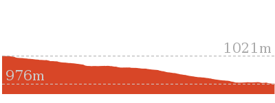
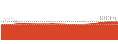
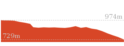
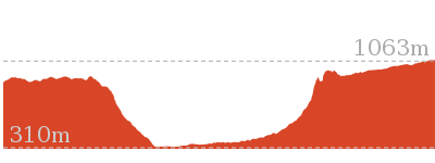
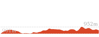
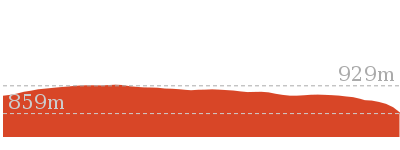
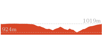
Cross sectional view of the Grand Canyon, Cliff Top and Braeside Walks bushwalking track
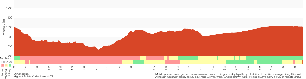
Analysis and summary of the altitude variation on the Grand Canyon, Cliff Top and Braeside Walks
Overview of this walks grade – based on the AS 2156.1 – 2001
Under this standard, a walk is graded based on the most difficult section of the walk.
| Length | 9.3 km | ||
| Time | 4 hrs 30 mins | ||
| . | |||
| Grade 4/6 Hard track |
AS 2156.1 | Gradient | Very steep (4/6) |
| Quality of track | Rough track, where fallen trees and other obstacles are likely (4/6) | ||
| Signs | Minimal directional signs (4/6) | ||
| Experience Required | Some bushwalking experience recommended (3/6) | ||
| Weather | Storms may impact on navigation and safety (3/6) | ||
| Infrastructure | Limited facilities (such as cliffs not fenced, significant creeks not bridged) (4/6) |
Some more details of this walks Grading
Here is a bit more details explaining grading looking at sections of the walk
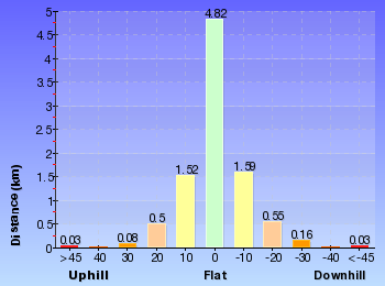
Gradient
4km of this walk has short steep hills and another 3.3km is very steep. Whilst another 1.9km has gentle hills with occasional steps and the remaining 150m is flat with no steps.
Quality of track
5km of this walk follows a formed track, with some branches and other obstacles and another 3.5km follows a rough track, where fallen trees and other obstacles are likely. Whilst another 220m follows a clear and well formed track or trail and the remaining 150m follows a smooth and hardened path.
Signs
6km of this walk has directional signs at most intersection and another 3.2km has minimal directional signs. The remaining (370m) is clearly signposted.
Experience Required
Around 6km of this walk requires no previous bushwalking experience, whilst the remaining 3.4km requires some bushwalking experience.
weather
Around 8km of this walk is not usually affected by severe weather events (that would unexpectedly impact safety and navigation), whilst the remaining 850m is affected by storms that may impact your navigation and safety.
Infrastructure
6km of this walk has limited facilities (such as not all cliffs fenced) and another 2.8km has limited facilities (such as cliffs not fenced, significant creeks not bridged). The remaining (840m) is close to useful facilities (such as fenced cliffs and seats).
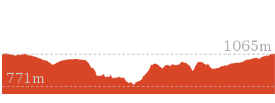
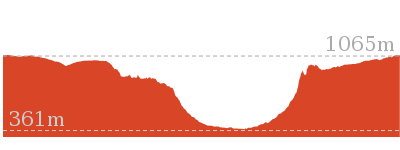
Similar walks
1.4 km Return
1 Hr
Hard track
2.5 km Return
1 Hr
Hard track
3.1 km Return
2 hrs
Hard track
3.2 km One way
1 hr 45 mins
Hard track
5.4 km Circuit
3 hrs 30 mins
Hard track

6.4 km Circuit
4 hrs
Very experienced only

6.6 km One way
4 hrs 15 mins
Hard track
8.7 km Circuit
3 hrs 30 mins
Hard track
8.7 km Circuit
4 hrs 30 mins
Hard track

10.7 km Circuit
6 hrs 30 mins
Hard track
13.6 km Circuit
8 hrs
Hard track

15.6 km Circuit
7 hrs 30 mins
Hard track

18.2 km Circuit
8 hrs 30 mins
Hard track
24.1 km Circuit
2 Days
Hard track
Other Nearby walks
2.4 km Circuit
1 Hr
Very easy
1.9 km One way
45 mins
Very easy
588 m Return
30 mins
Very easy
1.2 km Return
1 hr 45 mins
Hard track
3.8 km One way
2 hrs 30 mins
Hard track
1 km Return
30 mins
Moderate track

6.8 km Return
3 hrs 15 mins
Hard track

16.5 km One way
2 Days
Hard track
7.4 km Return
3 hrs
Moderate track
2.9 km Return
1 hr 30 mins
Moderate track
1.4 km Circuit
45 mins
Moderate track
5.4 km Circuit
3 hrs 30 mins
Hard track

Plan your trip to and from the walk here
The Grand Canyon, Cliff Top and Braeside Walks walk starts and ends at the Neates Glen car park (gps: -33.651464, 150.3146)Your main transport option to Neates Glen car park is by;
(get details)


Short URL = http://wild.tl/gcctabw
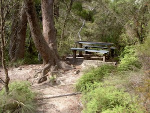
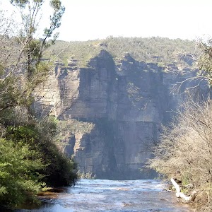
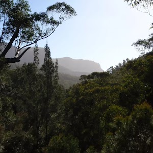
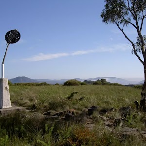
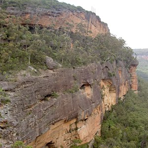
Gallery images
There are other downloads I am still working on.
You will probably need to login to access these — still all free.
* KML (google earth file)
* GPX (GPS file)
Special Maps/ brochures
* A3 topo maps
* PDF with Lands Topo map base
* PDF with arial image (and map overlay)
I wanted to get the main site live first, this extra stuff will come in time.
Happy walking
Matt 🙂
Comments