Golden Staircase to Mt Solitary via Ruined Castle


8 hrs 45 mins

1048 m
Experienced only
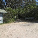


(0km) Golden Stairs Track carpark → Bottings Lookout

210 m
8 mins
9m
-80m
Moderate track
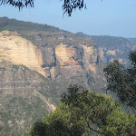
Botting’s Lookout

(0.21km) Bottings Lookout → Bottom of Golden Staircase
430 m
19 mins
41m
-177m
Hard track
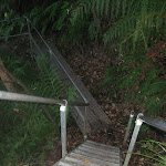
(0.64km) Bottom of Golden Staircase → Miners Campsite
2.3 km
51 mins
104m
-129m
Moderate track
Miners Campsite

(2.9km) Miners Campsite → Northern Ruined Castle campsite
300 m
7 mins
16m
-11m
Moderate track
Northern Ruined Castle campsite
(3.2km) Northern Ruined Castle campsite → Intersection South of Ruined Castle
930 m
23 mins
22m
-77m
Moderate track
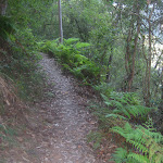
Continue straight: From the intersection, this walk follow the main track south-east, initially keeping the campsite and valley to your left. The track initially heads down a short rocky section[52] then flattens out to pass a large square boulder[53] after about 100m. The track continues through ferny forest for just over 200m, then passes another campsite[54] (down a steep hill to your left), and about 30m further on, comes to a signposted intersection where a ‘Katoomba’ arrow[55][56] points back along the track. Now Continue straight to rejoin the main walk .
(3.2km) Northern Ruined Castle campsite → Ruined Castle
730 m
20 mins
82m
-17m
Hard track
(3.93km) Ruined Castle → Intersection South of Ruined Castle
390 m
12 mins
1m
-123m
Experienced only
(4.32km) Intersection South of Ruined Castle → Bottom of Korrowall Knife-edge
1.3 km
35 mins
132m
-38m
Hard track
(5.65km) Bottom of Korrowall Knife-edge → Top of Korrowall Knife-edge
200 m
12 mins
86m
-2m
Experienced only
Maps for the Golden Staircase to Mt Solitary via Ruined Castle walk
You can download the PDF for this walk to print a map.These maps below cover the walk and the wider area around the walk, they are worth carrying for safety reasons.
| Six Foot Track | 1:50 000 Map Series | Six Foot Track | NSW-six-foot-track |
| Jamison | 1:25 000 Map Series | 89302N JAMISON | NSW-89302N |
| Katoomba | 1:25 000 Map Series | 89301S KATOOMBA | NSW-89301S |
| Katoomba | 1:100 000 Map Series | 8930 KATOOMBA | 8930 |
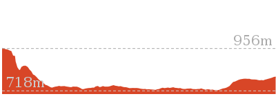
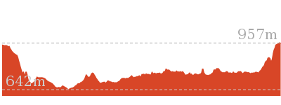
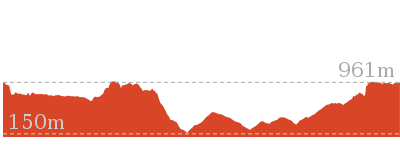
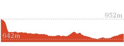
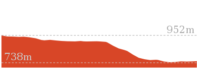
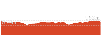
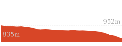
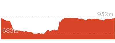
Cross sectional view of the Golden Staircase to Mt Solitary via Ruined Castle bushwalking track
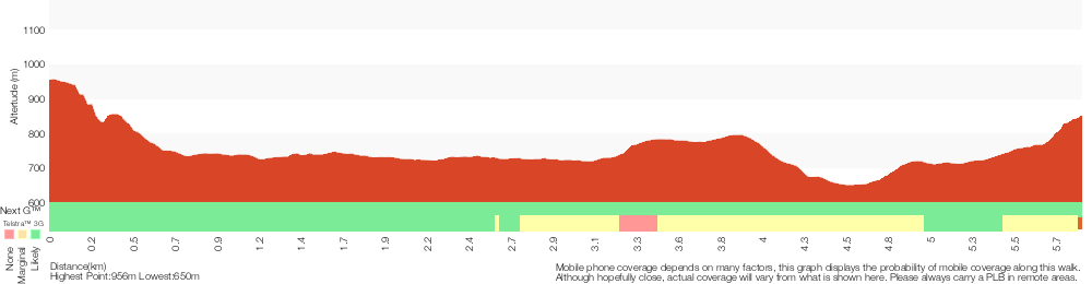
Analysis and summary of the altitude variation on the Golden Staircase to Mt Solitary via Ruined Castle
Overview of this walks grade – based on the AS 2156.1 – 2001
Under this standard, a walk is graded based on the most difficult section of the walk.
| Length | 11.7 km | ||
| Time | 8 hrs 45 mins | ||
| . | |||
| Grade 5/6 Experienced only |
AS 2156.1 | Gradient | Very steep and difficult scrambles (5/6) |
| Quality of track | Rough unclear track (5/6) | ||
| Signs | No directional signs (5/6) | ||
| Experience Required | High level of bushwalking experience recommended (5/6) | ||
| Weather | Forecast, unforecast storms and severe weather may impact on navigation and safety (4/6) | ||
| Infrastructure | No facilities provided (5/6) |
Some more details of this walks Grading
Here is a bit more details explaining grading looking at sections of the walk
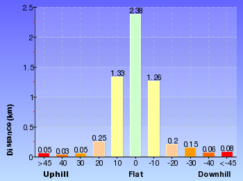
Gradient
2.6km of this walk has gentle hills with occasional steps and another 2.5km is very steep. Whilst another 590m is very steep with difficult rock scrambles and the remaining 210m has short steep hills.
Quality of track
3.2km of this walk follows a formed track, with some branches and other obstacles and another 2.1km follows a rough track, where fallen trees and other obstacles are likely. The remaining (590m) follows a rough unclear track.
Signs
3km of this walk has directional signs at most intersection and another 2.4km has minimal directional signs. Whilst another 210m is clearly signposted and the remaining 200m Has no directional signs.
Experience Required
3km of this walk requires some bushwalking experience and another 2.4km requires a leader a with moderate level of bushwalking experience. Whilst another 210m requires no previous bushwalking experience and the remaining 200m requires a leader with a high level of bushwalking experience.
weather
3.2km of this walk is not usually affected by severe weather events (that would unexpectedly impact safety and navigation) and another 1.7km is affected by storms that may impact your navigation and safety. The remaining (930m) is affected by forecast, unforecast storms and severe weather events that may impact on navigation and safety.
Infrastructure
3.7km of this walk has limited facilities (such as not all cliffs fenced) and another 1.7km has limited facilities (such as cliffs not fenced, significant creeks not bridged). Whilst another 210m is close to useful facilities (such as fenced cliffs and seats) and the remaining 200m has no facilities provided.
Similar walks
5.9 km Circuit
3 hrs 30 mins
Hard track

6.8 km Circuit
5 hrs
Hard track

7.9 km Return
5 hrs
Hard track
8 km One way
5 hrs
Hard track
12.4 km Return
7 hrs 30 mins
Hard track
16.2 km Return
11 hrs
Experienced only


29.2 km One way
2 Days
Experienced only


29.3 km One way
3 Days
Experienced only
33.8 km Circuit
3 Days
Experienced only
Other Nearby walks
20 km Return
7 hrs
Moderate track

4.2 km Return
1 hr 45 mins
Hard track


6.7 km Return
4 hrs 30 mins
Moderate track
2.7 km Return
2 hrs 30 mins
Moderate track
869 m Circuit
1 hr 15 mins
Hard track
1.5 km Circuit
1 hr 45 mins
Hard track

1.7 km Return
3 hrs 45 mins
Hard track
2.1 km One way
1 hr 15 mins
Moderate track
1.2 km Return
2 hrs
Hard track
5.8 km Circuit
5 hrs 30 mins
Hard track

6.8 km One way
3 hrs 30 mins
Moderate track
1.1 km Circuit
2 hrs
Hard track

Plan your trip to and from the walk here
The Golden Staircase to Mt Solitary via Ruined Castle walk starts and ends at the Golden Stairs Track carpark (gps: -33.734348, 150.28237)Your main transport option to Golden Stairs Track carpark is by;
(get details)


Short URL = http://wild.tl/gstmsvrc
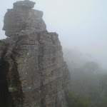
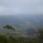
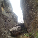
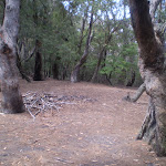
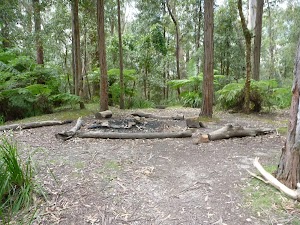
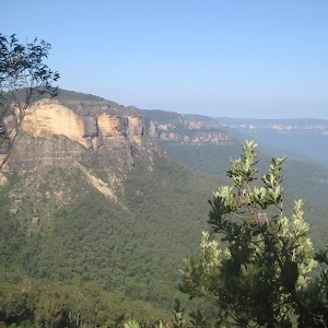
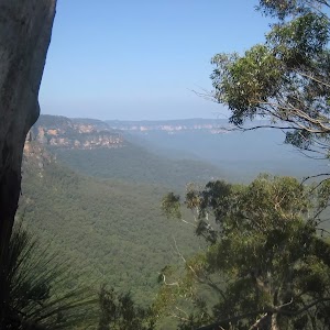
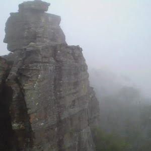
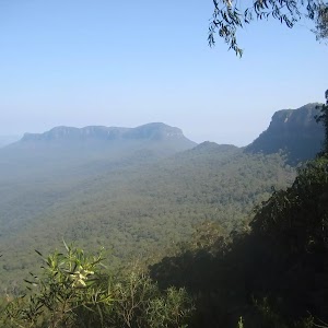
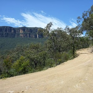
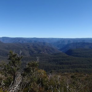
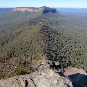
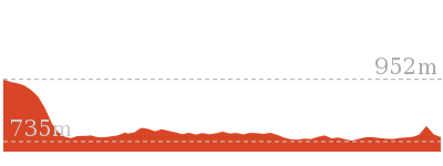
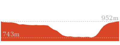
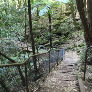
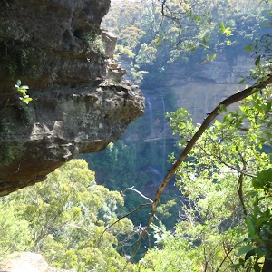
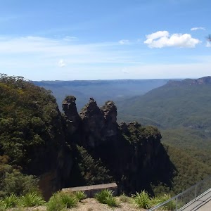
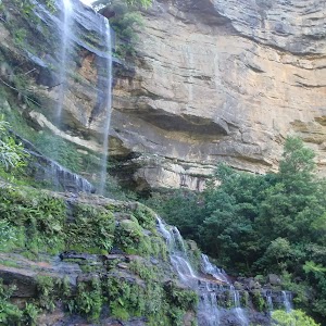
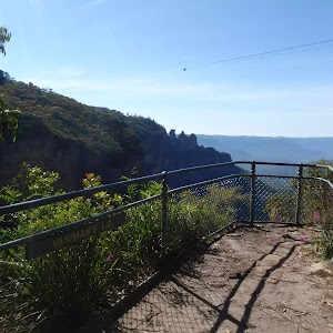
Gallery images
There are other downloads I am still working on.
You will probably need to login to access these — still all free.
* KML (google earth file)
* GPX (GPS file)
Special Maps/ brochures
* A3 topo maps
* PDF with Lands Topo map base
* PDF with arial image (and map overlay)
I wanted to get the main site live first, this extra stuff will come in time.
Happy walking
Matt 🙂
Comments