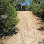
Currie Rd Track


1 hr 30 mins

145 m
Hard track


(0km) Start of Currie Road service trail → Int of Natural Bridge and Currie Road Tracks

910 m
16 mins
15m
-28m
Moderate track
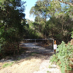
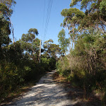
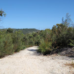
Veer left: From the intersection, this walk follows the flat service trail heading south, in the opposite direction of the closest telegraph pole, winding alongside the power lines for a little while. The trail then breaks away from the power lines, heading through thicker vegetation until it comes to the signposted intersection of the Natural Bridge Track.
(0.91km) Int of Natural Bridge and Currie Road Tracks → Natural Bridge
250 m
6 mins
0m
-39m
Moderate track
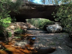
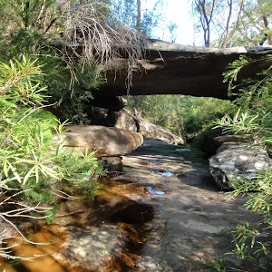
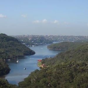
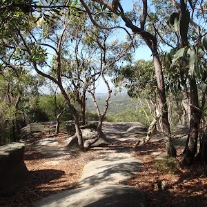
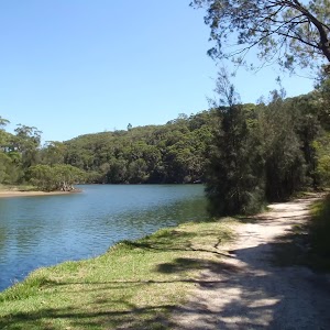
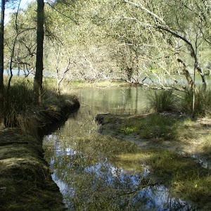
Natural Bridge
(0.91km) Int of Natural Bridge and Currie Road Tracks → Int of Bates Creek and Currie Rd tracks
180 m
3 mins
5m
-1m
Easy track
(1.09km) Int of Bates Creek and Currie Rd tracks → Bend in Cook St
290 m
7 mins
25m
-1m
Moderate track
(1.09km) Int of Bates Creek and Currie Rd tracks → End of Service trail
1.1 km
21 mins
7m
-85m
Moderate track
(2.19km) End of Service trail → Bantry Bay View
50 m
1 mins
0m
-4m
Hard track
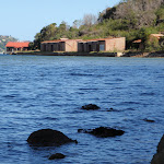
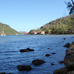
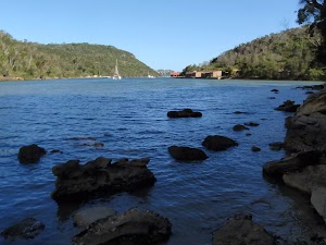
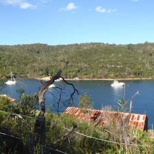
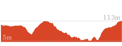
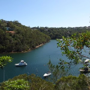
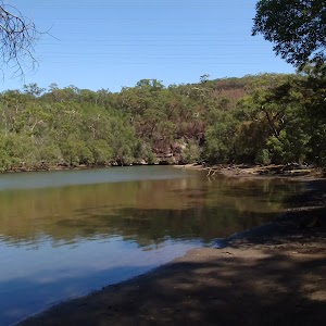
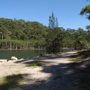
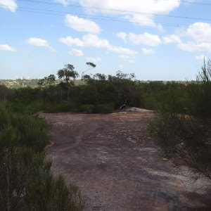
Bantry Bay View
Maps for the Currie Rd Track walk
You can download the PDF for this walk to print a map.These maps below cover the walk and the wider area around the walk, they are worth carrying for safety reasons.
| Parramatta River | 1:25 000 Map Series | 91303N PARRAMATTA RIVER | NSW-91303N |
| Sydney | 1:100 000 Map Series | 9130 SYDNEY | 9130 |
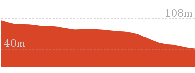
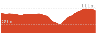
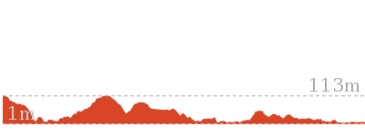
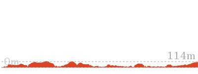
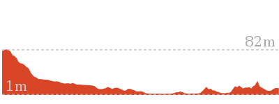
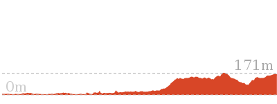
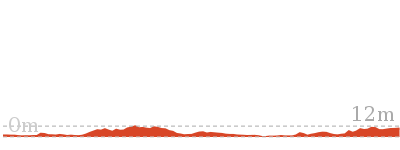
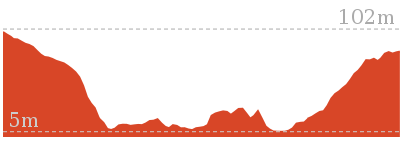
Cross sectional view of the Currie Rd Track bushwalking track
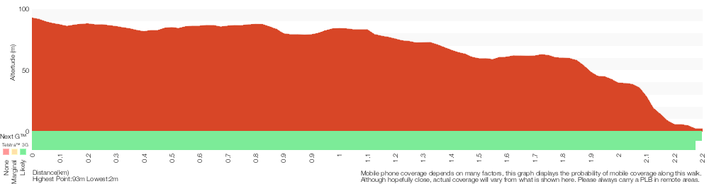
Analysis and summary of the altitude variation on the Currie Rd Track
Overview of this walks grade – based on the AS 2156.1 – 2001
Under this standard, a walk is graded based on the most difficult section of the walk.
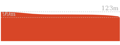
| Length | 4.5 km | ||
| Time | 1 hr 30 mins | ||
| . | |||
| Grade 4/6 Hard track |
AS 2156.1 | Gradient | Very steep (4/6) |
| Quality of track | Rough track, where fallen trees and other obstacles are likely (4/6) | ||
| Signs | Minimal directional signs (4/6) | ||
| Experience Required | Some bushwalking experience recommended (3/6) | ||
| Weather | Storms may impact on navigation and safety (3/6) | ||
| Infrastructure | Limited facilities, not all cliffs are fenced (3/6) |
Some more details of this walks Grading
Here is a bit more details explaining grading looking at sections of the walk
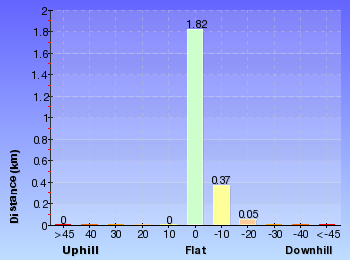
Gradient
1.1km of this walk has short steep hills and another 1.1km is flat with no steps. The remaining (55m) is very steep.
Quality of track
1.1km of this walk follows a smooth and hardened path and another 1.1km follows a clear and well formed track or trail. The remaining (55m) follows a rough track, where fallen trees and other obstacles are likely.
Signs
2km of this walk has directional signs at most intersection and another 180m is clearly signposted. The remaining (55m) has minimal directional signs.
Experience Required
Around 1.2km of this walk requires some bushwalking experience, whilst the remaining 1.1km requires no previous bushwalking experience.
weather
Around 2.2km of this walk is not usually affected by severe weather events (that would unexpectedly impact safety and navigation), whilst the remaining 55m is affected by storms that may impact your navigation and safety.
Infrastructure
Around 2.2km of this walk is close to useful facilities (such as fenced cliffs and seats), whilst the remaining 55m has limited facilities (such as not all cliffs fenced).
Similar walks
1.4 km Return
45 mins
Moderate track
3.4 km One way
1 hr 30 mins
Moderate track

3.7 km Return
1 hr 30 mins
Hard track
4.6 km One way
2 hrs
Hard track
7.2 km One way
3 hrs
Moderate track

10 km One way
4 hrs 30 mins
Hard track


10 km One way
4 hrs
Hard track
11.2 km One way
4 hrs 30 mins
Hard track
22.6 km One way
9 hrs 45 mins
Hard track
Other Nearby walks
986 m Return
30 mins
Moderate track
7 km Return
3 hrs 45 mins
Moderate track

7 km Circuit
2 hrs 30 mins
Hard track
3.8 km One way
1 hr 45 mins
Hard track

14.1 km One way
5 hrs 30 mins
Moderate track
15.1 km Circuit
5 hrs 45 mins
Experienced only
5.3 km Return
2 hrs
Moderate track
516 m Return
20 mins
Moderate track
2 km Return
1 hr 15 mins
Hard track

3.8 km One way
1 hr 30 mins
Hard track

2.6 km One way
1 hr 15 mins
Hard track
2.2 km One way
45 mins
Moderate track
Plan your trip to and from the walk here
The Currie Rd Track walk starts and ends at the Start of Currie Road service trail (gps: -33.760107, 151.22467)Your transport options to Start of Currie Road service trail are by;
(get details)


Short URL = http://wild.tl/crt
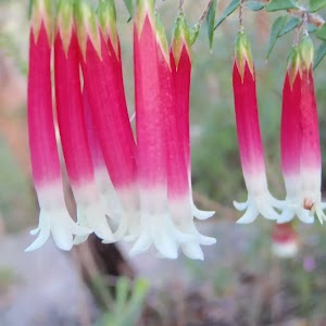
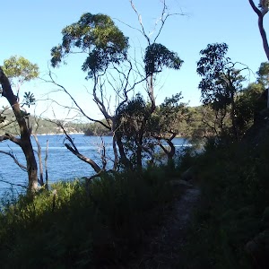
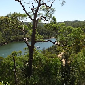
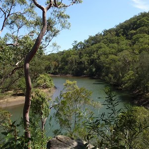
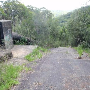
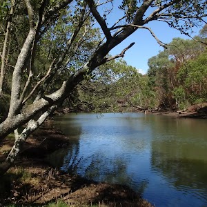
Gallery images
There are other downloads I am still working on.
You will probably need to login to access these — still all free.
* KML (google earth file)
* GPX (GPS file)
Special Maps/ brochures
* A3 topo maps
* PDF with Lands Topo map base
* PDF with arial image (and map overlay)
I wanted to get the main site live first, this extra stuff will come in time.
Happy walking
Matt 🙂
Comments