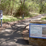
Fairfax Heritage Circuit Track


1 Hr

65 m
Very easy
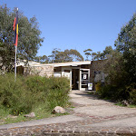


NPWS Heritage Centre


(0km) NPWS Heritage Centre car park → George Phillips Lookout

1.6 km
27 mins
10m
-50m
Very easy


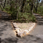
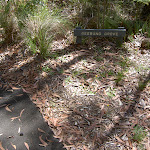
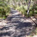
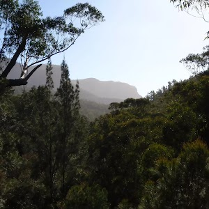
Continue straight: From the intersection, this walk leads down along the footpath, leaving the seat, sign and sidetrack behind (on the left). The path soon bends left and after 70m passes through (ignoring) a four-way intersection with a dirt trail[20]. The path leads on for another 75m, bending a few times, to find another bench seat[21] (on the left). From here the path continues to lead (gently undulating) through the forest for another 140m to find yet another bench seat[22] (on your left). Here the track bends sharply to the right and leads gently downhill for 230m to passes through (ignoring) another four-way intersection with a dirt trail marked with a ‘Rehabilitation Area – Please Keep Off’ sign[23]. The walk then continues downhill along the path for another 220m to find a few picnic tables[24], a stone picnic shelter[25] at an intersection with a short ramp[26] leading down to the signposted[27] ‘George Phillips Lookout’[28] (on your left).


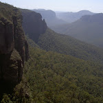
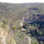
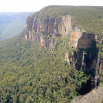
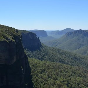
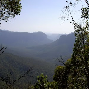
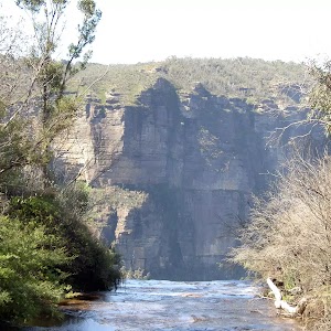
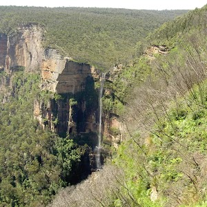
George Phillips Lookout
(1.55km) George Phillips Lookout → Govetts Leap Lookout
340 m
7 mins
7m
-18m
Very easy


Continue straight: From the large stone shelter[38] at the edge of the turning circle (and car park)[39] at the end of Govetts Leap Rd, this walk heads 35m towards the valley views[40] to head through the stone arch[41] then down the ramp[42] to the large flat gravel and fenced ‘Govetts Leap’ lookout platform[43].
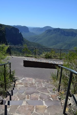
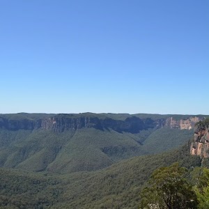
Govetts Leap Lookout


(1.89km) Govetts Leap Lookout → NPWS Heritage Centre car park
490 m
10 mins
48m
0m
Very easy
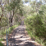
Continue straight: From Govetts Leap Picnic Area, this walk heads up the hill of the road, away from the lookouts and valley. The walk continues for a short time along the road, passing a few speed bumps, and turns to the right into the NPWS Heritage Centre car park.
Maps for the Fairfax Heritage Circuit Track walk
You can download the PDF for this walk to print a map.These maps below cover the walk and the wider area around the walk, they are worth carrying for safety reasons.
| Katoomba | 1:25 000 Map Series | 89301S KATOOMBA | NSW-89301S |
| Katoomba | 1:100 000 Map Series | 8930 KATOOMBA | 8930 |
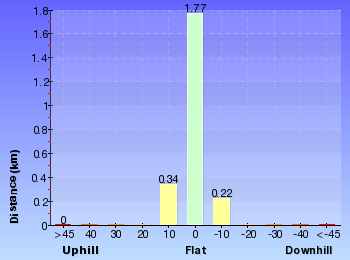
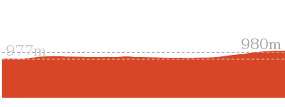
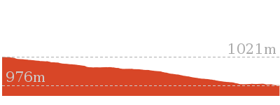
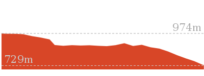
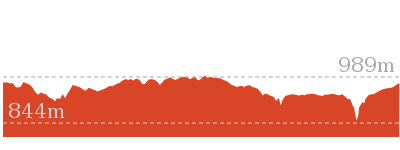
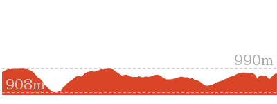
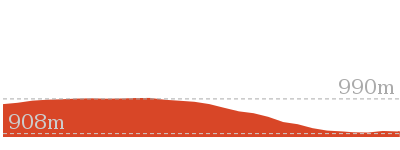
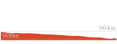
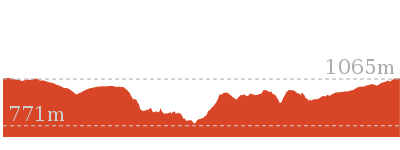
Cross sectional view of the Fairfax Heritage Circuit Track bushwalking track
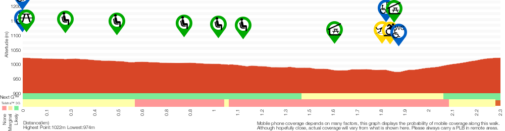
Analysis and summary of the altitude variation on the Fairfax Heritage Circuit Track
Overview of this walks grade – based on the AS 2156.1 – 2001
Under this standard, a walk is graded based on the most difficult section of the walk.
| Length | 2.4 km | ||
| Time | 1 Hr | ||
| . | |||
| Grade 1/6 Very easy |
AS 2156.1 | Gradient | Flat, no steps (1/6) |
| Quality of track | Smooth and hardened path (1/6) | ||
| Signs | Clearly signposted (1/6) | ||
| Experience Required | No experience required (1/6) | ||
| Weather | Weather generally has little impact on safety (1/6) | ||
| Infrastructure | Generally useful facilities (such as fenced cliffs and seats) (1/6) |
Some more details of this walks Grading
Here is a bit more details explaining grading looking at sections of the walk
Gradient
This whole walk, 2.4km is flat with no steps.
Quality of track
This whole walk, 2.4km follows a smooth and hardened path.
Signs
This whole walk, 2.4km is clearly signposted.
Experience Required
This whole walk, 2.4km requires no previous bushwalking experience.
weather
This whole walk, 2.4km is not usually affected by severe weather events (that would unexpectedly impact safety and navigation).
Infrastructure
This whole walk, 2.4km is close to useful facilities (such as fenced cliffs and seats).
Similar walks
588 m Return
30 mins
Very easy
1.9 km One way
45 mins
Very easy
Other Nearby walks
1.2 km Return
1 hr 45 mins
Hard track
3.8 km One way
2 hrs 30 mins
Hard track
3.2 km One way
1 hr 45 mins
Hard track
1.4 km Return
1 Hr
Hard track
13.6 km Circuit
8 hrs
Hard track
2.5 km Return
1 Hr
Hard track
8.7 km Circuit
3 hrs 30 mins
Hard track

18.2 km Circuit
8 hrs 30 mins
Hard track

15.6 km Circuit
7 hrs 30 mins
Hard track
8.7 km Circuit
4 hrs 30 mins
Hard track

24.1 km Circuit
2 Days
Hard track
3.1 km One way
2 hrs
Hard track

Plan your trip to and from the walk here
The Fairfax Heritage Circuit Track walk starts and ends at the NPWS Heritage Centre car park (gps: -33.630772, 150.30684)Your transport options to NPWS Heritage Centre car park are by;
(get details)


Short URL = http://wild.tl/ftc
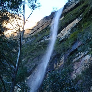
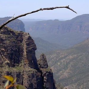
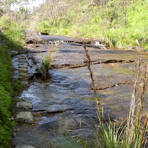
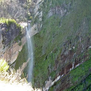
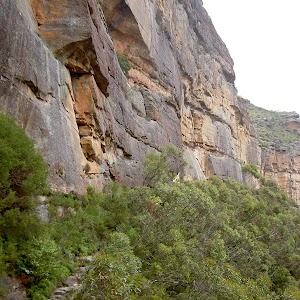
Gallery images
There are other downloads I am still working on.
You will probably need to login to access these — still all free.
* KML (google earth file)
* GPX (GPS file)
Special Maps/ brochures
* A3 topo maps
* PDF with Lands Topo map base
* PDF with arial image (and map overlay)
I wanted to get the main site live first, this extra stuff will come in time.
Happy walking
Matt 🙂
Comments