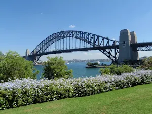
Harbour Bridge to Taronga Zoo

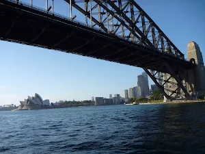
(0km) Milsons Point Station → Tunnel vent lookout
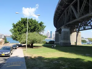
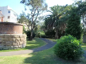
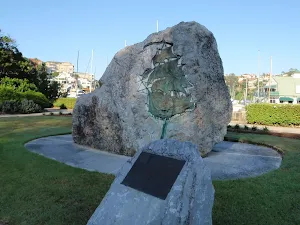
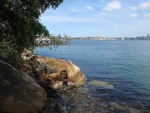
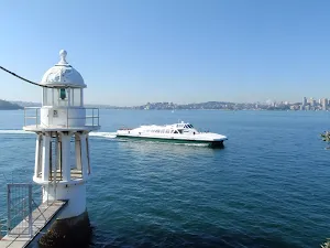
Tunnel vent lookout
(0km) Tunnel vent lookout → Dr Mary Booth Lookout
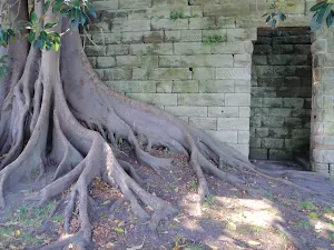
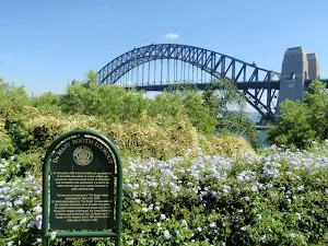
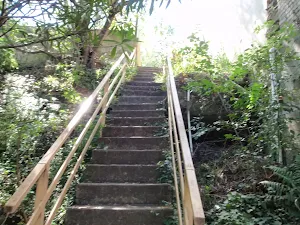
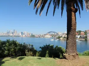
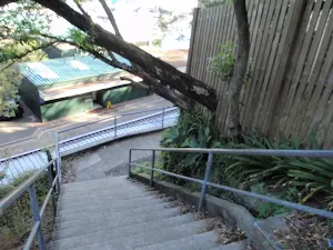
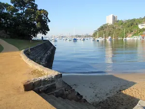
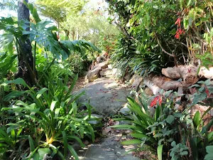
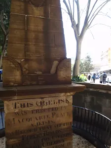
Continue straight: From Jeffreys St ferry wharf[12], this walk follows the foreshore footpath whilst keeping the harbour to your right[13]. The walk heads over a bridge then past a large strangler fig tree[14] beside a sandstone wall. This foreshore walkway also passes several seats[15], steps[16], historic items[17] and grand harbour views[18], and passes over a couple of bridges[19] before turning left and heading up a long flight of steps. At the top of these steps, the walk comes to a large grassy reserve and the signposted 'Dr Mary Booth Lookout'[20].
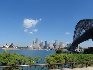
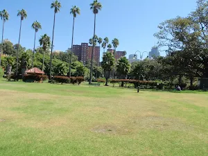
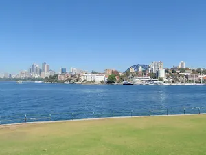
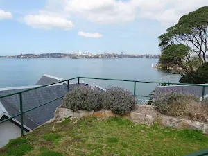
Dr Mary Booth Lookout
(1km) Dr Mary Booth Lookout → Admiralty House
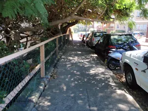
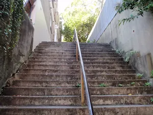
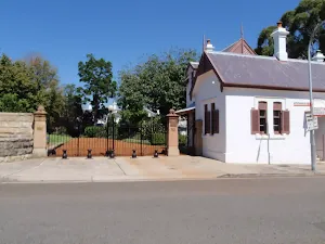
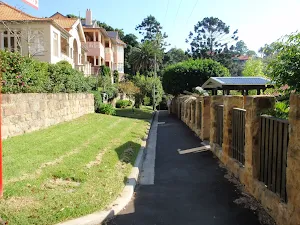
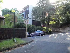
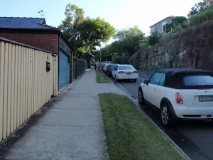
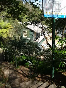
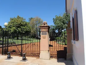
Continue straight: From the intersection, this walk heads along Waruda St whilst keeping the water glimpses to your right. At the end of a Waruda St, the walk turns left and heads up the steps[26] then follows the path to soon turn right onto Kirribilli Ave[27]. The walk heads past a old white building[28] to find the gate to 'Admiralty House'[29].
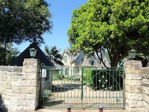
Admiralty House
(1km) Admiralty House → Lady Gowrie Lookout
Continue straight: From Kirribilli House[35], this walk heads towards the end of Kirribilli Ave[36], towards the water view. Just beyond the end of Kirribilli Ave, this walk heads down a few steps[37] to come to the good views and signposted 'Lady Gowrie Lookout'[38]. At the end of this side trip, retrace your steps back to the main walk then Turn right.
Kirribilli House
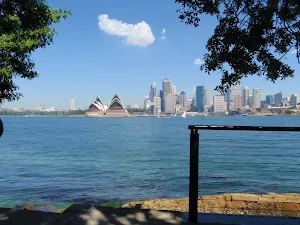
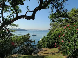
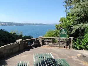
Lady Gowrie Lookout
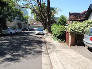
(1km) Admiralty House → Int of Carabella St and Holbrook Ave
(1km) Int of Carabella St and Holbrook Ave → Ensemble Theatre
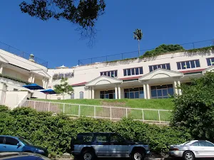
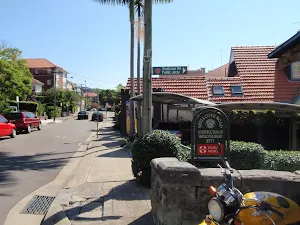
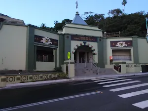
Ensemble Theatre
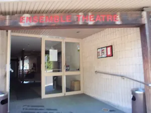
(2km) Ensemble Theatre → Milson Park
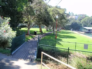
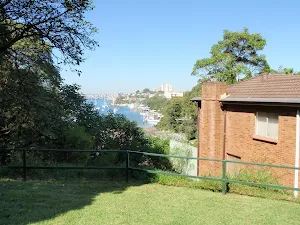
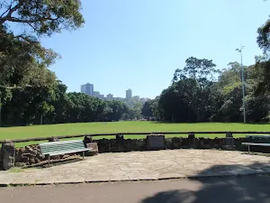
Milson Park
(2km) Milson Park → Anderson Park
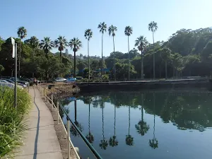
Turn right: From the intersection, this walk heads down the steps[69] then across the small timber[70] bridge into Anderson Park. Here the walk follows the footpath along the foreshore and soon finds a semi-circular seating area[71] with several plaques[72][73][74], a water view[75] and a drinking fountain[76]. The walk continues along the foreshore of the park to the far side to find a set of stairs heading up from between the toilets[77] and Neutral Bay Marina[78].
Anderson Park
(3km) Anderson Park → Int of Wycombe Rd and Hayes St
(3km) Int of Wycombe Rd and Hayes St → Neutral Bay (Hayes Street) Ferry Wharf
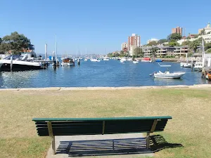
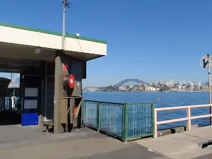
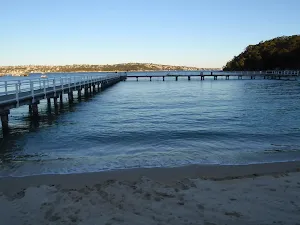
Neutral Bay (Hayes Street) Ferry Wharf
(3km) Int of Wycombe Rd and Hayes St → Nutcote House
Nutcote House
(3km) Nutcote House → Top of Kurraba ferry steps
(4km) Top of Kurraba ferry steps → Int of Kurraba and Shellcove Rds
(4km) Int of Kurraba and Shellcove Rds → Spains Lookout
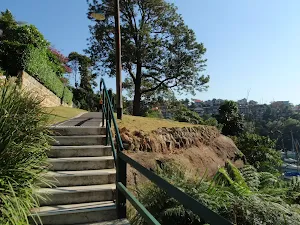
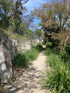
Continue straight: From the intersection, this walk heads uphill following the footpath beside Kurraba Rd[101]. Soon the walk takes the left fork[102] in the road and heads down past Hodgson Lookout[103] and just beyond the intersection with Baden Rd[104], to a small park and 'Spains Lookout'[105][106] At the end of this side trip, retrace your steps back to the main walk then Turn right.
Spains Lookout
Kurraba Point
(4km) Int of Kurraba and Shellcove Rds → Bogota Ave Lookout
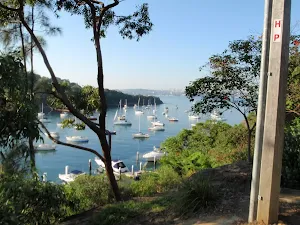
Bogota Ave Lookout
(4km) Bogota Ave Lookout → Top of Maccallum Pool path
Continue straight: From the intersection, this walk follows the 'Maccallum Pool' sign[123] along the path, keeping the water views to your right. Soon the path leads to a 'Y' intersection[124] in front of an apartment building[125] (the path on the right leads to Maccallum Pool).
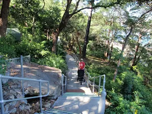
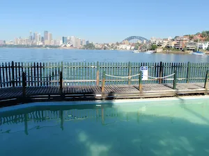
(5km) Top of Maccallum Pool path → Maccallum Pool
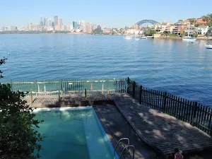
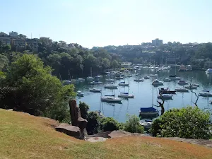
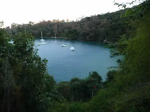
Maccallum Pool
(5km) Top of Maccallum Pool path → Int of Milson Rd and foreshore walk
(5km) Int of Milson Rd and foreshore walk → Sophies Lookout
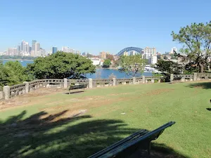
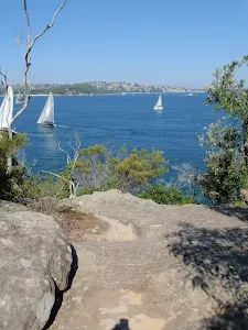
Sophies Lookout
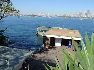
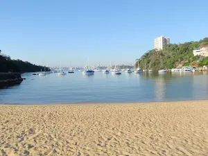
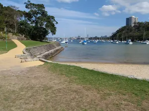
Cremorne Point Ferry Wharf
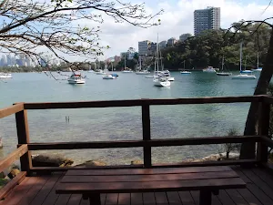
(6km) Sophies Lookout → Robertsons Point Lookout
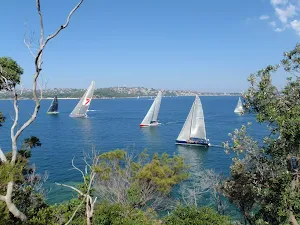
Robertsons Point Lookout
(6km) Sophies Lookout → Elephants Ear
Elephants Ear
(6km) Elephants Ear → Old Cremorne Ferry Wharf
Continue straight: From the intersection, this walk follows the 'Old Cremorne Wharf' sign[167] sign gently uphill along the path, keeping the water to your right. The path soon comes to another intersection where this walk tends right[168], following the path for about 120m (passing a few informal side tracks[169][170]) to find some large sandstone boulders[171] and the entrance to the 'Old Cremorne' Ferry Wharf[172][173].
(6km) Old Cremorne Ferry Wharf → Bottom of Hodgson Ave steps
(7km) Bottom of Hodgson Ave steps → Mosman Bay Marina
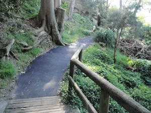
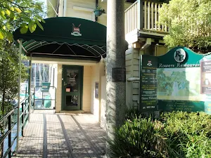
Continue straight: From 5 Bromley Ave[185], this walk heads down the steps[186][187] and follows the path to cross the timber bridge[188] over the valley. The walk bends right and follows the path for ≈250m, enjoying the water views to your right[189]. The path then passes a 'Harnett Park' sign[190] (and ignores the upper track on your left), then heads down some steps and turns left. The walk heads past the 'Rowers Restaurant'[191] to a car park and the Mosman Bay Marina[192].
Rowers Restaurant
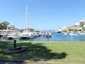
(7km) Mosman Bay Marina → Mosman Bay Ferry Wharf
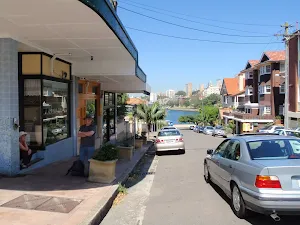
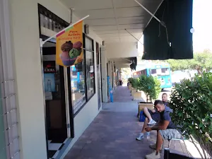
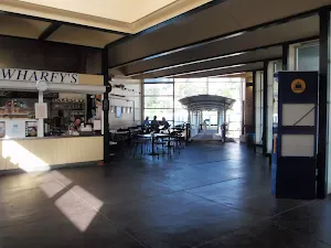
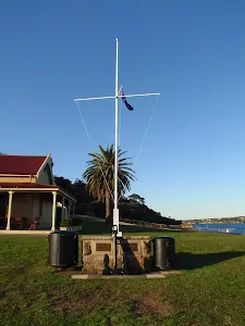
Mosman Bay Ferry Wharf and Shops
(7km) Mosman Bay Ferry Wharf → Int of Musgrave and McLeod Sts
(8km) Int of Musgrave and McLeod Sts → South Mosman Wharf
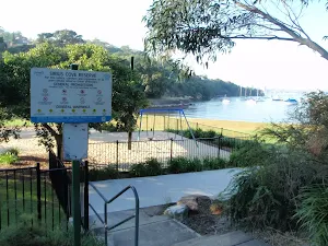
(8km) South Mosman Wharf → Curraghbeena Point
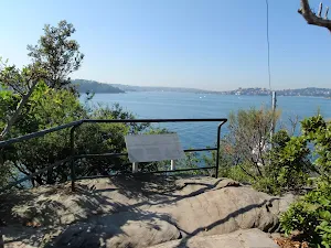
Curraghbeena Point Lookout
(8km) Curraghbeena Point → End of Curraghbeena Rd
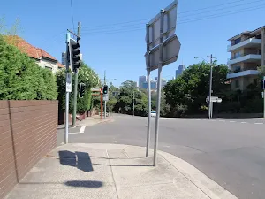
(9km) End of Curraghbeena Rd → Int. Illawarra St and Curlew Camp Rd
Turn right: From the intersection, this walk heads up the hill along the narrow concrete road[239], keeping the houses to your left. Soon the road leads to an intersection with Illawarra St and some stairs (on your right)[240].
(9km) Int. Illawarra St and Curlew Camp Rd → Sirius Cove Reserve
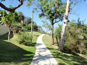
Sirius Cove Reserve
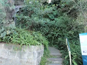
(9km) Sirius Cove Reserve → Int. Borogegal Walking Trail and Curlew Camp Trk
Continue straight: From the intersection, this walk follows the sign pointing to 'Curlew Camp'[242], following the footpath beside the tall barbed wire fence and wall. The track leads over a few sections of boardwalk, and soon comes to an intersection (with a track on the right marked with another 'Curlew Camp' sign[243], pointing '130 metres'.
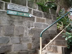
(9km) Int. Borogegal Walking Trail and Curlew Camp Trk → Camp Curlew
Continue straight: From the intersection, this walk heads down towards the water and onto the wooden platform. At the end of this side trip, retrace your steps back to the main walk then Continue straight.
Camp Curlew
(9km) Int. Borogegal Walking Trail and Curlew Camp Trk → Taronga Zoo Wharf
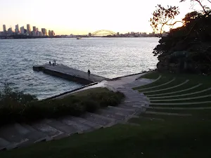
Taronga Zoo
Maps for the Harbour Bridge to Taronga Zoo walk
You can download the PDF for this walk to print a map.
These maps below cover the walk and the wider area around the walk, they are worth carrying for safety reasons.
| Parramatta River | 1:25 000 Map Series | 91303N PARRAMATTA RIVER | NSW-91303N |
| Sydney | 1:100 000 Map Series | 9130 SYDNEY | 9130 |
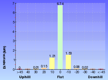
Cross sectional view of the Harbour Bridge to Taronga Zoo bushwalking track
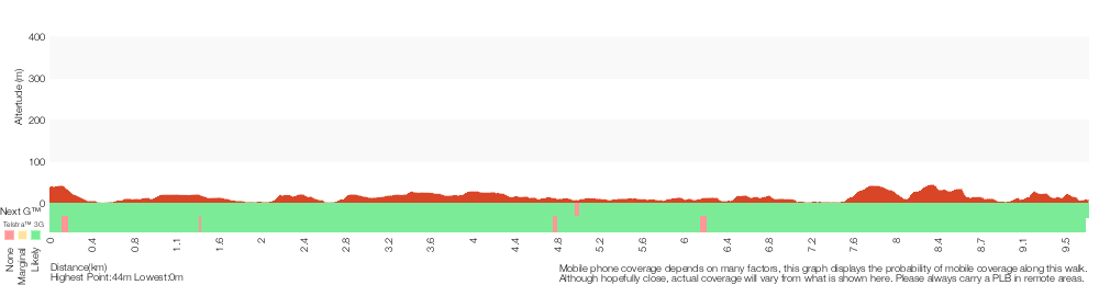
Analysis and summary of the altitude variation on the Harbour Bridge to Taronga Zoo
Overview of this walks grade – based on the AS 2156.1 – 2001
Under this standard, a walk is graded based on the most difficult section of the walk.
| Length | 9.8 km | ||
| Time | 4 hrs | ||
| . | |||
Grade 3/6 Moderate track | AS 2156.1 | Gradient | Short steep hills (3/6) |
| Quality of track | Clear and well formed track or trail (2/6) | ||
| Signs | Clearly signposted (1/6) | ||
| Experience Required | No experience required (1/6) | ||
| Weather | Weather generally has little impact on safety (1/6) | ||
| Infrastructure | Limited facilities, not all cliffs are fenced (3/6) |
Some more details of this walks Grading
Here is a bit more details explaining grading looking at sections of the walk
Gradient
4.4km of this walk has gentle hills with occasional steps and another 3.7km is flat with no steps. The remaining (1.6km) has short steep hills.
Quality of track
Around 9km of this walk follows a smooth and hardened path, whilst the remaining 940m follows a clear and well formed track or trail.
Signs
This whole walk, 10km is clearly signposted.
Experience Required
This whole walk, 10km requires no previous bushwalking experience.
weather
This whole walk, 10km is not usually affected by severe weather events (that would unexpectedly impact safety and navigation).
Infrastructure
Around 10km of this walk is close to useful facilities (such as fenced cliffs and seats), whilst the remaining 160m has limited facilities (such as not all cliffs fenced).
Similar walks
A list of walks that share part of the track with the Harbour Bridge to Taronga Zoo walk.
Robertsons Point Lookout
478 m Return, 15 mins
Easy track
Taronga Zoo to Camp Curlew
930 m Return, 30 mins
Moderate track
Taronga to Musgrave Wharf
1.7 km One way, 1 Hr
Moderate track
Cremorne Point to Mosman Wharf
2 km One way, 45 mins
Easy track
Cremorne Point Circuit
2.7 km Circuit, 1 hr 15 mins
Easy track
Cremorne Point to Taronga Zoo
4.2 km One way, 1 hr 45 mins
Moderate track
Taronga Zoo, Clifton Gardens return via Sirius Cove
6.5 km Circuit, 3 hrs 30 mins
Moderate track
Other Nearby walks
A list of walks that start near the Harbour Bridge to Taronga Zoo walk.
Bradleys Head and Chowder Head walk
3.7 km One way, 1 hr 45 mins
Moderate track
Taronga Wharf to Chowder Bay
4.4 km One way, 2 hrs
Moderate track
Taronga Zoo, Bradleys Head to Athol Hall
3 km Circuit, 1 hr 30 mins
Moderate track
Taronga Zoo to Balmoral Beach
6.8 km One way, 3 hrs
Hard track
Taronga Zoo to Chowder Bay return via Bradleys Head Rd
7 km Circuit, 3 hrs
Moderate track
Taronga Zoo to Manly
18.9 km One way, 8 hrs
Hard track
Taronga Zoo to Spit Bridge
10.4 km One way, 5 hrs
Hard track
Sydney to Boronia Park
6 km One way, 2 hrs 30 mins
Moderate track
Circular Quay to Hornsby
44.4 km One way, 3 Days

Hard track
Sydney to Thornleigh via Lane Cove Tourist Park
33 km One way, 2 Days
Hard track
Chowder Head
548 m Circuit, 20 mins
Moderate track
Bradleys Head to Chowder Bay walk
2.8 km One way, 1 hr 30 mins
Moderate track
Plan your trip to and from the walk here
The Harbour Bridge to Taronga Zoo walk starts at the Milsons Point Station (gps: -33.845818, 151.21242)
The Harbour Bridge to Taronga Zoo ends at the Taronga Zoo Wharf (gps: -33.845750, 151.23979)
Weather Forecast
This walk starts in the Metropolitan weather district.
Current Alerts
Park Information
Cremorne Reserve
Comments
Short URL: http://wild.tl/hbttz