Engadine to Audley
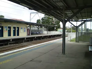
(0km) Engadine Railway Station → Int of Engadine Track and Bushtracks
Turn right: From the intersection, this walk follows the 'Audley 6km' arrow along the management trail. Very soon, the walk comes to an intersection with a bush track on the left, marked with a 'track closed for regeneration' sign.
(0km) Int of Engadine Bush and Servicetrail → Int of Audley and Engadine bushtracks
(0km) Int of Audley and Engadine bushtracks → Int of Engadine Track and The Ave Servicetrail
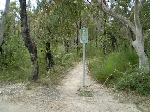
(1km) Int of Engadine Track and The Ave Servicetrail → Int of Engadine and Gnarra Rill Bike Track (south)
Continue straight: From the intersection, this walk heads south-east along the wide bush track for approximately 25m before coming to an signposted intersection with another bush track.
(1km) Int of Engadine and Gnarra Rill Bike Track (south) → Int of Engadine Track and Jacana Servicetrail
(1km) Int of Engadine Track and Jacana Servicetrail → Loop Track Servicetrail (south-east)
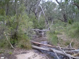
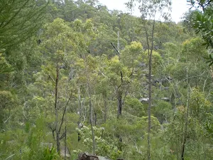
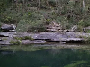
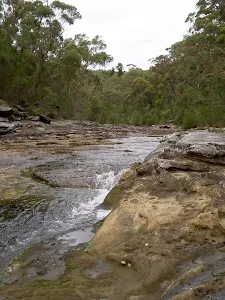
(2km) Int of Engadine and Loop Track (North-west) → Kangaroo Creek
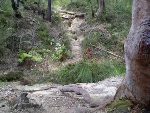
Continue straight: From the intersection the track follows the Audley arrow along the bushtrack, passing another sign to Audley shortly after as it heads along to the top of a long hill. From here the track follows the bushtrack as it heads down the long rocky hill until it flattens out after a set of wooden steps. From here the track follows the bushtrack for a while before it starts to head down another long hill, winding all the way down the rocky bushtrack to the bottom of the valley where it passes a sign pointing back to heathcote and comes to Kangaroo Creek.
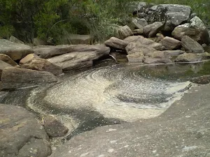
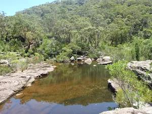
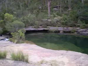
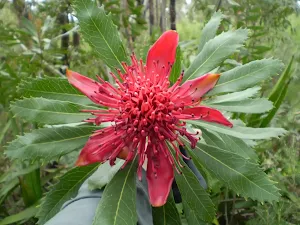
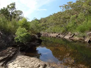
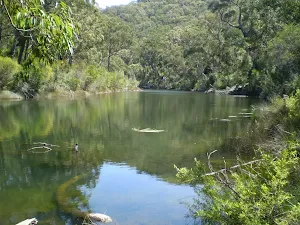
Kangaroo Creek Pools
(4km) Kangaroo Creek → Int of Engadine and Robertson Track
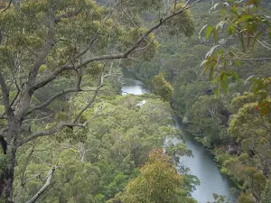
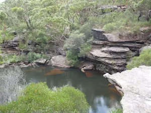
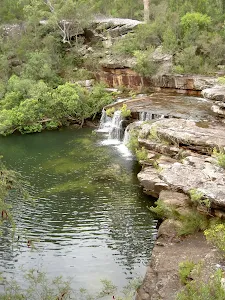
(5km) Int of Engadine and Robertson Track (North-West) → Currawong Flats
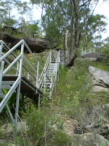
Veer left: From the intersection, this walk follows the bush track heading in the opposite direction to the Heathcote and Engadine arrows, winding down the hill via the rock steps that the track continues down to the banks of the Hacking River at Currawong Flats.
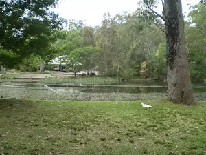
(6km) Currawong Flats → Royal National Park Information Centre
Turn left: From the bridge, this walk heads along the road, keeping the river to the left. Passing the park lands and picnic area, the road the meets Sir Bertram Stevens Drive and a short distance further comes to the Royal National Park Information Centre.
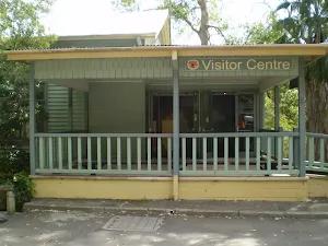
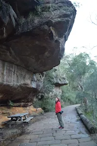
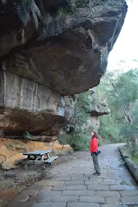
(6km) Visitor Centre → Ironbark Flat Picnic Area
Maps for the Engadine to Audley walk
You can download the PDF for this walk to print a map.
These maps below cover the walk and the wider area around the walk, they are worth carrying for safety reasons.
| Port Hacking | 1:25 000 Map Series | 91294N PORT HACKING | NSW-91294N |
| Port Hacking | 1:100 000 Map Series | 9129 PORT HACKING | 9129 |
Cross sectional view of the Engadine to Audley bushwalking track
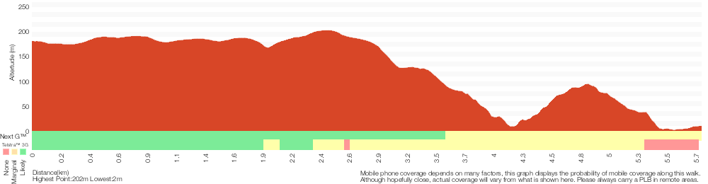
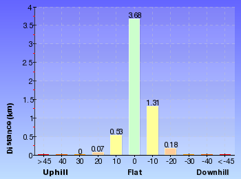
Analysis and summary of the altitude variation on the Engadine to Audley
Overview of this walks grade – based on the AS 2156.1 – 2001
Under this standard, a walk is graded based on the most difficult section of the walk.
| Length | 5.8 km | ||
| Time | 2 hrs 30 mins | ||
| . | |||
Grade 4/6 Hard track | AS 2156.1 | Gradient | Very steep (4/6) |
| Quality of track | Formed track, with some branches and other obstacles (3/6) | ||
| Signs | Directional signs along the way (3/6) | ||
| Experience Required | Some bushwalking experience recommended (3/6) | ||
| Weather | Weather generally has little impact on safety (1/6) | ||
| Infrastructure | Limited facilities, not all cliffs are fenced (3/6) |
Some more details of this walks Grading
Here is a bit more details explaining grading looking at sections of the walk
Gradient
2.7km of this walk is very steep and another 1.6km has gentle hills with occasional steps. Whilst another 950m is flat with no steps and the remaining 510m has short steep hills.
Quality of track
3.2km of this walk follows a formed track, with some branches and other obstacles and another 2.2km follows a clear and well formed track or trail. The remaining (420m) follows a smooth and hardened path.
Signs
Around 4km of this walk has directional signs at most intersection, whilst the remaining 1.8km is clearly signposted.
Experience Required
Around 3.7km of this walk requires no previous bushwalking experience, whilst the remaining 2.1km requires some bushwalking experience.
weather
This whole walk, 6km is not usually affected by severe weather events (that would unexpectedly impact safety and navigation).
Infrastructure
Around 4.5km of this walk has limited facilities (such as not all cliffs fenced), whilst the remaining 1.3km is close to useful facilities (such as fenced cliffs and seats).
Similar walks
A list of walks that share part of the track with the Engadine to Audley walk.
Robertson's Roundabout
2.3 km Circuit, 1 hr 15 mins

Hard track
Heathcote to Audley
10 km One way, 4 hrs 15 mins
Hard track
Heathcote to Engadine via Audley
15 km One way, 6 hrs 30 mins
Hard track
Other Nearby walks
A list of walks that start near the Engadine to Audley walk.
Uloola Track (Heathcote to Waterfall)
11.3 km One way, 4 hrs 30 mins

Hard track
The Karloo Track
5.6 km Return, 3 hrs
Moderate track
Heathcote to Waterfall
10.1 km One way, 5 hrs
Hard track
Heathcote to Waterfall Overnight Walk
10.8 km One way, 2 Days
Hard track
The Goanna Track Circuit
11 km Circuit, 4 hrs
Hard track
Bungoona Path
918 m Return, 20 mins
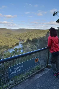
Very easy
Audley to Gibraltar Rock
2.2 km Return, 45 mins
Easy track
Gibraltar Rock
858 m Return, 20 mins
Easy track
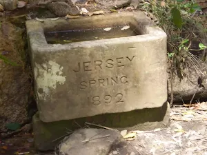
Jersey Spring
5 km Return, 1 hr 45 mins
Easy track
Willow Tree to Calala
10.5 km Return, 4 hrs
Moderate track
Loftus to Winifred Falls
11 km One way, 4 hrs
Hard track
Winifred Falls
4.4 km One way, 2 hrs
Hard track
Plan your trip to and from the walk here
The Engadine to Audley walk starts at the Engadine Railway Station (gps: -34.067891, 151.01472)
The Engadine to Audley ends at the Royal National Park Information Centre (gps: -34.075314, 151.05654)
Weather Forecast
This walk starts in the Metropolitan weather district.
Current Alerts
Park Information
Royal National Park
Comments
Short URL: http://wild.tl/eta