The Redhead Owens Walkway Circuit
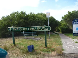


Ken & Audrey Owens Walkway
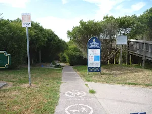
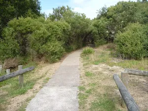
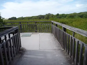
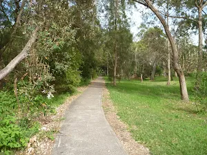
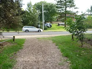
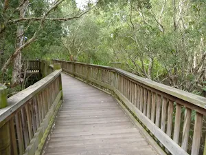
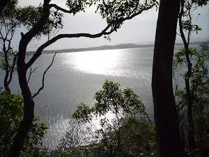
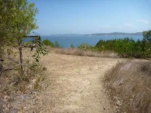
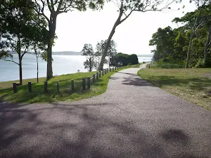
Owens Walkway Car Park & Viewpoint
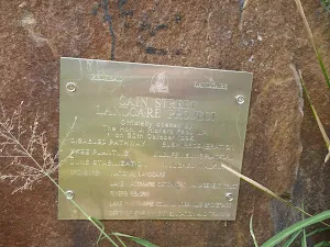
(0km) Owens Walkway Car Park (Off Cain Street) → Owens Walkway Intersection
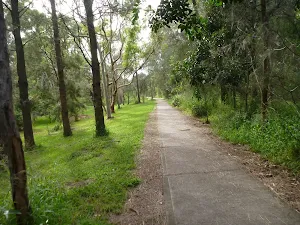
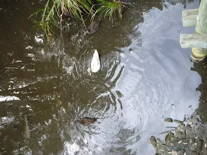
(0km) Owens Walkway Intersection → Owens Wetland Lookout
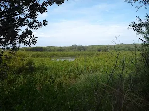
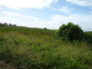
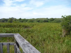
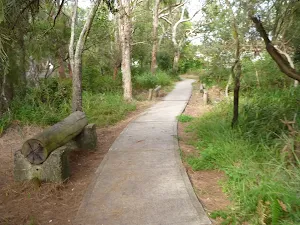
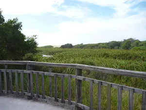
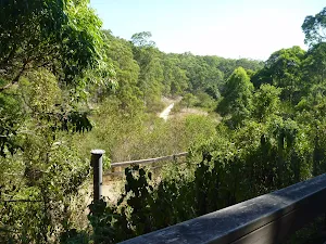
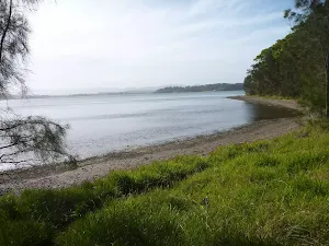
Owens Wetland Viewpoint
(0km) Owens Wetland Lookout → Int of Owens Walkway & Cain St Trail
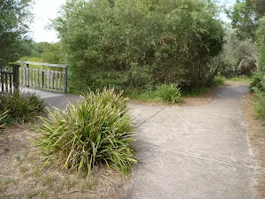
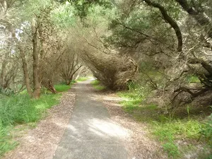
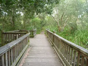
(1km) Int of Owens Walkway & Cain St Trail → Elevated Timber Bridge
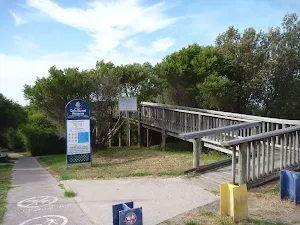
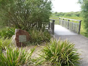
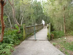
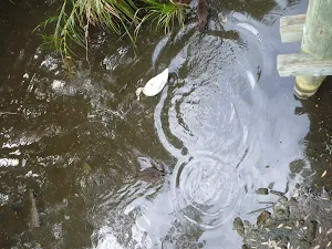
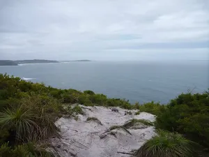
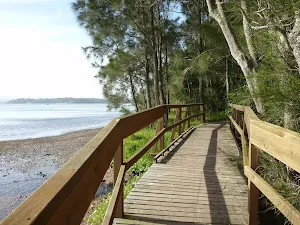
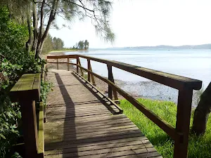
Elevated Timber Bridge Viewpoint
(1km) Elevated timber bridge → Redhead Beach (Owens Walk end)
(1km) Redhead Beach (Owens Walk end) → Redhead Surf Life Saving Club
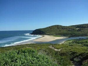
Continue straight: From Redhead Beach (near Webb Park)[59], this walk follows the beach with the ocean on your right. This walk crosses Freshwater Creek (may be covered with sand) after about 60m and continues for about 230m, until coming to the Redhead Beach Surf Life Saving Club[60].
Redhead Surf Life Saving Club
(2km) Redhead Surf Life Saving Club → Redhead Car Park (Fresh Water Creek end)
(3km) Redhead Car Park (Fresh Water Creek end) → Owens Walkway Intersection
(3km) Webb Park Four-Way Intersection → Int of Owens Walkway & Dog exercise footpath
(3km) Int of Owens Walkway & Dog exercise footpath → Owens Walkway Car Park (Off Cain Street)
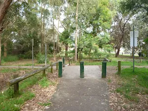
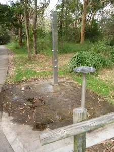
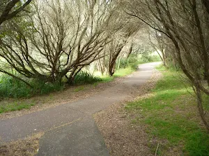
Turn right: From the intersection[103][104], this walk follows the concrete footpath gently uphill[105], leaving the ocean directly behind you. This walk continues through coastal forest (passing a water tap[106] on the right), until coming to the Owens Walkway car park[107][108], with an elevated lookout[109] on your left.
Maps for the The Redhead Owens Walkway Circuit walk
You can download the PDF for this walk to print a map.
These maps below cover the walk and the wider area around the walk, they are worth carrying for safety reasons.
| Swansea | 1:25 000 Map Series | 92314N SWANSEA | NSW-92314N |
| Lake Macquarie | 1:100 000 Map Series | 9231 LAKE MACQUARIE | 9231 |
Cross sectional view of the The Redhead Owens Walkway Circuit bushwalking track
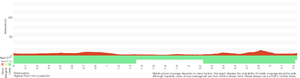
Analysis and summary of the altitude variation on the The Redhead Owens Walkway Circuit
Overview of this walks grade – based on the AS 2156.1 – 2001
Under this standard, a walk is graded based on the most difficult section of the walk.
| Length | 3.2 km | ||
| Time | 1 Hr | ||
| . | |||
Grade 4/6 Hard track | AS 2156.1 | Gradient | Short steep hills (3/6) |
| Quality of track | Rough track, where fallen trees and other obstacles are likely (4/6) | ||
| Signs | Minimal directional signs (4/6) | ||
| Experience Required | Moderate level of bushwalking experience recommended (4/6) | ||
| Weather | Storms may impact on navigation and safety (3/6) | ||
| Infrastructure | Limited facilities (such as cliffs not fenced, significant creeks not bridged) (4/6) |
Some more details of this walks Grading
Here is a bit more details explaining grading looking at sections of the walk
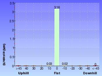
Gradient
Around 2.5km of this walk is flat with no steps, whilst the remaining 750m has short steep hills.
Quality of track
Around 1.9km of this walk follows a rough track, where fallen trees and other obstacles are likely, whilst the remaining 1.3km follows a smooth and hardened path.
Signs
Around 2.1km of this walk has minimal directional signs, whilst the remaining 1.1km is clearly signposted.
Experience Required
1.3km of this walk requires no previous bushwalking experience and another 1.1km requires some bushwalking experience. The remaining (850m) requires a leader a with moderate level of bushwalking experience.
weather
Around 1.8km of this walk is not usually affected by severe weather events (that would unexpectedly impact safety and navigation), whilst the remaining 1.4km is affected by storms that may impact your navigation and safety.
Infrastructure
1.3km of this walk has limited facilities (such as cliffs not fenced, significant creeks not bridged) and another 1.1km is close to useful facilities (such as fenced cliffs and seats). The remaining (750m) has limited facilities (such as not all cliffs fenced).
Similar walks
A list of walks that share part of the track with the The Redhead Owens Walkway Circuit walk.
Northern Redhead Beach Walk
1.2 km Circuit, 30 mins
Hard track
Cain's Timber Bridge Viewpoint Walk
1.3 km Return, 30 mins
Very easy
The Ken and Audrey Owens Walkway
2.4 km Return, 1 Hr
Very easy
Other Nearby walks
A list of walks that start near the The Redhead Owens Walkway Circuit walk.
Awabakal Coastal Walk
1.9 km One way, 45 mins

Hard track
Awabakal Viewpoint Walk
948 m Return, 30 mins
Hard track
Leichhardt's Green Point Walk
2.4 km Return, 1 Hr
Moderate track
Northern Green Point Circuit
3.8 km Circuit, 1 hr 30 mins
Hard track
Rocky-high Circuit Walk
666 m Circuit, 30 mins
Moderate track
Green Point Drive Circuit
3.4 km Circuit, 2 hrs 45 mins
Moderate track
The Green Point Walk
3 km Return, 1 hr 15 mins

Moderate track
Green Point Circuit Walk
7.7 km Circuit, 3 hrs
Hard track
The Foreshore Walk
2.9 km One way, 1 hr 15 mins
Hard track
The Lookout Circuit
2.4 km Circuit, 1 Hr
Moderate track
Charlestown Park track head to Merewether
7.9 km One way, 2 hrs 45 mins

Hard track
Charlestown Park trackhead to Newcastle station
12.1 km One way, 5 hrs 30 mins
Hard track
Plan your trip to and from the walk here
The The Redhead Owens Walkway Circuit walk starts and ends at the Owens Walkway Car Park (Off Cain Street) (gps: -33.015551, 151.71216)
Comments
Short URL: http://wild.tl/2o