The Basin Campsite to Heaton Gap
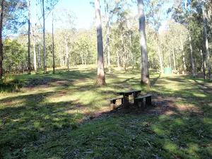
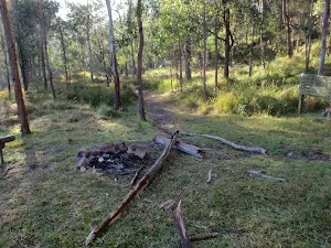

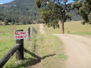
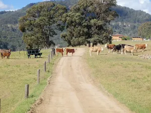
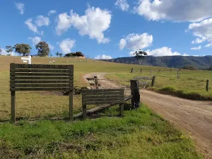
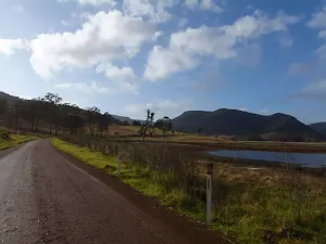
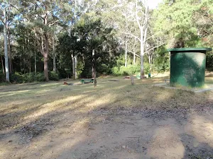


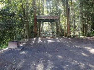
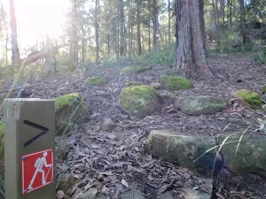
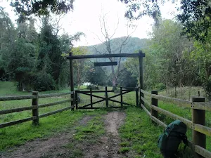
Basin Campsite
(0km) Basin Campsite → Int of GNW tracks AND Lyrebird Trail
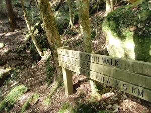
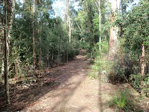
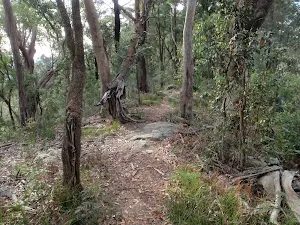
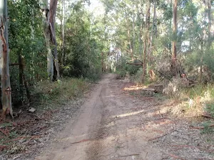
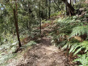
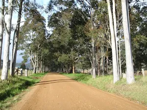
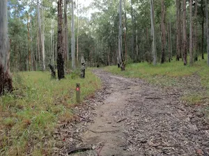
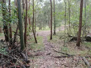
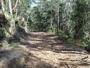
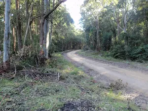
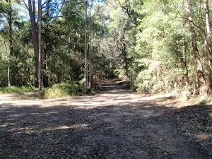
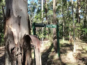
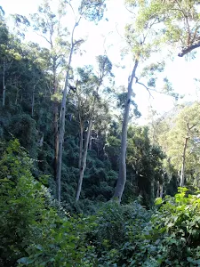
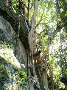
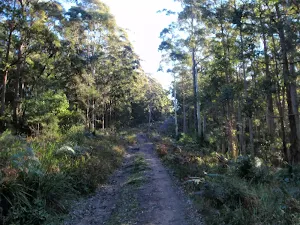
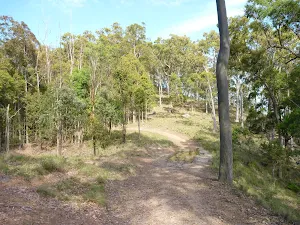
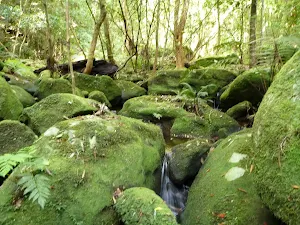
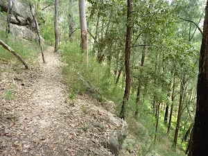
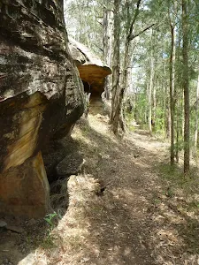
Continue straight: From the intersection at the edge of the saddle[17][18][19], this walk follows the GNW arrow east and gently downhill. The track leads downhill to come close to Wollombi Brook (on your left), where the track gently undulates as it leads into the dense vine and mossy forest for about 1.2km. Then over the next 700m or so, the track leads past a few sandstone caves[20][21] and crosses a few small creeks to come to a signposted three-way intersection[22][23] with 'The Great North Walk' and the 'Lyrebird Trail' track, where a sign points back to 'Basin Camping Area'[24].
(2km) Int of GNW AND Lyrebird trail → Int of Murrays Forest Road and the Fire Tower trail
Turn left: From the intersection[31][32][33], this walk follows the GNW arrow marker moderately steeply up[34] along the eroded management trail. The walk continues through the forest for about 400m, become less steep as it climbs[35], until coming to a T-intersection[36][37] with a trail in a small clearing[38].
Turn right: From the intersection[39][40], this walk follows the dirt road, away from the face of 'The Great North Walk' sign[41]. The walk continues through forest (ignoring side roads[42][43] as it leads over a gently rise for about 400m, then comes to a T-intersection[44][45], with Walkers Ridge Road[46], marked with another 'The Great North Walk' sign[47].
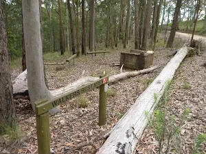
Veer left: From the intersection, this walk heads east along Walkers Ridge Road over a hill, coming down the other side to the intersection with Kingtree Ridge Road.
Continue straight: From the intersection, this walk follows the road along the ridge to the 'Y' intersection with Pig and Sow Ridge Road, marked with a Great North Walk arrow.
Continue straight: From the intersection, this walk heads north along Walkers Ridge Road until coming to the intersection with Murrays Forest Road.
Veer left: From the intersection, this walk heads north-west along Murrays Forest Road, following the Great North Walk arrow down the hill then back up the other side, winding to the top and on to the intersection with the Fire Tower trail. Now Turn right to rejoin the main walk .
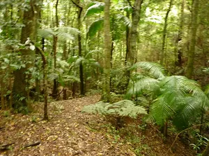
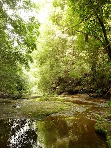
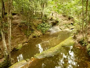
(2km) Int of GNW tracks & Lyrebird Trail → Wollombi Brook Pool
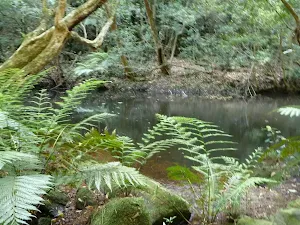
Wollombi Brook Pool
(2km) Wollombi Brook Pool → Int of GNW track & Pig and Sow Ridge Rd
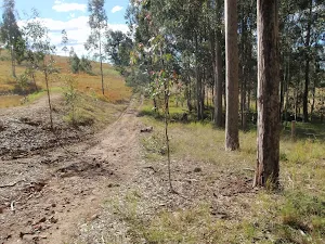
Continue straight: From the end of Wild Boar Road[62][63] (aka Piglet Point Road), this walk follows the dirt road fairly gently uphill[64][65] to the north. The roads leads distinctly uphill for about 500m, and then gently undulates along the ridge through forest[66] for about 2.5km. Here the walk comes to a clear and signposted four-way intersection[67][68] with 'Walkers Ridge Road' route and 'The Great North Walk' track.
(6km) Int of GNW track & Pig and Sow Ridge Rd → End of Kangaroo Point Road
(7km) End of Kangaroo Point Road → Int of Kangaroo Point & Murrays Forest Road
(8km) Int of Kangaroo Point & Murrays Forest Road → Int of Murrays Forest Road & GNW track
(8km) Int of Murrays Forest Road and the Great North Walk → Int of Great North Walk and Bar trail
Continue straight: From the rest area[92], this walk follows the track down along the ridge line. The track winds steeply down into a saddle, where the track flattens out to lead through thicker green forest to the intersection with the narrow Bar Trail[93][94].
(9km) Int of Great North Walk and Bar trail → Int of Bar trail and Warrawolong Road
(10km) Int of Bar trail and Warrawolong Road → Int of Turners and Warrawolong Roads
(11km) Int of Turners and Warrawolong Roads → Mt Warrawolong Fire Tower
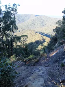
Veer left: From the intersection, this walk heads uphill along the upper trail[104] past the 'Authorised Vehicles Only' sign[105]. After about 200m, the walk heads around a locked gate[106] then continues moderately steeply uphill, winding up the hill[107] for about 1.5km to come to a large flat clearing[108] and the tall fire tower[109] at the top of Mt Warrawolong[110]. At the end of this side trip, retrace your steps back to the main walk then Veer left.
Mt Warrawolong
(11km) Int of Turners and Warrawolong Roads → Signposted Rest Area
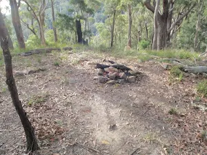
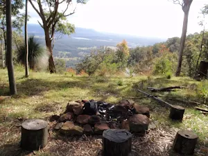
Watagan Creek Campsite
(13km) Signposted Rest Area → Int of GNW track & Watagan Creek Road(southside)
(13km) Int of GNW track & Watagan Creek Road(eastside) → Int of GNW track & Watagan Creek Road (westside)
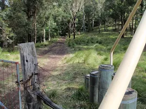
(13km) Int of GNW track & Watagan Creek Road (westside) → Great North Walk Paddock Gate
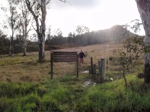
(13km) Great North Walk Paddock Gate → End of Langans Road
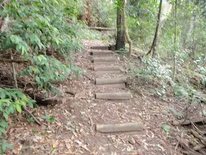
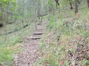
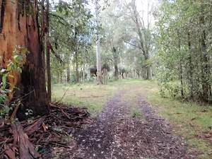
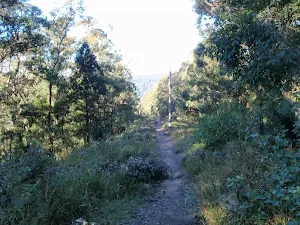
Continue straight: From the paddock gate[141] in the Watagan Valley[142], this walk follows the track moderately steeply uphill[143]. The walk heads through the wooded forest, up a series of timber[144] and rock steps[145] as the track winds up the hill. About 1km after leaving the open farmland, this track leads to an intersection with the turning area at the end of the dirt Langans Road[146].
(15km) End of Langans Rd → Walkers Rest Area
Continue straight: From the intersection[152], this walk follows the GNW arrow post north-west along the dirt[153] road, initially keeping Cabans Road[154] on your right. The walk continues, gently undulating up along the top of the ridge for about 1.4km, until coming to the signposted 'Walkers Rest Area'[155].
Great North Walk Campsite
End of day 1
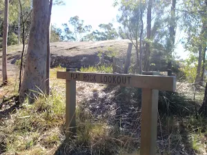
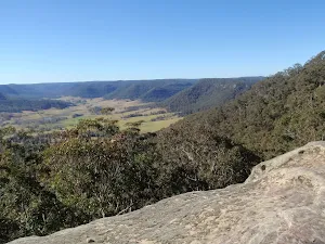
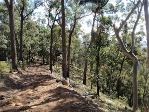
(17km) Walkers Rest Area → Flat Rock Lookout
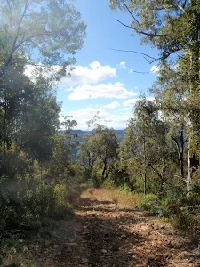
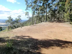
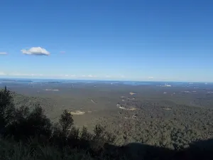
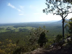
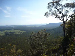
Flat Rock Lookout
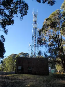
(17km) Flat Rock Lookout → Congewai Communications Tower
(21km) Congewai Communications Tower Management Trail → Paddock Gate
(24km) Paddock Gate → Int of GNW track AND sealed rd
(25km) Int of GNW AND Eglinford La → Lonely Goat Olives
Lonely Goat Olives
(25km) Int of GNW track & sealed road → Congewai Valley west trackhead
(26km) Congewai Valley west trackhead → Congewai Valley east trackhead
(31km) Congewai Valley east trackhead → Property Gate
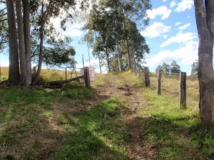
Continue straight: From here[219], this walk climbs over the fence using the stile and follows the track gently uphill[220], keeping the more open farmland[221] on your left. The walk continues for about 300m to an intersection with a wide dirt trail, just before a vehicular gate[222], marked with a GNW arrow post.
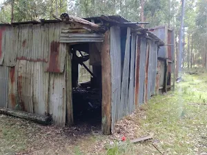
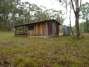
(32km) Property Gate → Crawford Tank AND Hut
Crawford Tank & Hut
(32km) Property Gate → Int on GNW bushtrack
(33km) Int on GNW bushtrack → Int of Georges Rd & GNW bushtrack
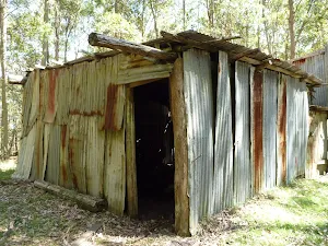
(35km) Int of Georges Rd AND GNW track → Old Loggers Hut
Old Loggers Hut
(35km) Old Loggers Hut → Georges Rd rest area
Georges Road Rest Area
(35km) Georges Rd rest area → Barraba Campsite
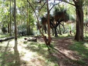
Continue straight: From the intersection[263], this walk follows the 'Barraba Trig Rest Area' sign[264] north-east, gently uphill along the trail[265]. Following a few GNW arrow markers over about 90m, this trail then comes to a large flat clearing[266][267] signposted as 'Barraba campsite'[268], with some lovely large grass trees[269].
Barraba Campsite
End of day 2
(35km) Barraba Campsite → Barbara Lowes gate
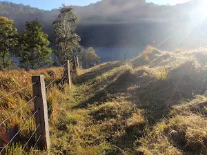
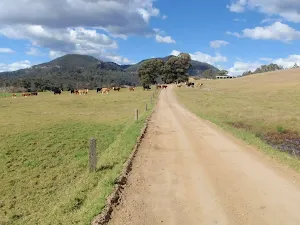
Continue straight: From the locked gate[277], this walk heads downhill along the wide dirt trail, directly away from the 'Barraba Trig' sign[278]. The trail leads down for about 400m, moderately steeply for a while. As the trail mostly flattens out, the walk climbs over another fence beside a locked gate[279] using the stile[280]. The walk continues down along this trail for almost 200m to pass 'The Barbara Lowes Conservation area' sign[281]. Here, the walk climbs over the fence using the stile[282] beside the vehicular gate[283]. There are filtered valley views to your left[284].
(36km) The Barbara Lowes gate → Saddle Rest Area
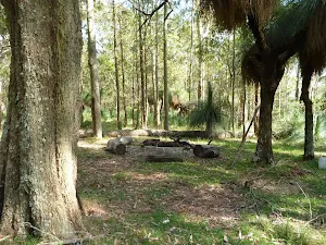
Saddle Rest Area
(37km) Saddle Rest Area → Int of Georges Rd AND Watagans National Park boundary gate
Great North Walk Rest Area
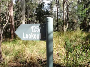
(38km) Int of Georges Rd AND Watagans National Park boundary gate → Top of the 125r Lookout trail
(39km) Top of the 125r Lookout trail → 125r Lookout Rest Area
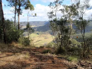
125r Lookout
(39km) Top of the 125r Lookout trail → Northern rest area
Great North Walk Rest Area
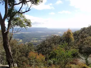
(40km) Northern rest area → Narrow Place Lookout
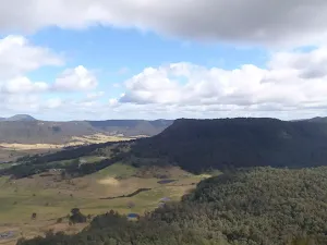
Narrow Place Lookout
(42km) Narrow Place Lookout → Int of Georges AND Heaton Rds
Continue straight: From the intersection[327][328], this walk follows the GNW arrow post east along the dirt Georges Road as it leads gently downhill[329], initially keeping the main valley to your left. The road leads along the ridge among the tall trees, past a few small clearings and side tracks for about 2.2km to pass a gate and timber fence[330] (on your left). The walk continues along this main road for another 600m, coming to a T-intersection[331] with the dirt Heaton Road, marked with a 'Watagans National Park' sign[332].
(47km) Int of Georges & Heaton Rds → Forestry H.Q campsite
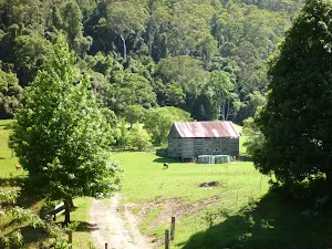
Veer left: From the intersection[337], this walk follows the 'Hunters Lookout' sign[338] gently uphill along Bakers Road[339]. The walk continues along this road for a bit over 150m, coming to a three-way intersection[340], just in front of the signposted 'Watagan Headquarters' campsite[341].
Watagan Headquarters

End of day 3
(48km) Forestry H.Q campsite → Hunter Lookout picnic area
Continue straight: From the intersection[352], this walk follows Bakers Road north and gently uphill, while keeping Rocky Creek Road (no signpost) on your right. The walk continues, undulating gently for about 400m until coming to a three-way intersection with Glen Road[353] (on the right).
Continue straight: From the intersection[354], this walk follows Bakers Road gently uphill[355], while keeping Glen Road on your right. The walk continues, undulating gently for about 250m until coming to Hunter Lookout picnic area[356] (on the left).
Veer left: From the intersection, this walk heads off the road and up the hill following the Hunter Lookout picnic area sign, past the wooden gate and the public toilet, to the picnic area area and the lookout.
Hunter Lookout
(50km) Hunter Lookout picnic area → Macleans Lookout
Veer left: From the Hunter Lookout picnic area[362] (on Bakers Road), this walk follows Bakers Road north and gently downhill[363], while keeping Hunter Lookout on your left. The walk continues for about 400m until coming to a Y-intersection[364] (Bakers Road loop).
Continue straight: From the intersection[365] (Bakers Road Loop), this walk follows the track gently uphill[366], while keeping the other end of Bakers Road Loop to your right, gently downhill. The walk follows the road for about 130m until coming to Macleans Lookout[367].
Mcleans Lookout
(50km) Maclean Lookout → Int of GNW track & a wide track
Continue straight: From the intersection[373], this walk follows the trail gently downhill[374], while keeping the 'Heaton Lookout' sign on your right. The walk continues (becoming moderately steep downhill) for about 280m until coming to a three-way intersection[375] with a track on the left.
(51km) Int of GNW track AND a wide track → Int of GNW track AND Glen Road
(51km) Int of GNW track & Glen Road → Int of GNW track & a wide bushtrack
(51km) Int of GNW track & a wide bushtrack → Int of GNW track & a narrow road
(52km) Int of GNW track & a wide track → Int of GNW track and Fosters Road south
Continue straight: From the intersection[400], this walk follows the wide track gently downhill, while keeping the 'Macleans Lookout 2km' sign[401] on your right. The walk continues for about 140m to a three-way intersection[402], with Fosters Road on your right and 'Fosters Road' sign[403] on your left.
(52km) Int of GNW track and Fosters Road south → Creek Crossing
Continue straight: From the intersection[415], this walk follows the 'Heaton Lookout' sign[416] downhill along the road a few metres, then veers left to follow the GNW arrow down the old trail[417]. The walk leads fairly steeply down for about 180m then passes around a timber barrier[418]. Here the track narrows and continues more steeply downhill[419] through forest for about 250m to a gully and creek crossing[420] (with many fallen dead trees[421]).
(53km) Creek Crossing → Int of GNW track and Barniers Road
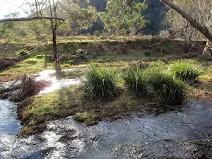
Continue straight: From here, the walk crosses Wallis Creek[426], and follows the GNW arrows south gently uphill along the track. The walk continues (crossing over a tree trunk[427] with carved steps) and after about 500m, comes to a creek and a tree trunk with a directional arrow carving[428]. Then the walk follows the track[429] for about 130m (crossing the creek a number[430] of times) to find the track leaving the creek[431]. The track is followed moderately steeply uphill[432] through forest for about 400m, until coming to a level four-way intersection[433] with a 'Barniers Road/Mt Faulk Road' sign on your right.
(55km) Int of GNW track and Barniers Road → Int of GNW track and Heaton Lookout
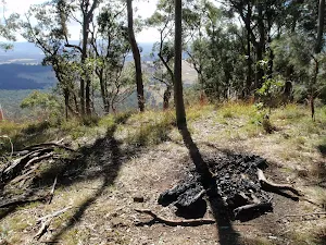
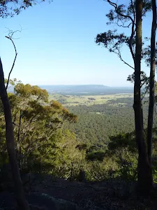
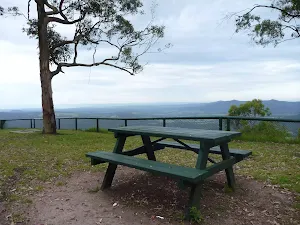
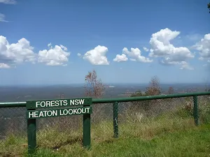
Heaton Lookout
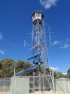
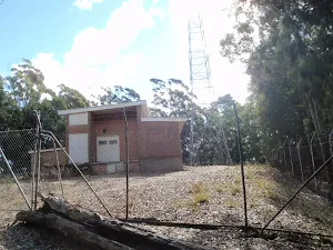
(56km) Heaton Lookout. → Heaton Communications Tower
(59km) Heaton Communications Tower → Heaton Gap Lookout
Heaton Gap Lookout
(59km) Heaton Gap Lookout → Int of GNW and Freemans Drive tracks
(60km) Int of GNW track and Freemans Drive trail → Heaton Gap Track Head
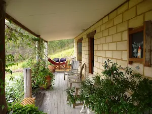
Watagan Forest Motel
Maps for the The Basin Campsite to Heaton Gap walk
You can download the PDF for this walk to print a map.
These maps below cover the walk and the wider area around the walk, they are worth carrying for safety reasons.
| Wollombi | 1:25 000 Map Series | 91323S WOLLOMBI | NSW-91323S |
| Quorrobolong | 1:25 000 Map Series | 91322S QUORROBOLONG | NSW-91322S |
| Murrays Run | 1:25 000 Map Series | 91314N MURRAYS RUN | NSW-91314N |
| Morisset | 1:25 000 Map Series | 91311N MORISSET | NSW-91311N |
| Wollombi | 1:50 000 Map Series | 91323 WOLLOMBI | CW-91323 |
| Cessnock | 1:50 000 Map Series | 91322 CESSNOCK | CW-91322 |
| Cessnock | 1:100 000 Map Series | 9132 CESSNOCK | 9132 |
| Gosford | 1:100 000 Map Series | 9131 GOSFORD | 9131 |
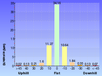
Cross sectional view of the The Basin Campsite to Heaton Gap bushwalking track
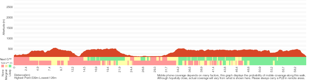
Analysis and summary of the altitude variation on the The Basin Campsite to Heaton Gap
Overview of this walks grade – based on the AS 2156.1 – 2001
Under this standard, a walk is graded based on the most difficult section of the walk.
| Length | 60.5 km | ||
| Time | 4 Days | ||
| . | |||
Grade 4/6 Hard track | AS 2156.1 | Gradient | Very steep (4/6) |
| Quality of track | Rough track, where fallen trees and other obstacles are likely (4/6) | ||
| Signs | Minimal directional signs (4/6) | ||
| Experience Required | Moderate level of bushwalking experience recommended (4/6) | ||
| Weather | Forecast, unforecast storms and severe weather may impact on navigation and safety (4/6) | ||
| Infrastructure | Limited facilities (such as cliffs not fenced, significant creeks not bridged) (4/6) |
Some more details of this walks Grading
Here is a bit more details explaining grading looking at sections of the walk
Gradient
27km of this walk has short steep hills and another 18km is very steep. Whilst another 15km has gentle hills with occasional steps and the remaining 40m is flat with no steps.
Quality of track
27km of this walk follows a clear and well formed track or trail and another 22km follows a formed track, with some branches and other obstacles. Whilst another 6km follows a smooth and hardened path and the remaining 4.7km follows a rough track, where fallen trees and other obstacles are likely.
Signs
51km of this walk has directional signs at most intersection and another 6km is clearly signposted. The remaining (3.7km) has minimal directional signs.
Experience Required
29km of this walk requires some bushwalking experience and another 28km requires no previous bushwalking experience. The remaining (2.8km) requires a leader a with moderate level of bushwalking experience.
weather
59km of this walk is not usually affected by severe weather events (that would unexpectedly impact safety and navigation) and another 1.7km is affected by storms that may impact your navigation and safety. The remaining (230m) is affected by forecast, unforecast storms and severe weather events that may impact on navigation and safety.
Infrastructure
38km of this walk has limited facilities (such as not all cliffs fenced) and another 17km is close to useful facilities (such as fenced cliffs and seats). The remaining (5km) has limited facilities (such as cliffs not fenced, significant creeks not bridged).
Similar walks
A list of walks that share part of the track with the The Basin Campsite to Heaton Gap walk.
Hunter Lookout to Glen road loop
2.5 km Circuit, 1 Hr
Hard track
Watagan Creek Road to Flat Rock
4.1 km One way, 2 hrs
Hard track
Heaton Lookout to Heaton Gap
4.3 km One way, 2 hrs
Hard track
Georges Road Rest Area to 125r Lookout
4.4 km Return, 3 hrs 30 mins
Moderate track
Hunter Lookout and Great North Walk loop
5.6 km Circuit, 2 hrs 30 mins
Hard track
Watagan Headquarters to Heaton Lookout
8.1 km One way, 4 hrs

Hard track
Cedar Brush to Basin Campsite
9.7 km One way, 4 hrs 30 mins
Hard track
Cedar Brush track head to the Basin Campsite
9.7 km One way, 4 hrs
Hard track
Watagan Forestry HQ campsite to Heaton Gap
12.5 km One way, 6 hrs

Hard track
Watagan Creek Road to Congewai Valley Track Head (West)
12.6 km One way, 5 hrs 30 mins
Hard track
Basin Campsite to Watagan Creek Road
13 km One way, 6 hrs
Hard track
Basin campsite to Watagan Valley
13 km One way, 6 hrs
Hard track
Flat Rock to Congewai Valley East Track Head
13.8 km One way, 5 hrs
Hard track
Congewai Track Head (East) to Watagan Headquarters
17.2 km One way, 7 hrs
Hard track
Watagan Creek Road to Congewai Valley East Track Head
17.8 km One way, 7 hrs
Hard track
Congewai East Track Head to Watagan Forest Motel via Forestry HQ Campsite
29.7 km One way, 2 Days
Hard track
Yarramalong to Watagan Creek via Basin Campsite
33.7 km One way, 2 Days
Hard track
Somersby to the Basin Campsite
47.4 km One way, 3 Days
Hard track
Other Nearby walks
A list of walks that start near the The Basin Campsite to Heaton Gap walk.
Muirs Rainforest Circuit Walk
1.9 km Circuit, 2 hrs 30 mins
Hard track
Muirs Rainforest Walk
1.5 km Return, 1 Hr

Moderate track
Abbotts Falls Walking Track
7.3 km Circuit, 3 hrs
Hard track
Pines Circuit Walk
1.7 km Circuit, 45 mins
Moderate track
Greta road to Cedar Brush track head
17 km One way, 6 hrs 30 mins
Hard track
Yarramalong to Cedar Brush
11 km One way, 3 hrs 30 mins
Easy track
Bumble Hill Dray track (Greta Rd to Forest Road to Yarramalong)
5.6 km One way, 2 hrs 45 mins
Hard track
Forest Road to Yarramalong
8.1 km One way, 3 hrs 30 mins
Hard track
Monkey Face Cliff Walk
406 m Return, 30 mins

Hard track
Monkey Face Circuit
1.3 km Circuit, 45 mins

Moderate track
Gap Creek Falls Walk
1.5 km Return, 1 Hr
Moderate track
Gap Creek Rainforest Walk
1.7 km Return, 1 Hr

Hard track
Plan your trip to and from the walk here
The The Basin Campsite to Heaton Gap walk starts at the Basin Campsite (gps: -33.104008, 151.23088)
The The Basin Campsite to Heaton Gap ends at the Heaton Gap Track Head (gps: -32.965275, 151.47939)
Weather Forecast
This walk starts in the Hunter weather district.
Current Alerts
Park Information
Olney State Forest
Only State Forest is a section of mostly native bushland just South of Watagan State forest and National parks
Watagan State Forest
Watagan State Forest is a large section of mostly native bushland west of Lake Macquarie.
Watagans National Park
Heaton State Forest
Boardering Watagan national Park, Heaton State forest is home to many great lookouts. There sre many highpoints with cliff edges giving great views across the Hunter valley and Lake Macquarie.
Corrabare State Forest
Corrabare State Forest is a large section of mostly native bushland west of Lake Macquarie.
Awaba State Forest
A large parcel of land west of the northern end of lake Macquarie, Awaba state forest lines the side of part of the Sydney - newcastle freeway. The park is home to mostly native forest
Comments
Short URL: http://wild.tl/tbcthg