Blaxland Station Florabella Pass Loop

(0km) Blaxland Station → Blaxland Library Carpark
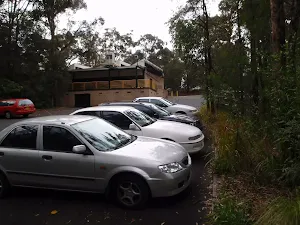
Turn right: From the intersection, this walk heads down along the pedestrian lane way, under the foot bridge[1] and away from the highway. Here the walk crosses the car park entrance[2] and follows the footpath downhill to turn left onto 'Hope St'[3]. This walk then crosses another car park entrance[4], then turns right to cross Hope St[5] at the traffic calming device[6]. Here the walk turns left and continues down along the footpath beside Hope St for about 150m to turn right at the 'Blaxland Civic Centre'[7] sign. Now the walk follows this footpath downhill then along the back deck of the library[8] to the car park on the far side of the building.
(1km) Blaxland Library Carpark → Int of Pipas Pass and Bates Ave tracks
(1km) Int of Pipas Pass and Bates Ave tracks → Int. Ross Cres Trk East and Pippas Pass
(2km) Int. Ross Cres Trk East and Pippas Pass → Int. Beneath rock Trk and Ross Cres Trk
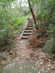
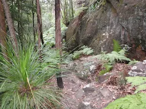
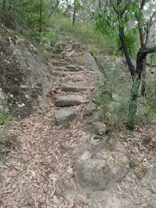
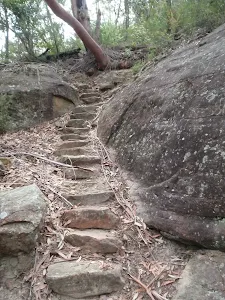
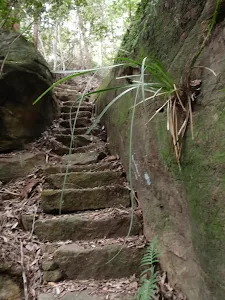
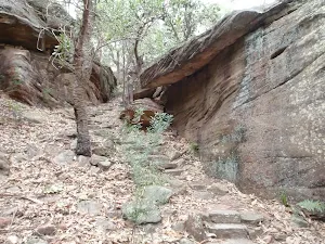
Veer right: From the intersection[30], this walk heads up the stone steps[31]. The track winds fairly steeply uphill at first, then leads a little more gently for just over 100m to come to an intersection at the base of a few rock walls. Here this walk ignores the stone step track (on the left) and veers right following the other stone steps up between the two rock walls[32]. This track winds up the stone steps then bends left to flatten out at the top of the hill at an intersection with a wider track. Here there is a large unfenced rock platform (on your left). At the end of this side trip, retrace your steps back to the main walk then Continue straight.
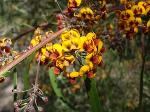
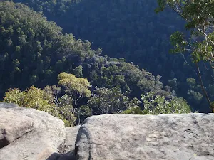
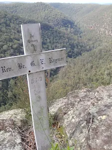
Ross Cres rock outcrop
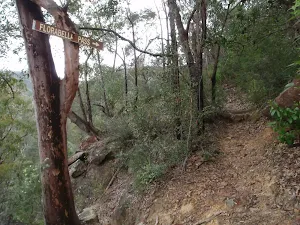
(2km) Int. Ross Cres Trk East and Pippas Pass → Int. Florabella Pass and Pippas Pass Trks
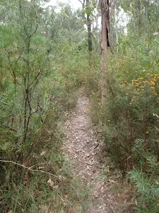
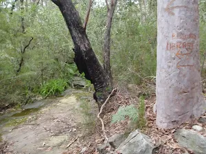
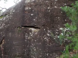
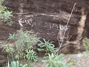
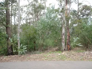
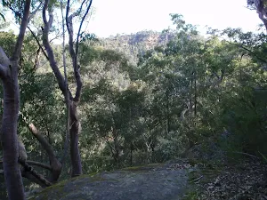
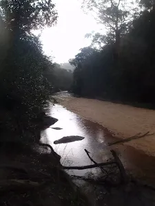
Continue straight: From the intersection[33], this walk follows 'Florabella Pass' arrow engraved in rock face[34] along the mostly flat track around the side of the hill, keeping the valley to your left. The track soon comes to another intersection with a set of stone steps (on the right)[35].
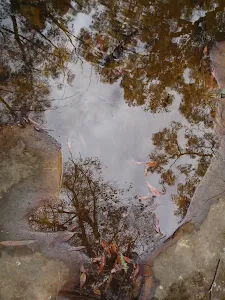
(2km) Int. Florabella Pass and Pippas Pass Trks → Boulder pool
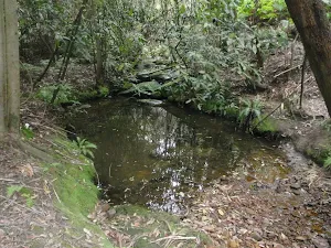
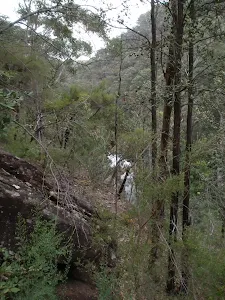
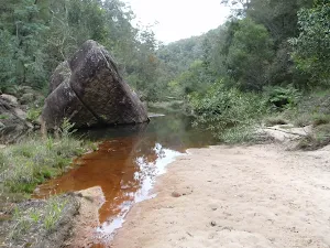
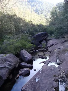
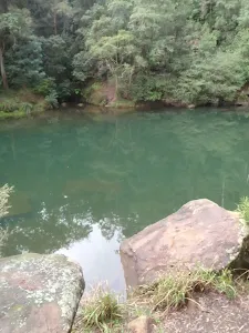
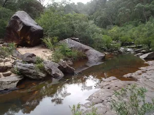
Turn left: From the intersection, the track keeps the creek on the right, as it heads down stream. The track winds to a creek junction where the track crosses a log to the right. From here the track meanders along the creek bed to a pool with a large boulder in it. At the end of this side trip, retrace your steps back to the main walk then Turn left.
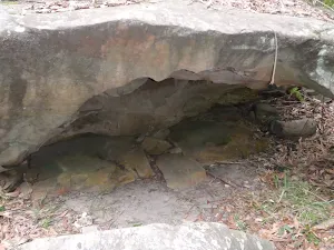
Boulder Pool
(2km) Int. Florabella Pass and Pippas Pass Trks → Int. Florabella Pass Trk and Plateau Pde Trk
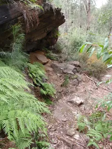
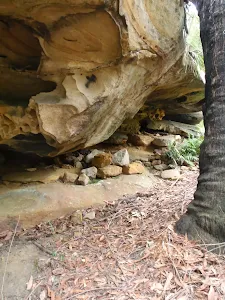
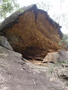
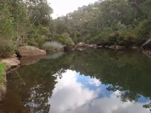
Florabella Pass overhang
(2km) Int. Florabella Pass Trk and Plateau Pde Trk → No. 14 Plateau Pde
(3km) No. 14 Plateau Pde → Blaxland Station
Continue straight: From the intersection the walkk heads up Bridge Rd passing No's 14, 12, 8. Then continues up Bridge Rd to soon pass Bourke St on the right before coming to the intersection with the Great Western Highway.
Turn sharp right: From Bridge St the walk heads down the Great Western Highway, keeping the houses on the right of the footpath. The walk continues down the hill passing Taringha St then View St as it then heads past the shops. The walk continues to the stairs, and ramp, leading up to the pedestrian bridge.
Turn sharp right: From the footpath, the walk uses the stairs or ramp to climb onto the pedestrian bridge. The walk then crosses the bridge over the Great Western Highway and then heads down onto Blaxland Station.
Maps for the Blaxland Station Florabella Pass Loop walk
You can download the PDF for this walk to print a map.
These maps below cover the walk and the wider area around the walk, they are worth carrying for safety reasons.
| Springwood | 1:25 000 Map Series | 90304S SPRINGWOOD | NSW-90304S |
| Penrith | 1:100 000 Map Series | 9030 PENRITH | 9030 |
Cross sectional view of the Blaxland Station Florabella Pass Loop bushwalking track
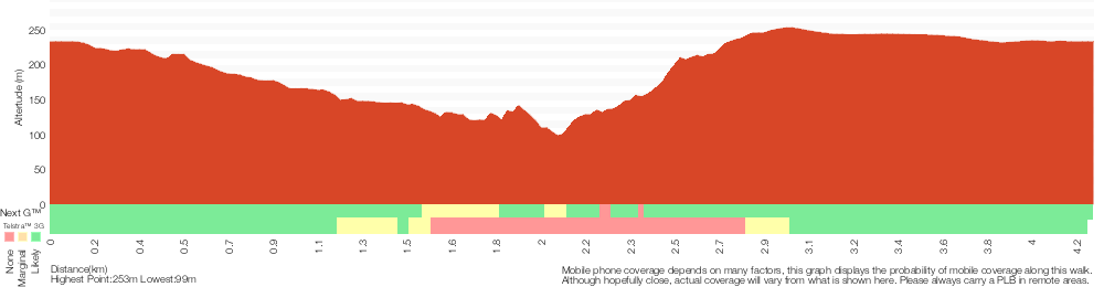
Analysis and summary of the altitude variation on the Blaxland Station Florabella Pass Loop
Overview of this walks grade – based on the AS 2156.1 – 2001
Under this standard, a walk is graded based on the most difficult section of the walk.
| Length | 4.3 km | ||
| Time | 2 hrs 30 mins | ||
| . | |||
Grade 4/6 Hard track | AS 2156.1 | Gradient | Very steep (4/6) |
| Quality of track | Rough track, where fallen trees and other obstacles are likely (4/6) | ||
| Signs | Minimal directional signs (4/6) | ||
| Experience Required | Some bushwalking experience recommended (3/6) | ||
| Weather | Storms may impact on navigation and safety (3/6) | ||
| Infrastructure | Limited facilities (such as cliffs not fenced, significant creeks not bridged) (4/6) |
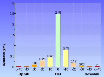
Some more details of this walks Grading
Here is a bit more details explaining grading looking at sections of the walk
Gradient
1.9km of this walk is flat with no steps and another 1.2km is very steep. Whilst another 1.1km has short steep hills and the remaining 70m has gentle hills with occasional steps.
Quality of track
2km of this walk follows a formed track, with some branches and other obstacles and another 1.9km follows a smooth and hardened path. Whilst another 350m follows a rough track, where fallen trees and other obstacles are likely and the remaining 55m follows a clear and well formed track or trail.
Signs
2km of this walk has directional signs at most intersection and another 1.9km is clearly signposted. The remaining (350m) has minimal directional signs.
Experience Required
Around 3.1km of this walk requires no previous bushwalking experience, whilst the remaining 1.2km requires some bushwalking experience.
weather
Around 3.1km of this walk is not usually affected by severe weather events (that would unexpectedly impact safety and navigation), whilst the remaining 1.1km is affected by storms that may impact your navigation and safety.
Infrastructure
2.6km of this walk is close to useful facilities (such as fenced cliffs and seats) and another 1.2km has limited facilities (such as not all cliffs fenced). The remaining (450m) has limited facilities (such as cliffs not fenced, significant creeks not bridged).
Similar walks
A list of walks that share part of the track with the Blaxland Station Florabella Pass Loop walk.
Plateau Pde Florabella Pass Loop
2.6 km Circuit, 1 hr 30 mins
Hard track
Plateau Pde to Blaxland Station via Florabella Pass
2.9 km One way, 2 hrs
Hard track
Blaxland Station to Boulder Pool
4 km Return, 2 hrs
Hard track
Blaxland to Warrimoo Station Florabella Pass
6 km One way, 3 hrs
Hard track
Springwood to Blaxland Station
13.5 km One way, 6 hrs
Experienced only
Faulconbridge to Blaxland
15.2 km One way, 2 Days

Experienced only
Woodford to Blaxland Station
18.3 km One way, 7 hrs 15 mins
Experienced only
Other Nearby walks
A list of walks that start near the Blaxland Station Florabella Pass Loop walk.
Martin's Lookout to Woodford Station
15.9 km One way, 7 hrs
Experienced only
Martin's Lookout
180 m Return, 15 mins
Moderate track
Martin's Lookout to Bunyan Lookout
3.1 km Return, 3 hrs 30 mins
Experienced only
Martin's Lookout to Glenbrook Creek
1.2 km Return, 1 hr 30 mins
Hard track
Martin's to Lost Worlds Lookout
5.4 km Return, 3 hrs 30 mins
Experienced only
Glenbrook and Euroka Circuit
16.6 km Circuit, 2 Days
Experienced only
Glenbrook to Lapstone via Euroka
18.8 km One way, 2 Days
Very experienced only
Blue Pool Track
522 m Return, 20 mins
Hard track
Blue Pool to Glenbrook Sandbar
2.5 km Return, 1 hr 15 mins
Hard track
Lapstone Bridge ZigZag walk
2 km Circuit, 1 Hr
Hard track
Lapstone train tunnel walk
1.4 km Return, 1 Hr
Moderate track
Glenbrook Gorge Track
1.7 km Return, 1 hr 30 mins
Hard track
Plan your trip to and from the walk here
The Blaxland Station Florabella Pass Loop walk starts and ends at the Blaxland Station (gps: -33.743785, 150.60987)
Weather Forecast
This walk starts in the Central Tablelands weather district.
Current Alerts
Park Information
Blue Mountains National Park
Attracting over 3 million visitors annually, Blue Mountains National Park holds some of Australia's most spectacular and diverse wilderness areas. Explore the Grose Valley, with its sheer sandstone cliffs, waterfalls and scenic walking, or enjoy the famous views of the Three Sisters. Easy access makes a day trips very worthwhile, but with such diversity it would be great to stay in one of the many B&B's and spend a few days soaking up the region.
Comments
Short URL: http://wild.tl/bsfpl