National Pass, Overcliff and Den Fenella Circuit
Closed:
Wentworth Falls Picnic Area
(0km) Sir H. Burrell Drive Car Park (Nth) → Jamison Lookout
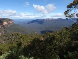
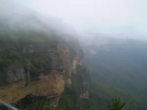
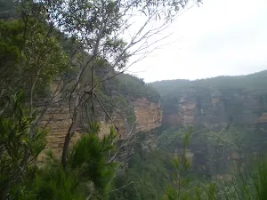
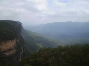
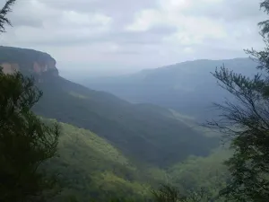
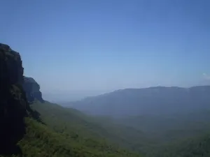
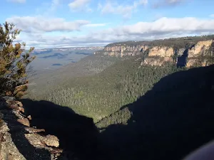
Jamison Lookout
(0km) Jamison Lookout → Int of Sir H. Burrell Drive and Princes Rock Track
(0km) Int of Sir H. Burrell Drive and Princes Rock Track → Wentworth Falls Lookout
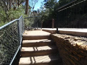
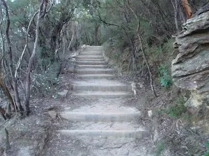
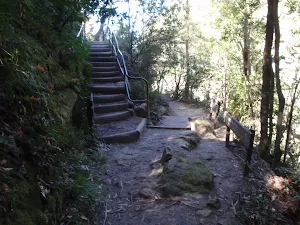
Turn left : From the intersection, this walk follows the 'Wentworth Falls Lookout' arrow up the steps as the track bends right. The track soon passes an old water trough on the left (not suitable for drinking). Soon after this, the track comes to Wentworth Falls Lookout (next to Sir H. Burrell Drive).
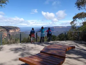
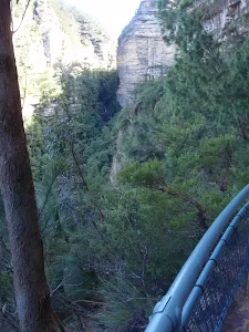
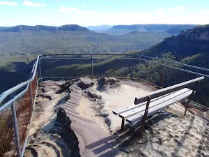
Wentworth Falls Lookout
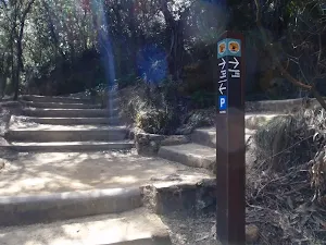
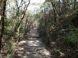
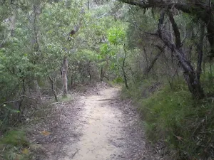
(0km) Wentworth Falls Lookout → Int of Wentworth Falls and Weeping Rock Tracks (Nth)
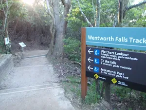
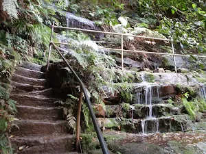
Turn left: From the intersection, this walk heads downhill following the 'Wentworth Falls - National Pass' sign. The walk gradually descends the well-maintained log stairs, passing some views of the valley on the right. Soon the track comes to an intersection with another sign, pointing back up to 'Wentworth Falls Picnic Area'.
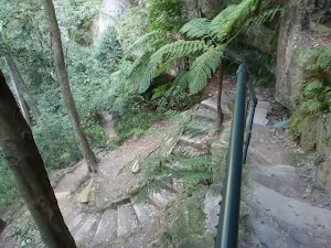
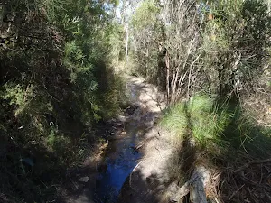
(1km) Int of Wentworth Falls and Weeping Rock Tracks (Nth) → Weeping Rock waterfall
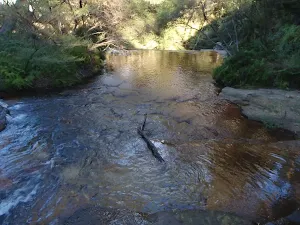
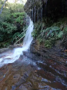
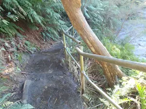
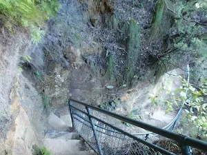
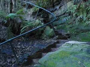
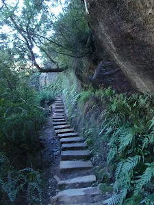
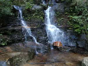
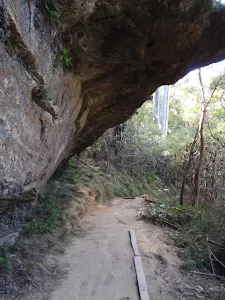
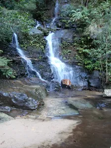
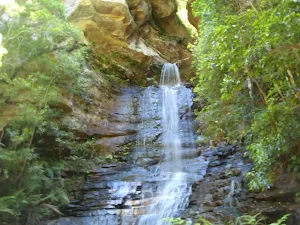
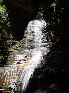
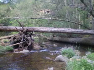
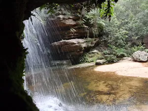
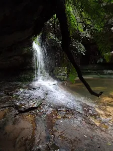
Turn right: From the intersection, this walk heads down the steps following the 'Weeping Rock Circuit' sign to the creek a short distance away. Soon the track comes beside Jamison Creek, a lovely flat section of the creek on top of the waterfall. The track continues downstream and across a slippery rockshelf and down a staircase beside the falls. At the bottom of the stairs is another slippery rock platform and a pool at the bottom of Weeping Rock waterfall.
Weeping Rock
(1km) Weeping Rock waterfall → Int of Weeping Rock and Wentworth Falls Tracks
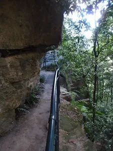
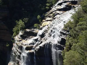
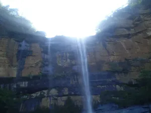
(1km) Int of Weeping Rock and Wentworth Falls Tracks → Top of Wentworth Falls
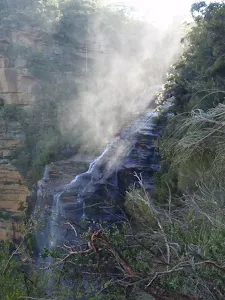
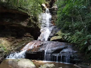
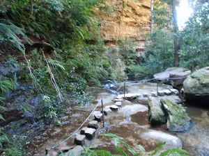
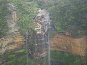
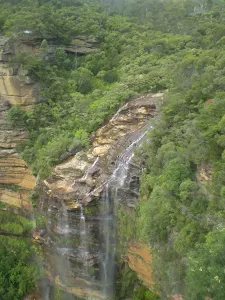
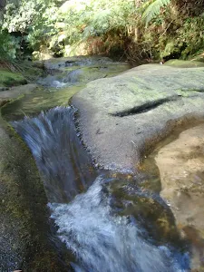
Queen's Cascades
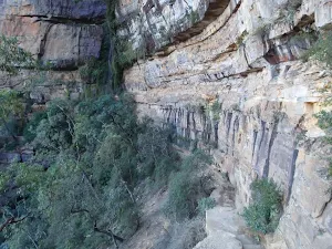
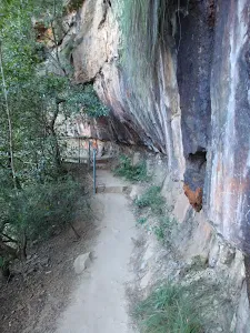
(1km) Top of Wentworth Falls → Rocket Point Creek Intersection
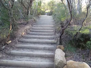
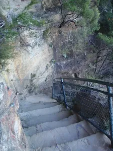
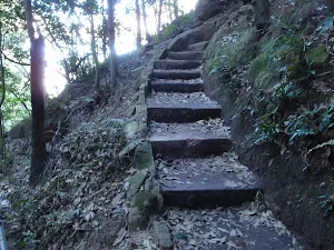
Grand Stairway
(1km) Rocket Point Creek Intersection → Middle Wentworth Falls
(1km) Middle Wentworth Falls → Top of the Slack Stairs
(2km) Top of the Slack Stairs → Int of Valley of the Waters and National Pass Tracks
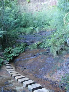
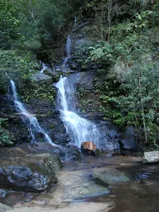
(3km) Int of Valley of the Waters and National Pass Tracks → Lodore Falls
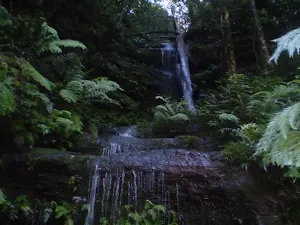
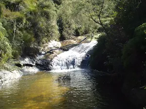
Lodore Falls
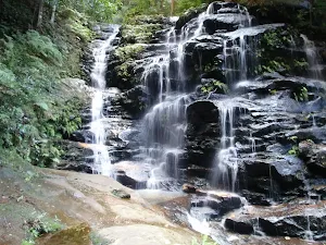
Sylvia Falls
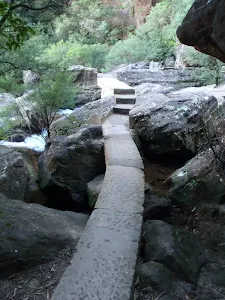
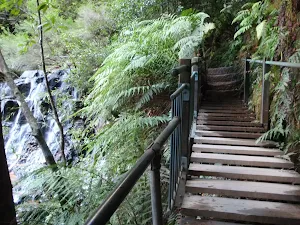
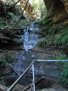
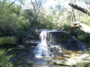
(3km) Lodore Falls → Empress Falls Crossing
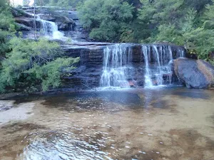
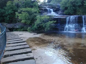
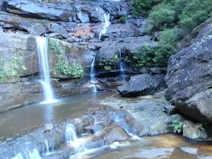
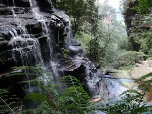
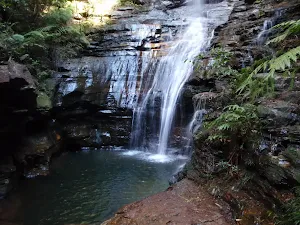
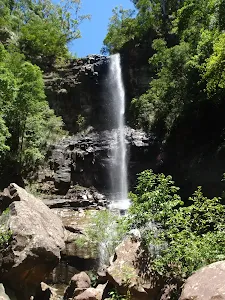
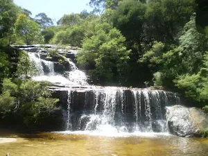
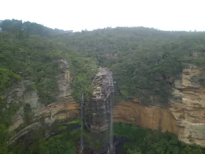
Empress Falls
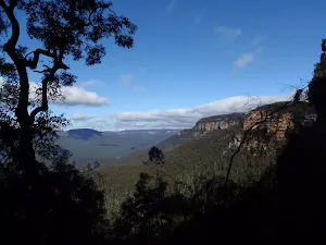
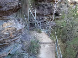
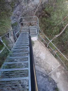
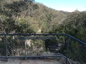
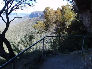
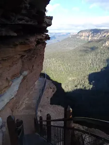
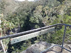
(3km) Empress Falls Crossing → Empress Lookout
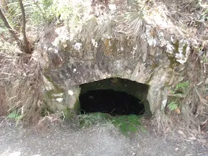
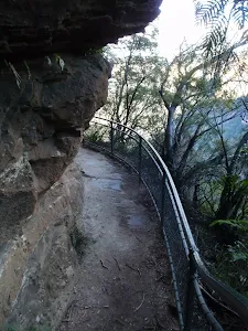
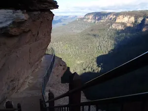
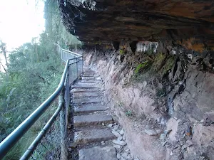
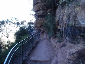
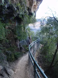
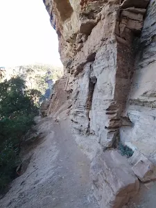
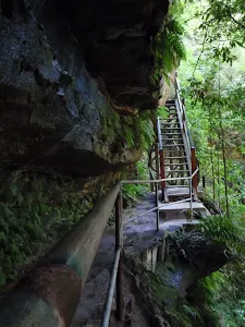
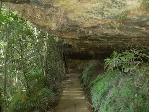
Turn right: From the intersection, this walk heads up the wooden steps, following the 'National Pass - Tea Rooms' sign. The walk soon heads though a long rock overhang to the base of a metal staircase. The walk climbs the series of steep metal staircases zigzagging up the hill. After climbing some wooden steps, the walk comes to the fenced and signposted 'Empress Lookout'.
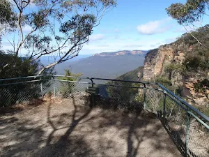
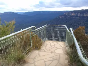
Empress Lookout
(3km) Empress Lookout → Int of Valley of the Waters and Queen Victoria Tracks
(3km) Int of Valley of the Waters and Queen Victoria Tracks → Queen Victoria Lookout
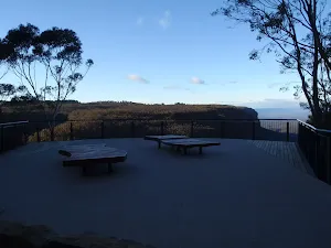
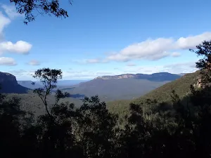
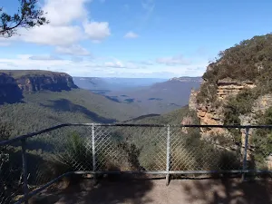
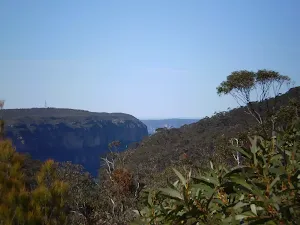
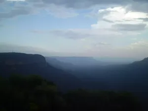
Queen Victoria Lookout
(3km) Int of Valley of the Waters and Queen Victoria Tracks → Int of Lyrebird Cliff Track and Valley of the Waters Track
(3km) Int of Lyrebird Cliff Track and Valley of the Waters Track → Int of Valley of the Waters and Overcliff Tracks
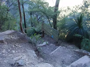
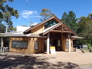
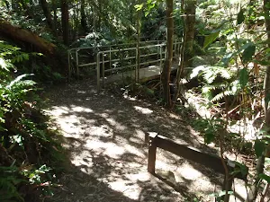
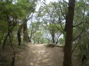
(3km) Int of Valley of the Waters and Overcliff Tracks → Conservation Hut
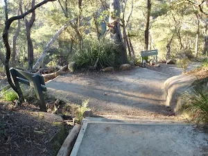
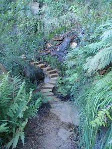
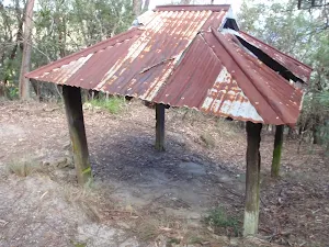
Continue straight: From the intersection, this walk heads up the steps towards the building. The walk passes a couple of picnic shelters (on the right) before coming to the road and the front of the 'Conservation Hut'. At the end of this side trip, retrace your steps back to the main walk then Turn left.
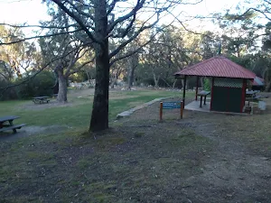
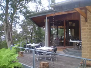
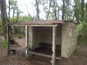
Conservation Hut
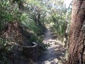
(3km) Int of Valley of the Waters and Overcliff Tracks → Lyrebird Lookout
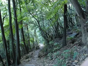
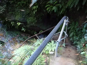
Continue straight: From the intersection, this walk heads east gently downhill, keeping the valley view to the right. After crossing a section of track that is often muddy, the walk comes to a handrail that leads to the signposted 'Lyrebird Lookout'.
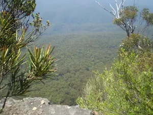
Lyrebird Lookout
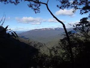
(4km) Lyrebird Lookout → Breakfast Point Lookout
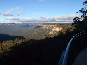
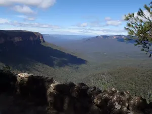
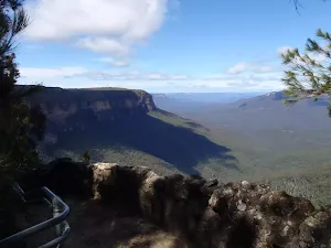
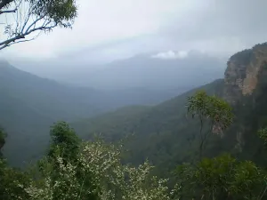
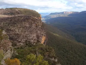
Breakfast Point Lookout
(4km) Breakfast Point Lookout → Int of Overcliff and Denfenella Lookout Track
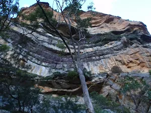
(5km) Int of Overcliff and Den Fenella Lookout Track → Den Fenella Lookout
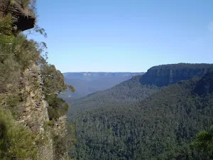
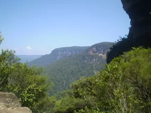
Den Fenella Lookout
(5km) Int of Overcliff and Denfenella Lookout Track → Int of Den Fenella and Undercliff Tracks
(5km) Int of Den Fenella and Undercliff Tracks → Jamison Lookout
(5km) Jamison Lookout → Sir H. Burrell Drive Car Park (Nth)
Maps for the National Pass, Overcliff and Den Fenella Circuit walk
You can download the PDF for this walk to print a map.
These maps below cover the walk and the wider area around the walk, they are worth carrying for safety reasons.
| Katoomba | 1:25 000 Map Series | 89301S KATOOMBA | NSW-89301S |
| Katoomba | 1:100 000 Map Series | 8930 KATOOMBA | 8930 |
Cross sectional view of the National Pass, Overcliff and Den Fenella Circuit bushwalking track
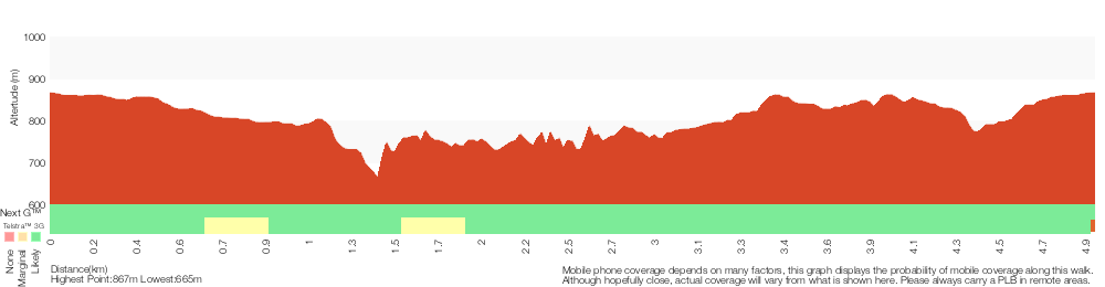
Analysis and summary of the altitude variation on the National Pass, Overcliff and Den Fenella Circuit
Overview of this walks grade – based on the AS 2156.1 – 2001
Under this standard, a walk is graded based on the most difficult section of the walk.
| Length | 5 km | ||
| Time | 4 hrs | ||
| . | |||
Grade 4/6 Hard track | AS 2156.1 | Gradient | Very steep (4/6) |
| Quality of track | Formed track, with some branches and other obstacles (3/6) | ||
| Signs | Directional signs along the way (3/6) | ||
| Experience Required | Some bushwalking experience recommended (3/6) | ||
| Weather | Storms may impact on navigation and safety (3/6) | ||
| Infrastructure | Limited facilities, not all cliffs are fenced (3/6) |
Some more details of this walks Grading
Here is a bit more details explaining grading looking at sections of the walk
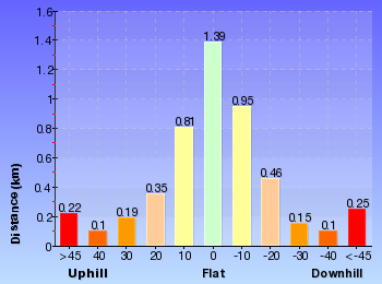
Gradient
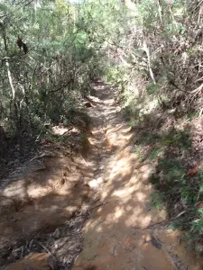
2.4km of this walk has short steep hills and another 1.7km has gentle hills with occasional steps. Whilst another 490m is very steep and the remaining 350m is flat with no steps.
Quality of track
2.5km of this walk follows a formed track, with some branches and other obstacles and another 2.2km follows a clear and well formed track or trail. The remaining (340m) follows a smooth and hardened path.
Signs
Around 2.5km of this walk is clearly signposted, whilst the remaining 2.5km has directional signs at most intersection.
Experience Required
Around 3.6km of this walk requires some bushwalking experience, whilst the remaining 1.4km requires no previous bushwalking experience.
weather
Around 3km of this walk is affected by storms that may impact your navigation and safety, whilst the remaining 2km is not usually affected by severe weather events (that would unexpectedly impact safety and navigation).
Infrastructure
Around 3.4km of this walk is close to useful facilities (such as fenced cliffs and seats), whilst the remaining 1.6km has limited facilities (such as not all cliffs fenced).
Similar walks
A list of walks that share part of the track with the National Pass, Overcliff and Den Fenella Circuit walk.
Queen Victoria Lookout
696 m Return, 30 mins
Moderate track
The Princes Rock Track
746 m Return, 45 mins
Moderate track
Conservation Hut to Empress Lookout
762 m Return, 30 mins

Moderate track
Den Fenella Track
926 m Return, 45 mins
Hard track
Lyrebird Lookout Loop
950 m Circuit, 30 mins
Moderate track
The Shortcut Track
1.1 km One way, 30 mins
Moderate track
Conservation Hut to Empress Falls
1.1 km Return, 1 Hr
Hard track
Den Fenella to Princes Rock Circuit
1.3 km Circuit, 45 mins
Moderate track
Rocket Point Lookout Track
1.3 km Return, 1 Hr
Moderate track
The Weeping Rock and Fletchers Lookout Tracks
1.4 km Circuit, 45 mins
Moderate track
The Falls Picnic Area to Upper Wentworth Falls
1.5 km Return, 45 mins
Moderate track
The Valley of the Waters Track
1.5 km Return, 1 hr 30 mins
Hard track
Wentworth Falls Lookouts Loop
1.7 km Circuit, 1 Hr
Hard track
Conservation Hut to Breakfast Point Lookout
1.9 km Circuit, 1 Hr
Moderate track
Wentworth Falls Undercliff Loop
2 km Circuit, 1 hr 30 mins
Moderate track
Wentworth Falls to Denfenella Lookout
2.2 km Circuit, 1 hr 30 mins
Hard track
Nature Track
3.1 km Circuit, 2 hrs
Hard track
National Pass from Wentworth Falls to Conservation Hut
3.6 km One way, 3 hrs
Hard track
Vera Falls Track
3.8 km Return, 4 hrs
Experienced only
Overcliff-Undercliff Track
4 km Circuit, 2 hrs
Moderate track
National Pass
4.6 km Circuit, 3 hrs 30 mins
Hard track
Conservation Hut, National Pass, Wentworth Pass Circuit
4.8 km Circuit, 4 hrs
Hard track
Wentworth Pass
5.1 km Circuit, 4 hrs
Hard track
The Charles Darwin Walk
5.6 km Return, 2 hrs
Moderate track
Wentworth Falls Conservation Hut Loop
6.7 km Circuit, 3 hrs
Hard track
Charles Darwin, National Pass and Nature Track walk
8.6 km Circuit, 5 hrs
Hard track
Wentworth Falls Station Loop (Undercliff Walk)
8.9 km Circuit, 4 hrs 30 mins
Hard track
Under and Over Cliff Walk
9.4 km Circuit, 4 hrs
Moderate track
Wentworth Falls Station Loop
9.5 km Circuit, 5 hrs 30 mins
Hard track
Wentworth Falls Loop
10.2 km Circuit, 6 hrs
Hard track
Katoomba to Wentworth Falls via the Jamison Valley
29.2 km One way, 2 Days
Experienced only
Scenic Railway - Ruined Castle - Mt Solitary - Kedumba River - Wentworth Falls
29.3 km One way, 3 Days
Experienced only
Other Nearby walks
A list of walks that start near the National Pass, Overcliff and Den Fenella Circuit walk.
Leura Golf Course to Gladstone Lookout
2.9 km Return, 1 hr 30 mins
Moderate track
Kings Tableland Walk
1.6 km One way, 45 mins
Easy track
Golf Links Lookout from Gladstone Rd
752 m Return, 30 mins
Moderate track
Pool of Siloam
600 m Return, 30 mins
Moderate track
Lyrebird Dell and Pool of Siloam Circuit
1.4 km Circuit, 1 Hr
Moderate track
Edinburgh Castle Rock
880 m Return, 30 mins
Moderate track
Lillian's Glen
1.6 km Return, 1 Hr
Moderate track
Gordon Falls Lookout Walk
260 m Return, 15 mins
Moderate track
Leura to Katoomba via Dardanelles Pass
6.6 km One way, 4 hrs
Hard track
Elysian Rock Lookout track
222 m Return, 15 mins
Moderate track

Plan your trip to and from the walk here
The National Pass, Overcliff and Den Fenella Circuit walk starts and ends at the Sir H. Burrell Drive Car Park (Nth) (gps: -33.724857, 150.36890)
Weather Forecast
This walk starts in the Central Tablelands weather district.
Current Alerts
Park Information
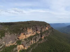
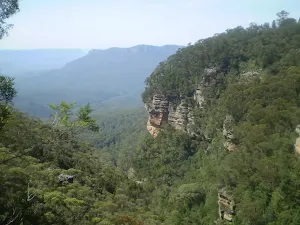
Blue Mountains National Park
Attracting over 3 million visitors annually, Blue Mountains National Park holds some of Australia's most spectacular and diverse wilderness areas. Explore the Grose Valley, with its sheer sandstone cliffs, waterfalls and scenic walking, or enjoy the famous views of the Three Sisters. Easy access makes a day trips very worthwhile, but with such diversity it would be great to stay in one of the many B&B's and spend a few days soaking up the region.
Comments
Short URL: http://wild.tl/npoadfc