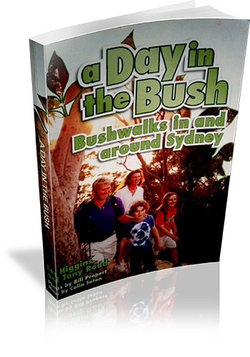
A Day in the Bush: Bushwalks in and around Sydney
About this book
New edition of this book available
Walks in Sydney and Blue Moutains, with large amounts of introductory information. Information on walking with children.
Our review notes
Tracknotes
- Level of detail
- Detailed route information
- Walk summaries
- Yes
- Grade system explained
- No
- Ascent/descent info
- Yes
- Driving directions
- Yes
- Review dates given
- No
- Interpretive info
- Plenty
Maps & photos
- Maps for walking
- Yes - reasonable detail
- Map type
- Simple Topographic
- Map colour
- Black and White
- Map size
- Full page
- Regional map
- Yes
- Map comment
- One walk per map
- Photos
- Black and White
- Photo comment
- Quarter-page to half-page photographs every 6 pages or so.
Look at any walk description in A Day in the Bush to identify immediately the book’s distinctive features. All the basic information you need about the walks covered by the book - length, distance from the Sydney CBD, and suitability for children, for example – is immediately accessible. The track notes are presented in a block format so that the stages of the walk are easy to identify and follow. A numbering system is used to help you relate the notes for a particular walk to the accompanying map. The track notes not only guide your steps but also inform you about the landscape and bushland your are passing through. People who want to know more about the bushland about Sydney can delve into the landform and vegetation chapters in Part One of the book. There is also a chapter on the basics of bushwalking in Part One. An important service that comes with the book is the provision of six-monthly walk updates. These can be found on the book’s website and help to keep walks information reliable and current.
List of walks in this book
| Walk Name | Length | Time | Grade | Page |
|---|---|---|---|---|
| Captain Cook's Landing place - Cape Baily Lighthouse | 10 km | 9 Years + | 42 | |
| Otford Station - Burning palms | 11 km | 9 Years + | 44 | |
| Wodi-Wodi Track | 6.5 km | 11 Years + | 46 | |
| Curra Moors Cuicuit | 10 km | 9 Years + | 48 | |
| Bundeena - Marley Head | 13 km | 11 Years + | 50 | |
| Maitland Bay Ccentre - Putty Beach | 6 km | 9 Years + | 53 | |
| Frazer Beach - Moonee Beach | 8 km | 9 Years + | 55 | |
| The Sphinx - Bobbin Head | 9 km | 9 Years + | 59 | |
| Mount Ku-ring-gai Station - Berowra Station via Berowra Creek | 8.5 km | 9 Years + | 62 | |
| Cowan Station - Hawkesbury River Station | 11 km | 11 Years + | 65 | |
| Point Clare Station - Koolewong Ridge - woy woy Station | 10 km | 9 Years + | 68 | |
| Wondabyne Station - Pindar cave | 12 km | 11 Years + | 71 | |
| Mill Creek Circuit | 11 km | 11 Years + | 73 | |
| Pines Forest Picnic area - Abbotts Falls | 8 km | 9 Years + | 75 | |
| Heathcote Station - Karloo Pool - Waterfall station | 12 km | 9 Years + | 78 | |
| Heathcote Station - Kangaroo Creek - Karloo Pool | 7.5 km | 9 Years + | 80 | |
| Walumarra Track - Forest Path | 13 km | 9 Years + | 82 | |
| Waterfall Station - Heathcote station via the Bullawarring Track | 12 km | 9 Years + | 84 | |
| Florabella Pass | 7 km | 9 Years + | 88 | |
| Glenbrook Causeway - Red hands cave | 8 km | 9 Years + | 91 | |
| Erskine Creek - Pisgah Rock - Jack Evans track (as two separate walks) | 4 km | 7 Years + | 93 | |
| Bob Turner Track | 7 km | 9 Years + | 95 | |
| Mountain Lagoon - Colo River Gorge Viewpoint | 11 km | 9 Years + | 97 | |
| Winmalee - Shaws Ridge - Grose Mountain Lookout | 15 km | 11 Years + | 99 | |
| Magdala Creek - Glenbrook Creek - Sassafra Creek | 11 km | 9 Years + | 101 | |
| Hazelbrook Station - Hazelbrook Lake (Bedford Pool) | 10 km | 9 Years + | 105 | |
| Wentworth Falls Amphitheatre | 10.5 km | 9 Years + | 108 | |
| Mount Hay Rd - Lockley Pylon - Du Faur Head | 8 km | 9 Years + | 111 | |
| Scenic Railway Picnic Area - Golden Stairs - Furber Stairs | 6.5 km | 9 Years + | 115 | |
| Golden Stairs - Ruined Castle | 12.5 km | 9 Years + | 116 | |
| Braeside Walk - Govetts Leap - Pulpit Rock - Popes Glen | 12 km | 9 Years + | 118 | |
| Perrys Lookdown - Blue Gum Forest | 4 km | 11 Years + | 120 | |
| Porters Pass | 4.5 km | 9 Years + | 122 | |
| Evans Lookout - Grand Canyon - Neates Glen | 7 km | 9 Years + | 124 | |
| Megalong Valley Road - Coxs River via Six foot track | 14 km | 11 Years + | 126 | |
| Little Zig Zag - Rienits Pass | 5 km | 9 Years + | 128 | |
| Mount Banks - Banks Wall | 11 km | 9 Years + | 130 | |
| Glow worm Tunnel - Old Coach track - Pagoda Track | 10 km | 9 Years + | 133 | |
| Wollangambe Track | 8 km | 11 Years + | 136 | |
| Kanangra Walls - Cottage Rock | 9 km | 9 Years + | 140 | |
| Starlight's Trail | 13 km | 9 Years + | 143 | |
| Blue Gum Creek - Little River | 16 km | 11 Years + | 145 | |
| Barren Grounds Nature Reserve - Griffith Trail | 8 km | 9 Years + | 147 | |
| Box Vale Track - Forty Foot Falls | 10 km | 9 Years + | 150 | |
| McPhails Fire Trail | 18 km | 11 Years + | 153 |