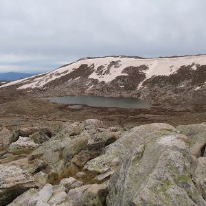
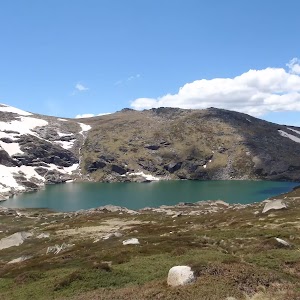
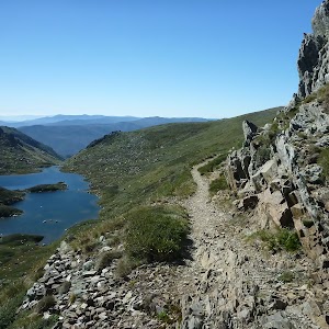
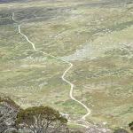
This walk starts with a ride up the Kosciuszko Express Chairlift. There is an opportunity to eat at Australia’s highest restaurant, before heading over the Rams Head Range. After enjoying the spectacular views from the Rams Head Range, the walk drops to Dead Horse Gap, then follows a bush track along the Thredbo river. After passing the golf course, the walk returns to the base of the chairlift. Alternatively, you may organise a lift from Dead Horse Gap.
Dead Horse Gap Loop track
And Walk
Dead Horse Gap Loop track


4 hrs 30 mins
9.8 km Circuit

144 m
Hard track


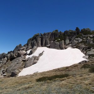
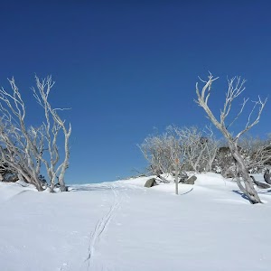
Covered in snow part of the year
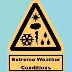
This walk leads through an extreme alpine environment and all walkers must be well prepared. During summer, be prepared for both very hot and cold weather, high winds, rain, snow, extreme UV levels and some sections of snow or ice on the ground. Before starting this walk, check advice with Snowy Region Visitor Information Centre (02) 6450 5600, the weather forecast and the snow conditions then change your plans as needed. These notes, grades and walking times have been written for use in the summer months only. Between May and the end of October, this walk is likely to be covered in snow/ice, visitors should be carrying and be prepared to use snowshoes or cross country skis. When there is a chance of significant snow on the ground, visitors will need particularly strong navigation and snowcraft skills – tracks and signage may not be visible. For most visitors, it is best to consider this walk closed during the colder months.
Kosciuszko Express Chairlift
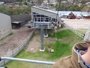
This is one of the few lifts operating in the summer months at Thredbo, and is made quite popular by thousands of people walking to the summit of Mt Kosciuszko each year. Lift tickets can be purchased from the store at the bottom of the chairlift. Lift tickets are $31 return ($25 one way) per person. This lift is generally closed during November and May for maintenance each year, but the the Snowgum chair can be used at this time instead, this will add extra walking time to you walk. More info.
(0km) Bottom of Kosciuszko Express chairlift → Top of Kosciuszko Express chairlift

1.9 km
20 mins
558m
-1m
Very easy
This walk heads into the ‘Valley Terminal’ building, where you can buy a ticket for the lift. Continue through the building and up the steps, where this walk turns right to find the bottom terminal of the ‘Kosciuszko Express’. Walk up to the platform as directed by the chairlift operator and sit down in the seat, letting it scoop you up. Once seated, pull down the safety bar and enjoy the ride to the top of the ridge. 🙂
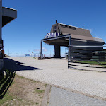
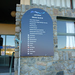
At the top step of the chair lift and turn left to find the restaurant (now on your right) and track information signs ahead.
At the top step of the chair lift and turn left to find the restaurant (now on your right) and track information signs ahead.
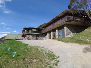
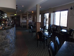
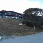
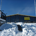
Eagles Nest Restaurant

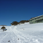
This is Australia’s highest restaurant, providing great food and outstanding views. It is easily accessible, nestled on the mountain directly opposite the top of the Kosciuszko Express chairlift, and is open year-round. For more information, call (02) 64576019.
(1.86km) Top of Kosciuszko Express chairlift → Int of Dead Horse Gap track and Kosciuszko footpath
350 m
6 mins
23m
0m
Moderate track
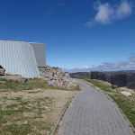
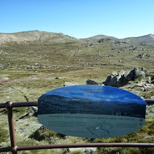
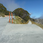
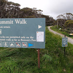
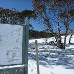
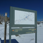
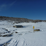
Turn right: From the top of the chairlift[3], this walk follows the footpath around Eagles Nest restaurant[4][5] (keeping the building to your right). The walk passes the large map[6] and information signs[7], heading up the gentle hill along the paved path[8]. Near the top of the rise, the path leads to a signposted intersection with the ‘Dead Horse Gap’ track[9] (on your left), where there is also an arrow pointing back to ‘Eagles Nest Restaurant’[10].
(2.21km) Int of Dead Horse Gap track and Kosciuszko footpath → Top of Basin Tbar
110 m
2 mins
10m
-1m
Hard track
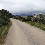
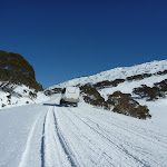
Veer left: From the intersection, the track follows the rocky bush track a short distance to the top of the Basin Tbar.
(2.32km) Top of Basin Tbar → Upper rest area
1.7 km
36 mins
54m
-74m
Hard track
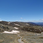
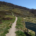
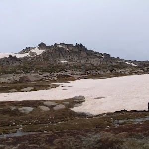
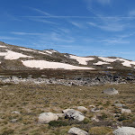
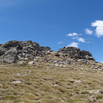
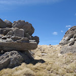
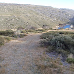
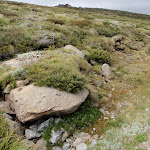
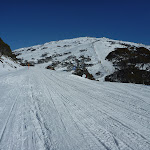
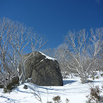
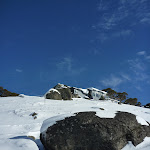
Continue straight: From the top of the Tbar, the walk follows the bush track heading west along the ridgeline. The track climbs the hill, passing numerous rock outcrops, and reaches an information sign titled “above the tree line”.
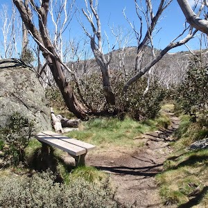
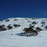
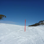
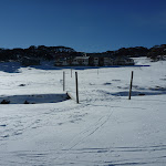
Continue straight: From the signpost, the walk follows the bush track along the ridgeline, down the hill. The track passes a long line of ski run markers, continuing down towards the tree line until it comes to the intersection at the wooden bench.
Continue straight: From the signpost, the walk follows the bush track along the ridgeline, down the hill. The track passes a long line of ski run markers, continuing down towards the tree line until it comes to the intersection at the wooden bench.
(3.99km) Upper rest area → Int of Thredbo River and Dead Horse Gap tracks
3 km
1 hr 27 mins
11m
-405m
Moderate track
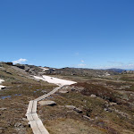
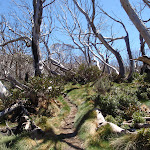
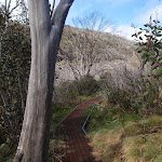
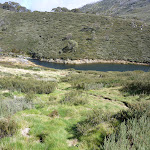
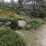
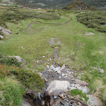
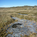
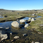
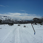
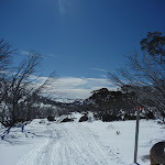
Continue straight: From the intersection, the walk follows the bush track down the hill. The track winds down the long hill, crossing some metal walkways and wooden boardwalks, then passing through the snowgum forest until it comes to the second, small rest area at the wooden bench seat.
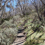
Continue straight: From the bench, the walk follows the bush track down the rocky hill. The track passes through the open snow gum forest, down into the valley. The track goes down a long set of wooden steps and comes to an intersection signposted ‘Dead Horse Gap track’.
Continue straight: From the bench, the walk follows the bush track down the rocky hill. The track passes through the open snow gum forest, down into the valley. The track goes down a long set of wooden steps and comes to an intersection signposted ‘Dead Horse Gap track’.
(7.02km) Int of Thredbo River and Dead Horse Gap tracks → Cascades Trail track head
160 m
3 mins
3m
-6m
Moderate track
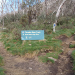
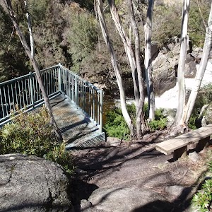
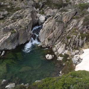
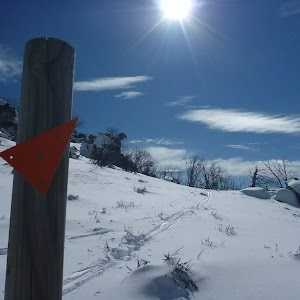
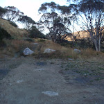
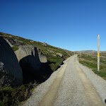
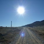
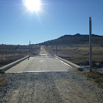
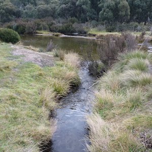
Turn right: From the intersection, this walk follow the clear track away from the other two sign posted tracks to soon cross Bogong Creek[11] on a metal bridge[12]. The track then leads left and heads up a series of steps to follow behind the road barrier, soon coming to a ‘Thredbo Walking Tracks’ sign[13] beside the road. Here the walk crosses the road to find the Cascades Trail track head car park (on the Alpine Way 5.4km west of Friday Drive).
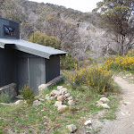
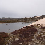
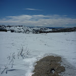
Dead Horse Gap
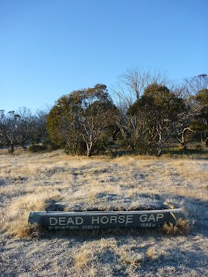
Dead Horse Gap is a relativley low mountain pass in the Great Dividing Range at 1582m AMSL. It was once a meeting place for Aboriginal groups in the summer, where they would perform ceremonies and trade with each other. In nature the pass acts as a funnel for the migration of insects and birds[14]. In the early 20th century, the pass became increasingly popular with stockmen, who brought sheep and cattle to the mountains each summer.[15]
(7.02km) Int Thredbo River and Dead Horse Gap tracks → Thredbo River track western bridge
1.1 km
23 mins
8m
-68m
Moderate track
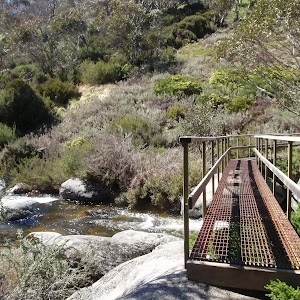
Veer left: From the intersection, this walk follows the ‘Thredbo village 4km’ sign[16] gently downhill whilst keeping the valley (and road) to your right. The track gently undulates along the side of the valley and after about 600m the track leads over a series of metal erosion control grates[17]. The walk continues crossing a series of these grates for about another 600m before leading down a long series of steps[18] to find a large metal bridge[19].
(8.09km) Thredbo River western bridge → Thredbo River eastern bridge
340 m
7 mins
6m
-15m
Moderate track
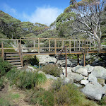
Continue straight: From the small clearing[20], this walk crosses Thredbo River using the long metal bridge[21]. This walk then turns left and heads through the grassy flat (initially over a metal grate[22]) enjoying the scattering of snow gums[23]. Before too long the track comes closer to the river again the leads down a log lined set of stairs[24] to cross the Thredbo River again on another metal bridge[25].
(8.43km) Int of Thredbo River track at eastern bridge → Cascades lookout
470 m
9 mins
8m
-21m
Moderate track
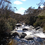
Continue straight: From the bridge, this walk crosses to the north side of the river and follows the bush track downstream, winding down the hill and through the snowgum forest. The walk continues along a metal walkway followed by a wooden boardwalk, then heads down a long hill to the intersection at the Thredbo River Cascades lookout platform.
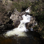
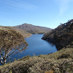
Cascades Lookout
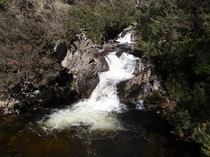
This metal platform leans over the Thredbo River, lookout upstream to the flowing cascades. There is also a wooden seat provided here, making it a great rest stop, conveniently situated about half way between Dead Horse Gap and Thredbo Village, on the Thredbo River track.
(8.9km) Cascades lookout → Int of Thredbo River and golf course tracks
1.3 km
27 mins
12m
-69m
Moderate track
Continue straight: From the lookout, this walk winds down the hill following the Thredbo River track as it continues along the creek, winding through the snow gum forest and crossing several metal walkways, continuing down some wooden steps until coming to the signposted intersection of the golf course loop track.
(10.19km) Int of Thredbo River and Golf Course Walk tracks → Int of Riverside Walk and Thredbo River bridge
810 m
15 mins
1m
-30m
Moderate track
Continue straight: From the intersection, this walk heads away from the face of the ‘Thredbo River Track’ sign[26] to follow the track east down the hill. The track leads down a series of steps the gently meanders along the side of the Thredbo River. Soon after passing the the green timber pump house[27], this walk comes to an intersection beside a small timber bridge[28] (that heads over a small creek onto the golf course).
Continue straight: From the intersection[29], this walk follows the track away from the golf course down the gentle hill and over a small metal bridge[30], keeping the main river to your right[31]. The track leads through the bush between the golf course and the river, crossing several sections of metal walkways[32] until winding back up to the golf course to soon come to an intersection at a large wooden bridge[33] (that crosses Thredbo River).
Continue straight: From the intersection[29], this walk follows the track away from the golf course down the gentle hill and over a small metal bridge[30], keeping the main river to your right[31]. The track leads through the bush between the golf course and the river, crossing several sections of metal walkways[32] until winding back up to the golf course to soon come to an intersection at a large wooden bridge[33] (that crosses Thredbo River).
(11km) Int of Riverside Walk and Thredbo River bridge → Int behind the community centre
80 m
2 mins
0m
-3m
Moderate track
Continue straight: From the timber bridge[34], this walk follows the clear track[35] keeping the river to your right. The track soon leads around the edge of the golf course and over a short metal bridge[36]. About 30m after this track leads to an intersection[37] (where the track on the right leads down to the creek), behind the community centre.
(11.08km) Int behind the community centre → Thredbo Memorial Community Centre
120 m
2 mins
1m
-4m
Moderate track
Thredbo Golf Course
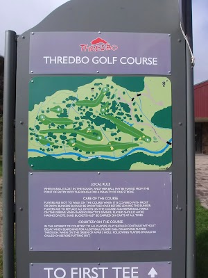
This nine hole AGU (Australian Golf Union) rated course is the highest in Australia. Nestled in beside Thredbo village, and bordering the Thredbo River, this course offers a great form of relaxation, and gives golfers a wonderful way to enjoy the Snowies, without having to travel too far from the village. More info.
(11.2km) Thredbo Memorial Community Centre → Bottom of Kosciuszko Express chairlift
480 m
9 mins
10m
-11m
Very easy
Turn right: From the Community Centre[42], this walk follows the road across the bridge[43], over Thredbo River to come to a signposted intersection with ‘Friday Drive’[44].
Turn left: From the intersection, this walk heads downhill following the ‘Friday Drive’ sign[45] past the pond (on your right). The road leads through a car park and past the children’s play ground[46]. In time the walk follow the footpath beside the road[47] that leads under a footbridge[48], where this walk then turns left across the road bridge[49]. Here the walk tends left up the road to find a large map[50] and the entrance to the tickets station[51] at the bottom of Kosciuszko Express chairlift.
Turn left: From the intersection, this walk heads downhill following the ‘Friday Drive’ sign[45] past the pond (on your right). The road leads through a car park and past the children’s play ground[46]. In time the walk follow the footpath beside the road[47] that leads under a footbridge[48], where this walk then turns left across the road bridge[49]. Here the walk tends left up the road to find a large map[50] and the entrance to the tickets station[51] at the bottom of Kosciuszko Express chairlift.
Maps for the Dead Horse Gap Loop track walk
You can download the PDF for this walk to print a map.
These maps below cover the walk and the wider area around the walk, they are worth carrying for safety reasons.
| Perisher Valley | 1:25 000 Map Series | 85252S PERISHER VALLEY | NSW-85252S |
| Chimneys Ridge | 1:25 000 Map Series | 85241N CHIMNEYS RIDGE | NSW-85241N |
| Kosciuszko | 1:100 000 Map Series | 8525 KOSCIUSZKO | 8525 |
| Jacobs River | 1:100 000 Map Series | 8524 JACOBS RIVER | 8524 |
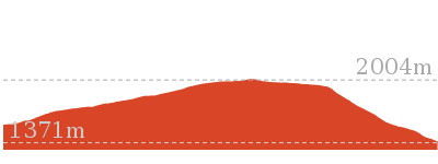
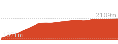
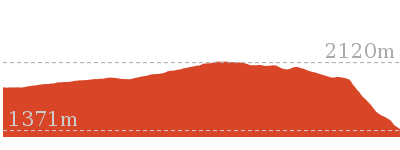
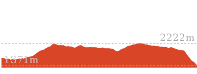
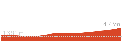
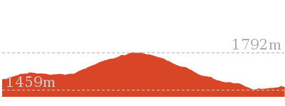
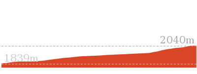
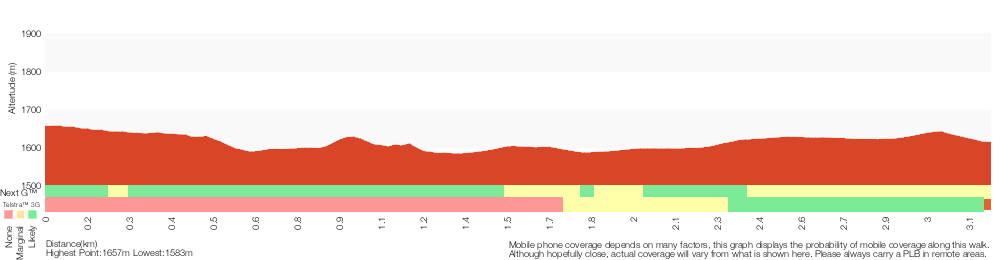
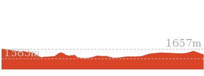
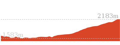
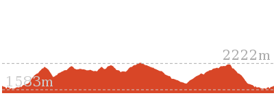
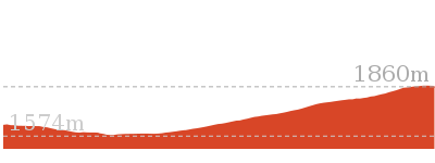
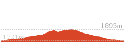
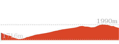
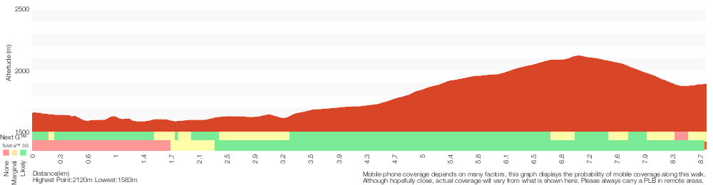
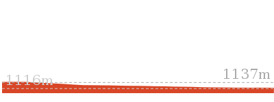
Cross sectional view of the Dead Horse Gap Loop track bushwalking track
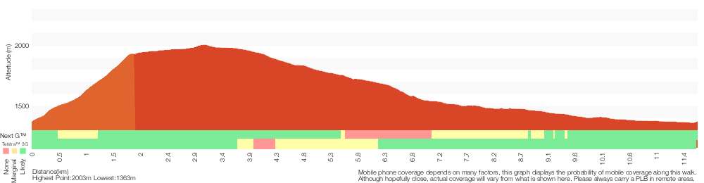
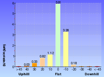
Analysis and summary of the altitude variation on the Dead Horse Gap Loop track
Overview of this walks grade – based on the AS 2156.1 – 2001
Under this standard, a walk is graded based on the most difficult section of the walk.
| Length | 9.8 km | ||
| Time | 4 hrs 30 mins | ||
| . | |||
| Grade 4/6 Hard track |
AS 2156.1 | Gradient | Short steep hills (3/6) |
| Quality of track | Formed track, with some branches and other obstacles (3/6) | ||
| Signs | Directional signs along the way (3/6) | ||
| Experience Required | Some bushwalking experience recommended (3/6) | ||
| Weather | Forecast, unforecast storms and severe weather may impact on navigation and safety (4/6) | ||
| Infrastructure | Limited facilities, not all cliffs are fenced (3/6) |
Some more details of this walks Grading
Here is a bit more details explaining grading looking at sections of the walk
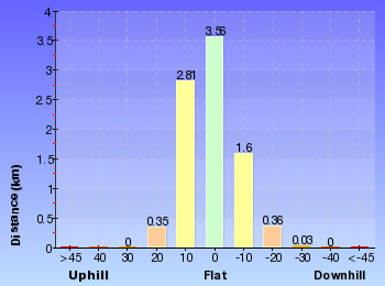
Gradient
5km of this walk has short steep hills and another 4km has gentle hills with occasional steps. The remaining (2.4km) is flat with no steps.
Quality of track
8km of this walk follows a formed track, with some branches and other obstacles and another 2.7km follows a smooth and hardened path. The remaining (890m) follows a clear and well formed track or trail.
Signs
Around 7km of this walk is clearly signposted, whilst the remaining 4.9km has directional signs at most intersection.
Experience Required
Around 8km of this walk requires some bushwalking experience, whilst the remaining 4.2km requires no previous bushwalking experience.
weather
8km of this walk is not usually affected by severe weather events (that would unexpectedly impact safety and navigation) and another 2.8km is affected by storms that may impact your navigation and safety. The remaining (1.3km) is affected by forecast, unforecast storms and severe weather events that may impact on navigation and safety.
Infrastructure
Around 8km of this walk is close to useful facilities (such as fenced cliffs and seats), whilst the remaining 3.5km has limited facilities (such as not all cliffs fenced).
Similar walks
A list of walks that share part of the track with the Dead Horse Gap Loop track walk.
3.3 km Circuit
1 hr 15 mins
Moderate track

3.7 km Circuit
2 hrs 30 mins
Hard track

3.8 km Return
2 hrs 30 mins
Hard track

4.1 km Return
1 hr 45 mins
Moderate track

4.7 km Return
2 hrs
Moderate track

4.8 km One way
1 hr 45 mins
Moderate track

5.3 km One way
3 hrs
Hard track
5.8 km Circuit
3 hrs
Hard track
7.5 km Return
3 hrs 45 mins
Hard track
10.1 km Circuit
5 hrs
Hard track

12.2 km One way
5 hrs
Hard track
12.4 km Return
6 hrs
Hard track
25.8 km One way
2 Days
Experienced only
Other Nearby walks
A list of walks that start near the Dead Horse Gap Loop track walk.
3.1 km Circuit
1 hr 30 mins
Hard track

3.3 km Circuit
1 hr 15 mins
Moderate track

2.2 km Return
1 Hr
Hard track
2.9 km Circuit
1 hr 15 mins
Moderate track
9.7 km Return
4 hrs
Hard track

19.6 km Return
7 hrs 30 mins
Hard track

778 m Return
30 mins
Moderate track

2.4 km Return
1 hr 30 mins
Hard track

4.2 km Circuit
2 hrs 15 mins
Hard track

3.8 km Return
1 hr 45 mins
Hard track
15.2 km Return
5 hrs 30 mins
Hard track
12 km Return
4 hrs 30 mins
Hard track
Plan your trip to and from the walk here
The Dead Horse Gap Loop track walk starts and ends at the Bottom of Kosciuszko Express chairlift (gps: -36.503981, 148.30397)
Your main transport option to Bottom of Kosciuszko Express chairlift is by;
![]() Car. A park entry fee is required for driving into the park.
Car. A park entry fee is required for driving into the park.
(get details)


Short URL = http://wild.tl/ww
Gallery images
There are other downloads I am still working on.
You will probably need to login to access these — still all free.
* KML (google earth file)
* GPX (GPS file)
Special Maps/ brochures
* A3 topo maps
* PDF with Lands Topo map base
* PDF with arial image (and map overlay)
I wanted to get the main site live first, this extra stuff will come in time.
Happy walking
Matt 🙂
Guthega to Snowy River Suspension Bridge

2 hrs 30 mins
6.4 km Return
343 m
Moderate track


Covered in snow part of the year
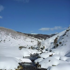
This walk leads through an extreme alpine environment and all walkers must be well prepared. During summer, be prepared for both very hot and cold weather, high winds, rain, snow, extreme UV levels and some sections of snow or ice on the ground. Before starting this walk, check advice with Snowy Region Visitor Information Centre (02) 6450 5600, the weather forecast and the snow conditions then change your plans as needed. These notes, grades and walking times have been written for use in the summer months only. Between May and the end of October, this walk is likely to be covered in snow/ice, visitors should be carrying and be prepared to use snowshoes or cross country skis. When there is a chance of significant snow on the ground, visitors will need particularly strong navigation and snowcraft skills – tracks and signage may not be visible. For most visitors, it is best to consider this walk closed during the colder months.
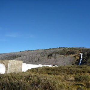
Guthega
Guthega is a relatively small township, north of Perisher, and comprises mostly of hotel and lodge-style buildings. The most popular service in town is the Guthega Alpine Inn, open year round. The town is remote and access is by an all-weather dirt road. There are great views over the main range and the Guthega Pondage (part of the Snowy River Scheme). Guthega offers a great place to ski in winter, and to holiday in summer. In summer, there is plenty of walking, mountain biking, fishing and relaxing to be done. Walkers please note – there is no public water supply in the township, please fill water bottle before coming (or be willing treat and use the creek water).
Guthega Alpine Inn
Guthega Alpine Inn is on Guthega Road, about 500 metres past the base of the chairlift and ‘Guthega Centre’. The hotel provides a year-round service including accommodation and meals. The hosts are friendly and the hotel provides a great base for walkers and other holiday makers. Please phone and book ahead for meals and accommodation. Phone 02 6457 5383
More info.
More info.
(0km) Car park below Guthega Alpine Inn → Int. of Guthega road servicetrail and Flying fox track
480 m
10 mins
6m
-34m
Moderate track
From the car park (just below Guthega Alpine Inn, on Guthega Rd, 500m past the Guthega Centre), the walk follows the concrete road down the hill, keeping the main valley to the left. The road passes a small stone building and light post, just before coming to an intersection with another road heading off to the left, below the building named ‘Toibunga’.
Turn sharp left: From the intersection, the walk follows the concrete road down the hill towards the dam. After about 100m, the track veers right at another intersection, following the lower track. The concrete track turns to the right, but this walk continues straight, onto the wide dirt management trail (between the small boulders). Soon the trail bends right and comes to an intersection with a bush track.
Turn sharp left: From the intersection, the walk follows the concrete road down the hill towards the dam. After about 100m, the track veers right at another intersection, following the lower track. The concrete track turns to the right, but this walk continues straight, onto the wide dirt management trail (between the small boulders). Soon the trail bends right and comes to an intersection with a bush track.
(0.48km) Int. of Guthega road servicetrail and Flying fox track → Flying Fox
330 m
9 mins
15m
-44m
Moderate track
Turn left: From the intersection, the walk heads between the boulders and is fairly flat initially, then, near a snow gum, the track steps down steeply and then winds down the hill to a ‘T’ intersection above Blue Cow Creek. (There is broken glass along this section of track, left over from Snowy River Scheme Camps).
Veer left: From the intersection, the walk initially steps over a small, eroded gap in the track[1] and then heads upstream alongside Blue Cow Creek, keeping the creek to your right. Before long, the track comes closer to the creek, and reaches a rocky crossing with a bridge[2] and a flying fox[3] over the creek.
Veer left: From the intersection, the walk initially steps over a small, eroded gap in the track[1] and then heads upstream alongside Blue Cow Creek, keeping the creek to your right. Before long, the track comes closer to the creek, and reaches a rocky crossing with a bridge[2] and a flying fox[3] over the creek.
Flying Fox
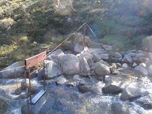
This metal flying fox was put in place to provide a safer option for crossing Blue Cow Creek when the water rises over the rocks. There are many flying foxes in the area to help people cross creeks, especially useful during snow melt when water is cold, deep and fast-moving. In 2010, a metal bridge was installed over this creek, parallel to the flying fox, and the bridge is now the safest way to cross.
(0.81km) Blue Cow Creek crossing → Illawong Lodge
2.2 km
50 mins
129m
-87m
Moderate track
Turn right: From the intersection, the walk crosses the creek on the bridge[4] next to the metal flying fox[5]. The walk then follows the bush track on the other side as it climbs to the top of the ridge. From the top of the hill, the track then winds down towards the Snowy River then turns left and generally follows it upstream. Soon the walk crosses a small creek and continues up the other side, undulating through the valley, crossing several more small creeks. The track winds left, away from the Snowy River, to climb the short hill to Illawong Lodge.
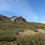
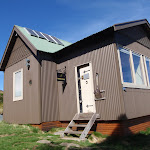
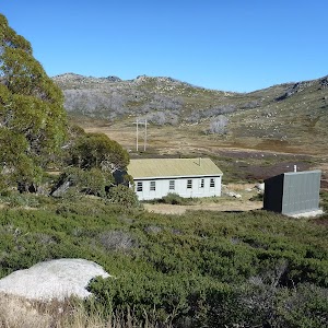
Illawong Lodge
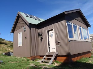
In 1956, the year after the Guthega Dam was first filled, the Kosciuszko State Park Trust gave permission for the conversion of the then-dilapidated hut into the present simple lodge. The lodge is maintained by members of Illawong Ski Tourers and friends. The nearby suspension bridge over the Snowy River and the flying fox over Farm Creek were built by members of Illawong. NPWS now maintains the suspension bridge and a new bridge over Farm Creek which has replaced the flying fox. The lodge can be reserved by members of the general public – see illawong.asn.au. There is also a small emergency shelter in the base of the hut, on the western wall, with enough room for a few people to see out a blizzard, with some water, blankets and other emergency supplies. More info.
(3.03km) Illawong Lodge → Suspension bridge
160 m
4 mins
0m
-28m
Moderate track
Turn right: From the west side of Illawong Lodge (where the emergency shelter is located), the walk heads down towards the creek following the bush track. The track winds through scrub, passing through a grass clearing along the way. The walk soon comes to a cable suspension bridge.
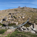
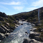
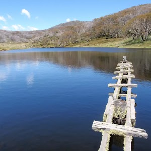
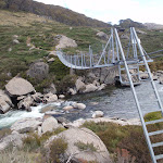
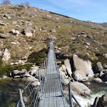
Suspension Bridge
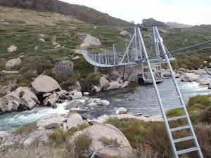
Constructed and maintained by Illawong Ski Tourers, and only a stone’s throw from Illawong Lodge, this cable suspension bridge provides a safer way to cross the upper Snowy River. This provides the main access between Guthega and the Main Range. The bridge also provides great views of the valley.
Maps for the Guthega to Snowy River Suspension Bridge walk
You can download the PDF for this walk to print a map.
These maps below cover the walk and the wider area around the walk, they are worth carrying for safety reasons.
| Perisher Valley | 1:25 000 Map Series | 85252S PERISHER VALLEY | NSW-85252S |
| Chimneys Ridge | 1:25 000 Map Series | 85241N CHIMNEYS RIDGE | NSW-85241N |
| Kosciuszko | 1:100 000 Map Series | 8525 KOSCIUSZKO | 8525 |
| Jacobs River | 1:100 000 Map Series | 8524 JACOBS RIVER | 8524 |
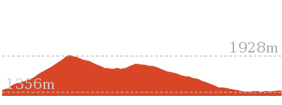
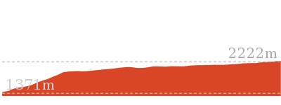
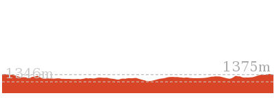
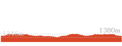
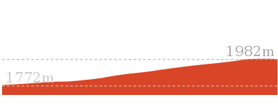
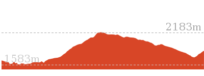
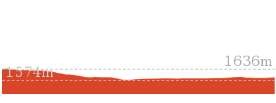
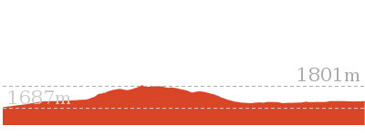
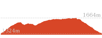
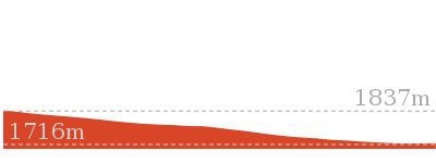
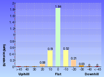
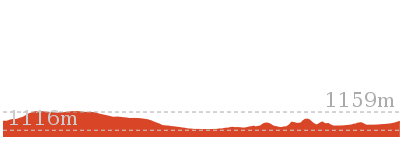
Cross sectional view of the Guthega to Snowy River Suspension Bridge bushwalking track
Analysis and summary of the altitude variation on the Guthega to Snowy River Suspension Bridge

Overview of this walks grade – based on the AS 2156.1 – 2001
Under this standard, a walk is graded based on the most difficult section of the walk.
| Length | 6.4 km | ||
| Time | 2 hrs 30 mins | ||
| . | |||
| Grade 3/6 Moderate track |
AS 2156.1 | Gradient | Short steep hills (3/6) |
| Quality of track | Formed track, with some branches and other obstacles (3/6) | ||
| Signs | Directional signs along the way (3/6) | ||
| Experience Required | Some bushwalking experience recommended (3/6) | ||
| Weather | Storms may impact on navigation and safety (3/6) | ||
| Infrastructure | Limited facilities, not all cliffs are fenced (3/6) |
Some more details of this walks Grading
Here is a bit more details explaining grading looking at sections of the walk
Gradient
2.6km of this walk has short steep hills and another 410m has gentle hills with occasional steps. The remaining (240m) is flat with no steps.
Quality of track
Around 2.7km of this walk follows a formed track, with some branches and other obstacles, whilst the remaining 480m follows a smooth and hardened path.
Signs
Around 2.7km of this walk has directional signs at most intersection, whilst the remaining 480m is clearly signposted.
Experience Required
Around 2.7km of this walk requires some bushwalking experience, whilst the remaining 480m requires no previous bushwalking experience.
weather
Around 2.8km of this walk is affected by storms that may impact your navigation and safety, whilst the remaining 400m is not usually affected by severe weather events (that would unexpectedly impact safety and navigation).
Infrastructure
Around 2.9km of this walk is close to useful facilities (such as fenced cliffs and seats), whilst the remaining 330m has limited facilities (such as not all cliffs fenced).
Similar walks
A list of walks that share part of the track with the Guthega to Snowy River Suspension Bridge walk.

6.4 km Return
2 hrs 45 mins
Moderate track
14.8 km Return
6 hrs 45 mins
Experienced only
15.2 km One way
6 hrs 30 mins
Experienced only
17.4 km Return
8 hrs
Experienced only

25.8 km One way
2 Days
Experienced only
45 km Circuit
4 Days
Experienced only
Other Nearby walks
A list of walks that start near the Guthega to Snowy River Suspension Bridge walk.
3.3 km Return
1 hr 30 mins
Hard track

6 km Return
3 hrs
Very experienced only
5.2 km One way
2 hrs 45 mins
Hard track
3 km Circuit
1 hr 30 mins
Moderate track

7.3 km Circuit
3 hrs
Hard track

5.6 km Return
2 hrs 30 mins
Hard track

14.1 km Circuit
5 hrs 30 mins
Hard track
22.4 km Return
9 hrs
Hard track

2.5 km Return
1 Hr
Moderate track

374 m Return
15 mins
Moderate track
9.3 km Return
4 hrs
Hard track
1.6 km Return
45 mins
Hard track
Plan your trip to and from the walk here
The Guthega to Snowy River Suspension Bridge walk starts and ends at the Car park below Guthega Alpine Inn (gps: -36.382035, 148.37259)
Your main transport option to Car park below Guthega Alpine Inn is by;
![]() Car. A park entry fee is required for driving into the park.
Car. A park entry fee is required for driving into the park.
(get details)
Short URL = http://wild.tl/gtsrsb
Gallery images
There are other downloads I am still working on.
You will probably need to login to access these — still all free.
* KML (google earth file)
* GPX (GPS file)
Special Maps/ brochures
* A3 topo maps
* PDF with Lands Topo map base
* PDF with arial image (and map overlay)
I wanted to get the main site live first, this extra stuff will come in time.
Happy walking
Matt 🙂
Guthega to Blue Lake via Little Twynam

8 hrs
17.4 km Return
1120 m
Experienced only
This great walk starts at Guthega and explores the area east of Blue Lake. The walk heads to the Illawong Lodge, via the Blue Cow Creek flying fox, and then crosses the famous Snowy River at the suspension bridge. The walk then winds up the long ridge to the top of Little Twynam and down to Blue Lake. From Blue lake there are optional side trips to Headley Tarn and up to the Blue Lake lookout, before returning to Guthega.* This walk passes through very remote areas and sections have no visible track. At least one person in your group should have training and experience in off track walking and navigation. Even with these notes and a GPS these extra skills and equipment are required.


Covered in snow part of the year
This walk leads through an extreme alpine environment and all walkers must be well prepared. During summer, be prepared for both very hot and cold weather, high winds, rain, snow, extreme UV levels and some sections of snow or ice on the ground. Before starting this walk, check advice with Snowy Region Visitor Information Centre (02) 6450 5600, the weather forecast and the snow conditions then change your plans as needed. These notes, grades and walking times have been written for use in the summer months only. Between May and the end of October, this walk is likely to be covered in snow/ice, visitors should be carrying and be prepared to use snowshoes or cross country skis. When there is a chance of significant snow on the ground, visitors will need particularly strong navigation and snowcraft skills – tracks and signage may not be visible. For most visitors, it is best to consider this walk closed during the colder months.
Guthega
Guthega is a relatively small township, north of Perisher, and comprises mostly of hotel and lodge-style buildings. The most popular service in town is the Guthega Alpine Inn, open year round. The town is remote and access is by an all-weather dirt road. There are great views over the main range and the Guthega Pondage (part of the Snowy River Scheme). Guthega offers a great place to ski in winter, and to holiday in summer. In summer, there is plenty of walking, mountain biking, fishing and relaxing to be done. Walkers please note – there is no public water supply in the township, please fill water bottle before coming (or be willing treat and use the creek water).
Guthega Alpine Inn
Guthega Alpine Inn is on Guthega Road, about 500 metres past the base of the chairlift and ‘Guthega Centre’. The hotel provides a year-round service including accommodation and meals. The hosts are friendly and the hotel provides a great base for walkers and other holiday makers. Please phone and book ahead for meals and accommodation. Phone 02 6457 5383
More info.
More info.
(0km) Car park below Guthega Alpine Inn → Int. of Guthega road servicetrail and Flying fox track
480 m
10 mins
6m
-34m
Moderate track
From the car park (just below Guthega Alpine Inn, on Guthega Rd, 500m past the Guthega Centre), the walk follows the concrete road down the hill, keeping the main valley to the left. The road passes a small stone building and light post, just before coming to an intersection with another road heading off to the left, below the building named ‘Toibunga’.
Turn sharp left: From the intersection, the walk follows the concrete road down the hill towards the dam. After about 100m, the track veers right at another intersection, following the lower track. The concrete track turns to the right, but this walk continues straight, onto the wide dirt management trail (between the small boulders). Soon the trail bends right and comes to an intersection with a bush track.
Turn sharp left: From the intersection, the walk follows the concrete road down the hill towards the dam. After about 100m, the track veers right at another intersection, following the lower track. The concrete track turns to the right, but this walk continues straight, onto the wide dirt management trail (between the small boulders). Soon the trail bends right and comes to an intersection with a bush track.
(0.48km) Int. of Guthega road servicetrail and Flying fox track → Flying Fox
330 m
9 mins
15m
-44m
Moderate track
Turn left: From the intersection, the walk heads between the boulders and is fairly flat initially, then, near a snow gum, the track steps down steeply and then winds down the hill to a ‘T’ intersection above Blue Cow Creek. (There is broken glass along this section of track, left over from Snowy River Scheme Camps).
Veer left: From the intersection, the walk initially steps over a small, eroded gap in the track[1] and then heads upstream alongside Blue Cow Creek, keeping the creek to your right. Before long, the track comes closer to the creek, and reaches a rocky crossing with a bridge[2] and a flying fox[3] over the creek.
Veer left: From the intersection, the walk initially steps over a small, eroded gap in the track[1] and then heads upstream alongside Blue Cow Creek, keeping the creek to your right. Before long, the track comes closer to the creek, and reaches a rocky crossing with a bridge[2] and a flying fox[3] over the creek.
Flying Fox
This metal flying fox was put in place to provide a safer option for crossing Blue Cow Creek when the water rises over the rocks. There are many flying foxes in the area to help people cross creeks, especially useful during snow melt when water is cold, deep and fast-moving. In 2010, a metal bridge was installed over this creek, parallel to the flying fox, and the bridge is now the safest way to cross.
(0.81km) Blue Cow Creek crossing → Illawong Lodge
2.2 km
50 mins
129m
-87m
Moderate track
Turn right: From the intersection, the walk crosses the creek on the bridge[4] next to the metal flying fox[5]. The walk then follows the bush track on the other side as it climbs to the top of the ridge. From the top of the hill, the track then winds down towards the Snowy River then turns left and generally follows it upstream. Soon the walk crosses a small creek and continues up the other side, undulating through the valley, crossing several more small creeks. The track winds left, away from the Snowy River, to climb the short hill to Illawong Lodge.
Illawong Lodge
In 1956, the year after the Guthega Dam was first filled, the Kosciuszko State Park Trust gave permission for the conversion of the then-dilapidated hut into the present simple lodge. The lodge is maintained by members of Illawong Ski Tourers and friends. The nearby suspension bridge over the Snowy River and the flying fox over Farm Creek were built by members of Illawong. NPWS now maintains the suspension bridge and a new bridge over Farm Creek which has replaced the flying fox. The lodge can be reserved by members of the general public – see illawong.asn.au. There is also a small emergency shelter in the base of the hut, on the western wall, with enough room for a few people to see out a blizzard, with some water, blankets and other emergency supplies. More info.
(3.03km) Illawong Lodge → Suspension bridge
160 m
4 mins
0m
-28m
Moderate track
Turn right: From the west side of Illawong Lodge (where the emergency shelter is located), the walk heads down towards the creek following the bush track. The track winds through scrub, passing through a grass clearing along the way. The walk soon comes to a cable suspension bridge.
Suspension Bridge
Constructed and maintained by Illawong Ski Tourers, and only a stone’s throw from Illawong Lodge, this cable suspension bridge provides a safer way to cross the upper Snowy River. This provides the main access between Guthega and the Main Range. The bridge also provides great views of the valley.
(3.19km) Suspension bridge → Pounds Creek flats
2.6 km
1 hr 13 mins
342m
0m
Experienced only
Continue straight: From the suspension bridge, this walk crosses the Snowy River to the west bank and climbs the hill, tending to the left of the top of the hill, and continuing up through the thick scrub. This section of the walk their is not track please fan out and minimse your impact. The walk winds up the ridge line through some more shallow scrub, passing through a thin tree line. The walk continues around to the left side of the ridge, where it gets much steeper, staying high out of the gully (which is to your left). The walk continues to the top of the ridge where it is much rockier, next to the large flats near the headwaters for Pounds Creek.
Pounds Creek Flats
Located in the far upper reaches of Pounds Creek, this large flat area on the side of the ridge makes a great place to camp. The plateau forms a shallow hanging swamp in the few months after winter, when the snow melts and pools in the area.
This campsite is flat and sheltered from the wind by the mountain. Water supply from the creek is unreliable.
This campsite is flat and sheltered from the wind by the mountain. Water supply from the creek is unreliable.
(5.78km) Pounds Creek flats → Twynam saddle
1.1 km
29 mins
131m
0m
Experienced only
Veer left: From the flats, this walk heads south-west, following the ridge line that runs up the steep hill. The walk winds up and around the left side of the flats towards Little Twynam, bending around to the right as it approaches the top, then climbing up into the saddle between Little Twynam and Mt Twynam.
(6.85km) Twynam saddle → Little Twynam peak
220 m
7 mins
34m
0m
Experienced only
Turn left : From the saddle, the walk heads south-east, up the hill and soon goes through a wide grassy pass between the two large rock outcrops to reach the top of Little Twynam.
(7.07km) Little Twynam peak → Int of Blue Lake track and Little Twynam route
1.5 km
35 mins
6m
-249m
Experienced only
Continue straight: From the top of Little Twynam, the walk follows the ridge running south. The walk heads down the ridgeline, keeping Blue Lake to the right, and tends to the left as Hedley Tarn comes into view. The walk then winds down along the ridgeline, keeping the tarn to the right. After a short distance, the ridge and the hill to the right flattens out substantially and the walk turns down the hill, arcing around towards the southern end of Blue Lake. The walk then crosses Blue Lake Creek, just south of Blue Lake, and almost immediately reaches the intersection of the Hedley Tarn and Blue Lake tracks.
(8.57km) Int of Blue Lake track and Little Twynam route → Hedley Tarn
870 m
18 mins
22m
-52m
Moderate track
Turn left : From the intersection, this walk follows the bush track heading south-east, down-stream alongside the creek flowing out of Blue Lake to Hedley Tarn. The walk heads through to the southern end of the shallow gully and around the western side of Hedley Tarn, coming to the southern side. At the end of this side trip, retrace your steps back to the main walk then Continue straight.
Hedley Tarn
Hedley Tarn is a beautiful glacial lake just south of Blue Lake, from which you can see right across the valley to the end of Kosciuszko Road at Charlotte Pass and is well worth the trip down from Blue Lake.
(8.57km) Int of Blue Lake track and Little Twynam route → Blue Lake
150 m
3 mins
14m
-1m
Moderate track
Veer right: From the intersection, this walk follows the bush track, winding north-west along the trail, following the Blue Lake Creek upstream as it climbs up over the foot of a spur to the south-eastern corner of the Blue Lake.
(8.72km) Blue Lake → Blue Lake lookout
410 m
8 mins
37m
0m
Moderate track
Veer left: From the intersection, this walk follows the bush track winding west, up over the foot of a spur and continuing up and around the left-hand side of Blue Lake, steadily climbing up the ridge until coming to a platform with an information sign and a great view of Blue Lake about halfway up. At the end of this side trip, retrace your steps back to the main walk then Turn left.
Blue Lake
Blue Lake is the best example of a glacial lake in the alpine area. At 28m deep, this lake was formed when glaciers, flowing from the Great Dividing Range, converged and carved out a basin in the rock. This is visible in the cliffs behind the lake, where the glaciers have plucked out blocks of stone and carried them away. There is also a stream that flows from Blue lake, feeding Hedley Tarn just to the south.
Maps for the Guthega to Blue Lake via Little Twynam walk
You can download the PDF for this walk to print a map.
These maps below cover the walk and the wider area around the walk, they are worth carrying for safety reasons.
| Perisher Valley | 1:25 000 Map Series | 85252S PERISHER VALLEY | NSW-85252S |
| Chimneys Ridge | 1:25 000 Map Series | 85241N CHIMNEYS RIDGE | NSW-85241N |
| Kosciuszko | 1:100 000 Map Series | 8525 KOSCIUSZKO | 8525 |
| Jacobs River | 1:100 000 Map Series | 8524 JACOBS RIVER | 8524 |
Cross sectional view of the Guthega to Blue Lake via Little Twynam bushwalking track
Analysis and summary of the altitude variation on the Guthega to Blue Lake via Little Twynam
Overview of this walks grade – based on the AS 2156.1 – 2001
Under this standard, a walk is graded based on the most difficult section of the walk.
| Length | 17.4 km | ||
| Time | 8 hrs | ||
| . | |||
| Grade 5/6 Experienced only |
AS 2156.1 | Gradient | Very steep (4/6) |
| Quality of track | Rough unclear track (5/6) | ||
| Signs | No directional signs (5/6) | ||
| Experience Required | High level of bushwalking experience recommended (5/6) | ||
| Weather | Forecast, unforecast storms and severe weather likely to have an impact on your navigation and safety (5/6) | ||
| Infrastructure | No facilities provided (5/6) |
Some more details of this walks Grading
Here is a bit more details explaining grading looking at sections of the walk
Gradient
6km of this walk has short steep hills and another 1.5km is very steep. Whilst another 560m has gentle hills with occasional steps and the remaining 240m is flat with no steps.
Quality of track
5km of this walk follows a formed track, with some branches and other obstacles and another 2.6km follows a rough unclear track. Whilst another 480m follows a smooth and hardened path and the remaining 220m follows a rough track, where fallen trees and other obstacles are likely.
Signs
2.8km of this walk Has no directional signs and another 2.7km has directional signs at most intersection. Whilst another 2.6km has minimal directional signs and the remaining 640m is clearly signposted.
Experience Required
3.7km of this walk requires a leader with a high level of bushwalking experience and another 3.1km requires some bushwalking experience. Whilst another 1.5km requires a leader a with moderate level of bushwalking experience and the remaining 480m requires no previous bushwalking experience.
weather
4.3km of this walk is affected by forecast, unforecast storms and severe weather events that may impact on navigation and safety and another 2.8km is affected by storms that may impact your navigation and safety. Whilst another 1.1km forecast, unforecast storms and severe weather likely to have an impact on your navigation and safety and the remaining 550m is not usually affected by severe weather events (that would unexpectedly impact safety and navigation).
Infrastructure
3.1km of this walk has limited facilities (such as not all cliffs fenced) and another 2.9km is close to useful facilities (such as fenced cliffs and seats). The remaining (2.8km) has no facilities provided.
Similar walks
A list of walks that share part of the track with the Guthega to Blue Lake via Little Twynam walk.
6.4 km Return
2 hrs 45 mins
Moderate track
6.4 km Return
2 hrs 30 mins
Moderate track

14.8 km Return
6 hrs 45 mins
Experienced only
15.2 km One way
6 hrs 30 mins
Experienced only
25.8 km One way
2 Days
Experienced only
27.7 km Circuit
2 Days
Experienced only

45 km Circuit
4 Days
Experienced only
Other Nearby walks
A list of walks that start near the Guthega to Blue Lake via Little Twynam walk.
3.3 km Return
1 hr 30 mins
Hard track
6 km Return
3 hrs
Very experienced only
5.2 km One way
2 hrs 45 mins
Hard track
3 km Circuit
1 hr 30 mins
Moderate track
7.3 km Circuit
3 hrs
Hard track
5.6 km Return
2 hrs 30 mins
Hard track
14.1 km Circuit
5 hrs 30 mins
Hard track
22.4 km Return
9 hrs
Hard track
2.5 km Return
1 Hr
Moderate track
374 m Return
15 mins
Moderate track
9.3 km Return
4 hrs
Hard track
1.6 km Return
45 mins
Hard track
Plan your trip to and from the walk here
The Guthega to Blue Lake via Little Twynam walk starts and ends at the Car park below Guthega Alpine Inn (gps: -36.382035, 148.37259)
Your main transport option to Car park below Guthega Alpine Inn is by;
![]() Car. A park entry fee is required for driving into the park.
Car. A park entry fee is required for driving into the park.
(get details)
Short URL = http://wild.tl/gtblvlt
Gallery images
There are other downloads I am still working on.
You will probably need to login to access these — still all free.
* KML (google earth file)
* GPX (GPS file)
Special Maps/ brochures
* A3 topo maps
* PDF with Lands Topo map base
* PDF with arial image (and map overlay)
I wanted to get the main site live first, this extra stuff will come in time.
Happy walking
Matt 🙂
Illawong Walk
And Walk
Illawong Walk

2 hrs 45 mins
6.4 km Return
343 m
Moderate track
From Guthega village, this walk leads you over Blue Cow Creek and alongside the Snowy River to Illawong Lodge and the suspension bridge. You will be using a narrow, unsignposted but generally clear track. A flying fox is in place over Blue Cow Creek, however a more modern bridge offers a safer path across. This walk takes you to remote (locked) hut on the flat plain beside the Snowy River, where the suspension bridge provides great views up and down the valley.


Covered in snow part of the year
This walk leads through an extreme alpine environment and all walkers must be well prepared. During summer, be prepared for both very hot and cold weather, high winds, rain, snow, extreme UV levels and some sections of snow or ice on the ground. Before starting this walk, check advice with Snowy Region Visitor Information Centre (02) 6450 5600, the weather forecast and the snow conditions then change your plans as needed. These notes, grades and walking times have been written for use in the summer months only. Between May and the end of October, this walk is likely to be covered in snow/ice, visitors should be carrying and be prepared to use snowshoes or cross country skis. When there is a chance of significant snow on the ground, visitors will need particularly strong navigation and snowcraft skills – tracks and signage may not be visible. For most visitors, it is best to consider this walk closed during the colder months.
Guthega
Guthega is a relatively small township, north of Perisher, and comprises mostly of hotel and lodge-style buildings. The most popular service in town is the Guthega Alpine Inn, open year round. The town is remote and access is by an all-weather dirt road. There are great views over the main range and the Guthega Pondage (part of the Snowy River Scheme). Guthega offers a great place to ski in winter, and to holiday in summer. In summer, there is plenty of walking, mountain biking, fishing and relaxing to be done. Walkers please note – there is no public water supply in the township, please fill water bottle before coming (or be willing treat and use the creek water).
Guthega Alpine Inn
Guthega Alpine Inn is on Guthega Road, about 500 metres past the base of the chairlift and ‘Guthega Centre’. The hotel provides a year-round service including accommodation and meals. The hosts are friendly and the hotel provides a great base for walkers and other holiday makers. Please phone and book ahead for meals and accommodation. Phone 02 6457 5383
More info.
More info.
(0km) Car park below Guthega Alpine Inn → Int. of Guthega road servicetrail and Flying fox track
480 m
10 mins
6m
-34m
Moderate track
From the car park (just below Guthega Alpine Inn, on Guthega Rd, 500m past the Guthega Centre), the walk follows the concrete road down the hill, keeping the main valley to the left. The road passes a small stone building and light post, just before coming to an intersection with another road heading off to the left, below the building named ‘Toibunga’.
Turn sharp left: From the intersection, the walk follows the concrete road down the hill towards the dam. After about 100m, the track veers right at another intersection, following the lower track. The concrete track turns to the right, but this walk continues straight, onto the wide dirt management trail (between the small boulders). Soon the trail bends right and comes to an intersection with a bush track.
Turn sharp left: From the intersection, the walk follows the concrete road down the hill towards the dam. After about 100m, the track veers right at another intersection, following the lower track. The concrete track turns to the right, but this walk continues straight, onto the wide dirt management trail (between the small boulders). Soon the trail bends right and comes to an intersection with a bush track.
(0.48km) Int. of Guthega road servicetrail and Flying fox track → Flying Fox
330 m
9 mins
15m
-44m
Moderate track
Turn left: From the intersection, the walk heads between the boulders and is fairly flat initially, then, near a snow gum, the track steps down steeply and then winds down the hill to a ‘T’ intersection above Blue Cow Creek. (There is broken glass along this section of track, left over from Snowy River Scheme Camps).
Veer left: From the intersection, the walk initially steps over a small, eroded gap in the track[1] and then heads upstream alongside Blue Cow Creek, keeping the creek to your right. Before long, the track comes closer to the creek, and reaches a rocky crossing with a bridge[2] and a flying fox[3] over the creek.
Veer left: From the intersection, the walk initially steps over a small, eroded gap in the track[1] and then heads upstream alongside Blue Cow Creek, keeping the creek to your right. Before long, the track comes closer to the creek, and reaches a rocky crossing with a bridge[2] and a flying fox[3] over the creek.
Flying Fox
This metal flying fox was put in place to provide a safer option for crossing Blue Cow Creek when the water rises over the rocks. There are many flying foxes in the area to help people cross creeks, especially useful during snow melt when water is cold, deep and fast-moving. In 2010, a metal bridge was installed over this creek, parallel to the flying fox, and the bridge is now the safest way to cross.
(0.81km) Blue Cow Creek crossing → Illawong Lodge
2.2 km
50 mins
129m
-87m
Moderate track
Turn right: From the intersection, the walk crosses the creek on the bridge[4] next to the metal flying fox[5]. The walk then follows the bush track on the other side as it climbs to the top of the ridge. From the top of the hill, the track then winds down towards the Snowy River then turns left and generally follows it upstream. Soon the walk crosses a small creek and continues up the other side, undulating through the valley, crossing several more small creeks. The track winds left, away from the Snowy River, to climb the short hill to Illawong Lodge.
Illawong Lodge
In 1956, the year after the Guthega Dam was first filled, the Kosciuszko State Park Trust gave permission for the conversion of the then-dilapidated hut into the present simple lodge. The lodge is maintained by members of Illawong Ski Tourers and friends. The nearby suspension bridge over the Snowy River and the flying fox over Farm Creek were built by members of Illawong. NPWS now maintains the suspension bridge and a new bridge over Farm Creek which has replaced the flying fox. The lodge can be reserved by members of the general public – see illawong.asn.au. There is also a small emergency shelter in the base of the hut, on the western wall, with enough room for a few people to see out a blizzard, with some water, blankets and other emergency supplies. More info.
(3.03km) Illawong Lodge → Suspension bridge
160 m
4 mins
0m
-28m
Moderate track
Turn right: From the west side of Illawong Lodge (where the emergency shelter is located), the walk heads down towards the creek following the bush track. The track winds through scrub, passing through a grass clearing along the way. The walk soon comes to a cable suspension bridge.
Suspension Bridge
Constructed and maintained by Illawong Ski Tourers, and only a stone’s throw from Illawong Lodge, this cable suspension bridge provides a safer way to cross the upper Snowy River. This provides the main access between Guthega and the Main Range. The bridge also provides great views of the valley.
Maps for the Illawong Walk walk
You can download the PDF for this walk to print a map.
These maps below cover the walk and the wider area around the walk, they are worth carrying for safety reasons.
| Perisher Valley | 1:25 000 Map Series | 85252S PERISHER VALLEY | NSW-85252S |
| Chimneys Ridge | 1:25 000 Map Series | 85241N CHIMNEYS RIDGE | NSW-85241N |
| Kosciuszko | 1:100 000 Map Series | 8525 KOSCIUSZKO | 8525 |
| Jacobs River | 1:100 000 Map Series | 8524 JACOBS RIVER | 8524 |
Cross sectional view of the Illawong Walk bushwalking track

Analysis and summary of the altitude variation on the Illawong Walk
Overview of this walks grade – based on the AS 2156.1 – 2001
Under this standard, a walk is graded based on the most difficult section of the walk.
| Length | 6.4 km | ||
| Time | 2 hrs 45 mins | ||
| . | |||
| Grade 3/6 Moderate track |
AS 2156.1 | Gradient | Short steep hills (3/6) |
| Quality of track | Formed track, with some branches and other obstacles (3/6) | ||
| Signs | Directional signs along the way (3/6) | ||
| Experience Required | Some bushwalking experience recommended (3/6) | ||
| Weather | Storms may impact on navigation and safety (3/6) | ||
| Infrastructure | Limited facilities, not all cliffs are fenced (3/6) |
Some more details of this walks Grading
Here is a bit more details explaining grading looking at sections of the walk
Gradient
2.6km of this walk has short steep hills and another 410m has gentle hills with occasional steps. The remaining (240m) is flat with no steps.
Quality of track
Around 2.7km of this walk follows a formed track, with some branches and other obstacles, whilst the remaining 480m follows a smooth and hardened path.
Signs
Around 2.7km of this walk has directional signs at most intersection, whilst the remaining 480m is clearly signposted.
Experience Required
Around 2.7km of this walk requires some bushwalking experience, whilst the remaining 480m requires no previous bushwalking experience.
weather
Around 2.8km of this walk is affected by storms that may impact your navigation and safety, whilst the remaining 400m is not usually affected by severe weather events (that would unexpectedly impact safety and navigation).
Infrastructure
Around 2.9km of this walk is close to useful facilities (such as fenced cliffs and seats), whilst the remaining 330m has limited facilities (such as not all cliffs fenced).
Similar walks
A list of walks that share part of the track with the Illawong Walk walk.
6.4 km Return
2 hrs 30 mins
Moderate track
14.8 km Return
6 hrs 45 mins
Experienced only
15.2 km One way
6 hrs 30 mins
Experienced only
17.4 km Return
8 hrs
Experienced only
25.8 km One way
2 Days
Experienced only
45 km Circuit
4 Days
Experienced only
Other Nearby walks
A list of walks that start near the Illawong Walk walk.
3.3 km Return
1 hr 30 mins
Hard track
6 km Return
3 hrs
Very experienced only
5.2 km One way
2 hrs 45 mins
Hard track
3 km Circuit
1 hr 30 mins
Moderate track
7.3 km Circuit
3 hrs
Hard track
5.6 km Return
2 hrs 30 mins
Hard track
14.1 km Circuit
5 hrs 30 mins
Hard track
22.4 km Return
9 hrs
Hard track
2.5 km Return
1 Hr
Moderate track
374 m Return
15 mins
Moderate track
9.3 km Return
4 hrs
Hard track
1.6 km Return
45 mins
Hard track
Plan your trip to and from the walk here
The Illawong Walk walk starts and ends at the Car park below Guthega Alpine Inn (gps: -36.382035, 148.37259)
Your main transport option to Car park below Guthega Alpine Inn is by;
![]() Car. A park entry fee is required for driving into the park.
Car. A park entry fee is required for driving into the park.
(get details)
Short URL = http://wild.tl/gtil
Gallery images
There are other downloads I am still working on.
You will probably need to login to access these — still all free.
* KML (google earth file)
* GPX (GPS file)
Special Maps/ brochures
* A3 topo maps
* PDF with Lands Topo map base
* PDF with arial image (and map overlay)
I wanted to get the main site live first, this extra stuff will come in time.
Happy walking
Matt 🙂
Summit walk – Charlotte Pass to Mount Kosciuszko – Summit Trail

6 hrs
18.5 km Return
611 m
Hard track
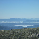
This popular walk starts at Charlotte Pass and follows the Old Kosciuszko Road, as it winds through the mountains, to Rawsons Pass, then continues to the top of Kosciuszko. The walk passes the well known Snowy River and Seamans Hut. From Rawsons Pass it is a fairly short walk up the footpath to Mt Kosciuszko’s peak. On a clear day the views span all the way to the horizon in every direction from the highest spot in Australia.


Covered in snow part of the year
This walk leads through an extreme alpine environment and all walkers must be well prepared. During summer, be prepared for both very hot and cold weather, high winds, rain, snow, extreme UV levels and some sections of snow or ice on the ground. Before starting this walk, check advice with Snowy Region Visitor Information Centre (02) 6450 5600, the weather forecast and the snow conditions then change your plans as needed. These notes, grades and walking times have been written for use in the summer months only. Between May and the end of October, this walk is likely to be covered in snow/ice, visitors should carry and be prepared to use snowshoes or cross country skis. When there is a chance of significant snow on the ground, visitors will need particularly strong navigation and snowcraft skills – tracks and signage may not be visible. For most visitors, it is best to consider this walk closed during the colder months.
Between the long weekend in June and October, the road between Perisher Village and Charlotte Pass is closed by the RTA. It is possible to organise oversnow transport.
Between the long weekend in June and October, the road between Perisher Village and Charlotte Pass is closed by the RTA. It is possible to organise oversnow transport.
(0km) End of Kosciuszko Road → Snowy River bridge
4.5 km
1 hr 27 mins
164m
-73m
Hard track
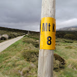
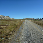
From the end of Kosciuszko Rd at Charlotte Pass[1] (just near the toilet block[2]), this walk heads along a wide management trail[3], following the large ‘Summit walk’ sign[4]. The walk initially dips down a bit[5] and heads through a grove of snow gums[6]. This walk soon leaves the snow gums and the landscape opens to a fantastic view of the Snowy River and the valley (on your right)[7]. After about 1km, the walk passes a yellow ‘MT K 8’ sign[8] on a snow pole. This walk continues along the management trail and gently undulates up along the side of the long ridge, passing several more ‘Mt K’ milestone signs counting down. After a while, the old road heads up and over a ridge[9], passing the ‘MT K 5’[10] and the original ‘K 3’ milestone (on your left) to find the un-signposted concrete bridge over Merritts Creek[11].
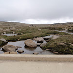
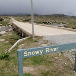
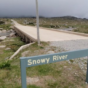
Continue straight: From the bridge, this walk follows the management trail west through the valley, where the trail soon bends right and passes a ‘Snowy River’ sign[12], coming to the bridge crossing the river[13].
Continue straight: From the bridge, this walk follows the management trail west through the valley, where the trail soon bends right and passes a ‘Snowy River’ sign[12], coming to the bridge crossing the river[13].
(4.48km) Snowy River bridge → Seamans Hut
1.5 km
27 mins
95m
0m
Hard track
Continue straight: From the ‘Snowy River’ sign[14], this walk crosses the bridge and heads north-west up along the management trail[15]. The trail bends right and heads up towards Seamans Hut (visible in clear weather[16]). The walk winds up the long hill and bends left, near a flat clearing with some valley views (to your right[17]). Here, the old road bends left and heads up the hill, coming to the signposted ‘Seamans Hut’[18].
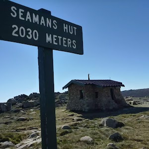
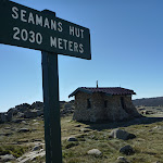
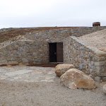
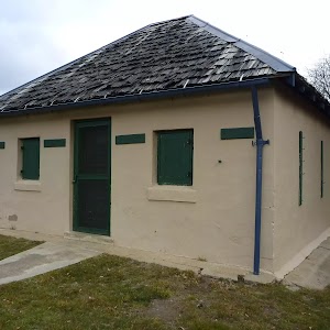
Seamans Hut
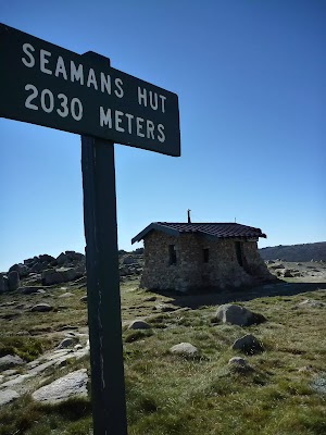
This hut was erected in 1929, after a young skier named Laurie Seaman perished in a blizzard when he was separated from his group. The hut was built using money donated by Seaman’s parents, for the use of those who might need emergency shelter in the mountains. It was renovated in 1938 due to fire. Seamans Hut is a 7m x3m granite stone building with a wood stove, although there is little wood in the area. More info.
(5.99km) Seamans Hut → Rawson Pass
1.6 km
31 mins
114m
-15m
Hard track
Continue straight: From ‘Seamans Hut’[20], this walk follows the management trail, heading west up the gentle hill, keeping the large valley to your right[21]. The trail winds steadily up along the side of the long hill and, about 150m past the road cutting, this trail leads to a stone path and Australia’s highest toilet block[22]. The walk then follows the stone path past the toilet and bike parking area[23] to come to a clearly signposted three-way intersection at ‘Rawson Pass’[24].
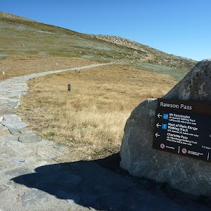
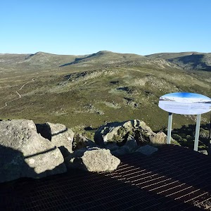
Rawson Pass

Rawson Pass is where the old Kosciuszko Road, from Charlotte Pass, meets the metal walkway from Thredbo. It is home to highest public toilet in Australia, this recently-added facility is perfectly positioned for those taking the walk up to the top of Kosciuszko. Rawson Pass is well signposted and 500m south east of Mt Kosciuszko (by straight line). There is also a place for to park mountain bikes for those cycling along the old road from Charlotte Pass.
(7.6km) Rawson Pass → Mt Kosciuszko
1.6 km
39 mins
127m
-23m
Hard track
Veer right: From the intersection at Rawson Pass, this walk follows the ‘Mt Kosciuszko’ sign[25] uphill along the stone pathway. The stone pathway soon becomes a gravel track and winds up and around the hill, keeping the peak of Mt Kosciuszko to your left. About 500m along the gravel track, this walk comes to a ‘Y’ intersection[26] (with the Kosciuszko summit track on your left), just past the ‘Alpine Walks’ sign and map[27].
Veer left: From the intersection, this walk follows the ‘Mt Kosciuszko’ sign[28] uphill along the upper track. This track winds steadily up and around the peak of the mountain, passing a stone-paved[29] section of track, and also a metal grate[30] before climbing a few steps[31] to the cairn at the peak of Mt Kosciuszko[32].
Veer left: From the intersection, this walk follows the ‘Mt Kosciuszko’ sign[28] uphill along the upper track. This track winds steadily up and around the peak of the mountain, passing a stone-paved[29] section of track, and also a metal grate[30] before climbing a few steps[31] to the cairn at the peak of Mt Kosciuszko[32].
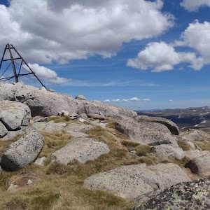
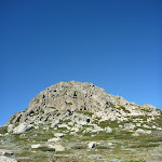
Mt Kosciuszko

Mt Kosciuszko is the highest peak on the Australian continent, at 2228m above sea level. It was named by the Polish explorer Count Paul Edmund Strzelecki and named in honour of the Polish national hero General Tadeusz Kościuszko. Now a popular tourist attraction, thousands of people walk up to the summit each year. On a clear day, the 360-degree views from the summit across the roof of Australia are fantastic. There are higher mountains elsewhere on Australian territory. ‘The highest mountains in Australian Antarctic Territory are Mt McClintock (3490 meters) and Mt Menzies (3355 meters).’ .
Maps for the Summit walk – Charlotte Pass to Mount Kosciuszko – Summit Trail walk
You can download the PDF for this walk to print a map.
These maps below cover the walk and the wider area around the walk, they are worth carrying for safety reasons.
| Perisher Valley | 1:25 000 Map Series | 85252S PERISHER VALLEY | NSW-85252S |
| Kosciuszko | 1:100 000 Map Series | 8525 KOSCIUSZKO | 8525 |
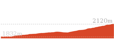
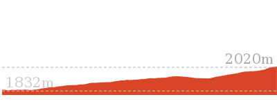
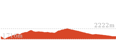
Cross sectional view of the Summit walk – Charlotte Pass to Mount Kosciuszko – Summit Trail bushwalking track
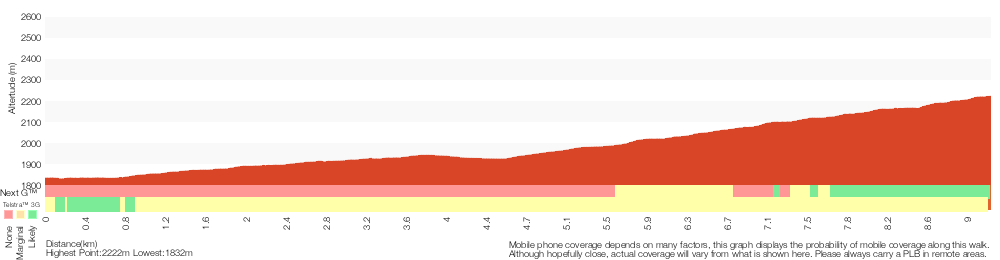
Analysis and summary of the altitude variation on the Summit walk – Charlotte Pass to Mount Kosciuszko – Summit Trail
Overview of this walks grade – based on the AS 2156.1 – 2001
Under this standard, a walk is graded based on the most difficult section of the walk.
| Length | 18.5 km | ||
| Time | 6 hrs | ||
| . | |||
| Grade 4/6 Hard track |
AS 2156.1 | Gradient | Short steep hills (3/6) |
| Quality of track | Clear and well formed track or trail (2/6) | ||
| Signs | Clearly signposted (1/6) | ||
| Experience Required | No experience required (1/6) | ||
| Weather | Forecast, unforecast storms and severe weather may impact on navigation and safety (4/6) | ||
| Infrastructure | Generally useful facilities (such as fenced cliffs and seats) (1/6) |
Some more details of this walks Grading
Here is a bit more details explaining grading looking at sections of the walk
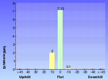
Gradient
5km of this walk is flat with no steps and another 2.3km has gentle hills with occasional steps. The remaining (1.5km) has short steep hills.
Quality of track
This whole walk, 9km follows a clear and well formed track or trail.
Signs
This whole walk, 9km is clearly signposted.
Experience Required
This whole walk, 9km requires no previous bushwalking experience.
weather
This whole walk, 9km is affected by forecast, unforecast storms and severe weather events that may impact on navigation and safety.
Infrastructure
This whole walk, 9km is close to useful facilities (such as fenced cliffs and seats).
Similar walks
A list of walks that share part of the track with the Summit walk – Charlotte Pass to Mount Kosciuszko – Summit Trail walk.
9 km Return
3 hrs
Hard track

12 km Return
4 hrs 30 mins
Hard track
12.2 km One way
5 hrs
Hard track
12.4 km Return
6 hrs
Hard track
15.2 km Return
5 hrs 30 mins
Hard track
21.9 km Circuit
9 hrs
Hard track
25.8 km One way
2 Days
Experienced only
27.7 km Circuit
2 Days
Experienced only
45 km Circuit
4 Days
Experienced only
Other Nearby walks
A list of walks that start near the Summit walk – Charlotte Pass to Mount Kosciuszko – Summit Trail walk.
3.8 km Return
1 hr 45 mins
Hard track
9.3 km Return
4 hrs
Hard track
1.6 km Return
45 mins
Hard track
374 m Return
15 mins
Moderate track
4.2 km Circuit
2 hrs 15 mins
Hard track
778 m Return
30 mins
Moderate track
2.4 km Return
1 hr 30 mins
Hard track
5.6 km Return
2 hrs 30 mins
Hard track

5.2 km Circuit
2 hrs
Moderate track
4.5 km Circuit
1 hr 30 mins
Moderate track

1.5 km Return
30 mins
Moderate track
3 km Circuit
1 hr 30 mins
Moderate track
Plan your trip to and from the walk here
The Summit walk – Charlotte Pass to Mount Kosciuszko – Summit Trail walk starts and ends at the End of Kosciuszko Road (gps: -36.431855, 148.32828)
Your main transport option to End of Kosciuszko Road is by;
![]() Car. A park entry fee is required for driving into the park.
Car. A park entry fee is required for driving into the park.
(get details)
Short URL = http://wild.tl/1p
Gallery images
There are other downloads I am still working on.
You will probably need to login to access these — still all free.
* KML (google earth file)
* GPX (GPS file)
Special Maps/ brochures
* A3 topo maps
* PDF with Lands Topo map base
* PDF with arial image (and map overlay)
I wanted to get the main site live first, this extra stuff will come in time.
Happy walking
Matt 🙂
Wheatley Circuit
And Walk
Wheatley Circuit

3 hrs
7.3 km Circuit
251 m
Hard track
This snowshoe walk follows a winter-only route. From Perisher Valley, you walk up along the Kosciuszko Rd to a gap, just past the last ski lift. Here you leave the road to follow the snow pole line up along the Wheatley Link among the snow gums and crossing some open plains. This link leads up to a valley below Porcupine Rocks, where you follow the snow poles and valley back down towards Perisher. A great walk for people comfortable on snowshoes and wanting to explore a more remote area near Perisher Valley.


Share the Snow
Here are some tips to help you share the snow with skiers. Please avoid snowshoeing on ski trails, whether groomed or ungroomed – it is fine to walk right next to the ski trail. When crossing a ski trail, please do so in a single file and on a flat, more visible, section. These tips aim to minimise trail ruts and collisions. Visit Wilderness Sports for snowshoe hire.
Winter only route
This walk follows an over-snow only route. During the warmer months, this walk crosses important and sensitive bogs that can be significantly damaged, even by light footed walkers. Please only walk this track when it is well covered with snow.
Perisher Valley Village
Perisher Valley village is centred about the Skitube[1] building, Perisher Centre[2] and the National Park Visitor Centre[3]. Just outside the Skitube is the shelter for the shuttle bus service to Smiggins. Perisher Centre is accessed by the long metal bridge – inside, you will find food shops, toilets and skiing-related shops. Inside the Skitube building is the train station, kiosk, medical centre and some other services. The National Park Visitor Centre provides a warm shelter, toilets, seats and information about the park. Most of these services only operate during the ski season, but the NPWS visitor centre is open most of the year and a food outlet is generally open for lunch Monday-Friday.
(0km) Int Kosciuszko and Porcupine Rds → Rock Creek Ski Club intersection
180 m
3 mins
0m
-2m
Moderate track
From the intersection, this walk heads west along the main Kosciuszko Rd, away from the ‘The Man from Snowy River Hotel’[4] and keeping the main valley to your right. The walk soon crosses Rock Creek, then continues beside the road to an intersection marked with a ‘Rock Creek Snowshoe Track’ sign[5] just after the ‘Rock Creek Ski Club’ hut[6](both on your left).
Rock Creek Ski Club
This building was first opened for use in 1948 then destroyed by a lighting strike in January the next year. In 1959, a few men drove down from Sydney most weekends over a few years to build the current lodge. Still owned by the builders’ families, the lodge is available to the public for hire. The lodge has two bedrooms and sleeps 6 people. The lodge can be hired in winter or in summer and makes for a great base with its central location in Perisher Valley. rockcreek.org.au [email protected] More info.
(0.18km) Rock Creek Ski Club intersection → Int Wheatley Link Track and Kosciuszko Rd
2.1 km
40 mins
111m
-25m
Moderate track
Continue straight: From the Rock Creek Ski Club intersection[11][12], this walk follows Kosciuszko Rd gently uphill[13], away from the main village. After about 50m, this walk continues along the road, passing a track (which leads to bridge[14] over Perisher Creek, on your right) and continuing for about another 60m to find an intersection with Wheatley Rd, just before ‘Corroboree Restaurant & Bar’[15][16] (on your left).
Continue straight: From this intersection, this walk follows the Kosciuszko Rd east gently uphill, out of town. The walk immediately passes ‘Corroboree Restaurant & Bar’[17] (on your left) and continues up the hill past a series of other lodges [18][19] (up to your left). The road steadily begins to climb a bit more steeply, then soon after passing the last ski lift (in the valley on your right[20]), the road comes to a high point and a clearing[21] with a large metal sign and map[22] (on your left).
Continue straight: From this intersection, this walk follows the Kosciuszko Rd east gently uphill, out of town. The walk immediately passes ‘Corroboree Restaurant & Bar’[17] (on your left) and continues up the hill past a series of other lodges [18][19] (up to your left). The road steadily begins to climb a bit more steeply, then soon after passing the last ski lift (in the valley on your right[20]), the road comes to a high point and a clearing[21] with a large metal sign and map[22] (on your left).
(2.3km) Int Wheatley Link Track and Kosciuszko Rd → Int of Porcupine Trail and Wheatley Link Track
1.9 km
39 mins
127m
-41m
Hard track
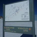
Turn left: From the grassy clearing on the south side of Kosciuszko Road[23], this walk follows the ‘Wheatley Link’ sign[24] uphill following the snow-poles. The track leads through a narrow grove of snow gums[25], then climbs up to a flat clearing[26] to follow the line of snow poles[27] up through the trees. After dipping down a bit, the poles wind up the hill to pass through a gap in the ridge[28], revealing a large fairly flat plain[29] (with a view back over Perisher, behind you[30]). The walk continues to follow the poles down and across the plain[31]. The poles soon lead right, rounding a rocky outcrop[32] (on your right) and passing a open section, where the poles then tends left and up the hill. The walk soon comes to a intersection in a large saddle[33], near a sign pointing back down ‘Wheatley Link’ track[34].
(4.19km) Int of Porcupine Trail and Wheatley Link Track → Porcupine Saddle
320 m
8 mins
25m
-7m
Hard track
Turn right: From the intersection, this walk follows the ‘Porcupine’ trail signs[35][36] north-west over the top of the saddle and towards the large rocky pinnacle[37]. The track soon begins to steepen through a rocky area and, just after passing a large rocky outcrop[38] (on your left), the track leads up to a three-way intersection beside the gap[39] (on your left) between the two main peaks[40]. At the end of this side trip, retrace your steps back to the main walk then Continue straight.
Porcupine Rocks
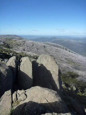
The Porcupine Rocks are a large granite outcrop on the ridge, south of Perisher Valley. There are two main peaks[41][42], and a rock scramble[43] leads to the top of the southern peak, providing fantastic views of Perisher Valley[44], Mt Duncan[45], Thredbo River Valley[46] and Bullocks Flat. The gap between the two summits provides some shade and protection from the wind. An amazing place to visit – allow time to just relax and enjoy this place. The summit can be slippery and icy, and there is a shear drop and other hazards. Much care is required.
(4.19km) Int of Porcupine Trail and Wheatley Link Track → Int of Porcupine and Link Track
1.3 km
31 mins
7m
-109m
Hard track
Turn left: From the intersection, this walk heads north-east, downhill, following the old timber ‘Perisher Valley 3km’ sign[47]. The track leads down through the wide valley past the newer sign (pointing back up to ‘Porcupine Trail’[48]), over some metal grates and through a grove of old dead snow gums to come to a signposted intersection with the Porcupine Link Track (on your right)[49].
(5.52km) Int of Porcupine and Link Track → Perisher Reservoir intersection
1.1 km
22 mins
2m
-58m
Hard track
Continue straight: From the intersection, this walk follows the ‘Perisher Valley 2km’ sign[50] north-east along the track that soon leads across an flat timber bridge[51] over Rock Creek. Now, the walk leaves the creek for a while and heads downhill, following the series of snow-poles[52] on a groomed trail towards the Perisher Valley Resort[53]. After about 1km and just before the Perisher Valley Reservoir[54], the snow poles lead left[55] across a valley (near the stone pump house building[56]) to head up the rise to a three-way intersection with another snow-pole line[57], near the pole with the second yellow sign[58].
(6.62km) Perisher Reservoir intersection → Int Kosciuszko and Porcupine Rds
680 m
12 mins
4m
-16m
Moderate track
Veer right: From the intersection, this walk follows the snow-pole line (with the yellow signs, facing away) over the gentle rise[59], whilst keeping Rock Creek a short distance to your right. The track leads over the hill, keeping the poles to your right, and soon passes a large green timber lodge[60]. The walk leads down closer to the creek[61] and continues following the snow-poles, soon passing straight through an intersection (ignoring the bridge over Rock Creek to your right[62]). The poles lead over another small rise past the Rock Creek Ski Club building[63], then under the power-lines to find the ‘Rock Creek Snowshoe Track’ information sign[64]. Here, the walk heads the short distance towards the main ski field to an intersection with Kosciuszko Rd[65].
Turn right: From this intersection near the ‘Rock Creek Ski Club’ hut[66], this walk follows the main road gently downhill[67] towards the resort centre, where the road soon crosses Rock Creek[68]. The walk crosses the creek[69] and passes a few buildings to come to an intersection with Porcupine Road[70] (on your right), just before ‘The Man from Snowy River Hotel’[71] (and the ski tube station on your left[72]).
Turn right: From this intersection near the ‘Rock Creek Ski Club’ hut[66], this walk follows the main road gently downhill[67] towards the resort centre, where the road soon crosses Rock Creek[68]. The walk crosses the creek[69] and passes a few buildings to come to an intersection with Porcupine Road[70] (on your right), just before ‘The Man from Snowy River Hotel’[71] (and the ski tube station on your left[72]).
Maps for the Wheatley Circuit walk
You can download the PDF for this walk to print a map.
These maps below cover the walk and the wider area around the walk, they are worth carrying for safety reasons.
| Perisher Valley | 1:25 000 Map Series | 85252S PERISHER VALLEY | NSW-85252S |
| Kosciuszko | 1:100 000 Map Series | 8525 KOSCIUSZKO | 8525 |
Cross sectional view of the Wheatley Circuit bushwalking track
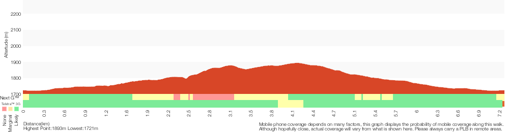
Analysis and summary of the altitude variation on the Wheatley Circuit
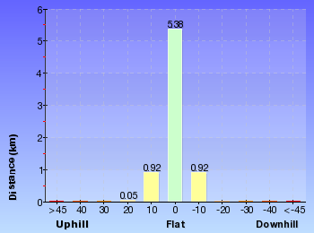
Overview of this walks grade – based on the AS 2156.1 – 2001
Under this standard, a walk is graded based on the most difficult section of the walk.
| Length | 7.3 km | ||
| Time | 3 hrs | ||
| . | |||
| Grade 4/6 Hard track |
AS 2156.1 | Gradient | Short steep hills (3/6) |
| Quality of track | Formed track, with some branches and other obstacles (3/6) | ||
| Signs | Directional signs along the way (3/6) | ||
| Experience Required | Moderate level of bushwalking experience recommended (4/6) | ||
| Weather | Forecast, unforecast storms and severe weather may impact on navigation and safety (4/6) | ||
| Infrastructure | Limited facilities, not all cliffs are fenced (3/6) |
Some more details of this walks Grading
Here is a bit more details explaining grading looking at sections of the walk
Gradient
4.8km of this walk has short steep hills and another 2km has gentle hills with occasional steps. The remaining (480m) is flat with no steps.
Quality of track
4.8km of this walk follows a formed track, with some branches and other obstacles and another 2km follows a clear and well formed track or trail. The remaining (480m) follows a smooth and hardened path.
Signs
Around 4.3km of this walk is clearly signposted, whilst the remaining 3km has directional signs at most intersection.
Experience Required
2.9km of this walk requires some bushwalking experience and another 2.5km requires no previous bushwalking experience. The remaining (1.9km) requires a leader a with moderate level of bushwalking experience.
weather
4.3km of this walk is affected by forecast, unforecast storms and severe weather events that may impact on navigation and safety and another 2.1km is not usually affected by severe weather events (that would unexpectedly impact safety and navigation). The remaining (860m) is affected by storms that may impact your navigation and safety.
Infrastructure
Around 5km of this walk has limited facilities (such as not all cliffs fenced), whilst the remaining 2.3km is close to useful facilities (such as fenced cliffs and seats).
Similar walks
A list of walks that share part of the track with the Wheatley Circuit walk.
3 km Circuit
1 hr 30 mins
Moderate track
5.6 km Return
2 hrs 30 mins
Hard track
Other Nearby walks
A list of walks that start near the Wheatley Circuit walk.
5.2 km One way
2 hrs 45 mins
Hard track
17.4 km Return
8 hrs
Experienced only
25.8 km One way
2 Days
Experienced only
15.2 km One way
6 hrs 30 mins
Experienced only
6.4 km Return
2 hrs 45 mins
Moderate track
14.8 km Return
6 hrs 45 mins
Experienced only
6.4 km Return
2 hrs 30 mins
Moderate track
45 km Circuit
4 Days
Experienced only
3.3 km Return
1 hr 30 mins
Hard track
6 km Return
3 hrs
Very experienced only
5.2 km Circuit
2 hrs
Moderate track
4.5 km Circuit
1 hr 30 mins
Moderate track
Plan your trip to and from the walk here
The Wheatley Circuit walk starts and ends at the Int Kosciuszko and Porcupine Rds (gps: -36.405802, 148.41192)
Your main transport option to Int Kosciuszko and Porcupine Rds is by;
![]() Car. A park entry fee is required for driving into the park.
Car. A park entry fee is required for driving into the park.
(get details)
Short URL = http://wild.tl/1n
Gallery images
There are other downloads I am still working on.
You will probably need to login to access these — still all free.
* KML (google earth file)
* GPX (GPS file)
Special Maps/ brochures
* A3 topo maps
* PDF with Lands Topo map base
* PDF with arial image (and map overlay)
I wanted to get the main site live first, this extra stuff will come in time.
Happy walking
Matt 🙂
Cascade Hut
And Walk
Cascade Hut

7 hrs 30 mins
19.6 km Return
797 m
Hard track
Starting near Dead Horse Gap on the Alpine Way, you will follow the wide Cascade Trail past Bobs Ridge to Cascade Hut in the Pilot Wilderness Area. You follow the Thredbo River for a while before heading over Bobs Ridge, enjoying the distant views into Victoria. The walk then explores a few wooded forests before crossing Cascade Creek and then finding Cascade Hut. The hut is a great place to rest or camp.
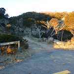

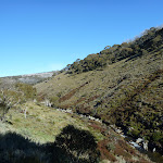
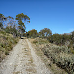


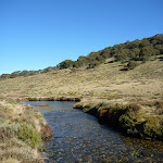
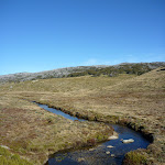
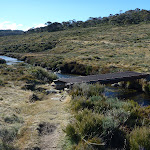
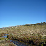
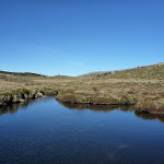
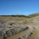

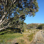

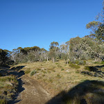
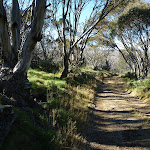
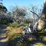
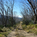
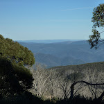


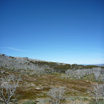
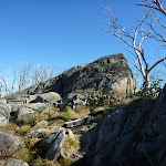
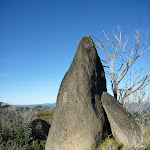
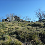
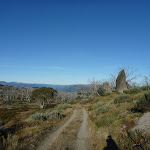
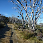


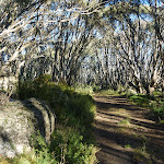
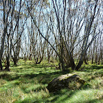


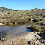
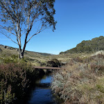
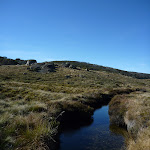
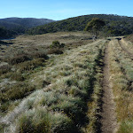


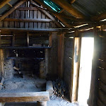


Covered in snow part of the year
This walk leads through an extreme alpine environment and all walkers must be well prepared. During summer, be prepared for both very hot and cold weather, high winds, rain, snow, extreme UV levels and some sections of snow or ice on the ground. Before starting this walk, check advice with Snowy Region Visitor Information Centre (02) 6450 5600, the weather forecast and the snow conditions then change your plans as needed. These notes, grades and walking times have been written for use in the summer months only. Between May and the end of October, this walk is likely to be covered in snow/ice, visitors should be carrying and be prepared to use snowshoes or cross country skis. When there is a chance of significant snow on the ground, visitors will need particularly strong navigation and snowcraft skills – tracks and signage may not be visible. For most visitors, it is best to consider this walk closed during the colder months.
Dead Horse Gap
Dead Horse Gap is a relativley low mountain pass in the Great Dividing Range at 1582m AMSL. It was once a meeting place for Aboriginal groups in the summer, where they would perform ceremonies and trade with each other. In nature the pass acts as a funnel for the migration of insects and birds[1]. In the early 20th century, the pass became increasingly popular with stockmen, who brought sheep and cattle to the mountains each summer.[2]
(0km) Cascades Trail track head → North side of Thredbo River Bridge track
2.1 km
44 mins
100m
-48m
Hard track
From the car park (on the Alpine Way 5.4km west of Friday Drive), this walk follows the ‘Cascade Trail’ sign[3] along the management trail and around the locked gate. The trail soon leads past a ‘Wilderness Entry’ information sign[4] as it winds along the side of the hill, keeping the Thredbo River below[5] and to your right. The trail leads up the side of the hill moderately steeply[6], crossing a few small creeks[7][8] before leading back down to cross another creek, very close to the Thredbo River[9]. Here the trail continues through the valley for about 400m to find an intersection with a track[10] (on the right, leading to a bridge), just before the trail crosses the Thredbo River[11].
(2.13km) North side of Thredbo River Bridge track → Bobs Ridge
2.7 km
1 hr 4 mins
212m
-19m
Hard track
Veer right: From the intersection, this walk heads downhill along the narrow track[12] to cross the Thredbo River on the flat, narrow, metal bridge[13]. Then, a short track leads to an intersection, meeting again with the Cascade Trail[14] (now on the other side of the creek crossing).
Veer right: From the intersection, this walk heads uphill along the management trail[15], away from the Thredbo River. The trail soon bends left and crosses a smaller creek[16], then winds up out of the valley, passing some short granite tors[17] (on your right). Here the trail bends right and leads up into the snow gum forest. The trail climbs up along the ridge (with a view across the valley to Thredbo behind) and about 900m after entering the snow gum forest, the trail flattens out for a few hundred metres (passing a faint track on your right which leads to a clearing). The trail then begins to climb again and after about 200m, leads through a section of dead snow gums and continues uphill to find a ‘Bobs Ridge’ sign[18] near a few large granite outcrops (on your right) and some great views.
Veer right: From the intersection, this walk heads uphill along the management trail[15], away from the Thredbo River. The trail soon bends left and crosses a smaller creek[16], then winds up out of the valley, passing some short granite tors[17] (on your right). Here the trail bends right and leads up into the snow gum forest. The trail climbs up along the ridge (with a view across the valley to Thredbo behind) and about 900m after entering the snow gum forest, the trail flattens out for a few hundred metres (passing a faint track on your right which leads to a clearing). The trail then begins to climb again and after about 200m, leads through a section of dead snow gums and continues uphill to find a ‘Bobs Ridge’ sign[18] near a few large granite outcrops (on your right) and some great views.
Bob’s Ridge
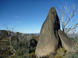
Bob’s Ridge is a highlight along the Cascades Trail. The ridge is signposted[19], and a large granite outcrop is just to the west of the signpost. The rounded boulders vary in shape and size[20]. It is possible to climb up some of the rocks for an even better view. On a clear day, there are expansive views south-west across the Murray River valley into Victoria[21], only 6.5km away. There are many interesting rock formations to enjoy and, if you are quiet, you may see Brumbies that enjoy the grove of trees to the south.
(4.85km) Bobs Ridge → Cascade Creek Crossing
3.9 km
1 hr 17 mins
17m
-345m
Hard track
Continue straight: From Bobs Ridge[22], this walk heads south along the management trail gently downhill, initially keeping the granite tors to your right[23]. The trail soon heads across the small valley[24] (ignoring the faint trail on the left[25]) and follows the broad ridge downhill. The trail leads through the lovely snow gum forest[26] with a scattering of granite boulders[27] for about 2.3km, where the trail bends sharply left at a hair-pin bend[28]. Soon after this bend, the trail heads moderately steeply[29] down to cross a valley with a grove of tall Alpine Ash trees[30]. After crossing the small creek[31], the trail leads along the side of the hill though a run of dead alpine ash and snow gums[32]. The trail then leads down two short but steep sections[33], leaving the trees to come to an intersection[34] just before Cascade Creek[35].
(8.72km) Cascade Creek Crossing → Cascade Hut intersection
980 m
19 mins
38m
-7m
Hard track
Continue straight: From the intersection, this walk crosses the creek using the flat metal bridge[36] (just upstream of the main crossing[37]), marked with a solitary snow gum. The walk then turns left and follows the management trail beside the creek[38] for about 80m before bending right around a rock outcrop[39] and heading up to the tree line. The trail then heads briefly through some snow gums before leading along the side of the hill below the tree line for a while[40]. Then about 300m after entering the next lot of snow gums[41], the trail bends right (leaving the main valley), coming to an intersection with a grassy management trail[42] (on your left).
(9.7km) Cascade Hut intersection → Cascade Hut
110 m
2 mins
0m
-11m
Moderate track
Cascade Hut
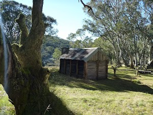
Cascade Hut was built by Bill Nankervis and other stock-men in 1935 to assist with their grazing. This hut is made from horizontal slabs of wood[46], with the roof and floor having been upgraded over the years. There is a wooden sleeping platform[47] and fireplace[48] inside. There is good camping around the hut, with flat fields, a large fire scar with bench seating[49], a toilet [50] and plenty of brumbies[51] to add interest. Cascade Hut is maintained by Ilawarra Alpine Club. More info.
Maps for the Cascade Hut walk
You can download the PDF for this walk to print a map.
These maps below cover the walk and the wider area around the walk, they are worth carrying for safety reasons.
| Chimneys Ridge | 1:25 000 Map Series | 85241N CHIMNEYS RIDGE | NSW-85241N |
| Jacobs River | 1:100 000 Map Series | 8524 JACOBS RIVER | 8524 |
Cross sectional view of the Cascade Hut bushwalking track
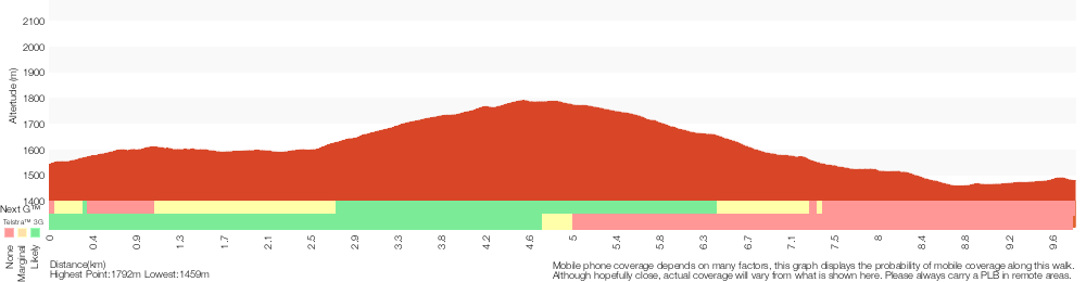
Analysis and summary of the altitude variation on the Cascade Hut
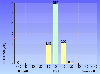
Overview of this walks grade – based on the AS 2156.1 – 2001
Under this standard, a walk is graded based on the most difficult section of the walk.
| Length | 19.6 km | ||
| Time | 7 hrs 30 mins | ||
| . | |||
| Grade 4/6 Hard track |
AS 2156.1 | Gradient | Short steep hills (3/6) |
| Quality of track | Formed track, with some branches and other obstacles (3/6) | ||
| Signs | Minimal directional signs (4/6) | ||
| Experience Required | Moderate level of bushwalking experience recommended (4/6) | ||
| Weather | Forecast, unforecast storms and severe weather may impact on navigation and safety (4/6) | ||
| Infrastructure | Limited facilities, not all cliffs are fenced (3/6) |
Some more details of this walks Grading
Here is a bit more details explaining grading looking at sections of the walk
Gradient
Around 9km of this walk has short steep hills, whilst the remaining 1.2km has gentle hills with occasional steps.
Quality of track
Around 9km of this walk follows a clear and well formed track or trail, whilst the remaining 1.1km follows a formed track, with some branches and other obstacles.
Signs
Around 5km of this walk has directional signs at most intersection, whilst the remaining 4.9km has minimal directional signs.
Experience Required
7km of this walk requires a leader a with moderate level of bushwalking experience and another 2.2km requires some bushwalking experience. The remaining (110m) requires no previous bushwalking experience.
weather
Around 10km of this walk is affected by forecast, unforecast storms and severe weather events that may impact on navigation and safety, whilst the remaining 110m is affected by storms that may impact your navigation and safety.
Infrastructure
Around 10km of this walk has limited facilities (such as not all cliffs fenced), whilst the remaining 110m is close to useful facilities (such as fenced cliffs and seats).
Similar walks
A list of walks that share part of the track with the Cascade Hut walk.
9.7 km Return
4 hrs
Hard track
Other Nearby walks
A list of walks that start near the Cascade Hut walk.
10.1 km Circuit
5 hrs
Hard track
4.1 km Return
1 hr 45 mins
Moderate track
5.3 km One way
3 hrs
Hard track
4.7 km Return
2 hrs
Moderate track
3.3 km Circuit
1 hr 15 mins
Moderate track
4.8 km One way
1 hr 45 mins
Moderate track
3.7 km Circuit
2 hrs 30 mins
Hard track
5.8 km Circuit
3 hrs
Hard track
3.8 km Return
2 hrs 30 mins
Hard track
7.5 km Return
3 hrs 45 mins
Hard track
12.4 km Return
6 hrs
Hard track
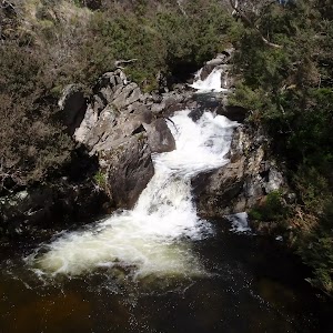
9.8 km Circuit
4 hrs 30 mins
Hard track
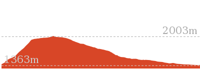
Plan your trip to and from the walk here
The Cascade Hut walk starts and ends at the Cascades Trail track head (gps: -36.522927, 148.26452)
Your main transport option to Cascades Trail track head is by;
![]() Car. A park entry fee is required for driving into the park.
Car. A park entry fee is required for driving into the park.
(get details)
Short URL = http://wild.tl/1q
Gallery images
There are other downloads I am still working on.
You will probably need to login to access these — still all free.
* KML (google earth file)
* GPX (GPS file)
Special Maps/ brochures
* A3 topo maps
* PDF with Lands Topo map base
* PDF with arial image (and map overlay)
I wanted to get the main site live first, this extra stuff will come in time.
Happy walking
Matt 🙂
Charlotte Pass Village and Mt Stilwell loop

2 hrs 15 mins
4.2 km Circuit
295 m
Hard track
This loop walk starts at Charlotte Pass, and winds up to Mt Stilwell’s peak, with stunning views in every direction. The walk then goes along the ridge line to the village lookdown, near the demolished Tbar station, before returning to the village through the snow gum forest. There is an optional side trip to the village dam, in Spencers Creek, that is a nice area for a picnic before returning to the village.
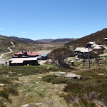
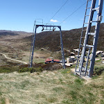


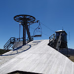

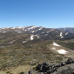
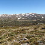

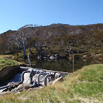
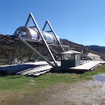

Covered in snow part of the year
This walk leads through an extreme alpine environment and all walkers must be well prepared. During summer, be prepared for both very hot and cold weather, high winds, rain, snow, extreme UV levels and some sections of snow or ice on the ground. Before starting this walk, check advice with Snowy Region Visitor Information Centre (02) 6450 5600, the weather forecast and the snow conditions then change your plans as needed. These notes, grades and walking times have been written for use in the summer months only. Between May and the end of October, this walk is likely to be covered in snow/ice, visitors should carry and be prepared to use snowshoes or cross country skis. When there is a chance of significant snow on the ground, visitors will need particularly strong navigation and snowcraft skills – tracks and signage may not be visible. For most visitors, it is best to consider this walk closed during the colder months.
Between the long weekend in June and October, the road between Perisher Village and Charlotte Pass is closed by the RTA. It is possible to organise oversnow transport.
Between the long weekend in June and October, the road between Perisher Village and Charlotte Pass is closed by the RTA. It is possible to organise oversnow transport.
Charlotte Pass Village
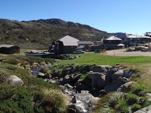
Charlotte Pass is a small village consisting mostly of resorts and hotels, and a number of neighbouring ski runs. This small township is located a stone’s throw from the end of Kosciuszko Road, where the turning circle and public toilets were put in place after the last stretch of the road (that winds down across the Snowy River and up to Rawsons Pass via Seamans Hut) was closed to public vehicles. More info.
(0km) Bottom of Basin Poma lift → Top of Pulpit Tbar
510 m
13 mins
103m
0m
Moderate track
From the bottom of the Basin Poma lift, this walk follows the grassy management trail which winds along the side of the hill. The walk turns up the ridge towards the top of the Pulpit T-bar and leaves the management trail as it fades out. The walk continues up the ridge to the top of the Pulpit T-bar.
(0.51km) Top of Pulpit Tbar → Kangaroo Ridge chairlift lookout platform
650 m
13 mins
61m
0m
Moderate track
Turn left: From the top of the Tbar[1], the walk follows the clear track up the ridge line towards the rusty ruins of an old ski lift[2]. The track soon passes in front of the old lift[3] and then continues to climb up a series of stone steps winding between the granite boulders and snow gums[4]. The track enjoys wide views down over Charlotte Pass village to your left[5]. The track continues up to come a metal platform and lookout[6] (on your right) just near the top of the Kangaroo Ridge Chairlift[7].
Kangaroo Ridge chairlift lookout platform
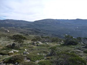
At the top of the Kangaroo Ridge chairlift lies a steel platform. This partially fenced lookout offers broad views to the north-west over the Snowy River valley and across the Main Range. From the chairlift, there are also views down to Charlotte Pass Village[8].
(1.16km) Kangaroo Ridge chairlift lookout platform → Mt Stilwell
1.1 km
22 mins
119m
-1m
Hard track
Continue straight: From the Kangaroo Ridge chairlift lookout platform[9], this walk heads south, behind the chairlift station[10][11] and along the grassy track[12], keeping Charlotte Pass village to your left. The track leads up between some granite boulders and becomes much clearer again. Here the track winds gently uphill and up a series of stone steps[13] before heading down across a valley and over two small metal grate bridges[14]. About 100m after the second metal grate the track leads to a rocky and boggy hollow[15]. From here the track narrows[16] and starts to round Mt Stilwell (to your right). The track continues to bend right to the side of Stilwell saddle (where you can see down to the snow poles on your left). Here the fainter track leads almost straight up the side of Mt Stilwell[17] heading for the rocky summit marked with a metal trig[18]. Near the top the walk climbs over the granite boulders[19] to find the summit[20] and the impressive 360 degree view.
Mt Stilwell
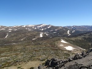
At approximately 2040m above sea level, Mt Stilwell is the highest peak in the ridge line winding around the southern side of Charlotte Pass village. With arguably one of the best views in the Kosciusko National Park, Mt Stilwell’s peak looks down at the village, and out across the main range to Headley Tarn, Blue Lake and Mt Twynam, and the Snowy River. There is also the lower half of an old trig point located at the peak which, when whole, was used for navigation.
(2.22km) Mt Stilwell → Village Lookdown saddle
900 m
21 mins
11m
-69m
Hard track
Turn around: From the top of Mt Stilwell[22], this walk heads south-east down towards the saddle[23]. About two thirds of the way down to the saddle, this walk ignores the clear track that veers left (around the side of Mt Stillwell) and continues straight down the side of the hill, following a very faint track down into the saddle to pass a snowpole line[24]. The route continues east up the other side for just shy of 200m, winding through the rock outcrops to near the top of a small hill. Here the walk continues east along the grassy ridgeline for another 450m to come to an intersection with a track (on your left) on the far side of the next saddle.
(3.12km) Village Lookdown saddle → Village Lookdown
80 m
1 mins
0m
-3m
Hard track
Veer right: From the intersection, this walk heads east gently uphill, passing what appears to be the remains of a demolished ski lift[25] for about 80m to come to a rocky outcrop on the side of the ridge with views north into the valley (and to the Main Range)[26], known as Charlotte Pass village lookdown[27]. At the end of this side trip, retrace your steps back to the main walk then Veer right.
Charlotte Pass Village Lookdown
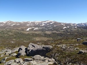
The Charlotte Pass village lookdown is located on the ridge line east of Mt Stilwell, where the remains of what appears to be an old Tbar lift leading down into the valley to the south are located. From the lookdown you can also see all the way across to the tall cliffs behind Blue Lake and to Mt Twynam in the distance.
(3.12km) Village Lookdown saddle → Int of Dam and Village Lookdown tracks
900 m
32 mins
1m
-184m
Hard track
Turn left : From the saddle, this walk follows the narrow grassy track north-west down the side of the ridge[28]. The track winds down through the open for about 300m, then passes through a snowgum forest for about 500m[29], (passing a snowpole line about halfway down the hill). At the bottom of the hill, this walk crosses the small creek then heads up a short climb (over a metal pipe[30]) to come to a T-intersection with the Charlotte Pass dam management trail.
(4.01km) Int of Dam and Village Lookdown tracks → Charlotte Pass Dam
150 m
4 mins
17m
-1m
Moderate track
Turn sharp left: From the intersection, this walk follows the faint grassy management trail, winding south-west up the hill and alongside the creek. The walk follows the snow poles as it winds up the hill to the small dam above Charlotte Pass village. At the end of this side trip, retrace your steps back to the main walk then Continue straight.
Charlotte Pass Dam
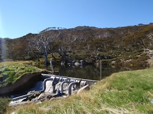
Charlotte Pass Dam is a relatively small store of water in the upper reaches of Spencers Creek, and a short stroll south from the Charlotte Pass village.
(4.01km) Int of Dam and Village Lookdown tracks → Bottom of Kangaroo Ridge chairlift
240 m
6 mins
0m
-27m
Easy track
Veer right: From the intersection, this walk follows the grassy management trail, heading down the hill towards the chairlift. The trail follows this down to the bottom of Kangaroo Ridge chairlift.
Maps for the Charlotte Pass Village and Mt Stilwell loop walk
You can download the PDF for this walk to print a map.
These maps below cover the walk and the wider area around the walk, they are worth carrying for safety reasons.
| Perisher Valley | 1:25 000 Map Series | 85252S PERISHER VALLEY | NSW-85252S |
| Kosciuszko | 1:100 000 Map Series | 8525 KOSCIUSZKO | 8525 |
Cross sectional view of the Charlotte Pass Village and Mt Stilwell loop bushwalking track
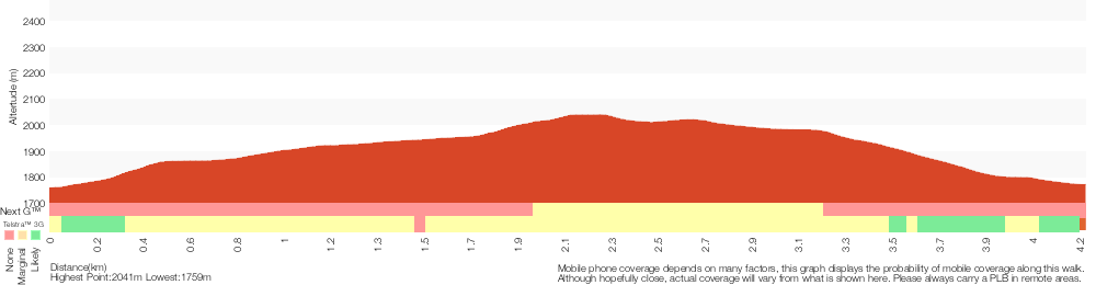
Analysis and summary of the altitude variation on the Charlotte Pass Village and Mt Stilwell loop
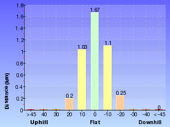
Overview of this walks grade – based on the AS 2156.1 – 2001
Under this standard, a walk is graded based on the most difficult section of the walk.
| Length | 4.2 km | ||
| Time | 2 hrs 15 mins | ||
| . | |||
| Grade 4/6 Hard track |
AS 2156.1 | Gradient | Very steep (4/6) |
| Quality of track | Rough track, where fallen trees and other obstacles are likely (4/6) | ||
| Signs | Minimal directional signs (4/6) | ||
| Experience Required | Moderate level of bushwalking experience recommended (4/6) | ||
| Weather | Forecast, unforecast storms and severe weather may impact on navigation and safety (4/6) | ||
| Infrastructure | Limited facilities, not all cliffs are fenced (3/6) |
Some more details of this walks Grading
Here is a bit more details explaining grading looking at sections of the walk
Gradient
2.5km of this walk has short steep hills and another 900m is very steep. The remaining (890m) has gentle hills with occasional steps.
Quality of track
2km of this walk follows a rough track, where fallen trees and other obstacles are likely and another 1.4km follows a formed track, with some branches and other obstacles. The remaining (890m) follows a clear and well formed track or trail.
Signs
2.1km of this walk has directional signs at most intersection and another 2km has minimal directional signs. The remaining (240m) is clearly signposted.
Experience Required
2km of this walk requires a leader a with moderate level of bushwalking experience and another 1.4km requires some bushwalking experience. The remaining (890m) requires no previous bushwalking experience.
weather
1.8km of this walk is affected by forecast, unforecast storms and severe weather events that may impact on navigation and safety and another 1.7km is affected by storms that may impact your navigation and safety. The remaining (750m) is not usually affected by severe weather events (that would unexpectedly impact safety and navigation).
Infrastructure
Around 2.3km of this walk is close to useful facilities (such as fenced cliffs and seats), whilst the remaining 2km has limited facilities (such as not all cliffs fenced).
Similar walks
A list of walks that share part of the track with the Charlotte Pass Village and Mt Stilwell loop walk.
778 m Return
30 mins
Moderate track
2.4 km Return
1 hr 30 mins
Hard track
3.8 km Return
1 hr 45 mins
Hard track
Other Nearby walks
A list of walks that start near the Charlotte Pass Village and Mt Stilwell loop walk.
374 m Return
15 mins
Moderate track
15.2 km Return
5 hrs 30 mins
Hard track
12 km Return
4 hrs 30 mins
Hard track
12.2 km One way
5 hrs
Hard track

18.5 km Return
6 hrs
Hard track
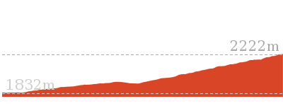
9 km Return
3 hrs
Hard track
9.3 km Return
4 hrs
Hard track
1.6 km Return
45 mins
Hard track
21.9 km Circuit
9 hrs
Hard track
27.7 km Circuit
2 Days
Experienced only
5.2 km Circuit
2 hrs
Moderate track
4.5 km Circuit
1 hr 30 mins
Moderate track
Plan your trip to and from the walk here
The Charlotte Pass Village and Mt Stilwell loop walk starts and ends at the Bottom of Basin Poma lift (gps: -36.434466, 148.33219)
Your main transport option to Bottom of Basin Poma lift is by;
![]() Car. A park entry fee is required for driving into the park.
Car. A park entry fee is required for driving into the park.
(get details)
Short URL = http://wild.tl/cpvamsl
Gallery images
There are other downloads I am still working on.
You will probably need to login to access these — still all free.
* KML (google earth file)
* GPX (GPS file)
Special Maps/ brochures
* A3 topo maps
* PDF with Lands Topo map base
* PDF with arial image (and map overlay)
I wanted to get the main site live first, this extra stuff will come in time.
Happy walking
Matt 🙂
Thredbo to Cootapatamba lookout return

3 hrs 45 mins
7.5 km Return
287 m
Hard track
This walk starts at the Thredbo Village and takes a ride up the Kosciuszko Express chairlift to the Eagles Nest restaurant. Then on foot, you head along the footpath, winding up towards Mt Kosciuszko, passing North Rams Head and the Kosciuszko lookout. The walk soon arrives at the metal platform overlooking Lake Cootapatamba. There are great views through this alpine area along this popular walking track.

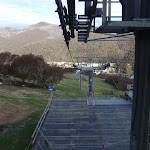


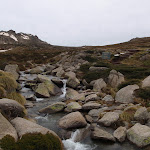
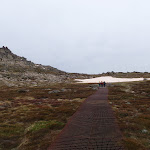
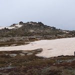


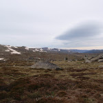
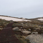
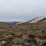
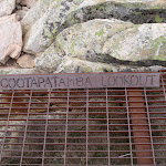

Covered in snow part of the year
This walk leads through an extreme alpine environment and all walkers must be well prepared. During summer, be prepared for both very hot and cold weather, high winds, rain, snow, extreme UV levels and some sections of snow or ice on the ground. Before starting this walk, check advice with Snowy Region Visitor Information Centre (02) 6450 5600, the weather forecast and the snow conditions then change your plans as needed. These notes, grades and walking times have been written for use in the summer months only. Between May and the end of October, this walk is likely to be covered in snow/ice, visitors should be carrying and be prepared to use snowshoes or cross country skis. When there is a chance of significant snow on the ground, visitors will need particularly strong navigation and snowcraft skills – tracks and signage may not be visible. For most visitors, it is best to consider this walk closed during the colder months.
Kosciuszko Express Chairlift
This is one of the few lifts operating in the summer months at Thredbo, and is made quite popular by thousands of people walking to the summit of Mt Kosciuszko each year. Lift tickets can be purchased from the store at the bottom of the chairlift. Lift tickets are $31 return ($25 one way) per person. This lift is generally closed during November and May for maintenance each year, but the the Snowgum chair can be used at this time instead, this will add extra walking time to you walk. More info.
(0km) Bottom of Kosciuszko Express chairlift → Top of Kosciuszko Express chairlift
1.9 km
20 mins
558m
-1m
Very easy
This walk heads into the ‘Valley Terminal’ building, where you can buy a ticket for the lift. Continue through the building and up the steps, where this walk turns right to find the bottom terminal of the ‘Kosciuszko Express’. Walk up to the platform as directed by the chairlift operator and sit down in the seat, letting it scoop you up. Once seated, pull down the safety bar and enjoy the ride to the top of the ridge. 🙂
At the top step of the chair lift and turn left to find the restaurant (now on your right) and track information signs ahead.
At the top step of the chair lift and turn left to find the restaurant (now on your right) and track information signs ahead.
Eagles Nest Restaurant
This is Australia’s highest restaurant, providing great food and outstanding views. It is easily accessible, nestled on the mountain directly opposite the top of the Kosciuszko Express chairlift, and is open year-round. For more information, call (02) 64576019.
(1.86km) Top of Kosciuszko Express chairlift → Start of metal walkway
550 m
9 mins
24m
-7m
Hard track
Turn right: From the top of the chairlift[3], this walk follows the footpath around Eagles Nest restaurant[4][5] (keeping the building to your right). The walk passes the large map[6] and information signs[7], heading up the gentle hill along the paved path[8]. Near the top of the rise, the path leads to a signposted intersection with the ‘Dead Horse Gap’ track[9] (on your left), where there is also an arrow pointing back to ‘Eagles Nest Restaurant’[10].
Continue straight: From the intersection, this walk follows the ‘Mt Kosciuszko Lookout’ sign[11] north along the paved path, heading up the gentle hill. The path soon leads past an alcove with two information signs[12], then leads gently downhill to cross a river on a steel bridge[13] to find an intersection (with a narrow track on your right) at a lovely spot beside the creek.
Continue straight: From the intersection, this walk follows the ‘Mt Kosciuszko Lookout’ sign[11] north along the paved path, heading up the gentle hill. The path soon leads past an alcove with two information signs[12], then leads gently downhill to cross a river on a steel bridge[13] to find an intersection (with a narrow track on your right) at a lovely spot beside the creek.
(2.41km) Start of metal walkway → Int of Kosciuszko path and lookout walkway
1.3 km
31 mins
117m
0m
Hard track
Continue straight: From the intersection, this walk heads away from the bridge and up the metal steps, keeping the creek to your left. The path soon leads past a large ‘Kosciuszko Walk’ sign[14] and an ‘Everything is connected’ information sign[15]. Soon after the ‘Thredbo 1.0km’ badge[16][17] (welded to the track), this walk comes to a ‘Plant communities – keeping a low profile’ information sign[18], marking an intersection (where the snow-pole line starts to leave the main track)[19].
Continue straight: From the intersection, the walk continues along the metal walkway, heading up the hill[20]. The walk soon passes a ‘Flowers emerge with warmer weather’ information sign[21], then heads up a series of steps to find ‘A rocky mountain home’ information sign[22] and a ‘Thredbo 1.5km’ tag[23] pointing back down the hill. The track mostly flattens out and heads over a gentle rise, soon leading to a clear ‘Y’ intersection[24] on the metal track, marked with ‘Mt Kosciuszko Lookout’ tag[25] welded to the track.
Continue straight: From the intersection, the walk continues along the metal walkway, heading up the hill[20]. The walk soon passes a ‘Flowers emerge with warmer weather’ information sign[21], then heads up a series of steps to find ‘A rocky mountain home’ information sign[22] and a ‘Thredbo 1.5km’ tag[23] pointing back down the hill. The track mostly flattens out and heads over a gentle rise, soon leading to a clear ‘Y’ intersection[24] on the metal track, marked with ‘Mt Kosciuszko Lookout’ tag[25] welded to the track.
(3.69km) Int of Kosciuszko path and lookout walkway → Kosciuszko lookout
50 m
1 mins
0m
-1m
Hard track
Veer right: From the intersection[26], this walk heads north-east along the metal path that branches off the main path. The path leads a short distance up some steps[27] to soon come to the metal platform at the Kosciuszko lookout[28][29]. At the end of this side trip, retrace your steps back to the main walk then Turn sharp right.
Kosciuszko lookout
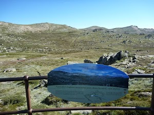
Kosciuszko lookout is about 30m off the main Kosciuszko walk, along a metal walkway. At the lookout, there is a larger platform with an information sign about how the landscape was formed over the years. Granting a great view of the Snowy Mountains to the summit of Mt Kosciuszko.
(3.69km) Int of Kosciuszko path and lookout walkway → Lake Cootapatamba lookout
1.9 km
40 mins
94m
-45m
Hard track
Continue straight: From the intersection, this walk follows the metal walkway north, down the gentle hill (initially keeping Mt Kosciuszko lookout to your right). The walk continues along the metal walkway as it dips to cross the upper reaches of the Snowy River. About 400m past the ‘Endangered Mammals Live between boulders’ sign[30], the path leads to a faint intersection with the North Rams Head track (where the spur comes down to the metal walkway on your left).
Continue straight: From the intersection, this walk follows the metal walkway north into the saddle and up the spur. The path then crosses onto the left-hand side of the ridge as it comes to the signposted ‘Lake Cootapatamba Lookout’[31] and the great valley view[32].
Continue straight: From the intersection, this walk follows the metal walkway north into the saddle and up the spur. The path then crosses onto the left-hand side of the ridge as it comes to the signposted ‘Lake Cootapatamba Lookout’[31] and the great valley view[32].
Lake Cootapatamba lookout
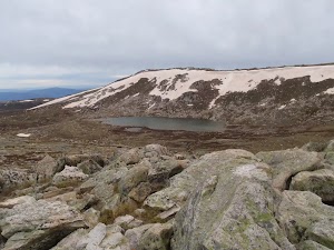
Situated on the Kosciuszko walk, this platform looks down over Lake Cootapatamba, in the valley on the western side of the path. This is a pleasant place to stop and enjoy the mountains and views.
Maps for the Thredbo to Cootapatamba lookout return walk
You can download the PDF for this walk to print a map.
These maps below cover the walk and the wider area around the walk, they are worth carrying for safety reasons.
| Perisher Valley | 1:25 000 Map Series | 85252S PERISHER VALLEY | NSW-85252S |
| Chimneys Ridge | 1:25 000 Map Series | 85241N CHIMNEYS RIDGE | NSW-85241N |
| Kosciuszko | 1:100 000 Map Series | 8525 KOSCIUSZKO | 8525 |
| Jacobs River | 1:100 000 Map Series | 8524 JACOBS RIVER | 8524 |
Cross sectional view of the Thredbo to Cootapatamba lookout return bushwalking track
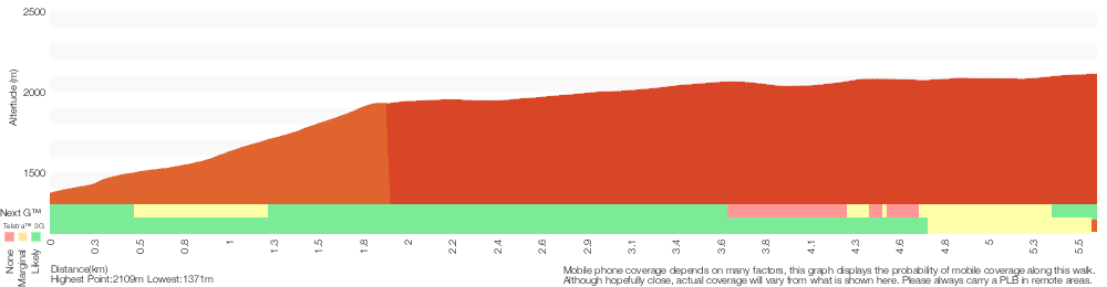
Analysis and summary of the altitude variation on the Thredbo to Cootapatamba lookout return
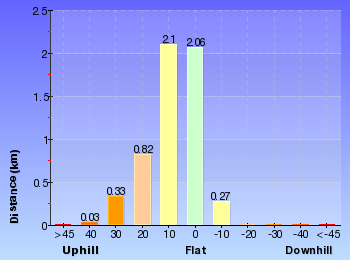
Overview of this walks grade – based on the AS 2156.1 – 2001
Under this standard, a walk is graded based on the most difficult section of the walk.
| Length | 7.5 km | ||
| Time | 3 hrs 45 mins | ||
| . | |||
| Grade 4/6 Hard track |
AS 2156.1 | Gradient | Short steep hills (3/6) |
| Quality of track | Clear and well formed track or trail (2/6) | ||
| Signs | Clearly signposted (1/6) | ||
| Experience Required | No experience required (1/6) | ||
| Weather | Forecast, unforecast storms and severe weather may impact on navigation and safety (4/6) | ||
| Infrastructure | Generally useful facilities (such as fenced cliffs and seats) (1/6) |
Some more details of this walks Grading
Here is a bit more details explaining grading looking at sections of the walk
Gradient
3.1km of this walk has gentle hills with occasional steps and another 1.9km is flat with no steps. The remaining (690m) has short steep hills.
Quality of track
Around 3.2km of this walk follows a clear and well formed track or trail, whilst the remaining 2.4km follows a smooth and hardened path.
Signs
This whole walk, 6km is clearly signposted.
Experience Required
This whole walk, 6km requires no previous bushwalking experience.
weather
3.4km of this walk is affected by forecast, unforecast storms and severe weather events that may impact on navigation and safety and another 1.9km is not usually affected by severe weather events (that would unexpectedly impact safety and navigation). The remaining (350m) is affected by storms that may impact your navigation and safety.
Infrastructure
This whole walk, 6km is close to useful facilities (such as fenced cliffs and seats).
Similar walks
A list of walks that share part of the track with the Thredbo to Cootapatamba lookout return walk.
3.7 km Circuit
2 hrs 30 mins
Hard track
3.8 km Return
2 hrs 30 mins
Hard track
5.3 km One way
3 hrs
Hard track
5.8 km Circuit
3 hrs
Hard track
9.8 km Circuit
4 hrs 30 mins
Hard track
10.1 km Circuit
5 hrs
Hard track
12.2 km One way
5 hrs
Hard track
12.4 km Return
6 hrs
Hard track
25.8 km One way
2 Days
Experienced only
Other Nearby walks
A list of walks that start near the Thredbo to Cootapatamba lookout return walk.
3.1 km Circuit
1 hr 30 mins
Hard track
3.3 km Circuit
1 hr 15 mins
Moderate track
2.2 km Return
1 Hr
Hard track
3.3 km Circuit
1 hr 15 mins
Moderate track
4.8 km One way
1 hr 45 mins
Moderate track
4.7 km Return
2 hrs
Moderate track
2.9 km Circuit
1 hr 15 mins
Moderate track
4.1 km Return
1 hr 45 mins
Moderate track
9.7 km Return
4 hrs
Hard track
19.6 km Return
7 hrs 30 mins
Hard track
778 m Return
30 mins
Moderate track
2.4 km Return
1 hr 30 mins
Hard track
Plan your trip to and from the walk here
The Thredbo to Cootapatamba lookout return walk starts and ends at the Bottom of Kosciuszko Express chairlift (gps: -36.503981, 148.30397)
Your main transport option to Bottom of Kosciuszko Express chairlift is by;
![]() Car. A park entry fee is required for driving into the park.
Car. A park entry fee is required for driving into the park.
(get details)
Short URL = http://wild.tl/ttklrxx
Gallery images
There are other downloads I am still working on.
You will probably need to login to access these — still all free.
* KML (google earth file)
* GPX (GPS file)
Special Maps/ brochures
* A3 topo maps
* PDF with Lands Topo map base
* PDF with arial image (and map overlay)
I wanted to get the main site live first, this extra stuff will come in time.
Happy walking
Matt 🙂
Main Range Walk – Charlotte Pass to Mount Kosciuszko

9 hrs
21.9 km Circuit
920 m
Hard track
This full day walk explores some of the greatest alpine country on offer in NSW. The walk grants views of Blue, Club and Albina Lakes, climbs to the top of Mt Kosciuszko and crosses the famous Snowy River twice. This main range circuit is one of the classic walks in New South Wales, as the views in clear weather extend all the way over the mountainous landscape to the distant horizon. If you want to stay overnight there is a flat area for camping at Wilkinsons Creek, described as a side trip.
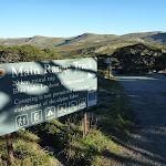


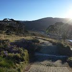
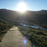

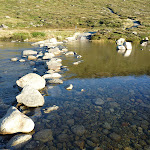
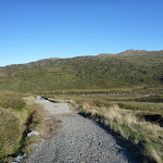

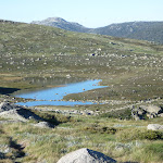


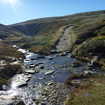


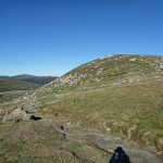


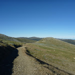
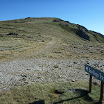
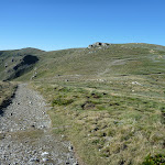

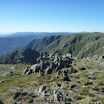
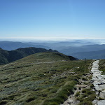
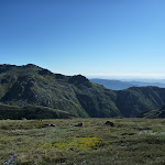

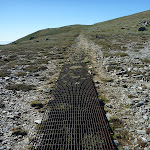
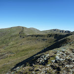


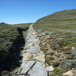


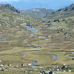


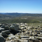
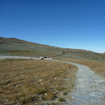


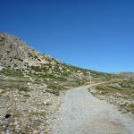
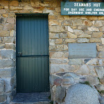
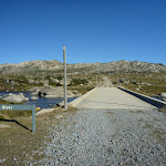


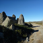
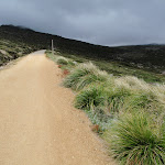
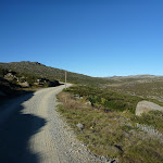
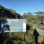
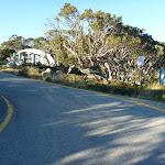
Covered in snow part of the year
This walk leads through an extreme alpine environment and all walkers must be well prepared. During summer, be prepared for both very hot and cold weather, high winds, rain, snow, extreme UV levels and some sections of snow or ice on the ground. Before starting this walk, check advice with Snowy Region Visitor Information Centre (02) 6450 5600, the weather forecast and the snow conditions then change your plans as needed. These notes, grades and walking times have been written for use in the summer months only. Between May and the end of October, this walk is likely to be covered in snow/ice, visitors should carry and be prepared to use snowshoes or cross country skis. When there is a chance of significant snow on the ground, visitors will need particularly strong navigation and snowcraft skills – tracks and signage may not be visible. For most visitors, it is best to consider this walk closed during the colder months.
Between the long weekend in June and October, the road between Perisher Village and Charlotte Pass is closed by the RTA. It is possible to organise oversnow transport.
Between the long weekend in June and October, the road between Perisher Village and Charlotte Pass is closed by the RTA. It is possible to organise oversnow transport.
(0km) End of Kosciuszko Road → Snowy River crossing
790 m
18 mins
1m
-122m
Hard track
From Charlotte Pass[1] (at the turning circle at the end of Kosciuszko Rd), this walk follows the ‘Main Range Track’ – ‘Blue Lake Lookout’ sign[2] downhill along the wide paved path[3]. The walk winds down past the stone path[4] (on your right) and continues beside the ‘Glaciers shaped this ancient landscape’ information sign[5]. The path continues down through lightly scattered snow gums to the bottom of the valley, approximately 650m further. Just past the ‘From the mountains to the sea’ information sign[6], this walk crosses the Snowy River using the stepping stones[7] and comes to a strip of land between the two creeks[8]. (Crossing the river is dangerous and is not advisable when the water is flowing over the stepping stones[9]).
Snowy River crossing
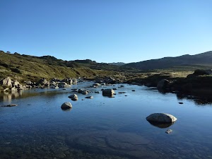
At the lowest point of the the Main Range circuit track is the confluence (meeting) of the Snowy River and Club Lake Creek. The walking track uses stones in the river to try to get across with dry feet. Since the track crosses just above the confluence there is an ‘island’[10] halfway across. These creeks may become impassable after rain and snow melt. This is lovely place to rest and enjoy the water and valley.
(0.79km) Snowy River crossing → Int of Main Range and Blue Lake Lookout tracks
3.2 km
1 hr 7 mins
306m
-33m
Hard track
Veer right: From between the two creeks, this walk heads north along the wide track to cross Club Lake Creek using the stepping stones. (The creek may not be safe to cross when water covers the stepping stones[11]). The walk then follows the wide, paved track fairly steeply up the hill. After a short time, the track becomes gravel and continues up the hill for about 400m further before passing a ‘Mountains of Soil’ information sign[12], where the track soon becomes less steep. After about 1.5km, the track passes a ‘Created by glaciers’ information sign[13] and reveals some views down to Hedley Tarn[14] (on your right). The track continues up the hill and between the granite boulders[15] to then head down the other side of the ridge[16]. The walk leads down to rock-hop across Carruthers Creek[17], then follows the wide, paved path up the hill, passing the ‘Remnants of an ancient sea’ information sign[18] and coming to a paved area[19], with a view to Blue Lake[20] and some information signs marking a three-way intersection.
(4.02km) Int of Main Range and Blue Lake Lookout tracks → Blue Lake lookout
640 m
14 mins
8m
-72m
Hard track
Turn right: From the paved area[21], this walk follows the dirt track next to the stone seat, heading east towards Blue Lake[22]. The rocky track winds down and around the northern side of the ridge[23] to a platform[24] with an information sign[25] and a fantastic view of Blue Lake[26]. At the end of this side trip, retrace your steps back to the main walk then Veer right.
Blue Lake
Blue Lake is the best example of a glacial lake in the alpine area. At 28m deep, this lake was formed when glaciers, flowing from the Great Dividing Range, converged and carved out a basin in the rock. This is visible in the cliffs behind the lake, where the glaciers have plucked out blocks of stone and carried them away. There is also a stream that flows from Blue lake, feeding Hedley Tarn just to the south.
(4.02km) Int of Main Range and Blue Lake Lookout tracks → Int of Main Range and Mt Twynam tracks
880 m
17 mins
60m
-7m
Hard track
Turn left: From the intersection, this walk heads west, uphill[27] away from Blue Lake[28]. The walk initially heads along a short section of paved path before continuing along the wide gravel track[29]. The track winds gently uphill for a while, keeping the wide valley to your left. The walk comes to a saddle and a three-way intersection, marked with a ‘Main Range Track’ signpost[30].
(4.9km) Int of Main Range and Mt Twynam tracks → Carruthers Peak
860 m
18 mins
99m
-2m
Hard track
Continue straight: From the intersection, this walk follows the ‘Main Range Track’ sign[31] across the saddle then uphill along the clear track. The track winds up along the ridge and in time comes to a rocky clearing on the eastern side of Carruthers Peak[32] (where a short detour will reveal views down to Club Lake). Here the walk bends right and follows the clear track as it winds up the hill[33] to the views at the top of Carruthers Peak[34].
Carruthers Peak
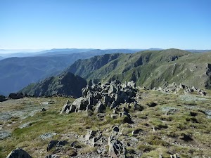
Carruthers Peak is a prominent mountain that is found along the Main Range track, from which you can see great views down over Club Lake and out across the valley to Charlotte Pass. Carruthers Peak was named after the NSW Minister for Lands and Premier, Joseph Carruthers. This name was given in 1991 by Richard Helms, who had previously named it Crummer.
(5.76km) Carruthers Peak → Int of Main Range and Muellers Peak track
4.2 km
1 hr 29 mins
105m
-235m
Hard track
Continue straight: From the top of Carruthers Peak, this walk follows the clear track west as it winds down the ridge[35]. After about 50m, the track passes an ‘I30’ survey marker[36] (more good views) where the track bends left and follows the stone path and steps down the hill[37]. At the end of the stone path, the track bends left and heads down the hill[38], over a few lengths of metal grate[39] and comes to a saddle with good views down to Club Lake[40] (on your left). The walk then continues across the saddle, following the clear track to soon pass the ‘Rarest Alpine Plant Community’ information sign[41]. Heading around the side of the hill (keeping the valley to your right), the walk then comes to another rocky saddle[42]. About 320m beyond this saddle, this track leads to a very faint intersection where the ridge[43] (that leads to the northern end of Albina Lake) on the right meets the main track.
Continue straight: From the intersection, the walk follows the gravel Main Range track south, keeping the valley and Albina Lake to your right. The track heads downhill[44] and then winds around beside a rocky saddle (a short side trip to the left over the small rise reveals some views into the valley). This walk continues along the clear track as it traverses fairly gently around the side of the very steep hill. In a few places, the track has been cut into the rock[45] and provides great views down into the Albina Lake – take care not to slip. The walk continues to another large saddle and just as the track starts to dip down past the saddle, the track comes to a faint intersection with an old management trail[46] (leading to Lake Albina, on your right).
Continue straight: From the intersection, the walk follows the rock-paved Main Range track south[47]. The track steadily winds around the side of the hill (keeping the large valley to your left). After heading between a rocky outcrop[48], the track becomes gravel[49] and starts to head over the ridge before gently winding down the hill. Just before flattening out on the large saddle, the track comes to a faint intersection (with the Muellers Peak and Mt Townsend tracks on your right) marked with a rock cairn[50] (on your right).
(9.98km) Int of Main Range and Muellers Peak track → Int of Main Range and Wilkinsons Creek track
200 m
4 mins
3m
-7m
Hard track
Veer left: From the intersection, this walk heads south along the main track to the low point in the saddle[51] (where there is a faint intersection with a pad leading down to Wilkinsons Creek on your right).
(10.19km) Int of Main Range and Wilkinsons creek track → Wilkinsons creek
780 m
16 mins
1m
-94m
Experienced only
Turn right: From the low point in the saddle[52], this walk heads west, off the main track, over the grassy rise. Soon finding an overgrown management trail that leads down towards the creek at the bottom of the valley. The walk continues down the side of the hill passing through some low scrub to find many boulders and flat areas[53] beside Wilkinsons Creek[54]. At the end of this side trip, retrace your steps back to the main walk then Turn right.
Wilkinsons Creek
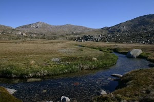
Wilkinsons Creek meanders through a beautiful and broad valley. Nestled in the valley between Mt Kosciuszko and Mt Townsend, this is a great spot to cool down or camp for a night. The large, flat, grassy plain, with a scattering of boulders, makes this great place to stay, although can be pretty exposed to westerly winds. You can often get great sunset views from the rocks at the western end. There are no facilities, please remember to use minimal impact techniques when visiting this area. Water is available from the creek. Camp more than 100m from the creek, and if staying for more than a day or two, move your camp to minimise the risk of damage. No fires – use fuel stoves only (there are a few gravelly areas to set your stove up to avoid destroying the grass).
(10.19km) Int of Main Range and Wilkinsons Creek track → Int of Main Range track and Kosciuszko walk
1.4 km
38 mins
159m
-2m
Hard track
Continue straight: From the intersection[55], this walk heads south along the clear track, climbing up out of the saddle and along the side of the hill, keeping the valley to your left. The walk heads up many stone steps[56] for about 600m, then flattens out for a little while[57] before coming to a clear and signposted three-way intersection[58]. (Here, the track on the right leads up to the summit of Mt Kosciuszko.)
(11.63km) Int of Main Range track and Kosciuszko path → Mt Kosciuszko
970 m
23 mins
76m
-15m
Hard track
Turn sharp right: From the intersection, this walk follows the ‘Mt Kosciuszko’ sign[59] uphill along the upper track. This track winds steadily up and around the peak of the mountain, passing a stone-paved[60] section of track, and also a metal grate[61] before climbing a few steps[62] to the cairn at the peak of Mt Kosciuszko[63].
Mt Kosciuszko
Mt Kosciuszko is the highest peak on the Australian continent, at 2228m above sea level. It was named by the Polish explorer Count Paul Edmund Strzelecki and named in honour of the Polish national hero General Tadeusz Kościuszko. Now a popular tourist attraction, thousands of people walk up to the summit each year. On a clear day, the 360-degree views from the summit across the roof of Australia are fantastic. There are higher mountains elsewhere on Australian territory. ‘The highest mountains in Australian Antarctic Territory are Mt McClintock (3490 meters) and Mt Menzies (3355 meters).’ .
(12.6km) Mt Kosciuszko → Rawson Pass
1.6 km
39 mins
23m
-127m
Hard track
Turn around: From the cairn at the peak of Mt Kosciuszko[65], this walk heads down the steps[66] and past the information sign[67]. The walk heads gently downhill along the gravel track[68] then over a metal grate[69] and a stone path[70], where the gravel path then leads[71] the rest of the way around the side of the peak to come to the signposted intersection with the ‘Main Range Track’[72][73].
Veer right: From the intersection, this walk follows the gravel track towards ‘Rawson Pass’[74] gently downhill, keeping the main valley to your left. The track almost immediately passes an ‘Alpine Walks’ information sign and map[75] as it continues south. After about 500m, the track becomes a stone path[76] that leads a little further to the clearly signposted three-way intersection at ‘Rawson Pass’[77].
Veer right: From the intersection, this walk follows the gravel track towards ‘Rawson Pass’[74] gently downhill, keeping the main valley to your left. The track almost immediately passes an ‘Alpine Walks’ information sign and map[75] as it continues south. After about 500m, the track becomes a stone path[76] that leads a little further to the clearly signposted three-way intersection at ‘Rawson Pass’[77].
Rawson Pass
Rawson Pass is where the old Kosciuszko Road, from Charlotte Pass, meets the metal walkway from Thredbo. It is home to highest public toilet in Australia, this recently-added facility is perfectly positioned for those taking the walk up to the top of Kosciuszko. Rawson Pass is well signposted and 500m south east of Mt Kosciuszko (by straight line). There is also a place for to park mountain bikes for those cycling along the old road from Charlotte Pass.
(14.25km) Rawson Pass → Seamans Hut
1.6 km
31 mins
15m
-114m
Hard track
Veer left: From the intersection at Rawson Pass[78], this walk follows the ‘Seamans Hut’ sign[79] along the stone path. The walk soon passes the bicycle parking area[80] then Australia’s highest toilet block[81] (on your right). The walk then continues along the management trail[82] as it winds down along the side of the hill to a gap and the clearly signposted ‘Seamans Hut’[83] on your left.
Seamans Hut
This hut was erected in 1929, after a young skier named Laurie Seaman perished in a blizzard when he was separated from his group. The hut was built using money donated by Seaman’s parents, for the use of those who might need emergency shelter in the mountains. It was renovated in 1938 due to fire. Seamans Hut is a 7m x3m granite stone building with a wood stove, although there is little wood in the area. More info.
(15.87km) Seamans Hut → Snowy River bridge
1.5 km
27 mins
0m
-95m
Hard track
Continue straight: From ‘Seamans Hut’[85], this walk follows the management trail as it winds down the hill[86]. After about 450m, the trail passes a flat clearing[87] with views (on your left) where the trail bends right to head down to the valley. After a little while, the trail crosses the concrete bridge over the signposted ‘Snowy River’[88].
(17.37km) Snowy River bridge → End of Kosciuszko Road
4.5 km
1 hr 27 mins
73m
-164m
Hard track
Continue straight: From the bridge[89], this walk follows the management trail east, passing the ‘Snowy River’ sign[90]. The trail soon bends left, coming to the un-signposted concrete Merritts Creek bridge[91][92].
Continue straight: From the bridge[93], this walk heads uphill along the management trail[94], keeping the main line of snow poles to your left. The old road soon leads past a ‘CP 4’ sign[95] (on your left), over the ridge line[96] and down the other side[97]. The trail gently winds down along the side of the hill, enjoying views of the Snowy River and valley to your left[98]. The old road passes a few creeks[99] and more ‘CP’ signs along the way. A little while after the ‘CP 1’ sign[100], the management trail enters a nice grove of snow gum trees[101][102] then heads up a small rise to find the turning circle at the end of Kosciuszko Rd[103][104] at Charlotte Pass (with the toilet block to your right).
Continue straight: From the bridge[93], this walk heads uphill along the management trail[94], keeping the main line of snow poles to your left. The old road soon leads past a ‘CP 4’ sign[95] (on your left), over the ridge line[96] and down the other side[97]. The trail gently winds down along the side of the hill, enjoying views of the Snowy River and valley to your left[98]. The old road passes a few creeks[99] and more ‘CP’ signs along the way. A little while after the ‘CP 1’ sign[100], the management trail enters a nice grove of snow gum trees[101][102] then heads up a small rise to find the turning circle at the end of Kosciuszko Rd[103][104] at Charlotte Pass (with the toilet block to your right).
Maps for the Main Range Walk – Charlotte Pass to Mount Kosciuszko walk
You can download the PDF for this walk to print a map.
These maps below cover the walk and the wider area around the walk, they are worth carrying for safety reasons.
| Perisher Valley | 1:25 000 Map Series | 85252S PERISHER VALLEY | NSW-85252S |
| Kosciuszko | 1:100 000 Map Series | 8525 KOSCIUSZKO | 8525 |
Cross sectional view of the Main Range Walk – Charlotte Pass to Mount Kosciuszko bushwalking track
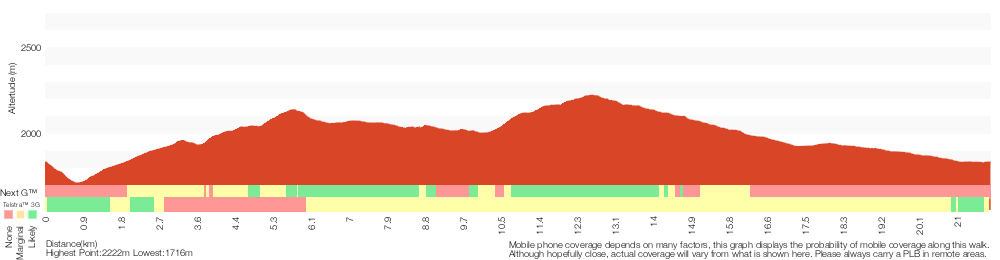
Analysis and summary of the altitude variation on the Main Range Walk – Charlotte Pass to Mount Kosciuszko
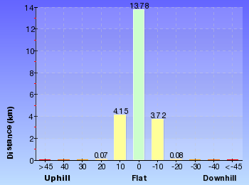
Overview of this walks grade – based on the AS 2156.1 – 2001
Under this standard, a walk is graded based on the most difficult section of the walk.
| Length | 21.9 km | ||
| Time | 9 hrs | ||
| . | |||
| Grade 4/6 Hard track |
AS 2156.1 | Gradient | Short steep hills (3/6) |
| Quality of track | Formed track, with some branches and other obstacles (3/6) | ||
| Signs | Directional signs along the way (3/6) | ||
| Experience Required | Moderate level of bushwalking experience recommended (4/6) | ||
| Weather | Forecast, unforecast storms and severe weather may impact on navigation and safety (4/6) | ||
| Infrastructure | Limited facilities (such as cliffs not fenced, significant creeks not bridged) (4/6) |
Some more details of this walks Grading
Here is a bit more details explaining grading looking at sections of the walk
Gradient
10km of this walk has short steep hills and another 6km is flat with no steps. The remaining (6km) has gentle hills with occasional steps.
Quality of track
Around 20km of this walk follows a clear and well formed track or trail, whilst the remaining 2.2km follows a formed track, with some branches and other obstacles.
Signs
Around 19km of this walk is clearly signposted, whilst the remaining 2.4km has directional signs at most intersection.
Experience Required
10km of this walk requires no previous bushwalking experience and another 7km requires some bushwalking experience. The remaining (4km) requires a leader a with moderate level of bushwalking experience.
weather
This whole walk, 22km is affected by forecast, unforecast storms and severe weather events that may impact on navigation and safety.
Infrastructure
11km of this walk is close to useful facilities (such as fenced cliffs and seats) and another 10km has limited facilities (such as not all cliffs fenced). The remaining (790m) has limited facilities (such as cliffs not fenced, significant creeks not bridged).
Similar walks
A list of walks that share part of the track with the Main Range Walk – Charlotte Pass to Mount Kosciuszko walk.
1.6 km Return
45 mins
Hard track
9 km Return
3 hrs
Hard track
9.3 km Return
4 hrs
Hard track
12 km Return
4 hrs 30 mins
Hard track
12.2 km One way
5 hrs
Hard track
12.4 km Return
6 hrs
Hard track
15.2 km Return
5 hrs 30 mins
Hard track
15.2 km One way
6 hrs 30 mins
Experienced only
18.5 km Return
6 hrs
Hard track
25.8 km One way
2 Days
Experienced only
27.7 km Circuit
2 Days
Experienced only
45 km Circuit
4 Days
Experienced only
Other Nearby walks
A list of walks that start near the Main Range Walk – Charlotte Pass to Mount Kosciuszko walk.
374 m Return
15 mins
Moderate track
3.8 km Return
1 hr 45 mins
Hard track
4.2 km Circuit
2 hrs 15 mins
Hard track
778 m Return
30 mins
Moderate track
2.4 km Return
1 hr 30 mins
Hard track
5.6 km Return
2 hrs 30 mins
Hard track
5.2 km Circuit
2 hrs
Moderate track
4.5 km Circuit
1 hr 30 mins
Moderate track
1.5 km Return
30 mins
Moderate track
3 km Circuit
1 hr 30 mins
Moderate track
7.3 km Circuit
3 hrs
Hard track
17.4 km Return
8 hrs
Experienced only
Plan your trip to and from the walk here
The Main Range Walk – Charlotte Pass to Mount Kosciuszko walk starts and ends at the End of Kosciuszko Road (gps: -36.43167, 148.32865)
Your main transport option to End of Kosciuszko Road is by;
![]() Car. A park entry fee is required for driving into the park.
Car. A park entry fee is required for driving into the park.
(get details)
Short URL = http://wild.tl/mrtblakl
Gallery images
There are other downloads I am still working on.
You will probably need to login to access these — still all free.
* KML (google earth file)
* GPX (GPS file)
Special Maps/ brochures
* A3 topo maps
* PDF with Lands Topo map base
* PDF with arial image (and map overlay)
I wanted to get the main site live first, this extra stuff will come in time.
Happy walking
Matt 🙂
Comments