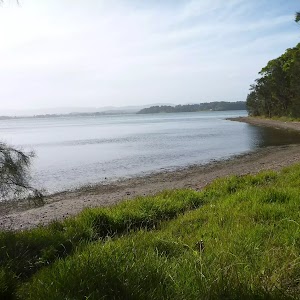
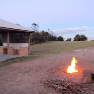
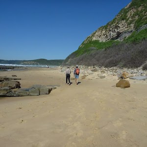
This walk traverses the coastline of the Green Point reserve. By following a variety of tracks and occasionally traveling inland through eucalyptus forest, this walk visits both Jetty and Sea Eagle picnic areas, Green Point itself and Rocky-high viewpoint. When looking into the waters of Lake Macquarie, keep a lookout for sea grass meadows and historical middens under the water. A thoroughly recommended walk, which will possibly require a car shuffle at the start of the walk.
The Foreshore Walk
And Walk
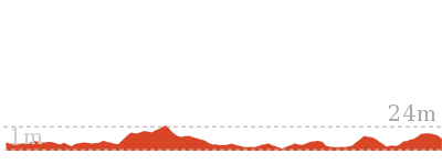
The Foreshore Walk


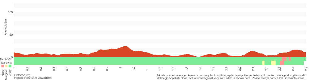
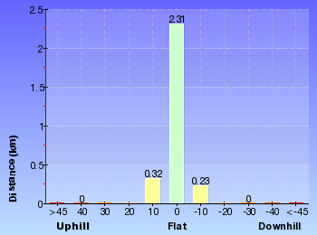
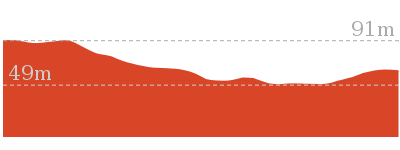
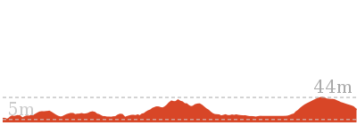
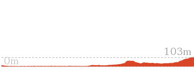
1 hr 15 mins
2.9 km One way

81 m
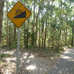
Hard track


Green Point Foreshore Reserve on Lake Macquarie
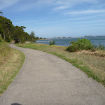
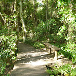
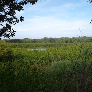
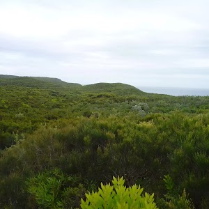
The Green Point Foreshore Reserve on Lake Macquarie is a great place for a bush walk, bicycle or picnic. The Green Point Foreshore reserve offers many historical and environmentally interpretative signs along its multi use pathways. There is an unformed foreshore pathway beside Lake Macquarie, or more physically demanding walks away from the lake foreshore and into rainforest.
Historically, the Green Point area was involved in a coal rush from the 1860’s. This coal rush was spearheaded by the Cardiff Coal Company. Coal was proposed to be transported by barge to Threlkeld’s old wharf at Reid’s Mistake (Swansea Heads) for shipping to Sydney. However, the coal was poor quality ‘boiler coal’ and used mostly for steamer boilers. This coal rush finished in 1870. Timber was also milled on site after the coal rush. The Lake Macquarie Council is undergoing extensive rehabilitation works to improve the area for recreation. For more information contact the Lake Macquarie Visitor Information Centre on (02) 4921 0740 More info.
Historically, the Green Point area was involved in a coal rush from the 1860’s. This coal rush was spearheaded by the Cardiff Coal Company. Coal was proposed to be transported by barge to Threlkeld’s old wharf at Reid’s Mistake (Swansea Heads) for shipping to Sydney. However, the coal was poor quality ‘boiler coal’ and used mostly for steamer boilers. This coal rush finished in 1870. Timber was also milled on site after the coal rush. The Lake Macquarie Council is undergoing extensive rehabilitation works to improve the area for recreation. For more information contact the Lake Macquarie Visitor Information Centre on (02) 4921 0740 More info.
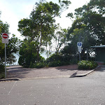
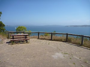
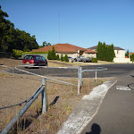
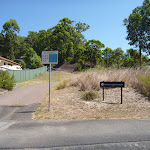
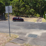
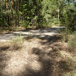
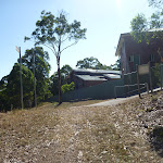
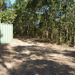
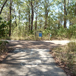
The Car Park (off The Shores Way, Green Point)
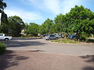
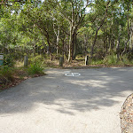
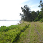
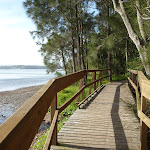
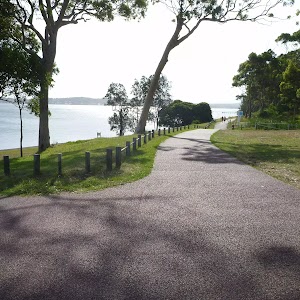
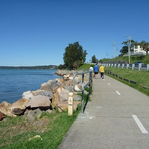
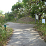
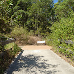
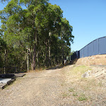
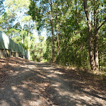
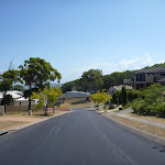
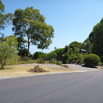
The Shores Way park entrance[1] and car park[2] is a great place to start a walk within the Green Point Foreshore Reserve on Lake Macquarie. The park entrance offers a toilet[3], a water tap[4], seating and plenty of car parking. There are attractive grass slopes here dropping into the water, that make a fine spot to have a picnic.
(0km) The Shores Way Car Park → Int of Foreshore Track AND Jetty Picnic Area

550 m
10 mins
10m
-13m
Moderate track
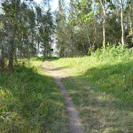
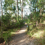
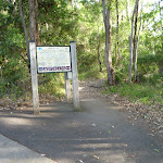
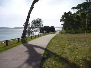
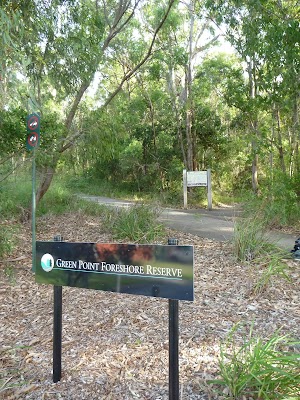
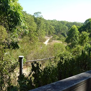
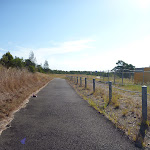
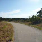
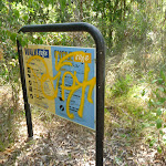
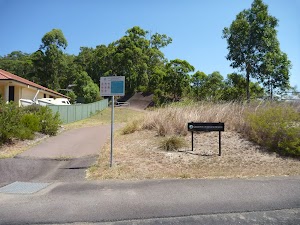
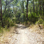
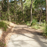
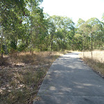
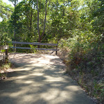
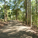
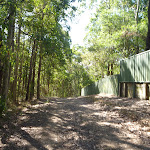
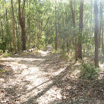
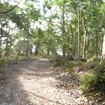
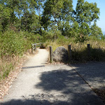
From the car park[5](on The Shores Way, Green Point), this walk heads towards the lake[6] past the toilet block[7] and along the footpath for 25m, to a four-way intersection[8] with a ‘Welcome to Green Point Foreshore Reserve’ sign[9] (on the right).
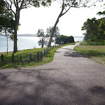
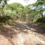
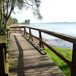
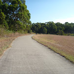
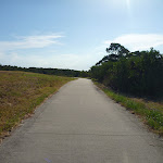
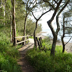
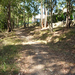
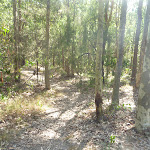
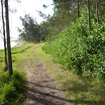
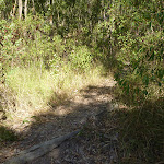
Turn right: From the intersection[10], this walk follows the shared concrete cycle/footpath gently downhill, while keeping the Shores Way car park[11] on your right and the water[12] on your left. This walk continues, undulating[13] for about 500m, until coming to the Jetty picnic area[14] on the right and jetty[15] on your left.
Turn right: From the intersection[10], this walk follows the shared concrete cycle/footpath gently downhill, while keeping the Shores Way car park[11] on your right and the water[12] on your left. This walk continues, undulating[13] for about 500m, until coming to the Jetty picnic area[14] on the right and jetty[15] on your left.
Jetty Picnic Area
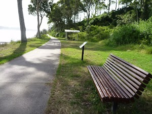
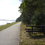
The Jetty Picnic area[16] in the Green Point Foreshore Reserve on Lake Macquarie offers a public jetty[17], a sheltered picnic table[18], seating[19][20], a drinking fountain[21] and historical interpretative signs[22]. The historical signs detail the ‘timber getting’ period of Green Point from 1860, with the timber used to build jetty’s, pit prop for coal mining, ships and boats. There is also an historical sign detailing ‘The Cardiff Coal Company’, which mined coal out of Green Point during a minor coal rush.
(0.55km) Jetty Picnic Area (Green Point Foreshore Reserve) → Int of Foreshore Track & Sea Eagle Park
260 m
5 mins
9m
-6m
Easy track
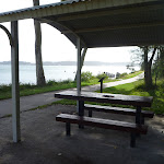
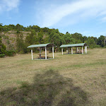
Sea Eagle Park
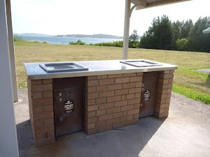
Sea Eagle Park in Green Point Foreshore Reserve on Lake Macquarie is a large grassed picnic area[27], with a toilet[28], sheltered picnic tables[29], water from a tap[30][31] and gas/electric barbeque’s[32]. This picnic area is particularly good for larger family group, for there is room to play ball games or just sit and look at the views. The short walk up to the Sea Eagle Lookouts is recommended for the commanding views south towards Swansea.
(0.8km) Int of Foreshore Track & Sea Eagle Park → Int of Foreshore & Lookout Tracks
80 m
2 mins
6m
-1m
Moderate track
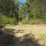
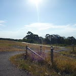
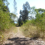
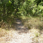
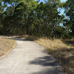
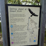
Continue straight: From the intersection[33], this walk follows the footpath gently uphill[34], while keeping Sea Eagle Park[35] on your right. This walk continues for about 70m, until coming to a three-way intersection[36] with a track and ‘Lookout’ sign on your right and a ‘Getting about at Green Point’ sign[37] on your left.
(0.89km) Int of Foreshore & Lookout Tracks → Lower Lookout (Sea Eagle Park)
110 m
2 mins
16m
0m
Moderate track
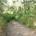
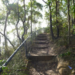
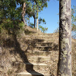
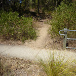
Turn right: From the intersection[38][39], this walk heads up timber steps, directly away from the face of the ‘Getting about at Green Point’ sign[40]. This walk continues gently uphill, with occasional timber steps (and passing a seat[41]) for about 110m, until coming to the Lower Lookout[42][43] above Sea Eagle Park (on the right). At the end of this side trip, retrace your steps back to the main walk then Turn right.
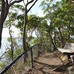
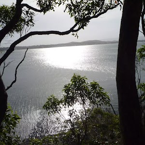
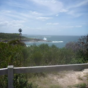
Sea Eagle Park Lookouts (lower, middle & upper)
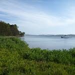
These three lookouts (lower, middle and upper lookouts) are above Sea Eagle Park in Green Point Foreshore Reserve on Lake Macquarie and give great views[44][45] across Lake Macquarie towards Swansea. The upper lookout has a picnic table[46] in the shade behind the lookout, which gives relief on a hot day. The upper lookout also a picnic table[47] at the lookout, offering fabulous views to the south. Each of these lookouts has a bench seat and interpretative signs[48]. White Bellied Sea Eagles have been known to nest nearby and are often seen flying in the area.
(0.89km) Int of Foreshore AND Lookout Tracks → Int of Foreshore AND Green Point Drive Tracks
190 m
4 mins
11m
-3m
Easy track
Continue straight: From the intersection[49][50], this walk follows the ‘Rainforest Boardwalk 1130m’ sign[51] and footpath gently downhill and keeping the ‘Getting about at Green Point’ sign[52] on your left. This walk continues, undulating for about 180m, until coming to a three-way intersection[53], with a gently downhill gravel track[54] on the right and the concrete footpath[55] continuing to the right.
(1.08km) Int of Foreshore & Green Point Drive Tracks → Green Point
750 m
14 mins
8m
-32m
Moderate track
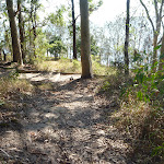
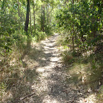
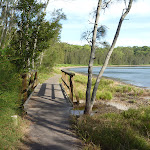
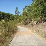
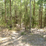
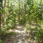
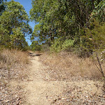
Turn left: From the intersection[56][57], this walk follows the gently downhill gravel track and timber steps, while leaving behind the concrete footpath[58] and ‘Green Point Drive’ sign[59]. This walk continues, undulating moderately steeply[60] (ignoring side tracks[61]) through open eucalyptus forest and with occasional short sections of timber boardwalk[62], for about 600m, until crossing over a timber footbridge[63] by the lake[64] and coming to the open grassy area[65] of Green Point[66].
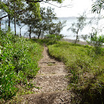
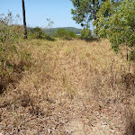
Turn left: From the intersection[67], this walk follows the track towards Green Point[68] (and the water), while leaving the forest[69] directly behind you. This walk continues for about 60m, passing across grasslands[70] and towards a small clump of She Oak trees[71], until coming to the lake edge[72] and Green Point.
Turn left: From the intersection[67], this walk follows the track towards Green Point[68] (and the water), while leaving the forest[69] directly behind you. This walk continues for about 60m, passing across grasslands[70] and towards a small clump of She Oak trees[71], until coming to the lake edge[72] and Green Point.
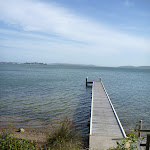
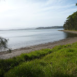
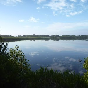
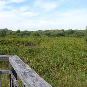
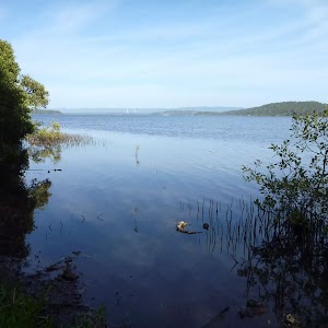
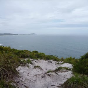
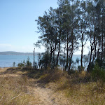
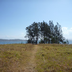
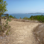
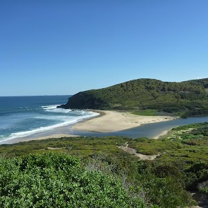
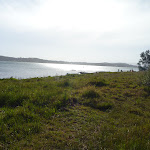
Green Point (on Lake Macquarie)
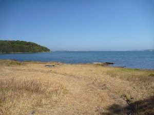
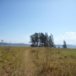
Green Point in the Green Point Foreshore Reserve on Lake Macquarie is a large grassed area[73] which looks out over Lake Macquarie. From the vantage point of Green Point, a walker can see up and down Lake Macquarie[74]. There are often boats passing by this low headland. This is a fabulous place to have a picnic and there is even a clump of She Oak trees[75] by the water for shade. There are no facilities here, other than the open grassed area.
(1.83km) Green Point → Int of Fore Shore & Coast Tracks
630 m
13 mins
22m
-15m
Hard track
Turn around: From Green Point (by the lake[76] and small clump of She Oak trees[77][78]), this walk follows the track across grasslands and towards the forest. This walk continues for about 60m, until coming to a four-way intersection[79][80] with a track and forest ahead.
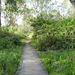
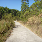
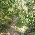
Turn left: From the intersection[81], this walk follows the track[82], while keeping the lake and water on your left. This walk continues for about 210m, then passes over a timber boardwalk[83] and bridge (with good views over the lake). Then this walk continues for about 160m through forest[84] before climbing gently up and down timber steps[85]. After a further 60m, this walk climbs gently up eroded timber steps[86], then after another 60m, comes to a track[87][88] (on the right) as you are walking down timber steps.
Turn left: From the intersection[81], this walk follows the track[82], while keeping the lake and water on your left. This walk continues for about 210m, then passes over a timber boardwalk[83] and bridge (with good views over the lake). Then this walk continues for about 160m through forest[84] before climbing gently up and down timber steps[85]. After a further 60m, this walk climbs gently up eroded timber steps[86], then after another 60m, comes to a track[87][88] (on the right) as you are walking down timber steps.
(2.46km) Int of Fore Shore & Coast Tracks → Int of Fore Shore & Short Cut Tracks
90 m
2 mins
1m
-5m
Moderate track
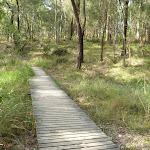
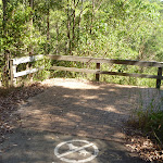
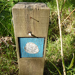
Continue straight: From the intersection[89][90], this walk follows the timber steps[91] gently downhill, while keeping the lake on your left. This walk continues through forest for about 35m, to find a timber boardwalk[92] and bridge[93] (with views of the lake). Then this walk continues for about 20m, climbing up timber steps[94] and following a track for a further about 50m, until coming to a three-way intersection[95], with a track and ‘mangrove seed symbol’ signed[96] timber post (on the right).
(2.55km) Int of Fore Shore AND Short Cut Tracks → Rockyhigh Viewpoint
120 m
2 mins
6m
-1m
Moderate track
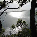
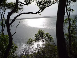
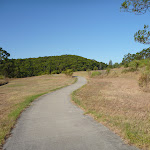
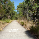
Veer left: From the intersection[97], this walk follows the track while initially keeping the ‘mangrove seed symbol’ signed[98] timber post on the right and lake on the left. This walk continues for about 90m, undulating gently, to climb moderately steeply up timber steps[99] (with a metal ring fence[100]). This walk continues for 20m until coming to Rockyhigh Viewpoint[101], with a bench seat[102] (on the right) and views[103] over the lake (on the left).
(2.66km) Rockyhigh Viewpoint → Int of Foreshore Track & Dilkera Ave Reserve Entrance
210 m
4 mins
8m
-7m
Moderate track
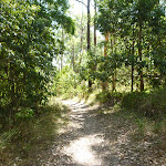
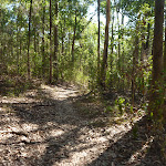
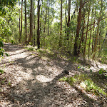
Continue straight: From Rockyhigh Viewpoint[106][107], this walk follows the track[108] moderately steeply downhill (beside a metal ring fence[109]), while keeping the water on your left. This walk continues for about 190m, undulating gently through forest[110], until coming to a T-intersection[111] with a concrete footpath and ‘Welcome to Green Point Fore Shore Reserve’ sign[112] (on the right)(Dilkera Ave[113] is visible directly ahead).
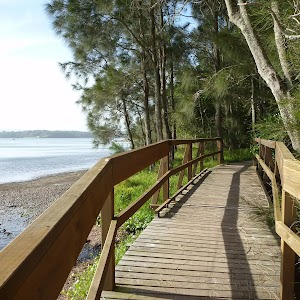
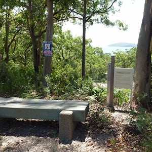
Green Point Reserve Entrance (Dilkera Avenue, Valentine)
The Dilkera Avenue entrance (in Valentine) to Green Point Foreshore Reserve offers access to both walking and bicycling paths. There is car parking and a large grassed park overlooking Lake Macquarie, a great spot to sit or have a picnic. A short walk away in the Green Point Reserve is Rockyhigh Viewpoint over Lake Macquarie, which is fabulous at sunset.
Maps for the The Foreshore Walk walk
You can download the PDF for this walk to print a map.
These maps below cover the walk and the wider area around the walk, they are worth carrying for safety reasons.
| Swansea | 1:25 000 Map Series | 92314N SWANSEA | NSW-92314N |
| Lake Macquarie | 1:100 000 Map Series | 9231 LAKE MACQUARIE | 9231 |
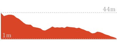
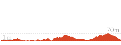
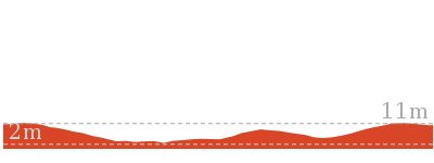
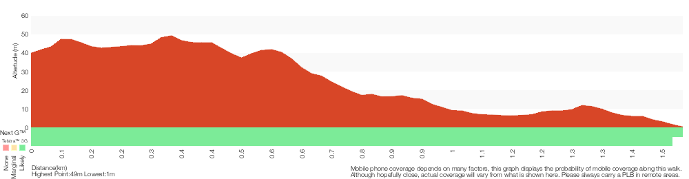
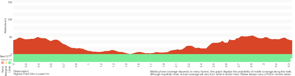
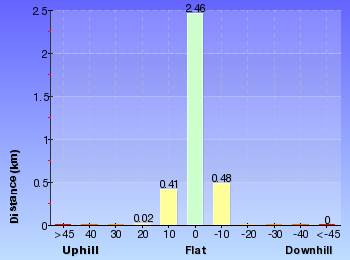
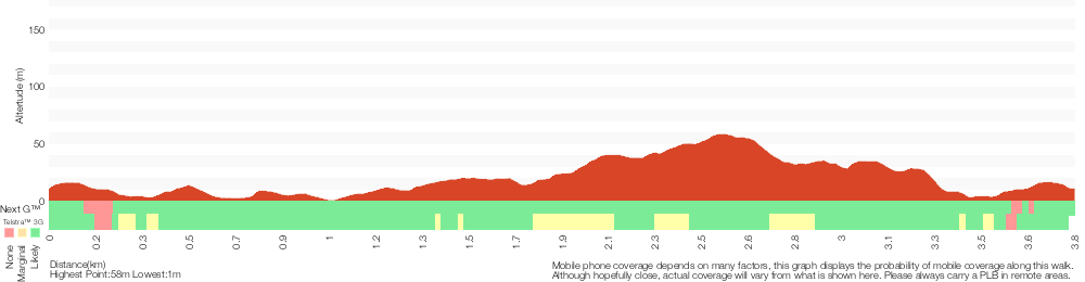
Cross sectional view of the The Foreshore Walk bushwalking track
Analysis and summary of the altitude variation on the The Foreshore Walk
Overview of this walks grade – based on the AS 2156.1 – 2001
Under this standard, a walk is graded based on the most difficult section of the walk.
| Length | 2.9 km | ||
| Time | 1 hr 15 mins | ||
| . | |||
| Grade 4/6 Hard track |
AS 2156.1 | Gradient | Short steep hills (3/6) |
| Quality of track | Formed track, with some branches and other obstacles (3/6) | ||
| Signs | Minimal directional signs (4/6) | ||
| Experience Required | Some bushwalking experience recommended (3/6) | ||
| Weather | Weather generally has little impact on safety (1/6) | ||
| Infrastructure | Limited facilities, not all cliffs are fenced (3/6) |
Some more details of this walks Grading
Here is a bit more details explaining grading looking at sections of the walk
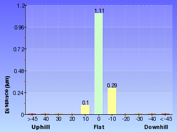
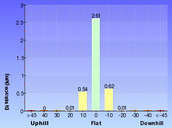
Gradient
1.5km of this walk has short steep hills and another 1.1km has gentle hills with occasional steps. The remaining (190m) is flat with no steps.
Quality of track
1.6km of this walk follows a formed track, with some branches and other obstacles and another 820m follows a smooth and hardened path. The remaining (430m) follows a clear and well formed track or trail.
Signs
1.9km of this walk has directional signs at most intersection and another 540m has minimal directional signs. The remaining (470m) is clearly signposted.
Experience Required
Around 2.2km of this walk requires no previous bushwalking experience, whilst the remaining 660m requires some bushwalking experience.
weather
This whole walk, 2.9km is not usually affected by severe weather events (that would unexpectedly impact safety and navigation).
Infrastructure
Around 1.5km of this walk is close to useful facilities (such as fenced cliffs and seats), whilst the remaining 1.4km has limited facilities (such as not all cliffs fenced).
Similar walks
A list of walks that share part of the track with the The Foreshore Walk walk.
666 m Circuit
30 mins
Moderate track

2.4 km Circuit
1 Hr
Moderate track

2.4 km Return
1 Hr
Moderate track

3 km Return
1 hr 15 mins
Moderate track


3.4 km Circuit
2 hrs 45 mins
Moderate track
3.8 km Circuit
1 hr 30 mins
Hard track

7.7 km Circuit
3 hrs
Hard track
Other Nearby walks
A list of walks that start near the The Foreshore Walk walk.
3.2 km Return
1 Hr
Moderate track
1.3 km Return
30 mins
Very easy

3.2 km Circuit
1 Hr
Hard track

1.2 km Circuit
30 mins
Hard track
2.4 km Return
1 Hr
Very easy

3.2 km Return
1 Hr
Moderate track
1.9 km One way
45 mins
Hard track
948 m Return
30 mins
Hard track

904 m Return
30 mins
Hard track

8.3 km Return
3 hrs
Hard track
7.8 km One way
2 hrs 45 mins
Hard track
13.3 km One way
4 hrs 30 mins
Moderate track
Plan your trip to and from the walk here
The The Foreshore Walk walk starts at the The Shores Way Car Park (gps: -33.029923, 151.64209)
Your transport options to The Shores Way Car Park are by;
![]() Bus. (get details)
Bus. (get details)
![]() Car. There is free parking available.
Car. There is free parking available.
(get details)
The The Foreshore Walk ends at the Int of Foreshore Track & Dilkera Ave Reserve Entrance (gps: -33.013892, 151.62875)
Your transport options to Int of Foreshore Track & Dilkera Ave Reserve Entrance are by;
![]() Bus. (get details)
Bus. (get details)
![]() Car. There is free parking available.
Car. There is free parking available.
(get details)


Short URL = http://wild.tl/tfw
Gallery images
There are other downloads I am still working on.
You will probably need to login to access these — still all free.
* KML (google earth file)
* GPX (GPS file)
Special Maps/ brochures
* A3 topo maps
* PDF with Lands Topo map base
* PDF with arial image (and map overlay)
I wanted to get the main site live first, this extra stuff will come in time.
Happy walking
Matt 🙂
The Green Point Walk
And Walk
The Green Point Walk

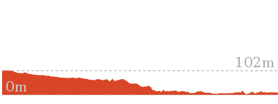
1 hr 15 mins
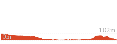
3 km Return
102 m
Moderate track
This walk descends through open grasslands and eucalyptus forest to arrive at the grassed Green Point. This is a quiet and secluded spot and a fabulous place for a picnic. From Green Point, there are good views up and down Lake Macquarie. The side trip to the Sea Eagle Lookouts is also worthwhile. A good walk, with both scenic views and waterside relaxation.


Green Point Foreshore Reserve on Lake Macquarie
The Green Point Foreshore Reserve on Lake Macquarie is a great place for a bush walk, bicycle or picnic. The Green Point Foreshore reserve offers many historical and environmentally interpretative signs along its multi use pathways. There is an unformed foreshore pathway beside Lake Macquarie, or more physically demanding walks away from the lake foreshore and into rainforest.
Historically, the Green Point area was involved in a coal rush from the 1860’s. This coal rush was spearheaded by the Cardiff Coal Company. Coal was proposed to be transported by barge to Threlkeld’s old wharf at Reid’s Mistake (Swansea Heads) for shipping to Sydney. However, the coal was poor quality ‘boiler coal’ and used mostly for steamer boilers. This coal rush finished in 1870. Timber was also milled on site after the coal rush. The Lake Macquarie Council is undergoing extensive rehabilitation works to improve the area for recreation. For more information contact the Lake Macquarie Visitor Information Centre on (02) 4921 0740 More info.
Historically, the Green Point area was involved in a coal rush from the 1860’s. This coal rush was spearheaded by the Cardiff Coal Company. Coal was proposed to be transported by barge to Threlkeld’s old wharf at Reid’s Mistake (Swansea Heads) for shipping to Sydney. However, the coal was poor quality ‘boiler coal’ and used mostly for steamer boilers. This coal rush finished in 1870. Timber was also milled on site after the coal rush. The Lake Macquarie Council is undergoing extensive rehabilitation works to improve the area for recreation. For more information contact the Lake Macquarie Visitor Information Centre on (02) 4921 0740 More info.
Green Point Reserve Entrance (Green Point Drive, Belmont)
At the end of Green Point Drive[1] (in Belmont) is an entrance to Green Point Foreshore Reserve[2]. Both walking tracks and cycling paths start from this entrance, giving the advantage of traveling downhill to the foreshore and enjoying views as you go. No facilities are here at this stage, other than a turning circle for vehicles, but this entrance will be developed at a later time.
(0km) end of Green Point Drive (Green Point) → Int of Green Point & Green Point Drive Tracks
400 m
8 mins
18m
-12m
Very easy
From the end of Green Point Drive[3][4][5] (in Belmont), this walk follows the concrete footpath gently uphill between metal fencing[6], while initially keeping the ‘Green Point Foreshore Reserve’ sign[7] on the left. This walk continues for about 100m, to find a ‘No Dogs’ sign[8]. Then this walk continues, undulating for 300m with views[9] and grasslands (on the right), until coming to a three-way intersection[10] with a footpath and ‘Green Point’ sign[11] (on the right).
(0.4km) Int of Green Point Drive & Green Point Tracks → Upper Lookout (Sea Eagle Park)
290 m
6 mins
11m
-17m
Easy track
Continue straight: From the intersection[12], this walk follows the ‘Sea Eagle Lookout & Picnic Area’ sign[13] gently downhill across grasslands, while keeping the views[14] on your right. This walk continues for about 60m and then enters forest[15]. Then this walk continues for about 100m until coming to a three-way intersection[16][17] with a ‘Lookout’ sign (on the right).
Turn left: From the intersection[18][19], this walk follows the ‘Lookout’ sign[20] and footpath gently uphill. This walk continues through forest for about 80m to pass a picnic table[21] (on the right), until coming to a three-way intersection[22][23] with a track[24] (on the left and just before metal fencing[25].
Continue straight: From the intersection[26][27], this walk follows the footpath gently downhill[28] towards the viewpoint for 45m, until coming to the Upper Lookout[29][30] (above Sea Eagle Park). At the end of this side trip, retrace your steps back to the main walk then Turn left.
Sea Eagle Park Lookouts (lower, middle & upper)
These three lookouts (lower, middle and upper lookouts) are above Sea Eagle Park in Green Point Foreshore Reserve on Lake Macquarie and give great views[31][32] across Lake Macquarie towards Swansea. The upper lookout has a picnic table[33] in the shade behind the lookout, which gives relief on a hot day. The upper lookout also a picnic table[34] at the lookout, offering fabulous views to the south. Each of these lookouts has a bench seat and interpretative signs[35]. White Bellied Sea Eagles have been known to nest nearby and are often seen flying in the area.
(0.4km) Int of Green Point Drive & Green Point Tracks → Int of Green Point & Zig Zag Tracks
840 m
16 mins
10m
-47m
Very easy
Turn right: From the intersection[36][37], this walk follows the ‘Green Point’ sign[38] and foot path gently downhill across grasslands and towards the distance views[39]. This walk continues for about 230m, to find the footpath bends (to the right) with forest[40] on the left. Then this walk continues, surrounded by forest (ignoring side tracks[41]) for about 600m, until coming to a three-way intersection[42] with a track and ‘Walk Safe/Cycle Safe’ sign[43] (on the left).
(1.25km) Int of Green Point AND Zig Zag Tracks → Green Point
250 m
5 mins
3m
-12m
Moderate track
Veer left: From the intersection[44], this walk follows the track gently downhill, while initially keeping the ‘Walk Safe/Cycle Safe’ sign[45] on your left. This walk continues through forest[46] for about 160m, until coming to a four-way intersection[47] with a track and the grassed Green Point[48] directly ahead.
Continue straight: From the intersection[49], this walk follows the track towards Green Point[50] (and the water), while leaving the forest[51] directly behind you. This walk continues for about 60m, passing across grasslands[52] and towards a small clump of She Oak trees[53], until coming to the lake edge[54] and Green Point.
Continue straight: From the intersection[49], this walk follows the track towards Green Point[50] (and the water), while leaving the forest[51] directly behind you. This walk continues for about 60m, passing across grasslands[52] and towards a small clump of She Oak trees[53], until coming to the lake edge[54] and Green Point.
Green Point (on Lake Macquarie)
Green Point in the Green Point Foreshore Reserve on Lake Macquarie is a large grassed area[55] which looks out over Lake Macquarie. From the vantage point of Green Point, a walker can see up and down Lake Macquarie[56]. There are often boats passing by this low headland. This is a fabulous place to have a picnic and there is even a clump of She Oak trees[57] by the water for shade. There are no facilities here, other than the open grassed area.
Maps for the The Green Point Walk walk
You can download the PDF for this walk to print a map.
These maps below cover the walk and the wider area around the walk, they are worth carrying for safety reasons.
| Swansea | 1:25 000 Map Series | 92314N SWANSEA | NSW-92314N |
| Lake Macquarie | 1:100 000 Map Series | 9231 LAKE MACQUARIE | 9231 |
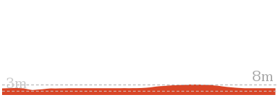
Cross sectional view of the The Green Point Walk bushwalking track
Analysis and summary of the altitude variation on the The Green Point Walk
Overview of this walks grade – based on the AS 2156.1 – 2001
Under this standard, a walk is graded based on the most difficult section of the walk.
| Length | 3 km | ||
| Time | 1 hr 15 mins | ||
| . | |||
| Grade 3/6 Moderate track |
AS 2156.1 | Gradient | Flat, no steps (1/6) |
| Quality of track | Clear and well formed track or trail (2/6) | ||
| Signs | Directional signs along the way (3/6) | ||
| Experience Required | No experience required (1/6) | ||
| Weather | Weather generally has little impact on safety (1/6) | ||
| Infrastructure | Generally useful facilities (such as fenced cliffs and seats) (1/6) |
Some more details of this walks Grading
Here is a bit more details explaining grading looking at sections of the walk
Gradient
This whole walk, 1.5km is flat with no steps.
Quality of track
Around 1.2km of this walk follows a smooth and hardened path, whilst the remaining 250m follows a clear and well formed track or trail.
Signs
Around 1.2km of this walk is clearly signposted, whilst the remaining 250m has directional signs at most intersection.
Experience Required
This whole walk, 1.5km requires no previous bushwalking experience.
weather
This whole walk, 1.5km is not usually affected by severe weather events (that would unexpectedly impact safety and navigation).
Infrastructure
This whole walk, 1.5km is close to useful facilities (such as fenced cliffs and seats).
Similar walks
A list of walks that share part of the track with the The Green Point Walk walk.
2.4 km Circuit
1 Hr
Moderate track
2.4 km Return
1 Hr
Moderate track
2.9 km One way
1 hr 15 mins
Hard track
3.4 km Circuit
2 hrs 45 mins
Moderate track
3.8 km Circuit
1 hr 30 mins
Hard track
7.7 km Circuit
3 hrs
Hard track
Other Nearby walks
A list of walks that start near the The Green Point Walk walk.
666 m Circuit
30 mins
Moderate track
3.2 km Return
1 Hr
Moderate track
1.3 km Return
30 mins
Very easy
3.2 km Circuit
1 Hr
Hard track
1.2 km Circuit
30 mins
Hard track
2.4 km Return
1 Hr
Very easy
1.9 km One way
45 mins
Hard track
948 m Return
30 mins
Hard track
3.2 km Return
1 Hr
Moderate track
13.3 km One way
4 hrs 30 mins
Moderate track
25.7 km One way
2 Days
Hard track

7.9 km One way
2 hrs 45 mins
Hard track
Plan your trip to and from the walk here
The The Green Point Walk walk starts and ends at the end of Green Point Drive (Green Point) (gps: -33.024109, 151.64048)
Your transport options to end of Green Point Drive (Green Point) are by;
![]() Bus. (get details)
Bus. (get details)
![]() Car. There is free parking available.
Car. There is free parking available.
(get details)
Short URL = http://wild.tl/tgpw
Gallery images
There are other downloads I am still working on.
You will probably need to login to access these — still all free.
* KML (google earth file)
* GPX (GPS file)
Special Maps/ brochures
* A3 topo maps
* PDF with Lands Topo map base
* PDF with arial image (and map overlay)
I wanted to get the main site live first, this extra stuff will come in time.
Happy walking
Matt 🙂
Green Point Drive Circuit
And Walk
Green Point Drive Circuit

2 hrs 45 mins
3.4 km Circuit
127 m
Moderate track
This walk takes in two of the best parts of Green Point Reserve, the quiet and secluded Green Point itself and the views at Sea Eagle Lookout. Starting at the high point of Green Point Drive entrance, you gradually descend to the foreshore, crossing over open grasslands and through eucalyptus forest. The lookout on the return journey has good seating to rest and enjoy the views. The side trip to Sea Eagle park offers excellent picnic facilities. A recommended walk.


Green Point Foreshore Reserve on Lake Macquarie
The Green Point Foreshore Reserve on Lake Macquarie is a great place for a bush walk, bicycle or picnic. The Green Point Foreshore reserve offers many historical and environmentally interpretative signs along its multi use pathways. There is an unformed foreshore pathway beside Lake Macquarie, or more physically demanding walks away from the lake foreshore and into rainforest.
Historically, the Green Point area was involved in a coal rush from the 1860’s. This coal rush was spearheaded by the Cardiff Coal Company. Coal was proposed to be transported by barge to Threlkeld’s old wharf at Reid’s Mistake (Swansea Heads) for shipping to Sydney. However, the coal was poor quality ‘boiler coal’ and used mostly for steamer boilers. This coal rush finished in 1870. Timber was also milled on site after the coal rush. The Lake Macquarie Council is undergoing extensive rehabilitation works to improve the area for recreation. For more information contact the Lake Macquarie Visitor Information Centre on (02) 4921 0740 More info.
Historically, the Green Point area was involved in a coal rush from the 1860’s. This coal rush was spearheaded by the Cardiff Coal Company. Coal was proposed to be transported by barge to Threlkeld’s old wharf at Reid’s Mistake (Swansea Heads) for shipping to Sydney. However, the coal was poor quality ‘boiler coal’ and used mostly for steamer boilers. This coal rush finished in 1870. Timber was also milled on site after the coal rush. The Lake Macquarie Council is undergoing extensive rehabilitation works to improve the area for recreation. For more information contact the Lake Macquarie Visitor Information Centre on (02) 4921 0740 More info.
Green Point Reserve Entrance (Green Point Drive, Belmont)
At the end of Green Point Drive[1] (in Belmont) is an entrance to Green Point Foreshore Reserve[2]. Both walking tracks and cycling paths start from this entrance, giving the advantage of traveling downhill to the foreshore and enjoying views as you go. No facilities are here at this stage, other than a turning circle for vehicles, but this entrance will be developed at a later time.
(0km) end of Green Point Drive (Green Point) → Int of Green Point & Green Point Drive Tracks
400 m
8 mins
18m
-12m
Very easy
From the end of Green Point Drive[3][4][5] (in Belmont), this walk follows the concrete footpath gently uphill between metal fencing[6], while initially keeping the ‘Green Point Foreshore Reserve’ sign[7] on the left. This walk continues for about 100m, to find a ‘No Dogs’ sign[8]. Then this walk continues, undulating for 300m with views[9] and grasslands (on the right), until coming to a three-way intersection[10] with a footpath and ‘Green Point’ sign[11] (on the right).
(0.4km) Int of Green Point Drive & Green Point Tracks → Int of Green Point & Zig Zag Tracks
840 m
16 mins
10m
-47m
Very easy
Turn right: From the intersection[12][13], this walk follows the ‘Green Point’ sign[14] and foot path gently downhill across grasslands and towards the distance views[15]. This walk continues for about 230m, to find the footpath bends (to the right) with forest[16] on the left. Then this walk continues, surrounded by forest (ignoring side tracks[17]) for about 600m, until coming to a three-way intersection[18] with a track and ‘Walk Safe/Cycle Safe’ sign[19] (on the left).
(1.25km) Int of Green Point AND Zig Zag Tracks → Green Point
250 m
5 mins
3m
-12m
Moderate track
Veer left: From the intersection[20], this walk follows the track gently downhill, while initially keeping the ‘Walk Safe/Cycle Safe’ sign[21] on your left. This walk continues through forest[22] for about 160m, until coming to a four-way intersection[23] with a track and the grassed Green Point[24] directly ahead.
Continue straight: From the intersection[25], this walk follows the track towards Green Point[26] (and the water), while leaving the forest[27] directly behind you. This walk continues for about 60m, passing across grasslands[28] and towards a small clump of She Oak trees[29], until coming to the lake edge[30] and Green Point.
Continue straight: From the intersection[25], this walk follows the track towards Green Point[26] (and the water), while leaving the forest[27] directly behind you. This walk continues for about 60m, passing across grasslands[28] and towards a small clump of She Oak trees[29], until coming to the lake edge[30] and Green Point.
Green Point (on Lake Macquarie)
Green Point in the Green Point Foreshore Reserve on Lake Macquarie is a large grassed area[31] which looks out over Lake Macquarie. From the vantage point of Green Point, a walker can see up and down Lake Macquarie[32]. There are often boats passing by this low headland. This is a fabulous place to have a picnic and there is even a clump of She Oak trees[33] by the water for shade. There are no facilities here, other than the open grassed area.
(1.5km) Green Point → Int of Foreshore & Green Point Drive Tracks
750 m
14 mins
32m
-8m
Moderate track
Turn around: From Green Point (by the lake[34] and small clump of She Oak trees[35][36]), this walk follows the track across grasslands and towards the forest. This walk continues for about 60m, until coming to a four-way intersection[37][38] with a track and forest ahead.
Turn right: From Green Point[39], this walk crosses over a timber footbridge[40] and follows the track, while keeping the lake on your right. This walk continues through open eucalyptus forest, with occasional short sections of timber boardwalk[41] for about 600m, until undulating moderately steeply[42] and coming to a three-way intersection[43], with a concrete footpath and ‘Green Point Drive’ sign[44] on the right.
Turn right: From Green Point[39], this walk crosses over a timber footbridge[40] and follows the track, while keeping the lake on your right. This walk continues through open eucalyptus forest, with occasional short sections of timber boardwalk[41] for about 600m, until undulating moderately steeply[42] and coming to a three-way intersection[43], with a concrete footpath and ‘Green Point Drive’ sign[44] on the right.
(2.25km) Int of Foreshore AND Green Point Drive Tracks → Int of Foreshore AND Lookout Tracks
190 m
4 mins
3m
-11m
Easy track
Turn right: From the intersection[45], this walk follows the footpath gently downhill[46], while keeping the gravel track[47] and ‘Green Point Drive’ timber sign[48] on your right. This walk continues, undulating for about 180m, until coming to a three-way intersection[49], with a ‘Lookout’ sign[50] on the left and a ‘Getting about at Green Point’ sign[51] on your right.
(2.44km) Int of Foreshore & Lookout Tracks → Int of Foreshore Track & Sea Eagle Park
80 m
2 mins
1m
-6m
Moderate track
Continue straight: From the intersection[52], this walk follows the footpath gently downhill[53], while keeping the Lookout track on your left and the ‘Getting about at Green Point’ sign[54] on your right. This walk continues for about 70m until coming to a three-way intersection[55], with a track and Sea Eagle Park[56] on your left. At the end of this side trip, retrace your steps back to the main walk then Turn right.
Sea Eagle Park
Sea Eagle Park in Green Point Foreshore Reserve on Lake Macquarie is a large grassed picnic area[57], with a toilet[58], sheltered picnic tables[59], water from a tap[60][61] and gas/electric barbeque’s[62]. This picnic area is particularly good for larger family group, for there is room to play ball games or just sit and look at the views. The short walk up to the Sea Eagle Lookouts is recommended for the commanding views south towards Swansea.
(2.44km) Int of Foreshore & Lookout Tracks → Lower Lookout (Sea Eagle Park)
110 m
2 mins
16m
0m
Moderate track
Turn left: From the intersection[63][64], this walk heads up timber steps, directly away from the face of the ‘Getting about at Green Point’ sign[65]. This walk continues gently uphill, with occasional timber steps (and passing a seat[66]) for about 110m, until coming to the Lower Lookout[67][68] above Sea Eagle Park (on the right).
Sea Eagle Park Lookouts (lower, middle & upper)
These three lookouts (lower, middle and upper lookouts) are above Sea Eagle Park in Green Point Foreshore Reserve on Lake Macquarie and give great views[69][70] across Lake Macquarie towards Swansea. The upper lookout has a picnic table[71] in the shade behind the lookout, which gives relief on a hot day. The upper lookout also a picnic table[72] at the lookout, offering fabulous views to the south. Each of these lookouts has a bench seat and interpretative signs[73]. White Bellied Sea Eagles have been known to nest nearby and are often seen flying in the area.
(2.55km) Lower Lookout (Sea Eagle Park) → Upper Lookout (Sea Eagle Park)
140 m
4 mins
16m
-9m
Moderate track
Turn left: From Lower Lookout[74][75], this walk heads gently uphill, while keeping the views on your right. This walk continues along the track for about 100m, using timber steps[76][77], until coming to Middle Lookout[78].
Turn left : From the Middle Lookout[79], this walk heads up timber steps[80] for 30m, until coming to the Upper Lookout[81][82] (with Sea Eagle Park below).
Turn left : From the Middle Lookout[79], this walk heads up timber steps[80] for 30m, until coming to the Upper Lookout[81][82] (with Sea Eagle Park below).
(2.69km) Upper Lookout (Sea Eagle Park) → Int of Lookout Track and Lookout Footpath
50 m
1 mins
8m
-2m
Very easy
(2.74km) Int of Lookout & Linkage Tracks → Int of Green Point Drive & Linkage Tracks
80 m
2 mins
6m
-1m
Easy track
Continue straight: From the three-way intersection[90][91], this walk follows the concrete footpath[92], while passing a picnic table[93] (on the left) and initially keeping the views[94] on the left. This walk continues through forest for about 80m, until coming to a three-way intersection[95][96] with a ‘Green Point Drive Entry 570m’ sign (on the right).
(2.81km) Int of Green Point Drive & Linkage Tracks → Int of Green Point Drive & Green Point Tracks
170 m
3 mins
3m
-8m
Very easy
Turn right: From the intersection[97], this walk follows the ‘Green Point Drive Entry’ sign[98] and footpath gently uphill. This walk continues through forest for about 100m, to come to open grasslands[99] and views (on your left). Then this walk continues for about 60m, until coming to a three-way intersection[100], with a ‘Green Point’ sign[101] (on the left) and a metal seat[102] (on the right).
(2.98km) Int of Green Point & Green Point Drive Tracks → end of Green Point Drive (Green Point)
400 m
8 mins
12m
-18m
Very easy
Continue straight: From the intersection[103], this walk follows the ‘Green Point Entry’ sign[104] and concrete footpath gently uphill, while keeping the views[105] over grassland on your left. This walk continues, gently undulating across grasslands for about 300m, to find a ‘No Dogs’ sign[106]. Then this walk continues on the footpath (keeping a metal cabled fence[107] on your left) for about 100m, until coming to the end of Green Point Drive[108][109][110] (in Belmont).
Maps for the Green Point Drive Circuit walk
You can download the PDF for this walk to print a map.
These maps below cover the walk and the wider area around the walk, they are worth carrying for safety reasons.
| Swansea | 1:25 000 Map Series | 92314N SWANSEA | NSW-92314N |
| Lake Macquarie | 1:100 000 Map Series | 9231 LAKE MACQUARIE | 9231 |
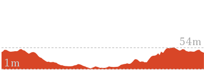
Cross sectional view of the Green Point Drive Circuit bushwalking track
Analysis and summary of the altitude variation on the Green Point Drive Circuit
Overview of this walks grade – based on the AS 2156.1 – 2001
Under this standard, a walk is graded based on the most difficult section of the walk.
| Length | 3.4 km | ||
| Time | 2 hrs 45 mins | ||
| . | |||
| Grade 3/6 Moderate track |
AS 2156.1 | Gradient | Short steep hills (3/6) |
| Quality of track | Formed track, with some branches and other obstacles (3/6) | ||
| Signs | Directional signs along the way (3/6) | ||
| Experience Required | Some bushwalking experience recommended (3/6) | ||
| Weather | Weather generally has little impact on safety (1/6) | ||
| Infrastructure | Limited facilities, not all cliffs are fenced (3/6) |
Some more details of this walks Grading
Here is a bit more details explaining grading looking at sections of the walk
Gradient
2.3km of this walk is flat with no steps and another 660m has short steep hills. The remaining (440m) has gentle hills with occasional steps.
Quality of track
2.2km of this walk follows a smooth and hardened path and another 880m follows a formed track, with some branches and other obstacles. The remaining (340m) follows a clear and well formed track or trail.
Signs
Around 2.4km of this walk is clearly signposted, whilst the remaining 1km has directional signs at most intersection.
Experience Required
Around 2.6km of this walk requires no previous bushwalking experience, whilst the remaining 770m requires some bushwalking experience.
weather
This whole walk, 3.4km is not usually affected by severe weather events (that would unexpectedly impact safety and navigation).
Infrastructure
Around 2.7km of this walk is close to useful facilities (such as fenced cliffs and seats), whilst the remaining 660m has limited facilities (such as not all cliffs fenced).
Similar walks
A list of walks that share part of the track with the Green Point Drive Circuit walk.
2.4 km Circuit
1 Hr
Moderate track
2.4 km Return
1 Hr
Moderate track
2.9 km One way
1 hr 15 mins
Hard track
3 km Return
1 hr 15 mins
Moderate track
3.8 km Circuit
1 hr 30 mins
Hard track
7.7 km Circuit
3 hrs
Hard track
Other Nearby walks
A list of walks that start near the Green Point Drive Circuit walk.
666 m Circuit
30 mins
Moderate track
3.2 km Return
1 Hr
Moderate track
1.3 km Return
30 mins
Very easy
3.2 km Circuit
1 Hr
Hard track
1.2 km Circuit
30 mins
Hard track
2.4 km Return
1 Hr
Very easy
1.9 km One way
45 mins
Hard track
948 m Return
30 mins
Hard track
3.2 km Return
1 Hr
Moderate track
13.3 km One way
4 hrs 30 mins
Moderate track
25.7 km One way
2 Days
Hard track
7.9 km One way
2 hrs 45 mins
Hard track
Plan your trip to and from the walk here
The Green Point Drive Circuit walk starts and ends at the end of Green Point Drive (Green Point) (gps: -33.024109, 151.64048)
Your transport options to end of Green Point Drive (Green Point) are by;
![]() Bus. (get details)
Bus. (get details)
![]() Car. There is free parking available.
Car. There is free parking available.
(get details)
Short URL = http://wild.tl/gpdc
Gallery images
There are other downloads I am still working on.
You will probably need to login to access these — still all free.
* KML (google earth file)
* GPX (GPS file)
Special Maps/ brochures
* A3 topo maps
* PDF with Lands Topo map base
* PDF with arial image (and map overlay)
I wanted to get the main site live first, this extra stuff will come in time.
Happy walking
Matt 🙂
Northern Green Point Circuit
And Walk
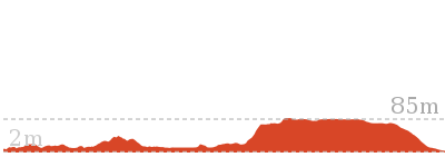
Northern Green Point Circuit

1 hr 30 mins
3.8 km Circuit
140 m
Hard track
This walk visits two lovely foreshore locations on Lake Macquarie, before gaining height and traveling through eucalyptus forest and then finally descending again to the foreshore. The forest walking is mostly along fire trails adjacent to houses and it is possible to shorten the walk by exiting onto Roma or Leichhardt Roads. To finish this walk, you can return over Rocky-high viewpoint or alternatively inland through forest. This walk explores the lesser walked northern half of Green Point Reserve.


Green Point Foreshore Reserve on Lake Macquarie
The Green Point Foreshore Reserve on Lake Macquarie is a great place for a bush walk, bicycle or picnic. The Green Point Foreshore reserve offers many historical and environmentally interpretative signs along its multi use pathways. There is an unformed foreshore pathway beside Lake Macquarie, or more physically demanding walks away from the lake foreshore and into rainforest.
Historically, the Green Point area was involved in a coal rush from the 1860’s. This coal rush was spearheaded by the Cardiff Coal Company. Coal was proposed to be transported by barge to Threlkeld’s old wharf at Reid’s Mistake (Swansea Heads) for shipping to Sydney. However, the coal was poor quality ‘boiler coal’ and used mostly for steamer boilers. This coal rush finished in 1870. Timber was also milled on site after the coal rush. The Lake Macquarie Council is undergoing extensive rehabilitation works to improve the area for recreation. For more information contact the Lake Macquarie Visitor Information Centre on (02) 4921 0740 More info.
Historically, the Green Point area was involved in a coal rush from the 1860’s. This coal rush was spearheaded by the Cardiff Coal Company. Coal was proposed to be transported by barge to Threlkeld’s old wharf at Reid’s Mistake (Swansea Heads) for shipping to Sydney. However, the coal was poor quality ‘boiler coal’ and used mostly for steamer boilers. This coal rush finished in 1870. Timber was also milled on site after the coal rush. The Lake Macquarie Council is undergoing extensive rehabilitation works to improve the area for recreation. For more information contact the Lake Macquarie Visitor Information Centre on (02) 4921 0740 More info.
Green Point Reserve Entrance (Dilkera Avenue, Valentine)
The Dilkera Avenue entrance (in Valentine) to Green Point Foreshore Reserve offers access to both walking and bicycling paths. There is car parking and a large grassed park overlooking Lake Macquarie, a great spot to sit or have a picnic. A short walk away in the Green Point Reserve is Rockyhigh Viewpoint over Lake Macquarie, which is fabulous at sunset.
(0km) Int of Foreshore Track & Dilkera Ave Reserve Entrance → Rockyhigh Viewpoint
210 m
4 mins
7m
-8m
Moderate track
From the intersection[1], this walk follows the track, while initially keeping the ‘Welcome to Green Point Fore Shore Reserve’ sign[2][3] on your left. This walk continues, passing a ‘Mangrove Seed Symbol’ timber signed post[4] (on the left) after about 5m. Then this walk continues through forest for about 190m, undulating gently to climb moderately steeply up timber steps[5] (beside a metal ring fence[6][7]) to find Rockyhigh Viewpoint, with a bench seat[8] (on the left) and views[9] over the lake (on the right).
(0.21km) Rockyhigh Viewpoint → Int of Fore Shore AND Short Cut Tracks
120 m
2 mins
1m
-6m
Moderate track
Continue straight: From Rockyhigh Viewpoint[12][13], this walk follows the track moderately steeply downhill[14], while keeping the views on the right. This walk continues for 20m, then undulates gently for about 90m, until coming to a three-way intersection[15] with a track and ‘Mangrove Seed Symbol’ timber posted sign[16] (on the left).
(0.32km) Int of Fore Shore & Short Cut Tracks → Int of Fore Shore & Coast Tracks
90 m
2 mins
5m
-1m
Moderate track
Veer right: From the intersection[17][18], this walk follows the track through forest, while keeping the lake on your right. This walk continues through forest for about 50m, to descend timber steps[19] and then continues for a further 20m, to find a timber boardwalk[20] and bridge[21] (with views of the lake). Then this walk continues for about 35m, until climbing gently up timber steps[22][23] and coming to a track[24][25] (on the left) midway up the steps.
(0.41km) Int of Fore Shore & Coast Tracks → Green Point
630 m
13 mins
15m
-22m
Hard track
Continue straight: From the intersection[26][27], this walk follows the timber steps gently uphill[28], while keeping the lake on your right. This walk continues for about 60m, then descends down timber steps[29]. Then this walk continues for about 160m through forest, climbing gently up and down timber steps[30] to find a timber boardwalk[31] and bridge (with good views over the lake). The walk continues for about 210m, until coming to a four-way intersection[32][33][34], with a large grassy area (Green Point) (on the right).
Turn right: From the intersection[35], this walk follows the track towards Green Point[36] (and the water), while leaving the forest[37] directly behind you. This walk continues for about 60m, passing across grasslands[38] and towards a small clump of She Oak trees[39], until coming to the lake edge[40] and Green Point.
Turn right: From the intersection[35], this walk follows the track towards Green Point[36] (and the water), while leaving the forest[37] directly behind you. This walk continues for about 60m, passing across grasslands[38] and towards a small clump of She Oak trees[39], until coming to the lake edge[40] and Green Point.
Green Point (on Lake Macquarie)
Green Point in the Green Point Foreshore Reserve on Lake Macquarie is a large grassed area[41] which looks out over Lake Macquarie. From the vantage point of Green Point, a walker can see up and down Lake Macquarie[42]. There are often boats passing by this low headland. This is a fabulous place to have a picnic and there is even a clump of She Oak trees[43] by the water for shade. There are no facilities here, other than the open grassed area.
(1.04km) Green Point → Int of Green Point AND Zig Zag Tracks
250 m
5 mins
12m
-3m
Moderate track
Turn around: From Green Point (by the lake[44] and small clump of She Oak trees[45][46]), this walk follows the track across grasslands and towards the forest. This walk continues for about 60m, until coming to a four-way intersection[47][48] with a track and forest ahead.
Continue straight: From the intersection[49], this walk follows the track gently uphill into forest[50][51] and leaving Green Point directly behind you. This walk continues through forest[52] for about 160m, until coming to a three-way intersection[53] with a concrete footpath and ‘Walk Safe/Cycle Safe’ sign[54] (on the right).
Continue straight: From the intersection[49], this walk follows the track gently uphill into forest[50][51] and leaving Green Point directly behind you. This walk continues through forest[52] for about 160m, until coming to a three-way intersection[53] with a concrete footpath and ‘Walk Safe/Cycle Safe’ sign[54] (on the right).
(1.29km) Int of Green Point & Zig Zag Tracks → Int of Green Point Track & Leichhardt Trail
840 m
18 mins
44m
-13m
Moderate track
Turn left : From the intersection[55], this walk follows the gently uphill concrete footpath, while initially keeping the track and ‘Walk Safe/Cycle Safe’ sign[56] (on your left). This walk then continues through forest[57] (ignoring side tracks[58]) for about 400m to come to a small heath clearing[59] (on the left). Then this walk continues moderately steeply on the zigzagging footpath[60] for about 130m (passing a metal seat[61]), until coming to a three-way intersection[62] with a trail[63] (on the right), and houses[64] (directly ahead).
(2.13km) Int of Green Point Track & Leichhardt Trai → Int of Leichhardt Trail & Upper Leichhardt Track
380 m
8 mins
24m
-7m
Easy track
Turn left: From the intersection[65][66], this walk follows the footpath gently uphill, while keeping the houses on the right and the valley on the left. This walk continues through forest for 70m, until coming to a three-way intersection[67] with a footpath between houses[68] (on the right) and a ‘Green Point Fire Trail’ sign[69] (on the left).
Continue straight: From this intersection[70], this walk follows the trail, while keeping houses[71] on your right and the valley on your left. This walk continues, undulating for 300m, until coming to a three-way intersection[72] (as the trail turns left), with a gently uphill track into houses (on the right).
Continue straight: From this intersection[70], this walk follows the trail, while keeping houses[71] on your right and the valley on your left. This walk continues, undulating for 300m, until coming to a three-way intersection[72] (as the trail turns left), with a gently uphill track into houses (on the right).
(2.52km) Int of Leichhardt Trail & Upper Leichhardt Track → Int of Leichhardt Trail & Roma Track
440 m
9 mins
6m
-31m
Moderate track
Turn left: From the intersection[73][74], this walk follows the trail while keeping the houses on the right and the valley on the left. This walk continues, undulating moderately steeply[75][76] along the fire trail for about 400m, until coming to a three-way intersection[77] with a locked gate[78][79] and concrete foot path between houses (on the right) and a ‘Green Point Fire Trail’ sign[80] (on the left).
(2.95km) Int of Leichhardt Trail & Roma Track → Int of Leichhardt Trail & Coast Track
130 m
3 mins
8m
-7m
Easy track
Veer left: From the intersection[81][82], this walk follows the trail[83] moderately steeply downhill, while initially keeping the locked gate[84] and houses on your right. This walk continues through forest, becoming gently undulating for about 140m, until coming to a faint three-way intersection[85] with a moderately steeply downhill track (on the left), just as the trail bends[86][87] (to the right).
(3.08km) Int of Leichhardt Trail & Coast Track → Int of Fore Shore and Coast Tracks
300 m
6 mins
3m
-30m
Hard track
Turn left: From the intersection[88][89][90], this walk follows the track moderately steeply downhill into forest, while leaving behind the level trail and houses. This walk continues for about 300m (ignoring side tracks[91]), becoming gently downhill, until coming to a T-intersection[92] with timber steps[93] (and Lake Macquarie[94] directly ahead).
(3.38km) Int of Fore Shore & Coast Tracks → Int of Fore Shore & Short Cut Tracks
90 m
2 mins
1m
-5m
Moderate track
Turn right: From the intersection[95][96], this walk follows the timber steps[97] gently downhill, while keeping the lake on your left. This walk continues through forest for about 35m, to find a timber boardwalk[98] and bridge[99] (with views of the lake). Then this walk continues for about 20m, climbing up timber steps[100] and following a track for a further about 50m, until coming to a three-way intersection[101], with a track and ‘mangrove seed symbol’ signed[102] timber post (on the right).
(3.47km) Int of Fore Shore & Short Cut Tracks → Int of Foreshore Track & Dilkera Ave Reserve Entrance
340 m
9 mins
19m
-13m
Moderate track
Continue straight: From the intersection[103], this walk follows the track away from the lake, initially keeping the ‘Mangrove Seed Symbol’ timber posted sign[104] on your left. This walk continues through forest[105][106] and gently uphill for about 180m, until coming to a T-intersection[107] with a concrete foot path[108], and ‘steep bike riding’ sign[109] (on the right).
Turn left: From the intersection[110], this walk follows the footpath gently downhill, while keeping the ‘steep bike riding’ sign[111][112] and track initially on the left. This walk continues through forest for about 140m (with houses[113] on the right), until coming to a three-way intersection[114] with a track and ‘Welcome to Green Point Fore Shore Reserve’ sign[115][116] (on the left).
Turn left: From the intersection[110], this walk follows the footpath gently downhill, while keeping the ‘steep bike riding’ sign[111][112] and track initially on the left. This walk continues through forest for about 140m (with houses[113] on the right), until coming to a three-way intersection[114] with a track and ‘Welcome to Green Point Fore Shore Reserve’ sign[115][116] (on the left).
(3.47km) Int of Fore Shore AND Short Cut Tracks → Rockyhigh Viewpoint
120 m
2 mins
6m
-1m
Moderate track
Veer left: From the intersection[117], this walk follows the track while initially keeping the ‘mangrove seed symbol’ signed[118] timber post on the right and lake on the left. This walk continues for about 90m, undulating gently, to climb moderately steeply up timber steps[119] (with a metal ring fence[120]). This walk continues for 20m until coming to Rockyhigh Viewpoint[121], with a bench seat[122] (on the right) and views[123] over the lake (on the left).
(3.59km) Rockyhigh Viewpoint → Int of Foreshore Track & Dilkera Ave Reserve Entrance
210 m
4 mins
8m
-7m
Moderate track
Continue straight: From Rockyhigh Viewpoint[124][125], this walk follows the track[126] moderately steeply downhill (beside a metal ring fence[127]), while keeping the water on your left. This walk continues for about 190m, undulating gently through forest[128], until coming to a T-intersection[129] with a concrete footpath and ‘Welcome to Green Point Fore Shore Reserve’ sign[130] (on the right)(Dilkera Ave[131] is visible directly ahead).
Maps for the Northern Green Point Circuit walk
You can download the PDF for this walk to print a map.
These maps below cover the walk and the wider area around the walk, they are worth carrying for safety reasons.
| Swansea | 1:25 000 Map Series | 92314N SWANSEA | NSW-92314N |
| Lake Macquarie | 1:100 000 Map Series | 9231 LAKE MACQUARIE | 9231 |
Cross sectional view of the Northern Green Point Circuit bushwalking track
Analysis and summary of the altitude variation on the Northern Green Point Circuit
Overview of this walks grade – based on the AS 2156.1 – 2001
Under this standard, a walk is graded based on the most difficult section of the walk.
| Length | 3.8 km | ||
| Time | 1 hr 30 mins | ||
| . | |||
| Grade 4/6 Hard track |
AS 2156.1 | Gradient | Short steep hills (3/6) |
| Quality of track | Formed track, with some branches and other obstacles (3/6) | ||
| Signs | Minimal directional signs (4/6) | ||
| Experience Required | Some bushwalking experience recommended (3/6) | ||
| Weather | Weather generally has little impact on safety (1/6) | ||
| Infrastructure | Limited facilities (such as cliffs not fenced, significant creeks not bridged) (4/6) |
Some more details of this walks Grading
Here is a bit more details explaining grading looking at sections of the walk
Gradient
2.8km of this walk has short steep hills and another 690m has gentle hills with occasional steps. The remaining (340m) is flat with no steps.
Quality of track
1.7km of this walk follows a formed track, with some branches and other obstacles and another 1.2km follows a clear and well formed track or trail. The remaining (920m) follows a smooth and hardened path.
Signs
1.8km of this walk is clearly signposted and another 1.2km has directional signs at most intersection. The remaining (850m) has minimal directional signs.
Experience Required
Around 3.5km of this walk requires no previous bushwalking experience, whilst the remaining 300m requires some bushwalking experience.
weather
This whole walk, 3.8km is not usually affected by severe weather events (that would unexpectedly impact safety and navigation).
Infrastructure
2.5km of this walk is close to useful facilities (such as fenced cliffs and seats) and another 950m has limited facilities (such as not all cliffs fenced). The remaining (300m) has limited facilities (such as cliffs not fenced, significant creeks not bridged).
Similar walks
A list of walks that share part of the track with the Northern Green Point Circuit walk.
666 m Circuit
30 mins
Moderate track
2.4 km Return
1 Hr
Moderate track
2.9 km One way
1 hr 15 mins
Hard track
3 km Return
1 hr 15 mins
Moderate track
3.4 km Circuit
2 hrs 45 mins
Moderate track
7.7 km Circuit
3 hrs
Hard track
Other Nearby walks
A list of walks that start near the Northern Green Point Circuit walk.
2.4 km Circuit
1 Hr
Moderate track
1.3 km Return
30 mins
Very easy
3.2 km Circuit
1 Hr
Hard track
1.2 km Circuit
30 mins
Hard track
2.4 km Return
1 Hr
Very easy
3.2 km Return
1 Hr
Moderate track
13.3 km One way
4 hrs 30 mins
Moderate track
25.7 km One way
2 Days
Hard track
1.9 km One way
45 mins
Hard track
948 m Return
30 mins
Hard track
7.9 km One way
2 hrs 45 mins
Hard track
12.1 km One way
5 hrs 30 mins
Hard track
Plan your trip to and from the walk here
The Northern Green Point Circuit walk starts and ends at the Int of Foreshore Track & Dilkera Ave Reserve Entrance (gps: -33.013892, 151.62875)
Your transport options to Int of Foreshore Track & Dilkera Ave Reserve Entrance are by;
![]() Bus. (get details)
Bus. (get details)
![]() Car. There is free parking available.
Car. There is free parking available.
(get details)
Short URL = http://wild.tl/ngpc
Gallery images
There are other downloads I am still working on.
You will probably need to login to access these — still all free.
* KML (google earth file)
* GPX (GPS file)
Special Maps/ brochures
* A3 topo maps
* PDF with Lands Topo map base
* PDF with arial image (and map overlay)
I wanted to get the main site live first, this extra stuff will come in time.
Happy walking
Matt 🙂
Green Point Circuit Walk
And Walk
Green Point Circuit Walk

3 hrs
7.7 km Circuit
269 m
Hard track
This walk visits all of the popular locations in Green Point Reserve, as well as some of the lesser-visited areas inland. Taking in Sea Eagle Park, Green Point and Rocky-high viewpoint on the foreshore and then travel inland through mostly eucalyptus forest to enjoy the views at Sea Eagle Lookout, before completing this circuit walk back to your starting point. A varied walk that gives the walker an excellent sense of what Green Point Reserve has to offer. This walk is thoroughly recommended.


Green Point Foreshore Reserve on Lake Macquarie
The Green Point Foreshore Reserve on Lake Macquarie is a great place for a bush walk, bicycle or picnic. The Green Point Foreshore reserve offers many historical and environmentally interpretative signs along its multi use pathways. There is an unformed foreshore pathway beside Lake Macquarie, or more physically demanding walks away from the lake foreshore and into rainforest.
Historically, the Green Point area was involved in a coal rush from the 1860’s. This coal rush was spearheaded by the Cardiff Coal Company. Coal was proposed to be transported by barge to Threlkeld’s old wharf at Reid’s Mistake (Swansea Heads) for shipping to Sydney. However, the coal was poor quality ‘boiler coal’ and used mostly for steamer boilers. This coal rush finished in 1870. Timber was also milled on site after the coal rush. The Lake Macquarie Council is undergoing extensive rehabilitation works to improve the area for recreation. For more information contact the Lake Macquarie Visitor Information Centre on (02) 4921 0740 More info.
Historically, the Green Point area was involved in a coal rush from the 1860’s. This coal rush was spearheaded by the Cardiff Coal Company. Coal was proposed to be transported by barge to Threlkeld’s old wharf at Reid’s Mistake (Swansea Heads) for shipping to Sydney. However, the coal was poor quality ‘boiler coal’ and used mostly for steamer boilers. This coal rush finished in 1870. Timber was also milled on site after the coal rush. The Lake Macquarie Council is undergoing extensive rehabilitation works to improve the area for recreation. For more information contact the Lake Macquarie Visitor Information Centre on (02) 4921 0740 More info.
The Car Park (off The Shores Way, Green Point)
The Shores Way park entrance[1] and car park[2] is a great place to start a walk within the Green Point Foreshore Reserve on Lake Macquarie. The park entrance offers a toilet[3], a water tap[4], seating and plenty of car parking. There are attractive grass slopes here dropping into the water, that make a fine spot to have a picnic.
(0km) The Shores Way Car Park → Int of Foreshore Track AND Jetty Picnic Area
550 m
10 mins
10m
-13m
Moderate track
From the car park[5](on The Shores Way, Green Point), this walk heads towards the lake[6] past the toilet block[7] and along the footpath for 25m, to a four-way intersection[8] with a ‘Welcome to Green Point Foreshore Reserve’ sign[9] (on the right).
Turn right: From the intersection[10], this walk follows the shared concrete cycle/footpath gently downhill, while keeping the Shores Way car park[11] on your right and the water[12] on your left. This walk continues, undulating[13] for about 500m, until coming to the Jetty picnic area[14] on the right and jetty[15] on your left.
Turn right: From the intersection[10], this walk follows the shared concrete cycle/footpath gently downhill, while keeping the Shores Way car park[11] on your right and the water[12] on your left. This walk continues, undulating[13] for about 500m, until coming to the Jetty picnic area[14] on the right and jetty[15] on your left.
Jetty Picnic Area
The Jetty Picnic area[16] in the Green Point Foreshore Reserve on Lake Macquarie offers a public jetty[17], a sheltered picnic table[18], seating[19][20], a drinking fountain[21] and historical interpretative signs[22]. The historical signs detail the ‘timber getting’ period of Green Point from 1860, with the timber used to build jetty’s, pit prop for coal mining, ships and boats. There is also an historical sign detailing ‘The Cardiff Coal Company’, which mined coal out of Green Point during a minor coal rush.
(0.55km) Jetty Picnic Area (Green Point Foreshore Reserve) → Int of Foreshore Track & Sea Eagle Park
260 m
5 mins
9m
-6m
Easy track
Sea Eagle Park
Sea Eagle Park in Green Point Foreshore Reserve on Lake Macquarie is a large grassed picnic area[27], with a toilet[28], sheltered picnic tables[29], water from a tap[30][31] and gas/electric barbeque’s[32]. This picnic area is particularly good for larger family group, for there is room to play ball games or just sit and look at the views. The short walk up to the Sea Eagle Lookouts is recommended for the commanding views south towards Swansea.
(0.8km) Int of Foreshore Track & Sea Eagle Park → Int of Foreshore AND Green Point Drive Tracks
280 m
6 mins
17m
-4m
Moderate track
Continue straight: From the intersection[33], this walk follows the footpath gently uphill[34], while keeping Sea Eagle Park[35] on your right. This walk continues for about 70m, until coming to a three-way intersection[36] with a track and ‘Lookout’ sign on your right and a ‘Getting about at Green Point’ sign[37] on your left.
Continue straight: From the intersection[38][39], this walk follows the ‘Rainforest Boardwalk 1130m’ sign[40] and footpath gently downhill and keeping the ‘Getting about at Green Point’ sign[41] on your left. This walk continues, undulating for about 180m, until coming to a three-way intersection[42], with a gently downhill gravel track[43] on the right and the concrete footpath[44] continuing to the right.
Continue straight: From the intersection[38][39], this walk follows the ‘Rainforest Boardwalk 1130m’ sign[40] and footpath gently downhill and keeping the ‘Getting about at Green Point’ sign[41] on your left. This walk continues, undulating for about 180m, until coming to a three-way intersection[42], with a gently downhill gravel track[43] on the right and the concrete footpath[44] continuing to the right.
(1.08km) Int of Foreshore & Green Point Drive Tracks → Green Point
750 m
14 mins
8m
-32m
Moderate track
Turn left: From the intersection[45][46], this walk follows the gently downhill gravel track and timber steps, while leaving behind the concrete footpath[47] and ‘Green Point Drive’ sign[48]. This walk continues, undulating moderately steeply[49] (ignoring side tracks[50]) through open eucalyptus forest and with occasional short sections of timber boardwalk[51], for about 600m, until crossing over a timber footbridge[52] by the lake[53] and coming to the open grassy area[54] of Green Point[55].
Turn left: From the intersection[56], this walk follows the track towards Green Point[57] (and the water), while leaving the forest[58] directly behind you. This walk continues for about 60m, passing across grasslands[59] and towards a small clump of She Oak trees[60], until coming to the lake edge[61] and Green Point.
Turn left: From the intersection[56], this walk follows the track towards Green Point[57] (and the water), while leaving the forest[58] directly behind you. This walk continues for about 60m, passing across grasslands[59] and towards a small clump of She Oak trees[60], until coming to the lake edge[61] and Green Point.
Green Point (on Lake Macquarie)
Green Point in the Green Point Foreshore Reserve on Lake Macquarie is a large grassed area[62] which looks out over Lake Macquarie. From the vantage point of Green Point, a walker can see up and down Lake Macquarie[63]. There are often boats passing by this low headland. This is a fabulous place to have a picnic and there is even a clump of She Oak trees[64] by the water for shade. There are no facilities here, other than the open grassed area.
(1.83km) Green Point → Int of Fore Shore & Coast Tracks
630 m
13 mins
22m
-15m
Hard track
Turn around: From Green Point (by the lake[65] and small clump of She Oak trees[66][67]), this walk follows the track across grasslands and towards the forest. This walk continues for about 60m, until coming to a four-way intersection[68][69] with a track and forest ahead.
Turn left: From the intersection[70], this walk follows the track[71], while keeping the lake and water on your left. This walk continues for about 210m, then passes over a timber boardwalk[72] and bridge (with good views over the lake). Then this walk continues for about 160m through forest[73] before climbing gently up and down timber steps[74]. After a further 60m, this walk climbs gently up eroded timber steps[75], then after another 60m, comes to a track[76][77] (on the right) as you are walking down timber steps.
Turn left: From the intersection[70], this walk follows the track[71], while keeping the lake and water on your left. This walk continues for about 210m, then passes over a timber boardwalk[72] and bridge (with good views over the lake). Then this walk continues for about 160m through forest[73] before climbing gently up and down timber steps[74]. After a further 60m, this walk climbs gently up eroded timber steps[75], then after another 60m, comes to a track[76][77] (on the right) as you are walking down timber steps.
(2.46km) Int of Fore Shore & Coast Tracks → Int of Fore Shore & Short Cut Tracks
90 m
2 mins
1m
-5m
Moderate track
Continue straight: From the intersection[78][79], this walk follows the timber steps[80] gently downhill, while keeping the lake on your left. This walk continues through forest for about 35m, to find a timber boardwalk[81] and bridge[82] (with views of the lake). Then this walk continues for about 20m, climbing up timber steps[83] and following a track for a further about 50m, until coming to a three-way intersection[84], with a track and ‘mangrove seed symbol’ signed[85] timber post (on the right).
(2.55km) Int of Fore Shore AND Short Cut Tracks → Rockyhigh Viewpoint
120 m
2 mins
6m
-1m
Moderate track
Veer left: From the intersection[86], this walk follows the track while initially keeping the ‘mangrove seed symbol’ signed[87] timber post on the right and lake on the left. This walk continues for about 90m, undulating gently, to climb moderately steeply up timber steps[88] (with a metal ring fence[89]). This walk continues for 20m until coming to Rockyhigh Viewpoint[90], with a bench seat[91] (on the right) and views[92] over the lake (on the left).
(2.66km) Rockyhigh Viewpoint → Int of Foreshore Track & Dilkera Ave Reserve Entrance
210 m
4 mins
8m
-7m
Moderate track
Continue straight: From Rockyhigh Viewpoint[95][96], this walk follows the track[97] moderately steeply downhill (beside a metal ring fence[98]), while keeping the water on your left. This walk continues for about 190m, undulating gently through forest[99], until coming to a T-intersection[100] with a concrete footpath and ‘Welcome to Green Point Fore Shore Reserve’ sign[101] (on the right)(Dilkera Ave[102] is visible directly ahead).
Green Point Reserve Entrance (Dilkera Avenue, Valentine)
The Dilkera Avenue entrance (in Valentine) to Green Point Foreshore Reserve offers access to both walking and bicycling paths. There is car parking and a large grassed park overlooking Lake Macquarie, a great spot to sit or have a picnic. A short walk away in the Green Point Reserve is Rockyhigh Viewpoint over Lake Macquarie, which is fabulous at sunset.
(2.87km) Int of Foreshore Track & Dilkera Ave Reserve Entrance → Int of Fore Shore & Short Cut Tracks
340 m
9 mins
13m
-19m
Moderate track
Turn sharp right: From the intersection[103], this walk follows the footpath gently uphill, while initially keeping the ‘Welcome to Green Point Fore Shore Reserve’ sign[104][105] on your right. This walk continues (with houses[106] initially on the left) through forest for about 140m, until coming to a track[107] (on the right and just before a ‘steep bike riding’ sign[108].
Turn right: From the intersection[109], this walk follows the track gently downhill[110], while leaving the concrete foot path and initially leaving the ‘steep bike riding’ sign[111] (on your left). This walk continues through forest[112] for about 180m, until coming to a three-way intersection[113] with a track and ‘Mangrove Seed Symbol’ timber posted sign[114] (on the right).
Turn right: From the intersection[109], this walk follows the track gently downhill[110], while leaving the concrete foot path and initially leaving the ‘steep bike riding’ sign[111] (on your left). This walk continues through forest[112] for about 180m, until coming to a three-way intersection[113] with a track and ‘Mangrove Seed Symbol’ timber posted sign[114] (on the right).
(3.21km) Int of Fore Shore & Short Cut Tracks → Int of Fore Shore & Coast Tracks
90 m
2 mins
5m
-1m
Moderate track
Continue straight: From the intersection[115][116], this walk follows the track through forest, while keeping the lake on your right. This walk continues through forest for about 50m, to descend timber steps[117] and then continues for a further 20m, to find a timber boardwalk[118] and bridge[119] (with views of the lake). Then this walk continues for about 35m, until climbing gently up timber steps[120][121] and coming to a track[122][123] (on the left) midway up the steps.
(3.3km) Int of Fore Shore and Coast Tracks → Int of Leichhardt Trail & Coast Track
300 m
6 mins
30m
-3m
Hard track
Turn left : From the intersection[124][125], this walk follows the track[126] gently uphill into forest, while leaving the timber steps[127] and Lake Macquarie directly behind you. This walk continues for about 300m (ignoring side tracks[128]), becoming moderately steeply uphill, until coming to a three-way intersection[129][130] with a trail and fenced houses directly ahead.
(3.61km) Int of Leichhardt Trail & Coast Track → Int of Leichhardt Trail & Roma Track
130 m
3 mins
7m
-8m
Easy track
Turn right: From the intersection[131][132], this walk follows the trail gently uphill, while initially keeping the track[133] (into the forest) on your right and the houses[134] on your left. This walk continues through forest (becoming moderately steeply uphill) for about 140m, until coming to a three-way intersection[135][136], with a locked gate (on the left) and a ‘Green Point Fire Trail’ sign[137] (on the right).
(3.73km) Int of Leichhardt Trail & Roma Track → Int of Leichhardt Trail & Upper Leichhardt Track
440 m
9 mins
31m
-6m
Moderate track
Veer right: From the intersection[138][139], this walk follows the trail moderately steeply downhill, while initially keeping the concrete foot path and locked gate[140] (on the left) and the valley (on the right). This walk continues for about 400m, undulating moderately steeply with houses on the left, until coming to a three-way intersection[141][142][143] (where the trail turns right) with a gently uphill track.
(4.17km) Int of Leichhardt Trail & Upper Leichhardt Track → Int of Green Point Track & Leichhardt Trai
380 m
8 mins
7m
-24m
Easy track
Turn right: From the intersection[144][145], this walk follows the trail gently uphill, while initially leaving the gently uphill track[146] on your left and keeping the houses[147] on your left. This walk continues, undulating for 300m, until coming to a three-way intersection[148], with a concrete foot path[149] between houses (on the left) and ‘Green Point Fire Trail’ sign[150] (on the right).
Continue straight: From the intersection[151], this walk follows the ‘Green Point Fire Trail’ sign[152] and concrete footpath gently downhill. This walk then continues, with houses on the left, for about 70m until coming to a three-way intersection[153] with a trail[154] (on the left) and footpath[155] continuing into forest (on the right).
Continue straight: From the intersection[151], this walk follows the ‘Green Point Fire Trail’ sign[152] and concrete footpath gently downhill. This walk then continues, with houses on the left, for about 70m until coming to a three-way intersection[153] with a trail[154] (on the left) and footpath[155] continuing into forest (on the right).
(4.55km) Int of Green Point Track & Leichhardt Trail → Int of Green Point & Zig Zag Tracks
840 m
18 mins
13m
-44m
Moderate track
Turn right: From the intersection[156], this walk follows the concrete footpath[157] moderately steeply downhill, while initially keeping the trail[158] on your left and houses[159] directly behind you. This walk continues, zigzagging[160] for about 130m (passing a metal seat[161]) to come to a small heath clearing[162] (on the right). Then this walk continues gently downhill through forest for about 400m (ignoring side tracks[163]), until coming to a three-way intersection[164] with a track and ‘Walk Safe/Cycle Safe’ sign[165] (on the right).
(5.39km) Int of Green Point & Zig Zag Tracks → Int of Green Point Drive & Green Point Tracks
840 m
16 mins
47m
-10m
Very easy
Continue straight: From the intersection[166], this walk follows the footpath gently uphill, while initially keeping the track and ‘Walk Safe/Cycle Safe’ sign[167] on your right. This walk continues for about 600m, (ignoring side tracks[168]) to find the footpath bend to the right and grasslands[169] open up (on the left). Then this walk continues for about 230m, with grasslands[170] opening up on both sides, until coming to a three-way intersection[171], with a ‘Green Point Drive Entry’ sign[172] (on the left) and metal seat[173] (directly ahead).
(6.23km) Int of Green Point Drive & Green Point Tracks → Int of Lookout & Linkage Tracks
240 m
5 mins
9m
-9m
Easy track
Turn right: From the intersection[174], this walk follows the ‘Sea Eagle Lookout & Picnic Area’ sign[175] gently downhill across grasslands, while keeping the views[176] on your right. This walk continues for about 60m and then enters forest[177]. Then this walk continues for about 100m until coming to a three-way intersection[178][179] with a ‘Lookout’ sign (on the right).
Turn left: From the intersection[180][181], this walk follows the ‘Lookout’ sign[182] and footpath gently uphill. This walk continues through forest for about 80m to pass a picnic table[183] (on the right), until coming to a three-way intersection[184][185] with a track[186] (on the left and just before metal fencing[187].
Turn left: From the intersection[180][181], this walk follows the ‘Lookout’ sign[182] and footpath gently uphill. This walk continues through forest for about 80m to pass a picnic table[183] (on the right), until coming to a three-way intersection[184][185] with a track[186] (on the left and just before metal fencing[187].
(6.48km) Int of Lookout Track and Lookout Footpath → Upper Lookout (Sea Eagle Park)
50 m
1 mins
2m
-8m
Very easy
Sea Eagle Park Lookouts (lower, middle & upper)
These three lookouts (lower, middle and upper lookouts) are above Sea Eagle Park in Green Point Foreshore Reserve on Lake Macquarie and give great views[193][194] across Lake Macquarie towards Swansea. The upper lookout has a picnic table[195] in the shade behind the lookout, which gives relief on a hot day. The upper lookout also a picnic table[196] at the lookout, offering fabulous views to the south. Each of these lookouts has a bench seat and interpretative signs[197]. White Bellied Sea Eagles have been known to nest nearby and are often seen flying in the area.
(6.48km) Int of Lookout & Linkage Tracks → Int of The Shores Way & Crown St
870 m
17 mins
26m
-32m
Moderate track
Turn left : From the intersection[198][199][200], this walk follows the gravel track gently uphill, while leaving the concrete foot path and keeping the viewpoint directly behind you. This walk continues through forest for about 60m, to veer right at a open gravel clearing[201] (with vandalized timber post). Then this walk continues, undulating along a forest[202] covered ridge (ignoring side tracks) and passing vandalized timber posts[203] for about 700m, until coming to a three-way intersection[204][205][206], with a faint track (into grassland[207] on the left).
Continue straight: From the intersection[208][209], this walk follows the track gently downhill, while initially keeping the faint track[210] (into grassland) on your left. This walk continues through forest (passing a leaf symbol post[211]) for about 100m, until coming down timber steps and coming to a four-way intersection[212][213], with Crown St and The Shores Way.
Continue straight: From the intersection[208][209], this walk follows the track gently downhill, while initially keeping the faint track[210] (into grassland) on your left. This walk continues through forest (passing a leaf symbol post[211]) for about 100m, until coming down timber steps and coming to a four-way intersection[212][213], with Crown St and The Shores Way.
(7.35km) Int of The Shores Way AND Crown St → The Car Park (off The Shores Way, Green Point)
320 m
8 mins
0m
-29m
Very easy
Turn right: From the corner of The Shores Way and Crown Street, [214], this walk follows The Shores Way moderately steeply downhill, while initially keeping the timber steps and ‘Lake Macquarie’ sign[215] on the right. This walk continues (passing The Capstan and The Mainsail streets) for 250m, to turn left into the Green Point Foreshore Reserve car park[216]. Then this walk continues gently downhill for 90m, until coming to the toilet block[217][218].
Maps for the Green Point Circuit Walk walk
You can download the PDF for this walk to print a map.
These maps below cover the walk and the wider area around the walk, they are worth carrying for safety reasons.
| Swansea | 1:25 000 Map Series | 92314N SWANSEA | NSW-92314N |
| Lake Macquarie | 1:100 000 Map Series | 9231 LAKE MACQUARIE | 9231 |
Cross sectional view of the Green Point Circuit Walk bushwalking track
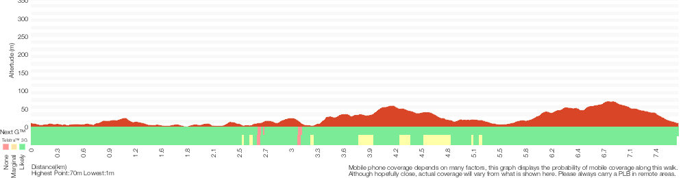
Analysis and summary of the altitude variation on the Green Point Circuit Walk
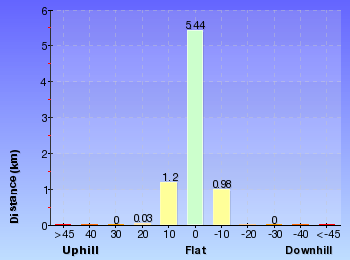
Overview of this walks grade – based on the AS 2156.1 – 2001
Under this standard, a walk is graded based on the most difficult section of the walk.
| Length | 7.7 km | ||
| Time | 3 hrs | ||
| . | |||
| Grade 4/6 Hard track |
AS 2156.1 | Gradient | Short steep hills (3/6) |
| Quality of track | Formed track, with some branches and other obstacles (3/6) | ||
| Signs | Minimal directional signs (4/6) | ||
| Experience Required | Some bushwalking experience recommended (3/6) | ||
| Weather | Weather generally has little impact on safety (1/6) | ||
| Infrastructure | Limited facilities (such as cliffs not fenced, significant creeks not bridged) (4/6) |
Some more details of this walks Grading
Here is a bit more details explaining grading looking at sections of the walk
Gradient
3.2km of this walk has short steep hills and another 2.9km has gentle hills with occasional steps. The remaining (1.6km) is flat with no steps.
Quality of track
3.3km of this walk follows a smooth and hardened path and another 3.1km follows a formed track, with some branches and other obstacles. The remaining (1.3km) follows a clear and well formed track or trail.
Signs
3.7km of this walk is clearly signposted and another 3.2km has directional signs at most intersection. The remaining (850m) has minimal directional signs.
Experience Required
Around 7km of this walk requires no previous bushwalking experience, whilst the remaining 970m requires some bushwalking experience.
weather
This whole walk, 8km is not usually affected by severe weather events (that would unexpectedly impact safety and navigation).
Infrastructure
4.8km of this walk is close to useful facilities (such as fenced cliffs and seats) and another 2.6km has limited facilities (such as not all cliffs fenced). The remaining (300m) has limited facilities (such as cliffs not fenced, significant creeks not bridged).
Similar walks
A list of walks that share part of the track with the Green Point Circuit Walk walk.
666 m Circuit
30 mins
Moderate track
2.4 km Circuit
1 Hr
Moderate track
2.4 km Return
1 Hr
Moderate track
2.9 km One way
1 hr 15 mins
Hard track
3 km Return
1 hr 15 mins
Moderate track
3.4 km Circuit
2 hrs 45 mins
Moderate track
3.8 km Circuit
1 hr 30 mins
Hard track
Other Nearby walks
A list of walks that start near the Green Point Circuit Walk walk.
3.2 km Return
1 Hr
Moderate track
1.3 km Return
30 mins
Very easy
3.2 km Circuit
1 Hr
Hard track
1.2 km Circuit
30 mins
Hard track
2.4 km Return
1 Hr
Very easy
3.2 km Return
1 Hr
Moderate track
1.9 km One way
45 mins
Hard track
948 m Return
30 mins
Hard track
904 m Return
30 mins
Hard track
8.3 km Return
3 hrs
Hard track
7.8 km One way
2 hrs 45 mins
Hard track
13.3 km One way
4 hrs 30 mins
Moderate track
Plan your trip to and from the walk here
The Green Point Circuit Walk walk starts and ends at the The Shores Way Car Park (gps: -33.029923, 151.64209)
Your transport options to The Shores Way Car Park are by;
![]() Bus. (get details)
Bus. (get details)
![]() Car. There is free parking available.
Car. There is free parking available.
(get details)
Short URL = http://wild.tl/gpcw
Gallery images
There are other downloads I am still working on.
You will probably need to login to access these — still all free.
* KML (google earth file)
* GPX (GPS file)
Special Maps/ brochures
* A3 topo maps
* PDF with Lands Topo map base
* PDF with arial image (and map overlay)
I wanted to get the main site live first, this extra stuff will come in time.
Happy walking
Matt 🙂
Rocky-high Circuit Walk
And Walk
Rocky-high Circuit Walk

30 mins
666 m Circuit
27 m
Moderate track
This short circuit walk offers elevated views over Lake Macquarie from Rocky-high Viewpoint. This walk offers pleasant walking beside Lake Macquarie, as well as on a quiet track inland through eucalyptus forest. If possible, complete this walk close to sunset to take advantage of the views across the lake. This local walk is recommended, with the highlight being the views from Rocky-high viewpoint.
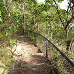


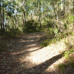

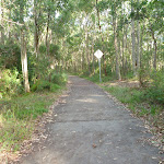
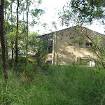


Green Point Foreshore Reserve on Lake Macquarie
The Green Point Foreshore Reserve on Lake Macquarie is a great place for a bush walk, bicycle or picnic. The Green Point Foreshore reserve offers many historical and environmentally interpretative signs along its multi use pathways. There is an unformed foreshore pathway beside Lake Macquarie, or more physically demanding walks away from the lake foreshore and into rainforest.
Historically, the Green Point area was involved in a coal rush from the 1860’s. This coal rush was spearheaded by the Cardiff Coal Company. Coal was proposed to be transported by barge to Threlkeld’s old wharf at Reid’s Mistake (Swansea Heads) for shipping to Sydney. However, the coal was poor quality ‘boiler coal’ and used mostly for steamer boilers. This coal rush finished in 1870. Timber was also milled on site after the coal rush. The Lake Macquarie Council is undergoing extensive rehabilitation works to improve the area for recreation. For more information contact the Lake Macquarie Visitor Information Centre on (02) 4921 0740 More info.
Historically, the Green Point area was involved in a coal rush from the 1860’s. This coal rush was spearheaded by the Cardiff Coal Company. Coal was proposed to be transported by barge to Threlkeld’s old wharf at Reid’s Mistake (Swansea Heads) for shipping to Sydney. However, the coal was poor quality ‘boiler coal’ and used mostly for steamer boilers. This coal rush finished in 1870. Timber was also milled on site after the coal rush. The Lake Macquarie Council is undergoing extensive rehabilitation works to improve the area for recreation. For more information contact the Lake Macquarie Visitor Information Centre on (02) 4921 0740 More info.
Green Point Reserve Entrance (Dilkera Avenue, Valentine)
The Dilkera Avenue entrance (in Valentine) to Green Point Foreshore Reserve offers access to both walking and bicycling paths. There is car parking and a large grassed park overlooking Lake Macquarie, a great spot to sit or have a picnic. A short walk away in the Green Point Reserve is Rockyhigh Viewpoint over Lake Macquarie, which is fabulous at sunset.
(0km) Int of Foreshore Track & Dilkera Ave Reserve Entrance → Rockyhigh Viewpoint
210 m
4 mins
7m
-8m
Moderate track
From the intersection[1], this walk follows the track, while initially keeping the ‘Welcome to Green Point Fore Shore Reserve’ sign[2][3] on your left. This walk continues, passing a ‘Mangrove Seed Symbol’ timber signed post[4] (on the left) after about 5m. Then this walk continues through forest for about 190m, undulating gently to climb moderately steeply up timber steps[5] (beside a metal ring fence[6][7]) to find Rockyhigh Viewpoint, with a bench seat[8] (on the left) and views[9] over the lake (on the right).
(0.21km) Rockyhigh Viewpoint → Int of Fore Shore AND Short Cut Tracks
120 m
2 mins
1m
-6m
Moderate track
Continue straight: From Rockyhigh Viewpoint[12][13], this walk follows the track moderately steeply downhill[14], while keeping the views on the right. This walk continues for 20m, then undulates gently for about 90m, until coming to a three-way intersection[15] with a track and ‘Mangrove Seed Symbol’ timber posted sign[16] (on the left).
(0.32km) Int of Fore Shore & Short Cut Tracks → Int of Short Cut Track & Frederick St Footpath
190 m
5 mins
19m
0m
Moderate track
Turn left : From the intersection[17], this walk follows the track away from the lake, initially keeping the ‘Mangrove Seed Symbol’ timber posted sign[18] on your left. This walk continues through forest[19][20] and gently uphill for about 180m, until coming to a T-intersection[21] with a concrete foot path[22], and ‘steep bike riding’ sign[23] (on the right).
(0.51km) Int of Short Cut Track & Frederick St Footpath → Int of Foreshore Track & Dilkera Ave Reserve Entrance
160 m
4 mins
0m
-13m
Moderate track
Turn left: From the intersection[24], this walk follows the footpath gently downhill, while keeping the ‘steep bike riding’ sign[25][26] and track initially on the left. This walk continues through forest for about 140m (with houses[27] on the right), until coming to a three-way intersection[28] with a track and ‘Welcome to Green Point Fore Shore Reserve’ sign[29][30] (on the left).
Maps for the Rocky-high Circuit Walk walk
You can download the PDF for this walk to print a map.
These maps below cover the walk and the wider area around the walk, they are worth carrying for safety reasons.
| Swansea | 1:25 000 Map Series | 92314N SWANSEA | NSW-92314N |
| Lake Macquarie | 1:100 000 Map Series | 9231 LAKE MACQUARIE | 9231 |
Cross sectional view of the Rocky-high Circuit Walk bushwalking track
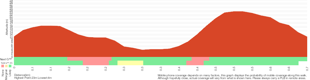
Analysis and summary of the altitude variation on the Rocky-high Circuit Walk
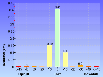
Overview of this walks grade – based on the AS 2156.1 – 2001
Under this standard, a walk is graded based on the most difficult section of the walk.
| Length | 666 m | ||
| Time | 30 mins | ||
| . | |||
| Grade 3/6 Moderate track |
AS 2156.1 | Gradient | Short steep hills (3/6) |
| Quality of track | Formed track, with some branches and other obstacles (3/6) | ||
| Signs | Directional signs along the way (3/6) | ||
| Experience Required | No experience required (1/6) | ||
| Weather | Weather generally has little impact on safety (1/6) | ||
| Infrastructure | Limited facilities, not all cliffs are fenced (3/6) |
Some more details of this walks Grading
Here is a bit more details explaining grading looking at sections of the walk
Gradient
Around 340m of this walk has gentle hills with occasional steps, whilst the remaining 320m has short steep hills.
Quality of track
Around 510m of this walk follows a formed track, with some branches and other obstacles, whilst the remaining 160m follows a smooth and hardened path.
Signs
This whole walk, 670m has directional signs at most intersection.
Experience Required
This whole walk, 670m requires no previous bushwalking experience.
weather
This whole walk, 670m is not usually affected by severe weather events (that would unexpectedly impact safety and navigation).
Infrastructure
Around 360m of this walk is close to useful facilities (such as fenced cliffs and seats), whilst the remaining 300m has limited facilities (such as not all cliffs fenced).
Similar walks
A list of walks that share part of the track with the Rocky-high Circuit Walk walk.
2.9 km One way
1 hr 15 mins
Hard track
3.8 km Circuit
1 hr 30 mins
Hard track
7.7 km Circuit
3 hrs
Hard track
Other Nearby walks
A list of walks that start near the Rocky-high Circuit Walk walk.
2.4 km Return
1 Hr
Moderate track
3.4 km Circuit
2 hrs 45 mins
Moderate track
3 km Return
1 hr 15 mins
Moderate track
2.4 km Circuit
1 Hr
Moderate track
1.3 km Return
30 mins
Very easy
3.2 km Circuit
1 Hr
Hard track
1.2 km Circuit
30 mins
Hard track
2.4 km Return
1 Hr
Very easy
3.2 km Return
1 Hr
Moderate track
13.3 km One way
4 hrs 30 mins
Moderate track
25.7 km One way
2 Days
Hard track
1.9 km One way
45 mins
Hard track
Plan your trip to and from the walk here
The Rocky-high Circuit Walk walk starts and ends at the Int of Foreshore Track & Dilkera Ave Reserve Entrance (gps: -33.013892, 151.62875)
Your transport options to Int of Foreshore Track & Dilkera Ave Reserve Entrance are by;
![]() Bus. (get details)
Bus. (get details)
![]() Car. There is free parking available.
Car. There is free parking available.
(get details)
Short URL = http://wild.tl/rcw
Gallery images
There are other downloads I am still working on.
You will probably need to login to access these — still all free.
* KML (google earth file)
* GPX (GPS file)
Special Maps/ brochures
* A3 topo maps
* PDF with Lands Topo map base
* PDF with arial image (and map overlay)
I wanted to get the main site live first, this extra stuff will come in time.
Happy walking
Matt 🙂
The Lookout Circuit
And Walk
The Lookout Circuit

1 Hr
2.4 km Circuit
91 m
Moderate track
The Lookout Circuit is a classic Green Point reserve walk. This walk offers walkers plenty of picnic opportunities, elevated views over Lake Macquarie and travel through eucalyptus forest. There is also good historical and environmental interpretative signage along much of this walk. This recommended walk makes a lovely half day walk if a picnic is included and remember to keep a lookout for Sea Eagles.

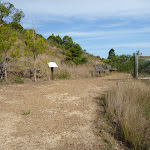


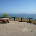
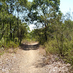
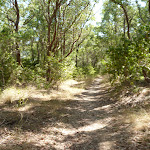


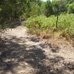
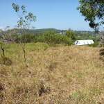
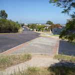
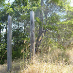

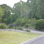
Green Point Foreshore Reserve on Lake Macquarie
The Green Point Foreshore Reserve on Lake Macquarie is a great place for a bush walk, bicycle or picnic. The Green Point Foreshore reserve offers many historical and environmentally interpretative signs along its multi use pathways. There is an unformed foreshore pathway beside Lake Macquarie, or more physically demanding walks away from the lake foreshore and into rainforest.
Historically, the Green Point area was involved in a coal rush from the 1860’s. This coal rush was spearheaded by the Cardiff Coal Company. Coal was proposed to be transported by barge to Threlkeld’s old wharf at Reid’s Mistake (Swansea Heads) for shipping to Sydney. However, the coal was poor quality ‘boiler coal’ and used mostly for steamer boilers. This coal rush finished in 1870. Timber was also milled on site after the coal rush. The Lake Macquarie Council is undergoing extensive rehabilitation works to improve the area for recreation. For more information contact the Lake Macquarie Visitor Information Centre on (02) 4921 0740 More info.
Historically, the Green Point area was involved in a coal rush from the 1860’s. This coal rush was spearheaded by the Cardiff Coal Company. Coal was proposed to be transported by barge to Threlkeld’s old wharf at Reid’s Mistake (Swansea Heads) for shipping to Sydney. However, the coal was poor quality ‘boiler coal’ and used mostly for steamer boilers. This coal rush finished in 1870. Timber was also milled on site after the coal rush. The Lake Macquarie Council is undergoing extensive rehabilitation works to improve the area for recreation. For more information contact the Lake Macquarie Visitor Information Centre on (02) 4921 0740 More info.
The Car Park (off The Shores Way, Green Point)
The Shores Way park entrance[1] and car park[2] is a great place to start a walk within the Green Point Foreshore Reserve on Lake Macquarie. The park entrance offers a toilet[3], a water tap[4], seating and plenty of car parking. There are attractive grass slopes here dropping into the water, that make a fine spot to have a picnic.
(0km) The Shores Way Car Park → Int of Foreshore Track AND Jetty Picnic Area
550 m
10 mins
10m
-13m
Moderate track
From the car park[5](on The Shores Way, Green Point), this walk heads towards the lake[6] past the toilet block[7] and along the footpath for 25m, to a four-way intersection[8] with a ‘Welcome to Green Point Foreshore Reserve’ sign[9] (on the right).
Turn right: From the intersection[10], this walk follows the shared concrete cycle/footpath gently downhill, while keeping the Shores Way car park[11] on your right and the water[12] on your left. This walk continues, undulating[13] for about 500m, until coming to the Jetty picnic area[14] on the right and jetty[15] on your left.
Turn right: From the intersection[10], this walk follows the shared concrete cycle/footpath gently downhill, while keeping the Shores Way car park[11] on your right and the water[12] on your left. This walk continues, undulating[13] for about 500m, until coming to the Jetty picnic area[14] on the right and jetty[15] on your left.
Jetty Picnic Area
The Jetty Picnic area[16] in the Green Point Foreshore Reserve on Lake Macquarie offers a public jetty[17], a sheltered picnic table[18], seating[19][20], a drinking fountain[21] and historical interpretative signs[22]. The historical signs detail the ‘timber getting’ period of Green Point from 1860, with the timber used to build jetty’s, pit prop for coal mining, ships and boats. There is also an historical sign detailing ‘The Cardiff Coal Company’, which mined coal out of Green Point during a minor coal rush.
(0.55km) Jetty Picnic Area (Green Point Foreshore Reserve) → Int of Foreshore Track & Sea Eagle Park
260 m
5 mins
9m
-6m
Easy track
Sea Eagle Park
Sea Eagle Park in Green Point Foreshore Reserve on Lake Macquarie is a large grassed picnic area[27], with a toilet[28], sheltered picnic tables[29], water from a tap[30][31] and gas/electric barbeque’s[32]. This picnic area is particularly good for larger family group, for there is room to play ball games or just sit and look at the views. The short walk up to the Sea Eagle Lookouts is recommended for the commanding views south towards Swansea.
(0.8km) Int of Foreshore Track & Sea Eagle Park → Int of Foreshore & Lookout Tracks
80 m
2 mins
6m
-1m
Moderate track
Continue straight: From the intersection[33], this walk follows the footpath gently uphill[34], while keeping Sea Eagle Park[35] on your right. This walk continues for about 70m, until coming to a three-way intersection[36] with a track and ‘Lookout’ sign on your right and a ‘Getting about at Green Point’ sign[37] on your left.
(0.89km) Int of Foreshore & Lookout Tracks → Lower Lookout (Sea Eagle Park)
110 m
2 mins
16m
0m
Moderate track
Turn right: From the intersection[38][39], this walk heads up timber steps, directly away from the face of the ‘Getting about at Green Point’ sign[40]. This walk continues gently uphill, with occasional timber steps (and passing a seat[41]) for about 110m, until coming to the Lower Lookout[42][43] above Sea Eagle Park (on the right).
Sea Eagle Park Lookouts (lower, middle & upper)
These three lookouts (lower, middle and upper lookouts) are above Sea Eagle Park in Green Point Foreshore Reserve on Lake Macquarie and give great views[44][45] across Lake Macquarie towards Swansea. The upper lookout has a picnic table[46] in the shade behind the lookout, which gives relief on a hot day. The upper lookout also a picnic table[47] at the lookout, offering fabulous views to the south. Each of these lookouts has a bench seat and interpretative signs[48]. White Bellied Sea Eagles have been known to nest nearby and are often seen flying in the area.
(1km) Lower Lookout (Sea Eagle Park) → Middle Lookout (Sea Eagle Park)
100 m
3 mins
7m
-7m
Moderate track
(1.14km) Upper Lookout (Sea Eagle Park) → Int of Lookout Track and Lookout Footpath
50 m
1 mins
8m
-2m
Very easy
(1.19km) Int of Lookout & Linkage Tracks → Int of The Shores Way & Crown St
870 m
17 mins
26m
-32m
Moderate track
Turn right: From the intersection[65][66][67], this walk follows the gravel track gently uphill, while leaving the concrete foot path and keeping the viewpoint directly behind you. This walk continues through forest for about 60m, to veer right at a open gravel clearing[68] (with vandalized timber post). Then this walk continues, undulating along a forest[69] covered ridge (ignoring side tracks) and passing vandalized timber posts[70] for about 700m, until coming to a three-way intersection[71][72][73], with a faint track (into grassland[74] on the left).
Continue straight: From the intersection[75][76], this walk follows the track gently downhill, while initially keeping the faint track[77] (into grassland) on your left. This walk continues through forest (passing a leaf symbol post[78]) for about 100m, until coming down timber steps and coming to a four-way intersection[79][80], with Crown St and The Shores Way.
Continue straight: From the intersection[75][76], this walk follows the track gently downhill, while initially keeping the faint track[77] (into grassland) on your left. This walk continues through forest (passing a leaf symbol post[78]) for about 100m, until coming down timber steps and coming to a four-way intersection[79][80], with Crown St and The Shores Way.
(2.06km) Int of The Shores Way AND Crown St → The Car Park (off The Shores Way, Green Point)
320 m
8 mins
0m
-29m
Very easy
Turn right: From the corner of The Shores Way and Crown Street, [81], this walk follows The Shores Way moderately steeply downhill, while initially keeping the timber steps and ‘Lake Macquarie’ sign[82] on the right. This walk continues (passing The Capstan and The Mainsail streets) for 250m, to turn left into the Green Point Foreshore Reserve car park[83]. Then this walk continues gently downhill for 90m, until coming to the toilet block[84][85].
Maps for the The Lookout Circuit walk
You can download the PDF for this walk to print a map.
These maps below cover the walk and the wider area around the walk, they are worth carrying for safety reasons.
| Swansea | 1:25 000 Map Series | 92314N SWANSEA | NSW-92314N |
| Lake Macquarie | 1:100 000 Map Series | 9231 LAKE MACQUARIE | 9231 |
Cross sectional view of the The Lookout Circuit bushwalking track
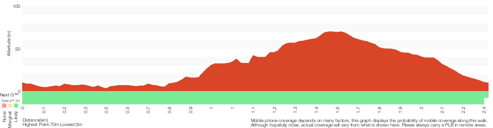
Analysis and summary of the altitude variation on the The Lookout Circuit

Overview of this walks grade – based on the AS 2156.1 – 2001
Under this standard, a walk is graded based on the most difficult section of the walk.
| Length | 2.4 km | ||
| Time | 1 Hr | ||
| . | |||
| Grade 3/6 Moderate track |
AS 2156.1 | Gradient | Short steep hills (3/6) |
| Quality of track | Formed track, with some branches and other obstacles (3/6) | ||
| Signs | Directional signs along the way (3/6) | ||
| Experience Required | Some bushwalking experience recommended (3/6) | ||
| Weather | Weather generally has little impact on safety (1/6) | ||
| Infrastructure | Limited facilities, not all cliffs are fenced (3/6) |
Some more details of this walks Grading
Here is a bit more details explaining grading looking at sections of the walk
Gradient
1.9km of this walk has gentle hills with occasional steps and another 390m is flat with no steps. The remaining (100m) has short steep hills.
Quality of track
1.1km of this walk follows a formed track, with some branches and other obstacles and another 1km follows a smooth and hardened path. The remaining (260m) follows a clear and well formed track or trail.
Signs
Around 1.5km of this walk has directional signs at most intersection, whilst the remaining 890m is clearly signposted.
Experience Required
Around 2.3km of this walk requires no previous bushwalking experience, whilst the remaining 100m requires some bushwalking experience.
weather
This whole walk, 2.4km is not usually affected by severe weather events (that would unexpectedly impact safety and navigation).
Infrastructure
Around 1.5km of this walk is close to useful facilities (such as fenced cliffs and seats), whilst the remaining 870m has limited facilities (such as not all cliffs fenced).
Similar walks
A list of walks that share part of the track with the The Lookout Circuit walk.
2.9 km One way
1 hr 15 mins
Hard track
3 km Return
1 hr 15 mins
Moderate track
3.4 km Circuit
2 hrs 45 mins
Moderate track
7.7 km Circuit
3 hrs
Hard track
Other Nearby walks
A list of walks that start near the The Lookout Circuit walk.
2.4 km Return
1 Hr
Moderate track
3.8 km Circuit
1 hr 30 mins
Hard track
666 m Circuit
30 mins
Moderate track
3.2 km Return
1 Hr
Moderate track
1.3 km Return
30 mins
Very easy
3.2 km Circuit
1 Hr
Hard track
1.2 km Circuit
30 mins
Hard track
2.4 km Return
1 Hr
Very easy
3.2 km Return
1 Hr
Moderate track
1.9 km One way
45 mins
Hard track
948 m Return
30 mins
Hard track
904 m Return
30 mins
Hard track
Plan your trip to and from the walk here
The The Lookout Circuit walk starts and ends at the The Shores Way Car Park (gps: -33.029923, 151.64209)
Your transport options to The Shores Way Car Park are by;
![]() Bus. (get details)
Bus. (get details)
![]() Car. There is free parking available.
Car. There is free parking available.
(get details)
Short URL = http://wild.tl/tlc
Gallery images
There are other downloads I am still working on.
You will probably need to login to access these — still all free.
* KML (google earth file)
* GPX (GPS file)
Special Maps/ brochures
* A3 topo maps
* PDF with Lands Topo map base
* PDF with arial image (and map overlay)
I wanted to get the main site live first, this extra stuff will come in time.
Happy walking
Matt 🙂
Leichhardt’s Green Point Walk
And Walk
Leichhardt’s Green Point Walk

1 Hr
2.4 km Return
84 m
Moderate track
This walk offers the shortest way of walking to Green Point. Starting from the elevated Leichhardt Road in Valentine, the walk descends through eucalyptus forest with some pleasant clearings on the way. Green Point is a great place for picnics and feels as if you can see the entire Lake Macquarie from the foreshore. A recommended walk.

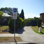
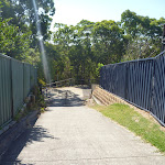
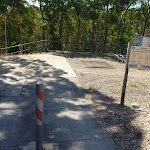

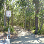
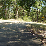


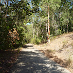

Green Point Foreshore Reserve on Lake Macquarie
The Green Point Foreshore Reserve on Lake Macquarie is a great place for a bush walk, bicycle or picnic. The Green Point Foreshore reserve offers many historical and environmentally interpretative signs along its multi use pathways. There is an unformed foreshore pathway beside Lake Macquarie, or more physically demanding walks away from the lake foreshore and into rainforest.
Historically, the Green Point area was involved in a coal rush from the 1860’s. This coal rush was spearheaded by the Cardiff Coal Company. Coal was proposed to be transported by barge to Threlkeld’s old wharf at Reid’s Mistake (Swansea Heads) for shipping to Sydney. However, the coal was poor quality ‘boiler coal’ and used mostly for steamer boilers. This coal rush finished in 1870. Timber was also milled on site after the coal rush. The Lake Macquarie Council is undergoing extensive rehabilitation works to improve the area for recreation. For more information contact the Lake Macquarie Visitor Information Centre on (02) 4921 0740 More info.
Historically, the Green Point area was involved in a coal rush from the 1860’s. This coal rush was spearheaded by the Cardiff Coal Company. Coal was proposed to be transported by barge to Threlkeld’s old wharf at Reid’s Mistake (Swansea Heads) for shipping to Sydney. However, the coal was poor quality ‘boiler coal’ and used mostly for steamer boilers. This coal rush finished in 1870. Timber was also milled on site after the coal rush. The Lake Macquarie Council is undergoing extensive rehabilitation works to improve the area for recreation. For more information contact the Lake Macquarie Visitor Information Centre on (02) 4921 0740 More info.
(0km) Int of Leichhardt Track & Leichhardt Road → Int of Leichhardt Trail & Leichhardt Track
60 m
2 mins
0m
-7m
Easy track
From Leichhardt Road[1][2] (Valentine), this walk follows the concrete footpath, while initially keeping the ‘No Dogs’ sign on your left. This walk continues for 50m, passing between houses and around a metal post[3][4] until coming to a three-way intersection a trail and ‘Green Point Foreshore Reserve’ sign[5] (on the right).
(0.06km) Int of Leichhardt Trail & Leichhardt Track → Int of Green Point Track & Leichhardt Trai
80 m
1 mins
4m
-1m
Easy track
Turn left: From the intersection[6], this walk follows the ‘Green Point Fire Trail’ sign[7] and concrete footpath gently downhill. This walk then continues, with houses on the left, for about 70m until coming to a three-way intersection[8] with a trail[9] (on the left) and footpath[10] continuing into forest (on the right).
(0.13km) Int of Green Point Track & Leichhardt Trail → Int of Green Point & Zig Zag Tracks
840 m
18 mins
13m
-44m
Moderate track
Turn right: From the intersection[11], this walk follows the concrete footpath[12] moderately steeply downhill, while initially keeping the trail[13] on your left and houses[14] directly behind you. This walk continues, zigzagging[15] for about 130m (passing a metal seat[16]) to come to a small heath clearing[17] (on the right). Then this walk continues gently downhill through forest for about 400m (ignoring side tracks[18]), until coming to a three-way intersection[19] with a track and ‘Walk Safe/Cycle Safe’ sign[20] (on the right).
(0.97km) Int of Green Point AND Zig Zag Tracks → Green Point (Four Way Intersection)
160 m
3 mins
3m
-6m
Moderate track
Turn right: From the intersection[21], this walk follows the track gently downhill, while initially keeping the ‘Walk Safe/Cycle Safe’ sign[22] on your left. This walk continues through forest[23] for about 160m, until coming to a four-way intersection[24] with a track and the grassed Green Point[25] directly ahead.
(1.14km) Green Point (Four Way Intersection) → Green Point
90 m
2 mins
0m
-6m
Moderate track
Continue straight: From the intersection[26], this walk follows the track towards Green Point[27] (and the water), while leaving the forest[28] directly behind you. This walk continues for about 60m, passing across grasslands[29] and towards a small clump of She Oak trees[30], until coming to the lake edge[31] and Green Point.
Green Point (on Lake Macquarie)
Green Point in the Green Point Foreshore Reserve on Lake Macquarie is a large grassed area[32] which looks out over Lake Macquarie. From the vantage point of Green Point, a walker can see up and down Lake Macquarie[33]. There are often boats passing by this low headland. This is a fabulous place to have a picnic and there is even a clump of She Oak trees[34] by the water for shade. There are no facilities here, other than the open grassed area.
Maps for the Leichhardt’s Green Point Walk walk
You can download the PDF for this walk to print a map.
These maps below cover the walk and the wider area around the walk, they are worth carrying for safety reasons.
| Swansea | 1:25 000 Map Series | 92314N SWANSEA | NSW-92314N |
| Lake Macquarie | 1:100 000 Map Series | 9231 LAKE MACQUARIE | 9231 |
Cross sectional view of the Leichhardt’s Green Point Walk bushwalking track
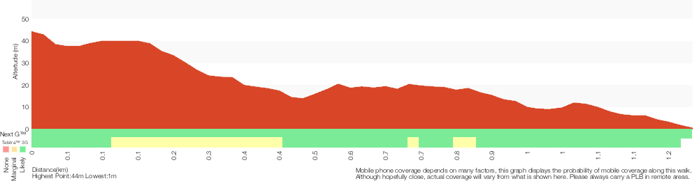
Analysis and summary of the altitude variation on the Leichhardt’s Green Point Walk
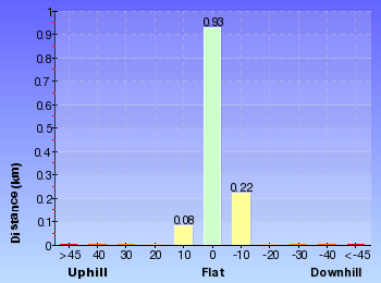
Overview of this walks grade – based on the AS 2156.1 – 2001
Under this standard, a walk is graded based on the most difficult section of the walk.
| Length | 2.4 km | ||
| Time | 1 Hr | ||
| . | |||
| Grade 3/6 Moderate track |
AS 2156.1 | Gradient | Short steep hills (3/6) |
| Quality of track | Clear and well formed track or trail (2/6) | ||
| Signs | Directional signs along the way (3/6) | ||
| Experience Required | No experience required (1/6) | ||
| Weather | Weather generally has little impact on safety (1/6) | ||
| Infrastructure | Generally useful facilities (such as fenced cliffs and seats) (1/6) |
Some more details of this walks Grading
Here is a bit more details explaining grading looking at sections of the walk
Gradient
840m of this walk has short steep hills and another 250m is flat with no steps. The remaining (130m) has gentle hills with occasional steps.
Quality of track
Around 970m of this walk follows a smooth and hardened path, whilst the remaining 250m follows a clear and well formed track or trail.
Signs
Around 970m of this walk is clearly signposted, whilst the remaining 250m has directional signs at most intersection.
Experience Required
This whole walk, 1.2km requires no previous bushwalking experience.
weather
This whole walk, 1.2km is not usually affected by severe weather events (that would unexpectedly impact safety and navigation).
Infrastructure
This whole walk, 1.2km is close to useful facilities (such as fenced cliffs and seats).
Similar walks
A list of walks that share part of the track with the Leichhardt’s Green Point Walk walk.
2.9 km One way
1 hr 15 mins
Hard track
3 km Return
1 hr 15 mins
Moderate track
3.4 km Circuit
2 hrs 45 mins
Moderate track
3.8 km Circuit
1 hr 30 mins
Hard track
7.7 km Circuit
3 hrs
Hard track
Other Nearby walks
A list of walks that start near the Leichhardt’s Green Point Walk walk.
666 m Circuit
30 mins
Moderate track
2.4 km Circuit
1 Hr
Moderate track
1.3 km Return
30 mins
Very easy
3.2 km Circuit
1 Hr
Hard track
3.2 km Return
1 Hr
Moderate track
1.2 km Circuit
30 mins
Hard track
2.4 km Return
1 Hr
Very easy
1.9 km One way
45 mins
Hard track
948 m Return
30 mins
Hard track
13.3 km One way
4 hrs 30 mins
Moderate track
25.7 km One way
2 Days
Hard track
7.9 km One way
2 hrs 45 mins
Hard track
Plan your trip to and from the walk here
The Leichhardt’s Green Point Walk walk starts and ends at the Int of Leichhardt Track & Leichhardt Road (gps: -33.017445, 151.6353)
Your transport options to Int of Leichhardt Track & Leichhardt Road are by;
![]() Bus. (get details)
Bus. (get details)
![]() Car. There is free parking available.
Car. There is free parking available.
(get details)
Short URL = http://wild.tl/lgpw
Gallery images
There are other downloads I am still working on.
You will probably need to login to access these — still all free.
* KML (google earth file)
* GPX (GPS file)
Special Maps/ brochures
* A3 topo maps
* PDF with Lands Topo map base
* PDF with arial image (and map overlay)
I wanted to get the main site live first, this extra stuff will come in time.
Happy walking
Matt 🙂
Comments