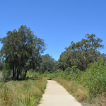
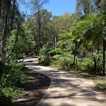
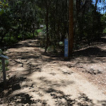
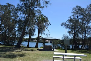
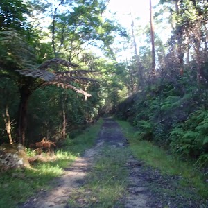
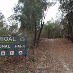
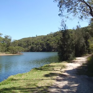
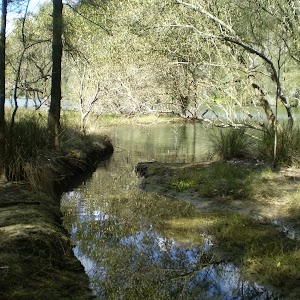
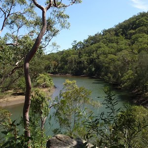
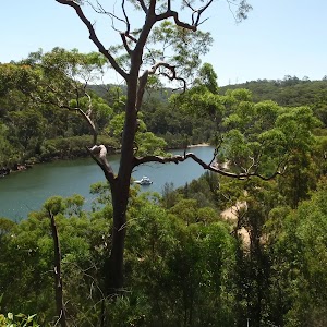
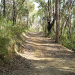
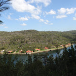
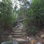
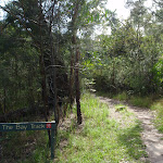
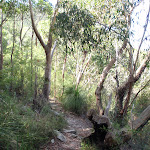
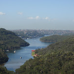
The Narrabeen Lagoon Trail is a wonderful and accessible walk on the Northern Beaches of Sydney. The trail is used by walkers, runners cyclists, kids on scooters and people in wheelchairs to explore the stunning bushland and lagoon views. There are bridges over rivers, quiet spots to enjoy the view, cafes to refuel as well as toilets and picnic areas. A quick lap for exercise or take the time enjoy all the facilities along the way.
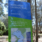
Narrabeen Lagoon Trail (from Middle Creek)


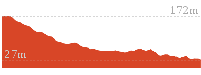
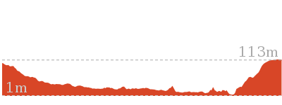
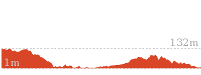
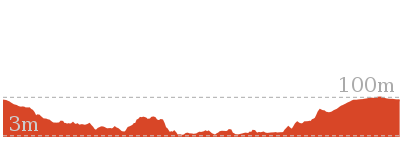
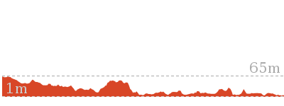
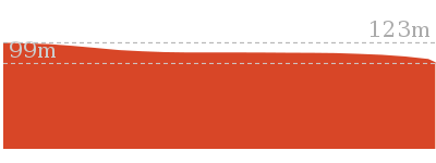
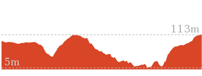
2 hrs 30 mins
8.6 km Circuit

105 m
Very easy

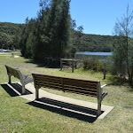


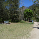


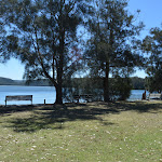


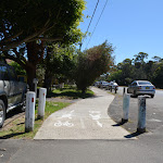


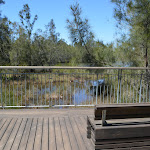


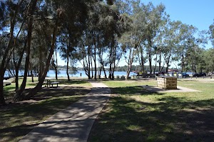
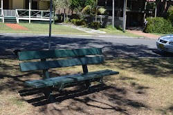
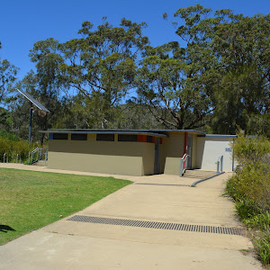
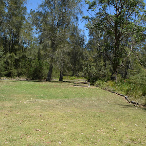
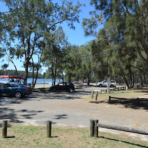
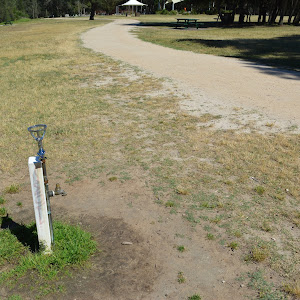
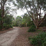
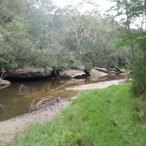
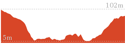
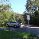
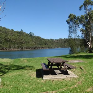
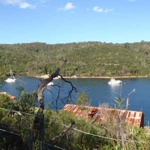
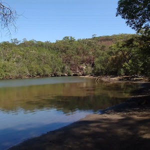
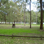
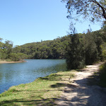
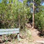
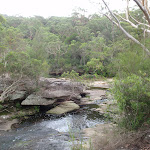
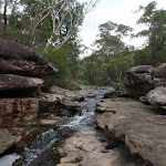
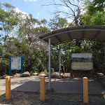
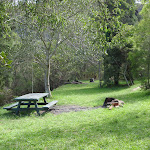
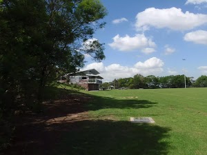
Middle Creek Reserve
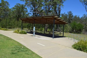
Middle Creek Reserve, is signposted on Wakehurst Parkway,
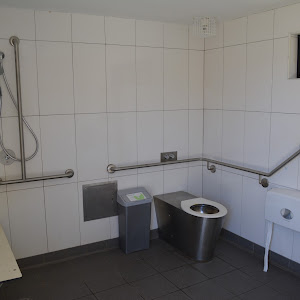
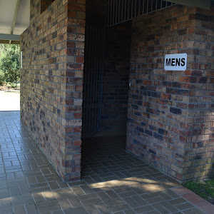
Ingleside at the northwestern edge of Narrabeen Lagoon. The modern picnic area hosts a public toilet and change areas
Ingleside at the northwestern edge of Narrabeen Lagoon. The modern picnic area hosts a public toilet and change areas

and an accessible toilet

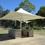
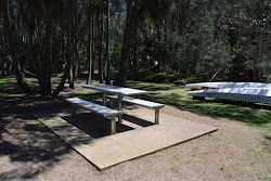
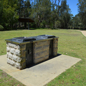
. There are a series of picnic tables


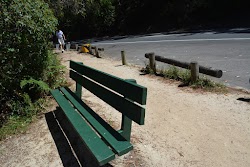
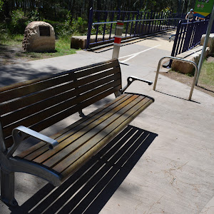
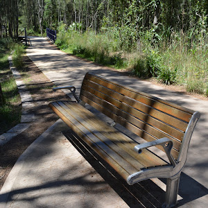
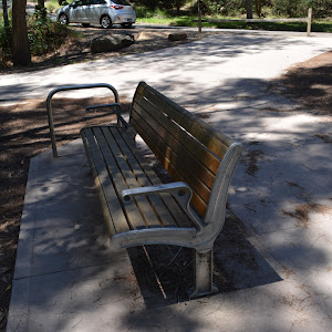
scattered throughout the picnic area. There are also plenty of bench seats


, BBQs

and drinking fountain

. There is space to park about 50 cars, including two mobility parking bays

. Parking is metered at $6 per hour[1]. There is also a concrete boat ramp[2]
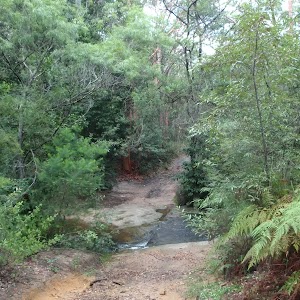
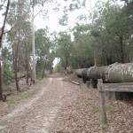
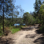
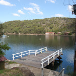
(0km) Middle Creek Reserve boat ramp → Sport and Recreation boat shed

460 m
7 mins
3m
-2m
Very easy
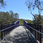
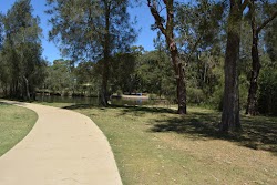
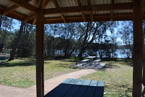
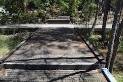
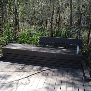
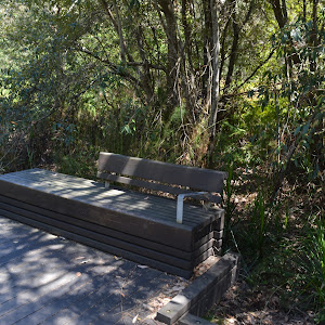
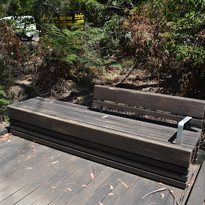
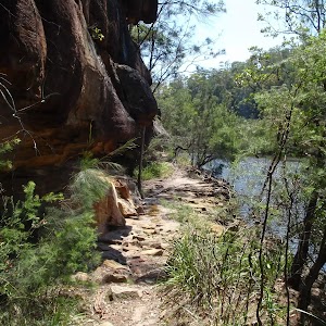
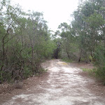
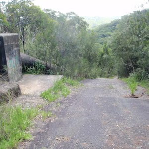
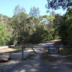
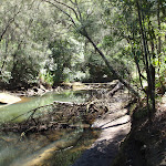
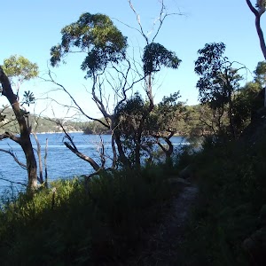
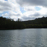
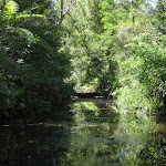
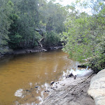
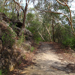
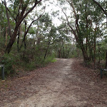
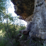
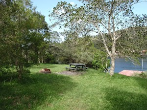
From the Middle Creek Reserve boat ramp[3], this walk follows the concrete path[4] along the edge of Middle Creek Reserve keeping the lagoon to the left. This walk meanders through the picnic area with a couple of sheltered picnic tables
[5], a toilet block
[6] and car parking. At the southern end of the picnic area just before Middle Creek the path bends left[7] past the sheltered tables
] to a seat

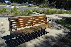
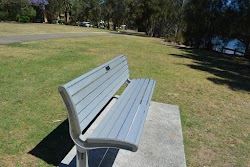
(on the right) and a ‘The Jim Somerville Bridge’ sign[8] on a rock (on the left) just before a bridge[9]. The seat continues the the Jim Somerville Bridge[10] ramp then after about 60m the bridge turns right and flattens out for 70m to cross the creek and after 70m then leads gently downhill for about 50m, passing a fenced off abseiling area[11]. At the end of the bridge[12] this walk continues on a concrete path[13] for another 60m to come to a grassy clearing[14] (on the left) with two seats

just before the boat shed for the Sport and Recreaction Center[15].
(0.46km) Sport and Recreation boat shed → James Wheeler Place Intersection
750 m
12 mins
7m
-7m
Very easy
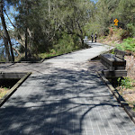
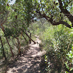
Continue straight: From the Sport and Recreation boat shed[17] clearing, this walk follows the concrete path past the boat shed and archery range keeping the lagoon to the left. This walk then follows the concrete path for about 110m to pass the ‘Caution you are next to an active golf course’ sign[18] (on the right) just before the start of the fibreglass boardwalk[19]. After about 50m this path continues along a small bridge with handrails[20] for 25m, then follows the concrete path [21] to come to a seat

(on the left).
From this seat this walk continues along the footpath[22] for about 190m past a seat

(on the left) to come to a another seat

(on the left). From the seat this walk continues along the concrete path[23] gently uphill for about 35m to the start of fence[24] and fiberglass bridge with handrails[25]. This walk zig zags on the bridge for about 70m, offering beautiful views[26][27] across the lagoon. This walk then heads gently downhill for about 20m to come to a concrete path[28] and end of handrails where the path flattens out and comes to another seat

(on the left). From here this walk follows the concrete path for about 190m past a seat

(on the left) to come to another seat

(on the left) just before the intersection[29] beside James Wheeler Place, marked by a ‘South Creek Reserve’ sign[30] (on the left).
(1.21km) James Wheeler Place Intersection → RSL War Veterans access intersection
440 m
7 mins
5m
-2m
Very easy
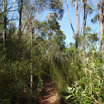
Turn left: From the intersection beside James Wheeler Place, this walk follows the ‘Jamieson Park 2.3km’ arrow gently dowhnill along the wide gravel track[31] initially keeping James Wheeler Place to your right. This walk continues past a
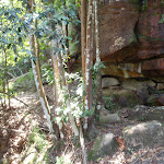
‘Cyclists slow down’ sign[32] (on the left) and a ‘Wildlife Protection Area’ sign[33] (on the right) and follows the gravel track for about 90m to come to an intersection with a short informal track to the water[34] (on the left). This walk then continues along the wide track for another 110m past a series of signs (on the left) remembering each war [35][36][37] before coming to a Y-intersection marked by a sign (on the right)[38]. This walk then veers left, following the ‘Jamieson Park 2.1km’ arrow along the track for the next 80m past more signs in the series (on the left) remembering each war [39][40][41][42] before crossing a 40m long fiberglass ‘RSL War Veterans Footbridge’ with timber handrails[43]. At the end of the footbridge this walk comes to an intersection[44] with a faint informal steep rough track to the right just below the Dardanelles coffee shop[45].
Continue straight: From the intersection, this walk follows the ‘Jamieson Park 2km’ arrow[46] along the gravel track keeping the road and village a short distance to the right. This walk continues for about 50m past the continuing series of information signs (on the left) remembering each war [47][48][49] before crossing to a 15m long fiberglass bridge with timber handrailing[50] and then continues along the gravel track for about 40m past more information signs (on the left) [51][52][53]. This walk then heads gently uphill to a 3-way intersection marked by a ‘RSL War Veterans North’ signpost[54] (on the right).
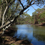
(1.64km) RSL War Veterans access intersection → Northern end of Jamison Park
1.6 km
28 mins
20m
-25m
Very easy
Turn left: From the intersection, this walk follows the ‘Jamieson Park 1.9km’ arrow[55] gently downhill, directly away from the buildings. After just a few meters this walk leads past the war information sign ’14’[56], then leads past another 15 signs [57][58][59][60][61][62][63][64][65][66][67][68][69][70][71] in the same series over the next 220m (all on the left). About 60m after the last of these signs (no. ’29’)[72], the track leads up a short moderately steep hill then continues through the dense forest[73] for another 130m to cross a wide timber bridge[74]. The walk continues along the wide track for another 300m when it leads up the the lagoons edge[75]. About 150m along the edge of the lagoon the walks passes a ‘Pipeclay Point’ arrow post[76] where the track soon bends right to lead away from the lagoon into the forest. After another 400m the track leads back close to the lagoon for a short distance then back into the denser forest for another 150m to then cross a flat fibreglass bridge[77]. About 60m past this bridge the track comes to a Y-intersection[78] on edge of a clearing, the walk turns right leading past the metal bench seat

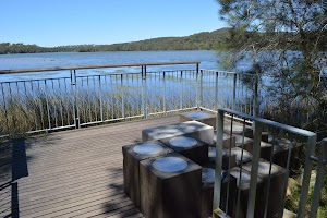
[79] to find the ‘Jamieson Park Trail Entry’ post[80]. The walking continues along the wide gravel track for 30m, to pass the ‘Jamieson Park’[81] to then come to a 3-way intersection[82] (with a concrete track and picnic area[83]


on the left).
(3.29km) Northern end of Jamison Park → Int behind Jamison Park
260 m
4 mins
2m
-1m
Easy track
Turn sharp left: From the intersection[84], this walk heads along the concrete footpath heading towards the lagoon[85]. After about 20m the path leads past a nearby picnic table
[86] (on the right), (and past the other picnic facilities
) as the path then bends right and leads beside the lagoon for about 80m to come to, then cross a small creek on a narrow (1.07m wide[87]) timber footbridge[88] with metal handrails (1.02m high[89]. On the other side of the bridge this walk leads past a picnic table

[90] to come beside the boat ramp[91] at the end of Jamison Park car park.
Turn right: From just beside the boat ramp[92] at the end of Jamison Park car park, this walk follows the footpath gently uphill towards the sailing club. After about 20m this walk passes a picnic table
[93], BBQ

[94], as well at the accessible

and public toilets

[95] (in the ‘Narrabeen Lakes sailing Club’ building). The walk continues along the footpath for just over 100m, as it leads behind the club building, past another picnic table

[96], to come to a T-intersection beside the ‘Water Refill Jamison Park’

[97] station. Now Turn left to rejoin the main walk .
(3.29km) Northern end of Jamison Park → Int behind Jamison Park
230 m
4 mins
3m
-1m
Very easy
Veer right: From the intersection[98], this walk heads directly away from the clearing and lagoon along the wide gravel trail, past the ‘Warning – Vehicles on track at any time’ sign[99], to then lead between the timber fences[100]. This trail may become boggy after prolonged rain. After about 150m this trail leads over a culverted creek[101] (with timber handrails[102]), where the trail continues for another 100m through the lovely dense forest[103] to come to a 3-way intersection with a concrete path, beside the ‘Water Refill Jamison Park’
[104] station.
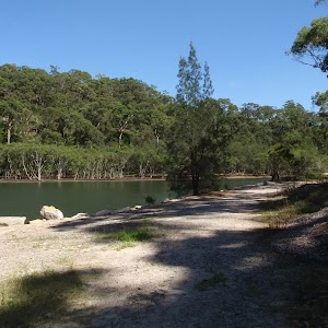
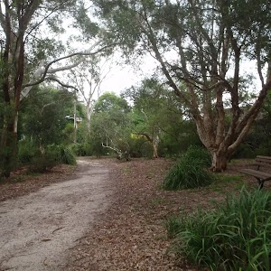
Jamison Park
Jamison Park is a large picnic area on the southern shoreline of Narrabeen Lagoon, at the end of The Esplanade,
Narrabeen. The picnic area has a large paid[105] parking area, including two mobility parking bays
Narrabeen. The picnic area has a large paid[105] parking area, including two mobility parking bays

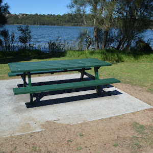
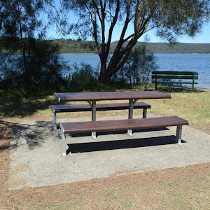
and is home to the ‘Narrabeen Lakes Sailing Club’[106]. There is a boat ramp, picnic tables
, BBQ’s
, drinking fountain
, public
and accessible toilets
. A pleasant area to enjoy the lagoon.
(3.53km) Int behind Jamison Park → Wheeler Park
760 m
13 mins
7m
-7m
Very easy
Continue straight: From the intersection (beside the ‘Water Refill Jamison Park’
[107] station), this walk heads along the wide concrete footpath 30m towards the road, to pass the large ‘Narrabeen Lagoon Trail’ sign[108] then cross ‘The Esplanade’ at the main entrance to Jamison Park.
Continue straight: From the entrance to ‘Jamison Park’, this walk follow the footpath out of the park keeping ‘The Esplanade’ to the right[109]. The path leads between the lagoon and the road for about 130m to pass the end of ‘Nioka Rd’. The walk continues beside the lagoon for another 250m to find a green timber bench seat

[110], then just 100m later to find another metal[111] and timber seat
[112]. The walk continues along the footpath for 70m to pass a roundabout, then past some houses to turn left onto the footpath beside ‘Lakeside Rd’[113]. The walk continues beside ‘Lakeside Rd’ for about 70m to come to the ‘water refill’ station

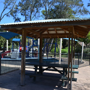
Wheeler Park
Wheeler Park is an open picnic area and playground between Lakeside Rd and Narrabeen Lagoon. There is a drinking fountain
and bench seat
beside the footpath. A great fenced and shaded children’s playground[116] as well as rubbish bins[117]. Behind the playground is a sheltered BBQ

and sheltered picnic tables

(as well as some other unsheltered picnic tables) beside the open grassy area[118].
(4.28km) Wheeler Park → Coffee and Kayaks
470 m
7 mins
2m
-3m
Very easy
Continue straight: From the ‘water refill’ station
[119] beside the playground[120] at Wheeler Park (Lakeside Rd Narrabeen), this walk follows the footpath, past the garbage bins and seat
, initially keeping the road to the right. After about 25m this walk leads past the large ‘Narrabeen Lagoon Trail’ sign[121] to continue for just shy of 100m past the scout hall[122] to head between the timber bollards[123] (1.2m wide and 1m high). The walk continues along the footpath for another 50m to pass the end of ‘Devitt St’[124], then continues for another 120m to come to a seat

[125] (on the left) at the end of ‘Roberston St’. From here this walk continues straight, following the ‘Berry Reserve 500m’[126] arrow along the footpath for 90m to pass another bench seat
[127] (on the left) and continues for another 80m to come to the ‘Pro-kayaks’[128] and the ‘The Boatshed’ cafe[129] (on the right), beside the lagoon.
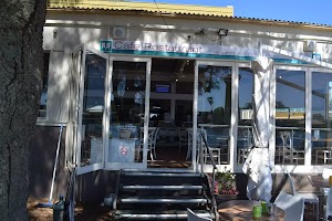
The Boatshed cafe
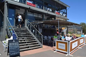
The Boatshed Cafe[130] is a pleasant waterfront cafe & bar. There is a sheltered outside seating area and an upstairs indoor section. Lift access to the inside area is via the road side of the building, where there are also accessible toilets. theboatshedcafe.com.au. Beside the cafe is ‘Pro-Kayaks’[131] where you can hire kayaks and paddle boats[132]. www.prokayaks.com.au. The upper story of the same building (11 Narrabeen St, Narrabeen) is ‘Limani’, a seafood restaurant if you want to get even more fancy. limani.com.au
(4.75km) Coffee and Kayaks → Berry Reserve
370 m
6 mins
1m
-1m
Very easy
Continue straight: From beside the cafe[133], this walk heads along the concrete footpath[134] keeping the lagoon to the left (being mindful of the unguarded drop from the path into the lagoon

[135]). After about 40m the path leads past the end of ‘Narrabeen St’[136] and past the seat

[137] (on the left) then continues for just shy of 200m beside the lagoon, through the casuarina grove, to find a picnic table

[138] (on the left). About 45m further along this path this walk passes a BBQ shelter

[139] then continues for another 70m through the open park (beside the car park) to come to the ‘Narrabeen Lagoon Trail – Berry Reserve’ signposted intersection (beside the exercise equipment [140]).
Berry Reserve
Berry Reserve is a waterside open grassy picnic area found at 1417 Pittwater Rd Narrabeen. Public toilets

[141] , picnic tables


, 2hr car parking

, short basketball court[142], exercise area[143], garbage bins[144], and sheltered BBQs
. There are a wide range of shops within 100m along Pittwater Rd as well as bus stops. warringah.nsw.gov.au
Berry Markets are held on the 3rd Sunday of every month. It is a busy time with around 80 stalls offering arts & crafts, home wares & fashion as well as yummy food.
(5.12km) Berry Reserve → H20 cafe
120 m
2 mins
0m
-1m
Very easy
Continue straight: From Berry Reserve[145], this walk follows the Narrabeen Lagoon Trail ‘Bilarong Reserve 1.2km’ arrow[146] along the footpath (keeping the lagoon to the left.) After about 30m the path leads behind some fenced properties beside the lagoon. Over the next 80m the path leads to another open grassy area[147] and the back of the ‘H2O Cafe Restaurant’[148] (on the right).
H20 cafe
H2O Cafe Restaurant is a pleasant cafe and function facility at 1431 Pittwater Road, Narrabeen. The cafe sits on the edge of Narrabeen Lagoon, just north of Berry Reserve and offers indoor and outdoor options[149] . h2ocafe.com.au
(5.23km) H20 cafe → South end of Pitwater Rd Bridge
90 m
1 mins
0m
0m
Very easy
Continue straight: From the back of the ‘H2O Cafe Restaurant’[150], this walk follows the footpath between timber bollards[151] keeping the water to the left. Over the next 80m this walk passes 4 bench seats

[152][153][154] as the path bends right and headhill up to a T-intersection with another footpath beside Pittwater Road[155].
(5.33km) South end of Pitwater Rd Bridge → East end of Billarong Reserve
610 m
10 mins
10m
-4m
Very easy
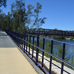
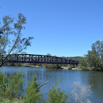
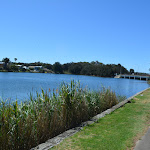
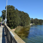
Turn left: From the intersection[156], this walk follows the ‘Billarong Reserve 1km’ arrow[157] over Pittwater Road Bridge[158], keeping the road to your right[159]. After about 30m this walk passes the ‘No fishing, climbing or jumping’ sign [160] and continues over the beautiful lagoon with lovely views[161], the narrowest section of the footpath here is 1.4m. [162]. At the far end of bridge this walk continues along the footpath[163] beside past the large ‘Wakehurst Parkway’ sign[164] to come to the ‘Welcome to Pittwater’ sign[165] (near the pedestrian lights[166]). The walk continues along the footpath (keeping Wakehurst Parkway to your right) for 110m to cross ‘Wimbledon Avenue’[167], then pass between the timber bollards[168]. Continue along the footpath for another 150m to cross the the other end of ‘Wimbledon Avenue’[169]. From this intersection, this walk continues along the main footpath very gently uphill, (still keeping Wakehurst Parkway to your right)[170] for 90m to come to the end of the concrete path at the signposted entrance to ‘Billarong Reserve’[171].
(5.93km) East end of Bilarong Reserve → Bilarong Reserve playground
330 m
5 mins
1m
-6m
Very easy
Continue straight: From the ‘Bilarong Reserve’ sign[172] beside the Wakehurst Parkway[173], this walk heads along the flat gravel track, towards the distant lagoon and away from the road. After about 170m this walk heads past two picnic tables


(one on each side of the track) to then cross a concrete ford with 57cm high timber guiding (2.6m wide)[174]. From the ford the track heads gently uphill to pass the exercise area[175] (on the right). Here this walk flattens and continues for another 130m passing a scattering of picnic tables (on both sides of the path)


, a drinking fountain (on the left)

, a double BBQ (on the right) to come to Y-intersection[176] beside a picnic area with another drinking fountain

and a playground[177] (on the right).
Bilarong Reserve playground and picnic area
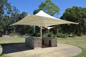
Bilarong Reserve playground is accessed from Wakehurst Parkway, North Narrabeen. The main Picnic area has twin sheltered BBQs (97cm high, 2.3m wide, 88cm deep) with hot plates (44/44cm)[178]. The distance between BBQs is 1.4m[179]. Each of the 4 picnic tables[180] sits on a concrete slab 3×3.2m. Tables are 79cm high, 2m wide and 60cm deep. Seats are 46cm high and 39cm deep. Drinking fountain is 70cm high. The playground[181][182] has a shaded fenced area with a slide and see-saw and a more open naturally shaded soft fall area with many climbing nets, single pole see-saw and a large sand area.
In the centre of the carpark is a scout hall with toilets
In the centre of the carpark is a scout hall with toilets

.
(6.26km) Bilarong Reserve playground → Bilarong Reserve boat ramp
140 m
2 mins
1m
0m
Very easy
Veer left: From the intersection, this walk follows the arrow post[183] on the lower gravel track (2.5m wide) keeping the lagoon to the left. This walk soon passes a seat (on the right)

and continues for about 40m to cross a flat fiber glass bridge (6m long, 2.6m wide, no handrails)[184] over a small creek. This walk heads below the carpark[185] for about 90m to just before the boat ramp[186] where there’s a 1.8m high shower (on the left)[187]. (Opposite the canoe ramp across the parking lot are accessible public toilets
.)
Bilarong Reserve car park
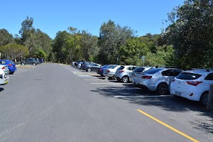
Bilarong Reserve car park is located just off Wakehurst Parkway, Narrabeen. There are 2 signposted mobility parking
[188] bays, a space for motor bikes[189] and plenty of car parking[190]. Parking fees ($6hr) apply[191]. There is a boat ramp[192] opposite the scout hall[193]. Also beside the scout hall are accessible
public toilets[194].
(6.41km) Bilarong Reserve boat ramp → Bilarong Reserve turning circle
180 m
3 mins
0m
0m
Very easy
Continue straight: From the boat ramp by the Bilarong Reserve car park, this walk follows the gravel track keeping the lagoon to your left. This walk continues for about 100m to soon pass a drinking fountain

, a scattering of picnic tables


, a seat

and a BBQ

(all on the left). From here this walk bends right and through the forest[195] for about 20m to lead up to a T-intersection[196] with a road (at the end of car park area).
Turn left: From the intersection, this walk heads along the road[197] past the timber bollards keeping the lagoon (through the trees) to the left. This walk continues for about 60m to come to the ‘Bilarong Sanctuary’ gate [198] (1.3m wide) at the far end of the turning circle.
(6.59km) Billarong Reserve turning circle → Deep Creek Intersection
1 km
19 mins
26m
-27m
Very easy
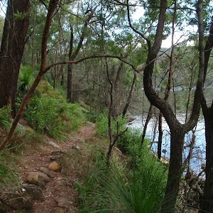
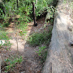
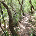
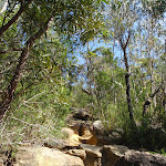
Veer left: From the gate in the fence[199] at the far end of the turning circle at the end of Billarong Reserve carpark, this walk follows the gravel track [200] away from the road and towards the ‘Bilarong Sanctuary’ sign[201]. This walk continues along the gravel track past the ‘Dogs prohibited’ sign[202] through the mixed forest beside the lagoon. After 300m the track comes gently up beside the Wakehurst Parkway (on the right) to a 1.9m wide gap in the fence[203], and heads moderately steeply up the gravel track to be behind the safety barrier[204] on Wakehurst Parkway. This track (1.4m wide) continues for about 130m beside the road (behind the safety barrier)[205] along the Wakehurst Parkway, past a rock with ‘Wakehurst Parkway’[206] and ‘Gateway to Pittwater’[207] signs (on the left) and a seat
(on the left) to come to a ’80’ km/h sign[208] (on the right). From the sign this walk starts to head moderately steeply downhill for about 30m to a flat fibreglass bridge[209]. From here this walk continues for the next 100m, crosses another flat fibreglass bridge [210] and follows the 80m section of timber boardwalk (1.78m wide)[211]. This walk continues along the gravel track for the next 70m, across another 12m long flat fiberglass bridge[212] to come to timber lookout[213] with 2 seats


(at time of writing the platform was closed of for repair), located by a gorgeous angophora tree[214]. This walk continues gently uphill to then pass a 15m long moderately steep dowhnill section of gravel track[215] and a flat fibreglass bridge[216]. This walk follows the gravel track for about 140m past a timber fence[217] (on the left) and a facing away ‘Welcome to Pittwater’ sign[218] (opposite the fence) to come to a Y-intersection[219] at the start of the concrete path.
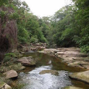
(7.59km) Deep Creek Intersection → Cement Works Lookout
310 m
5 mins
2m
-2m
Very easy
Turn right: From the intersection, this walk follows the main path arrow up a 15m moderately steep (8.4° incline) section of concrete footpath. The walk then leads over a long pedestrian bridge with handrails[220] offering beautiful views along Deep Creek[221]. At the end of the bridge this walk follows the gravel track[222] for about 30m gently downhill to come to a timber lookout[223](on the left) and 2 seats

. This walk now continues along the fiberglass footpath with handrails (handrails stop after 45m) for about 90m to come to another seat

(on the left). This walk then leads into a forest and zig-zags a little bit away from the Wakehurst Parkway to come to a handrailed (116cm high) lookout (on the left) with a seat

, just by the ‘Cement Works’ sign (on the left) and a shaded seat (on the right).
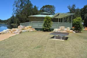
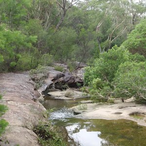
Cement Works Lookout
Cement Works Lookout[224] is a pleasant viewing platform on the northern edge of Narrabeen Lagoon. On display are some remains from the long since removed lime and cement works[225] that were established here by Edward Giles Stone. These works never reached their full potential due to the construction of Wakehurst Parkway.
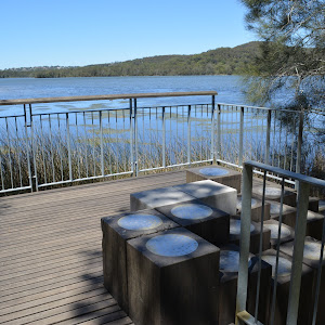
The lookout offers beautiful views across the lagoon[226] and unique seats
The lookout offers beautiful views across the lagoon[226] and unique seats

as a reminder of the works that were done here. There is a 1.2m high railing[227] at the main viewing area.
(7.9km) Cement Works Lookout → Northern end of Middle Creek Reserve
630 m
12 mins
17m
-14m
Very easy
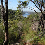
Continue straight: From the ‘Cement Works’ Lookout sign[228], this walk heads gently downhill across a short section of fibreglass boardwalk[229] keeping the lagoon to the left. This walk continues along the wide gravel track for about 60m. After crossing another short section of fiberglass boardwalk[230] gently uphill this walk comes to a seat

(on the right) and an unfenced timber viewing platform[231] (on the left) with 4 steps[232], offering beautiful views across the lagoon[233].
From beside this viewing platform this walk continues straight, along the 15m section of boardwalk with handrails[234] then another 80m of boardwalk to come to another viewing platform (on the left) and a seat

(on the right).
This walk continues along the fibreglass board for the next 140m as it meanders through the forest to come to the next viewing platform[235] (on the left) and a seat

(on the right).
From this viewing platform this walk continues along the fibreglass board for the next 120m through the forest to come to yet another viewing platform[236] (on the left) with a trip hazard
and a seat

(on the right).
From the viewing platform this walk continues along the fibreglass board and after about 70m this walk comes closer to the road and to yet another similar viewing platform[237] (on the left) and a seat

(on the right).
This walk continues along fiberglass board for the next 40m to come across a small handrailed bridge[238] then the end of the fiberglass boardwalk and a start of the gravel track[239].
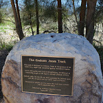
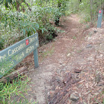
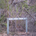
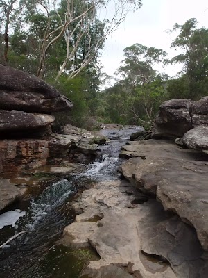
This walk continues along the wide gravel track for the next 80m to come to a seat

and a timber viewing platform (on the left), marked by a ‘Middle Creek Reserve’ sign[240](on the right) and ‘The Graham Jones Track’ sign[241] on a rock (on the left) at the start of the Middle Creek Reserve.
(8.53km) Northern end of Middle Creek Reserve → Middle Creek Reserve boat ramp
90 m
2 mins
0m
-3m
Very easy
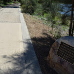
Continue straight: From the viewing platform[242] at the Northern end of Middle Creek Reserve, this walk follows the ‘South Creek Reserve 1.2km’ sign[243] along the concrete footpath along the edge of Middle Creek Reserve parking area. After about 60m this walk passes a seat
(on the left) and 15m later a parking pay station[244] (on the left), to come to the boat ramp[245] in the middle of the Middle Creek Reserve parking area (be mindful of a ‘Give way’ sign[246] when crossing).
Maps for the Narrabeen Lagoon Trail (from Middle Creek) walk
You can download the PDF for this walk to print a map.
These maps below cover the walk and the wider area around the walk, they are worth carrying for safety reasons.
| Mona Vale | 1:25 000 Map Series | 91301S MONA VALE | NSW-91301S |
| Sydney | 1:100 000 Map Series | 9130 SYDNEY | 9130 |
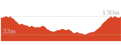
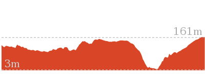
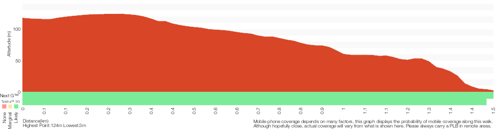
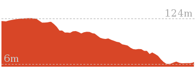
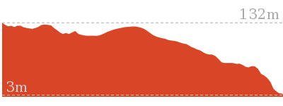
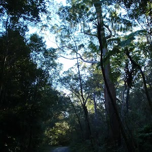
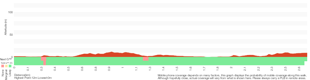
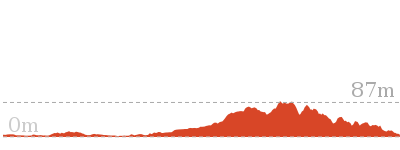
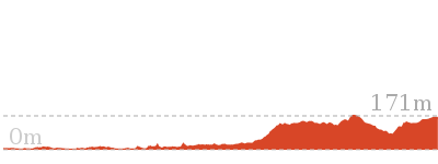
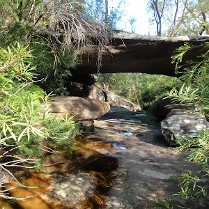
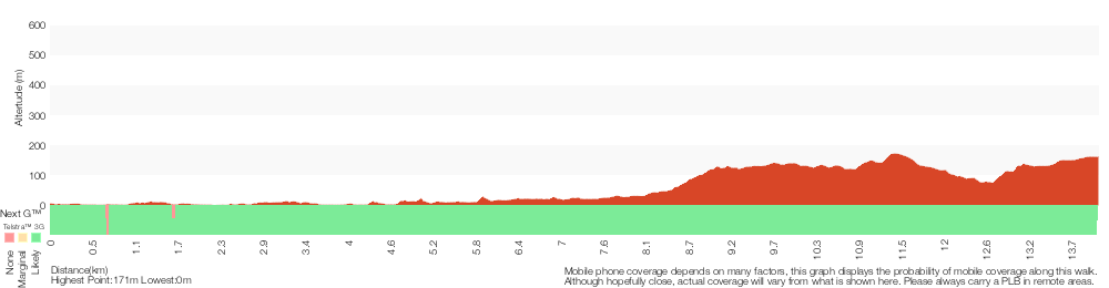
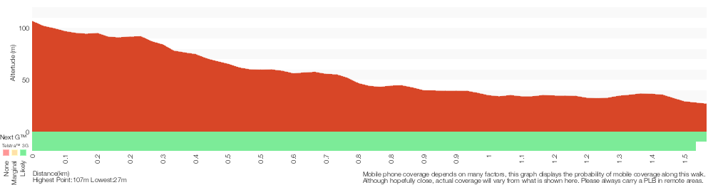
Cross sectional view of the Narrabeen Lagoon Trail (from Middle Creek) bushwalking track
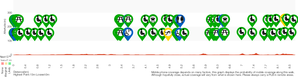
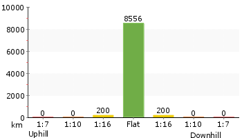
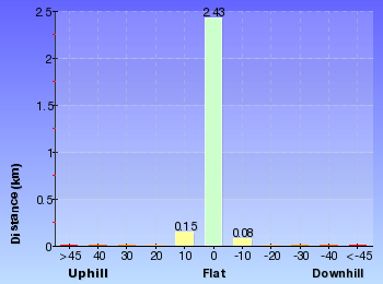
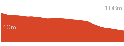
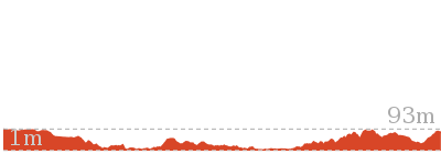
Analysis and summary of the altitude variation on the Narrabeen Lagoon Trail (from Middle Creek)
Accessibility summary information for the Narrabeen Lagoon Trail (from Middle Creek)
Parking: There are 4 designated accessible parking areas on this walk.
They are on average 2140m apart, with a maximum gap of 3480m.
Toilets: There are 2 designated accessible toilets on this walk.
They are 6390m apart.
Seats: There are 58 places to sit on this walk.
They are on average 150m apart, with a maximum gap of 1990m.
Hazards: There are 2 specific noteable accessability related hazards on this walk.
Trip Hazard The footpath beside the Boastshed Cafe has an unfenced direct 1m drop into the lagoon. There is a white line marking the edge but no change in texture. Found about 4730m into the walk.
Trip Hazard A 15cm step on a timber viewing platform with no handrails. Found about 8290m into the walk.
Accessibility Details

Found 0m into this walk


Found 30m into this walk
Found 60m into this walk
Found 60m into this walk


Found 90m into this walk


Found 130m into this walk
Found 140m into this walk

Found 140m into this walk

Found 170m into this walk


Found 3240m into this walk

Found 3240m into this walk

Found 3280m into this walk

Found 3280m into this walk

Found 3290m into this walk


Found 3500m into this walk


Found 3510m into this walk
Found 3510m into this walk
Found 4260m into this walk


Found 4990m into this walk

Found 5010m into this walk

Found 5020m into this walk


Found 5100m into this walk


Found 5990m into this walk

Found 6030m into this walk

Found 6120m into this walk

Found 6140m into this walk

Found 6160m into this walk

Found 6170m into this walk
Found 6210m into this walk


Found 6390m into this walk


Found 6420m into this walk

Found 6450m into this walk

Found 6460m into this walk

Found 6460m into this walk

Found 6470m into this walk


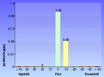
Overview of this walks grade – based on the AS 2156.1 – 2001
Under this standard, a walk is graded based on the most difficult section of the walk.
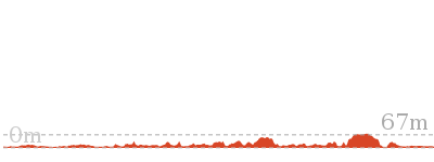
| Length | 8.6 km | ||
| Time | 2 hrs 30 mins | ||
| . | |||
| Grade 1/6 Very easy |
AS 2156.1 | Gradient | Flat, no steps (1/6) |
| Quality of track | Smooth and hardened path (1/6) | ||
| Signs | Clearly signposted (1/6) | ||
| Experience Required | No experience required (1/6) | ||
| Weather | Weather generally has little impact on safety (1/6) | ||
| Infrastructure | Generally useful facilities (such as fenced cliffs and seats) (1/6) |
Some more details of this walks Grading
Here is a bit more details explaining grading looking at sections of the walk
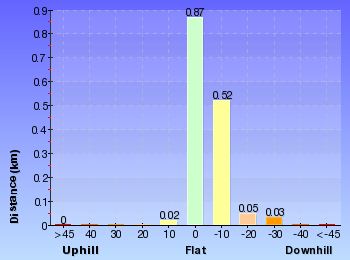
Gradient
This whole walk, 9km is flat with no steps.
Quality of track
This whole walk, 9km follows a smooth and hardened path.
Signs
This whole walk, 9km is clearly signposted.
Experience Required
This whole walk, 9km requires no previous bushwalking experience.
weather
This whole walk, 9km is not usually affected by severe weather events (that would unexpectedly impact safety and navigation).
Infrastructure
This whole walk, 9km is close to useful facilities (such as fenced cliffs and seats).
Similar walks
A list of walks that share part of the track with the Narrabeen Lagoon Trail (from Middle Creek) walk.
Other Nearby walks
A list of walks that start near the Narrabeen Lagoon Trail (from Middle Creek) walk.
8.2 km Return
3 hrs 15 mins
Moderate track
5.5 km One way
2 hrs 15 mins
Hard track
4.4 km Circuit
2 hrs
Moderate track
3.5 km Return
1 hr 30 mins
Moderate track

3.2 km One way
1 hr 30 mins
Moderate track

3 km Return
1 hr 15 mins
Moderate track

5.8 km One way
2 hrs 30 mins
Hard track
9.4 km One way
4 hrs 15 mins
Moderate track

14.6 km One way
6 hrs 30 mins
Hard track

6.6 km One way
2 hrs 45 mins
Moderate track
4.2 km One way
1 hr 45 mins
Moderate track

2.4 km Return
1 Hr
Hard track

Plan your trip to and from the walk here
The Narrabeen Lagoon Trail (from Middle Creek) walk starts and ends at the Middle Creek Reserve boat ramp (gps: -33.716926, 151.26987)
Your main transport option to Middle Creek Reserve boat ramp is by;
![]() Car. Parking fees apply in the area.
Car. Parking fees apply in the area.
(get details)


Short URL = http://wild.tl/nltmc
Gallery images
There are other downloads I am still working on.
You will probably need to login to access these — still all free.
* KML (google earth file)
* GPX (GPS file)
Special Maps/ brochures
* A3 topo maps
* PDF with Lands Topo map base
* PDF with arial image (and map overlay)
I wanted to get the main site live first, this extra stuff will come in time.
Happy walking
Matt 🙂
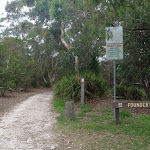
Founders Way
And Walk
Founders Way

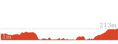
1 hr 30 mins
3 km Return
137 m
Moderate track
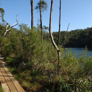
This return walk starts at the Founders Way track head, in St Ives, and follows the pipeline through the National Park. The walk heads down into the valley where it comes to the Middle Harbour Creek pipe bridge. There is a short, optional side trip along the Bungaroo Track to the stepping stones crossing the creek.


(0km) Int of Hunter Ave and Founders Way → Int of Pipeline Track and Founders Way
70 m
1 mins
0m
-2m
Easy track
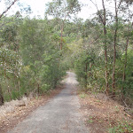
From the intersection, this walk follows the Founders Way service trail, heading away from the road and past a picnic seat, continuing along to the ‘T’ intersection with the pipeline track.
(0.07km) Int of Pipeline Track and Founders Way → Int of Pipeline and Bungaroo Tracks
180 m
3 mins
8m
0m
Easy track
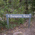
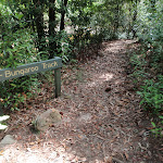
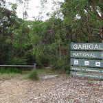
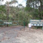
Veer left: From the intersection, this walk follows the management trail keeping the pipeline on the right as it heads up the gentle hill and past a Garigal National Park sign. It then continues through the bush for a while before coming to the signposted intersection with the Bungaroo Track.
(0.24km) Int of Pipeline and Bungaroo Tracks → Int of Pipeline and Middle Harbour Creek tracks
1.2 km
31 mins
3m
-124m
Moderate track
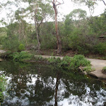
Continue straight: From the intersection, this walk follows the service trail in the opposite direction to the Pipeline Track arrow. The track keeps the pipe line on the right while heading through the bush, until the track comes to the intersection of the upper link track almost directly below the high-tension power lines. (Look for an arrow marked into the concrete pipeline support opposite the bush track.)
Continue straight: From the intersection, this walk follows the service trail, keeping the pipeline on the right as the track heads through the bush. The trail comes down a gentle hill to the intersection with the middle link track as it flattens out. (Look for an ‘X’ marked into the concrete pipeline support opposite the bush track)
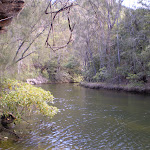
Continue straight: From the intersection, this walk follows the service trail, keeping the pipeline on the right as it steadily heads down the long hill into the valley, coming to the intersection with the Middle Harbour Creek bush track at the pipe bridge.
Continue straight: From the intersection, this walk follows the service trail, keeping the pipeline on the right as the track heads through the bush. The trail comes down a gentle hill to the intersection with the middle link track as it flattens out. (Look for an ‘X’ marked into the concrete pipeline support opposite the bush track)
Continue straight: From the intersection, this walk follows the service trail, keeping the pipeline on the right as it steadily heads down the long hill into the valley, coming to the intersection with the Middle Harbour Creek bush track at the pipe bridge.
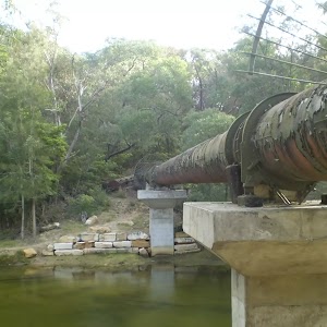
Pipeline
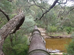
This pipeline is unearthed at Hunter Street, St Ives, and travels through Garigal National Park, across Middle Harbour Creek to John Oxley Drive, Sorlie. The pipe carries water under pressure From Ryde to Pymble to the reservoir at Beacon Hill. The old smaller-capacity pipe can still be seen running parallel to the larger pipe.
(1.49km) Int of Pipeline and Middle Harbour Creek tracks → Int of Gov. Phillip and Bungaroo tracks
660 m
12 mins
23m
-14m
Moderate track
Turn left: From the intersection, this walk follows the bush track heading away from the pipeline, keeping the creek on the right as it winds through the thick bush for a while with the ground sloping up to the left. The walk comes to the intersection with the Bungaroo track (this heads up the wooden steps on the left).
Continue straight: From the intersection, this walk follows the bush track, with the ground sloping up to the left and keeping the wide creek a short distance (through the bush) to the right. The track continues through the thick bush and around some boulders for a little while before bending to the right and coming to the Middle Harbour Creek, which it crosses at the large sandstone steppingstones (not safe to cross if stepping stones covered in water). The walk then continues up the steps on the other side to the signposted intersection of the ‘Governor Phillip Track’. At the end of this side trip, retrace your steps back to the main walk then Turn around.
Continue straight: From the intersection, this walk follows the bush track, with the ground sloping up to the left and keeping the wide creek a short distance (through the bush) to the right. The track continues through the thick bush and around some boulders for a little while before bending to the right and coming to the Middle Harbour Creek, which it crosses at the large sandstone steppingstones (not safe to cross if stepping stones covered in water). The walk then continues up the steps on the other side to the signposted intersection of the ‘Governor Phillip Track’. At the end of this side trip, retrace your steps back to the main walk then Turn around.
Bungaroo

Governor Arthur Phillip (first governor of NSW) described this section of the river as where “the flowing of the tide ceased”. Phillip and his party of nine camped here in 1788 whilst looking for land suitable for farming. John White (Surgeon General) described the the area as “the most desert, wild and solitary seclusion that the imagination can form any idea of”. Over the past 200 years the river has changed, but somewhere not far upstream of the stepping stone is Bungaroo. More info.
Maps for the Founders Way walk
You can download the PDF for this walk to print a map.
These maps below cover the walk and the wider area around the walk, they are worth carrying for safety reasons.
| Hornsby | 1:25 000 Map Series | 91304S HORNSBY | NSW-91304S |
| Sydney | 1:100 000 Map Series | 9130 SYDNEY | 9130 |
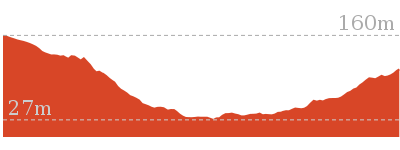
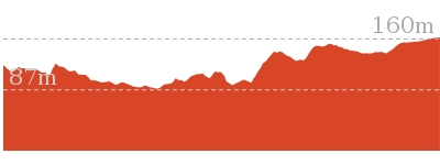
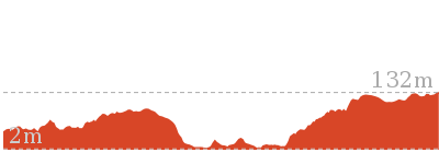
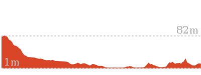
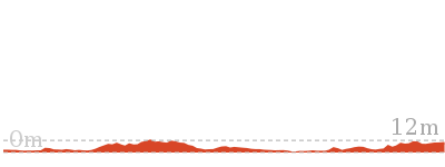
Cross sectional view of the Founders Way bushwalking track
Analysis and summary of the altitude variation on the Founders Way
Overview of this walks grade – based on the AS 2156.1 – 2001
Under this standard, a walk is graded based on the most difficult section of the walk.
| Length | 3 km | ||
| Time | 1 hr 30 mins | ||
| . | |||
| Grade 3/6 Moderate track |
AS 2156.1 | Gradient | Short steep hills (3/6) |
| Quality of track | Clear and well formed track or trail (2/6) | ||
| Signs | Directional signs along the way (3/6) | ||
| Experience Required | No experience required (1/6) | ||
| Weather | Weather generally has little impact on safety (1/6) | ||
| Infrastructure | Generally useful facilities (such as fenced cliffs and seats) (1/6) |
Some more details of this walks Grading
Here is a bit more details explaining grading looking at sections of the walk
Gradient
760m of this walk has short steep hills and another 490m has gentle hills with occasional steps. The remaining (240m) is flat with no steps.
Quality of track
This whole walk, 1.5km follows a clear and well formed track or trail.
Signs
Around 1.1km of this walk has directional signs at most intersection, whilst the remaining 390m is clearly signposted.
Experience Required
This whole walk, 1.5km requires no previous bushwalking experience.
weather
This whole walk, 1.5km is not usually affected by severe weather events (that would unexpectedly impact safety and navigation).
Infrastructure
This whole walk, 1.5km is close to useful facilities (such as fenced cliffs and seats).
Similar walks
A list of walks that share part of the track with the Founders Way walk.
3.5 km Circuit
1 hr 30 mins
Hard track

3.6 km Return
1 hr 30 mins
Hard track
4.7 km Return
2 hrs
Moderate track
4.7 km One way
2 hrs 15 mins
Hard track


6.8 km One way
3 hrs
Experienced only
9 km One way
4 hrs
Hard track
15.1 km Circuit
5 hrs 45 mins
Experienced only
Other Nearby walks
A list of walks that start near the Founders Way walk.

6 km One way
2 hrs 45 mins
Hard track

2.6 km One way
1 hr 15 mins
Hard track
2 km Return
1 hr 15 mins
Hard track

3.8 km One way
1 hr 30 mins
Hard track

3 km Return
1 hr 15 mins
Moderate track
5.8 km One way
2 hrs 30 mins
Hard track
3.5 km Return
1 hr 30 mins
Moderate track
3.2 km One way
1 hr 30 mins
Moderate track
5.5 km One way
2 hrs 15 mins
Hard track
4.4 km Circuit
2 hrs
Moderate track
5.5 km Return
2 hrs
Moderate track


12.2 km One way
4 hrs 30 mins
Hard track
Plan your trip to and from the walk here
The Founders Way walk starts and ends at the Int of Hunter Ave and Founders Way (gps: -33.743155, 151.17616)
Your transport options to Int of Hunter Ave and Founders Way are by;
![]() Bus. (get details)
Bus. (get details)
![]() Car. There is free parking available.
Car. There is free parking available.
(get details)
Short URL = http://wild.tl/fw
Gallery images
There are other downloads I am still working on.
You will probably need to login to access these — still all free.
* KML (google earth file)
* GPX (GPS file)
Special Maps/ brochures
* A3 topo maps
* PDF with Lands Topo map base
* PDF with arial image (and map overlay)
I wanted to get the main site live first, this extra stuff will come in time.
Happy walking
Matt 🙂
The Lyrebird Track
And Walk
The Lyrebird Track

2 hrs
5.3 km Return
100 m
Moderate track
This pleasant return walk starts from the end of the Davidson Reserve picnic area and follows the Lyrebird Track through the bush, along the edge of Middle Harbour Creek, to the stepping stone crossing on Carroll Creek. The stepping stones are a great place to take a break before returning along the same route to Davidson Reserve for a picnic.


Davidson picnic area

Davidson Picnic Area is in Garigal National Park, under Roseville Bridge (access via Warringah Road, south bound lanes, or via many walking tracks in the area). The picnic area has a boat ramp, wheelchair-accessible toilets, large open grassy areas, picnic tables, free electric BBQ’s, and a large rotunda. There are plenty of shady spots provided by the trees. The northern section of the picnic area has a small beach swimming area, and the southern section boasts a boat ramp. The park is open 6am to 8pm (6:30pm outside daylight savings time). Ticket machines are provided to pay the car access fee.
(0km) Int of the Lyrebird Track and end of Davidson Park driveway → Int of Lyrebird and Carroll Creek tracks
2.7 km
48 mins
54m
-46m
Moderate track
From the gate at the north-western corner of Davidson Park, this walk follows the ‘Lyrebird Track’ sign through the metal gate and along the service trail, heading through the bush and following Middle Harbour Creek for a while before the track narrows to a bush track at a long grassy clearing.
Continue straight: From the clearing at the end of the management trail, this walk continues along the bush track, keeping Middle Harbour Creek on the left as it meanders along the water’s edge for a while. The track climbs up the side of the hill, then flattens out and continues through the bush, steadily winding down to the edge of Carroll Creek, which it follows for a while before the track comes down to the signposted intersection of the ‘Carroll Creek Track’ at the stepping stones.
Continue straight: From the clearing at the end of the management trail, this walk continues along the bush track, keeping Middle Harbour Creek on the left as it meanders along the water’s edge for a while. The track climbs up the side of the hill, then flattens out and continues through the bush, steadily winding down to the edge of Carroll Creek, which it follows for a while before the track comes down to the signposted intersection of the ‘Carroll Creek Track’ at the stepping stones.
Maps for the The Lyrebird Track walk
You can download the PDF for this walk to print a map.
These maps below cover the walk and the wider area around the walk, they are worth carrying for safety reasons.
| Parramatta River | 1:25 000 Map Series | 91303N PARRAMATTA RIVER | NSW-91303N |
| Sydney | 1:100 000 Map Series | 9130 SYDNEY | 9130 |
Cross sectional view of the The Lyrebird Track bushwalking track
Analysis and summary of the altitude variation on the The Lyrebird Track
Overview of this walks grade – based on the AS 2156.1 – 2001
Under this standard, a walk is graded based on the most difficult section of the walk.
| Length | 5.3 km | ||
| Time | 2 hrs | ||
| . | |||
| Grade 3/6 Moderate track |
AS 2156.1 | Gradient | Short steep hills (3/6) |
| Quality of track | Formed track, with some branches and other obstacles (3/6) | ||
| Signs | Directional signs along the way (3/6) | ||
| Experience Required | Some bushwalking experience recommended (3/6) | ||
| Weather | Weather generally has little impact on safety (1/6) | ||
| Infrastructure | Limited facilities, not all cliffs are fenced (3/6) |
Some more details of this walks Grading
Here is a bit more details explaining grading looking at sections of the walk
Gradient
Around 1.6km of this walk is flat with no steps, whilst the remaining 1km has short steep hills.
Quality of track
This whole walk, 2.7km follows a formed track, with some branches and other obstacles.
Signs
Around 1.6km of this walk has directional signs at most intersection, whilst the remaining 1km is clearly signposted.
Experience Required
Around 1.6km of this walk requires no previous bushwalking experience, whilst the remaining 1km requires some bushwalking experience.
weather
This whole walk, 2.7km is not usually affected by severe weather events (that would unexpectedly impact safety and navigation).
Infrastructure
Around 1.6km of this walk is close to useful facilities (such as fenced cliffs and seats), whilst the remaining 1km has limited facilities (such as not all cliffs fenced).
Similar walks
A list of walks that share part of the track with the The Lyrebird Track walk.

7 km Circuit
2 hrs 30 mins
Hard track
11.5 km One way
4 hrs 30 mins
Hard track

14.1 km One way
5 hrs 30 mins
Moderate track
15.1 km Circuit
5 hrs 45 mins
Experienced only
Other Nearby walks
A list of walks that start near the The Lyrebird Track walk.
3.8 km One way
1 hr 45 mins
Hard track

3.4 km One way
1 hr 30 mins
Moderate track

1.4 km Return
45 mins
Moderate track
6.7 km Circuit
2 hrs 45 mins
Moderate track
7 km Return
3 hrs 45 mins
Moderate track
6.1 km One way
2 hrs 30 mins
Moderate track
2.2 km One way
1 Hr
Moderate track
986 m Return
30 mins
Moderate track
4.5 km Return
1 hr 30 mins
Hard track

7.2 km One way
3 hrs
Moderate track

3.7 km Return
1 hr 30 mins
Hard track
11.2 km One way
4 hrs 30 mins
Hard track
Plan your trip to and from the walk here
The The Lyrebird Track walk starts and ends at the Int of the Lyrebird Track and end of Davidson Park driveway (gps: -33.767005, 151.19964)
Your transport options to Int of the Lyrebird Track and end of Davidson Park driveway are by;
![]() Bus. (get details)
Bus. (get details)
![]() Car. A park entry fee is required for driving into the park.
Car. A park entry fee is required for driving into the park.
(get details)
Short URL = http://wild.tl/tlt
Gallery images
There are other downloads I am still working on.
You will probably need to login to access these — still all free.
* KML (google earth file)
* GPX (GPS file)
Special Maps/ brochures
* A3 topo maps
* PDF with Lands Topo map base
* PDF with arial image (and map overlay)
I wanted to get the main site live first, this extra stuff will come in time.
Happy walking
Matt 🙂
Davidson Park to St Ives Chase
And Walk
Davidson Park to St Ives Chase

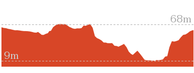
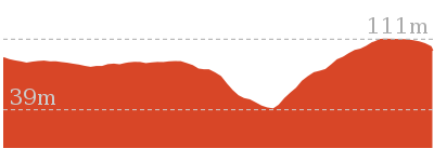
5 hrs 30 mins
14.1 km One way
591 m
Moderate track


Davidson picnic area
Davidson Picnic Area is in Garigal National Park, under Roseville Bridge (access via Warringah Road, south bound lanes, or via many walking tracks in the area). The picnic area has a boat ramp, wheelchair-accessible toilets, large open grassy areas, picnic tables, free electric BBQ’s, and a large rotunda. There are plenty of shady spots provided by the trees. The northern section of the picnic area has a small beach swimming area, and the southern section boasts a boat ramp. The park is open 6am to 8pm (6:30pm outside daylight savings time). Ticket machines are provided to pay the car access fee.
(0km) Int of Davidson Park driveway and Rotary Rotunda path → Int of the Lyrebird Track and end of Davidson Park Driveway
430 m
8 mins
4m
-8m
Very easy
From the intersection, this walk follows the road, keeping the park and Middle Harbour on the left. After a little while, this walk comes to the signposted intersection at the bottom of the ‘Casuarina Stairway’, uphill on the right.
Continue straight: From the intersection at the bottom of the ‘Casuarina Stairway’, this walk follows the driveway, keeping the park and Middle Harbour Creek on the left. The walk heads along for little while before coming to the end of the driveway, at the signposted start of the ‘Lyre Bird Track 4km’.
Continue straight: From the intersection at the bottom of the ‘Casuarina Stairway’, this walk follows the driveway, keeping the park and Middle Harbour Creek on the left. The walk heads along for little while before coming to the end of the driveway, at the signposted start of the ‘Lyre Bird Track 4km’.
(0.43km) Int of the Lyrebird Track and end of Davidson Park driveway → End Lyrebird service trail
1.6 km
29 mins
29m
-29m
Moderate track
Continue straight: From the gate at the north-western corner of Davidson Park, this walk follows the ‘Lyrebird Track’ sign through the metal gate and along the service trail, heading through the bush and following Middle Harbour Creek for a while before the track narrows to a bush track at a long grassy clearing.
(2.05km) End Lyrebird service trail → Int of Gov. Phillip and Bungaroo tracks
3.2 km
1 hr 3 mins
94m
-86m
Moderate track
Continue straight: From the clearing at the end of the management trail, this walk continues along the bush track, keeping Middle Harbour Creek on the left as it meanders along the water’s edge for a while. The track climbs up the side of the hill, then flattens out and continues through the bush, steadily winding down to the edge of Carroll Creek, which it follows for a while before the track comes down to the signposted intersection of the ‘Carroll Creek Track’ at the stepping stones.
Veer left: From the intersection, this walk crosses Carroll Creek at the stepping stones and continues along the bush track, passing the “Governor Phillip Walk” sign as the track bends to the left. This walk winds through the bush alongside Carrol Creek before steadily climbing up the rocky hill to the right for a little while. The track then drops back down to the edge of Middle Harbour Creek, which it follows as the walk undulates along the rocky bush track for a while, before crossing under a large pipe bridge to the end of an asphalt service trail.
Veer left: From the intersection, this walk follows the ‘Bungaroo Track (450m)’ sign, keeping Middle Harbour Creek to the left. The bush track makes its way upstream following the main creek, but crossing a few small gullies along the way. The track then comes an intersection with a signpost ‘Bungaroo Track’ and stepping stones across the creek, clearly visable on the left.
Bungaroo
Governor Arthur Phillip (first governor of NSW) described this section of the river as where “the flowing of the tide ceased”. Phillip and his party of nine camped here in 1788 whilst looking for land suitable for farming. John White (Surgeon General) described the the area as “the most desert, wild and solitary seclusion that the imagination can form any idea of”. Over the past 200 years the river has changed, but somewhere not far upstream of the stepping stone is Bungaroo. More info.
(5.3km) Int of Gov. Phillip and Bungaroo tracks → The Cascades
2.6 km
51 mins
89m
-72m
Moderate track
Continue straight: From the intersection, this walk follows the track, with the signposted ‘Bungaroo track’[1] on the left and the ground sloping up to the right. The walk heads through the forest and follows Middle Harbour Creek north, crossing rock platforms and winding through undulating bushland for quite some time. The track then comes down to a large rock platform at a junction in the creek, where the track turns right and continues to an intersection with a management trail.
The Cascades
The Cascades are a series of small cascades (little waterfalls) in Garigal National Park. The cascades centre around a large rock platform on Middle Harbour Creek and are found in the northern section of the park, at the intersection of the Middle Harbour and Cascade Tracks. The cascades make a great spot to sit and rest when exploring the area.
(7.89km) The Cascades → Int of Cambourne Ave and Upper Cambourne Track
1.5 km
32 mins
128m
-27m
Moderate track
Turn left: From the cascades, this walk follows the service trail across the creek and past the “Cascades” sign, continuing up the gentle hill and through the bush for a short while before dropping back down and across a creek. From here, the track continues up the other side to the signposted intersection of the ‘Bare Creek Track’ service trail.
Continue straight: From the intersection, the walk follows the “Cascades Track” sign along the service trail. The walk climbs for a while to reach the intersection with the Link track (on the right).
Continue straight: From the intersection, the walk follows the service trail going up the hill. After winding up the long, and sometimes steep hill, the walk passes an intersection and continues up the hill on an asphalted section of management trail to reach the signposted intersection with the ‘Lower Cambourne Track’.
Veer left: From the intersection, this walk follows the Cascades track arrow along the service trail, climbing up the hill for a short while before coming to the intersection of the Upper Cambourne track.
Turn right: From the intersection, the walk follows the service trail, zigzagging up the hill behind the ‘Upper Cambourne’ sign. The walk flattens out for a while and reaches an intersection with a service trail at a track marker.
Continue straight: From the intersection, the walk follows the service trail down the side of the hill, with the ground sloping up to the left. The walk descends steadily until it crosses a small creek and climbs up the hill on the other side, passing through a metal gate to arrive at Cambourne Ave.
(9.39km) Int of Cambourne Ave and Upper Cambourne Track → End of Kitchener St
2.6 km
57 mins
105m
-117m
Very easy
Turn right: From the intersection the track heads up Cambourne Ave keeping the bush on the right and the houses to the left of the road. The walk continues along Cambourne Ave which tends left to the intersection with Blackburn St. The track turns right onto Blackburn St, which it follows still keeping the bush on the right of the track. The walk then continues to the intersection with Whitehaven St, which it turns right onto. Whitehaven St is followed, passing Linigen Pl on the right, before tending left onto Roma Rd. The walk turns right onto Roma Rd which it follows to the intersection with Kitchener St.
Veer left: From the intersection the track heads straight up Kitchener St to cross Mona Vale Rd and continue down to the other end of Kitchener St at the gate on the left.
Veer left: From the intersection the track heads straight up Kitchener St to cross Mona Vale Rd and continue down to the other end of Kitchener St at the gate on the left.
(12.04km) End of Kitchener St → End of Phillip Rd
1.6 km
39 mins
129m
-93m
Moderate track
Veer left: From the end of the road the track heads past a gate and down the hill swinging right. The track tends right for approximately 100m to pass a large white house above on the right. The track then follows the hillside for approximately 200m to a signposted intersection on the right.
Continue straight: From the intersection the track heads down the hill tending right, to a large vertical green pipe. From the pipe the track continues down the hill for approximately 50m to turn left into the sign posted intersection.
Veer left: From the intersection the track heads winds up the hill along the service trail away from Ku-ring-gai Creek. Once reaching the top of the hill the track winds, continuing along the servictrail until reaching the gate at the end of Phillip Ave signposted ‘Harbour to Hawkesbury Track’.
(13.67km) End of Phillip Rd → End of Warrimoo Ave
470 m
8 mins
13m
-1m
Very easy
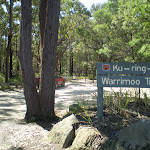
Continue straight: From the end of Phillip Rd the track heads away from the bush up the road between the houses. The track continues along the road to turn right onto Warrimoo Ave. This is then followed to the end of Warimoo Ave where the track crosses Timbarra Rd to the National Parks sign to the right of the black and white traffic sign.
Maps for the Davidson Park to St Ives Chase walk
You can download the PDF for this walk to print a map.
These maps below cover the walk and the wider area around the walk, they are worth carrying for safety reasons.
| Hornsby | 1:25 000 Map Series | 91304S HORNSBY | NSW-91304S |
| Parramatta River | 1:25 000 Map Series | 91303N PARRAMATTA RIVER | NSW-91303N |
| Sydney | 1:100 000 Map Series | 9130 SYDNEY | 9130 |
Cross sectional view of the Davidson Park to St Ives Chase bushwalking track
Analysis and summary of the altitude variation on the Davidson Park to St Ives Chase

Overview of this walks grade – based on the AS 2156.1 – 2001
Under this standard, a walk is graded based on the most difficult section of the walk.
| Length | 14.1 km | ||
| Time | 5 hrs 30 mins | ||
| . | |||
| Grade 3/6 Moderate track |
AS 2156.1 | Gradient | Short steep hills (3/6) |
| Quality of track | Formed track, with some branches and other obstacles (3/6) | ||
| Signs | Directional signs along the way (3/6) | ||
| Experience Required | Some bushwalking experience recommended (3/6) | ||
| Weather | Weather generally has little impact on safety (1/6) | ||
| Infrastructure | Limited facilities, not all cliffs are fenced (3/6) |
Some more details of this walks Grading
Here is a bit more details explaining grading looking at sections of the walk
Gradient
5km of this walk has short steep hills and another 5km is flat with no steps. The remaining (3.7km) has gentle hills with occasional steps.
Quality of track
8km of this walk follows a formed track, with some branches and other obstacles and another 3.5km follows a smooth and hardened path. The remaining (2.2km) follows a clear and well formed track or trail.
Signs
Around 9km of this walk is clearly signposted, whilst the remaining 5km has directional signs at most intersection.
Experience Required
Around 8km of this walk requires no previous bushwalking experience, whilst the remaining 6km requires some bushwalking experience.
weather
This whole walk, 14km is not usually affected by severe weather events (that would unexpectedly impact safety and navigation).
Infrastructure
Around 8km of this walk has limited facilities (such as not all cliffs fenced), whilst the remaining 6km is close to useful facilities (such as fenced cliffs and seats).
Similar walks
A list of walks that share part of the track with the Davidson Park to St Ives Chase walk.
3.2 km One way
1 hr 30 mins
Moderate track
3.5 km Return
1 hr 30 mins
Moderate track
3.8 km One way
1 hr 30 mins
Hard track
4.4 km Circuit
2 hrs
Moderate track
4.7 km One way
2 hrs 15 mins
Hard track
5.3 km Return
2 hrs
Moderate track
5.5 km One way
2 hrs 15 mins
Hard track
5.8 km One way
2 hrs 30 mins
Hard track
7 km Return
3 hrs 45 mins
Moderate track
7 km Circuit
2 hrs 30 mins
Hard track
8.2 km Return
3 hrs 15 mins
Moderate track
9 km One way
4 hrs
Hard track
11.2 km One way
4 hrs 30 mins
Hard track
11.5 km One way
4 hrs 30 mins
Hard track
15.1 km Circuit
5 hrs 45 mins
Experienced only
Other Nearby walks
A list of walks that start near the Davidson Park to St Ives Chase walk.
3.8 km One way
1 hr 45 mins
Hard track
3.4 km One way
1 hr 30 mins
Moderate track
1.4 km Return
45 mins
Moderate track
6.7 km Circuit
2 hrs 45 mins
Moderate track
6.1 km One way
2 hrs 30 mins
Moderate track
986 m Return
30 mins
Moderate track
2.2 km One way
1 Hr
Moderate track
4.5 km Return
1 hr 30 mins
Hard track
7.2 km One way
3 hrs
Moderate track
3.7 km Return
1 hr 30 mins
Hard track

4.6 km One way
2 hrs
Hard track
2 km Return
1 hr 15 mins
Hard track
Plan your trip to and from the walk here
The Davidson Park to St Ives Chase walk starts at the Int of Davidson Park driveway and Rotary Rotunda path (gps: -33.768199, 151.20325)
Your transport options to Int of Davidson Park driveway and Rotary Rotunda path are by;
![]() Bus. (get details)
Bus. (get details)
![]() Car. There is free parking available.
Car. There is free parking available.
(get details)
The Davidson Park to St Ives Chase ends at the End of Warrimoo Ave (gps: -33.700638, 151.16557)
Your transport options to End of Warrimoo Ave are by;
![]() Bus. (get details)
Bus. (get details)
![]() Car. There is free parking available.
Car. There is free parking available.
(get details)
Short URL = http://wild.tl/dptsic
Gallery images
There are other downloads I am still working on.
You will probably need to login to access these — still all free.
* KML (google earth file)
* GPX (GPS file)
Special Maps/ brochures
* A3 topo maps
* PDF with Lands Topo map base
* PDF with arial image (and map overlay)
I wanted to get the main site live first, this extra stuff will come in time.
Happy walking
Matt 🙂
Cascades Track (from Davidson)
And Walk
Cascades Track (from Davidson)

1 hr 15 mins
3 km Return
119 m
Moderate track
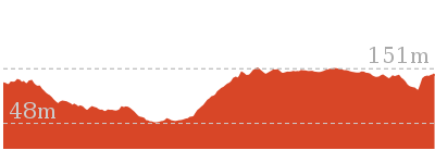
This pleasant, return walk starts in Davidson and follows the Cascades Track along the management trails as it winds down into the valley. In the main valley, the walk comes to the Cascades just upstream of the Frenchs and Middle Harbour Creeks junction. The Cascades are surrounded by rock platforms, which make the perfect vantage points to stop and enjoy a picnic lunch.


(0km) Stone Pde → Int of Cascades and Frenchs Creek service trails
950 m
22 mins
10m
-77m
Moderate track
From the intersection, the walk passes through the metal gate marked with the Cascades Track sign, and follows the (initially) asphalted service trail. The service trail winds down into the valley, steeply at times, until it comes to the signposted intersection with the French’s Creek Track.
(0.95km) Int of Cascades and Frenchs Creek service trails → The Cascades
570 m
11 mins
10m
-22m
Moderate track
Continue straight: From the intersection, this walk follows the service trail, leaving the French’s Creek track to the right. The walk descends before following a creek for a short distance to the cascades.
The Cascades
The Cascades are a series of small cascades (little waterfalls) in Garigal National Park. The cascades centre around a large rock platform on Middle Harbour Creek and are found in the northern section of the park, at the intersection of the Middle Harbour and Cascade Tracks. The cascades make a great spot to sit and rest when exploring the area.
Maps for the Cascades Track (from Davidson) walk
You can download the PDF for this walk to print a map.
These maps below cover the walk and the wider area around the walk, they are worth carrying for safety reasons.
| Hornsby | 1:25 000 Map Series | 91304S HORNSBY | NSW-91304S |
| Sydney | 1:100 000 Map Series | 9130 SYDNEY | 9130 |
Cross sectional view of the Cascades Track (from Davidson) bushwalking track
Analysis and summary of the altitude variation on the Cascades Track (from Davidson)
Overview of this walks grade – based on the AS 2156.1 – 2001
Under this standard, a walk is graded based on the most difficult section of the walk.
| Length | 3 km | ||
| Time | 1 hr 15 mins | ||
| . | |||
| Grade 3/6 Moderate track |
AS 2156.1 | Gradient | Short steep hills (3/6) |
| Quality of track | Clear and well formed track or trail (2/6) | ||
| Signs | Directional signs along the way (3/6) | ||
| Experience Required | No experience required (1/6) | ||
| Weather | Weather generally has little impact on safety (1/6) | ||
| Infrastructure | Limited facilities, not all cliffs are fenced (3/6) |
Some more details of this walks Grading
Here is a bit more details explaining grading looking at sections of the walk
Gradient
Around 950m of this walk has short steep hills, whilst the remaining 570m has gentle hills with occasional steps.
Quality of track
This whole walk, 1.5km follows a clear and well formed track or trail.
Signs
Around 950m of this walk is clearly signposted, whilst the remaining 570m has directional signs at most intersection.
Experience Required
This whole walk, 1.5km requires no previous bushwalking experience.
weather
This whole walk, 1.5km is not usually affected by severe weather events (that would unexpectedly impact safety and navigation).
Infrastructure
Around 950m of this walk is close to useful facilities (such as fenced cliffs and seats), whilst the remaining 570m has limited facilities (such as not all cliffs fenced).
Similar walks
A list of walks that share part of the track with the Cascades Track (from Davidson) walk.
3.2 km One way
1 hr 30 mins
Moderate track
5.8 km One way
2 hrs 30 mins
Hard track
Other Nearby walks
A list of walks that start near the Cascades Track (from Davidson) walk.
2 km Return
1 hr 15 mins
Hard track
3.8 km One way
1 hr 30 mins
Hard track
8.2 km Return
3 hrs 15 mins
Moderate track
3.6 km Return
1 hr 30 mins
Hard track
3 km Return
1 hr 30 mins
Moderate track

3.5 km Circuit
1 hr 30 mins
Hard track
2.6 km One way
1 hr 15 mins
Hard track
9 km One way
4 hrs
Hard track
4.7 km Return
2 hrs
Moderate track
4.7 km One way
2 hrs 15 mins
Hard track
5.5 km One way
2 hrs 15 mins
Hard track
4.4 km Circuit
2 hrs
Moderate track
Plan your trip to and from the walk here
The Cascades Track (from Davidson) walk starts and ends at the Stone Pde (gps: -33.737283, 151.19618)
Your transport options to Stone Pde are by;
![]() Bus. (get details)
Bus. (get details)
![]() Car. There is free parking available.
Car. There is free parking available.
(get details)
Short URL = http://wild.tl/ctd
Gallery images
There are other downloads I am still working on.
You will probably need to login to access these — still all free.
* KML (google earth file)
* GPX (GPS file)
Special Maps/ brochures
* A3 topo maps
* PDF with Lands Topo map base
* PDF with arial image (and map overlay)
I wanted to get the main site live first, this extra stuff will come in time.
Happy walking
Matt 🙂
Seaforth Oval to the Bluff Lookout
And Walk
Seaforth Oval to the Bluff Lookout

3 hrs
5.4 km Return
363 m
Hard track


Seaforth Oval
Seaforth Oval is a large playing oval on the Wakehurst Parkway in North Balgowlah. It is managed by Manly Council, who have also recently been upgrading the Timber Getters Track in association with NPWS. There is a distant view of Chatswood from the oval. There are toilets, but they are usually locked. There is a large car park, shelter and sign with information about the Harbour to Hawkesbury walk. More info.
(0km) Seaforth Oval → Int of the Timbergetters and Engraving Tracks
50 m
1 mins
0m
-2m
Moderate track
From the corner of the car park with the information signs, the walk heads into the bush and down the wooden steps to the bottom, where it flattens out at the signposted intersection with the Engraving Track[1].
(0.05km) Int of the Timber Getters and Engraving Tracks → Bantry Bay Picnic Area
840 m
24 mins
9m
-109m
Hard track
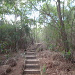
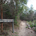
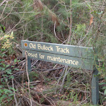
Veer left: From the intersection, this walk follows the ‘Timbergetters Track’ sign[2] down the wooden steps and through the bush, winding steadily down a long hill as it drops down several more sets of steps, following the bush track to the signposted intersection with the Old Bullock Track[3] (closed for maintenance at time of writing).
Continue straight: From the intersection (with the signposted ‘Old Bullock Track’[4] on the right), this walk heads west down the three wooden steps and along the track, winding through the dense scrub for a while. The walk crosses a small creek at some stepping stones and passes an old telegraph pole with no power lines attached. The track continues in this manner for a little while longer before it comes to the top of a short set of rock steps, where it starts to wind down into the valley using several scattered sets of wooden steps and one long set of rock steps, until coming down to the large picnic area at the bottom.
Continue straight: From the intersection (with the signposted ‘Old Bullock Track’[4] on the right), this walk heads west down the three wooden steps and along the track, winding through the dense scrub for a while. The walk crosses a small creek at some stepping stones and passes an old telegraph pole with no power lines attached. The track continues in this manner for a little while longer before it comes to the top of a short set of rock steps, where it starts to wind down into the valley using several scattered sets of wooden steps and one long set of rock steps, until coming down to the large picnic area at the bottom.
Bantry Bay Picnic Area
The area of Bantry Bay has been popular with day visitors since the late 1800s. In the early 1900s, the picnic area was also home to a dance hall (foundations still visible), dining room, picnic ground and overnight accommodation. Today, the picnic area has a picnic table and a number of fireplaces. There is also a public wharf, toilets, open grassy area, shade from trees and a great view across the water. There are no garbage facilities. The picnic area is at the bottom of the Timber Getters Track, below Seaforth Oval, on the eastern shore of Bantry Bay. More info.
(0.89km) Bantry Bay Picnic Area → The Bluff Lookout
1.8 km
48 mins
166m
-77m
Hard track
Turn right: From the picnic area (keeping the water on the left), this walk follows the “Bantry Bay Track” sign along the rocky bush track which undulates along the side of the hill, winding through the bush for a little while. The walk passes by the base of some cliffs and starts to climb up the hill at a rocky outcrop, continuing to wind up the long rocky hill as the track climbs to the top of the valley, eventually winding up some rock steps to a large rock platform, Here, the walk passes some track markers pointing back down the valley to a short bush track, leading to the signposted intersection of the Bluff Track at the lookout.
Bluff Lookout
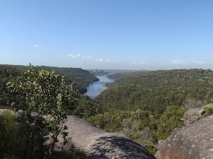
The Bluff is a large, unfenced rocky hilltop, in Garigal National Park, that provides great views up Middle Harbour. The views extend across the bushland of the National Park, along Bantry Bay, to the city of Sydney (You can even see Centrepoint Tower). Apart from the distant views, the bluff is also an interesting rock feature, with a number of caves containing honeycomb rock formations.
Maps for the Seaforth Oval to the Bluff Lookout walk
You can download the PDF for this walk to print a map.
These maps below cover the walk and the wider area around the walk, they are worth carrying for safety reasons.
| Parramatta River | 1:25 000 Map Series | 91303N PARRAMATTA RIVER | NSW-91303N |
| Sydney | 1:100 000 Map Series | 9130 SYDNEY | 9130 |
Cross sectional view of the Seaforth Oval to the Bluff Lookout bushwalking track
Analysis and summary of the altitude variation on the Seaforth Oval to the Bluff Lookout
Overview of this walks grade – based on the AS 2156.1 – 2001
Under this standard, a walk is graded based on the most difficult section of the walk.
| Length | 5.4 km | ||
| Time | 3 hrs | ||
| . | |||
| Grade 4/6 Hard track |
AS 2156.1 | Gradient | Very steep (4/6) |
| Quality of track | Formed track, with some branches and other obstacles (3/6) | ||
| Signs | Clearly signposted (1/6) | ||
| Experience Required | Some bushwalking experience recommended (3/6) | ||
| Weather | Weather generally has little impact on safety (1/6) | ||
| Infrastructure | Limited facilities, not all cliffs are fenced (3/6) |
Some more details of this walks Grading
Here is a bit more details explaining grading looking at sections of the walk
Gradient
Around 2.3km of this walk is very steep, whilst the remaining 380m has short steep hills.
Quality of track
Around 2.3km of this walk follows a formed track, with some branches and other obstacles, whilst the remaining 380m follows a clear and well formed track or trail.
Signs
This whole walk, 2.7km is clearly signposted.
Experience Required
Around 2.3km of this walk requires some bushwalking experience, whilst the remaining 380m requires no previous bushwalking experience.
weather
This whole walk, 2.7km is not usually affected by severe weather events (that would unexpectedly impact safety and navigation).
Infrastructure
Around 1.8km of this walk has limited facilities (such as not all cliffs fenced), whilst the remaining 890m is close to useful facilities (such as fenced cliffs and seats).
Similar walks
A list of walks that share part of the track with the Seaforth Oval to the Bluff Lookout walk.

1.8 km Return
1 Hr
Hard track
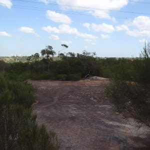
2.2 km One way
45 mins
Moderate track
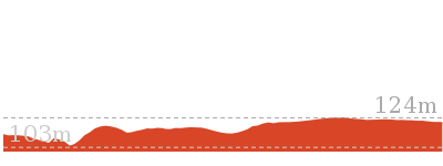
4.6 km One way
2 hrs
Hard track
10 km One way
4 hrs 30 mins
Hard track


10 km One way
4 hrs
Hard track
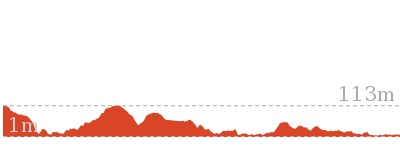
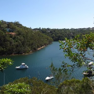
22.6 km One way
9 hrs 45 mins
Hard track
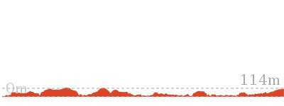
Other Nearby walks
A list of walks that start near the Seaforth Oval to the Bluff Lookout walk.
516 m Return
20 mins
Moderate track
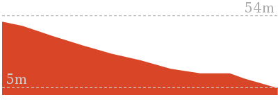

7.3 km Circuit
3 hrs
Moderate track
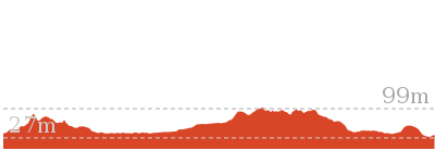

3.2 km Return
1 hr 30 mins
Moderate track

3.1 km One way
2 hrs
Moderate track
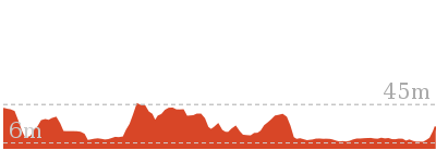
986 m Return
30 mins
Moderate track
9.1 km One way
3 hrs 45 mins
Moderate track
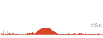
3.4 km One way
1 hr 30 mins
Moderate track
1.4 km Return
45 mins
Moderate track
8.7 km Circuit
4 hrs
Moderate track
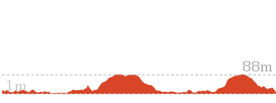
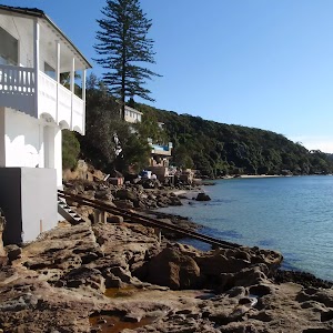
6.1 km One way
2 hrs 30 mins
Hard track

4.5 km Return
1 hr 30 mins
Hard track
7.2 km One way
3 hrs
Moderate track
Plan your trip to and from the walk here
The Seaforth Oval to the Bluff Lookout walk starts and ends at the Seaforth Oval (gps: -33.781957, 151.23724)
Your transport options to Seaforth Oval are by;
![]() Bus. (get details)
Bus. (get details)
![]() Car. There is free parking available.
Car. There is free parking available.
(get details)
Short URL = http://wild.tl/sottbl
Gallery images
There are other downloads I am still working on.
You will probably need to login to access these — still all free.
* KML (google earth file)
* GPX (GPS file)
Special Maps/ brochures
* A3 topo maps
* PDF with Lands Topo map base
* PDF with arial image (and map overlay)
I wanted to get the main site live first, this extra stuff will come in time.
Happy walking
Matt 🙂
Middle Harbour Creek Loop
And Walk
Middle Harbour Creek Loop

5 hrs 45 mins
15.1 km Circuit
570 m
Experienced only
This walk explores the upper reaches of Middle Harbour Creek, starting and ending at the great parklands at Davidson Park, in Garigal National Park. There are plenty of nice spots along the way to rest and enjoy the views. There are several sandstone overhangs, plenty of water views and most of the walk enjoys shade from the surrounding bushland. This walk is graded so high because of a tricky creek crossing (Rocky Creek) and the faint section of track afterwards.* This walk passes through very remote areas and sections have no visible track. At least one person in your group should have training and experience in off track walking and navigation. Even with these notes and a GPS these extra skills and equipment are required.


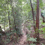
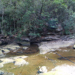
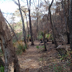
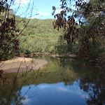


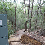


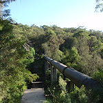
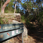

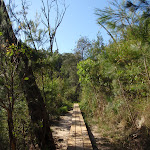

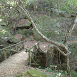
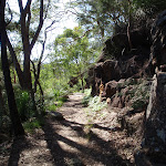
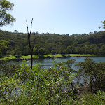


Davidson picnic area
Davidson Picnic Area is in Garigal National Park, under Roseville Bridge (access via Warringah Road, south bound lanes, or via many walking tracks in the area). The picnic area has a boat ramp, wheelchair-accessible toilets, large open grassy areas, picnic tables, free electric BBQ’s, and a large rotunda. There are plenty of shady spots provided by the trees. The northern section of the picnic area has a small beach swimming area, and the southern section boasts a boat ramp. The park is open 6am to 8pm (6:30pm outside daylight savings time). Ticket machines are provided to pay the car access fee.
(0km) Int of the Lyrebird Track and end of Davidson Park driveway → Int of Lyrebird and Carroll Creek tracks
2.7 km
48 mins
54m
-46m
Moderate track
From the gate at the north-western corner of Davidson Park, this walk follows the ‘Lyrebird Track’ sign through the metal gate and along the service trail, heading through the bush and following Middle Harbour Creek for a while before the track narrows to a bush track at a long grassy clearing.
Continue straight: From the clearing at the end of the management trail, this walk continues along the bush track, keeping Middle Harbour Creek on the left as it meanders along the water’s edge for a while. The track climbs up the side of the hill, then flattens out and continues through the bush, steadily winding down to the edge of Carroll Creek, which it follows for a while before the track comes down to the signposted intersection of the ‘Carroll Creek Track’ at the stepping stones.
Continue straight: From the clearing at the end of the management trail, this walk continues along the bush track, keeping Middle Harbour Creek on the left as it meanders along the water’s edge for a while. The track climbs up the side of the hill, then flattens out and continues through the bush, steadily winding down to the edge of Carroll Creek, which it follows for a while before the track comes down to the signposted intersection of the ‘Carroll Creek Track’ at the stepping stones.
(2.66km) Int of Lyrebird and Carroll Creek tracks → Int of Davidson and Governor Phillip tracks
1.5 km
28 mins
31m
-39m
Moderate track
Veer left: From the intersection, this walk crosses Carroll Creek at the stepping stones and continues along the bush track, passing the “Governor Phillip Walk” sign as the track bends to the left. This walk winds through the bush alongside Carrol Creek before steadily climbing up the rocky hill to the right for a little while. The track then drops back down to the edge of Middle Harbour Creek, which it follows as the walk undulates along the rocky bush track for a while, before crossing under a large pipe bridge to the end of an asphalt service trail.
Pipeline
This pipeline is unearthed at Hunter Street, St Ives, and travels through Garigal National Park, across Middle Harbour Creek to John Oxley Drive, Sorlie. The pipe carries water under pressure From Ryde to Pymble to the reservoir at Beacon Hill. The old smaller-capacity pipe can still be seen running parallel to the larger pipe.
(4.17km) Int of Davidson and Governor Phillip tracks → Int of Gov. Phillip and Bungaroo tracks
700 m
16 mins
38m
-30m
Moderate track
Veer left: From the intersection, this walk follows the ‘Bungaroo Track (450m)’ sign, keeping Middle Harbour Creek to the left. The bush track makes its way upstream following the main creek, but crossing a few small gullies along the way. The track then comes an intersection with a signpost ‘Bungaroo Track’ and stepping stones across the creek, clearly visable on the left.
Bungaroo
Governor Arthur Phillip (first governor of NSW) described this section of the river as where “the flowing of the tide ceased”. Phillip and his party of nine camped here in 1788 whilst looking for land suitable for farming. John White (Surgeon General) described the the area as “the most desert, wild and solitary seclusion that the imagination can form any idea of”. Over the past 200 years the river has changed, but somewhere not far upstream of the stepping stone is Bungaroo. More info.
(4.86km) Int of Gov. Phillip and Bungaroo tracks → Int of Pipeline and Middle Harbour Creek tracks
660 m
12 mins
14m
-23m
Moderate track
Turn left: From the intersection, the walk follows the ‘Bungaroo Track’ sign down the hill and across the creek at the large steppingstones (not safe to cross if steppingstones covered in water). This walk continues along the bush track on the other side, as it bends around to the left and continues through the thick bush and around some boulders, keeping Middle Harbour Creek a short distance through the bush to the left, until it comes to the intersection with a bush track heading up some wooden steps on the right.
Continue straight: From the intersection, this walk follows the bush track, with the ground sloping up to the right, through the bush to a grassy clearing at the waters edge. From here, it continues along the track, winding back through the thick bush, keeping the creek on the left as it winds along to the intersection of the Pipeline Track, at the end of the pipe bridge.
Continue straight: From the intersection, this walk follows the bush track, with the ground sloping up to the right, through the bush to a grassy clearing at the waters edge. From here, it continues along the track, winding back through the thick bush, keeping the creek on the left as it winds along to the intersection of the Pipeline Track, at the end of the pipe bridge.
(5.53km) Int of Pipeline and Middle Harbour Creek tracks → Koola and Gordon Creek tracks Intersection
1.2 km
25 mins
60m
-45m
Experienced only
Continue straight: From the end of the management trail, this walk heads down towards the creek and turns right, continuing under the large pipeline bridge. The track heads up and around the end of the smaller pipeline, coming to a less distinct track. The walk follows a very faint track, winding around for a little while until coming down to the edge of Rocky Creek, where there is a wire spanning the water. This walk crosses Rocky Creek and continues up through the bush, climbing steeply for a short distance before flattening out. Soon, the junction of Rocky Creek with Middle Harbour Creek comes into view, and the track bends to the right to follow Middle Harbour Creek. The rocky track undulates along the side of the hill for a long while, until coming to the intersection with a bush track (up the steep rocky hill on the right).
(6.68km) Koola and Gordon Creek tracks Intersection → Gordon Creek Pipe Bridge (bottom of Barrie Street Track)
1.4 km
29 mins
62m
-61m
Moderate track
Continue straight: From the intersection, this walk follows the rocky bush track, keeping Middle Harbour Creek on the left. The track undulates along the side of the hill for a while, then drops down to the wide creek. The walk passes through a mangrove clearing and crosses a smaller creek, continuing along the other side. The track then climbs steeply up a rock outcrop and continues along the side of the hill for a while, before heading over the hill and along the narrow bush track, with ground sloping up to the right and running parallel with Gordon Creek (on the left). The track heads through the dense forest, then climbs a set of wooden steps, coming to the end of a management trail at a pipe bridge.
(8.03km) Gordon Creek Pipe Bridge (bottom of Barrie Street Track) → Int of Gordon Creek Crossing and Barrie Street tracks
280 m
6 mins
16m
-8m
Moderate track
Turn left: From the intersection, this walk follows the bush track, with the pipe bridge and valley on the left. The track heads through the bush for a short while before climbing steadily up the hill, then flattening out again for a while, coming to the signposted intersection with the ‘Gordon Creek Track’.
(8.31km) Int of Gordon Creek Crossing and Barrie Street tracks → Int of Gordon Creek Crossing track and servicetrail
250 m
6 mins
11m
-18m
Moderate track
Turn left: From the intersection, this walk follows the ‘Two Creeks Track’ arrow down the wooden steps. The walk continues along the bush track as it winds down the hill, dropping down behind a rock platform and continuing down the steps. At the bottom, the track crosses Gordon Creek at the large stepping stones and continues up the short set of steps to a bush track, which it follows for a short distance before climbing a long set of wooden steps to the signposted intersection with the ‘Two Creeks Track’.
(8.56km) Int of Gordon Creek Crossing track and servicetrail → Gordon Creek Pipebridge
170 m
4 mins
6m
-13m
Easy track
Turn left: From the intersection, this walk follows the service trail (with the ground sloping up to the right), heading through the bush to the large water pipeline that crosses Gordon Creek a short while later.
(8.73km) Gordon Creek Pipebridge → End of Gordon Creek service trail
110 m
3 mins
12m
-1m
Moderate track
Continue straight: From the pipe bridge, this walk follows the service trail (with the ground sloping up to the right) as it heads through the bush for a short while before it comes to a clearing at the end of the trail, at some rock steps.
(8.84km) End of Gordon Creek service trail → Western end of Two Creeks detour
100 m
2 mins
10m
0m
Moderate track
Veer left: From the end of the service trail, this walk follows the bush track, climbing up the rock steps to the top where it flattens out a little. The track continues up the long gentle hill for a little while, with the valley down to the left, until coming to the intersection with the defined bush track on the right.
(8.94km) Western end of Two Creeks detour → Eastern end of Two Creeks detour
220 m
6 mins
20m
-11m
Moderate track
Turn sharp right: From the intersection, this walk follows the bush track, climbing up the steep rock steps until the track flattens out and turns left. The walk continues along the side of the hill for a short while, before dropping down some steps cut into a rock outcrop. The track then continues through the bush for a while before coming down to the intersection of the Two Creeks bush track.
(9.16km) Eastern end of Two Creeks detour → Int of Two Creeks and Wellington Road tracks
1.1 km
25 mins
40m
-78m
Moderate track
Turn right: From the intersection, this walk follows the bush track (with the ground sloping up to the right) as it heads through the trees and along the side of the hill. The track passes a ‘Garigal National Park’ sign while bending around to follow the Middle Harbour Creek. The walk continues through the bush for a while until it crosses a long wooden walkway to the intersection of the ‘to Wellington Road’ bush track, at the wooden steps on the right.
(10.3km) Int of Two Creeks and Wellington Road tracks → Int of Two Creeks and Carlyle Road tracks
880 m
18 mins
32m
-28m
Moderate track
Continue straight: From the intersection, this walk follows the bush track (keeping Middle Harbour Creek on the left) as it heads through the ferns and around some mangroves (down to the left). After a little while,the track bends to the right and following Moores Creek, heading along the side of the hill and under a shallow rock overhang and passing an old stone chair. The walk crosses a short wooden bridge and follows the wide bush track as it continues along the side of the hill, until it comes to the signposted intersection with the ‘Carlyle Road’ bush track at the next wooden bridge, near another stone chair.
(11.18km) Int of Two Creeks and Carlyle Road tracks → Int of Two Creeks and Ormonde Road tracks
880 m
20 mins
46m
-46m
Moderate track
Turn left: From the intersection, this walk heads across the wooden bridge and follows the track through the bush and along the side of the hill. After a while, the track bends around to the right and follows the wide Middle Harbour Creek, with Davidson Park across on the other side. The track continues along the side of the hill above Middle Harbour Creek for a while, before coming to the signposted intersection of the ‘Ormonde Road 200m’ track, uphill on the right.
(12.06km) Int of Two Creeks and Ormonde Road tracks → End of Ormonde Road Track
150 m
6 mins
34m
-1m
Moderate track
Turn sharp right: From the intersection, the walk follows the ‘Ormonde Road 200m’ arrow up the steep rocky hill. The walk flattens out and continues to the end of Ormonde Rd.
(12.2km) End of Ormonde Road Track → Int of Davidson Park driveway and Warringah Road on-ramp
1.8 km
39 mins
69m
-107m
Moderate track
Veer left: From the intersection, the walk follows Ormonde Rd up the hill (passing Chase Ave, Cardigan Rd and The Kingsway), passing the off-ramp from Warringah Rd, then turning right at the Warringah Rd on-ramp (just before the bridge over Warringah Rd). The walk follows the grassy strip at the left hand edge of the on-ramp, as it loops around under the bridge. The walk continues down the hill following the very narrow verge on the left-hand side of Warringah Rd until reaching an intersection with a concrete footpath (which goes down the hill to the left, closed at the time of writing), just before the Roseville Bridge.
Continue straight: From the intersection, this walk follows the footpath on the left-hand side of Warringah Rd and crosses the long Roseville Bridge. The walk continues up the hill before turning sharply to the left and following the off-ramp road down the hill. After crossing under the Roseville Bridge the walk arrives at the intersection with the Davidson Park driveway.
Continue straight: From the intersection, this walk follows the footpath on the left-hand side of Warringah Rd and crosses the long Roseville Bridge. The walk continues up the hill before turning sharply to the left and following the off-ramp road down the hill. After crossing under the Roseville Bridge the walk arrives at the intersection with the Davidson Park driveway.
(13.96km) Int of Davidson Park Driveway and Warringah Road on-ramp → Int of the Lyrebird Track and end of Davidson Park Driveway
1.1 km
20 mins
15m
-17m
Very easy
Turn right: From the intersection, this walk follows the Davidson Park driveway, crossing under Roseville Bridge with Middle Harbour Creek on the left. The walk passes a small car park and bends to the right, winding around the large picnic areas (on the left), passing a building with some toilets (also on the left), and continuing along for a little while before coming to the signposted intersection of the Rotary Rotunda footpath.
Continue straight: From the intersection, this walk follows the road, keeping the park and Middle Harbour on the left. After a little while, this walk comes to the signposted intersection at the bottom of the ‘Casuarina Stairway’, uphill on the right.
Continue straight: From the intersection at the bottom of the ‘Casuarina Stairway’, this walk follows the driveway, keeping the park and Middle Harbour Creek on the left. The walk heads along for little while before coming to the end of the driveway, at the signposted start of the ‘Lyre Bird Track 4km’.
Maps for the Middle Harbour Creek Loop walk
You can download the PDF for this walk to print a map.
These maps below cover the walk and the wider area around the walk, they are worth carrying for safety reasons.
| Hornsby | 1:25 000 Map Series | 91304S HORNSBY | NSW-91304S |
| Parramatta River | 1:25 000 Map Series | 91303N PARRAMATTA RIVER | NSW-91303N |
| Sydney | 1:100 000 Map Series | 9130 SYDNEY | 9130 |
Cross sectional view of the Middle Harbour Creek Loop bushwalking track
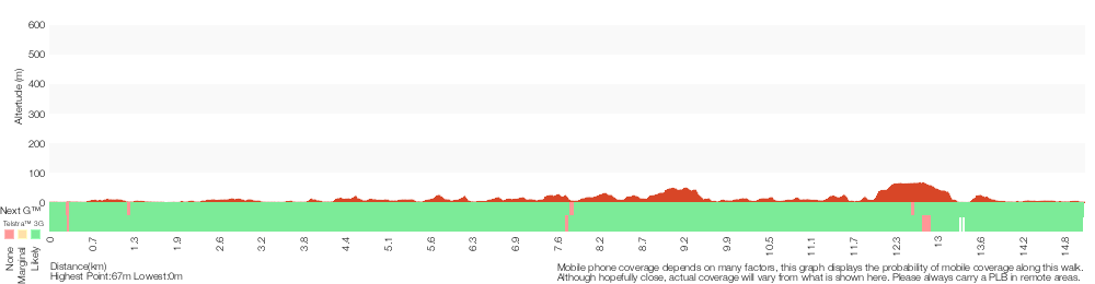
Analysis and summary of the altitude variation on the Middle Harbour Creek Loop
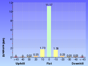
Overview of this walks grade – based on the AS 2156.1 – 2001
Under this standard, a walk is graded based on the most difficult section of the walk.
| Length | 15.1 km | ||
| Time | 5 hrs 45 mins | ||
| . | |||
| Grade 5/6 Experienced only |
AS 2156.1 | Gradient | Short steep hills (3/6) |
| Quality of track | Rough unclear track (5/6) | ||
| Signs | Directional signs along the way (3/6) | ||
| Experience Required | Some bushwalking experience recommended (3/6) | ||
| Weather | Weather generally has little impact on safety (1/6) | ||
| Infrastructure | Limited facilities, not all cliffs are fenced (3/6) |
Some more details of this walks Grading
Here is a bit more details explaining grading looking at sections of the walk
Gradient
7km of this walk has gentle hills with occasional steps and another 4.5km has short steep hills. The remaining (3.7km) is flat with no steps.
Quality of track
11km of this walk follows a formed track, with some branches and other obstacles and another 2km follows a smooth and hardened path. Whilst another 1.2km follows a rough unclear track and the remaining 530m follows a clear and well formed track or trail.
Signs
Around 9km of this walk has directional signs at most intersection, whilst the remaining 6km is clearly signposted.
Experience Required
Around 9km of this walk requires no previous bushwalking experience, whilst the remaining 6km requires some bushwalking experience.
weather
This whole walk, 15km is not usually affected by severe weather events (that would unexpectedly impact safety and navigation).
Infrastructure
Around 9km of this walk is close to useful facilities (such as fenced cliffs and seats), whilst the remaining 6km has limited facilities (such as not all cliffs fenced).
Similar walks
A list of walks that share part of the track with the Middle Harbour Creek Loop walk.
2.6 km One way
1 hr 15 mins
Hard track
3 km Return
1 hr 30 mins
Moderate track
3.5 km Circuit
1 hr 30 mins
Hard track
3.6 km Return
1 hr 30 mins
Hard track
3.8 km One way
1 hr 30 mins
Hard track
4.7 km One way
2 hrs 15 mins
Hard track
5.3 km Return
2 hrs
Moderate track
5.8 km One way
2 hrs 30 mins
Hard track
6 km One way
2 hrs 45 mins
Hard track
6.1 km One way
2 hrs 30 mins
Moderate track
6.7 km Circuit
2 hrs 45 mins
Moderate track
6.8 km One way
3 hrs
Experienced only
7 km Return
3 hrs 45 mins
Moderate track
7 km Circuit
2 hrs 30 mins
Hard track
7.2 km One way
3 hrs
Moderate track
9 km One way
4 hrs
Hard track
10 km One way
4 hrs 30 mins
Hard track
10 km One way
4 hrs
Hard track
11.2 km One way
4 hrs 30 mins
Hard track
11.5 km One way
4 hrs 30 mins
Hard track
14.1 km One way
5 hrs 30 mins
Moderate track
22.6 km One way
9 hrs 45 mins
Hard track
Other Nearby walks
A list of walks that start near the Middle Harbour Creek Loop walk.
3.8 km One way
1 hr 45 mins
Hard track
3.4 km One way
1 hr 30 mins
Moderate track
1.4 km Return
45 mins
Moderate track
2.2 km One way
1 Hr
Moderate track
986 m Return
30 mins
Moderate track
4.5 km Return
1 hr 30 mins
Hard track
3.7 km Return
1 hr 30 mins
Hard track
4.6 km One way
2 hrs
Hard track
2 km Return
1 hr 15 mins
Hard track
516 m Return
20 mins
Moderate track
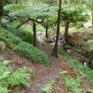
6 km One way
2 hrs 30 mins
Hard track
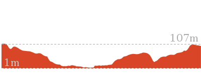

8.9 km One way
3 hrs 30 mins
Hard track

Plan your trip to and from the walk here
The Middle Harbour Creek Loop walk starts and ends at the Int of the Lyrebird Track and end of Davidson Park driveway (gps: -33.767005, 151.19964)
Your transport options to Int of the Lyrebird Track and end of Davidson Park driveway are by;
![]() Bus. (get details)
Bus. (get details)
![]() Car. A park entry fee is required for driving into the park.
Car. A park entry fee is required for driving into the park.
(get details)
Short URL = http://wild.tl/cgnpc
Gallery images
There are other downloads I am still working on.
You will probably need to login to access these — still all free.
* KML (google earth file)
* GPX (GPS file)
Special Maps/ brochures
* A3 topo maps
* PDF with Lands Topo map base
* PDF with arial image (and map overlay)
I wanted to get the main site live first, this extra stuff will come in time.
Happy walking
Matt 🙂
North Arm Walking Track
And Walk
North Arm Walking Track

2 hrs
3.1 km One way
145 m
Moderate track
Following the edge of Middle Harbour, this walk has excellent views and Special spots, including the views from the end of North Arm Rd and the trail near the Mannerim Rd Turnoff. The change in the track from bush track to mangroves and mudflats south of the Pump Station gives a good feel of the diversity of environments that can be found in the area.
(0km) H.C. Press Park → End of Willis Rd
890 m
19 mins
26m
-59m
Moderate track
From the end of Emerstan Rd, this walk begins by descending steeply from the road along the asphalted management trail, past the large green gate and information signs. Soon the track flattens out it changes and narrows into a track that curves around to the south-west, running parallel to Middle Harbour. The track continues pass a small boat shed and widens back into an asphalted management trail, heading slightly uphill to an intersection at the end of Willis Road. This is marked by a large gate and more information signs.
(0.89km) End of Willis Rd → Mannerim Rd turnoff
860 m
22 mins
63m
-61m
Moderate track
Continue straight: From the intersection, this walk heads north-west along the management trail until coming to a small green building. From the building, the trail narrows to a track and continues north-west until coming to an intersection with another track (that heads up the hill away from Middle Harbour). This intersection is marked by a small sign and arrow stating that this is the ‘Mannerim Rd turnoff’.
(1.75km) Mannerim Rd turnoff → Pump Station Int
630 m
14 mins
28m
-33m
Moderate track
Continue straight: From the intersection, this walk heads north-west along the track (following Scotts Creek) before coming to an intersection with an asphalt road.
Continue straight: From the intersection, this walk heads down the road to the south, coming to a small intersection with a diverging track, marked by an arrow. At this point, there is a large fenced building, approximately 100m away.
Continue straight: From the intersection, this walk heads down the road to the south, coming to a small intersection with a diverging track, marked by an arrow. At this point, there is a large fenced building, approximately 100m away.
(2.38km) Pump Station Int → North Arm Road
740 m
14 mins
28m
-11m
Moderate track
Continue straight: From the intersection near the pumping station, this walk heads steeply down along the track. At the bottom of the hill, the track continues south until reaching the grasslands and the boardwalk across Scotts Creek. On the southern side of the creek, the track then curves around to the east. After heading east for a short while, the track suddenly climbs away from the grasslands and heads steadily up to North Arm Rd.
Maps for the North Arm Walking Track walk
You can download the PDF for this walk to print a map.
These maps below cover the walk and the wider area around the walk, they are worth carrying for safety reasons.
| Parramatta River | 1:25 000 Map Series | 91303N PARRAMATTA RIVER | NSW-91303N |
| Sydney | 1:100 000 Map Series | 9130 SYDNEY | 9130 |
Cross sectional view of the North Arm Walking Track bushwalking track
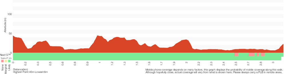
Analysis and summary of the altitude variation on the North Arm Walking Track
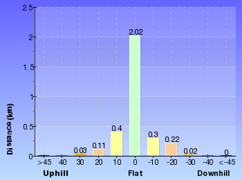
Overview of this walks grade – based on the AS 2156.1 – 2001
Under this standard, a walk is graded based on the most difficult section of the walk.
| Length | 3.1 km | ||
| Time | 2 hrs | ||
| . | |||
| Grade 3/6 Moderate track |
AS 2156.1 | Gradient | Short steep hills (3/6) |
| Quality of track | Clear and well formed track or trail (2/6) | ||
| Signs | Directional signs along the way (3/6) | ||
| Experience Required | Some bushwalking experience recommended (3/6) | ||
| Weather | Weather generally has little impact on safety (1/6) | ||
| Infrastructure | Limited facilities, not all cliffs are fenced (3/6) |
Some more details of this walks Grading
Here is a bit more details explaining grading looking at sections of the walk
Gradient
This whole walk, 3.1km has short steep hills.
Quality of track
This whole walk, 3.1km follows a clear and well formed track or trail.
Signs
Around 2.4km of this walk is clearly signposted, whilst the remaining 740m has directional signs at most intersection.
Experience Required
This whole walk, 3.1km requires some bushwalking experience.
weather
This whole walk, 3.1km is not usually affected by severe weather events (that would unexpectedly impact safety and navigation).
Infrastructure
This whole walk, 3.1km has limited facilities (such as not all cliffs fenced).
Similar walks
A list of walks that share part of the track with the North Arm Walking Track walk.
Other Nearby walks
A list of walks that start near the North Arm Walking Track walk.
516 m Return
20 mins
Moderate track
2.2 km One way
45 mins
Moderate track
10 km One way
4 hrs 30 mins
Hard track
10 km One way
4 hrs
Hard track
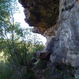
5.4 km Return
3 hrs
Hard track

1.8 km Return
1 Hr
Hard track
9.1 km One way
3 hrs 45 mins
Moderate track
8.7 km Circuit
4 hrs
Moderate track
7.3 km Circuit
3 hrs
Moderate track
3.2 km Return
1 hr 30 mins
Moderate track
6.1 km One way
2 hrs 30 mins
Hard track
22.6 km One way
9 hrs 45 mins
Hard track
Plan your trip to and from the walk here
The North Arm Walking Track walk starts at the H.C. Press Park (gps: -33.789673, 151.22865)
Your transport options to H.C. Press Park are by;
![]() Bus. (get details)
Bus. (get details)
![]() Car. There is free parking available.
Car. There is free parking available.
(get details)
The North Arm Walking Track ends at the North Arm Road (gps: -33.792453, 151.21522)
Your transport options to North Arm Road are by;
![]() Bus. (get details)
Bus. (get details)
![]() Car. There is free parking available.
Car. There is free parking available.
(get details)
Short URL = http://wild.tl/nawt
Gallery images
There are other downloads I am still working on.
You will probably need to login to access these — still all free.
* KML (google earth file)
* GPX (GPS file)
Special Maps/ brochures
* A3 topo maps
* PDF with Lands Topo map base
* PDF with arial image (and map overlay)
I wanted to get the main site live first, this extra stuff will come in time.
Happy walking
Matt 🙂
Quarry Rd Track
And Walk
Quarry Rd Track

2 hrs 15 mins
5.5 km One way
245 m
Hard track
Starting at Cambourne Ave, St Ives, this walks explores the ridges and valleys of the upper reaches of the Middle Harbour Creek in Garigal National Park. The walk follows service trails, and crosses several creeks along the way. The Lower Cambourne waterhole is a great spot to rest and enjoy a snack whilst enjoying the peace and quiet.


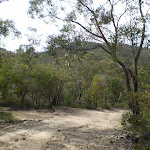


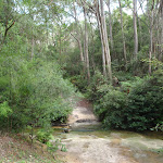
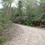
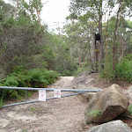
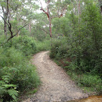
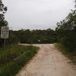
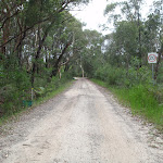


(0km) Int of Cambourne Ave and Upper Cambourne Track → Int of Upper Cambourne and Douglass Street East tracks
160 m
3 mins
5m
-8m
Easy track
From the intersection, the walk follows the ‘Upper Cambourne Track’ arrow through the metal gate and along the management trail. After crossing the creek, the walk continues up and along to the intersection with the Douglass Street East service trail (at the track marker).
(0.16km) Int of Upper Cambourne and Douglass Street East tracks → Int of Cascades and Upper Cambourne service trails
450 m
11 mins
15m
-39m
Moderate track
Continue straight: From the intersection, the walk follows the service trail along the side of the hill with the ground sloping up to the right. The trail then zigzags all the way down to the intersection with the Cascades service trail, marked with an ‘Upper Cambourne Track’ sign.
(0.6km) Int of Cascades and Upper Cambourne service trails → Int of Cascades and Lower Cambourne service trails
90 m
2 mins
1m
-15m
Moderate track
Turn left: From the intersection, this walk follows the service trail opposite the ‘Upper Cambourne’ sign, heading down the hill for a short distance to the signposted intersection of the Lower Cambourne track.
(0.7km) Int of Cascades and Lower Cambourne service trails → Int of Lower Cambourne and Waterhole Track
1.2 km
26 mins
29m
-65m
Moderate track
Veer left: From the intersection, this walk follows the ‘Lower Cambourne Track ->’ sign along the management trail, with the ground sloping up to the left. The trail starts to descend into the valley, dropping down the side of the hill and crossing a small creek. The trail undulates gently through the bush, winding steadily down into the valley and steepening after a while. At the bottom, the trail flattens out, coming to the intersection with a narrow bush track a short distance later.
(1.9km) Int of Lower Cambourne and Waterhole Track → Middle Harbour Creek Waterhole
20 m
0m
-1m
Moderate track
Turn right: From the intersection, this walk follows the short bush track, heading away from the management trail and through the bush. The walk soon comes to a rockshelf, situated above a waterhole in Middle Harbour Creek. At the end of this side trip, retrace your steps back to the main walk then Turn right.
Lower Cambourne waterhole
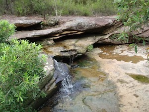
This unnamed waterhole and cascade is on Middle Harbour Creek, just below its junction with Bare Creek in Garigal National Park. The waterhole accessed by a short track from the Lower Cambourne track. There is a large rock platform, and a waterhole with a small waterfall flowing into it. This can be a great spot to relax and enjoy the local area, if you sit quietly enough you may see a Water Dragon.
(1.9km) Int of Lower Cambourne and Waterhole Track → Int of Bare Creek and Lower Cambourne service trails
200 m
3 mins
7m
-2m
Moderate track
Continue straight: From the intersection, this walk follows the management trail heading north, down the gentle slope. It soon crosses a wide creek via some stepping stones, and continues up the other side, following the management trail as it climbs to the ‘T’ intersection with the Bare Creek management trail.
(2.09km) Int of Bare Creek and Lower Cambourne service trails → Int of Quarry Road and Bare Creek Tracks
240 m
4 mins
5m
-6m
Moderate track
Turn left : From the intersection, this walk follows the Bare Creek management trail down the gentle hill, with the ground sloping up to the right. Soon, the trail flattens out and comes to an intersection with a bush track on the right.
Continue straight: From the intersection, this walk follows the management trail, with the ground sloping up to the right. It soon comes down to the intersection with a management trail (heading down across the creek on the left).
Continue straight: From the intersection, this walk follows the management trail, with the ground sloping up to the right. It soon comes down to the intersection with a management trail (heading down across the creek on the left).
(2.34km) Int of Quarry Road and Bare Creek Track → Mcintosh Lookout
2.5 km
50 mins
142m
-60m
Hard track
Turn left : From the intersection, this walk follows the service trail heading down the short hill and across the small creek. The walk continues up the other side as the trail climbs up and out of the valley, passing through a metal gate at the top. From here, the walk follows the management trail, heading up to a ‘Y’ intersection with another trail where this walk veers left. The walk continues through the bush for a little while longer, until coming to an intersection with another management trail.
Veer right: From the intersection, this walk follows the management trail, heading away from the large power line tower. The walk crosses a drainage ditch, veering left at the intersection on the other side. The trail passes a large pond on the right and veers left again, passing an old tip and continuing along for a little while before crossing under a set of power lines to the intersection with the Pump House Track.
Veer right: From the intersection, this walk follows the management trail, heading away from the power lines and through the bush. The walk passes a ’20’ speed limit sign (facing the other way) and continues along for a little while before coming to an intersection with a slightly overgrown management trail on the left.
(4.82km) Mcintosh Lookout → Int of Kitchener and Linigen Servicetrails
460 m
10 mins
12m
-40m
Moderate track
Veer left: From the intersection, this walk follows the slightly overgrown management trail past the ‘No Vehicles’ and No Pets signs and through the bush. The trail steadily winds down the long hill and drops into a gully then continues up the other side, following the trail as it winds up and around to the intersection with the Kitchener Street management trail.
(5.28km) Int of Kitchener and Linigen Servicetrails → Kitchener Rd
190 m
6 mins
29m
-1m
Moderate track
Turn right: From the intersection, this walk follows the steeper of the two management trails heading up the steep hill, bending sharply to the left partway up then flattening out, continuing through the bush behind some houses and up a shorter hill to the intersection with Kitchener Street.
Maps for the Quarry Rd Track walk
You can download the PDF for this walk to print a map.
These maps below cover the walk and the wider area around the walk, they are worth carrying for safety reasons.
| Hornsby | 1:25 000 Map Series | 91304S HORNSBY | NSW-91304S |
| Sydney | 1:100 000 Map Series | 9130 SYDNEY | 9130 |
Cross sectional view of the Quarry Rd Track bushwalking track
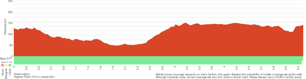
Analysis and summary of the altitude variation on the Quarry Rd Track
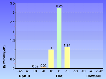
Overview of this walks grade – based on the AS 2156.1 – 2001
Under this standard, a walk is graded based on the most difficult section of the walk.
| Length | 5.5 km | ||
| Time | 2 hrs 15 mins | ||
| . | |||
| Grade 4/6 Hard track |
AS 2156.1 | Gradient | Very steep (4/6) |
| Quality of track | Formed track, with some branches and other obstacles (3/6) | ||
| Signs | Directional signs along the way (3/6) | ||
| Experience Required | Some bushwalking experience recommended (3/6) | ||
| Weather | Weather generally has little impact on safety (1/6) | ||
| Infrastructure | Limited facilities, not all cliffs are fenced (3/6) |
Some more details of this walks Grading
Here is a bit more details explaining grading looking at sections of the walk
Gradient
2.1km of this walk has short steep hills and another 1.5km is very steep. Whilst another 1.2km has gentle hills with occasional steps and the remaining 610m is flat with no steps.
Quality of track
Around 4.4km of this walk follows a clear and well formed track or trail, whilst the remaining 1.1km follows a formed track, with some branches and other obstacles.
Signs
Around 3.8km of this walk has directional signs at most intersection, whilst the remaining 1.6km is clearly signposted.
Experience Required
Around 3.2km of this walk requires some bushwalking experience, whilst the remaining 2.3km requires no previous bushwalking experience.
weather
This whole walk, 5km is not usually affected by severe weather events (that would unexpectedly impact safety and navigation).
Infrastructure
Around 4.4km of this walk has limited facilities (such as not all cliffs fenced), whilst the remaining 1.1km is close to useful facilities (such as fenced cliffs and seats).
Similar walks
A list of walks that share part of the track with the Quarry Rd Track walk.
3.2 km One way
1 hr 30 mins
Moderate track
3.5 km Return
1 hr 30 mins
Moderate track
4.4 km Circuit
2 hrs
Moderate track
8.2 km Return
3 hrs 15 mins
Moderate track
14.1 km One way
5 hrs 30 mins
Moderate track
Other Nearby walks
A list of walks that start near the Quarry Rd Track walk.
3 km Return
1 hr 15 mins
Moderate track
5.8 km One way
2 hrs 30 mins
Hard track
9.4 km One way
4 hrs 15 mins
Moderate track
14.6 km One way
6 hrs 30 mins
Hard track
6.6 km One way
2 hrs 45 mins
Moderate track
4.2 km One way
1 hr 45 mins
Moderate track
3.6 km Return
1 hr 30 mins
Hard track
3 km Return
1 hr 30 mins
Moderate track
3.5 km Circuit
1 hr 30 mins
Hard track
9 km One way
4 hrs
Hard track
4.7 km Return
2 hrs
Moderate track
4.7 km One way
2 hrs 15 mins
Hard track
Plan your trip to and from the walk here
The Quarry Rd Track walk starts at the Int of Cambourne Ave and Upper Cambourne Track (gps: -33.723674, 151.18253)
Your transport options to Int of Cambourne Ave and Upper Cambourne Track are by;
![]() Bus. (get details)
Bus. (get details)
![]() Car. There is free parking available.
Car. There is free parking available.
(get details)
The Quarry Rd Track ends at the Kitchener Rd (gps: -33.713665, 151.17727)
Your transport options to Kitchener Rd are by;
![]() Bus. (get details)
Bus. (get details)
![]() Car. There is free parking available.
Car. There is free parking available.
(get details)
Short URL = http://wild.tl/qrt
Gallery images
There are other downloads I am still working on.
You will probably need to login to access these — still all free.
* KML (google earth file)
* GPX (GPS file)
Special Maps/ brochures
* A3 topo maps
* PDF with Lands Topo map base
* PDF with arial image (and map overlay)
I wanted to get the main site live first, this extra stuff will come in time.
Happy walking
Matt 🙂
Spit to Lindfield
And Walk
Spit to Lindfield

9 hrs 45 mins
22.6 km One way
1181 m
Hard track
This full day walk starts at the southern end of the Spit Bridge and explores a lot of Garigal National Park and Middle Harbour Creek. The walk follows the ‘Harbour to Hawkesbury’ track into Garigal National Park, skirting around Bantry Bay and along Middle Harbour Creek before crossing Roseville Bridge. The walk continues to explore the other side of Garigal, before leaving the National Park and arriving at Lindfield train station.


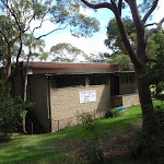

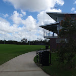
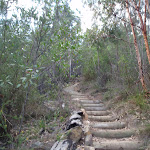
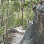
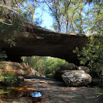

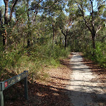
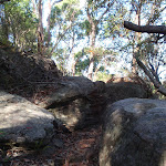
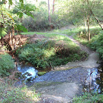


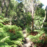

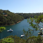
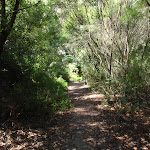

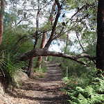
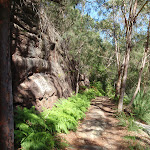


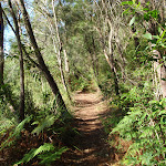

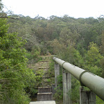
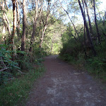
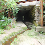
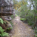

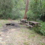
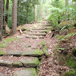
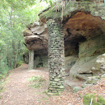
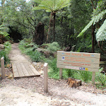
Sydney Harbour Kayaks
Sydney Harbour Kayaks, at the southern end of the Spit Bridge, provide sales and rentals of kayaks. One hour in a single plastic kayak costs $20, and a double $40. The enterprise also provides tours of the harbour, catering for individuals through to large groups. For further information and bookings, contact: [email protected] or (02) 99604389 More info.
(0km) Spit Bridge South → Int. Spit Rd and Ellery’s Punt Reserve Road
350 m
6 mins
11m
-2m
Easy track
From the intersection, this walk heads over the Spit Bridge, with the road to the left of the footpath. The walk crosses the bridge to where it meets the road down to Ellery’s Punt Reserve, first on the right.
(0.35km) Int. Spit Rd and Ellery’s Punt Reserve Road → Int. Ellery’s Punt Rd and Avona Cres Trk
40 m
1 mins
2m
0m
Easy track
Veer right: From the intersection, this walk heads downhill away from the main road for approximately 20m to the intersection below the bridge, on the left.
(0.39km) Int. Ellery’s Punt Rd and Avona Cres Trk → Int. Ellery’s Punt Reserve Rd and Manly Scenic Walkway
60 m
1 mins
0m
-7m
Easy track
Veer right: From the intersection, this walk heads down the hill towards the water. The walk soon comes to Ellery’s Punt Reserve car park on the right. This walk continues past this, down the footpath to the signposted intersection.
Ellery’s Punt Reserve
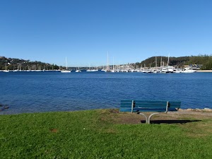
Ellery’s Punt Reserve is a very nice grassed area on the north eastern side of the Spit Bridge. The reserve has road access and parking, and seems to be a popular spot for fishing from the bank. There is also seating and shaded areas.
(0.46km) Int. Ellery’s Punt Reserve Rd and Manly Scenic Walkway → End of Battle Boulevard
90 m
2 mins
3m
0m
Moderate track
Turn right: From the ‘Manly Scenic Walkway’ map and info sign, this walk heads across the grass following the coast line, keeping the water to the left and heading towards the “Ellery’s Punt Reserve” sign. From the sign, the walk passes under the Spit Bridge and then up the flight of stairs that come to the end of Battle Boulevard.
(0.55km) End of Battle Boulevard → Int. Battle Boulevard and Manly Rd
140 m
3 mins
8m
0m
Easy track
Continue straight: From the end of the cul-de-sac, this walk follows Battle Bvd up the road to the car park just near the intersection with Manly Road.
(0.69km) Int. Battle Boulevard and Manly Rd → Top of the Gallipoli Steps
160 m
4 mins
40m
0m
Moderate track
Turn left: From the car park, the walk crosses to the other side of Battle Boulevard and follows the footpath up the hill for a short distance, to the signposted Gallipoli Steps. From here, the walk heads up the Gallipoli Steps to the top of the hill, where it flattens out and follows the short path to the intersection with Edgecliff Esplanade.
(0.85km) Top of the Gallipoli Steps → Int of Sangrado Street and Seaforth Crescent
2 km
44 mins
82m
-99m
Easy track
Turn sharp left: From the intersection, the walk follows the track marker along the Edgecliff Esplanade, keeping Middle harbour down to the left. At the intersection with Palmerston Place, the walk turns left and heads down the short hill before turning right onto Seaforth Crescent. From here the walk follows Seaforth Crescent all the way around the top of the headland, providing frequent views of middle harbor over and inbetween the houses, until it reaches the ‘T’ intersection with Princes Promenade. At the intersection, the walk turns left onto Seaforth Crescent, heading down the gentle hill, and almost immediately bending to the right. The walk continues along the road for a little while longer until it comes to the intersection with the narrow road, heading down the hill to the left, just before the Seaforth Scout Hall.
(2.83km) Int of Sangrado Street and Seaforth Crescent → Int of Sangrado Street and the Powder Hulk Bay footpath
80 m
2 mins
0m
-4m
Easy track
Turn left: From the intersection, the walk follows the track marker along the narrow road, heading down the hill with the Seaforth Scout Hall on the right. The walk continues down to the intersection at the top of the concrete steps (heading down the hill to the right).
(2.91km) Int of Sangrado Street and the Powder Hulk Bay footpath → Top of the Jenner Street Steps
260 m
9 mins
35m
-31m
Moderate track
Turn right: From the intersection, the walk follows the track marker down the concrete steps and along the footpath. The footpath winds down the hill, crossing two small footbridges and comes to the waters edge, where it passes the North Ridge Sailing Club, then continues along for a little while to the intersection at the bottom of a long set of concrete steps.
Turn right: From the intersection, the walk follows the track marker up the concrete steps. The walk follows the steps all the way up the hill to a driveway, which it crosses and continues up the steps on the other side, climbing up to the top of the hill at the intersection with Jenner Street.
Turn right: From the intersection, the walk follows the track marker up the concrete steps. The walk follows the steps all the way up the hill to a driveway, which it crosses and continues up the steps on the other side, climbing up to the top of the hill at the intersection with Jenner Street.
(3.17km) Top of the Jenner Street Steps → Wakehurst Pkwy Bus stop
1.6 km
30 mins
78m
-25m
Moderate track
Turn left: From the intersection, the walk follows Jenner Street up the hill. The walk turns left into Abernethy Street and continues to the end of the road. From here the walk climbs up a concrete staircase to the end of Harvey Street, which it follows. The walk then turns left into Dalwood Avenue and continues to the end of the road where it comes to the intersection of Clontarf Street. From here, the walk continues straight onto Clontarf Street, and soon turns left onto Callicoma Road, then turns right onto Acacia Road (which becomes Castle Circuit) and continues all the way along to the end of the footpath, where it comes to a small reserve on the right. From here, the walk follows the track marker through the reserve for a little distance to the Wakehust Parkway, where it turns left and follows the side of the road to a bus stop almost directly opposite the intersection with Armstrong Street.
(4.76km) Wakehurst Pkwy Bus stop → Seaforth Oval
530 m
9 mins
23m
-4m
Moderate track
Turn left: From the intersection, this walk follows the track behind the bus stop, heading away from the road and down through the bush. The walk steps over a few fallen trees and passes small rock outcrops, continuing along until passing a track marker and heading up to the end of a long grassy clearing, from which the playground at Seaforth Oval is clearly visible.
Veer left: From the intersection, the walk heads across the long grassy clearing towards the play equipment. Upon reaching the play equipment, the walk then follows the asphalt path, heading up on the right-hand side of the club house to the car park. Here, it turns left, passing the club house and coming to the information signs on the other side of the car park.
Veer left: From the intersection, the walk heads across the long grassy clearing towards the play equipment. Upon reaching the play equipment, the walk then follows the asphalt path, heading up on the right-hand side of the club house to the car park. Here, it turns left, passing the club house and coming to the information signs on the other side of the car park.
Seaforth Oval
Seaforth Oval is a large playing oval on the Wakehurst Parkway in North Balgowlah. It is managed by Manly Council, who have also recently been upgrading the Timber Getters Track in association with NPWS. There is a distant view of Chatswood from the oval. There are toilets, but they are usually locked. There is a large car park, shelter and sign with information about the Harbour to Hawkesbury walk. More info.
(5.29km) Seaforth Oval → Int of the Timbergetters and Engraving Tracks
50 m
1 mins
0m
-2m
Moderate track
Continue straight: From the corner of the car park with the information signs, the walk heads into the bush and down the wooden steps to the bottom, where it flattens out at the signposted intersection with the Engraving Track[1].
(5.34km) Int of the Timber Getters and Engraving Tracks → Bantry Bay Picnic Area
840 m
24 mins
9m
-109m
Hard track
Veer left: From the intersection, this walk follows the ‘Timbergetters Track’ sign[2] down the wooden steps and through the bush, winding steadily down a long hill as it drops down several more sets of steps, following the bush track to the signposted intersection with the Old Bullock Track[3] (closed for maintenance at time of writing).
Continue straight: From the intersection (with the signposted ‘Old Bullock Track’[4] on the right), this walk heads west down the three wooden steps and along the track, winding through the dense scrub for a while. The walk crosses a small creek at some stepping stones and passes an old telegraph pole with no power lines attached. The track continues in this manner for a little while longer before it comes to the top of a short set of rock steps, where it starts to wind down into the valley using several scattered sets of wooden steps and one long set of rock steps, until coming down to the large picnic area at the bottom.
Continue straight: From the intersection (with the signposted ‘Old Bullock Track’[4] on the right), this walk heads west down the three wooden steps and along the track, winding through the dense scrub for a while. The walk crosses a small creek at some stepping stones and passes an old telegraph pole with no power lines attached. The track continues in this manner for a little while longer before it comes to the top of a short set of rock steps, where it starts to wind down into the valley using several scattered sets of wooden steps and one long set of rock steps, until coming down to the large picnic area at the bottom.
Bantry Bay Picnic Area
The area of Bantry Bay has been popular with day visitors since the late 1800s. In the early 1900s, the picnic area was also home to a dance hall (foundations still visible), dining room, picnic ground and overnight accommodation. Today, the picnic area has a picnic table and a number of fireplaces. There is also a public wharf, toilets, open grassy area, shade from trees and a great view across the water. There are no garbage facilities. The picnic area is at the bottom of the Timber Getters Track, below Seaforth Oval, on the eastern shore of Bantry Bay. More info.
(6.18km) Bantry Bay Picnic Area → The Bluff Lookout
1.8 km
48 mins
166m
-77m
Hard track
Turn right: From the picnic area (keeping the water on the left), this walk follows the “Bantry Bay Track” sign along the rocky bush track which undulates along the side of the hill, winding through the bush for a little while. The walk passes by the base of some cliffs and starts to climb up the hill at a rocky outcrop, continuing to wind up the long rocky hill as the track climbs to the top of the valley, eventually winding up some rock steps to a large rock platform, Here, the walk passes some track markers pointing back down the valley to a short bush track, leading to the signposted intersection of the Bluff Track at the lookout.
Bluff Lookout
The Bluff is a large, unfenced rocky hilltop, in Garigal National Park, that provides great views up Middle Harbour. The views extend across the bushland of the National Park, along Bantry Bay, to the city of Sydney (You can even see Centrepoint Tower). Apart from the distant views, the bluff is also an interesting rock feature, with a number of caves containing honeycomb rock formations.
(8.01km) The Bluff Lookout → Int of Bluff and Natural Bridge Tracks
210 m
4 mins
11m
0m
Moderate track
Turn right: From the intersection, this walk follows the ‘Bluff Track’ sign along the rocky service trail, heading away from the lookout and through the bush for a little while before coming to the intersection with a defined bush track on the right.
Continue straight: From the intersection, the track follows the service trail (with the bush track on the right), heading north-west through the bush for a little while before coming to the signposted intersection with the Natural Bridge Track.
Continue straight: From the intersection, the track follows the service trail (with the bush track on the right), heading north-west through the bush for a little while before coming to the signposted intersection with the Natural Bridge Track.
(8.21km) Int of Bluff and Natural Bridge Tracks → Natural Bridge
500 m
15 mins
1m
-71m
Hard track
Continue straight: From the intersection, this walk follows the Natural Bridge Track along the bush track, heading away from the service trails for a short distance before coming to the intersection of the Currie Road Oval bush track at the track marker.
Veer left: From the intersection, this walk follows the track marker along the bush track, heading west through the bush for a short distance to a large rock outcrop. From here, the walk continues along the defined bush track, winding down the long and sometimes steep rocky hill, into the valley. The vegetation gradually gets thicker, until this walk comes down to a wide rock arch crossing a creek – the Natural Bridge.
Veer left: From the intersection, this walk follows the track marker along the bush track, heading west through the bush for a short distance to a large rock outcrop. From here, the walk continues along the defined bush track, winding down the long and sometimes steep rocky hill, into the valley. The vegetation gradually gets thicker, until this walk comes down to a wide rock arch crossing a creek – the Natural Bridge.
Natural Bridge
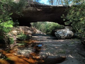
The Natural Bridge is a sandstone arch in Garigal National Park. The arch spans an unnamed creek feeding into Bantry Bay. The Natural Bridge track uses this arch to cross the creek, and is not always noticed by walkers as the surrounding vegetation hides the full view of the feature from the track. The arch has formed the eroding forces of water flowing down the creek. The arch provides an interesting natural feature to explore and enjoy.
(8.71km) Natural Bridge → Int of Natural Bridge and Currie Road Tracks
250 m
6 mins
39m
0m
Moderate track
Continue straight: From the bridge, the walk follows the bush track heading west (with downstream to the left) up the hill and away from the creek, steadily winding up a gentle hill. This steepens as the walk climbs up a few sets of wooden steps, continuing up the rock hill to the top, where it comes to the signposted intersection of the Currie Road Track.
(8.97km) Int of Natural Bridge and Currie Road Tracks → Int of Bates Creek and Currie Rd tracks
180 m
3 mins
5m
-1m
Easy track
Turn left: From the intersection, this walk follows the H/H walker on the ‘Currie Road Track’ sign south, along the service trail. The track soon comes to a four-way intersection with a large gum tree in the centre.
(9.15km) Int of Bates Creek and Currie Rd tracks → Int of Magazine Track and Tipperary Road service trail
730 m
13 mins
5m
-35m
Moderate track
Continue straight: From the intersection, this walk follows the bush track, heading through the dense vegetation. After a little while, the track starts to zigzag down the rocky hill and through the bush until it flattens out and crosses Bates Creek. The walk then turns left and continues through the bush, meandering along the flat bush track until coming to the signposted intersection with the Magazine Track.
(9.88km) Int of Magazine Track and Tipperary Road service trail → Back of Magazine Buildings
1.1 km
27 mins
45m
-79m
Moderate track
Continue straight: From the intersection, this walk follows the ‘Magazine Track’ sign along the wide, flat trail which winds around behind some houses (on the right). The track continues along a narrower, rocky bush track which steadily winds down a long hill to the bottom of the valley, where it flattens out just above the water. From here, the walk continues along the bush track, winding up and down along the side of the hill until it follows a track marker up to the magazine buildings’ fence line. The track runs parallel to this fence as it heads along to an open, square concrete tank just off to the left of the track, from which the roofs of the magazine buildings and Middle Harbour Creek are both visible.
Bantry Bay Explosives Magazine complex
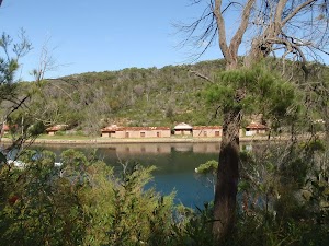
The Magazine Buildings were the premier storage facility for merchants’ explosives between 1915 and 1974. During this time, the carefully constructed building where crucial for the safe storage of explosives used for building public works such as the Sydney Harbour Bridge, and additionally used by the Australian Navy during World War II. There is currently no public access to the site, and the buildings are best viewed from across the water at Bantry Bay Picnic Area, or anywhere on the other side of Bantry Bay. More info.
(11.03km) Back of Magazine Buildings → Int of Magazine and Flat Rock Beach Tracks
1.1 km
23 mins
44m
-53m
Moderate track
Continue straight: From the open concrete tank, this walk follows the bush track, with the ground sloping up to the right, as it heads down a short rocky hill. The track flattens out and follows the fence line to the end, where it turns left and continues down the rocky hill, along the bush track running parallel to a shorter fence. Soon, the track turns right and leaves the fence line. The walk follows the bush track heading away from the buildings and down the rocky hill, to the waters edge where it continues along the side of the hill, following Middle Harbour Creek for a long while. In time, the track winds around behind a small beach to the intersection of a narrow bush track heading down a short hill on the left.
(12.08km) Int of Magazine and Flat Rock Beach Tracks → Flat Rock Beach
30 m
1 mins
0m
-6m
Moderate track
Turn sharp left: From the intersection, this walk follows the narrow bush track heading down the hill to the small beach at the bottom. At the end of this side trip, retrace your steps back to the main walk then Veer left.
Flat Rock Beach
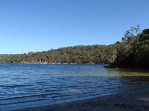
Flat Rock Beach is a small, south-facing beach on Middle Harbour, in Garigal National Park. The sand is deposited on a rock shelf that pokes through in places, forming interesting sculptures. The beach is frequented by walkers and boaters enjoying their day by the water. The beach can be accessed by a bush track from the end of Killarney Drive, Killarney Heights. Historically, the beach was a popular picnic area and serviced by a ferry in the early 1900’s. Today, there are no facilities, but some shade is provided by the trees at the back of the beach.
(12.08km) Int of Magazine and Flat Rock Beach Tracks → Int of Flat Rock and Magazine Tracks
190 m
5 mins
36m
0m
Moderate track
Continue straight: From the intersection, this walk follows the bush track with the ground sloping up to the right, heading up the wooden steps. The track flattens out and turns right, following the track marker through the bush and up the rocky hill, using the spread-out sets of wooden steps. The walk comes to an intersection and a signpost for the ‘Magazine Track’[5].
(12.26km) Int of Flat Rock and Magazine Tracks → Int of Downpatrick Road Servicetrail and Flat Rock Track
1.5 km
39 mins
86m
-116m
Moderate track
Turn left: From the intersection, this walk follows the ‘Flat Rock Track’ sign along the bush track heading down the side of the hill, with the ground sloping up to the right. The walk winds down the rocky track for a little while, before flattening out as it passes by a small pipeline and then continues along the side of the hill. The track meanders through the bush for a while before coming to the four-way intersection with a bush track (which heads up the rocky hill to the right, and down to a private property at the bottom of the hill on the left).
Continue straight: From the intersection, this walk follows the bush track along the side of the hill, with the ground sloping up to the right. The track meanders through the dense bushland, occasionally catching a nice view over Middle Harbour Creek down to the left, and continues to the intersection of a rough service trail on the right, which heads uphill.
Continue straight: From the intersection, this walk follows the bush track along the side of the hill, with the ground sloping up to the right. The track meanders through the dense bushland, occasionally catching a nice view over Middle Harbour Creek down to the left, and continues to the intersection of a rough service trail on the right, which heads uphill.
(13.81km) Int of Downpatrick Road Servicetrail and Flat Rock Track → Int of Davidson Park driveway and Flat Rock Track
690 m
16 mins
32m
-41m
Moderate track
Continue straight: From the intersection, this walk follows the bush track along the side of the hill, with the ground sloping up to the right as it heads through the bush. The walk stays above Middle Harbour Creek for a while before it drops down a steep set of wooden steps to the intersection with the Davidson Park driveway, at a wooden picnic seat.
(14.49km) Int of Davidson Park driveway and Flat Rock Track → Int of Davidson Park driveway and Warringah Road on-ramp
70 m
1 mins
1m
-2m
Very easy
Veer right: From the intersection, this walk follows the flat driveway towards the Roseville Bridge, heading under a pipe bridge and coming to the intersection with the driveway to Davidson Park.
(14.56km) Int of Davidson Park driveway and Warringah Road on-ramp → End of Ormonde Road Track
1.8 km
39 mins
107m
-69m
Moderate track
Veer right: From the intersection, this walk follows the road, heading up the hill and crossing under the Roseville Bridge. The road continues up the hill to reach Warringah Road, where the walk turns sharply to the right and continues along the footpath on the right-hand side of Warringah Road. The walk crosses Roseville Bridge and continues for a few meters to find an intersection with a concrete footpath (which goes down the hill to the right, closed at the time of writing).
Continue straight: From the intersection, the walk follows very narrow verge on the side of Warringah Rd up the hill away from Roseville Bridge. After about 270m the walk passes under a road bridge the turns right to follow the on-ramp up the hill to Ormonde Rd. The on-ramp loops around to an intersection with Ormonde Rd, where the walk turns left, following Ormonde Rd away from Warringah Rd. The walk passes The Kingsway, Cardigan Road and Chase Avenue before reaching the end of Ormonde Rd.
Continue straight: From the intersection, the walk follows very narrow verge on the side of Warringah Rd up the hill away from Roseville Bridge. After about 270m the walk passes under a road bridge the turns right to follow the on-ramp up the hill to Ormonde Rd. The on-ramp loops around to an intersection with Ormonde Rd, where the walk turns left, following Ormonde Rd away from Warringah Rd. The walk passes The Kingsway, Cardigan Road and Chase Avenue before reaching the end of Ormonde Rd.
(16.31km) End of Ormonde Road Track → Int of Two Creeks and Ormonde Road tracks
150 m
6 mins
1m
-34m
Moderate track
Veer right: From the end of Ormonde Rd, the walk follows the bush track down the gentle hill. The walk becomes quite steep before reaching the intersection with the Two Creeks Track at the bottom of the hill.
(16.46km) Int of Two Creeks and Ormonde Road tracks → Int of Two Creeks and Carlyle Road tracks
880 m
20 mins
46m
-46m
Moderate track
Turn sharp left: From the intersection, this walk follows the bush track with Middle Harbour Creek down on the right, as the track follows the side of the hill through the bush. After some time, the track leaves the creek as it bends to the left and continues along for a while before crossing a wooden bridge to the signposted intersection of the ‘Carlyle Road’ track.
(17.34km) Int of Two Creeks and Carlyle Road tracks → Eastern end of Two Creeks detour
2 km
43 mins
106m
-72m
Moderate track
Turn right: From the intersection, this walk follows the wide bush track opposite the signposted ‘Carlyle Road’ track, past the stone chair on the left. The walk follows along the wide bush track for a little while before crossing a short wooden bridge. Further along the bush track, this walk passes another stone chair and heads under a shallow rock overhang, following the side of the hill above Moores Creek for a while until coming down to the water level as the creek meets Middle Harbour Creek. From here, the track bends around to the left and follows Middle Harbour Creek through the bush and along the side of the hill to the signposted intersection of the ‘to Wellington Road’ track.
Continue straight: From the intersection (at the ‘to Wellington Road’ sign), this walk follows the Two Creeks bush track (keeping the Middle Harbour Creek down the hill on the right) as it heads though the bush for a while. The track passes a ‘Garigal National Park’ sign while bending into the Gordon Creek valley, and continues through the trees, keeping the valley down to the right as it heads along to the intersection with the defined bush track on the left.
Continue straight: From the intersection (at the ‘to Wellington Road’ sign), this walk follows the Two Creeks bush track (keeping the Middle Harbour Creek down the hill on the right) as it heads though the bush for a while. The track passes a ‘Garigal National Park’ sign while bending into the Gordon Creek valley, and continues through the trees, keeping the valley down to the right as it heads along to the intersection with the defined bush track on the left.
(19.36km) Eastern end of Two Creeks detour → Western end of Two Creeks detour
220 m
6 mins
11m
-20m
Moderate track
Turn left: From the intersection, this walk follows the bush track heading uphill, steadily climbing up the long gentle hill and up some rock steps. The track then flattens out and continues through the trees for a short distance before turning downhill and winding down the steep rock steps, coming to the intersection with the Two Creeks Track.
(19.58km) Western end of Two Creeks detour → End of Gordon Creek service trail
100 m
2 mins
0m
-10m
Moderate track
Turn sharp left: From the intersection, this walk follows the bush track, keeping the valley down to the right, as the track continues along the side of the hill for a short while before winding down a steep set of rock steps, coming to the end of a service trail at the bottom.
(19.68km) End of Gordon Creek service trail → Int of Gordon Creek Crossing track and servicetrail
280 m
7 mins
14m
-18m
Moderate track
Veer right: From the bottom of the steps, this walk follows the service trail (with the ground sloping up to the left) as it continues through the bush for a short while, before coming to a pipe bridge, which extends across the valley on the right.
Continue straight: From the pipeline, this walk follows the service trail, with the pipeline on the right and the ground sloping up to the left. The trail heads through the bush and along the side of the hill to the signposted intersection with wooden steps on the right.
Continue straight: From the pipeline, this walk follows the service trail, with the pipeline on the right and the ground sloping up to the left. The trail heads through the bush and along the side of the hill to the signposted intersection with wooden steps on the right.
(19.96km) Int of Gordon Creek Crossing track and servicetrail → Int of tunnel track and Gordon Creek servicetrail
1.2 km
25 mins
68m
-36m
Moderate track
Continue straight: From the intersection, this walk follows the Two Creeks Track, with the ground sloping up to the left as it heads through the bush. The walk crosses a short wooden bridge after a little while and continues along the side of the hill until coming to an intersection with some rock steps (down to a bush track) on the right.
(21.16km) Int of tunnel track and Gordon Creek servicetrail → Gordon Creek waterfall
50 m
2 mins
0m
-8m
Moderate track
Veer right: From the intersection, this walk winds down the bush track and steps through the dense bush. Soon, the track opens up to a large rock platform, next to the tunnel under Eastern Arterial Road.
Gordon Creek waterfall

This waterfall (not officially named) cascades off the top of a rock platform, soon after passing under Eastern Arterial Rd. It is difficult to view the full waterfall, but it still can be a great sight, watching the water on its journey over the rock platform and cascading off the edge.
(21.21km) Gordon Creek waterfall → Foot Bridge Intersection
170 m
3 mins
2m
-5m
Moderate track
Continue straight: From the rock platform, this walk passes under Eastern Arterial Rd using the foot path on the left of the tunnel (track not safe to use if covered with water). The first half of the tunnel has sandstone walls. Past the tunnel, the walk turns left then follows the defined bush track, keeping the creek to the right. Soon, this track come to an intersection just before a foot bridge.
(21.38km) Foot Bridge Intersection → Picnic area intersection
40 m
1 mins
2m
-1m
Easy track
Turn right: From the intersection, this walk crosses the foot bridge, veering right and heading up the stone steps. The track then veers to the left, passing a small picnic area, then comes to a well-signposted intersection, with ‘Slade Ave carpark’ track on the right.
Seven Little Australians Picnic Area
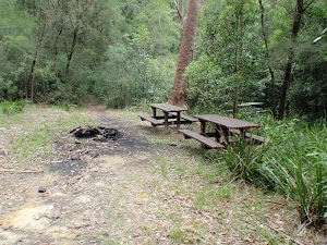
This small picnic area is in the middle of the Seven Little Australian Park reserve, at the intersection of Two Creeks Track and Slade Ave track. The picnic area has three picnic tables and some shade, provided by the surrounding trees. The picnic area is bordered with sandstone blocks, dating from prior to WW1.
(21.42km) Picnic area intersection → Sandstone Pillar overhang
220 m
5 mins
17m
0m
Easy track
Continue straight: From the intersection, this walk follows the ‘Tryon Road’ sign. The track passes though a coachwood forest, with some tall pine trees scattered throughout. The track keeps the wide valley on the left and soon climbs up to a large sandstone overhang, supported by stone pillars.
Sandstone Pillar overhang
This sandstone overhang is of particular note, due to the stone pillar supports that appear to be reinforcing it. Prior to WW1, members of the army built these pillars and surrounding tracks as part of their training. It appears that this was added to during the depression, with further sandstone masonry work. Their efforts have resulted in a Lara Croft reminiscent ruin – OK, maybe a bit of an exaggeration, but the cave is a highlight of the tracks in the area.
(21.64km) Sandstone Pillar overhang → Slade Ave (Just north of Tryon Rd)
210 m
4 mins
10m
-3m
Easy track
Continue straight: From the sandstone overhang, this walk heads up the stairs, keeping the wide valley to the left. The bush soon thins out as the track approaches some houses and a brick wall at the end of laneway. The track the follows the laneway to Slade Ave, just north of Tryon Rd.
(21.85km) Slade Ave (Just north of Tryon Rd) → Lindfield Station
790 m
14 mins
35m
-2m
Very easy
Turn left: From the intersection, the walk follows Slade Ave to the nearby ‘T’ intersection with Tryon Road. The walk turns right and follows Tryon Rd. At the ‘T’ intersection with Nelson Road, the walk turns left and immediately right, continuing along Tryon Road, crossing Lindfield Ave and arriving at Lindfield Station.
Maps for the Spit to Lindfield walk
You can download the PDF for this walk to print a map.
These maps below cover the walk and the wider area around the walk, they are worth carrying for safety reasons.
| Parramatta River | 1:25 000 Map Series | 91303N PARRAMATTA RIVER | NSW-91303N |
| Sydney | 1:100 000 Map Series | 9130 SYDNEY | 9130 |
Cross sectional view of the Spit to Lindfield bushwalking track
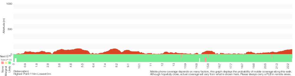
Analysis and summary of the altitude variation on the Spit to Lindfield
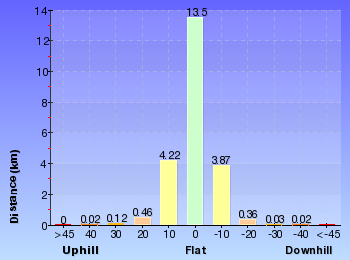
Overview of this walks grade – based on the AS 2156.1 – 2001
Under this standard, a walk is graded based on the most difficult section of the walk.
| Length | 22.6 km | ||
| Time | 9 hrs 45 mins | ||
| . | |||
| Grade 4/6 Hard track |
AS 2156.1 | Gradient | Very steep (4/6) |
| Quality of track | Formed track, with some branches and other obstacles (3/6) | ||
| Signs | Directional signs along the way (3/6) | ||
| Experience Required | Some bushwalking experience recommended (3/6) | ||
| Weather | Storms may impact on navigation and safety (3/6) | ||
| Infrastructure | Limited facilities, not all cliffs are fenced (3/6) |
Some more details of this walks Grading
Here is a bit more details explaining grading looking at sections of the walk
Gradient
8km of this walk has gentle hills with occasional steps and another 8km has short steep hills. Whilst another 4km is flat with no steps and the remaining 2.8km is very steep.
Quality of track
13km of this walk follows a formed track, with some branches and other obstacles and another 4.8km follows a clear and well formed track or trail. The remaining (4.6km) follows a smooth and hardened path.
Signs
Around 13km of this walk is clearly signposted, whilst the remaining 9km has directional signs at most intersection.
Experience Required
Around 15km of this walk requires no previous bushwalking experience, whilst the remaining 8km requires some bushwalking experience.
weather
Around 22km of this walk is not usually affected by severe weather events (that would unexpectedly impact safety and navigation), whilst the remaining 220m is affected by storms that may impact your navigation and safety.
Infrastructure
Around 14km of this walk is close to useful facilities (such as fenced cliffs and seats), whilst the remaining 9km has limited facilities (such as not all cliffs fenced).
Similar walks
A list of walks that share part of the track with the Spit to Lindfield walk.
516 m Return
20 mins
Moderate track
986 m Return
30 mins
Moderate track
1.4 km Return
45 mins
Moderate track
1.8 km Return
1 Hr
Hard track
2.2 km One way
45 mins
Moderate track
3.4 km One way
1 hr 30 mins
Moderate track
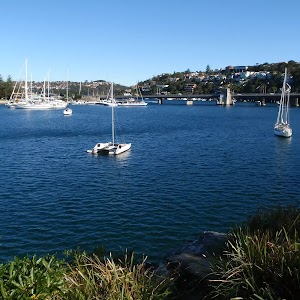
3.6 km Circuit
1 hr 30 mins
Hard track
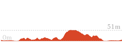
3.7 km Return
1 hr 30 mins
Hard track
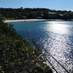
4.3 km One way
2 hrs 30 mins
Hard track
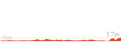
4.5 km Return
1 hr 30 mins
Hard track
4.6 km One way
2 hrs
Hard track
5.4 km Return
3 hrs
Hard track
6 km One way
2 hrs 45 mins
Hard track
6.1 km One way
2 hrs 30 mins
Moderate track
6.7 km Circuit
2 hrs 45 mins
Moderate track
7.2 km One way
3 hrs
Moderate track
8.7 km Circuit
4 hrs
Moderate track
9.1 km One way
3 hrs 45 mins
Moderate track
10 km One way
4 hrs 30 mins
Hard track
10 km One way
4 hrs
Hard track
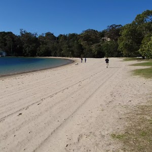
10.4 km One way
5 hrs
Hard track
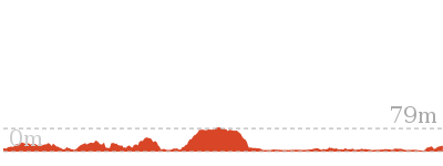
11.2 km One way
4 hrs 30 mins
Hard track
11.5 km One way
4 hrs 30 mins
Hard track
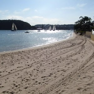
13.7 km One way
5 hrs 45 mins
Moderate track

15.1 km Circuit
5 hrs 45 mins
Experienced only
18.9 km One way
8 hrs
Hard track

Other Nearby walks
A list of walks that start near the Spit to Lindfield walk.
6.1 km One way
2 hrs 30 mins
Hard track
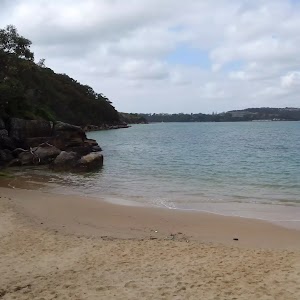
200 m Return
30 mins
Moderate track
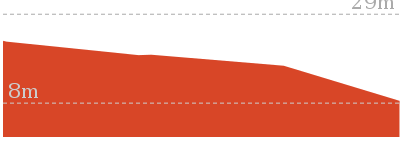
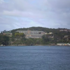
2 km Return
1 Hr
Moderate track

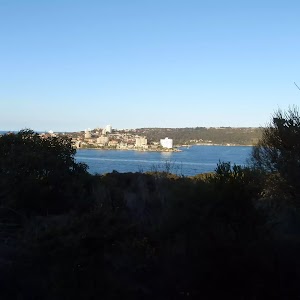
2.5 km Circuit
1 Hr
Hard track
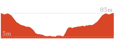
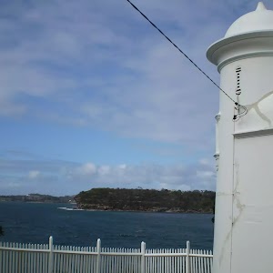
3.6 km Return
2 hrs
Moderate track
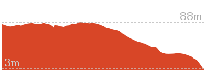
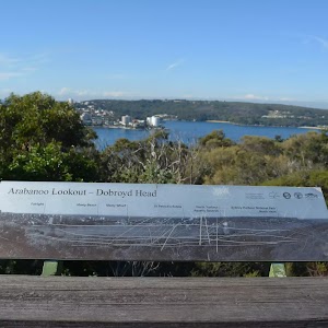
142 m Return
15 mins
Very easy


60 m Return
3 mins
Moderate track

1.7 km Return
1 Hr
Moderate track
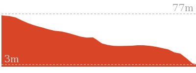
3.1 km One way
2 hrs
Moderate track
7.3 km Circuit
3 hrs
Moderate track
3.2 km Return
1 hr 30 mins
Moderate track
3.9 km Circuit
2 hrs
Hard track
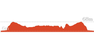
Plan your trip to and from the walk here
The Spit to Lindfield walk starts at the Spit Bridge South (gps: -33.804355, 151.24615)
Your transport options to Spit Bridge South are by;
![]() Bus. (get details)
Bus. (get details)
![]() Car. There is free parking available.
Car. There is free parking available.
(get details)
The Spit to Lindfield ends at the Lindfield Station (gps: -33.775095, 151.16906)
Your transport options to Lindfield Station are by;
![]() Train. (get details)
Train. (get details)
![]() Bus. (get details)
Bus. (get details)
![]() Car. There is free parking available.
Car. There is free parking available.
(get details)
Short URL = http://wild.tl/stl
Gallery images
There are other downloads I am still working on.
You will probably need to login to access these — still all free.
* KML (google earth file)
* GPX (GPS file)
Special Maps/ brochures
* A3 topo maps
* PDF with Lands Topo map base
* PDF with arial image (and map overlay)
I wanted to get the main site live first, this extra stuff will come in time.
Happy walking
Matt 🙂
Comments