South Head Heritage Trail


45 mins

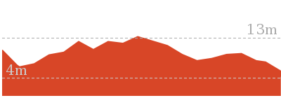
64 m
Easy track


(0km) Camp Cove car park → Camp Cove Beach

50 m
1 mins
0m
-4m
Easy track
Camp Cove
(0.05km) Camp Cove Beach → Cannon
130 m
3 mins
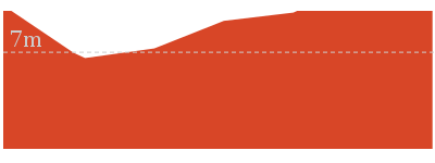
7m
-3m
Easy track
Cannon
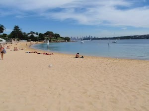
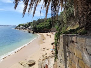
(0.18km) Cannon → Lady Bay Beach Int
290 m
6 mins
9m
-12m
Easy track
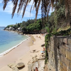
(0.47km) Lady Bay Beach Int → Lady Bay Beach
30 m
1 mins
0m
-3m
Moderate track
Lady Bay Beach
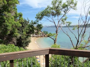
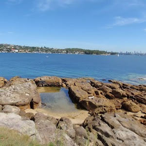
(0.47km) Lady Bay Beach Int → Lady Bay Lookout
90 m
2 mins
5m
-2m
Easy track
Lady Bay Lookout
(0.62km) Circuit intersection → Lightkeepers Cottage
170 m
3 mins
3m
-10m
Very easy
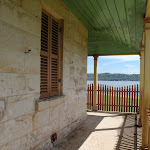
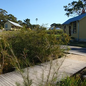
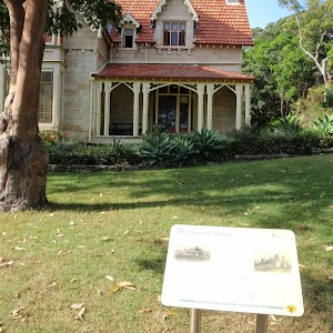
Lightkeepers Cottage
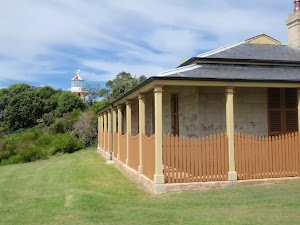
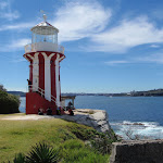
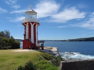
(0.79km) Lightkeepers Cottage → Hornby Lighthouse
90 m
2 mins
4m
-1m
Easy track
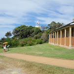
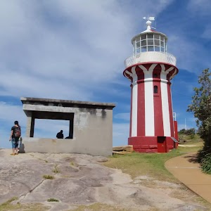
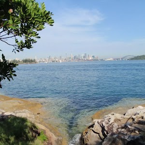
Hornby Lighthouse
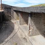
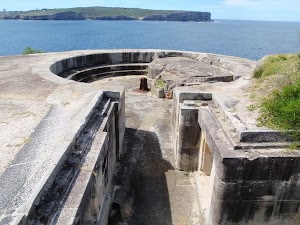
(0.88km) Hornby Lighthouse → Gun Emplacements
70 m
2 mins
7m
0m
Very easy
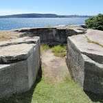
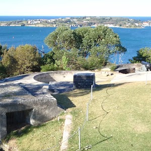
Gun Emplacements
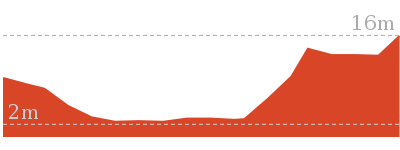
(0.95km) Gun Emplacements → Camp Cove car park
750 m
16 mins
24m
-32m
Easy track
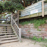
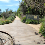
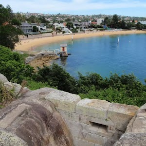
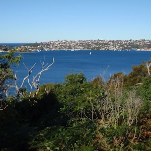
Turn left: From the intersection, this walk heads directly away from the face of the ‘South Head Heritage Trail’ sign[68] along the timber boardwalk[69] and down a series of steps. The timber boardwalk soon leads to a fenced lookout with a view over Lady Bay[70].
Continue straight: From Lady Bay Lookout, this walk heads down the steps[71] next to the lookout and follows the footpath alongside the large fence[72]. The path heads up a series of steps to the signposted intersection above ‘Lady Bay Beach’[73].
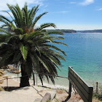
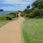
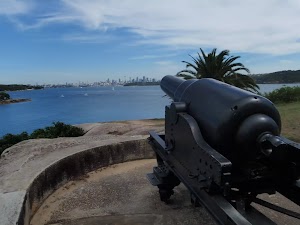
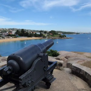
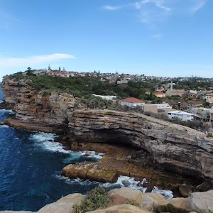
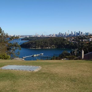
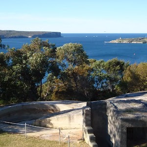
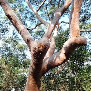
Continue straight: From the intersection, this walk heads gently uphill along the footpath (keeping the water to the right) and after ≈60m, the path comes to the end of an old road. This walk continues along the old road, past the garage bins[74] and the large toilet block (on your left)[75]. The walk now follows the road as it leads around a sweeping left-hand bend, enjoying more harbour views until turning right onto a footpath, near a palm tree (just before the road meets a large fence). The walk heads down this path and some steps to find a disused cannon[76], gun emplacement and more great harbour views[77].
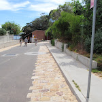
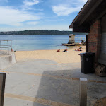
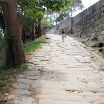
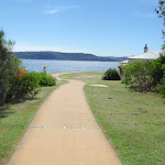
Continue straight: From the cannon, this walk heads down along the wide, cobbled sandstone path[78] (keeping the water views to your right). The walk then follows the footpath gently downhill to an intersection[79][80] (with a toilet block on the left). The walk heads straight, then down the steps and across the beach to the front of the Camp Cove Beach Kiosk[81].
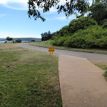
Veer left: From the northern end of Camp Cove Beach, this walk heads up the concrete path next to the kiosk[82] to find the end of Cliff St. The walk follows the road past the ‘Camp Cove timeline’ information sign[83] to an intersection with Victoria St and the signposted ‘Camp Cove Car Park[84].
Maps for the South Head Heritage Trail walk
You can download the PDF for this walk to print a map.These maps below cover the walk and the wider area around the walk, they are worth carrying for safety reasons.
| Sydney Heads | 1:25 000 Map Series | 91302N SYDNEY HEADS | NSW-91302N |
| Sydney | 1:100 000 Map Series | 9130 SYDNEY | 9130 |
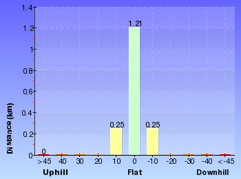
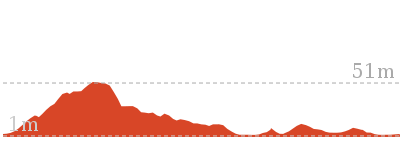
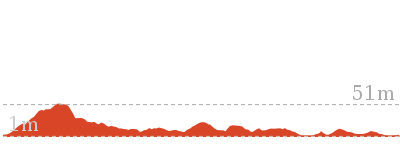
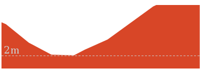
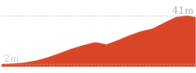
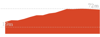
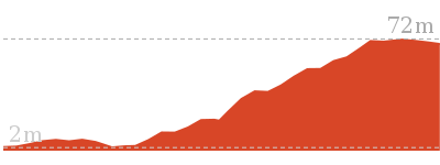
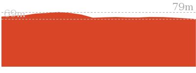
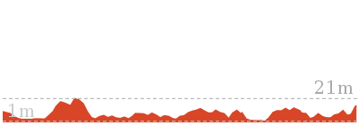
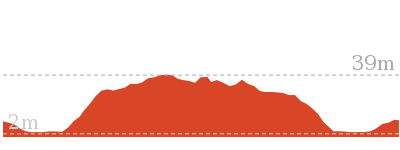
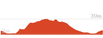
Cross sectional view of the South Head Heritage Trail bushwalking track

Analysis and summary of the altitude variation on the South Head Heritage Trail
Overview of this walks grade – based on the AS 2156.1 – 2001
Under this standard, a walk is graded based on the most difficult section of the walk.
| Length | 1.7 km | ||
| Time | 45 mins | ||
| . | |||
| Grade 2/6 Easy track |
AS 2156.1 | Gradient | Gentle hills with occasional steps (2/6) |
| Quality of track | Clear and well formed track or trail (2/6) | ||
| Signs | Clearly signposted (1/6) | ||
| Experience Required | No experience required (1/6) | ||
| Weather | Weather generally has little impact on safety (1/6) | ||
| Infrastructure | Generally useful facilities (such as fenced cliffs and seats) (1/6) |
Some more details of this walks Grading
Here is a bit more details explaining grading looking at sections of the walk
Gradient
Around 1.4km of this walk has gentle hills with occasional steps, whilst the remaining 350m is flat with no steps.
Quality of track
Around 1.6km of this walk follows a smooth and hardened path, whilst the remaining 110m follows a clear and well formed track or trail.
Signs
This whole walk, 1.7km is clearly signposted.
Experience Required
This whole walk, 1.7km requires no previous bushwalking experience.
weather
This whole walk, 1.7km is not usually affected by severe weather events (that would unexpectedly impact safety and navigation).
Infrastructure
This whole walk, 1.7km is close to useful facilities (such as fenced cliffs and seats).
Similar walks
358 m Return
15 mins
Easy track
992 m Return
30 mins
Moderate track
2.5 km Circuit
1 Hr
Hard track
2.8 km Return
1 hr 15 mins
Easy track

4.1 km Circuit
1 hr 45 mins
Hard track
Other Nearby walks

243 m Circuit
15 mins
Easy track
886 m Return
30 mins
Hard track
842 m Return
30 mins
Moderate track
4.9 km Circuit
2 hrs 30 mins
Moderate track

144 m Return
7 mins
Very easy

1.7 km Return
1 Hr
Moderate track
904 m Return
30 mins
Easy track
2.2 km One way
1 Hr
Moderate track
896 m Return
20 mins
Easy track
1.7 km Circuit
40 mins
Easy track

2.5 km Circuit
1 Hr
Moderate track

1.8 km Circuit
40 mins
Easy track
Plan your trip to and from the walk here
The South Head Heritage Trail walk starts and ends at the Camp Cove car park (gps: -33.83939, 151.27997)Your transport options to Camp Cove car park are by;
(get details)


Short URL = http://wild.tl/shht
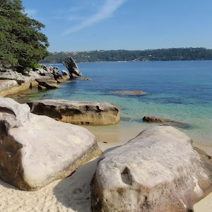
Gallery images
There are other downloads I am still working on.
You will probably need to login to access these — still all free.
* KML (google earth file)
* GPX (GPS file)
Special Maps/ brochures
* A3 topo maps
* PDF with Lands Topo map base
* PDF with arial image (and map overlay)
I wanted to get the main site live first, this extra stuff will come in time.
Happy walking
Matt 🙂
Comments