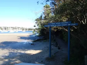
Spit Bridge to Manly (Manly Scenic Walkway)

(0km) Int. Battle Boulevard and Manly Rd → Int. Ellery's Punt Reserve Rd and Manly Scenic Walkway
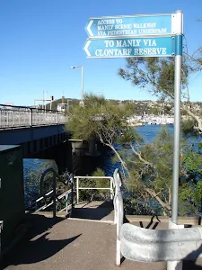
Continue straight: From the end of Battle Boulevard, this walk heads down the stairs following the sign 'To Manly'. The walk follows the stairs under the bridge then across the grass clearing to the 'Manly Scenic Walkway' map and info sign on the footpath, in Ellery's Punt Reserve.
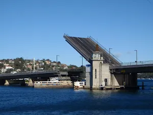
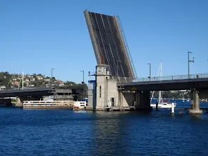
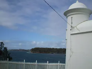
Spit Bridge
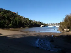
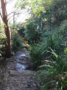
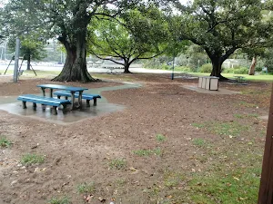
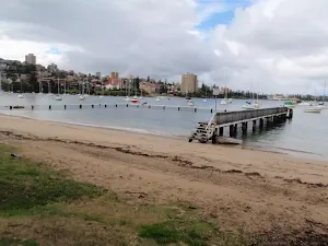
Ellery's Punt Reserve
(0km) Int. Ellery's Punt Reserve Rd and Manly Scenic Walkway → Int. Sandy Bay Rd and Fairbairn Ave
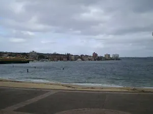
Continue straight: From the end of Sandy Bay Rd, this walk heads along the road, keeping the water to the right, coming to the signposted intersection with Fairbairn Ave.
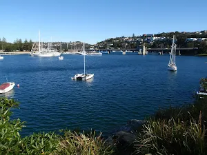
(1km) Int. Sandy Bay Rd and Fairbairn Ave → Clontarf Reserve (Clonny's)
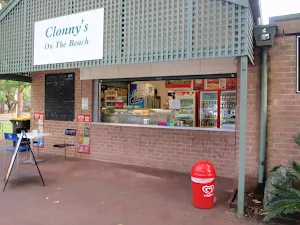
Turn left: From Clontarf Marina, this walk follows the footpath along Sandy Bay Road, keeping the water on the right. About 100m from the marina, the footpath turns right and heads into 'Clontarf Reserve'. The walk passes the 'Manly Scenic Walkway' signpost and heads over the grass towards the children's play area, then past the public phone to Clonny's Cafe.
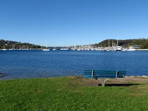
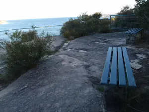
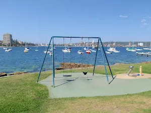
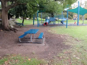
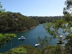
Clontarf Reserve
Clonny's
(2km) Clontarf Reserve (Clonny's) → Monash Cres Track
(2km) Monash Cres Track → Int of Manly to Spit track and Castle Rock Beach steps
Continue straight: From the intersection, this walk follows the 'Manly' sign (keeping the water to the right) as it passes up the stairs between the rocks. The track soon comes to a signposted intersection, with the 'Access to Cutler & Amiens Rd' off to the left.
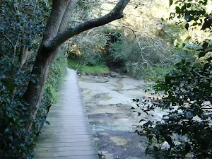
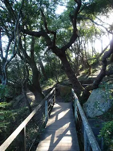
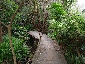
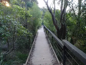
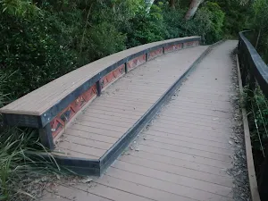
Continue straight: From the intersection, this walk follows the 'Manly' sign as it heads up the slight hill and across the rock shelf, keeping the water on the right. The walk then steps off the rockshelf to continue along the hillside, undulating steeply in parts. The track is board-walked in many places, with a few access points to the water along the way. The walk crosses a bridge before continuing left around the hill to a well signposted intersection.
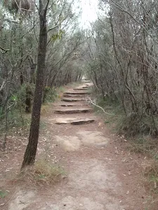
Turn right: From the intersection, this walk follows the 'Manly Scenic Walk' arrow down the concrete steps towards the water, to the signposted intersection of the 'Manly to Spit' and 'Castle Rock' beach tracks.
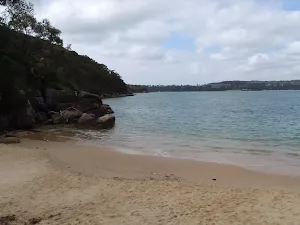
(3km) Int of Manly to Spit Track and Castle Rock Beach steps → Castle Rock Beach
Castle Rock Beach
(3km) Int of Manly to Spit Track and Castle Rock Beach steps → Int of Grotto Point Lighthouse and Manly to Spit tracks
Continue straight: From the rest area, this walk follows the bush track up the rock steps and along the side of the hill, keeping the water to the right. The track continues steadily up to the 4-way signposted intersection.
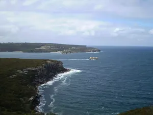
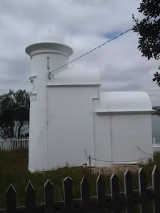
(3km) Int of Grotto Point Lighthouse and Manly to Spit tracks → Grotto Point Lighthouse
Veer right: From the intersection, this walk winds down the hill, passing an old, blank signpost. The track wanders through dense bush and along the ridge, flattening out for a while until it drops down another hill towards the end of the point, coming to the Grotto Point Lighthouse. At the end of this side trip, retrace your steps back to the main walk then Turn right.
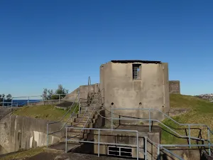
Grotto Point Lighthouse
(3km) Int of Grotto Point Lighthouse and Manly to Spit tracks → Grotto Point Engravings track
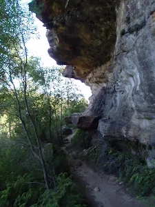
(3km) Grotto Point Engravings track → Grotto Point Engravings
Grotto Point Engravings

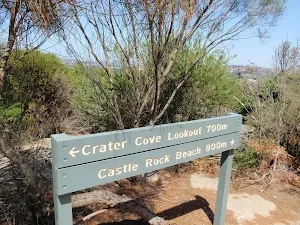
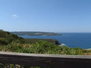
(3km) Grotto Point Engravings track → Crater Cove Lookout
Continue straight: From the intersection, this walk follows 'Crater Cove Lookout 700m' sign along bush track, keeping the water to the right. The walk crosses several separate sections of boardwalk and rock platforms as it winds through the heath, to come to a large rock platform with great views at the unnamed lookout in southern Crater Cove .
Continue straight: From the lookout, this walk follows the bush track along the hillside, keeping the water out to the right. The track continues for a short while until coming to an intersection at the base of some stairs on the left.
Turn right: From the intersection, this walk follows the bush track down the short hill towards the ocean, soon coming to the Crater Cove Lookout.
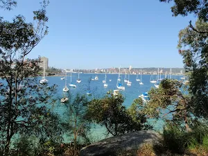
Crater Cove Lookout
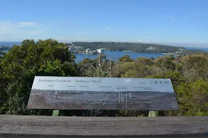
(4km) Crater Cove Lookout → Int. Arabanoo Lookout Trk and Manly Scenic Walkway
(4km) Int. Arabanoo Lookout Trk and Manly Scenic Walkway → Arabanoo Lookout
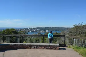
Turn right: From the car parking bays on the north eastern edge of Tania Park on Dobroyd Scenic Dr, Balgowlah Heights[1] this walk heads towards the 'Arabanoo Lookout' sign[2]. From the edge of the road, this walk follows the (1.5m wide) concrete footpath, directly away from the oval and road, gently uphill[3], initially passing the 'Arabanoo' information sign[4][5]. About 35m from the road this walk comes to the fenced (1.2m high) lookout area[6], and seats. At the end of this side trip, retrace your steps back to the main walk then Veer left.

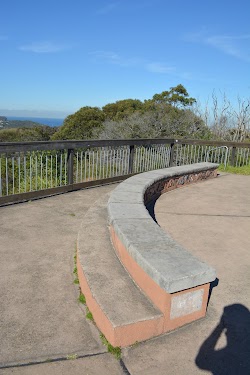
Arabanoo Lookout
(4km) Int. Arabanoo Lookout Trk and Manly Scenic Walkway → Reef Beach platform
Continue straight: From the intersection, this walk follows the 'Manly via Reef Beach' sign down the hill to a fenced lookout. From the lookout, the track heads further along the hillside to wind down past some more views. The track soon passes by a large rock shelf, as it comes close to the water and then comes to a boardwalk with bench seat behind Reef Beach.
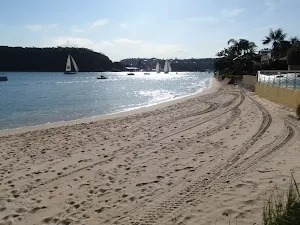
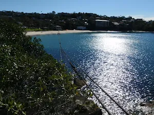
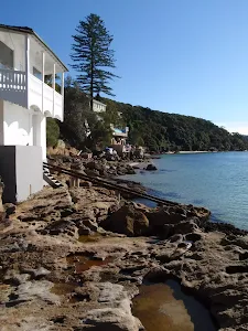
Reef Beach
(5km) Reef Beach platform → South end of Forty Baskets Reserve
Continue straight: (This section of track may not be passable at higher tides, alternate route provides drier option). From the intersection, this walk follows the 'Manly via Forty Baskets Beach' sign along the well-defined track, keeping the water on the right. Soon the walk heads down a series of stone steps, passing some National Park signs onto the rock beach. From here, the walk follows the beach/rocks till coming to an intersection with a narrow laneway on the left, just past the start of the hardened footpath.
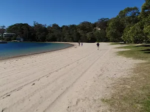
Forty Baskets Reserve
(6km) South end of Forty Baskets Reserve → End of Gourlay Avenue
Continue straight: From the toilet block, the walk follows the footpath up the gentle hill, keeping the water on the right. The footpath soon comes the intersection with a set of stairs, uphill to the left.
Continue straight: From the intersection, this walk follows the footpath up the gentle hill, keeping the water to the right. The path soon comes to another intersection with a set of stone and dirt stairs (uphill to the left).
Continue straight: From the intersection, this walk follows the footpath, keeping the water below on the right. Soon, the walk passes around a blue metal gate then continues on to the hairpin bend at the end of Gourlay Ave, just above a small marina.
(6km) End of Gourlay Avenue → Int of Beach Ln and North Harbour St
Veer right: From the intersection, this walk follows the 'Manly' arrow down the hill and across the bridge (and a wonderful waterfall after rain). On the other side, the footpath leads up to Clarence St.
Turn right: From the intersection, this walk follows the 'Manly' sign down along North Harbour St. The road then comes to the top of a set of stairs (heading down to North Harbour Reserve) at the intersection of Beach Ln (unsignposted).
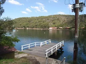
North Harbour Reserve
(7km) Int of Beach Ln and North Harbour St → Int. of Lauderdale avenue and Manly Scenic Walk
Continue straight: From the intersection, the walk follows King Road, as it bends to the right, then left up the gentle hill, reaching a 'T' intersection with Lauderdale avenue.
Turn right: From the intersection, the walk follows the footpath along Lauderdale Avenue, down the hill past the bus stop sign. After a couple of houses the footpath comes to a clearing on the right, with views of the water and a signposted intersection with the sealed 'Manly Scenic Walk' footpath.
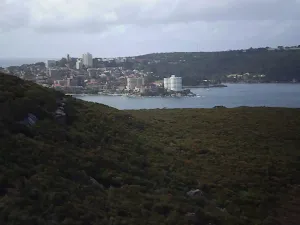
(7km) Int. of Lauderdale avenue and Manly Scenic Walk → Manly Wharf
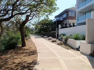
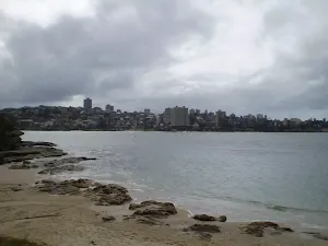
Turn right: From the end of Bolingbroke Parade, this walk follows the concrete footpath, keeping the water to the right. The path winds behind the houses, through the open parkland, following the water. The walk passes picnic chairs and some nice views before coming to Fairlight Beach and ocean bath.
Continue straight: From Fairlight Beach, this walk follows the wide yellow footpath past the pool, keeping the water on the right. The footpath continues behind the houses and past several information signs before emerging onto Commonwealth Parade. Once beside the road, the footpath bends left and heads past Manly Waterworks. Just before West Esplanade, this walk turns right and heads along the footpath, with Manly Cove beach on the right, and soon comes to the ferry wharf.
Maps for the Spit Bridge to Manly (Manly Scenic Walkway) walk
You can download the PDF for this walk to print a map.
These maps below cover the walk and the wider area around the walk, they are worth carrying for safety reasons.
| Parramatta River | 1:25 000 Map Series | 91303N PARRAMATTA RIVER | NSW-91303N |
| Sydney Heads | 1:25 000 Map Series | 91302N SYDNEY HEADS | NSW-91302N |
| Sydney | 1:100 000 Map Series | 9130 SYDNEY | 9130 |
Cross sectional view of the Spit Bridge to Manly (Manly Scenic Walkway) bushwalking track
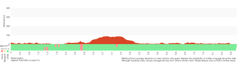
Analysis and summary of the altitude variation on the Spit Bridge to Manly (Manly Scenic Walkway)
Overview of this walks grade – based on the AS 2156.1 – 2001
Under this standard, a walk is graded based on the most difficult section of the walk.
| Length | 9.1 km | ||
| Time | 3 hrs 45 mins | ||
| . | |||
Grade 3/6 Moderate track | AS 2156.1 | Gradient | Short steep hills (3/6) |
| Quality of track | Formed track, with some branches and other obstacles (3/6) | ||
| Signs | Directional signs along the way (3/6) | ||
| Experience Required | Some bushwalking experience recommended (3/6) | ||
| Weather | Storms may impact on navigation and safety (3/6) | ||
| Infrastructure | Limited facilities, not all cliffs are fenced (3/6) |
Some more details of this walks Grading
Here is a bit more details explaining grading looking at sections of the walk
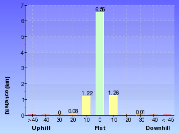
Gradient
3.6km of this walk is flat with no steps and another 3km has short steep hills. The remaining (2.6km) has gentle hills with occasional steps.
Quality of track
4.2km of this walk follows a smooth and hardened path and another 2.7km follows a formed track, with some branches and other obstacles. The remaining (2.2km) follows a clear and well formed track or trail.
Signs
Around 7km of this walk is clearly signposted, whilst the remaining 2.1km has directional signs at most intersection.
Experience Required
Around 9km of this walk requires no previous bushwalking experience, whilst the remaining 450m requires some bushwalking experience.
weather
Around 9km of this walk is not usually affected by severe weather events (that would unexpectedly impact safety and navigation), whilst the remaining 240m is affected by storms that may impact your navigation and safety.
Infrastructure
Around 7km of this walk is close to useful facilities (such as fenced cliffs and seats), whilst the remaining 1.8km has limited facilities (such as not all cliffs fenced).
Similar walks
A list of walks that share part of the track with the Spit Bridge to Manly (Manly Scenic Walkway) walk.
Crater Cove Lookout
60 m Return, 3 mins
Moderate track
Arabanoo Lookout
142 m Return, 15 mins
Very easy
Castle Rock Beach
200 m Return, 30 mins
Moderate track
Grotto Point Lighthouse Walk
1.7 km Return, 1 Hr
Moderate track
Castle Rock to Grotto Point Lighthouse
2 km Return, 1 Hr
Moderate track
Dobroyd Head Walk
2.5 km Circuit, 1 Hr
Hard track
Spit Bridge to Fisher Bay
3.6 km Circuit, 1 hr 30 mins
Hard track
Grotto Point Walk
3.6 km Return, 2 hrs
Moderate track
Balmoral Beach to The Spit
4.3 km One way, 2 hrs 30 mins
Hard track
Spit Bridge to North Harbour Reserve
8.7 km Circuit, 4 hrs
Moderate track
Taronga Zoo to Spit Bridge
10.4 km One way, 5 hrs
Hard track
Manly to Seaforth Oval
13.7 km One way, 5 hrs 45 mins
Moderate track
Taronga Zoo to Manly
18.9 km One way, 8 hrs
Hard track
Spit to Lindfield
22.6 km One way, 9 hrs 45 mins
Hard track
Other Nearby walks
A list of walks that start near the Spit Bridge to Manly (Manly Scenic Walkway) walk.
Spit Bridge to Middle Head Forts
6.1 km One way, 2 hrs 30 mins
Hard track
North Arm Walking Track
3.1 km One way, 2 hrs

Moderate track
Manly Dam Circuit Walk
7.3 km Circuit, 3 hrs

Moderate track
Manly Dam Nature Trail
3.2 km Return, 1 hr 30 mins

Moderate track
Engravings Track
2.2 km One way, 45 mins

Moderate track
Seaforth Oval to Davidson Park
10 km One way, 4 hrs 30 mins

Hard track
Seaforth Oval to Roseville Bridge via Bantry Bay
10 km One way, 4 hrs

Hard track
Seaforth Oval to the Bluff Lookout
5.4 km Return, 3 hrs
Hard track
Timber Getters Track
1.8 km Return, 1 Hr
Hard track
Flat Rock Beach track
516 m Return, 20 mins
Moderate track
Balmoral to Middle Head Forts
3.9 km Circuit, 2 hrs
Hard track
Middle Head
1.9 km Circuit, 1 Hr
Moderate track
Plan your trip to and from the walk here
The Spit Bridge to Manly (Manly Scenic Walkway) walk starts at the Int. Battle Boulevard and Manly Rd (gps: -33.800405, 151.24678)
The Spit Bridge to Manly (Manly Scenic Walkway) ends at the Manly Wharf (gps: -33.799562, 151.28427)
Weather Forecast
This walk starts in the Metropolitan weather district.
Current Alerts
Park Information
Sydney Harbour National Park
One of Sydney's most diverse parks, Sydney Harbour National Park is formed from 11 pockets of harbour islands and shoreline. Highlights include coastal walks and swimming, breath-taking viewpoints, tours of colonial buildings and Aboriginal cave art.
Comments
Short URL: http://wild.tl/sbtm