The Goanna Track Circuit


4 hrs

484 m
Hard track


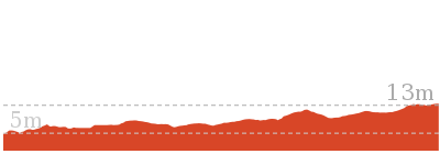
(0km) Heathcote Railway Station → End of Freeman Rd

1 km
17 mins
4m
-24m
Very easy
(1.03km) End of Freeman Rd → Int of Scout Camp and Freeman Road bushtracks
400 m
9 mins
2m
-47m
Moderate track
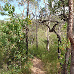
Turn right: From the intersection, the walk follows the bush track on the opposite side of the management trail to the power line tower. The walk passes a burnt-out car shell before turning down the long steep hill and winding down to the ‘T’ intersection with a wider track.
(1.43km) Int of Scout Camp and Freeman Road bushtracks → Int. of Mirang Track and Friendly Tracks
330 m
7 mins
4m
-37m
Moderate track
(1.76km) Int. of Mirang Track and Friendly Tracks → Int. of Mirang and Mirang Pool Tracks
940 m
21 mins
43m
-50m
Moderate track
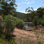
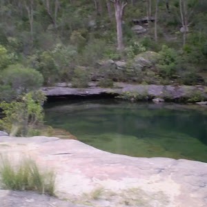
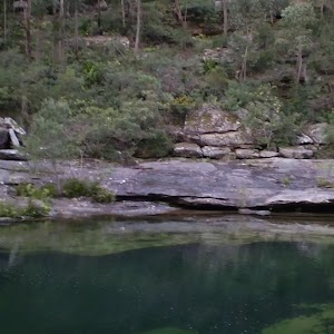
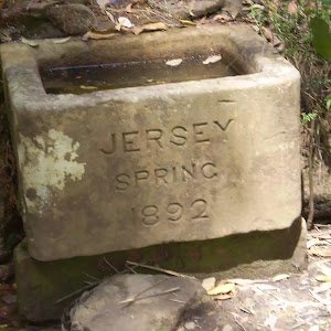
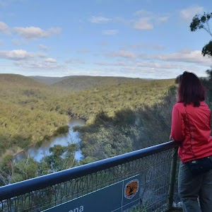
Mirang Pool camping ground
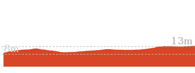
(2.7km) Int. of Mirang and Mirang Pool Tracks → Int of Pipeline Track and Mirang Rd Servicetrail
340 m
8 mins
13m
-24m
Moderate track
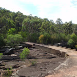
(3.04km) Int of Pipeline Track and Mirang Rd Servicetrail → Battery Causeway
1 km
21 mins
46m
-32m
Moderate track
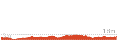
(4.06km) Battery Causeway → Int of Lake Eckersley and Pipeline Tracks
290 m
6 mins
14m
-1m
Moderate track
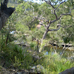
(4.34km) Int of Lake Eckersley and Pipeline Tracks → Lake Eckersley
220 m
5 mins
0m
-41m
Moderate track
(4.34km) Int of Lake Eckersley and Pipeline Tracks → Int of Pipeline and Goanna Tracks
840 m
19 mins
46m
-34m
Moderate track
(5.18km) Int of Pipeline and Goanna Tracks → Int of Goanna Track and the Pipeline bushtrack
300 m
9 mins
49m
0m
Moderate track
(5.48km) Int of Goanna Track and the Pipeline bushtrack → Int of Goanna and Bullawarring Tracks
160 m
3 mins
0m
-23m
Moderate track
(5.64km) Int of Bullawarring and Goanna Tracks → Int. of Mirang Track and Friendly Tracks
3.6 km
1 hr 20 mins
155m
-202m
Hard track
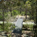
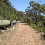
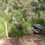
Veer right: From the intersection, the walk crosses the creek using concrete Battery Causeway and follows the management trail up the gentle hill, past a picnic table to soon cross the pipeline on a timber bridge. From here, the walk continues along the management trail, keeping the pipeline on the right for 750m until the trail bends left away from the pipeline and onto an asphalt surface. The trail winds down a hill to the intersection of the Mirang Road service trail.
Continue straight: From the intersection, the walk follows the asphalt management trail down the hill and through a gate, doing a large ‘S’ bend and crossing the pipeline twice. The surface of the trail changes to dirt and the walk continues, with Heathcote Creek on the left, to the signposted intersection with the Mirang Pool track.
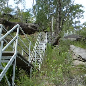
Continue straight: From the intersection, this walk follows the management trail in the unsignposted direction, keeping the pipeline on the right and Heathcote Creek down the hill on the left. The walk heads along until it crosses a bridge onto an asphalt surface and heads up the long hill that winds to the intersection with another trail, opposite the metal platform crossing the pipeline.
(9.26km) Int. of Mirang Track and Friendly Tracks → Heathcote Railway Station
1.8 km
33 mins
108m
-10m
Moderate track
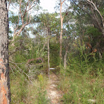
Turn left: From the intersection, the walk follows the rough bush track heading up the side of the hill, climbing steeply up along the sometimes-faint path. The track soon flattens out and bends around to the right, passing a burnt-out car shell before coming an the intersection with a management trail.
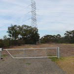
Turn left: From the intersection, the walk follows the management trail up the long hill. The walk passes a trail on the right and flattens out a little, continuing up and around to the right. This walk passes another management trail (heading behind some houses) as it flattens out more and crosses under the power lines to the road.
Veer right: From the intersection, this walk follows Freemans Road all the way past the large scout camp facility, to the intersection of Boundary Road, where it turns left and continues along for a short distance to the intersection of Oliver Street. From here, this walk turns right onto Oliver Street, which it follows to the end, meeting the Princes Highway. From here, the track crosses the highway at the traffic lights and continues along the footpath, with the car park to the left, coming to the train station.
Maps for the The Goanna Track Circuit walk
You can download the PDF for this walk to print a map.These maps below cover the walk and the wider area around the walk, they are worth carrying for safety reasons.
| Port Hacking | 1:25 000 Map Series | 91294N PORT HACKING | NSW-91294N |
| Campbelltown | 1:25 000 Map Series | 90291N CAMPBELLTOWN | NSW-90291N |
| Campbelltown | 1:50 000 Map Series | 90291 CAMPBELLTOWN | CW-90291 |
| Port Hacking | 1:100 000 Map Series | 9129 PORT HACKING | 9129 |
| Wollongong | 1:100 000 Map Series | 9029 WOLLONGONG | 9029 |
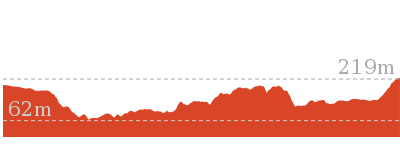
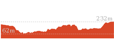
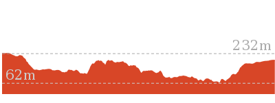
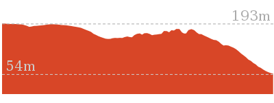
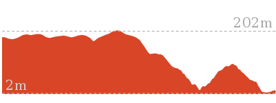
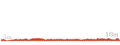
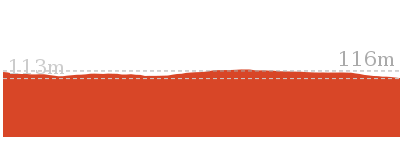
Cross sectional view of the The Goanna Track Circuit bushwalking track
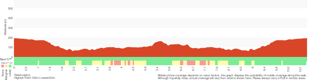
Analysis and summary of the altitude variation on the The Goanna Track Circuit
Overview of this walks grade – based on the AS 2156.1 – 2001
Under this standard, a walk is graded based on the most difficult section of the walk.
| Length | 11 km | ||
| Time | 4 hrs | ||
| . | |||
| Grade 4/6 Hard track |
AS 2156.1 | Gradient | Short steep hills (3/6) |
| Quality of track | Rough track, where fallen trees and other obstacles are likely (4/6) | ||
| Signs | Minimal directional signs (4/6) | ||
| Experience Required | Some bushwalking experience recommended (3/6) | ||
| Weather | Weather generally has little impact on safety (1/6) | ||
| Infrastructure | Limited facilities, not all cliffs are fenced (3/6) |
Some more details of this walks Grading
Here is a bit more details explaining grading looking at sections of the walk
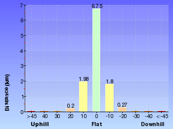
Gradient
8km of this walk has gentle hills with occasional steps and another 2.1km is flat with no steps. The remaining (1.2km) has short steep hills.
Quality of track
7km of this walk follows a clear and well formed track or trail and another 2.1km follows a smooth and hardened path. Whilst another 1.3km follows a rough track, where fallen trees and other obstacles are likely and the remaining 640m follows a formed track, with some branches and other obstacles.
Signs
9km of this walk is clearly signposted and another 1.3km has minimal directional signs. The remaining (840m) has directional signs at most intersection.
Experience Required
Around 10km of this walk requires no previous bushwalking experience, whilst the remaining 1.5km requires some bushwalking experience.
weather
This whole walk, 11km is not usually affected by severe weather events (that would unexpectedly impact safety and navigation).
Infrastructure
Around 8km of this walk has limited facilities (such as not all cliffs fenced), whilst the remaining 3.2km is close to useful facilities (such as fenced cliffs and seats).
Similar walks
10.1 km One way
5 hrs
Hard track
10.8 km One way
2 Days
Hard track

10.8 km One way
5 hrs
Hard track
Other Nearby walks
10 km One way
4 hrs 15 mins
Hard track

15 km One way
6 hrs 30 mins
Hard track

11.3 km One way
4 hrs 30 mins
Hard track

5.6 km Return
3 hrs
Moderate track
5.8 km One way
2 hrs 30 mins
Hard track

858 m Return
20 mins
Easy track
5 km Return
1 hr 45 mins
Easy track
10.5 km Return
4 hrs
Moderate track
4.4 km One way
2 hrs
Hard track

2.3 km Circuit
1 hr 15 mins
Hard track

2.2 km Return
45 mins
Easy track
918 m Return
20 mins
Very easy
Plan your trip to and from the walk here
The The Goanna Track Circuit walk starts and ends at the Heathcote Railway Station (gps: -34.088189, 151.00809)Your transport options to Heathcote Railway Station are by;
(get details)


Short URL = http://wild.tl/tgtc
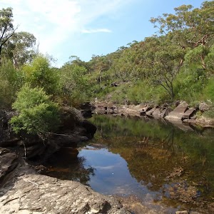
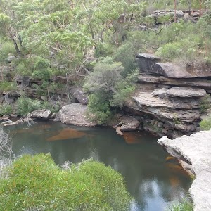
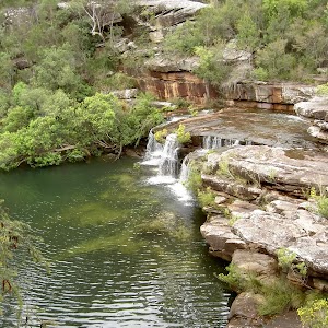
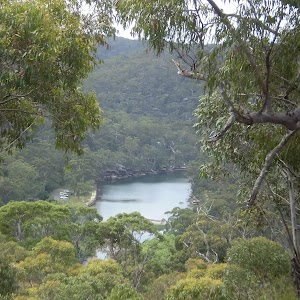
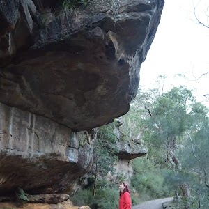
Gallery images
There are other downloads I am still working on.
You will probably need to login to access these — still all free.
* KML (google earth file)
* GPX (GPS file)
Special Maps/ brochures
* A3 topo maps
* PDF with Lands Topo map base
* PDF with arial image (and map overlay)
I wanted to get the main site live first, this extra stuff will come in time.
Happy walking
Matt 🙂
Comments