North Arm Walking Track


2 hrs

145 m
Moderate track


(0km) H.C. Press Park → End of Willis Rd

890 m
19 mins
26m
-59m
Moderate track
(0.89km) End of Willis Rd → Mannerim Rd turnoff
860 m
22 mins
63m
-61m
Moderate track
(1.75km) Mannerim Rd turnoff → Pump Station Int
630 m
14 mins
28m
-33m
Moderate track
Continue straight: From the intersection, this walk heads down the road to the south, coming to a small intersection with a diverging track, marked by an arrow. At this point, there is a large fenced building, approximately 100m away.
(2.38km) Pump Station Int → North Arm Road
740 m
14 mins
28m
-11m
Moderate track
Maps for the North Arm Walking Track walk
You can download the PDF for this walk to print a map.These maps below cover the walk and the wider area around the walk, they are worth carrying for safety reasons.
| Parramatta River | 1:25 000 Map Series | 91303N PARRAMATTA RIVER | NSW-91303N |
| Sydney | 1:100 000 Map Series | 9130 SYDNEY | 9130 |
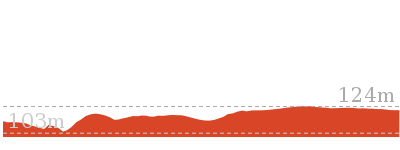
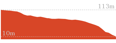
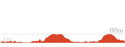
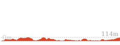
Cross sectional view of the North Arm Walking Track bushwalking track
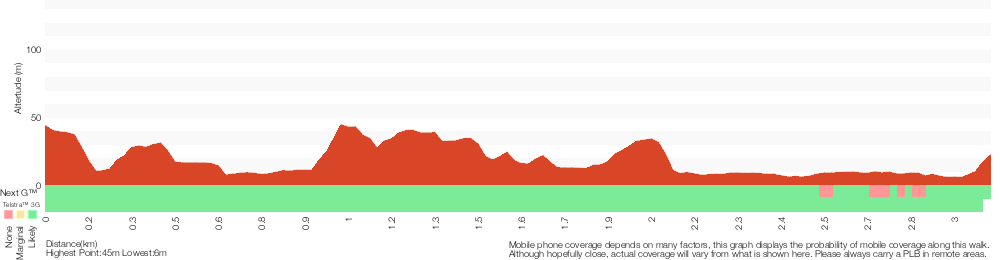
Analysis and summary of the altitude variation on the North Arm Walking Track
Overview of this walks grade – based on the AS 2156.1 – 2001
Under this standard, a walk is graded based on the most difficult section of the walk.
| Length | 3.1 km | ||
| Time | 2 hrs | ||
| . | |||
| Grade 3/6 Moderate track |
AS 2156.1 | Gradient | Short steep hills (3/6) |
| Quality of track | Clear and well formed track or trail (2/6) | ||
| Signs | Directional signs along the way (3/6) | ||
| Experience Required | Some bushwalking experience recommended (3/6) | ||
| Weather | Weather generally has little impact on safety (1/6) | ||
| Infrastructure | Limited facilities, not all cliffs are fenced (3/6) |
Some more details of this walks Grading
Here is a bit more details explaining grading looking at sections of the walk
Gradient
This whole walk, 3.1km has short steep hills.
Quality of track
This whole walk, 3.1km follows a clear and well formed track or trail.
Signs
Around 2.4km of this walk is clearly signposted, whilst the remaining 740m has directional signs at most intersection.
Experience Required
This whole walk, 3.1km requires some bushwalking experience.
weather
This whole walk, 3.1km is not usually affected by severe weather events (that would unexpectedly impact safety and navigation).
Infrastructure
This whole walk, 3.1km has limited facilities (such as not all cliffs fenced).
Similar walks
Other Nearby walks

516 m Return
20 mins
Moderate track
2.2 km One way
45 mins
Moderate track
10 km One way
4 hrs 30 mins
Hard track

10 km One way
4 hrs
Hard track
5.4 km Return
3 hrs
Hard track

1.8 km Return
1 Hr
Hard track
9.1 km One way
3 hrs 45 mins
Moderate track
8.7 km Circuit
4 hrs
Moderate track

7.3 km Circuit
3 hrs
Moderate track

3.2 km Return
1 hr 30 mins
Moderate track

6.1 km One way
2 hrs 30 mins
Hard track

22.6 km One way
9 hrs 45 mins
Hard track
Plan your trip to and from the walk here
The North Arm Walking Track walk starts at the H.C. Press Park (gps: -33.789673, 151.22865)Your transport options to H.C. Press Park are by;
(get details)
The North Arm Walking Track ends at the North Arm Road (gps: -33.792453, 151.21522)
Your transport options to North Arm Road are by;
(get details)


Short URL = http://wild.tl/nawt
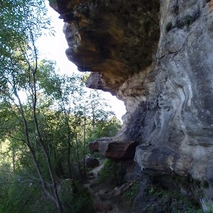
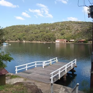
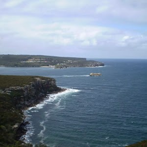
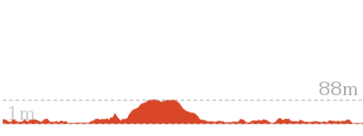
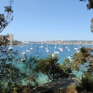
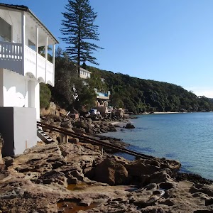
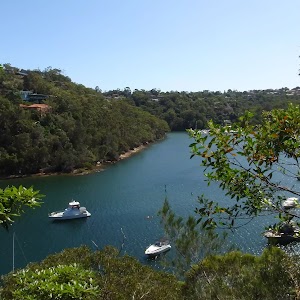
Gallery images
There are other downloads I am still working on.
You will probably need to login to access these — still all free.
* KML (google earth file)
* GPX (GPS file)
Special Maps/ brochures
* A3 topo maps
* PDF with Lands Topo map base
* PDF with arial image (and map overlay)
I wanted to get the main site live first, this extra stuff will come in time.
Happy walking
Matt 🙂
Comments