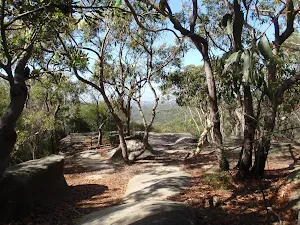
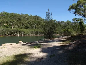
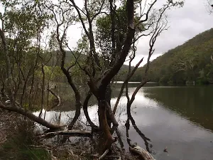
Bushwalking and hiking trails in Garigal National Park. Browse 44 walks with detailed track notes, maps and photos.
Flat Rock Beach track
516 m Return, 20 mins

Moderate track
The Bluff Track
986 m Return, 30 mins
Moderate track
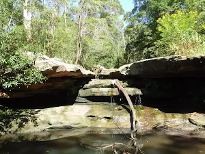
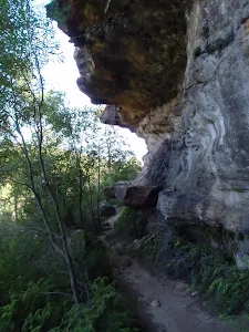
Natural Bridge Walk
1.4 km Return, 45 mins

Moderate track
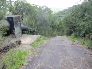
Timber Getters Track
1.8 km Return, 1 Hr
Hard track
Davidson Track
2 km Return, 1 hr 15 mins
Hard track
Engravings Track
2.2 km One way, 45 mins

Moderate track
Little Digger Track
2.2 km One way, 1 Hr
Moderate track
East Killara Bushtrack
2.6 km One way, 1 hr 15 mins
Hard track
Founders Way
3 km Return, 1 hr 30 mins
Moderate track
Cascades Track (from Davidson)
3 km Return, 1 hr 15 mins
Moderate track
North Arm Walking Track
3.1 km One way, 2 hrs

Moderate track
The Cascades Track (St Ives to Davidson)
3.2 km One way, 1 hr 30 mins
Moderate track
Magazine Track
3.4 km One way, 1 hr 30 mins

Moderate track
Bungaroo and Founders Way Loop
3.5 km Circuit, 1 hr 30 mins

Hard track
Cascades Track, return from St Ives
3.5 km Return, 1 hr 30 mins
Moderate track
Bungaroo Track
3.6 km Return, 1 hr 30 mins
Hard track
Curry Rd to The Bluff (via the Natural Bridge)
3.7 km Return, 1 hr 30 mins
Hard track
Davidson Track to Carroll Creek and Ferguson St
3.8 km One way, 1 hr 30 mins
Hard track
Casuarina Track (Davidson Park to Ferguson St)
3.8 km One way, 1 hr 45 mins
Hard track
The Cambourne Loop
4.4 km Circuit, 2 hrs
Moderate track
Currie Rd Track
4.5 km Return, 1 hr 30 mins
Hard track
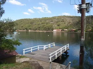
East Bantry Bay
4.6 km One way, 2 hrs
Hard track
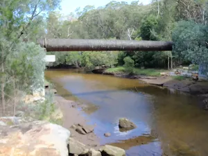
The Pipeline Track
4.7 km Return, 2 hrs
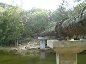
Moderate track
The Pipeline Way
4.7 km One way, 2 hrs 15 mins
Hard track
The Lyrebird Track
5.3 km Return, 2 hrs
Moderate track
Seaforth Oval to the Bluff Lookout
5.4 km Return, 3 hrs
Hard track
Quarry Rd Track
5.5 km One way, 2 hrs 15 mins
Hard track
Davidson Exploration
5.8 km One way, 2 hrs 30 mins

Hard track
East Killara Track
6 km One way, 2 hrs 45 mins
Hard track
Two Creeks Track
6.1 km One way, 2 hrs 30 mins
Moderate track
Lindfield Park and Little Digger Track Loop
6.7 km Circuit, 2 hrs 45 mins
Moderate track
Killara to St Ives via Rocky Creek
6.8 km One way, 3 hrs
Experienced only
Governor Phillip Walk
7 km Return, 3 hrs 45 mins
Moderate track
Casuarina and Carroll Creek Tracks
7 km Circuit, 2 hrs 30 mins
Hard track
Currie Rd to Davidson Park
7.2 km One way, 3 hrs
Moderate track
The Bare Creek Track
8.2 km Return, 3 hrs 15 mins
Moderate track
Narrabeen Lagoon Trail (from Middle Creek)
8.6 km Circuit, 2 hrs 30 mins
Very easy
St Ives to Davidson Park via Casuarina Track
9 km One way, 4 hrs
Hard track
Seaforth Oval to Roseville Bridge via Bantry Bay
10 km One way, 4 hrs
Hard track
Currie Rd Track to Ferguson St via Magazine Buildings and Davidson Park
11.2 km One way, 4 hrs 30 mins

Hard track
Little Digger Track to Davidson Reserve and Lyrebird Circuit
11.5 km One way, 4 hrs 30 mins
Hard track
Davidson Park to St Ives Chase
14.1 km One way, 5 hrs 30 mins
Moderate track
Middle Harbour Creek Loop
15.1 km Circuit, 5 hrs 45 mins
Experienced only
Spit to Lindfield
22.6 km One way, 9 hrs 45 mins
Hard track