Bouddi Coastal Walk


5 hrs

364 m
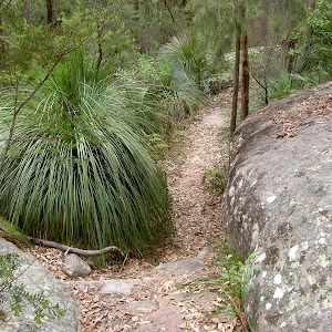
Hard track


(0km) Grahame Dr car park → Int. Bouddi Trail Access and Little Beach Trk

280 m
5 mins
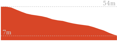
1m
-20m
Moderate track
(0.28km) Int. Bouddi Trail Access and Little Beach Trk → Little Beach
320 m
6 mins
0m
-26m
Moderate track
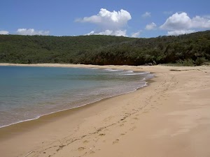
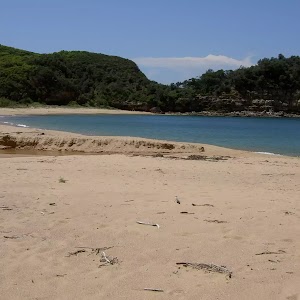
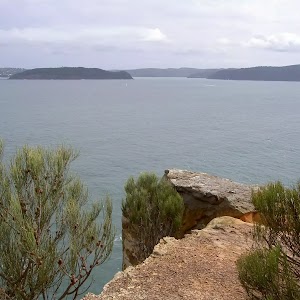
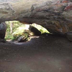
Little Beach
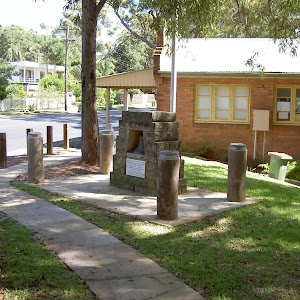
Little Beach Campsite
(0.28km) Int. Bouddi Trail Access and Little Beach Trk → Sandy Clearing Little Beach Access Trail Int.
460 m
15 mins
77m
0m
Hard track
(0.73km) Sandy Clearing Little Beach Access Trail Int. → End of Caves Bay management trail
1.3 km
23 mins
13m
-50m
Moderate track
Continue straight: From the intersection, this walk follows the management trail down the hill, keeping the sea far on the left of the track. The trail continues down to a large sandy area marked by a ‘Little Beach car park’ sign.
Veer left: From the intersection, this walk follows the management trail down the hill, in the opposite direction to the Little Beach car park. The trail winds down the spur for some time, then straightens out and continues for a while before ending in a larger clear area, signposted ‘Bouddi Coastal Walk’.
(2km) End of Caves Bay management trail → Int. Bouddi Trail and Dingeldei Picnic Trail
1.2 km
33 mins
96m
-105m
Moderate track
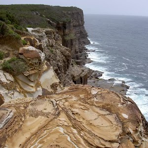
(3.17km) Int. Bouddi Trail and Dingeldei Picnic Trail → Bouddi Lookout
350 m
8 mins
56m
0m
Moderate track
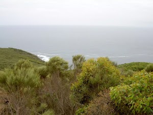
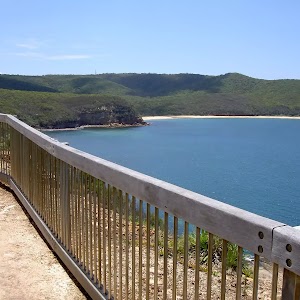
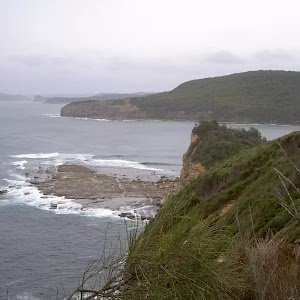
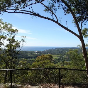
Bouddi Lookout
(3.17km) Int. Bouddi Coastal Trk and Dingeldei Picnic Trail → Eastern corner of Maitland Beach
390 m
13 mins
7m
-67m
Hard track
(3.56km) Eastern corner of Maitland Beach → S.S. Maitland Shipwreck
310 m
7 mins
14m
-15m
Hard track
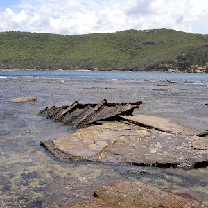
S.S. Maitland Shipwreck

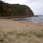
Maitland Beach
(3.56km) Eastern corner of Maitland Beach → Maitland Beach West End
600 m
10 mins
7m
-6m
Hard track
Continue straight: From the creek, this walk heads along the beach, keeping the ocean on the left. The walk leads to the base of some paved steps, which lead up the hill away from the beach.
(4.16km) Maitland Beach West End → Int. of Maitland Bay Trk and Bouddi Coastal Walk
250 m
6 mins
39m
0m
Moderate track
(4.4km) Int. of Maitland Bay Trk and Bouddi Coastal Walk → Int. of Bullimah Beach Trk and Bouddi Coastal Walk
1.7 km
38 mins
80m
-104m
Hard track
Turn right: From Gerrin Point lookout, this walk follows the track down the hill, keeping the water below on the left. The track continues along steps and boardwalks, following the hillside to the sign posted intersection.
(6.06km) Int. of Bullimah Beach Trk and Bouddi Coastal Walk → Bullimah Beach
140 m
3 mins
2m
-12m
Moderate track
Bullimah Beach
(6.06km) Int. of Bullimah Beach Trk and Bouddi Coastal Walk → Putty Beach Camping Area Trk
880 m
18 mins
28m
-47m
Hard track
Continue straight: From the creek, this walk heads west along the beach, keeping the water on the left. After approximately 200m, the walk reaches a spot on the beach opposite a white-roofed building behind the dunes, just before another wide (dry) creek entry.
(6.94km) Putty Beach Camping Area Trk → Putty Beach Camping Area
90 m
1 mins
1m
0m
Moderate track
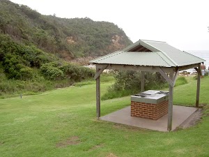
Putty Beach Camping Area
(6.94km) Putty Beach Camping Area Trk → Putty Beach car park Trk
1.1 km
18 mins
10m
-6m
Moderate track
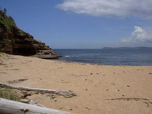
Putty Beach
(8.02km) Putty Beach → Putty Beach car park
60 m
1 mins
6m
0m
Easy track
Maps for the Bouddi Coastal Walk walk
You can download the PDF for this walk to print a map.These maps below cover the walk and the wider area around the walk, they are worth carrying for safety reasons.
| Broken Bay | 1:25 000 Map Series | 91301N BROKEN BAY | NSW-91301N |
| Sydney | 1:100 000 Map Series | 9130 SYDNEY | 9130 |
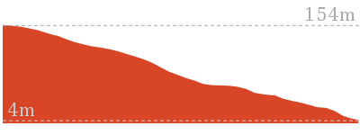
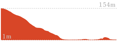
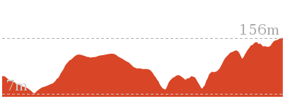
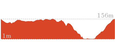
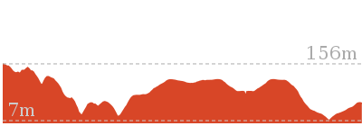
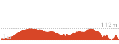
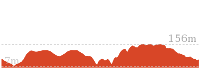
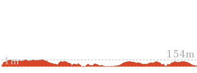
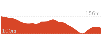
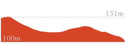
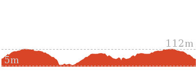
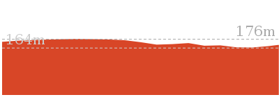
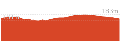
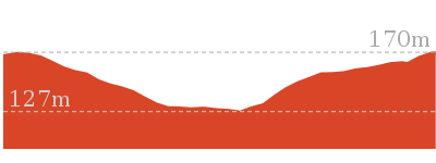
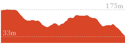
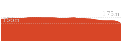
Cross sectional view of the Bouddi Coastal Walk bushwalking track
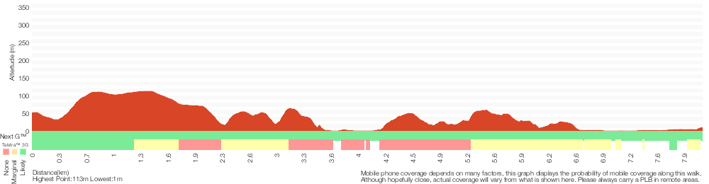
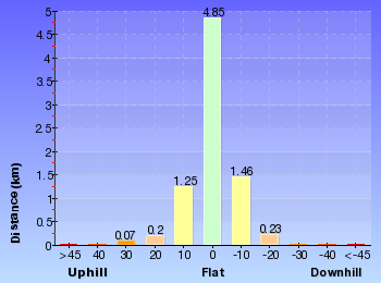
Analysis and summary of the altitude variation on the Bouddi Coastal Walk
Overview of this walks grade – based on the AS 2156.1 – 2001
Under this standard, a walk is graded based on the most difficult section of the walk.
| Length | 8.1 km | ||
| Time | 5 hrs | ||
| . | |||
| Grade 4/6 Hard track |
AS 2156.1 | Gradient | Very steep (4/6) |
| Quality of track | Rough track, where fallen trees and other obstacles are likely (4/6) | ||
| Signs | Minimal directional signs (4/6) | ||
| Experience Required | No experience required (1/6) | ||
| Weather | Weather generally has little impact on safety (1/6) | ||
| Infrastructure | Limited facilities (such as cliffs not fenced, significant creeks not bridged) (4/6) |
Some more details of this walks Grading
Here is a bit more details explaining grading looking at sections of the walk
Gradient
4km of this walk has short steep hills and another 3.6km has gentle hills with occasional steps. The remaining (390m) is very steep.
Quality of track
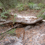
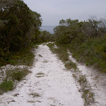
7km of this walk follows a formed track, with some branches and other obstacles and another 850m follows a rough track, where fallen trees and other obstacles are likely. The remaining (580m) follows a clear and well formed track or trail.
Signs
3.9km of this walk has directional signs at most intersection and another 3km has minimal directional signs. The remaining (1.1km) is clearly signposted.
Experience Required
This whole walk, 8km requires no previous bushwalking experience.
weather
This whole walk, 8km is not usually affected by severe weather events (that would unexpectedly impact safety and navigation).
Infrastructure
5km of this walk has limited facilities (such as not all cliffs fenced) and another 1.7km has limited facilities (such as cliffs not fenced, significant creeks not bridged). The remaining (1.3km) is close to useful facilities (such as fenced cliffs and seats).
Similar walks
1.2 km Return
1 Hr
Moderate track
2.1 km Return
1 Hr
Hard track
3.9 km Return
1 hr 45 mins
Hard track

3.9 km Return
1 hr 30 mins
Hard track
4.5 km One way
1 hr 45 mins
Hard track

5 km One way
2 hrs 30 mins
Hard track

5.2 km Circuit
2 hrs 30 mins
Hard track

6 km Circuit
2 hrs 15 mins
Hard track
6.5 km One way
3 hrs
Hard track
7.5 km One way
3 hrs 30 mins
Moderate track
9.1 km Circuit
4 hrs
Hard track
27 km Circuit
2 Days
Hard track
Other Nearby walks
1.8 km Return
1 Hr
Moderate track
2.3 km Return
1 hr 15 mins
Moderate track

1.8 km Return
1 Hr
Hard track
8.5 km Circuit
4 hrs
Hard track
3.1 km Return
2 hrs
Moderate track

3.1 km Return
1 hr 15 mins
Moderate track
922 m Return
20 mins
Easy track
1.3 km Circuit
30 mins
Easy track
3.2 km Return
1 hr 15 mins
Easy track

962 m Circuit
30 mins
Moderate track
4.1 km One way
1 hr 45 mins
Hard track
1.5 km Return
30 mins
Easy track
Plan your trip to and from the walk here
The Bouddi Coastal Walk walk starts at the Grahame Dr car park (gps: -33.509886, 151.41234)Your main transport option to Grahame Dr car park is by;
(get details)
The Bouddi Coastal Walk ends at the Putty Beach car park (gps: -33.530994, 151.36069)
Your main transport option to Putty Beach car park is by;
(get details)


Short URL = http://wild.tl/bcw
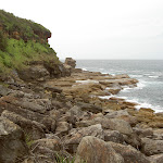
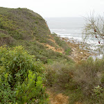
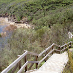
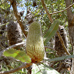
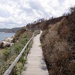
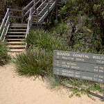
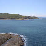
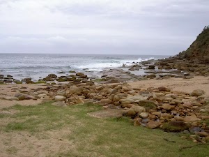
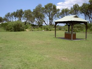
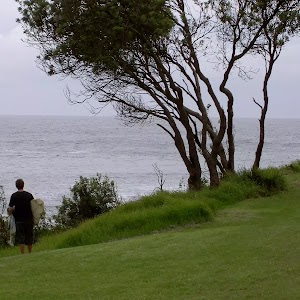
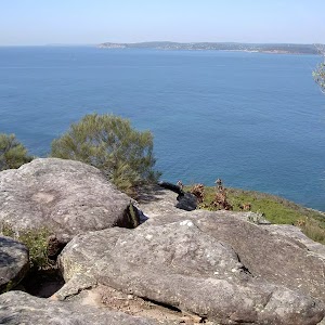
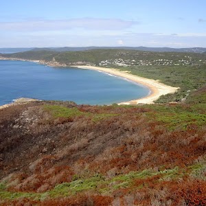
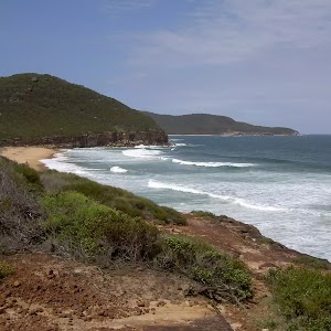
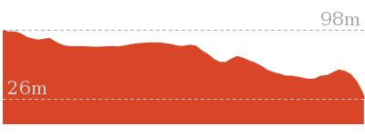
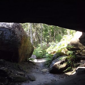
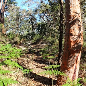
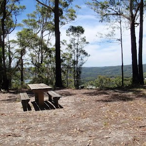
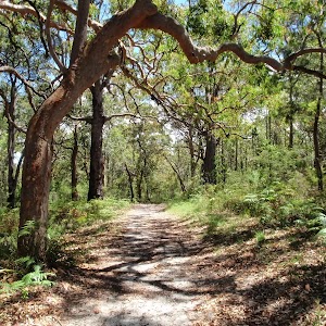
Gallery images
There are other downloads I am still working on.
You will probably need to login to access these — still all free.
* KML (google earth file)
* GPX (GPS file)
Special Maps/ brochures
* A3 topo maps
* PDF with Lands Topo map base
* PDF with arial image (and map overlay)
I wanted to get the main site live first, this extra stuff will come in time.
Happy walking
Matt 🙂
Comments