Wentworth Falls Lookouts Loop


1 Hr

191 m
Hard track
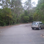


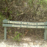


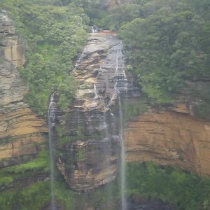
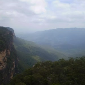
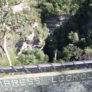
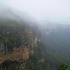
Wentworth Falls Lookout
(0km) Wentworth Falls Lookout → Int of Sir H. Burrell Drive and Princes Rock Track

180 m
5 mins
17m
-13m
Easy track
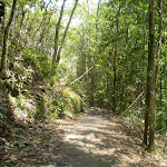
Turn right: From the intersection, this walk heads up the steps, following the ‘Car Park’ arrow. The track soon passes a sign pointing back to ‘Princes Rock Lookout’ and comes to the footpath on the side of Sir H. Burrell Drive.
(0.18km) Int of Sir H. Burrell Drive and Princes Rock Track → Jamison Lookout
140 m
2 mins
1m
-3m
Very easy
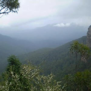
Jamison Lookout

(0.32km) Jamison Lookout → Int of Den Fenella and Undercliff Tracks
380 m
9 mins
1m
-64m
Moderate track
(0.7km) Int of Den Fenella and Undercliff Tracks → Den Fenella Lookout
80 m
4 mins
8m
-57m
Hard track
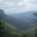
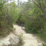
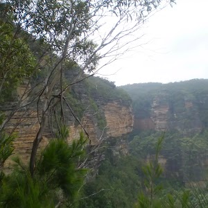
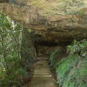
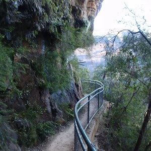
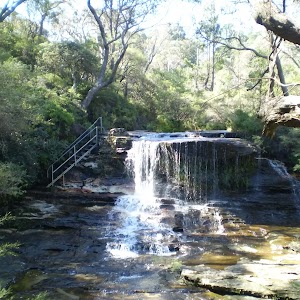
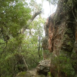
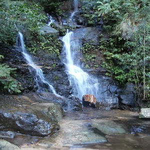
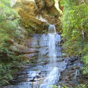
Veer left: From the intersection, this walk follows the ‘Den Fenella’ sign along the lower track, keeping the creek to the left. The track soon begins to go down very steeply (can be slippery) between the handrails and rock wall. The track then crosses the creek at the stepping stones below the cascades (the creek may be impassable after rain). On the other side of the creek, the walk heads down the steps to come to a bridge below the bigger Den Fenella Fall. From the Den Fenella Fall, this walk crosses the metal bridge and continues along the cliff edge along the fence-lined track. After heading down some steps, the track ends at a fenced point with great views across the valley.
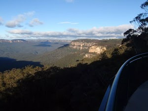
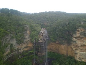
Den Fenella Lookout
(0.78km) Den Fenella Lookout → Int of Overcliff and Den Fenella Lookout Track
70 m
4 mins
51m
-8m
Hard track
(0.86km) Int of Overcliff and Denfenella Lookout Track → Int of Den Fenella and Undercliff Tracks
10 m
6m
0m
Very easy
(0.87km) Int of Den Fenella and Undercliff Tracks → Princes Rock
560 m
16 mins
54m
-42m
Moderate track
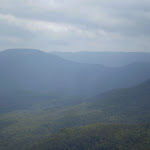
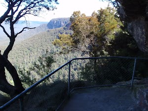
Turn sharp left: From the intersection, this walk follows the ‘Princes Rock’ sign up the steps, away from the Undercliff Walk. This track climbs up, passing by a great fenced view over to Mt Solitary and the valley to the right. Soon, the walk comes to an intersection, with a sign pointing back to the ‘Undercliff Track 100m’.
Turn right: From the intersection, this walk heads downhill following the ‘Princes Rock Lookout 200m’ sign along the wide track. Very soon, the walk comes to an intersection with another track (on the left – which was closed at time of writing).
Continue straight: From the intersection, the walk heads down the gentle hill towards the cliffs and the fenced (unsignposted) Princes Rock Lookout.
Princes Rock
(1.42km) Princes Rock → Wentworth Falls Lookout
260 m
9 mins
53m
-6m
Moderate track
Continue straight: From the intersection, this walk heads up the hill along the clear track for a short distance before coming to an intersection, with a sign pointing back to ‘Princes Rock Lookout 200m’.
Continue straight: From the intersection, this walk heads up the steps away from ‘Princes Rock Lookout’. The track soon heads across a large rock platform with steps carved in it and then, following the track back into the bush, the walk passes an old drinking trough (not suitable for drinking). After heading up more log steps, the track comes to a three-way intersection, with a small sign pointing back to ‘Princes Rock Lookout’.
Turn right: From the intersection, this walk follows the ‘Wentworth Falls Lookout’ arrow up the steps as the track bends right. The track soon passes an old water trough on the left (not suitable for drinking). Soon after this, the track comes to Wentworth Falls Lookout (next to Sir H. Burrell Drive).
Maps for the Wentworth Falls Lookouts Loop walk
You can download the PDF for this walk to print a map.These maps below cover the walk and the wider area around the walk, they are worth carrying for safety reasons.
| Katoomba | 1:25 000 Map Series | 89301S KATOOMBA | NSW-89301S |
| Katoomba | 1:100 000 Map Series | 8930 KATOOMBA | 8930 |
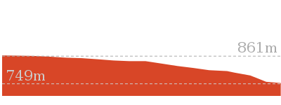
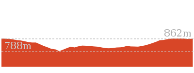
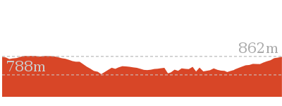
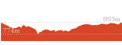
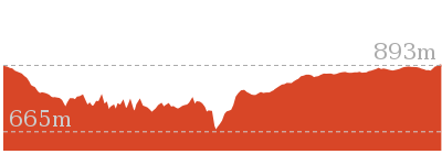
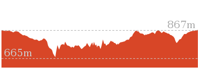
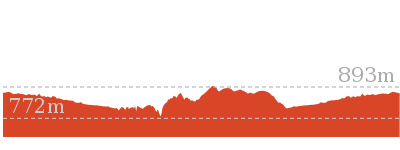
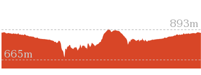
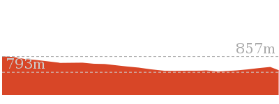
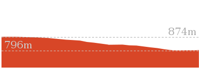
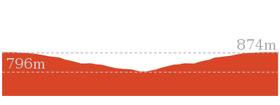
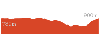
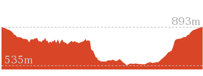
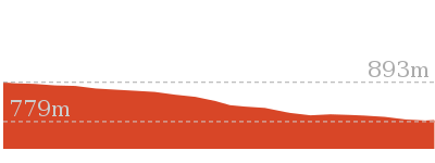
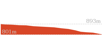
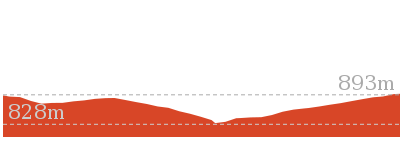
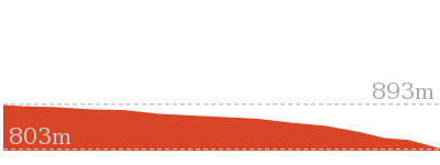
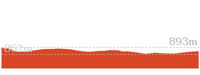
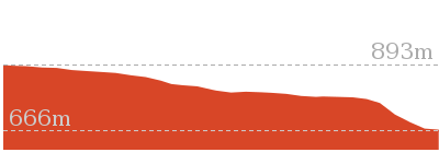
Cross sectional view of the Wentworth Falls Lookouts Loop bushwalking track
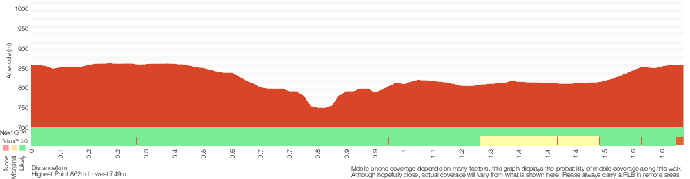
Analysis and summary of the altitude variation on the Wentworth Falls Lookouts Loop
Overview of this walks grade – based on the AS 2156.1 – 2001
Under this standard, a walk is graded based on the most difficult section of the walk.
| Length | 1.7 km | ||
| Time | 1 Hr | ||
| . | |||
| Grade 4/6 Hard track |
AS 2156.1 | Gradient | Very steep (4/6) |
| Quality of track | Formed track, with some branches and other obstacles (3/6) | ||
| Signs | Directional signs along the way (3/6) | ||
| Experience Required | Some bushwalking experience recommended (3/6) | ||
| Weather | Storms may impact on navigation and safety (3/6) | ||
| Infrastructure | Limited facilities (such as cliffs not fenced, significant creeks not bridged) (4/6) |
Some more details of this walks Grading
Here is a bit more details explaining grading looking at sections of the walk
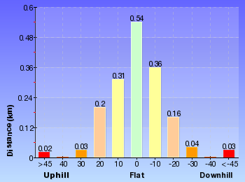
Gradient
1.1km of this walk has short steep hills and another 300m has gentle hills with occasional steps. Whilst another 180m is flat with no steps and the remaining 150m is very steep.
Quality of track
820m of this walk follows a clear and well formed track or trail and another 590m follows a formed track, with some branches and other obstacles. The remaining (270m) follows a smooth and hardened path.
Signs
Around 1.2km of this walk is clearly signposted, whilst the remaining 440m has directional signs at most intersection.
Experience Required
Around 1.2km of this walk requires no previous bushwalking experience, whilst the remaining 530m requires some bushwalking experience.
weather
Around 1.5km of this walk is not usually affected by severe weather events (that would unexpectedly impact safety and navigation), whilst the remaining 150m is affected by storms that may impact your navigation and safety.
Infrastructure
920m of this walk has limited facilities (such as not all cliffs fenced) and another 620m is close to useful facilities (such as fenced cliffs and seats). The remaining (150m) has limited facilities (such as cliffs not fenced, significant creeks not bridged).
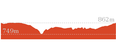
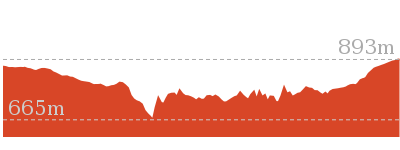
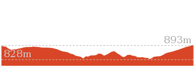
Similar walks
746 m Return
45 mins
Moderate track


926 m Return
45 mins
Hard track
1.3 km Circuit
45 mins
Moderate track
2 km Circuit
1 hr 30 mins
Moderate track

2.2 km Circuit
1 hr 30 mins
Hard track
3.6 km One way
3 hrs
Hard track
4 km Circuit
2 hrs
Moderate track
4.6 km Circuit
3 hrs 30 mins
Hard track
5 km Circuit
4 hrs
Hard track
8.9 km Circuit
4 hrs 30 mins
Hard track
9.4 km Circuit
4 hrs
Moderate track
10.2 km Circuit
6 hrs
Hard track
Other Nearby walks
1.3 km Return
1 Hr
Moderate track
1.5 km Return
45 mins
Moderate track
1.4 km Circuit
45 mins
Moderate track
3.1 km Circuit
2 hrs
Hard track
4.8 km Circuit
4 hrs
Hard track
1.9 km Circuit
1 Hr
Moderate track
1.1 km Return
1 Hr
Hard track
762 m Return
30 mins
Moderate track
950 m Circuit
30 mins
Moderate track
696 m Return
30 mins
Moderate track
1.1 km One way
30 mins
Moderate track
1.5 km Return
1 hr 30 mins
Hard track
Plan your trip to and from the walk here
The Wentworth Falls Lookouts Loop walk starts and ends at the Wentworth Falls Lookout (gps: -33.72594, 150.372)Your transport options to Wentworth Falls Lookout are by;
(get details)


Short URL = http://wild.tl/wfll
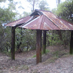
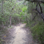
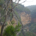
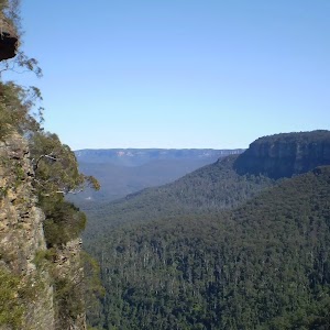
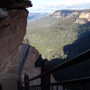
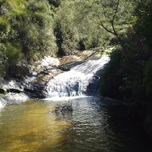
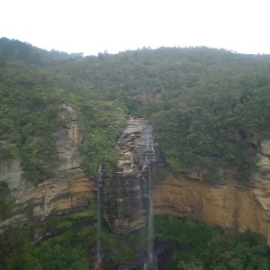
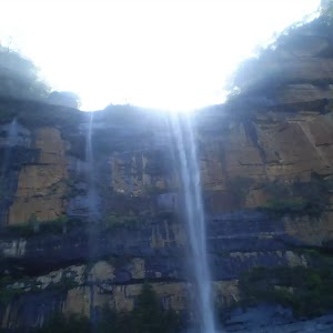
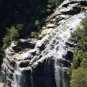
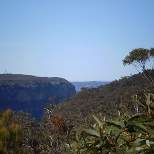
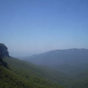
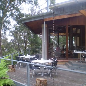
Gallery images
There are other downloads I am still working on.
You will probably need to login to access these — still all free.
* KML (google earth file)
* GPX (GPS file)
Special Maps/ brochures
* A3 topo maps
* PDF with Lands Topo map base
* PDF with arial image (and map overlay)
I wanted to get the main site live first, this extra stuff will come in time.
Happy walking
Matt 🙂
Comments