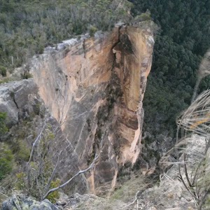
Thor Head


2 hrs 30 mins

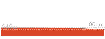
305 m
Very experienced only
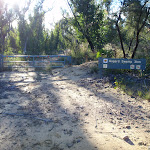


(0km) Int. Victoria Falls Rd and Asgard Swamp Trail East → Int. Asgard Swamp Trail and Pyramid Rock camping Trk

2 km
39 mins
22m
-129m
Moderate track
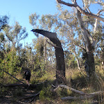
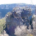
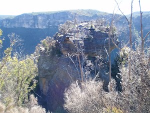
Pyramid Shaped Rock
(2.02km) Int. Asgard Swamp Trail and Pyramid Rock camping Trk → Int. Asgard Swamp Trail and Thor Head Trk
250 m
4 mins
1m
-4m
Hard track
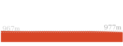
(2.28km) Int. Asgard Swamp Trail and Thor Head Trk → Asgard Kiln
520 m
11 mins
6m
-59m
Hard track
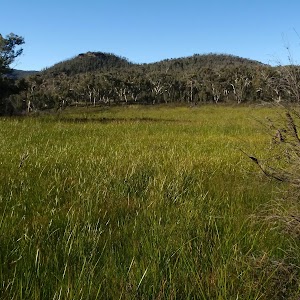
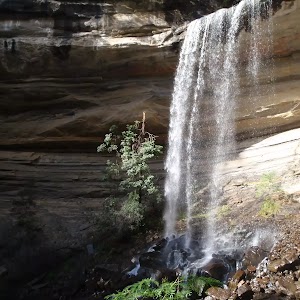
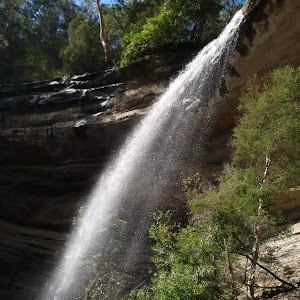
Turn left: From the intersection, this walk follows the sign ‘Asgard Swamp Coal Mine’ downhill towards the cliffs (which are across the valley). The track winds down the hill for approximately 100m to a small creek, then turns left to meet a more defined creek with a bridge. This walk crosses the small bridge and turns right, heading down the hill to where the track meets a small waterfall. This intersection is just up the gully from an overhang, on the left of the track.
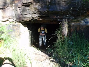
Continue straight: From the intersection, this walk crosses the creek and follows the cliffline for approximately 10m. The track then zigzags down the hill to come back on itself while leading down the hill. From the last step, the track ducks under a log to the mine entrance in the cliff, on the left.
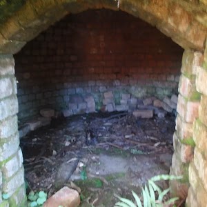
Continue straight: From the mine, this walk continues along the cliffline, keeping the cliffs to the left of the track. The walk crosses the creek to the north and contours around the base of the cliffs for approximately 20m to the overgrown kiln. At the end of this side trip, retrace your steps back to the main walk then Turn right.
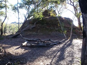
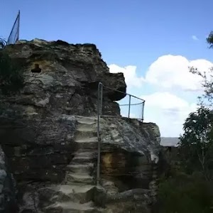
Asgard Mine
(2.28km) Int. Asgard Swamp Trail and Thor Head Track → Thor Head
940 m
25 mins
77m
-72m
Very experienced only
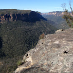
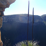
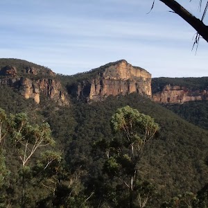
Thor Head
Maps for the Thor Head walk
You can download the PDF for this walk to print a map.These maps below cover the walk and the wider area around the walk, they are worth carrying for safety reasons.
| Mount Wilson | 1:25 000 Map Series | 89301N MOUNT WILSON | NSW-89301N |
| Katoomba | 1:100 000 Map Series | 8930 KATOOMBA | 8930 |
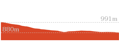
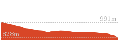
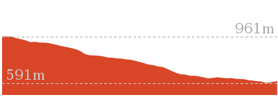
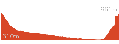
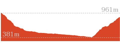
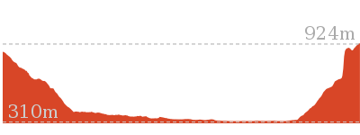
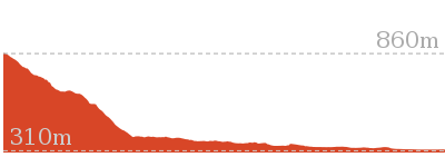
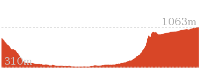
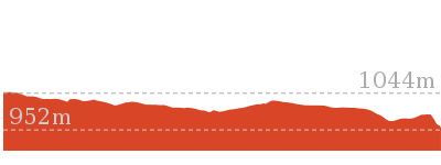
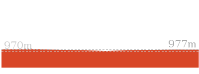
Cross sectional view of the Thor Head bushwalking track
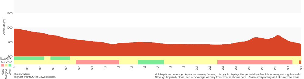
Analysis and summary of the altitude variation on the Thor Head
Overview of this walks grade – based on the AS 2156.1 – 2001
Under this standard, a walk is graded based on the most difficult section of the walk.
| Length | 6.4 km | ||
| Time | 2 hrs 30 mins | ||
| . | |||
| Grade 6/6 Very experienced only |
AS 2156.1 | Gradient | Very steep and difficult scrambles (5/6) |
| Quality of track | Off track (no visible track at times) (6/6) | ||
| Signs | No directional signs (5/6) | ||
| Experience Required | Moderate level of bushwalking experience recommended (4/6) | ||
| Weather | Weather generally has little impact on safety (1/6) | ||
| Infrastructure | No facilities provided (5/6) |
Some more details of this walks Grading
Here is a bit more details explaining grading looking at sections of the walk
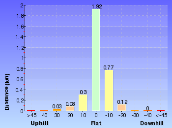
Gradient
Around 2.3km of this walk has gentle hills with occasional steps, whilst the remaining 940m is very steep with difficult rock scrambles.
Quality of track
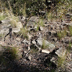
Around 2.3km of this walk follows a formed track, with some branches and other obstacles, whilst the remaining 940m follows a known route where there is no visible track.
Signs
2km of this walk has directional signs at most intersection and another 940m Has no directional signs. The remaining (250m) has minimal directional signs.
Experience Required
Around 2.3km of this walk requires no previous bushwalking experience, whilst the remaining 940m requires a leader a with moderate level of bushwalking experience.
weather
This whole walk, 3.2km is not usually affected by severe weather events (that would unexpectedly impact safety and navigation).
Infrastructure
Around 2.3km of this walk has limited facilities (such as not all cliffs fenced), whilst the remaining 940m has no facilities provided.
Similar walks
4.2 km Return
1 hr 30 mins
Moderate track
5.6 km Return
2 hrs
Hard track
Other Nearby walks
3.1 km Return
2 hrs
Hard track
22.5 km One way
3 Days
Experienced only
206 m Return
15 mins
Moderate track
13.8 km One way
8 hrs
Experienced only
22.2 km One way
2 Days
Experienced only

8.9 km One way
2 Days
Experienced only
10.4 km One way
5 hrs 30 mins
Experienced only
14 km Return
6 hrs 30 mins
Experienced only
17.6 km One way
9 hrs
Experienced only
7.6 km Return
3 hrs 30 mins
Hard track
460 m Return
15 mins
Moderate track
400 m Return
15 mins
Easy track
Plan your trip to and from the walk here
The Thor Head walk starts and ends at the Int. Victoria Falls Rd and Asgard Swamp Trail East (gps: -33.567982, 150.28456)Your main transport option to Int. Victoria Falls Rd and Asgard Swamp Trail East is by;
(get details)


Short URL = http://wild.tl/th
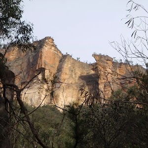
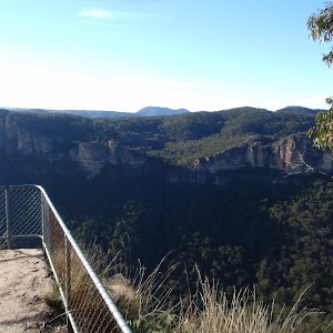
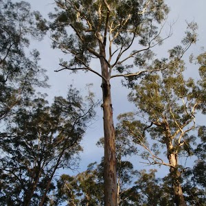
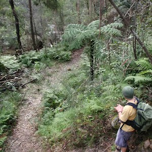
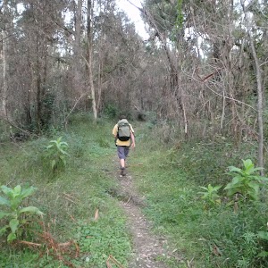
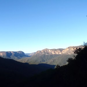
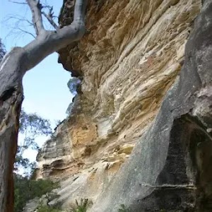
Gallery images
There are other downloads I am still working on.
You will probably need to login to access these — still all free.
* KML (google earth file)
* GPX (GPS file)
Special Maps/ brochures
* A3 topo maps
* PDF with Lands Topo map base
* PDF with arial image (and map overlay)
I wanted to get the main site live first, this extra stuff will come in time.
Happy walking
Matt 🙂
Comments